

Pennsylvania Route 940
Encyclopedia
Pennsylvania Route 940 is a 44 miles (70.8 km) long Pennsylvania
highway located in the sparsely-developed Poconos
. It runs from Pennsylvania Route 309
in Hazleton
to Pennsylvania Route 191
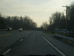
in Paradise Valley. Large segments of PA 940 are located in densely forest
ed areas.
at the Hazleton
city line. PA 940 begins as 22nd Street then makes a 35 degree turn to the northeast. In Hazle Township
, PA 940 makes a right angle turns toward the east as Main Street. PA 940 has many turns in Hazle Township. In Freeland
, PA 940 becomes Hazle Street then makes a northernly turn to become Centre Street. In downtown Freeland, PA 940 makes a 90 degree turn to the east and becomes South Street. As PA 940 exits the borough of Freeland, PA 940 continues toward the northeast as Foster Avenue. In White Haven
, PA 940 becomes Church Street then interchanges with Interstate 80
at exit 273. In downtown White Haven, PA 940 intersects the southern terminus of Pennsylvania Route 437
while making a 90 degree turn toward the east and crosses the Lehigh River
.
 After crossing the Lehigh River
, PA 940 has entered Carbon County
and the borough of East Side
. After crossing the Lehigh River, PA 940 makes a left turn to the north to become River Street, then curves to the east to become State Street. At the East Side borough boundary, PA 940 intersects the western terminus of Pennsylvania Route 534
, the only route to Hickory Run State Park
. In Kidder Township
, PA 940 interchanges with Interstate 80
and Interstate 476
(N.E. Extension of the Pennsylvania Turnpike
) at two trumpet interchanges that meet at PA 940 with traffic lights. East of the interchange, PA 940 goes under I-476/PA Turnpike into the village of Leonardsville.
, PA 940 has entered Monroe County
. In Tobyhanna Township
, PA 940 intersects Pennsylvania Route 115
. In Tobyhanna Township, PA 940 has many S-curves and passes north of Pocono Lake. In the village of Pocono Lake right in front of Lake Naomi, PA 940 intersects the southern terminus of Pennsylvania Route 423
. East of PA 423, PA 940 passes south of Lake Naomi. PA 940 also passes south of Stillwater Lake
. Southeast of Stillwater Lake, PA 940 interchanges with Interstate 380
at exit 3. East of I-380, PA 940 becomes a freeway for less than a mile with one exit. East of I-380, PA 940 interchanges with Pennsylvania Route 314
, and east of PA 314, PA 940 becomes at-grade again. In Mt. Pocono
, PA 940 has a short concurrency with Pennsylvania Route 611
and intersects the southern terminus of Pennsylvania Route 196
. In Paradise Valley, PA 940 intersects the southern terminus of Pennsylvania Route 390
, and east of PA 390, PA 940 ends at an intersection with Pennsylvania Route 191
.
in Paradise Valley.
Pennsylvania
The Commonwealth of Pennsylvania is a U.S. state that is located in the Northeastern and Mid-Atlantic regions of the United States. The state borders Delaware and Maryland to the south, West Virginia to the southwest, Ohio to the west, New York and Ontario, Canada, to the north, and New Jersey to...
highway located in the sparsely-developed Poconos
The Poconos
The Pocono Mountains is a region located in northeastern Pennsylvania, United States. The Poconos, located chiefly in Monroe and Pike counties , are an upland of the larger Allegheny Plateau...
. It runs from Pennsylvania Route 309
Pennsylvania Route 309
Pennsylvania Route 309 is a major highway which runs for 134 miles through Pennsylvania in the United States. It connects Philadelphia and its northern suburbs to Allentown, Hazleton, and Wilkes-Barre. A limited-access highway portion of PA 309 in the Wilkes-Barre area is known as the North...
in Hazleton
Hazleton, Pennsylvania
Hazleton is a city in Luzerne County, Pennsylvania, United States. The population was 25,340 at the 2010 census, an increase of 8.6% from the 2000 census count .-Greater Hazleton:...
to Pennsylvania Route 191
Pennsylvania Route 191
Pennsylvania Route 191 is a -long state highway in the U.S. state of Pennsylvania. The route, a major non-freeway corridor connecting the Lehigh Valley to The Poconos in eastern Pennsylvania, is designated from U.S...
in Paradise Valley. Large segments of PA 940 are located in densely forest
Forest
A forest, also referred to as a wood or the woods, is an area with a high density of trees. As with cities, depending where you are in the world, what is considered a forest may vary significantly in size and have various classification according to how and what of the forest is composed...
ed areas.
Luzerne County
PA 940 begins at an intersection with Pennsylvania Route 309Pennsylvania Route 309
Pennsylvania Route 309 is a major highway which runs for 134 miles through Pennsylvania in the United States. It connects Philadelphia and its northern suburbs to Allentown, Hazleton, and Wilkes-Barre. A limited-access highway portion of PA 309 in the Wilkes-Barre area is known as the North...
at the Hazleton
Hazleton, Pennsylvania
Hazleton is a city in Luzerne County, Pennsylvania, United States. The population was 25,340 at the 2010 census, an increase of 8.6% from the 2000 census count .-Greater Hazleton:...
city line. PA 940 begins as 22nd Street then makes a 35 degree turn to the northeast. In Hazle Township
Hazle Township, Pennsylvania
Hazle Township is a township in Luzerne County, Pennsylvania, United States. The population was 9,000 at the 2000 census.-Geography:According to the United States Census Bureau, the township has a total area of , of which, of it is land and of it is water. It is drained by the Susquehanna River...
, PA 940 makes a right angle turns toward the east as Main Street. PA 940 has many turns in Hazle Township. In Freeland
Freeland, Pennsylvania
Freeland, originally called Birbeckville after founder Joseph Birkbeck, then South Heberton, is a borough in Luzerne County, Pennsylvania, south of Wilkes-Barre, and 10 miles northeast of Hazleton in an agricultural region. Freeland was officially incorporated as a borough on September 11, 1876....
, PA 940 becomes Hazle Street then makes a northernly turn to become Centre Street. In downtown Freeland, PA 940 makes a 90 degree turn to the east and becomes South Street. As PA 940 exits the borough of Freeland, PA 940 continues toward the northeast as Foster Avenue. In White Haven
White Haven, Pennsylvania
White Haven is a borough in Luzerne County, Pennsylvania, United States. White Haven was created in 1824 by industrialist Josiah White. It is located along the Lehigh River which connects White Haven to Jim Thorpe, Pennsylvania. The population was 1,182 at the 2000 census...
, PA 940 becomes Church Street then interchanges with Interstate 80
Interstate 80 in Pennsylvania
The transcontinental Interstate 80 is designated across northern Pennsylvania as the Keystone Shortway, officially the Z.H. Confair Memorial Highway. This route was built mainly along a completely new alignment, not paralleling any earlier U.S. Routes, as a shortcut to the tolled Pennsylvania...
at exit 273. In downtown White Haven, PA 940 intersects the southern terminus of Pennsylvania Route 437
Pennsylvania Route 437
Pennsylvania Route 437 is an long state highway located in Luzerne county in Pennsylvania. The southern terminus is at PA 940 in White Haven. The northern terminus is at PA 309 in Fairview Township.-Route description:...
while making a 90 degree turn toward the east and crosses the Lehigh River
Lehigh River
The Lehigh River, a tributary of the Delaware River, is a river located in eastern Pennsylvania, in the United States. Part of the Lehigh, along with a number of its tributaries, is designated a Pennsylvania Scenic River by the state's Department of Conservation and Natural Resources...
.
Carbon County
Lehigh River
The Lehigh River, a tributary of the Delaware River, is a river located in eastern Pennsylvania, in the United States. Part of the Lehigh, along with a number of its tributaries, is designated a Pennsylvania Scenic River by the state's Department of Conservation and Natural Resources...
, PA 940 has entered Carbon County
Carbon County, Pennsylvania
As of the census of 2000, there were 58,802 people, 23,701 households, and 16,424 families residing in the county. The population density was 154 people per square mile . There were 30,492 housing units at an average density of 80 per square mile...
and the borough of East Side
East Side, Pennsylvania
East Side is a borough in Carbon County, Pennsylvania, United States. The population was 290 at the 2000 census.-Geography:East Side is located at ....
. After crossing the Lehigh River, PA 940 makes a left turn to the north to become River Street, then curves to the east to become State Street. At the East Side borough boundary, PA 940 intersects the western terminus of Pennsylvania Route 534
Pennsylvania Route 534
Pennsylvania Route 534 is an long state highway located in Monroe and Carbon counties in Pennsylvania. The western terminus is at PA 940 in East Side. The eastern terminus is at US 209 in Polk Township....
, the only route to Hickory Run State Park
Hickory Run State Park
Hickory Run State Park is a Pennsylvania state park in Kidder and Penn Forest Townships in Carbon County, Pennsylvania in the United States. The park is spread across the Pocono Mountains...
. In Kidder Township
Kidder Township, Pennsylvania
Kidder Township is a township in Carbon County, Pennsylvania, United States. The population was 1,185 at the 2000 census.- History :On October 10, 1888 a train wreck known as the Mud Run Disaster occurred on the Lehigh Valley Railroad which runs through the township, 66 people were killed, most...
, PA 940 interchanges with Interstate 80
Interstate 80
Interstate 80 is the second-longest Interstate Highway in the United States, following Interstate 90. It is a transcontinental artery running from downtown San Francisco, California to Teaneck, New Jersey in the New York City Metropolitan Area...
and Interstate 476
Interstate 476
Interstate 476 is a auxiliary Interstate Highway in the U.S. state of Pennsylvania designated between Interstate 95 near Chester and Interstate 81 near Scranton, serving as the primary north–south Interstate corridor through eastern Pennsylvania....
(N.E. Extension of the Pennsylvania Turnpike
Pennsylvania Turnpike
The Pennsylvania Turnpike is a toll highway system operated by the Pennsylvania Turnpike Commission in the Commonwealth of Pennsylvania, United States. The three sections of the turnpike system total . The main section extends from Ohio to New Jersey and is long...
) at two trumpet interchanges that meet at PA 940 with traffic lights. East of the interchange, PA 940 goes under I-476/PA Turnpike into the village of Leonardsville.
Monroe County
After crossing the Tobyhanna CreekTobyhanna Creek
Tobyhanna Creek is a tributary of the Lehigh River in the Poconos of eastern Pennsylvania in the United States.The upper reaches of the creek pass through or near Tobyhanna Township, Tobyhanna Army Depot and Tobyhanna State Park....
, PA 940 has entered Monroe County
Monroe County, Pennsylvania
-National protected areas:* Delaware Water Gap National Recreation Area * Middle Delaware National Scenic River -Demographics:As of the census of 2010, there are 176,567 people, 49,454 households, and 36,447 families residing in the county. The population density was 228 people per square mile...
. In Tobyhanna Township
Tobyhanna Township, Pennsylvania
Tobyhanna Township is a township in Monroe County, Pennsylvania, United States. The population was 6,152 at the 2000 census. Tobyhanna Township has Tobyhanna Elementary Center and Locust Lake Village.-Geography:...
, PA 940 intersects Pennsylvania Route 115
Pennsylvania Route 115
Pennsylvania Route 115 is a north–south state highway in eastern Pennsylvania. It stretches from U.S. Route 209 in Brodheadsville to Interstate 81 and Pennsylvania Route 309 near Wilkes-Barre. The road originated as the Sullivan Trail which later became known as the Easton and Wilkes-Barre...
. In Tobyhanna Township, PA 940 has many S-curves and passes north of Pocono Lake. In the village of Pocono Lake right in front of Lake Naomi, PA 940 intersects the southern terminus of Pennsylvania Route 423
Pennsylvania Route 423
Pennsylvania Route 423 is a state route in Monroe and Wayne Counties in Pennsylvania. It runs for , crossing through the Wyoming Valley from Route 940 in Pocono Pines to Route 191 in South Sterling.Route 423 was established in 1965...
. East of PA 423, PA 940 passes south of Lake Naomi. PA 940 also passes south of Stillwater Lake
Stillwater Lake (Pennsylvania)
Stillwater Lake is a reservoir that covers approximately . The lake is located in Pocono Summit, Pennsylvania at an elevation of . Feed by Dotter's Run, Hawkeye Run, Pocono Summit Creek, and several underground springs, the lake flows out to Lake Naomi via Tunkhannock Creek. There are several...
. Southeast of Stillwater Lake, PA 940 interchanges with Interstate 380
Interstate 380 (Pennsylvania)
Interstate 380 is a spur highway in northeast Pennsylvania that connects Interstate 80 with Interstate 81 and Interstate 84. The northern terminus of I-380 is at Interstate 84 near Elmhurst, PA; the southern terminus is in Tunkhannock Township at the junction with Interstate 80. The entire length...
at exit 3. East of I-380, PA 940 becomes a freeway for less than a mile with one exit. East of I-380, PA 940 interchanges with Pennsylvania Route 314
Pennsylvania Route 314
Pennsylvania Route 314 is an state highway located in Monroe County, Pennsylvania. The western terminus is at PA 940 in Pocono Summit. The eastern terminus is at PA 715 in Pocono Township.-Route description:...
, and east of PA 314, PA 940 becomes at-grade again. In Mt. Pocono
Mount Pocono, Pennsylvania
Mount Pocono is a borough in Monroe County, Pennsylvania, in the United States. It is located in the Poconos region of the state.As of the 2000 census, the borough population was 2,742.-Geography:Mount Pocono is located at ....
, PA 940 has a short concurrency with Pennsylvania Route 611
Pennsylvania Route 611
Pennsylvania Route 611 is a major state highway in Pennsylvania, United States, running from Interstate 95 south of downtown Philadelphia north to Interstate 380 in Coolbaugh Township, Pennsylvania in The Poconos....
and intersects the southern terminus of Pennsylvania Route 196
Pennsylvania Route 196
Pennsylvania Route 196 is a major highway in the Pennsylvania Highway System with a length of . It runs from Pennsylvania Route 940 and Pennsylvania Route 611 in Mount Pocono to Pennsylvania Route 296 in Varden.-Route description:...
. In Paradise Valley, PA 940 intersects the southern terminus of Pennsylvania Route 390
Pennsylvania Route 390
Pennsylvania Route 390 is an long state highway located in Monroe, and Pike counties in Pennsylvania. The southern terminus is at PA 940 near Paradise Township. The major routes that PA 390 joins are PA 191, PA 447, and I-84. The northern terminus is at PA 507 in Tafton View.Along the route, PA...
, and east of PA 390, PA 940 ends at an intersection with Pennsylvania Route 191
Pennsylvania Route 191
Pennsylvania Route 191 is a -long state highway in the U.S. state of Pennsylvania. The route, a major non-freeway corridor connecting the Lehigh Valley to The Poconos in eastern Pennsylvania, is designated from U.S...
.
History
State Route 940 was first a state legislative route assigned in 1927. The highway was designated as Pennsylvania Route 15 from Locust Lake Village to Mount Pocono. However, the designation was changed the next year with the mass numbering of state traffic routes. The segment from Blakeslee Corners to Swiftwater and the segment from Pocono Summit to Paradise Valley were designated SR 115 and SR 615. The rest was designated as SR 940. In 1935, the eastern terminus was moved from Blakeslee Corners to Swiftwater with the advent of decommissioning of SR 115. In 1946, SR 615 was decommissioned and the segment went unnumbered. In 1956, the segment from Mount Pocono to Paradise Valley was designated as SR 196, but when SR 940 was upgraded to an expressway in 1964 the SR 196 designated was removed and SR 940 was extended to an intersection with State Route 191Pennsylvania Route 191
Pennsylvania Route 191 is a -long state highway in the U.S. state of Pennsylvania. The route, a major non-freeway corridor connecting the Lehigh Valley to The Poconos in eastern Pennsylvania, is designated from U.S...
in Paradise Valley.