
.gif)
Interstate 84 (east)
Encyclopedia
Interstate 84 is an Interstate Highway extending from Dunmore, Pennsylvania
(near Scranton
) at an interchange with Interstate 81
to Sturbridge, Massachusetts
, at an interchange
with the Massachusetts Turnpike
(Interstate 90
). I-84 has mile-log junction numbering in Pennsylvania; otherwise, exit numbers are roughly sequential. There is also a separate I-84
in the northwestern United States
.
|PA
|54.55
|87.79
|-
|NY
|71.79
|115.53
|-
|CT
|97.90
|157.55
|-
|MA
|8.15
|13.12
|-
|Total
|232.39
|374.00
|}
in Dunmore, Pennsylvania
, a suburb east of Scranton
. The first two miles (3 km) are concurrent
with Interstate 380
. The two split in hilly country outside the city, with I-380 going southeast through the Poconos and I-84 continuing almost due east into Wayne
and Pike
counties. The Pennsylvania section is the only segment of I-84 that uses mile-based exit numbers; it began replacing sequential numbers in 2001.
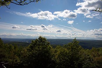
This section of Pennsylvania is very lightly populated, and there are no major settlements on or near I-84, although it offers access to popular outdoor recreation areas such as Lake Wallenpaupack
and Promised Land State Park
. Its right-of-way is very wide, with a large median strip
between the two roadways as it passes through densely wooded country, except for the swampy areas in southern Wayne County. The only development along Pennsylvania's section of I-84 is where US 6
and 209 start to parallel closely and form a commercial strip just south of Matamoras
, just west of the Delaware River
.
 I-84 enters New York by crossing both the Delaware
and Neversink
rivers on a long bridge south of Port Jervis
, the first large settlement near the highway. The first mile of the road in New York runs along the New Jersey
state line, then curves to the north to climb the Shawangunks
and cross Orange County
, where it forms one leg of a distribution
"golden triangle" with NY 17
(future I-86
) and the New York State Thruway
(I-87
). I-84 includes the Newburgh-Beacon Bridge
across the Hudson River
at Newburgh
.
East of the bridge and the city of Beacon
, I-84 continues to head east across Dutchess County
, beginning to turn south in the mountainous areas east of the Taconic State Parkway
and into Putnam County
. At Brewster
, where Interstate 684
heads south towards New York City, the road resumes its eastern course into Connecticut, closely paralleled by US 6
and 202
.
 The interstate's first exit is at the state line, where it enters the city of Danbury
. Here it is designated the Yankee Expressway. Two miles to the east, where US 7
comes in from the south near Danbury Fair Mall
to join I-84, it turns to the north. At the next exit, routes 6
and 202
join the highway.
The four-way concurrency ends after 3 miles (4.8 km), when 7 and 202 split off north towards New Milford
. Route 6 leaves the interstate at the next exit, and I-84 continues east across the countryside. At Exit 11 it turns to the northeast and descends to cross the Housatonic River
on the Rochambeau Bridge, into New Haven County
, then climbs into higher ground to the city of Waterbury
, which it passes on an elevated viaduct
with the eastbound and westbound lanes on different levels. Here the CT 8
expressway intersects.
The eastern heading continues past Waterbury to Milldale
, where Interstate 691
splits off to the east. This section has many left-hand exits and entrances and sharp curves, which were built for a planned network of freeways. I-84 heads northeast towards New Britain
and Hartford
, the state capital and the largest community along its eastern length. After intersecting Interstate 91
, the road crosses the Connecticut River
on the Bulkeley Bridge
, oldest on the Interstate system, then becomes the Wilbur Cross Highway
and continues towards the northeast.
The last exit in Connecticut is Exit 74, an exit for Route 171. I-84 crosses the Massachusetts border in the town of Union
.
in Hampden County
before crossing into Sturbridge
in Worcester County
for the remainder of its length. I-84 only has three exits in Massachusetts, before ending at Interstate 90
, the Massachusetts Turnpike
. I-84 ends at Exit 9 of I-90, which is located in Sturbridge, 7.7 miles (12.4 km) into the state, making the Massachusetts section of the highway the shortest distance within any of the four states it traverses.
to Providence, Rhode Island
.
to Bolton, Connecticut
, then along a never-built section of freeway that would have connected to the US 6
bypass around Willimantic, Connecticut
. Another never-built freeway section would have connected it to Interstate 395 and extended I-84 onto State Road 695 in Connecticut, the easternmost portion of the Connecticut Turnpike
in Plainfield, Connecticut
. From there, it would have roughly followed US 6 through western Rhode Island
to connect to the present-day US 6 freeway in Johnston
. From there, a freeway from Olneyville Square
to the Interstate 95
–Interstate 195 interchange was briefly considered, but abandoned in favor of what later became the Route 6-10 Connector.
as part of building its world headquarters in Danbury.
, many issues remained in Rhode Island
, the biggest of which were major environmental concerns about how the freeway would affect the Scituate Reservoir
, which is the main drinking water supply for Providence
.
that would have connected Interstate 84 to the present-day Route 37
freeway. This would have allowed construction of I-84 south of the Scituate Reservoir
. Major community opposition caused this plan, as well as I-84 as a whole, to be scrapped.
, a freeway has been added along the original route of Interstate 84 that will connect to the CT 695 freeway on the Rhode Island
–Connecticut
border.
(at the present-day junction with Interstate 384
) and Sturbridge, Massachusetts
(Interstate 90
) was for a time signed as Interstate 86 (unrelated to present-day Interstate 86
in New York
and Pennsylvania
). Signs stating "I-84 Ends, I-86 to Boston
" (eastbound) and "I-86 Ends, I-84 to Hartford" (westbound) were posted where the change took place. Exit numbering on I-86 was that of the road's predecessor, Route 15
, in a sequence beginning on New York's Hutchinson River Parkway
. Exits were renumbered to correspond with the rest of I-84 in Connecticut when the road was redesignated in 1984. The present I-384 as well as the present US 6 bypass near Willimantic, both of which were a part of what was then I-84's planned easterly continuation, were also numbered I-84 prior to 1984 even though they lacked any direct connection to the rest of I-84 at that time. (One had to use Silver Lane in East Hartford to travel between the two stretches of the highway.) These two sections were re-numbered I-384 and Rte 6 when what was then I-86 was re-numbered I-84.
crossing, the Newburgh-Beacon Bridge
. Since the bridge is under the New York State Bridge Authority
, it carries an eastbound-only toll of $1 for passenger vehicles (6/19/2010).
was a toll-free component of the New York State Thruway system. It was transferred by the state DOT to the Thruway Authority in order to capitalize on that agency's steady revenue stream from upstate sources.
In 1992, maintenance responsibility for I-84 in New York was transferred to the New York State Thruway Authority and the monies for that purpose came from existing tolls on I-190
in downtown Buffalo
, more than 300 miles (482.8 km) away. On Monday, October 30, 2006, the Thruway Authority began the process of returning maintenance and operation responsibilities to NYSDOT and the tolls in Buffalo were discontinued. The I-190 tolls were considered to be one of the principal causes of highway congestion in Buffalo. From 2006 to 2010, maintenance was performed by the Thruway Authority with funding provided by the state legislature. On Monday, October 11, 2010, NYSDOT resumed full control of I-84.
and Cheshire, Connecticut
has been beset by cost overruns, delays, and construction defects involving storm drains, as state and federal officials have launched criminal investigations stemming from this project. This episode has waned local enthusiasm for a proposed $2 billion reconstruction of the Mixmaster interchange in downtown Waterbury. Cost estimates for the Mixmaster replacement have increased to $3 billion. CT Attorney General Richard Blumenthal
has begun a lawsuit against the contractor and an engineering firm in response to threats from the U.S. DOT to withhold funds from the project. On May 18, 2007, the Waterbury Republican-American
reported this area had defective light poles, while Governor M. Jodi Rell
released an audit report of the construction disaster. A number of DOT personnel were either fired or reprimanded following the scandal. Meanwhile the FBI and a federal grand jury are investigating the now-defunct construction company and the same DOT officials, which may eventually lead to criminal charges in the case.
), in the town of Newburgh
.
Dunmore, Pennsylvania
Dunmore is a borough in Lackawanna County, Pennsylvania, adjoining Scranton. Dunmore was settled in 1835 and incorporated in 1862. Extensive anthracite coal, brick, stone, and silk interests had led to a rapid increase in the population to 8,315 in 1890, 12,583 in 1900, 17,615 in 1910, 20,250 in...
(near Scranton
Scranton, Pennsylvania
Scranton is a city in the northeastern part of Pennsylvania, United States. It is the county seat of Lackawanna County and the largest principal city in the Scranton/Wilkes-Barre metropolitan area. Scranton had a population of 76,089 in 2010, according to the U.S...
) at an interchange with Interstate 81
Interstate 81
Interstate 81 is an Interstate Highway in the eastern part of the United States. Its southern terminus is at Interstate 40 in Dandridge, Tennessee; its northern terminus is on Wellesley Island at the Canadian border, where the Thousand Islands Bridge connects it to Highway 401, the main freeway...
to Sturbridge, Massachusetts
Sturbridge, Massachusetts
Sturbridge is a town in Worcester County, Massachusetts, United States. It is home to Old Sturbridge Village living history museum and other sites of historical interest such as Tantiusques.The population was 9,268 at the 2010 census...
, at an interchange
Interchange (road)
In the field of road transport, an interchange is a road junction that typically uses grade separation, and one or more ramps, to permit traffic on at least one highway to pass through the junction without directly crossing any other traffic stream. It differs from a standard intersection, at which...
with the Massachusetts Turnpike
Massachusetts Turnpike
The Massachusetts Turnpike is the easternmost stretch of Interstate 90. The Turnpike begins at the western border of Massachusetts in West Stockbridge connecting with the Berkshire Connector portion of the New York State Thruway...
(Interstate 90
Interstate 90
Interstate 90 is the longest Interstate Highway in the United States at . It is the northernmost coast-to-coast interstate, and parallels US 20 for the most part. Its western terminus is in Seattle, at Edgar Martinez Drive S. near Safeco Field and CenturyLink Field, and its eastern terminus is in...
). I-84 has mile-log junction numbering in Pennsylvania; otherwise, exit numbers are roughly sequential. There is also a separate I-84
Interstate 84 (west)
Interstate 84 is an Interstate Highway in the Western United States that runs from Portland, Oregon, to a junction with Interstate 80 near Echo, Utah. The highway originally served as a fork of I-80 to serve the Pacific Northwest, and was originally numbered Interstate 80N.The highway serves and...
in the northwestern United States
Northwestern United States
The Northwestern United States comprise the northwestern states up to the western Great Plains regions of the United States, and consistently include the states of Oregon, Washington, Idaho, Montana, Wyoming, to which part of southeast Alaska is also sometimes included...
.
Route description
|-|PA
Pennsylvania
The Commonwealth of Pennsylvania is a U.S. state that is located in the Northeastern and Mid-Atlantic regions of the United States. The state borders Delaware and Maryland to the south, West Virginia to the southwest, Ohio to the west, New York and Ontario, Canada, to the north, and New Jersey to...
|54.55
|87.79
|-
|NY
Interstate 84 in New York
Interstate 84 is a part of the Interstate Highway System that runs from Dunmore, Pennsylvania, to Sturbridge, Massachusetts, in the Eastern United States. In New York, I-84 extends from the Pennsylvania state line at Port Jervis to the Connecticut state line east of Brewster...
|71.79
|115.53
|-
|CT
Interstate 84 in Connecticut
Interstate 84 is an East–West Interstate highway across the state of Connecticut into Danbury, Waterbury, Hartford and Union.-Route description:...
|97.90
|157.55
|-
|MA
Massachusetts
The Commonwealth of Massachusetts is a state in the New England region of the northeastern United States of America. It is bordered by Rhode Island and Connecticut to the south, New York to the west, and Vermont and New Hampshire to the north; at its east lies the Atlantic Ocean. As of the 2010...
|8.15
|13.12
|-
|Total
|232.39
|374.00
|}
Pennsylvania
Interstate 84 starts in Pennsylvania at Interstate 81Interstate 81
Interstate 81 is an Interstate Highway in the eastern part of the United States. Its southern terminus is at Interstate 40 in Dandridge, Tennessee; its northern terminus is on Wellesley Island at the Canadian border, where the Thousand Islands Bridge connects it to Highway 401, the main freeway...
in Dunmore, Pennsylvania
Dunmore, Pennsylvania
Dunmore is a borough in Lackawanna County, Pennsylvania, adjoining Scranton. Dunmore was settled in 1835 and incorporated in 1862. Extensive anthracite coal, brick, stone, and silk interests had led to a rapid increase in the population to 8,315 in 1890, 12,583 in 1900, 17,615 in 1910, 20,250 in...
, a suburb east of Scranton
Scranton, Pennsylvania
Scranton is a city in the northeastern part of Pennsylvania, United States. It is the county seat of Lackawanna County and the largest principal city in the Scranton/Wilkes-Barre metropolitan area. Scranton had a population of 76,089 in 2010, according to the U.S...
. The first two miles (3 km) are concurrent
Concurrency (road)
A concurrency, overlap, or coincidence in a road network is an instance of one physical road bearing two or more different highway, motorway, or other route numbers...
with Interstate 380
Interstate 380 (Pennsylvania)
Interstate 380 is a spur highway in northeast Pennsylvania that connects Interstate 80 with Interstate 81 and Interstate 84. The northern terminus of I-380 is at Interstate 84 near Elmhurst, PA; the southern terminus is in Tunkhannock Township at the junction with Interstate 80. The entire length...
. The two split in hilly country outside the city, with I-380 going southeast through the Poconos and I-84 continuing almost due east into Wayne
Wayne County, Pennsylvania
As of the census of 2000, there were 47,722 people, 18,350 households, and 12,936 families residing in the county. The population density was 65 people per square mile . There were 30,593 housing units at an average density of 42 per square mile...
and Pike
Pike County, Pennsylvania
-National protected areas:* Delaware Water Gap National Recreation Area * Middle Delaware National Scenic River * Upper Delaware Scenic and Recreational River -Demographics:...
counties. The Pennsylvania section is the only segment of I-84 that uses mile-based exit numbers; it began replacing sequential numbers in 2001.
This section of Pennsylvania is very lightly populated, and there are no major settlements on or near I-84, although it offers access to popular outdoor recreation areas such as Lake Wallenpaupack
Lake Wallenpaupack
Lake Wallenpaupack is a reservoir in Pennsylvania, USA. It was created in 1926 by PPL, the Pennsylvania Power & Light Company, for hydroelectric purposes. It is located near Hawley, on the border of Pike and Wayne counties in northeastern Pennsylvania...
and Promised Land State Park
Promised Land State Park
Promised Land State Park is a Pennsylvania state park in Blooming Grove, Greene and Palmyra Townships, Pike County, Pennsylvania, in the United States. The approximately park is mostly surrounded by Delaware State Forest. It is in the Poconos and sits at . The second growth forests in Promised...
. Its right-of-way is very wide, with a large median strip
Central reservation
On divided roads, such as divided highways or freeways/motorways, the central reservation , median, parkway , median strip or central nature strip is the area which separates opposing lanes of traffic...
between the two roadways as it passes through densely wooded country, except for the swampy areas in southern Wayne County. The only development along Pennsylvania's section of I-84 is where US 6
U.S. Route 6 in Pennsylvania
U.S. Route 6 travels east–west near the north edge of the U.S. state of Pennsylvania from the Ohio state line near Pymatuning Reservoir east to the Mid-Delaware Bridge over the Delaware River into Port Jervis, New York. It is the longest highway segment in the Commonwealth. Most of it is a...
and 209 start to parallel closely and form a commercial strip just south of Matamoras
Matamoras, Pennsylvania
Matamoras is a borough in Pike County, Pennsylvania, United States. The population was 2,469 at the 2010 census. It is the easternmost town in Pennsylvania.-History:...
, just west of the Delaware River
Delaware River
The Delaware River is a major river on the Atlantic coast of the United States.A Dutch expedition led by Henry Hudson in 1609 first mapped the river. The river was christened the South River in the New Netherland colony that followed, in contrast to the North River, as the Hudson River was then...
.
New York
Delaware River
The Delaware River is a major river on the Atlantic coast of the United States.A Dutch expedition led by Henry Hudson in 1609 first mapped the river. The river was christened the South River in the New Netherland colony that followed, in contrast to the North River, as the Hudson River was then...
and Neversink
Neversink River
The Neversink River is a tributary of the Delaware River in southeastern New York in the United States...
rivers on a long bridge south of Port Jervis
Port Jervis, New York
Port Jervis is a city on the Delaware River in western Orange County, New York, with a population of 8,860 at the 2000 census. The communities of Deerpark, Huguenot, Sparrowbush, and Greenville are adjacent to Port Jervis, and the towns of Montague, New Jersey and Matamoras, Pennsylvania face the...
, the first large settlement near the highway. The first mile of the road in New York runs along the New Jersey
New Jersey
New Jersey is a state in the Northeastern and Middle Atlantic regions of the United States. , its population was 8,791,894. It is bordered on the north and east by the state of New York, on the southeast and south by the Atlantic Ocean, on the west by Pennsylvania and on the southwest by Delaware...
state line, then curves to the north to climb the Shawangunks
Shawangunk Ridge
The Shawangunk Ridge , also known as the Shawangunk Mountains or The Gunks, is a ridge of bedrock in Ulster County, Sullivan County and Orange County in the state of New York, extending from the northernmost point of New Jersey to the Catskill Mountains.The ridgetop, which widens considerably at...
and cross Orange County
Orange County, New York
Orange County is a county located in the U.S. state of New York. It is part of the Poughkeepsie–Newburgh–Middletown, NY Metropolitan Statistical Area and is located at the northern reaches of the New York metropolitan area. The county sits in the state's scenic Mid-Hudson Region of the Hudson Valley...
, where it forms one leg of a distribution
Distribution (business)
Product distribution is one of the four elements of the marketing mix. An organization or set of organizations involved in the process of making a product or service available for use or consumption by a consumer or business user.The other three parts of the marketing mix are product, pricing,...
"golden triangle" with NY 17
New York State Route 17
New York State Route 17 is a state highway that extends for through the Southern Tier and Downstate regions of New York in the United States...
(future I-86
Interstate 86 (east)
Interstate 86 is an Interstate Highway that extends for through northwestern Pennsylvania and southern New York in the United States...
) and the New York State Thruway
New York State Thruway
The New York State Thruway is a system of limited-access highways located within the state of New York in the United States. The system, known officially as the Governor Thomas E. Dewey Thruway for former New York Governor Thomas E. Dewey, is operated by the New York State Thruway Authority and...
(I-87
Interstate 87
Interstate 87 is a Interstate Highway located entirely within New York State in the United States of America. I-87 is the longest intrastate Interstate highway in the Interstate Highway System. Its southern end is at the Bronx approaches of the Robert F. Kennedy Bridge in New York City...
). I-84 includes the Newburgh-Beacon Bridge
Newburgh-Beacon Bridge
The Newburgh–Beacon Bridge, is a cantilever toll bridge that spans the Hudson River in New York State carrying NY 52 and Interstate 84 between Newburgh and Beacon...
across the Hudson River
Hudson River
The Hudson is a river that flows from north to south through eastern New York. The highest official source is at Lake Tear of the Clouds, on the slopes of Mount Marcy in the Adirondack Mountains. The river itself officially begins in Henderson Lake in Newcomb, New York...
at Newburgh
Newburgh (city), New York
Newburgh is a city located in Orange County, New York, United States, north of New York City, and south of Albany, on the Hudson River. Newburgh is a principal city of the Poughkeepsie-Newburgh-Middletown metropolitan area, which includes all of Dutchess and Orange counties. The Newburgh area was...
.
East of the bridge and the city of Beacon
Beacon, New York
Beacon is a city located in Dutchess County, New York, United States. The 2010 census placed the city total population at 15,541. Beacon is part of the Poughkeepsie–Newburgh–Middletown, NY Metropolitan Statistical Area as well as the larger New York–Newark–Bridgeport,...
, I-84 continues to head east across Dutchess County
Dutchess County, New York
Dutchess County is a county located in the U.S. state of New York, in the state's Mid-Hudson Region of the Hudson Valley. The 2010 census lists the population as 297,488...
, beginning to turn south in the mountainous areas east of the Taconic State Parkway
Taconic State Parkway
The Taconic State Parkway , is a divided highway between Kensico Dam and Chatham, the longest parkway in the U.S. state of New York. It follows a generally northward route midway between the Hudson River and the Connecticut and Massachusetts state lines...
and into Putnam County
Putnam County, New York
Putnam County is a county located in the U.S. state of New York, in the lower Hudson River Valley. Putnam county formed in 1812, when it detached from Dutchess County. , the population was 99,710. It is part of the New York Metropolitan Area. The county seat is the hamlet of Carmel...
. At Brewster
Brewster, New York
Brewster is a village within the town of Southeast in Putnam County, New York, United States. Its population was 2,162 at the 2000 census. The village is the most densely populated portion of the town...
, where Interstate 684
Interstate 684
Interstate 684 is a 28.4 mile-long north–south Interstate Highway in the states of New York and Connecticut. The highway connects I-84 with I-287 and the Hutchinson River Parkway, primarily serving commuter traffic to and from the northern suburbs of the New York metropolitan area...
heads south towards New York City, the road resumes its eastern course into Connecticut, closely paralleled by US 6
U.S. Route 6 in New York
U.S. Route 6 is a part of the U.S. Highway System that runs from Bishop, California, to Provincetown, Massachusetts. In New York, US 6 extends from the Pennsylvania state line at Port Jervis to the Connecticut state line east of Brewster...
and 202
U.S. Route 202 in New York
U.S. Route 202 is a part of the U.S. Highway System that runs from New Castle, Delaware, to Bangor, Maine. In the U.S. state of New York, US 202 extends from the New Jersey state line near Suffern to the Connecticut state line east of Brewster. While most of US 202 is signed...
.
Connecticut
Danbury, Connecticut
Danbury is a city in northern Fairfield County, Connecticut, United States. It had population at the 2010 census of 80,893. Danbury is the fourth largest city in Fairfield County and is the seventh largest city in Connecticut....
. Here it is designated the Yankee Expressway. Two miles to the east, where US 7
U.S. Route 7 in Connecticut
In the state of Connecticut, U.S. Route 7 runs from Canaan to Norwalk.-Route description:U.S. 7 in Connecticut is mostly a surface road but has two short expressway sections in the Norwalk and Danbury areas. US 7 begins in Norwalk with a expressway to nearly the Wilton town line...
comes in from the south near Danbury Fair Mall
Danbury Fair Mall
As of 2011, Danbury Fair is the second largest shopping mall in Connecticut as well as the fifth largest in New England. It is located off of Interstate 84 and U.S...
to join I-84, it turns to the north. At the next exit, routes 6
U.S. Route 6 in Connecticut
U.S. Route 6 is the portion of the cross-country U.S. Route 6 within the state of Connecticut. West of Hartford, the route either closely parallels or runs along Interstate 84. Interstate 84 has largely supplanted Route 6 as a through route in western Connecticut. East of Hartford, the route serves...
and 202
U.S. Route 202 in Connecticut
In Connecticut, U.S. Route 202 is usually signed as an east–west route. It enters from the New York state line in Danbury overlapped with U.S. Route 6 and ends at the Massachusetts state line in Granby overlapped with Route 10. US 202 is overlapped with other routes for most of its...
join the highway.
The four-way concurrency ends after 3 miles (4.8 km), when 7 and 202 split off north towards New Milford
New Milford, Connecticut
New Milford is a town in southern Litchfield County, Connecticut, United States north of Danbury, on the Housatonic River. It is the largest town in the state in terms of land area at nearly . The population was 28,671 according to the Census Bureau's 2006 estimates...
. Route 6 leaves the interstate at the next exit, and I-84 continues east across the countryside. At Exit 11 it turns to the northeast and descends to cross the Housatonic River
Housatonic River
The Housatonic River is a river, approximately long, in western Massachusetts and western Connecticut in the United States. It flows south to southeast, and drains about of southwestern New England into Long Island Sound...
on the Rochambeau Bridge, into New Haven County
New Haven County, Connecticut
New Haven County is a county located in the south central part of the U.S. state of Connecticut. As of the 2010 Census, the county population is 862,477 making it the third most populated county in Connecticut. There are 1,340 people per square mile...
, then climbs into higher ground to the city of Waterbury
Waterbury, Connecticut
Waterbury is a city in New Haven County, Connecticut, on the Naugatuck River, 33 miles southwest of Hartford and 77 miles northeast of New York City...
, which it passes on an elevated viaduct
Viaduct
A viaduct is a bridge composed of several small spans. The term viaduct is derived from the Latin via for road and ducere to lead something. However, the Ancient Romans did not use that term per se; it is a modern derivation from an analogy with aqueduct. Like the Roman aqueducts, many early...
with the eastbound and westbound lanes on different levels. Here the CT 8
Route 8 (Connecticut)
Route 8 is the portion of the multistate New England Route 8 within the state of Connecticut. It is a state highway running north–south from Bridgeport, through Waterbury, all the way to the Massachusetts state line where it continues as Route 8...
expressway intersects.
The eastern heading continues past Waterbury to Milldale
Milldale, Connecticut
Milldale is a neighborhood in the incorporated town of Southington, Hartford County, Connecticut.-Geography:Milldale is located at geographical coordinates 41° 33′ 57" North, 72° 53′ 30" West .-External links:*...
, where Interstate 691
Interstate 691
Interstate 691 is a portion of the Interstate Highway System in Connecticut beginning at Interstate 91 in Meriden and ending at Interstate 84 near the Cheshire-Southington town line. It is in length, including of the exit ramp to the merge with westbound I-84.I-691 is also known as the Henry D...
splits off to the east. This section has many left-hand exits and entrances and sharp curves, which were built for a planned network of freeways. I-84 heads northeast towards New Britain
New Britain, Connecticut
New Britain is a city in Hartford County, Connecticut, United States. It is located approximately 9 miles southwest of Hartford. According to 2006 Census Bureau estimates, the population of the city is 71,254....
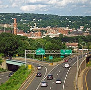
and Hartford
Hartford, Connecticut
Hartford is the capital of the U.S. state of Connecticut. The seat of Hartford County until Connecticut disbanded county government in 1960, it is the second most populous city on New England's largest river, the Connecticut River. As of the 2010 Census, Hartford's population was 124,775, making...
, the state capital and the largest community along its eastern length. After intersecting Interstate 91
Interstate 91
Interstate 91 is an Interstate Highway in the New England region of the United States. It provides the primary north–south thoroughfare in the western part of New England...
, the road crosses the Connecticut River
Connecticut River
The Connecticut River is the largest and longest river in New England, and also an American Heritage River. It flows roughly south, starting from the Fourth Connecticut Lake in New Hampshire. After flowing through the remaining Connecticut Lakes and Lake Francis, it defines the border between the...
on the Bulkeley Bridge
Bulkeley Bridge
The Bulkeley Bridge is a stone arch bridge composed of nine spans located in Hartford, Connecticut. The bridge carries Interstate 84, U.S. Route 6 and U.S. Route 44 across the Connecticut River, connecting Hartford to East Hartford...
, oldest on the Interstate system, then becomes the Wilbur Cross Highway
Wilbur Cross Highway
The Wilbur Cross Highway is the designation for the portion of old Route 15 from Wethersfield in Connecticut, through Hartford and Manchester, to the Massachusetts Turnpike in Sturbridge, Massachusetts. The highway was built in the 1940s before the Interstate Highway era...
and continues towards the northeast.
The last exit in Connecticut is Exit 74, an exit for Route 171. I-84 crosses the Massachusetts border in the town of Union
Union, Connecticut
Union is a town in Tolland County, Connecticut, United States. The population was 854 at the 2010 census, making it the least populous town in Connecticut and the second-least populous municipality in Connecticut; only the Borough of Fenwick has fewer people...
.
Massachusetts
The Wilbur Cross Highway continues on Interstate 84 after the highway crosses the state line. For a short distance (approximately 90 yards eastbound and 200 yards westbound), the interstate passes through the town of HollandHolland, Massachusetts
-Geography:According to the United States Census Bureau, the town has a total area of , of which, of it is land and of it is water. Holland is bounded on the east by Sturbridge; on the south by Union, Connecticut; on the west by Wales; and on the north by Brimfield. Holland is equidistant...
in Hampden County
Hampden County, Massachusetts
-Demographics:As of the census of 2004, there were 461,228 people, 175,288 households, and 115,690 families residing in the county. The population density was 738 people per square mile . There were 185,876 housing units at an average density of 301 per square mile...
before crossing into Sturbridge
Sturbridge, Massachusetts
Sturbridge is a town in Worcester County, Massachusetts, United States. It is home to Old Sturbridge Village living history museum and other sites of historical interest such as Tantiusques.The population was 9,268 at the 2010 census...
in Worcester County
Worcester County, Massachusetts
-Demographics:In 1990 Worcester County had a population of 709,705.As of the census of 2000, there were 750,963 people, 283,927 households, and 192,502 families residing in the county. The population density was 496 people per square mile . There were 298,159 housing units at an average density...
for the remainder of its length. I-84 only has three exits in Massachusetts, before ending at Interstate 90
Interstate 90
Interstate 90 is the longest Interstate Highway in the United States at . It is the northernmost coast-to-coast interstate, and parallels US 20 for the most part. Its western terminus is in Seattle, at Edgar Martinez Drive S. near Safeco Field and CenturyLink Field, and its eastern terminus is in...
, the Massachusetts Turnpike
Massachusetts Turnpike
The Massachusetts Turnpike is the easternmost stretch of Interstate 90. The Turnpike begins at the western border of Massachusetts in West Stockbridge connecting with the Berkshire Connector portion of the New York State Thruway...
. I-84 ends at Exit 9 of I-90, which is located in Sturbridge, 7.7 miles (12.4 km) into the state, making the Massachusetts section of the highway the shortest distance within any of the four states it traverses.
Road to Providence
Interstate 84 was originally to head east from Hartford, ConnecticutHartford, Connecticut
Hartford is the capital of the U.S. state of Connecticut. The seat of Hartford County until Connecticut disbanded county government in 1960, it is the second most populous city on New England's largest river, the Connecticut River. As of the 2010 Census, Hartford's population was 124,775, making...
to Providence, Rhode Island
Providence, Rhode Island
Providence is the capital and most populous city of Rhode Island and was one of the first cities established in the United States. Located in Providence County, it is the third largest city in the New England region...
.
Original route
The original route of Interstate 84 would have used present-day Interstate 384Interstate 384
Interstate 384 is an Interstate Highway located entirely within the state of Connecticut. It runs east to west, going from Interstate 84 in East Hartford to U.S. Route 6/U.S...
to Bolton, Connecticut
Bolton, Connecticut
Bolton is a town in Tolland County, Connecticut, United States. The population was 5,017 at the 2000 census. Bolton was incorporated in October 1720 and is governed by town meeting.-History:...
, then along a never-built section of freeway that would have connected to the US 6
U.S. Route 6
U.S. Route 6 , also called the Grand Army of the Republic Highway, a name that honors an American Civil War veterans association, is a main route of the U.S. Highway system, running east-northeast from Bishop, California to Provincetown, Massachusetts. Until 1964, it continued south from Bishop to...
bypass around Willimantic, Connecticut
Willimantic, Connecticut
Willimantic is a census-designated place and former city located in the town of Windham in Windham County, Connecticut, United States. The population was estimated at 15,823 at the 2000 census. It is home to Eastern Connecticut State University, as well as the Windham Textile and History Museum....
. Another never-built freeway section would have connected it to Interstate 395 and extended I-84 onto State Road 695 in Connecticut, the easternmost portion of the Connecticut Turnpike
Connecticut Turnpike
The Connecticut Turnpike, known now as the Governor John Davis Lodge Turnpike, is a freeway in Connecticut that runs from Greenwich to Killingly. It is signed as Interstate 95 from the New York state line at Greenwich to East Lyme, and then as Interstate 395 from East Lyme to Plainfield...
in Plainfield, Connecticut
Plainfield, Connecticut
Plainfield is a town in Windham County, Connecticut, United States. The population was 14,619 at the 2000 census. The town comprises four villages: Plainfield , Moosup , Wauregan , and Central Village . Each village has their own respective United States Post Office and fire department...
. From there, it would have roughly followed US 6 through western Rhode Island
Rhode Island
The state of Rhode Island and Providence Plantations, more commonly referred to as Rhode Island , is a state in the New England region of the United States. It is the smallest U.S. state by area...
to connect to the present-day US 6 freeway in Johnston
Johnston, Rhode Island
Johnston is a town in Providence County, Rhode Island, United States. The population was 28,769 at the 2010 census. Johnston is the site of the Clemence Irons House a stone-ender museum and the only landfill in Rhode Island...
. From there, a freeway from Olneyville Square
Olneyville Square
Olneyville is a neighborhood in Providence, Rhode Island bordered by Atwells Avenue to the north, U.S. Route 6 to the south and Rhode Island Route 10 to the east. The Woonasquatucket River runs through the southern portion of the neighborhood...
to the Interstate 95
Interstate 95 in Rhode Island
Interstate 95, the main north–south Interstate Highway on the east coast of the United States, runs generally southwest-northeast through the U.S. state of Rhode Island. It runs from the border with Connecticut near Westerly through Warwick and Providence and to the Massachusetts state line...
–Interstate 195 interchange was briefly considered, but abandoned in favor of what later became the Route 6-10 Connector.
Upgrades
Sections of I-84 in Connecticut were reconstructed and widened in the 1980s. The former I-86 portion from East Hartford to the Massachusetts state line was completely rebuilt from a narrow 4-lane freeway to a much wider profile ranging from 6 lanes at the Massachusetts state line, expanding to 8 lanes in Vernon, to 12 lanes with HOV lanes in East Hartford. Another section through Danbury was widened from 4 lanes to 6 lanes in 1985 and 1986. Widening of the highway through Danbury was funded by Union CarbideUnion Carbide
Union Carbide Corporation is a wholly owned subsidiary of The Dow Chemical Company. It currently employs more than 2,400 people. Union Carbide primarily produces chemicals and polymers that undergo one or more further conversions by customers before reaching consumers. Some are high-volume...
as part of building its world headquarters in Danbury.
Environmental concerns
Though the route was basically set in stone in ConnecticutConnecticut
Connecticut is a state in the New England region of the northeastern United States. It is bordered by Rhode Island to the east, Massachusetts to the north, and the state of New York to the west and the south .Connecticut is named for the Connecticut River, the major U.S. river that approximately...
, many issues remained in Rhode Island
Rhode Island
The state of Rhode Island and Providence Plantations, more commonly referred to as Rhode Island , is a state in the New England region of the United States. It is the smallest U.S. state by area...
, the biggest of which were major environmental concerns about how the freeway would affect the Scituate Reservoir
Scituate Reservoir
The Scituate Reservoir is the largest inland body of water in the state of Rhode Island. It has an aggregate capacity of and a surface area of 5.3 square miles...
, which is the main drinking water supply for Providence
Providence, Rhode Island
Providence is the capital and most populous city of Rhode Island and was one of the first cities established in the United States. Located in Providence County, it is the third largest city in the New England region...
.
Alternate route
In an attempt to ease environmental concerns, an alternate route was briefly studied in Rhode IslandRhode Island
The state of Rhode Island and Providence Plantations, more commonly referred to as Rhode Island , is a state in the New England region of the United States. It is the smallest U.S. state by area...
that would have connected Interstate 84 to the present-day Route 37
Route 37 (Rhode Island)
Route 37, also known as the Lincoln Avenue Freeway, is a numbered state highway running in Providence County and Kent County, Rhode Island, United States. The route is a nominally east–west freeway for its entire length. Route 37 serves the cities of Cranston and Warwick and is also a major...
freeway. This would have allowed construction of I-84 south of the Scituate Reservoir
Scituate Reservoir
The Scituate Reservoir is the largest inland body of water in the state of Rhode Island. It has an aggregate capacity of and a surface area of 5.3 square miles...
. Major community opposition caused this plan, as well as I-84 as a whole, to be scrapped.
Long-range plans
In the 1992 long-range transportation plan released by the Rhode Island Department of TransportationRhode Island Department of Transportation
The Rhode Island Department of Transportation is a Rhode Island state government agency charged with construction, maintenance and inspection of a wide range of transportation infrastructure. These include 1,102 miles of state roads and highways, 772 bridges, and 777 traffic signals...
, a freeway has been added along the original route of Interstate 84 that will connect to the CT 695 freeway on the Rhode Island
Rhode Island
The state of Rhode Island and Providence Plantations, more commonly referred to as Rhode Island , is a state in the New England region of the United States. It is the smallest U.S. state by area...
–Connecticut
Connecticut
Connecticut is a state in the New England region of the northeastern United States. It is bordered by Rhode Island to the east, Massachusetts to the north, and the state of New York to the west and the south .Connecticut is named for the Connecticut River, the major U.S. river that approximately...
border.
I-86 relation
The section of I-84 between East Hartford, ConnecticutEast Hartford, Connecticut
East Hartford is a town in Hartford County, Connecticut, United States. The population was 51,252 at the 2010 census.-Geography:...
(at the present-day junction with Interstate 384
Interstate 384
Interstate 384 is an Interstate Highway located entirely within the state of Connecticut. It runs east to west, going from Interstate 84 in East Hartford to U.S. Route 6/U.S...
) and Sturbridge, Massachusetts
Sturbridge, Massachusetts
Sturbridge is a town in Worcester County, Massachusetts, United States. It is home to Old Sturbridge Village living history museum and other sites of historical interest such as Tantiusques.The population was 9,268 at the 2010 census...
(Interstate 90
Interstate 90
Interstate 90 is the longest Interstate Highway in the United States at . It is the northernmost coast-to-coast interstate, and parallels US 20 for the most part. Its western terminus is in Seattle, at Edgar Martinez Drive S. near Safeco Field and CenturyLink Field, and its eastern terminus is in...
) was for a time signed as Interstate 86 (unrelated to present-day Interstate 86
Interstate 86 (east)
Interstate 86 is an Interstate Highway that extends for through northwestern Pennsylvania and southern New York in the United States...
in New York
New York
New York is a state in the Northeastern region of the United States. It is the nation's third most populous state. New York is bordered by New Jersey and Pennsylvania to the south, and by Connecticut, Massachusetts and Vermont to the east...
and Pennsylvania
Pennsylvania
The Commonwealth of Pennsylvania is a U.S. state that is located in the Northeastern and Mid-Atlantic regions of the United States. The state borders Delaware and Maryland to the south, West Virginia to the southwest, Ohio to the west, New York and Ontario, Canada, to the north, and New Jersey to...
). Signs stating "I-84 Ends, I-86 to Boston
Boston
Boston is the capital of and largest city in Massachusetts, and is one of the oldest cities in the United States. The largest city in New England, Boston is regarded as the unofficial "Capital of New England" for its economic and cultural impact on the entire New England region. The city proper had...
" (eastbound) and "I-86 Ends, I-84 to Hartford" (westbound) were posted where the change took place. Exit numbering on I-86 was that of the road's predecessor, Route 15
Route 15 (Connecticut)
Route 15 is a state highway in the U.S. state of Connecticut that runs from a connection with New York's Hutchinson River Parkway in Greenwich, Connecticut to its northern terminus intersecting with Interstate 84 in East Hartford, Connecticut...
, in a sequence beginning on New York's Hutchinson River Parkway
Hutchinson River Parkway
The Hutchinson River Parkway is a north–south parkway in southern New York, United States. It extends for from the massive Bruckner Interchange in the Throgs Neck section of the Bronx to the New York – Connecticut state line at Rye Brook...
. Exits were renumbered to correspond with the rest of I-84 in Connecticut when the road was redesignated in 1984. The present I-384 as well as the present US 6 bypass near Willimantic, both of which were a part of what was then I-84's planned easterly continuation, were also numbered I-84 prior to 1984 even though they lacked any direct connection to the rest of I-84 at that time. (One had to use Silver Lane in East Hartford to travel between the two stretches of the highway.) These two sections were re-numbered I-384 and Rte 6 when what was then I-86 was re-numbered I-84.
Tolls
As I-84 was built with federal funds, there are generally no highway tolls. The exception is I-84's Hudson RiverHudson River
The Hudson is a river that flows from north to south through eastern New York. The highest official source is at Lake Tear of the Clouds, on the slopes of Mount Marcy in the Adirondack Mountains. The river itself officially begins in Henderson Lake in Newcomb, New York...
crossing, the Newburgh-Beacon Bridge
Newburgh-Beacon Bridge
The Newburgh–Beacon Bridge, is a cantilever toll bridge that spans the Hudson River in New York State carrying NY 52 and Interstate 84 between Newburgh and Beacon...
. Since the bridge is under the New York State Bridge Authority
New York State Bridge Authority
The New York State Bridge Authority is a public benefit corporation in New York State, United States. The NYSBA was born out of the necessity for a bridge over the Hudson River to link the city of Hudson and the village of Catskill.-History:...
, it carries an eastbound-only toll of $1 for passenger vehicles (6/19/2010).
I-84 transfer to NYS Thruway Authority
From 1992 through 2006, Interstate 84 in New YorkNew York
New York is a state in the Northeastern region of the United States. It is the nation's third most populous state. New York is bordered by New Jersey and Pennsylvania to the south, and by Connecticut, Massachusetts and Vermont to the east...
was a toll-free component of the New York State Thruway system. It was transferred by the state DOT to the Thruway Authority in order to capitalize on that agency's steady revenue stream from upstate sources.
In 1992, maintenance responsibility for I-84 in New York was transferred to the New York State Thruway Authority and the monies for that purpose came from existing tolls on I-190
Interstate 190 (New York)
Interstate 190 runs 28.34 miles from Interstate 90 near Buffalo, New York to Lewiston, New York via Niagara Falls. Parts of this highway were built on the former rights-of-way of the Lehigh Valley Railroad and the Erie Canal. It is referred to by locals as The One-Ninety...
in downtown Buffalo
Buffalo, New York
Buffalo is the second most populous city in the state of New York, after New York City. Located in Western New York on the eastern shores of Lake Erie and at the head of the Niagara River across from Fort Erie, Ontario, Buffalo is the seat of Erie County and the principal city of the...
, more than 300 miles (482.8 km) away. On Monday, October 30, 2006, the Thruway Authority began the process of returning maintenance and operation responsibilities to NYSDOT and the tolls in Buffalo were discontinued. The I-190 tolls were considered to be one of the principal causes of highway congestion in Buffalo. From 2006 to 2010, maintenance was performed by the Thruway Authority with funding provided by the state legislature. On Monday, October 11, 2010, NYSDOT resumed full control of I-84.
Widening projects in Waterbury
A widening project along the congested stretch of I-84 through WaterburyWaterbury, Connecticut
Waterbury is a city in New Haven County, Connecticut, on the Naugatuck River, 33 miles southwest of Hartford and 77 miles northeast of New York City...
and Cheshire, Connecticut
Cheshire, Connecticut
Cheshire is a town in New Haven County, Connecticut, United States. The population was 28,543 at the 2000 census. The center of population of Connecticut is located in Cheshire. In 2009 Cheshire was ranked 72 in Money Magazine's 100 Best Places to Live.Likewise, in 2011 Cheshire was ranked 73 in...
has been beset by cost overruns, delays, and construction defects involving storm drains, as state and federal officials have launched criminal investigations stemming from this project. This episode has waned local enthusiasm for a proposed $2 billion reconstruction of the Mixmaster interchange in downtown Waterbury. Cost estimates for the Mixmaster replacement have increased to $3 billion. CT Attorney General Richard Blumenthal
Richard Blumenthal
Richard Blumenthal is the junior United States Senator from Connecticut and a member of the Democratic Party. Previously, he served as Attorney General of Connecticut....
has begun a lawsuit against the contractor and an engineering firm in response to threats from the U.S. DOT to withhold funds from the project. On May 18, 2007, the Waterbury Republican-American
Waterbury Republican-American
The Republican-American, headquartered in Waterbury, Connecticut is the United States' 193rd-largest newspaper with an average Sunday circulation of 61,100...
reported this area had defective light poles, while Governor M. Jodi Rell
M. Jodi Rell
Mary Jodi Rell is a Republican politician and was the 87th Governor of the U.S. state of Connecticut from 2004 until 2011. She was the Lieutenant Governor of Connecticut under Governor John G. Rowland, who resigned during a corruption investigation. Rell is Connecticut's second female Governor,...
released an audit report of the construction disaster. A number of DOT personnel were either fired or reprimanded following the scandal. Meanwhile the FBI and a federal grand jury are investigating the now-defunct construction company and the same DOT officials, which may eventually lead to criminal charges in the case.
Future
I-84 now has a direct interchange with the New York State Thruway (Interstate 87Interstate 87
Interstate 87 is a Interstate Highway located entirely within New York State in the United States of America. I-87 is the longest intrastate Interstate highway in the Interstate Highway System. Its southern end is at the Bronx approaches of the Robert F. Kennedy Bridge in New York City...
), in the town of Newburgh
Newburgh (town), New York
Newburgh is a town in Orange County, New York, United States. The 2010 census determined the population is 29,801. This is the first time ever that the population of the Town of Newburgh officially exceeded that of the adjacent but totally separate municipality known as the city of Newburgh...
.
Pennsylvania
| County | Location | Exit | Destinations | Notes |
|---|---|---|---|---|
| Lackawanna Lackawanna County, Pennsylvania As of the census of 2000, there were 213,295 people, 86,218 households, and 55,783 families residing in the county. The population density was 465 people per square mile . There were 95,362 housing units at an average density of 208 per square mile... |
Dunmore | - Binghamton | Westbound exit and eastbound entrance | |
| Westbound exit and eastbound entrance | ||||
| Westbound exit and eastbound entrance | ||||
| 1 | Tigue Street | |||
| Elmhurst Township. Elmhurst Township, Pennsylvania Elmhurst Township is a township in Lackawanna County, Pennsylvania, United States. The population was 894 at the 2010 census.-Geography:According to the United States Census Bureau, the township has a total area of , of which, of it is land and of it is water.-Demographics:As of the census of... |
2 | Eastbound exit and westbound entrance. Left exit from eastbound | ||
| 4 | ||||
| Jefferson Township. Jefferson Township, Lackawanna County, Pennsylvania Jefferson Township is a township in Lackawanna County, Pennsylvania, United States. The population was 3,731 at the 2010 census.-Geography:... |
8 | |||
| Wayne Wayne County, Pennsylvania As of the census of 2000, there were 47,722 people, 18,350 households, and 12,936 families residing in the county. The population density was 65 people per square mile . There were 30,593 housing units at an average density of 42 per square mile... |
Sterling Township. Sterling Township, Pennsylvania Sterling Township is a township in Wayne County, Pennsylvania, United States. The population was 1,450 at the 2010 census.-Geography:According to the United States Census Bureau, the township has a total area of 27.3 square miles , of which, 27.2 square miles of it is land and... |
17 | ||
| Pike Pike County, Pennsylvania -National protected areas:* Delaware Water Gap National Recreation Area * Middle Delaware National Scenic River * Upper Delaware Scenic and Recreational River -Demographics:... |
Greene Township. Greene Township, Pike County, Pennsylvania Greene Township is a township in Pike County, Pennsylvania, United States. The population was 3,956 at the 2010 census.-Geography:According to the United States Census Bureau, the township has a total area of , of which, of it is land and of it is water.-Demographics:As of the census of 2010,... |
20 | ||
| Palmyra Township. Palmyra Township, Pike County, Pennsylvania Palmyra Township is a township in Pike County, Pennsylvania, United States. The population was 3,312 at the 2010 census. The majority of its northwestern border is Lake Wallenpaupack.-Geography:... |
26 | |||
| Blooming Grove Township. Blooming Grove Township, Pennsylvania Blooming Grove Township is a township in Pike County, Pennsylvania, United States. The population was 4,819 at the 2010 census. Hemlock Farms housing community is located in Blooming Grove township.-Geography:... |
30 | |||
| Dingman Township. Dingman Township, Pennsylvania Dingman Township is a township in Pike County, Pennsylvania, United States. The population was 11,926 at the 2010 census. The Township was created in 1832 and named in honor of Judge Daniel Westbrook Dingman.-Geography:... |
34 | |||
| Milford Township. Milford Township, Pike County, Pennsylvania Milford Township is a township in Pike County, Pennsylvania, United States. The population was 1,530 at the 2010 census.-Geography:According to the United States Census Bureau, the township has a total area of 13.1 square miles , of which, 13 square miles of it is land and... |
46 | |||
| Matamoras Matamoras, Pennsylvania Matamoras is a borough in Pike County, Pennsylvania, United States. The population was 2,469 at the 2010 census. It is the easternmost town in Pennsylvania.-History:... |
53 |
Massachusetts
| Town New England town The New England town is the basic unit of local government in each of the six New England states. Without a direct counterpart in most other U.S. states, New England towns are conceptually similar to civil townships in other states, but are incorporated, possessing powers like cities in other... |
Mile | Exit Exit number An exit number is a number assigned to a road junction, usually an exit from a freeway. It is usually marked on the same sign as the destinations of the exit, as well as a sign in the gore.... |
Destination | Notes |
|---|---|---|---|---|
| Sturbridge Sturbridge, Massachusetts Sturbridge is a town in Worcester County, Massachusetts, United States. It is home to Old Sturbridge Village living history museum and other sites of historical interest such as Tantiusques.The population was 9,268 at the 2010 census... |
0.2 | Mashapaug Road | Westbound entrance only; former Route 15 Route 15 (Massachusetts) Route 15 is a short, unsigned route in the U.S. state of Massachusetts, connecting Rhode Island's Route 15 with Route 152 in Seekonk. At a length of just under a quarter mile , it is the shortest numbered highway in the state.-Route description:... |
|
| 3.25 | 1 | Mashapaug Road – Southbridge | Former Route 15 Route 15 (Massachusetts) Route 15 is a short, unsigned route in the U.S. state of Massachusetts, connecting Rhode Island's Route 15 with Route 152 in Seekonk. At a length of just under a quarter mile , it is the shortest numbered highway in the state.-Route description:... |
|
| 5.07 | 2 | |||
| 6.56 | 3 | Signed as exits 3A (east) and 3B (west) | ||
| 7.5 | Toll plaza | |||
| 7.7 | , New Hampshire New Hampshire New Hampshire is a state in the New England region of the northeastern United States of America. The state was named after the southern English county of Hampshire. It is bordered by Massachusetts to the south, Vermont to the west, Maine and the Atlantic Ocean to the east, and the Canadian... , Maine Maine Maine is a state in the New England region of the northeastern United States, bordered by the Atlantic Ocean to the east and south, New Hampshire to the west, and the Canadian provinces of Quebec to the northwest and New Brunswick to the northeast. Maine is both the northernmost and easternmost... , Albany |
Eastbound exit and westbound entrance To I-495, Route 128 Route 128 (Massachusetts) Route 128, also known as the Yankee Division Highway , and originally the Circumferential Highway, is a partial beltway around Boston, Massachusetts, United States. The majority of the highway is built to freeway standards, and about 3/5 of it is part of the Interstate Highway System... |
||
Auxiliary routes
I-484 was slated to be built below downtown Hartford (connecting with Interstate 91), but that highway was never completed.See also
- Interstate 84 (west)Interstate 84 (west)Interstate 84 is an Interstate Highway in the Western United States that runs from Portland, Oregon, to a junction with Interstate 80 near Echo, Utah. The highway originally served as a fork of I-80 to serve the Pacific Northwest, and was originally numbered Interstate 80N.The highway serves and...
- New York State Thruway