
Pennsylvania Route 136
Encyclopedia
Pennsylvania Route 136 is a 40 miles (64.4 km) long state highway
located in Washington
, Allegheny
, and Westmoreland
counties in Pennsylvania
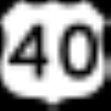
. The western terminus is at US 40
& PA 18
in Washington
. The eastern terminus is at US 30
in Greensburg
.
/PA 18
in Washington
, Washington County
, heading east on two-lane undivided West Beau Street. The road heads through the commercial downtown of Washington, becoming East Beau Street at the Main Street junction. The route intersects the one-way pair
carrying US 19
as it passes through the Washington & Jefferson College
campus. PA 136 heads into residential areas and enters East Washington
, turning to the northeast. The road heads into South Strabane Township
and comes to an interchange with I-70
/I-79, at which point it becomes a divided highway
. Past this interchange, the route becomes undivided again and passes a few businesses before continuing past more homes. PA 136 winds east through areas of woods and housing developments before heading through a mix of farmland and woodland with a few residences. The road becomes the border between North Strabane Township
to the north and South Strabane Township to the south as it heads into more industrial areas as an unnamed road. The route passes over a CSX railroad line and comes to an intersection with PA 519
, at which point it crosses into Somerset Township
. PA 136 continues east through areas of farms and woods with occasional homes. The road winds to the northeast and becomes the border between Nottingham Township
to the north and Somerset Township to the south, passing through Dunningsville. The route heads east through more agricultural areas with a few woods and residences, heading southeast into more wooded areas of homes, running through Kammerer. PA 136 turns northeast and fully enters Somerset Township again, running through more rural areas. The road becomes the border between Nottingham Township and Somerset Township again. The route forms the border between Nottingham Township to the north and Fallowfield Township
to the south as it curves northeast again and continues through more wooded areas with some fields and homes. PA 136 turns east and heads through residential areas, turning southeast onto Dry Run Road as it becomes the border between Carroll Township
to the north and Fallowfield Township to the south. A short distance later, the road comes to Ginger Hill
and intersects the northern terminus of PA 917
.
Here, the route turns east into Carroll Township, passing through woodland and coming to an interchange with the PA 43 toll road, where it becomes a divided highway. Following this interchange, PA 136 becomes undivided and heads through wooded areas with some homes, crossing under a Wheeling and Lake Erie Railway line and passing through Baidland
. The road runs east-northeast through areas of fields and woods with some homes, curving east into woodland as it forms the border between New Eagle
to the north and Carroll Township to the south. PA 136 turns northeast through more woods with some homes, running along the border between New Eagle to the northwest and Monongahela
to the southeast briefly before fully entering Monongahela. The route heads north to an intersection with PA 88
/PA 837
, turning east to form a concurrency
with the two routes on West Main Street, a three-lane road with a center left-turn lane. The road passes businesses before heading into residential areas as a two-lane road, turning southeast and heading through the commercial downtown of Monongahela. The three routes intersect PA 481
and become East Main Street, crossing a Norfolk Southern railroad line. The road passes more businesses as a four-lane divided highway, with PA 837 splitting to the southeast and PA 88/PA 136 becoming unnamed. A short distance later, PA 136 splits from PA 88 by turning northeast onto a two-lane undivided road, heading onto the Monongahela City Bridge
that carries the route over PA 837 and a Norfolk Southern railroad line before crossing over the Monongahela River
.
in Allegheny County
and passes over more of the river before heading over a CSX railroad line. After leaving the Monongahela City Bridge, the route briefly becomes a divided highway and curves east-southeast onto Bunola River Road. The road becomes undivided again and passes between woodland to the north and industry to the south with the CSX line and the Monongahela River located further south. PA 136 curves east at the residential community of Manown and becomes Rainbow Run Road. The road passes more woods and industrial establishments before running through Gallatin and Sunny Side. Farther east, the route passes between woods to the north and the railroad tracks to the south, coming to an intersection with PA 906
in Milesville. At this point, PA 136 curves northeast away from the river and runs through dense woodland with a few homes. The road heads through agricultural areas as it reaches an interchange with PA 51
, turning east and crossing into Elizabeth Township
immediately after the interchange. Here, the route becomes West Newton Road and heads through wooded areas with some farm fields and homes, briefly turning southeast before heading east again.
in Westmoreland County
and becomes an unnamed road, running through more farmland and woodland with a few homes and curving east-southeast. The road turns east and intersects PA 201
, becoming West Main Street at this point. The route passes through more woods with some businesses before crossing into West Newton
and heading through residential areas. PA 136 passes a few businesses before turning southeast and crossing the Youghiogheny River
, becoming East Main Street and heading through the commercial downtown of West Newton. The road passes more homes before turning south and forming the border between residential West Newton to the west and wooded South Huntingdon Township
to the east. The route turns east, fully entering South Huntingdon Township and becoming Mt. Pleasant Road as it passes farm fields and a few homes. PA 136 comes to an intersection with PA 31
, with that route continuing east on Mt. Pleasant Road and PA 136 turning north-northeast onto Greensburg Pike.
The road passes through rural areas of homes, curving to the east-northeast. The route heads into wooded areas and crosses the Sewickley Creek into Sewickley Township
and turns southeast, heading through a mix of farmland and woodland with a few residences. PA 136 turns northeast and runs through more agricultural areas with a few woods and homes. The road winds northeast through more rural areas before heading into Madison
and passing residences. The route turns northwest onto Main Street and runs through more residential areas, turning northeast onto an unnamed road and crossing into Hempfield Township
. PA 136 passes through wooded areas with some homes, heading north. The road heads into a mix of farmland and woodland with some homes, turning east in the residential community of Darragh. The road runs through areas of homes with some commercial development, passing over I-76
(Pennsylvania Turnpike
) before turning northeast and entering Arona
. Here, the route passes homes before crossing back into Hempfield Township. PA 136 continues through more agricultural areas and woodland with a few residences, curving east. The road heads through dense woods, turning northeast again. The route turns east onto a four-lane divided highway and comes to an interchange with the PA 66
toll road. PA 136 narrows back into a two-lane undivided road and turns northeast through rural residential areas before heading into areas of residential subdivisions, passing through Fort Allen. The road gains a center left-turn lane and passes a few businesses. The route becomes West Newton Road and is two lanes again as it passes more homes, crossing a Southwest Pennsylvania Railroad line. PA 136 continues east through dense residential areas and becomes the border between Greensburg
to the north and Hempfield Township to the south. The route becomes a divided highway and ends at an interchange with the US 30
freeway, with West Newton Street continuing east toward downtown Greensburg.
State highway
State highway, state road or state route can refer to one of three related concepts, two of them related to a state or provincial government in a country that is divided into states or provinces :#A...
located in Washington
Washington County, Pennsylvania
-Government and politics:As of November 2008, there are 152,534 registered voters in Washington County .* Democratic: 89,027 * Republican: 49,025 * Other Parties: 14,482...
, Allegheny
Allegheny County, Pennsylvania
Allegheny County is a county in the southwestern part of the U.S. state of Pennsylvania. As of the 2010 census, the population was 1,223,348; making it the second most populous county in Pennsylvania, following Philadelphia County. The county seat is Pittsburgh...
, and Westmoreland
Westmoreland County, Pennsylvania
-Demographics:As of the census of 2000, there were 369,993 people, 149,813 households, and 104,569 families residing in the county. The population density was 361 people per square mile . There were 161,058 housing units at an average density of 157 per square mile...
counties in Pennsylvania
Pennsylvania
The Commonwealth of Pennsylvania is a U.S. state that is located in the Northeastern and Mid-Atlantic regions of the United States. The state borders Delaware and Maryland to the south, West Virginia to the southwest, Ohio to the west, New York and Ontario, Canada, to the north, and New Jersey to...
. The western terminus is at US 40
U.S. Route 40
U.S. Route 40 is an east–west United States highway. As with most routes whose numbers end in a zero, U.S. 40 once traversed the entire United States. It is one of the original 1920s U.S. Highways, and its first termini were San Francisco, California, and Atlantic City, New Jersey...
& PA 18
Pennsylvania Route 18
Pennsylvania Route 18 is a major north–south highway in Western Pennsylvania whose southern terminus is at the West Virginia state line in Greene County, Pennsylvania near the village of Garrison, while the northern terminus is at PA Route 5 in Lake City, Pennsylvania...
in Washington
Washington, Pennsylvania
Washington is a city in and the county seat of Washington County, Pennsylvania, United States, within the Pittsburgh Metro Area in the southwestern part of the state...
. The eastern terminus is at US 30
U.S. Route 30
U.S. Route 30 is an east–west main route of the system of United States Numbered Highways, with the highway traveling across the northern tier of the country. It is the third longest U.S. route, after U.S. Route 20 and U.S. Route 6. The western end of the highway is at Astoria, Oregon; the...
in Greensburg
Greensburg, Pennsylvania
Greensburg is a city in Westmoreland County, Pennsylvania, United States, and a part of the Pittsburgh Metro Area. The city is named after Nathanael Greene, a major general of the Continental Army in the American Revolutionary War...
.
Washington County
PA 136 begins at an intersection with US 40U.S. Route 40 in Pennsylvania
U.S. Route 40 enters Pennsylvania at West Alexander. It closely parallels I-70 from West Virginia until it reaches Washington where it follows Jefferson Avenue and Maiden Street. In Washington, US 40 passes to the south of Washington & Jefferson College. Following Maiden Street out of town, the...
/PA 18
Pennsylvania Route 18
Pennsylvania Route 18 is a major north–south highway in Western Pennsylvania whose southern terminus is at the West Virginia state line in Greene County, Pennsylvania near the village of Garrison, while the northern terminus is at PA Route 5 in Lake City, Pennsylvania...
in Washington
Washington, Pennsylvania
Washington is a city in and the county seat of Washington County, Pennsylvania, United States, within the Pittsburgh Metro Area in the southwestern part of the state...
, Washington County
Washington County, Pennsylvania
-Government and politics:As of November 2008, there are 152,534 registered voters in Washington County .* Democratic: 89,027 * Republican: 49,025 * Other Parties: 14,482...
, heading east on two-lane undivided West Beau Street. The road heads through the commercial downtown of Washington, becoming East Beau Street at the Main Street junction. The route intersects the one-way pair
One-way pair
A one-way pair, one-way couple, or just couplet is a pair of parallel, usually one-way streets that carry opposite directions of a signed route or major traffic flow, or sometimes opposite directions of a bus or streetcar route....
carrying US 19
U.S. Route 19 in Pennsylvania
U.S. Route 19 in Pennsylvania closely parallels Interstate 79 for its entire length. US 19 enters Pennsylvania in Greene County near Mount Morris. Its northern terminus is in the city of Erie. Part is named for Commodore Oliver Hazard Perry, hero of the Battle of Lake Erie.-Route description:In...
as it passes through the Washington & Jefferson College
Washington & Jefferson College
Washington & Jefferson College, also known as W & J College or W&J, is a private liberal arts college in Washington, Pennsylvania, in the United States, which is south of Pittsburgh...
campus. PA 136 heads into residential areas and enters East Washington
East Washington, Pennsylvania
East Washington is a borough in Washington County, Pennsylvania, United States. The population was 1,930 at the 2000 census.-Geography:East Washington is located at ....
, turning to the northeast. The road heads into South Strabane Township
South Strabane Township, Pennsylvania
South Strabane Township is a township in Washington County, Pennsylvania, United States. The population was 9,346 at the 2000 census. The township is named after the town of Strabane in County Tyrone, Northern Ireland.-Geography:...
and comes to an interchange with I-70
Interstate 70 in Pennsylvania
In the U.S. state of Pennsylvania, Interstate 70 runs east–west across the southwest part of the state serving the southern half of the Pittsburgh metropolitan area. About half of the route is concurrent with Interstate 76 along the Pennsylvania Turnpike...
/I-79, at which point it becomes a divided highway
Divided Highway
Divided Highway is a compilation album by American rock band The Doobie Brothers, released in 2003. . All tracks are taken from the albums Cycles and Brotherhood .-Track listing:...
. Past this interchange, the route becomes undivided again and passes a few businesses before continuing past more homes. PA 136 winds east through areas of woods and housing developments before heading through a mix of farmland and woodland with a few residences. The road becomes the border between North Strabane Township
North Strabane Township, Pennsylvania
North Strabane Township is a township in Washington County, Pennsylvania, United States. The population was 13,408 at the 2010 census. The township is named after the town of Strabane in County Tyrone, Northern Ireland. The township borders the borough of Canonsburg, Pennsylvania to the north...
to the north and South Strabane Township to the south as it heads into more industrial areas as an unnamed road. The route passes over a CSX railroad line and comes to an intersection with PA 519
Pennsylvania Route 519
Pennsylvania Route 519 runs in a north–south route through central Washington County connecting the Glyde area of North Bethlehem Township at the southern terminus with the Hickory area of Mt...
, at which point it crosses into Somerset Township
Somerset Township, Washington County, Pennsylvania
Somerset Township is a township in Washington County, Pennsylvania, United States. The population was 2,701 at the 2000 census.-Geography:...
. PA 136 continues east through areas of farms and woods with occasional homes. The road winds to the northeast and becomes the border between Nottingham Township
Nottingham Township, Pennsylvania
Nottingham Township is a township in Washington County, Pennsylvania, United States. The population was 2,522 in the 2000 census.-Geography:...
to the north and Somerset Township to the south, passing through Dunningsville. The route heads east through more agricultural areas with a few woods and residences, heading southeast into more wooded areas of homes, running through Kammerer. PA 136 turns northeast and fully enters Somerset Township again, running through more rural areas. The road becomes the border between Nottingham Township and Somerset Township again. The route forms the border between Nottingham Township to the north and Fallowfield Township
Fallowfield Township, Pennsylvania
Fallowfield Township is a township in Washington County, Pennsylvania, United States. The population was 4,461 at the 2000 census.-Geography:...
to the south as it curves northeast again and continues through more wooded areas with some fields and homes. PA 136 turns east and heads through residential areas, turning southeast onto Dry Run Road as it becomes the border between Carroll Township
Carroll Township, Washington County, Pennsylvania
Carroll Township is a township in Washington County, Pennsylvania, United States. The population was 5,677 at the 2000 census.Carroll Township is strongly allied with the City of Monongahela and the boroughs of Donora and New Eagle...
to the north and Fallowfield Township to the south. A short distance later, the road comes to Ginger Hill
Ginger Hill, Pennsylvania
Ginger Hill, Pennsylvania is an unincorporated community in Washington County, Pennsylvania, United States. it is home to the Ebenezer Covered Bridge....
and intersects the northern terminus of PA 917
Pennsylvania Route 917
Pennsylvania Route 917 is a long state highway located in Washington county in Pennsylvania. The southern terminus is at US 40 in North Bethlehem Township. The northern terminus is at PA 136 in Fallowfield Township.-Route description:...
.
Here, the route turns east into Carroll Township, passing through woodland and coming to an interchange with the PA 43 toll road, where it becomes a divided highway. Following this interchange, PA 136 becomes undivided and heads through wooded areas with some homes, crossing under a Wheeling and Lake Erie Railway line and passing through Baidland
Baidland, Pennsylvania
Baidland is a census-designated place in Washington County, Pennsylvania, United States. The population was 1,576 at the 2000 census.-Geography:Baidland is located at ....
. The road runs east-northeast through areas of fields and woods with some homes, curving east into woodland as it forms the border between New Eagle
New Eagle, Pennsylvania
New Eagle is a borough in Washington County, Pennsylvania, United States and is part of the Pittsburgh Metro Area. The population was 2,262 at the 2000 census.-History:...
to the north and Carroll Township to the south. PA 136 turns northeast through more woods with some homes, running along the border between New Eagle to the northwest and Monongahela
Monongahela, Pennsylvania
Monongahela, colloquially called "Mon City," is a Third Class City in Washington County, Pennsylvania, United States and is part of the Pittsburgh Metro Area, located approximately south of the city proper. The population was 4,761 at the 2000 census...
to the southeast briefly before fully entering Monongahela. The route heads north to an intersection with PA 88
Pennsylvania Route 88
Pennsylvania Route 88 is a long north–south state highway located in southwestern Pennsylvania. The southern terminus of the route is at U.S. Route 119 in Point Marion less than from the Pennsylvania-West Virginia border. The northern terminus is at Pennsylvania Route 51 in Pittsburgh...
/PA 837
Pennsylvania Route 837
Pennsylvania Route 837 is a state route located in western Pennsylvania. The southern terminus of the route is at Pennsylvania Route 88 in the Carroll Township hamlet of Wickerham Manor. The northern terminus is at U.S. Route 19 and Pennsylvania Route 51 in downtown Pittsburgh at the junction of...
, turning east to form a concurrency
Concurrency (road)
A concurrency, overlap, or coincidence in a road network is an instance of one physical road bearing two or more different highway, motorway, or other route numbers...
with the two routes on West Main Street, a three-lane road with a center left-turn lane. The road passes businesses before heading into residential areas as a two-lane road, turning southeast and heading through the commercial downtown of Monongahela. The three routes intersect PA 481
Pennsylvania Route 481
Pennsylvania Route 481 is an long state highway located in Washington county in Pennsylvania. The southern terminus is at US 40 in Centerville. The northern terminus is at PA 88/PA 136/PA 837 in Monongahela.-Route description:...
and become East Main Street, crossing a Norfolk Southern railroad line. The road passes more businesses as a four-lane divided highway, with PA 837 splitting to the southeast and PA 88/PA 136 becoming unnamed. A short distance later, PA 136 splits from PA 88 by turning northeast onto a two-lane undivided road, heading onto the Monongahela City Bridge
Monongahela City Bridge
The Monongahela City Bridge spans the Monongahela River from the City of Monongahela in Washington County, Pennsylvania to Forward Township in Allegheny County, Pennsylvania...
that carries the route over PA 837 and a Norfolk Southern railroad line before crossing over the Monongahela River
Monongahela River
The Monongahela River is a river on the Allegheny Plateau in north-central West Virginia and southwestern Pennsylvania in the United States...
.
Allegheny County
In the middle of the river, PA 136 crosses into Forward TownshipForward Township, Allegheny County, Pennsylvania
Forward Township is a township in Allegheny County, Pennsylvania, United States. The population was 3,376 at the 2010 census. The township is named after Walter Forward, U.S...
in Allegheny County
Allegheny County, Pennsylvania
Allegheny County is a county in the southwestern part of the U.S. state of Pennsylvania. As of the 2010 census, the population was 1,223,348; making it the second most populous county in Pennsylvania, following Philadelphia County. The county seat is Pittsburgh...
and passes over more of the river before heading over a CSX railroad line. After leaving the Monongahela City Bridge, the route briefly becomes a divided highway and curves east-southeast onto Bunola River Road. The road becomes undivided again and passes between woodland to the north and industry to the south with the CSX line and the Monongahela River located further south. PA 136 curves east at the residential community of Manown and becomes Rainbow Run Road. The road passes more woods and industrial establishments before running through Gallatin and Sunny Side. Farther east, the route passes between woods to the north and the railroad tracks to the south, coming to an intersection with PA 906
Pennsylvania Route 906
Pennsylvania Route 906 is a long state highway located in Fayette, Westmoreland, and Allegheny counties in Pennsylvania. The southern terminus is at PA 201 in Washington Township...
in Milesville. At this point, PA 136 curves northeast away from the river and runs through dense woodland with a few homes. The road heads through agricultural areas as it reaches an interchange with PA 51
Pennsylvania Route 51
Pennsylvania Route 51 is a major state highway in Western Pennsylvania. It runs for from Uniontown to the Ohio state line near Darlington, where it connects with Ohio State Route 14. Route 51 is the termination point for Pennsylvania Route 43, Pennsylvania Route 48 and Pennsylvania Route 88. ...
, turning east and crossing into Elizabeth Township
Elizabeth Township, Allegheny County, Pennsylvania
Elizabeth Township is a township in Allegheny County, Pennsylvania, United States. The population was 13,271 at the 2010 census.-Geography:According to the United States Census Bureau, the township has a total area of , of which is land and , or 1.96%, is water.-Demographics:As of the census of...
immediately after the interchange. Here, the route becomes West Newton Road and heads through wooded areas with some farm fields and homes, briefly turning southeast before heading east again.
Westmoreland County
PA 136 enters Rostraver TownshipRostraver Township, Pennsylvania
Rostraver Township is a township in Westmoreland County, Pennsylvania, United States. The population was 11,634 at the 2000 census.-History:Rostraver Township is the location of the Household No. 1 Site, which was once occupied by a Monongahela village....
in Westmoreland County
Westmoreland County, Pennsylvania
-Demographics:As of the census of 2000, there were 369,993 people, 149,813 households, and 104,569 families residing in the county. The population density was 361 people per square mile . There were 161,058 housing units at an average density of 157 per square mile...
and becomes an unnamed road, running through more farmland and woodland with a few homes and curving east-southeast. The road turns east and intersects PA 201
Pennsylvania Route 201
Pennsylvania Route 201, designated by the Pennsylvania Department of Transportation as State Route 201, is a long south-north state highway located in southeast Pennsylvania in the counties of Fayette and Westmoreland. The southern terminus is at U.S. Route 119/PA 711 in Connellsville...
, becoming West Main Street at this point. The route passes through more woods with some businesses before crossing into West Newton
West Newton, Pennsylvania
West Newton, located southeast of Pittsburgh, is a borough in Westmoreland County in the U.S. state of Pennsylvania. Formerly, the manufacture of radiators and boilers were the chief industries. In 1900, the people living there numbered 2,467. In 1910, 2,880 people lived there...
and heading through residential areas. PA 136 passes a few businesses before turning southeast and crossing the Youghiogheny River
Youghiogheny River
The Youghiogheny River , or the Yough for short, is a tributary of the Monongahela River in the U.S. states of West Virginia, Maryland, and Pennsylvania...
, becoming East Main Street and heading through the commercial downtown of West Newton. The road passes more homes before turning south and forming the border between residential West Newton to the west and wooded South Huntingdon Township
South Huntingdon Township, Pennsylvania
South Huntingdon Township is a township in Westmoreland County, Pennsylvania, United States. The population was 6,175 at the 2000 census.-Geography:...
to the east. The route turns east, fully entering South Huntingdon Township and becoming Mt. Pleasant Road as it passes farm fields and a few homes. PA 136 comes to an intersection with PA 31
Pennsylvania Route 31
Pennsylvania Route 31 is a long state highway located in Western Pennsylvania, paralleling U.S. Route 30 and the Pennsylvania Turnpike for most of its length. The designation begins at PA 136 near West Newton and ends at US 30 near Bedford....
, with that route continuing east on Mt. Pleasant Road and PA 136 turning north-northeast onto Greensburg Pike.
The road passes through rural areas of homes, curving to the east-northeast. The route heads into wooded areas and crosses the Sewickley Creek into Sewickley Township
Sewickley Township, Pennsylvania
Sewickley Township is a township in Westmoreland County, Pennsylvania, United States. The population was 6,230 at the 2000 census.-Geography:...
and turns southeast, heading through a mix of farmland and woodland with a few residences. PA 136 turns northeast and runs through more agricultural areas with a few woods and homes. The road winds northeast through more rural areas before heading into Madison
Madison, Pennsylvania
Madison is a borough in Westmoreland County, Pennsylvania, United States. The population was 510 at the 2000 census.-Geography:Madison is located at ....
and passing residences. The route turns northwest onto Main Street and runs through more residential areas, turning northeast onto an unnamed road and crossing into Hempfield Township
Hempfield Township, Westmoreland County, Pennsylvania
Hempfield Township is a township in Westmoreland County, Pennsylvania, United States. The population was 43,241 at the 2010 census, making it the largest suburb in the Pittsburgh Metropolitan Area by population.- Geography :...
. PA 136 passes through wooded areas with some homes, heading north. The road heads into a mix of farmland and woodland with some homes, turning east in the residential community of Darragh. The road runs through areas of homes with some commercial development, passing over I-76
Interstate 76 (east)
Interstate 76 is an Interstate Highway in the United States, running 435 miles from an interchange with Interstate 71 west of Akron, Ohio, east to Interstate 295 near Camden, New Jersey....
(Pennsylvania Turnpike
Pennsylvania Turnpike
The Pennsylvania Turnpike is a toll highway system operated by the Pennsylvania Turnpike Commission in the Commonwealth of Pennsylvania, United States. The three sections of the turnpike system total . The main section extends from Ohio to New Jersey and is long...
) before turning northeast and entering Arona
Arona, Pennsylvania
Arona is a borough in Westmoreland County, Pennsylvania, United States. The population was 407 at the 2000 census.-Geography:Arona is located at ....
. Here, the route passes homes before crossing back into Hempfield Township. PA 136 continues through more agricultural areas and woodland with a few residences, curving east. The road heads through dense woods, turning northeast again. The route turns east onto a four-lane divided highway and comes to an interchange with the PA 66
Pennsylvania Route 66
Pennsylvania Route 66 is a long state highway in Western Pennsylvania. Its northern terminus is at U.S. Route 6 in Kane. Its southern terminus is at US 119 near New Stanton. West of Greensburg, PA 66 becomes the tolled Amos K. Hutchinson Bypass, a part of the Pennsylvania Turnpike System. The...
toll road. PA 136 narrows back into a two-lane undivided road and turns northeast through rural residential areas before heading into areas of residential subdivisions, passing through Fort Allen. The road gains a center left-turn lane and passes a few businesses. The route becomes West Newton Road and is two lanes again as it passes more homes, crossing a Southwest Pennsylvania Railroad line. PA 136 continues east through dense residential areas and becomes the border between Greensburg
Greensburg, Pennsylvania
Greensburg is a city in Westmoreland County, Pennsylvania, United States, and a part of the Pittsburgh Metro Area. The city is named after Nathanael Greene, a major general of the Continental Army in the American Revolutionary War...
to the north and Hempfield Township to the south. The route becomes a divided highway and ends at an interchange with the US 30
U.S. Route 30 in Pennsylvania
In the U.S. state of Pennsylvania, U.S. Route 30 runs east–west across the southern part of the state, passing through Pittsburgh and Philadelphia on its way from the West Virginia state line east to the Benjamin Franklin Bridge over the Delaware River into New Jersey...
freeway, with West Newton Street continuing east toward downtown Greensburg.