
Pennsylvania Route 201
Encyclopedia
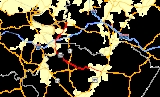
Pennsylvania Route 201, designated by the Pennsylvania Department of Transportation
as State Route 201, is a 25 miles (40.2 km) long south-north state highway
located in southeast Pennsylvania
in the counties of Fayette
and Westmoreland
. The southern terminus is at U.S. Route 119
/PA 711
in Connellsville
. The highway heads northwest and meets up with Pennsylvania Route 51
twice at two separate locations and Interstate 70
in Rostraver Township
. The northern terminus is at Pennsylvania Route 136
in Rostraver Township
.
in Connellsville. PA 201 will be named Vanderbilt Road. There are trees separating the road from a neighborhood. On the other side of the road there is an old supermarket. Then, it passes over a creek and through some woods. Ahead, on the right, there is a building with three large solar panels. On your left will be Dunbar Township Elementary School, and followed by the Connellsville Alliance Church. Passing the school, on the same side of the road will be a huge strip of farmland. When meeting up with Adelaide Road, there will be no more houses until reaching the borough of Vanderbilt
.
In Vanderbilt, there will be a fork in the road. To continue on PA 201, a left turn (south) will be needed. If someone would decide to turn right, then they would be driving on Pennsylvania Route 819
. When meeting up with Liberty Street, a left turn must be made to stay on the road. Dickerson Run will be underneath the road. On the right will be a plethora of neighborhoods, whereas on the left there will be a large forest. After passing Nellie Road, the town will rapidly disappear, and the road name will switch to Flatwoods Road. There will be a house or two on both sides of the road until State Route 1010 will intersect. On the right will be the Church of Jesus Christ. Like before, there will be an occasional house or two on your right, but nothing but trees on your left. Soon will be an intersection with Town County Road, and on the right will be the Flatwoods Cemetery. On both sides of the road, there will be nothing until Cemetery Road, will be on your right, which is a mile northeast of where Town County Road is. Here the name will change to Fayette City Road, and ahead will be Pennsylvania Route 51
.
When reaching Pennsylvania Route 51, PA 201 will pass under the two-lane divided highway. Also, there will be very few houses, because the area is mostly wooded. There will not be another road in sight until meeting up with Clark and Francis Roads a mile down the road. Here, the area will open up and there will be houses on both sides of the street as far as the eye can see. Ahead, the road will turn and there will be an entrance to Jefferson Drive, which links PA 201 up with the area of Redstone. When reaching Brownsville Road, there will be a small intersection. Here, the road will turn due north, and there will be increased woodlands. After a mile, Sicilytown Hill Road will be on the right and the road name will change to Second Street. On the left, the Monongahela River
will come into view.
When reaching Fayette City
, the road will bear right onto Main Street. If you were going south, the road would be a block west of the current location. After passing through the business district, both directions will once again meet up. The road name will change once again to Fayette Avenue, and it will open up into a two-lane highway. The Naomi Athletic Field will be on the left, and ahead will be another fork in the road. This is the southern terminus of Pennsylvania Route 906
. Ahead on the left will be the Washington Township Veterans Park. On both sides of the road, there will be houses and soon there will be a forest, which seems to be a little strange because it is right in the middle of the town. You will enter into the town of Lynnwood
. Here Fayette Avenue will split off from PA 201. The new name for the road is Washington Road. PA 201 will continue for half of a mile until entering into Westmoreland County
.
. To go east, a turn must be made at the first available possibility. After passing under I 70, to go east, there will be signs to tell people where to turn to. Immediately after passing I 70, there will be an underpass as PA 201 will drive below a pair of railroad tracks. Then, there will be another fork in the road and you must turn right. The road name will change to Rostraver Road. There will be houses on each side of the road until you get to Iron City Hill Road. When you meet Fells Church Road, the road will turn right once again, and soon you will meet up with Pennsylvania Route 51
.
There will be two chances to go onto PA 51. Each is a half of a mile apart. Ahead will be the Willowbrook Golf Course. There will be a neighborhood of the same houses on the right. Soon there will be a large neighborhood on your left and a forest on your right. After you pass Moores Road, there will not be a house in sight until you reach the northern terminus of Pennsylvania Route 201 at Pennsylvania Route 136
in West Newton
.
was signed as the section from Interstate 70
South at the Donora/Monessen Interchange to the current northern terminus at Pennsylvania Route 136
in West Newton
. Also at that time, the stretch of road south of Interstate 70 was known as Pennsylvania Route 711
. Then in 1964, the entire route got the numbering of Pennsylvania Route 201.
Pennsylvania Department of Transportation
The Pennsylvania Department of Transportation oversees transportation issues in the Commonwealth of Pennsylvania. The administrator of PennDOT is the Pennsylvania Secretary of Transportation, currently Barry Schoch Presently, PennDOT supports over of state roads and highways, about 25,000...
as State Route 201, is a 25 miles (40.2 km) long south-north state highway
State highway
State highway, state road or state route can refer to one of three related concepts, two of them related to a state or provincial government in a country that is divided into states or provinces :#A...
located in southeast Pennsylvania
Pennsylvania
The Commonwealth of Pennsylvania is a U.S. state that is located in the Northeastern and Mid-Atlantic regions of the United States. The state borders Delaware and Maryland to the south, West Virginia to the southwest, Ohio to the west, New York and Ontario, Canada, to the north, and New Jersey to...
in the counties of Fayette
Fayette County, Pennsylvania
Fayette County is a county located in the U.S. state of Pennsylvania. As of the2010 census, the population was 136,606. The county is part of the Pittsburgh Metropolitan Statistical Area....
and Westmoreland
Westmoreland County, Pennsylvania
-Demographics:As of the census of 2000, there were 369,993 people, 149,813 households, and 104,569 families residing in the county. The population density was 361 people per square mile . There were 161,058 housing units at an average density of 157 per square mile...
. The southern terminus is at U.S. Route 119
U.S. Route 119
U.S. Route 119, commonly abbreviated as US 119, is a spur of US 19. It is a north–south route that was an original United States highway of 1926. It is often referred to as Corridor G east of US 23 and KY 80 in Kentucky to Interstate 64 at Charleston, West Virginia.- Kentucky :US 119 is a two...
/PA 711
Pennsylvania Route 711
Pennsylvania Route 711 is an long, north–south state highway located in Fayette, Westmoreland and Indiana counties in Pennsylvania. The southern terminus is at US 119/PA 201 in Connellsville. The northern terminus is at PA 403 in East Wheatfield Township.-Route description:PA 711 goes by...
in Connellsville
Connellsville, Pennsylvania
Connellsville is a city in Fayette County, Pennsylvania, USA, 57 miles southeast of Pittsburgh on the Youghiogheny River, a tributary of the Monongahela River. It is part of the Pittsburgh Metro Area. In 1890, 5,629 people lived in Connellsville, which was a borough at that time...
. The highway heads northwest and meets up with Pennsylvania Route 51
Pennsylvania Route 51
Pennsylvania Route 51 is a major state highway in Western Pennsylvania. It runs for from Uniontown to the Ohio state line near Darlington, where it connects with Ohio State Route 14. Route 51 is the termination point for Pennsylvania Route 43, Pennsylvania Route 48 and Pennsylvania Route 88. ...
twice at two separate locations and Interstate 70
Interstate 70
Interstate 70 is an Interstate Highway in the United States that runs from Interstate 15 near Cove Fort, Utah, to a Park and Ride near Baltimore, Maryland. It was the first Interstate Highway project in the United States. I-70 approximately traces the path of U.S. Route 40 east of the Rocky...
in Rostraver Township
Rostraver Township, Pennsylvania
Rostraver Township is a township in Westmoreland County, Pennsylvania, United States. The population was 11,634 at the 2000 census.-History:Rostraver Township is the location of the Household No. 1 Site, which was once occupied by a Monongahela village....
. The northern terminus is at Pennsylvania Route 136
Pennsylvania Route 136
Pennsylvania Route 136 is a long state highway located in Washington, Allegheny, and Westmoreland counties in Pennsylvania. The western terminus is at US 40 & PA 18 in Washington...
in Rostraver Township
Rostraver Township, Pennsylvania
Rostraver Township is a township in Westmoreland County, Pennsylvania, United States. The population was 11,634 at the 2000 census.-History:Rostraver Township is the location of the Household No. 1 Site, which was once occupied by a Monongahela village....
.
Fayette County
Pennsylvania Route 201 begins at a five-way intersection with US Route 119 and Pennsylvania Route 711Pennsylvania Route 711
Pennsylvania Route 711 is an long, north–south state highway located in Fayette, Westmoreland and Indiana counties in Pennsylvania. The southern terminus is at US 119/PA 201 in Connellsville. The northern terminus is at PA 403 in East Wheatfield Township.-Route description:PA 711 goes by...
in Connellsville. PA 201 will be named Vanderbilt Road. There are trees separating the road from a neighborhood. On the other side of the road there is an old supermarket. Then, it passes over a creek and through some woods. Ahead, on the right, there is a building with three large solar panels. On your left will be Dunbar Township Elementary School, and followed by the Connellsville Alliance Church. Passing the school, on the same side of the road will be a huge strip of farmland. When meeting up with Adelaide Road, there will be no more houses until reaching the borough of Vanderbilt
Vanderbilt, Pennsylvania
Vanderbilt is a borough in Fayette County, Pennsylvania, United States. The population was 553 at the 2000 census. The town is named for the railroad tycoon Cornelius Vanderbilt...
.
In Vanderbilt, there will be a fork in the road. To continue on PA 201, a left turn (south) will be needed. If someone would decide to turn right, then they would be driving on Pennsylvania Route 819
Pennsylvania Route 819
Pennsylvania Route 819 is a long state highway located in Fayette and Westmoreland counties in Pennsylvania, USA. The southern terminus is at PA 201 in Vanderbilt. The northern terminus is at PA 66 in Oklahoma.-Fayette County:...
. When meeting up with Liberty Street, a left turn must be made to stay on the road. Dickerson Run will be underneath the road. On the right will be a plethora of neighborhoods, whereas on the left there will be a large forest. After passing Nellie Road, the town will rapidly disappear, and the road name will switch to Flatwoods Road. There will be a house or two on both sides of the road until State Route 1010 will intersect. On the right will be the Church of Jesus Christ. Like before, there will be an occasional house or two on your right, but nothing but trees on your left. Soon will be an intersection with Town County Road, and on the right will be the Flatwoods Cemetery. On both sides of the road, there will be nothing until Cemetery Road, will be on your right, which is a mile northeast of where Town County Road is. Here the name will change to Fayette City Road, and ahead will be Pennsylvania Route 51
Pennsylvania Route 51
Pennsylvania Route 51 is a major state highway in Western Pennsylvania. It runs for from Uniontown to the Ohio state line near Darlington, where it connects with Ohio State Route 14. Route 51 is the termination point for Pennsylvania Route 43, Pennsylvania Route 48 and Pennsylvania Route 88. ...
.
When reaching Pennsylvania Route 51, PA 201 will pass under the two-lane divided highway. Also, there will be very few houses, because the area is mostly wooded. There will not be another road in sight until meeting up with Clark and Francis Roads a mile down the road. Here, the area will open up and there will be houses on both sides of the street as far as the eye can see. Ahead, the road will turn and there will be an entrance to Jefferson Drive, which links PA 201 up with the area of Redstone. When reaching Brownsville Road, there will be a small intersection. Here, the road will turn due north, and there will be increased woodlands. After a mile, Sicilytown Hill Road will be on the right and the road name will change to Second Street. On the left, the Monongahela River
Monongahela River
The Monongahela River is a river on the Allegheny Plateau in north-central West Virginia and southwestern Pennsylvania in the United States...
will come into view.
When reaching Fayette City
Fayette City, Pennsylvania
Fayette City is a borough in Fayette County, Pennsylvania, United States. The population was 714 at the 2000 census. It is served by the Belle Vernon Area School District....
, the road will bear right onto Main Street. If you were going south, the road would be a block west of the current location. After passing through the business district, both directions will once again meet up. The road name will change once again to Fayette Avenue, and it will open up into a two-lane highway. The Naomi Athletic Field will be on the left, and ahead will be another fork in the road. This is the southern terminus of Pennsylvania Route 906
Pennsylvania Route 906
Pennsylvania Route 906 is a long state highway located in Fayette, Westmoreland, and Allegheny counties in Pennsylvania. The southern terminus is at PA 201 in Washington Township...
. Ahead on the left will be the Washington Township Veterans Park. On both sides of the road, there will be houses and soon there will be a forest, which seems to be a little strange because it is right in the middle of the town. You will enter into the town of Lynnwood
Lynnwood, Fayette County, Pennsylvania
Lynnwood is a place located in Fayette County, Pennsylvania in the United States of America. Its latitude is 40°7'27" North, longitude 79°50'37" West.-Midget League Football:...
. Here Fayette Avenue will split off from PA 201. The new name for the road is Washington Road. PA 201 will continue for half of a mile until entering into Westmoreland County
Westmoreland County, Pennsylvania
-Demographics:As of the census of 2000, there were 369,993 people, 149,813 households, and 104,569 families residing in the county. The population density was 361 people per square mile . There were 161,058 housing units at an average density of 157 per square mile...
.
Westmoreland County
Westmoreland County will begin as it passes through the area of Lynnwood. On the left will be the Belle Vernon Cemetery. Then, ahead the name of the town will switch to Pricedale. Ahead will be a massive shopping plaza. Right ahead of that is the intersection with Interstate 70Interstate 70
Interstate 70 is an Interstate Highway in the United States that runs from Interstate 15 near Cove Fort, Utah, to a Park and Ride near Baltimore, Maryland. It was the first Interstate Highway project in the United States. I-70 approximately traces the path of U.S. Route 40 east of the Rocky...
. To go east, a turn must be made at the first available possibility. After passing under I 70, to go east, there will be signs to tell people where to turn to. Immediately after passing I 70, there will be an underpass as PA 201 will drive below a pair of railroad tracks. Then, there will be another fork in the road and you must turn right. The road name will change to Rostraver Road. There will be houses on each side of the road until you get to Iron City Hill Road. When you meet Fells Church Road, the road will turn right once again, and soon you will meet up with Pennsylvania Route 51
Pennsylvania Route 51
Pennsylvania Route 51 is a major state highway in Western Pennsylvania. It runs for from Uniontown to the Ohio state line near Darlington, where it connects with Ohio State Route 14. Route 51 is the termination point for Pennsylvania Route 43, Pennsylvania Route 48 and Pennsylvania Route 88. ...
.
There will be two chances to go onto PA 51. Each is a half of a mile apart. Ahead will be the Willowbrook Golf Course. There will be a neighborhood of the same houses on the right. Soon there will be a large neighborhood on your left and a forest on your right. After you pass Moores Road, there will not be a house in sight until you reach the northern terminus of Pennsylvania Route 201 at Pennsylvania Route 136
Pennsylvania Route 136
Pennsylvania Route 136 is a long state highway located in Washington, Allegheny, and Westmoreland counties in Pennsylvania. The western terminus is at US 40 & PA 18 in Washington...
in West Newton
West Newton, Pennsylvania
West Newton, located southeast of Pittsburgh, is a borough in Westmoreland County in the U.S. state of Pennsylvania. Formerly, the manufacture of radiators and boilers were the chief industries. In 1900, the people living there numbered 2,467. In 1910, 2,880 people lived there...
.
History
In 1928, Pennsylvania Route 71Pennsylvania Route 71
Pennsylvania Route 71 was a state highway in the U.S. state of Pennsylvania, serving the Washington-Greensburg corridor that Interstate 70 now serves. The western terminus of the route was at U.S. Route 40 in North Bethlehem Township. The eastern terminus was at U.S...
was signed as the section from Interstate 70
Interstate 70
Interstate 70 is an Interstate Highway in the United States that runs from Interstate 15 near Cove Fort, Utah, to a Park and Ride near Baltimore, Maryland. It was the first Interstate Highway project in the United States. I-70 approximately traces the path of U.S. Route 40 east of the Rocky...
South at the Donora/Monessen Interchange to the current northern terminus at Pennsylvania Route 136
Pennsylvania Route 136
Pennsylvania Route 136 is a long state highway located in Washington, Allegheny, and Westmoreland counties in Pennsylvania. The western terminus is at US 40 & PA 18 in Washington...
in West Newton
West Newton, Pennsylvania
West Newton, located southeast of Pittsburgh, is a borough in Westmoreland County in the U.S. state of Pennsylvania. Formerly, the manufacture of radiators and boilers were the chief industries. In 1900, the people living there numbered 2,467. In 1910, 2,880 people lived there...
. Also at that time, the stretch of road south of Interstate 70 was known as Pennsylvania Route 711
Pennsylvania Route 711
Pennsylvania Route 711 is an long, north–south state highway located in Fayette, Westmoreland and Indiana counties in Pennsylvania. The southern terminus is at US 119/PA 201 in Connellsville. The northern terminus is at PA 403 in East Wheatfield Township.-Route description:PA 711 goes by...
. Then in 1964, the entire route got the numbering of Pennsylvania Route 201.