
New York State Route 7
Encyclopedia
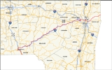
New York State Route 7 (NY 7) is a 180-mile (290 km) long New York State Highway that runs from the New York
/Pennsylvania
border south of Binghamton, New York
to the New York
/Vermont
border east of Hoosick
. Most of the road runs along the Susquehanna Valley, closely paralleling Interstate 88
throughout that road's length. Portions of the highway route near the cities of Binghamton
, Schenectady
, and Troy
date back to the early 19th century.
as Pennsylvania Route 29. Like PA 29 to the south, NY 7 follows Snake Creek north to Corbettsville, where it meets NY 7A on the banks of the Susquehanna River
. From Corbettsville northward, NY 7 becomes the riverside highway, following the river (as well as U.S. Route 11 and Interstate 81 on the opposite bank) through Conklin
to eastern Binghamton
, where it indirectly connects to US 11 via a bridge over the Susquehanna.
 The route continues west into downtown along Conklin Avenue, then heads north on Tompkins Avenue to traverse the Susquehanna River. On the opposite bank, NY 7 intersects US 11 and becomes Brandywine Avenue. After three blocks, NY 7 merges with NY 363, a limited-access highway. While NY 363 terminates at the merge, NY 7 follows the right-of-way of NY 363 northward, connecting to the concurrent routes of I-81 and NY 17
by way of an interchange before leaving the city limits.
Immediately north of Binghamton in Port Dickinson
, NY 7 merges with Interstate 88
across the Chenango River
from the western terminus of I-88 at I-81. NY 7 and I-88 continue to the northeast along the Chenango River through Chenango Bridge
(where the routes meet NY 12A) and Port Crane (where NY 7 and I-88 meet NY 369
and leave the path of the Chenango River) before separating in Sanitaria Springs.
NY 7 is signed north-south from the PA line to I-88 near Binghamton, while the remainder of the route is signed east-west.
 From Sanitaria Springs eastward, NY 7 and I-88 follow parallel routings through Colesville
to Harpursville, where NY 7 overlaps NY 79
for a short distance and intersects NY 235
outside of the community. East of NY 235, NY 7 rejoins the Susquehanna River, following the river (as well as I-88 on the opposite bank) through several riverside villages (including Bainbridge
) to Oneonta
. West of the city, NY 7 meets NY 23
and joins the route into the heart of Oneonta. Near the eastern edge of the city, NY 23 breaks from NY 7 while NY 7 continues onward in the shadow of I-88 and the Susquehanna River. To the northeast in Colliersville, the Susquehanna separates from NY 7 and is joined by NY 28
while NY 7 continues along the path of Schenevus Creek.
Both NY 7 and I-88 head northeast along the creek through numerous communities to Richmondville
, where NY 7 meets NY 10
at an interchange with I-88 near Cobleskill Creek. NY 10 turns east onto NY 7, forming an overlap along the creek to Cobleskill
before separating from NY 7 in the center of the village at an intersection with NY 145
. NY 145 then overlaps NY 7 east out of the village before separating midway between Cobleskill and Schoharie
near Howe Caverns
. North of Schoharie, NY 7 briefly overlaps NY 30A
across Schoharie Creek
before intersecting NY 30
west of the Schoharie
-Schenectady County
line.
, southwest of Schenectady
, NY 7 intersects U.S. Route 20 and meets I-88 once more at exit 24. Both routes continue northeast along Normans Kill
into western Schenectady, where I-88 meets NY 7 one final time by way of another interchange before terminating at an interchange with the New York State Thruway
(Interstate 90). NY 7, however, passes over the Thruway with no connection and heads east into Rotterdam
as Duanesburg Road. In the center of the community, NY 7 turns east onto Curry Road, remaining on the roadway to an interchange with Interstate 890 adjacent to the Schenectady-Albany County
line. NY 7 merges with I-890 northward for two exits (creating a wrong-way concurrency) before exiting onto the Crosstown Arterial.
At the end of the arterial in eastern Schenectady, NY 7 becomes the at-grade Troy-Schenectady Road as it heads along the south bank of the Mohawk River
into Albany County. Shortly after entering the county and the Town of Colonie, NY 7 leaves the river and progresses southeast toward the hamlet of Latham
. Soon after passing the Albany International Airport
and prior to entering the center of Latham, NY 7 meets Interstate 87 (the Adirondack Northway) at exit 6. Here, NY 7 joins the Adirondack Northway northward while Troy-Schenectady Road continues east as NY 2
. At exit 7, NY 7 separates from the Adirondack Northway and continues east on a freeway known locally as "Alternate Route 7". The route connects to U.S. Route 9 and Interstate 787/NY 787
by way of interchanges prior to crossing over the Hudson River
and into Troy
over the Collar City Bridge
. The route remains a limited-access highway to 8th Street, where it becomes the at-grade Hoosick Street.
NY 7 continues east through Troy, intersecting NY 40
before exiting the city. Past Troy, the land surrounding NY 7 is largely rural as it heads through Pittstown
to Hoosick
, where it meets and is briefly concurrent to NY 22
. Farther east, NY 7 intersects the western end of the Bennington Bypass, a limited-access highway leading to Bennington, Vermont, before crossing into Vermont
and becoming Vermont Route 9.
to the town of Otego
was also an old turnpike road (Unadilla Turnpike) that was chartered in 1806.
The state took over maintenance of certain trunk line highways at the beginning of the 20th century. Most of modern NY 7 was first defined in the 1909 Highway Law (amended in 1911) as State Route 7, which was designated from the Pennsylvania line at Binghamton town to Harpursville, then along the Susquehanna Valley through Oneonta to the town of Schoharie. From there, the legislative route 7 went east via Berne and New Scotland to Albany. The portion of modern NY 7 continuing northeast to Schenectady was part of State Route 7A. The road between Troy and Schenectady was defined as part of State Route 42, while that between Troy and Hoosick was part of State Route 22.
In 1924, when state highways were first publicly signed, most of what is now NY 7 between Binghamton and the Vermont
state line was designated as NY 9, continuing the numbering of New England Route 9 in Vermont. Within Albany, NY 9 followed the modern routing of NY 2
through Latham
to Troy
, where the connection to the modern alignment of NY 7 was made via current U.S. Route 4. In 1927, NY 9 was redesignated as NY 7 to avoid conflict with US 9. The route north of Binghamton remained unchanged in the 1930 renumbering; however, south of Binghamton, NY 7 was extended to the Pennsylvania
state line, where it became PA 29
.
, where it turned east and continued through Port Crane to the Colesville
hamlet of Sanitaria Springs. In the 1930 renumbering, NY 7 was extended south to Pennsylvania by way of Court Street, Tompkins Street, and Conklin Avenue. NY 7 was realigned slightly by 1947 to follow Robinson Street and Brandywine Avenue between Chenango and Tompkins Streets. Ca. 1961, the Brandywine Highway
, a four-lane arterial through Binghamton and Port Dickinson
, opened to traffic as a realignment of NY 7. The portion of NY 7 between Port Dickinson and Sanitaria Springs was relocated onto a new limited-access highway between 1968 and 1973. The segment of Chenango Street between the Binghamton city line and current NY 7 in Port Dickinson (a distance of 1.07 miles or 1.72 km) is now NY 990H, an unsigned reference route. The former routing of NY 7 between Port Crane and Sanitaria Springs is now NY 7B.
In Schenectady
, it was originally routed along Broadway, State Street, Nott Terrace, and Union Street. It was shifted at some point between 1938 and 1947 to avoid downtown along Curry Road, Altamont Avenue and Brandywine Avenue. Meanwhile, the portion of Curry Road between Altamont Avenue and NY 146
was designated as NY 146C in the mid-1930s. NY 7 was rerouted ca. 1962 to follow Curry Road east from Altamont Avenue to the new Interstate 890, where NY 7 turned north and followed I-890 to modern exit 7. Here, the route split from I-890 and continued to the junction of Union Street and Rosendale Road east of the city by way of a new arterial. The NY 146C designation was removed from Curry Road as part of the change. NY 7's former routing along Altamont Avenue from Curry Road to the Schenectady city line (a length of 0.96 miles or 1.54 km) is now the unsigned NY 911H. Prior to the creation of the modern reference route system, Altamont Avenue was designated as NY 951. Reference marker
s along the route still bear this number.
In 1981, the Collar City Bridge
was built, connecting Green Island
with Troy in the Capital District
. By 1985, construction had begun on the NY 7 freeway, then marked as NY 7 Alternate, between Interstate 87 and Interstate 787 west of Green Island. In 1986, NY 7 "Alternate" opened, becoming part of a realigned NY 7. The old surface alignment was designated as an extension of NY 2.
. A third formerly existed in the Capital District
near Schenectady
.
|colspan=3 align="center"|West end of freeway section
|-
|151.00
|
|
|-
|154.41
|
|Exits 9E-W (I-787); northern terminus of I-787; southern terminus of NY 787
|-
|rowspan=10|Rensselaer
|rowspan=4|Troy
|
|Downtown Troy
|Eastbound exit and westbound entrance
|-
|155.02
|8th Street
|At-grade intersection
|-
|colspan=3 align="center"|East end of freeway section
|-
New York
New York is a state in the Northeastern region of the United States. It is the nation's third most populous state. New York is bordered by New Jersey and Pennsylvania to the south, and by Connecticut, Massachusetts and Vermont to the east...
/Pennsylvania
Pennsylvania
The Commonwealth of Pennsylvania is a U.S. state that is located in the Northeastern and Mid-Atlantic regions of the United States. The state borders Delaware and Maryland to the south, West Virginia to the southwest, Ohio to the west, New York and Ontario, Canada, to the north, and New Jersey to...
border south of Binghamton, New York
Binghamton, New York
Binghamton is a city in the Southern Tier of New York in the United States. It is near the Pennsylvania border, in a bowl-shaped valley at the confluence of the Susquehanna and Chenango Rivers...
to the New York
New York
New York is a state in the Northeastern region of the United States. It is the nation's third most populous state. New York is bordered by New Jersey and Pennsylvania to the south, and by Connecticut, Massachusetts and Vermont to the east...
/Vermont
Vermont
Vermont is a state in the New England region of the northeastern United States of America. The state ranks 43rd in land area, , and 45th in total area. Its population according to the 2010 census, 630,337, is the second smallest in the country, larger only than Wyoming. It is the only New England...
border east of Hoosick
Hoosick, New York
Hoosick is a town in Rensselaer County, New York, United States. The population was 6,759 at the 2000 census.The Town of Hoosick is in the northeast corner of the county.- History :...
. Most of the road runs along the Susquehanna Valley, closely paralleling Interstate 88
Interstate 88 (east)
Interstate 88 is an intrastate Interstate Highway entirely within the U.S. state of New York. Its western end is at Interstate 81 in Binghamton and its eastern end is at Interstate 90 in Schenectady. It serves as an important connector route from Albany to Binghamton, Elmira , and...
throughout that road's length. Portions of the highway route near the cities of Binghamton
Binghamton, New York
Binghamton is a city in the Southern Tier of New York in the United States. It is near the Pennsylvania border, in a bowl-shaped valley at the confluence of the Susquehanna and Chenango Rivers...
, Schenectady
Schenectady, New York
Schenectady is a city in Schenectady County, New York, United States, of which it is the county seat. As of the 2010 census, the city had a population of 66,135...
, and Troy
Troy, New York
Troy is a city in the US State of New York and the seat of Rensselaer County. Troy is located on the western edge of Rensselaer County and on the eastern bank of the Hudson River. Troy has close ties to the nearby cities of Albany and Schenectady, forming a region popularly called the Capital...
date back to the early 19th century.
Binghamton area
NY 7 begins at the Pennsylvania state line south of Corbettsville, where the road continues into PennsylvaniaPennsylvania
The Commonwealth of Pennsylvania is a U.S. state that is located in the Northeastern and Mid-Atlantic regions of the United States. The state borders Delaware and Maryland to the south, West Virginia to the southwest, Ohio to the west, New York and Ontario, Canada, to the north, and New Jersey to...
as Pennsylvania Route 29. Like PA 29 to the south, NY 7 follows Snake Creek north to Corbettsville, where it meets NY 7A on the banks of the Susquehanna River
Susquehanna River
The Susquehanna River is a river located in the northeastern United States. At long, it is the longest river on the American east coast that drains into the Atlantic Ocean, and with its watershed it is the 16th largest river in the United States, and the longest river in the continental United...
. From Corbettsville northward, NY 7 becomes the riverside highway, following the river (as well as U.S. Route 11 and Interstate 81 on the opposite bank) through Conklin
Conklin, New York
Conklin is a town in Broome County, New York, United States. The population was 5,940 at the 2000 census.The Town of Conklin is on the south border of the county, southeast of Binghamton, New York.- History :The area was first settled around 1788....
to eastern Binghamton
Binghamton, New York
Binghamton is a city in the Southern Tier of New York in the United States. It is near the Pennsylvania border, in a bowl-shaped valley at the confluence of the Susquehanna and Chenango Rivers...
, where it indirectly connects to US 11 via a bridge over the Susquehanna.
New York State Route 17
New York State Route 17 is a state highway that extends for through the Southern Tier and Downstate regions of New York in the United States...
by way of an interchange before leaving the city limits.
Immediately north of Binghamton in Port Dickinson
Port Dickinson, New York
Port Dickinson is a village in Broome County, New York, United States. The population was 1,697 at the 2000 census. It is part of the Binghamton Metropolitan Statistical Area....
, NY 7 merges with Interstate 88
Interstate 88 (east)
Interstate 88 is an intrastate Interstate Highway entirely within the U.S. state of New York. Its western end is at Interstate 81 in Binghamton and its eastern end is at Interstate 90 in Schenectady. It serves as an important connector route from Albany to Binghamton, Elmira , and...
across the Chenango River
Chenango River
The Chenango River is a tributary of the Susquehanna River in central New York in the United States. It drains a dissected plateau area in upstate New York at the northern end of the Susquehanna watershed....
from the western terminus of I-88 at I-81. NY 7 and I-88 continue to the northeast along the Chenango River through Chenango Bridge
Chenango Bridge, New York
Chenango Bridge is a hamlet in the southern part of the town of Chenango in Broome County, New York, United States. It lies where State Route 12A crosses the Chenango River....
(where the routes meet NY 12A) and Port Crane (where NY 7 and I-88 meet NY 369
New York State Route 369
New York State Route 369 is a state highway located entirely within the town of Fenton in Broome County, New York. It begins at NY 7B south of the concurrency of Interstate 88 and NY 7 in the hamlet of Port Crane and ends at NY 79 in the hamlet of North Fenton.-Route...
and leave the path of the Chenango River) before separating in Sanitaria Springs.
NY 7 is signed north-south from the PA line to I-88 near Binghamton, while the remainder of the route is signed east-west.
Binghamton to Schenectady
Colesville, New York
Colesville is a town in Broome County, New York, United States. The population was 5,441 at the 2000 census.The Town of Colesville is in the northeast part of the county and is northeast of Binghamton.- History :...
to Harpursville, where NY 7 overlaps NY 79
New York State Route 79
New York State Route 79 is an east–west state highway in the Southern Tier of New York, United States. The western terminus of the route is at the intersection with NY 414 near the southern end of Seneca Lake east of Watkins Glen...
for a short distance and intersects NY 235
New York State Route 235
New York State Route 235 is a north–south state highway in the Southern Tier of New York in the United States. Most of the route is in Chenango County; however, the southernmost is in Broome County...
outside of the community. East of NY 235, NY 7 rejoins the Susquehanna River, following the river (as well as I-88 on the opposite bank) through several riverside villages (including Bainbridge
Bainbridge (village), New York
Bainbridge is a village in Chenango County, New York, USA. The population was 1,365 at the 2000 census.The Village of Bainbridge is near the center of the Town of Bainbridge and lies between Binghamton and Oneonta.- History :...
) to Oneonta
Oneonta, New York
Oneonta is a city in southern Otsego County, New York, USA. As of the 2010 U.S. Census, had a population of 13,901. Its nickname is "City of the Hills." While the word "oneonta" is of undetermined origin, it is popularly believed to mean "place of open rocks" in the Iroquois language...
. West of the city, NY 7 meets NY 23
New York State Route 23
New York State Route 23 is an east–west state highway in the eastern portion New York in the United States. It extends for from an intersection with NY 26 in the Central New York town of Cincinnatus to the Massachusetts state line in the Berkshire Mountains, where it continues east as...
and joins the route into the heart of Oneonta. Near the eastern edge of the city, NY 23 breaks from NY 7 while NY 7 continues onward in the shadow of I-88 and the Susquehanna River. To the northeast in Colliersville, the Susquehanna separates from NY 7 and is joined by NY 28
New York State Route 28
New York State Route 28 is a state highway extending for in the shape of a "C" between the Hudson Valley city of Kingston and southern Warren County in the U.S. state of New York. Along the way, it intersects several major routes, including Interstate 88 , U.S. Route 20 , and the...
while NY 7 continues along the path of Schenevus Creek.
Both NY 7 and I-88 head northeast along the creek through numerous communities to Richmondville
Richmondville (village), New York
Richmondville is a village in Schoharie County, New York, USA. The population was 918 at the 2010 census.The Village of Richmondville is in the center of the Town of Richmondville and is northeast of Oneonta.- History :...
, where NY 7 meets NY 10
New York State Route 10
New York State Route 10 is a north–south state highway in the Central New York and North Country regions of New York in the United States. It extends for from the Quickway in Deposit, Delaware County to NY 8 at Higgins Bay, a hamlet in the Hamilton County town of Arietta...
at an interchange with I-88 near Cobleskill Creek. NY 10 turns east onto NY 7, forming an overlap along the creek to Cobleskill
Cobleskill (village), New York
Cobleskill is a village in the western part of the town of Cobleskill in Schoharie County, New York, USA. The population was 4,533 at the 2000 census.The village is southwest of Amsterdam...
before separating from NY 7 in the center of the village at an intersection with NY 145
New York State Route 145
New York State Route 145 is a state highway in eastern New York in the United States. The highway extends for from NY 23 in the Greene County town of Cairo to U.S. Route 20 in the Schoharie County town of Sharon. Along the way, NY 145 intersects NY 30 in Middleburgh and...
. NY 145 then overlaps NY 7 east out of the village before separating midway between Cobleskill and Schoharie
Schoharie (village), New York
Schoharie is a village in Schoharie County, New York, USA. The population was 1,030 at the 2000 census. It is the county seat of Schoharie County...
near Howe Caverns
Howe Caverns
Howe Caverns is a cave in Howes Cave, Schoharie County, New York.-Geology:Geologists believe that the formation of the cave, which lies below ground, began several million years ago...
. North of Schoharie, NY 7 briefly overlaps NY 30A
New York State Route 30A
New York State Route 30A is a state highway in the Capital District of New York in the United States. It serves as a westerly alternate route of NY 30 from near the Schoharie County village of Schoharie to the Fulton County hamlet of Riceville, south of the village of Mayfield...
across Schoharie Creek
Schoharie Creek
Schoharie Creek in New York, USA flows north from the foot of Indian Head Mountain in the Catskill Mountains through the Schoharie Valley to the Mohawk River. It is twice impounded north of Prattsville to create New York City's Schoharie Reservoir and the Blenheim-Gilboa Power Project.Two notable...
before intersecting NY 30
New York State Route 30
New York State Route 30 is a state highway in the central part of New York in the United States. It extends for from an interchange with NY 17 in the Southern Tier to the Canadian border in the state's North Country, where it continues into Quebec as Route 138. On a regional level,...
west of the Schoharie
Schoharie County, New York
As of the census of 2000, there were 31,582 people, 11,991 households and 8,177 families residing in the county. The population density was 51 people per square mile . There were 15,915 housing units at an average density of 26 per square mile...
-Schenectady County
Schenectady County, New York
Schenectady County is a county located in the U.S. state of New York. As of the 2010 census, the population was 154,727. It is part of the Albany-Schenectady-Troy Metropolitan Statistical Area. The county seat is Schenectady. The name is from a Mohawk Indian word meaning "on the other side of the...
line.
Capital District
In DuanesburgDuanesburg, New York
Duanesburg is a town in Schenectady County, New York, USA. The population was 5,808 at the 2000 census. Duanesburg is named for James Duane, who held most of it as an original land grant. The town is in the western part of the county.-History:...
, southwest of Schenectady
Schenectady, New York
Schenectady is a city in Schenectady County, New York, United States, of which it is the county seat. As of the 2010 census, the city had a population of 66,135...
, NY 7 intersects U.S. Route 20 and meets I-88 once more at exit 24. Both routes continue northeast along Normans Kill
Normans Kill
The Normans Kill is a creek in New York's Capital District located in Schenectady and Albany counties, which flows southeasterly from its source in the town of Duanesburg near Delanson to its mouth at the Hudson River in the town of Bethlehem. The stream creates the Watervliet Reservoir in the...
into western Schenectady, where I-88 meets NY 7 one final time by way of another interchange before terminating at an interchange with the New York State Thruway
New York State Thruway
The New York State Thruway is a system of limited-access highways located within the state of New York in the United States. The system, known officially as the Governor Thomas E. Dewey Thruway for former New York Governor Thomas E. Dewey, is operated by the New York State Thruway Authority and...
(Interstate 90). NY 7, however, passes over the Thruway with no connection and heads east into Rotterdam
Rotterdam (town), New York
Rotterdam is a town in Schenectady County, New York, United States. The population was 28,316 at the 2000 census.The town of Rotterdam is in the south-central part of the county. It was founded by Dutch settlers, who named it after the port of Rotterdam in the Netherlands, where many emigrants last...
as Duanesburg Road. In the center of the community, NY 7 turns east onto Curry Road, remaining on the roadway to an interchange with Interstate 890 adjacent to the Schenectady-Albany County
Albany County, New York
Albany County is a county located in the U.S. state of New York, and is part of the Albany-Schenectady-Troy Metropolitan Statistical Area. The name is from the title of the Duke of York and Albany, who became James II of England . As of the 2010 census, the population was 304,204...
line. NY 7 merges with I-890 northward for two exits (creating a wrong-way concurrency) before exiting onto the Crosstown Arterial.
At the end of the arterial in eastern Schenectady, NY 7 becomes the at-grade Troy-Schenectady Road as it heads along the south bank of the Mohawk River
Mohawk River
The Mohawk River is a river in the U.S. state of New York. It is the largest tributary of the Hudson River. The Mohawk flows into the Hudson in the Capital District, a few miles north of the city of Albany. The river is named for the Mohawk Nation of the Iroquois Confederacy...
into Albany County. Shortly after entering the county and the Town of Colonie, NY 7 leaves the river and progresses southeast toward the hamlet of Latham
Latham, New York
Latham is a hamlet in Albany County, New York, United States. It is located along U.S. Route 9 in the town of Colonie, a dense suburb north of Albany.-History:...
. Soon after passing the Albany International Airport
Albany International Airport
Albany International Airport is a public use airport located six nautical miles northwest of the central business district of Albany, in Albany County, New York, United States. It is owned by the Albany County Airport Authority....
and prior to entering the center of Latham, NY 7 meets Interstate 87 (the Adirondack Northway) at exit 6. Here, NY 7 joins the Adirondack Northway northward while Troy-Schenectady Road continues east as NY 2
New York State Route 2
New York State Route 2 is a state highway in the Capital District of New York, United States. It extends from an interchange with Interstate 87 and NY 7 in the hamlet of Latham within the town of Colonie to the Massachusetts state line, where it continues to Boston as Route 2....
. At exit 7, NY 7 separates from the Adirondack Northway and continues east on a freeway known locally as "Alternate Route 7". The route connects to U.S. Route 9 and Interstate 787/NY 787
New York State Route 787
New York State Route 787 is a state highway in Albany County, New York, in the United States. It is a superhighway extension of I-787, continuing northward from the underpass at exit 9 for NY 7 near Green Island to downtown Cohoes at NY 32...
by way of interchanges prior to crossing over the Hudson River
Hudson River
The Hudson is a river that flows from north to south through eastern New York. The highest official source is at Lake Tear of the Clouds, on the slopes of Mount Marcy in the Adirondack Mountains. The river itself officially begins in Henderson Lake in Newcomb, New York...
and into Troy
Troy, New York
Troy is a city in the US State of New York and the seat of Rensselaer County. Troy is located on the western edge of Rensselaer County and on the eastern bank of the Hudson River. Troy has close ties to the nearby cities of Albany and Schenectady, forming a region popularly called the Capital...
over the Collar City Bridge
Collar City Bridge
The Collar City Bridge carries NY 7 across the Hudson River connecting Colonie, New York with Troy, by way of passing over Green Island...
. The route remains a limited-access highway to 8th Street, where it becomes the at-grade Hoosick Street.
NY 7 continues east through Troy, intersecting NY 40
New York State Route 40
New York State Route 40 is a north–south state highway in eastern New York, United States. It is long and runs from NY 7 in the city of Troy north to NY 22 in the town of Granville. NY 40 also passes through the villages of Schaghticoke and Argyle and enters the vicinity of...
before exiting the city. Past Troy, the land surrounding NY 7 is largely rural as it heads through Pittstown
Pittstown, New York
Pittstown is a town in Rensselaer County, New York, United States. The population was 5,644 at the 2000 census. It is in the northern part of the county.A small part of the north town line is Rensselaer County's border with Washington County, New York...
to Hoosick
Hoosick, New York
Hoosick is a town in Rensselaer County, New York, United States. The population was 6,759 at the 2000 census.The Town of Hoosick is in the northeast corner of the county.- History :...
, where it meets and is briefly concurrent to NY 22
New York State Route 22
New York State Route 22 is a north–south state highway in eastern New York in the United States. It runs parallel to the state's eastern edge from the outskirts of New York City to a short distance south of the Canadian border. At , it is the state's longest north–south route and...
. Farther east, NY 7 intersects the western end of the Bennington Bypass, a limited-access highway leading to Bennington, Vermont, before crossing into Vermont
Vermont
Vermont is a state in the New England region of the northeastern United States of America. The state ranks 43rd in land area, , and 45th in total area. Its population according to the 2010 census, 630,337, is the second smallest in the country, larger only than Wyoming. It is the only New England...
and becoming Vermont Route 9.
Origins and assignment
The history of parts of Route 7 date back to shortly after the settlement of Hoosick in 1688. Hoosick was a part of the Manor of Rensselaerswyck and a public manor road was laid from Rensselaer to the site later of Troy at a ferry crossing, and then to the northeast as far as Hoosick. The section of Route 7 from Troy to Hoosick is that old manor road. The 19th century toll road known as the Troy and Schenectady Turnpike (now the Troy-Schenectady Road) chartered in 1802, connecting the cities of Troy and Schenectady. Another turnpike road, the Troy Turnpike, was established in 1831 and went east from Troy to Bennington, Vermont. The road between Binghamton (at the location known as Chenango Point) through the village of UnadillaUnadilla (village), New York
Unadilla is a village located in the Town of Unadilla in Otsego County, New York, USA. The population was 1,127 at the 2000 census.The Village of Unadilla is located in the south part of the town, southwest of Oneonta...
to the town of Otego
Otego (town), New York
Otego is a town in Otsego County, New York, United States. The population was 3,183 at the 2000 census. The name is a native word meaning "where there is fire."The Town of Otego is on the south border of the county and contains a village called Otego...
was also an old turnpike road (Unadilla Turnpike) that was chartered in 1806.
The state took over maintenance of certain trunk line highways at the beginning of the 20th century. Most of modern NY 7 was first defined in the 1909 Highway Law (amended in 1911) as State Route 7, which was designated from the Pennsylvania line at Binghamton town to Harpursville, then along the Susquehanna Valley through Oneonta to the town of Schoharie. From there, the legislative route 7 went east via Berne and New Scotland to Albany. The portion of modern NY 7 continuing northeast to Schenectady was part of State Route 7A. The road between Troy and Schenectady was defined as part of State Route 42, while that between Troy and Hoosick was part of State Route 22.
In 1924, when state highways were first publicly signed, most of what is now NY 7 between Binghamton and the Vermont
Vermont
Vermont is a state in the New England region of the northeastern United States of America. The state ranks 43rd in land area, , and 45th in total area. Its population according to the 2010 census, 630,337, is the second smallest in the country, larger only than Wyoming. It is the only New England...
state line was designated as NY 9, continuing the numbering of New England Route 9 in Vermont. Within Albany, NY 9 followed the modern routing of NY 2
New York State Route 2
New York State Route 2 is a state highway in the Capital District of New York, United States. It extends from an interchange with Interstate 87 and NY 7 in the hamlet of Latham within the town of Colonie to the Massachusetts state line, where it continues to Boston as Route 2....
through Latham
Latham, New York
Latham is a hamlet in Albany County, New York, United States. It is located along U.S. Route 9 in the town of Colonie, a dense suburb north of Albany.-History:...
to Troy
Troy, New York
Troy is a city in the US State of New York and the seat of Rensselaer County. Troy is located on the western edge of Rensselaer County and on the eastern bank of the Hudson River. Troy has close ties to the nearby cities of Albany and Schenectady, forming a region popularly called the Capital...
, where the connection to the modern alignment of NY 7 was made via current U.S. Route 4. In 1927, NY 9 was redesignated as NY 7 to avoid conflict with US 9. The route north of Binghamton remained unchanged in the 1930 renumbering; however, south of Binghamton, NY 7 was extended to the Pennsylvania
Pennsylvania
The Commonwealth of Pennsylvania is a U.S. state that is located in the Northeastern and Mid-Atlantic regions of the United States. The state borders Delaware and Maryland to the south, West Virginia to the southwest, Ohio to the west, New York and Ontario, Canada, to the north, and New Jersey to...
state line, where it became PA 29
Pennsylvania Route 29
Pennsylvania Route 29 is a 118 mile long north–south state highway that runs through most of eastern Pennsylvania. The route currently exists in two segments, a southern segment and a northern segment. The southernmost terminus of the designation is at U.S. Route 30 in Malvern...
.
Realignments
Over the years, NY 7 has been realigned to follow different routings in and around the cities it serves. Prior to 1930, NY 7 began at Court Street in Binghamton and followed Chenango Street north into FentonFenton, New York
Fenton is a town in Broome County, New York, United States. The population was 6,909 at the 2000 census. The town was named after Reuben Fenton, a governor of New York...
, where it turned east and continued through Port Crane to the Colesville
Colesville, New York
Colesville is a town in Broome County, New York, United States. The population was 5,441 at the 2000 census.The Town of Colesville is in the northeast part of the county and is northeast of Binghamton.- History :...
hamlet of Sanitaria Springs. In the 1930 renumbering, NY 7 was extended south to Pennsylvania by way of Court Street, Tompkins Street, and Conklin Avenue. NY 7 was realigned slightly by 1947 to follow Robinson Street and Brandywine Avenue between Chenango and Tompkins Streets. Ca. 1961, the Brandywine Highway
Brandywine Highway
The Brandywine Highway is a north–south limited-access highway in the vicinity of the city of Binghamton, New York, United States. The highway is maintained by the New York State Department of Transportation and extends for through Downtown Binghamton and the neighboring village of Port Dickinson...
, a four-lane arterial through Binghamton and Port Dickinson
Port Dickinson, New York
Port Dickinson is a village in Broome County, New York, United States. The population was 1,697 at the 2000 census. It is part of the Binghamton Metropolitan Statistical Area....
, opened to traffic as a realignment of NY 7. The portion of NY 7 between Port Dickinson and Sanitaria Springs was relocated onto a new limited-access highway between 1968 and 1973. The segment of Chenango Street between the Binghamton city line and current NY 7 in Port Dickinson (a distance of 1.07 miles or 1.72 km) is now NY 990H, an unsigned reference route. The former routing of NY 7 between Port Crane and Sanitaria Springs is now NY 7B.
In Schenectady
Schenectady, New York
Schenectady is a city in Schenectady County, New York, United States, of which it is the county seat. As of the 2010 census, the city had a population of 66,135...
, it was originally routed along Broadway, State Street, Nott Terrace, and Union Street. It was shifted at some point between 1938 and 1947 to avoid downtown along Curry Road, Altamont Avenue and Brandywine Avenue. Meanwhile, the portion of Curry Road between Altamont Avenue and NY 146
New York State Route 146
New York State Route 146 is a state highway in the Capital District of New York in the United States. It extends for from Gallupville at NY 443 to near Mechanicville at U.S. Route 4 and NY 32. NY 146 is a major thoroughfare in the city of Schenectady, just outside of...
was designated as NY 146C in the mid-1930s. NY 7 was rerouted ca. 1962 to follow Curry Road east from Altamont Avenue to the new Interstate 890, where NY 7 turned north and followed I-890 to modern exit 7. Here, the route split from I-890 and continued to the junction of Union Street and Rosendale Road east of the city by way of a new arterial. The NY 146C designation was removed from Curry Road as part of the change. NY 7's former routing along Altamont Avenue from Curry Road to the Schenectady city line (a length of 0.96 miles or 1.54 km) is now the unsigned NY 911H. Prior to the creation of the modern reference route system, Altamont Avenue was designated as NY 951. Reference marker
Reference marker (New York)
In New York, a reference marker is a small green sign mounted approximately every one-tenth mile on highways maintained by the New York State Department of Transportation. This was initiated in response to the Highway Safety Act of 1966 enacted by Congress, in an effort to monitor traffic and...
s along the route still bear this number.
In 1981, the Collar City Bridge
Collar City Bridge
The Collar City Bridge carries NY 7 across the Hudson River connecting Colonie, New York with Troy, by way of passing over Green Island...
was built, connecting Green Island
Green Island, New York
Green Island is a coterminous town and village in Albany County, New York, USA some 8 miles north of Albany, New York. Green Island is one of only five such town-village amalgams in New York. The population was 2,620 at the 2010 census...
with Troy in the Capital District
Capital District
New York's Capital District, also known as the Capital Region, is a region in upstate New York that generally refers to the four counties surrounding Albany, the capital of the state: Albany County, Schenectady County, Rensselaer County, and Saratoga County...
. By 1985, construction had begun on the NY 7 freeway, then marked as NY 7 Alternate, between Interstate 87 and Interstate 787 west of Green Island. In 1986, NY 7 "Alternate" opened, becoming part of a realigned NY 7. The old surface alignment was designated as an extension of NY 2.
Suffixed routes
NY 7 currently has two spurs, both located in the Southern TierSouthern Tier
The Southern Tier is a geographical term that refers to the counties of New York State west of the Catskill Mountains along the northern border of Pennsylvania. It is a loosely defined term that generally includes the counties that border Pennsylvania west of Delaware County inclusive...
. A third formerly existed in the Capital District
Capital District
New York's Capital District, also known as the Capital Region, is a region in upstate New York that generally refers to the four counties surrounding Albany, the capital of the state: Albany County, Schenectady County, Rensselaer County, and Saratoga County...
near Schenectady
Schenectady, New York
Schenectady is a city in Schenectady County, New York, United States, of which it is the county seat. As of the 2010 census, the city had a population of 66,135...
.
- NY 7A (1.74 miles or 2.8 km) is a spur in the Broome CountyBroome County, New YorkBroome County is a county located in the U.S. state of New York. As of the 2010 census, the population was 200,600. It was named in honor of John Broome, who was lieutenant governor in 1806 when Broome County was established. Its county seat is Binghamton, which is also its major city. The current...
town of ConklinConklin, New YorkConklin is a town in Broome County, New York, United States. The population was 5,940 at the 2000 census.The Town of Conklin is on the south border of the county, southeast of Binghamton, New York.- History :The area was first settled around 1788....
that connects NY 7 to the PennsylvaniaPennsylvaniaThe Commonwealth of Pennsylvania is a U.S. state that is located in the Northeastern and Mid-Atlantic regions of the United States. The state borders Delaware and Maryland to the south, West Virginia to the southwest, Ohio to the west, New York and Ontario, Canada, to the north, and New Jersey to...
state line. While NY 7 follows a creek valley to the Pennsylvania border, NY 7A continues NY 7's course along the Susquehanna RiverSusquehanna RiverThe Susquehanna River is a river located in the northeastern United States. At long, it is the longest river on the American east coast that drains into the Atlantic Ocean, and with its watershed it is the 16th largest river in the United States, and the longest river in the continental United...
valley, paralleling US 11 and I-81. When NY 7A was assigned as part of the 1930 renumbering of state highways in New York, it connected to PA 602; it now connects to SR 1033, an unsigned quadrant route. - The NY 7B designation has been assigned to two distinct routes.
- The original NY 7B was an alternate route of NY 7 from UnadillaUnadilla, New YorkUnadilla, New York may refer to*Unadilla , New York, a town in Otsego County, New York*Unadilla , New York, a village located in that town...
to Oneonta that was assigned as part of the 1930 renumbering. It overlapped NY 28New York State Route 28New York State Route 28 is a state highway extending for in the shape of a "C" between the Hudson Valley city of Kingston and southern Warren County in the U.S. state of New York. Along the way, it intersects several major routes, including Interstate 88 , U.S. Route 20 , and the...
from North Franklin to Oneonta. On January 1, 1970, the Unadilla – North Franklin portion of NY 7B was renumbered to NY 357New York State Route 357New York State Route 357 is a state highway in New York, running from the Otsego County village of Unadilla to the Delaware County town of Franklin....
. - The current NY 7B is a 3.71 miles (5.97 km) spur in the Broome CountyBroome County, New YorkBroome County is a county located in the U.S. state of New York. As of the 2010 census, the population was 200,600. It was named in honor of John Broome, who was lieutenant governor in 1806 when Broome County was established. Its county seat is Binghamton, which is also its major city. The current...
towns of FentonFenton, New YorkFenton is a town in Broome County, New York, United States. The population was 6,909 at the 2000 census. The town was named after Reuben Fenton, a governor of New York...
and ColesvilleColesville, New YorkColesville is a town in Broome County, New York, United States. The population was 5,441 at the 2000 census.The Town of Colesville is in the northeast part of the county and is northeast of Binghamton.- History :...
. It follows the former, pre-expressway routing of NY 7 between NY 369New York State Route 369New York State Route 369 is a state highway located entirely within the town of Fenton in Broome County, New York. It begins at NY 7B south of the concurrency of Interstate 88 and NY 7 in the hamlet of Port Crane and ends at NY 79 in the hamlet of North Fenton.-Route...
in the hamlet of Port Crane and NY 7 in the hamlet of Sanitaria Springs. Prior to becoming NY 7B in the 1990s, it was designated NY 990K, an unsigned reference route.
- The original NY 7B was an alternate route of NY 7 from Unadilla
- NY 7C was a loop off of NY 7 east of SchenectadySchenectady, New YorkSchenectady is a city in Schenectady County, New York, United States, of which it is the county seat. As of the 2010 census, the city had a population of 66,135...
in the Capital District. The majority of the route was located in Schenectady CountySchenectady County, New YorkSchenectady County is a county located in the U.S. state of New York. As of the 2010 census, the population was 154,727. It is part of the Albany-Schenectady-Troy Metropolitan Statistical Area. The county seat is Schenectady. The name is from a Mohawk Indian word meaning "on the other side of the...
; however, the easternmost 40 yards (36.6 m) of the route was located in Albany CountyAlbany County, New YorkAlbany County is a county located in the U.S. state of New York, and is part of the Albany-Schenectady-Troy Metropolitan Statistical Area. The name is from the title of the Duke of York and Albany, who became James II of England . As of the 2010 census, the population was 304,204...
. It began at NY 7 in Niskayuna and proceeded east along Rosendale Road into Colonie, where it ended at NY 7. The route was assigned ca. 1961 and removed in the late 1960s. Ownership and maintenance of NY 7C's former routing in Schenectady County was transferred from the state of New YorkNew YorkNew York is a state in the Northeastern region of the United States. It is the nation's third most populous state. New York is bordered by New Jersey and Pennsylvania to the south, and by Connecticut, Massachusetts and Vermont to the east...
to the county on April 1, 1980, as part of a highway maintenance swap between the two levels of government. This portion of the route is now designated as County Route 158.
Major intersections
|-|colspan=3 align="center"|West end of freeway section
|-
|151.00
|
|
|-
|154.41
|
|Exits 9E-W (I-787); northern terminus of I-787; southern terminus of NY 787
|-
|rowspan=10|Rensselaer
Rensselaer County, New York
Rensselaer County is a county in the U.S. state of New York. As of the 2010 census, the population was 159,429. Its name is in honor of the family of Kiliaen van Rensselaer, the original Dutch owner of the land in the area. Its county seat is Troy...
|rowspan=4|Troy
Troy, New York
Troy is a city in the US State of New York and the seat of Rensselaer County. Troy is located on the western edge of Rensselaer County and on the eastern bank of the Hudson River. Troy has close ties to the nearby cities of Albany and Schenectady, forming a region popularly called the Capital...
|
|Downtown Troy
|Eastbound exit and westbound entrance
|-
|155.02
|8th Street
|At-grade intersection
|-
|colspan=3 align="center"|East end of freeway section
|-