
.gif)
List of rivers in New South Wales (L-Z)
Encyclopedia
New South Wales
New South Wales is a state of :Australia, located in the east of the country. It is bordered by Queensland, Victoria and South Australia to the north, south and west respectively. To the east, the state is bordered by the Tasman Sea, which forms part of the Pacific Ocean. New South Wales...
, Australia
Australia
Australia , officially the Commonwealth of Australia, is a country in the Southern Hemisphere comprising the mainland of the Australian continent, the island of Tasmania, and numerous smaller islands in the Indian and Pacific Oceans. It is the world's sixth-largest country by total area...
. With List of rivers of New South Wales (A-K) it includes all 439 river
River
A river is a natural watercourse, usually freshwater, flowing towards an ocean, a lake, a sea, or another river. In a few cases, a river simply flows into the ground or dries up completely before reaching another body of water. Small rivers may also be called by several other names, including...
s, as of 7 June 2008, listed by the Geographical Names Board of New South Wales in the Geographical Names Register (GNR) of NSW.
| River Name | Previous Names | Source Source (river or stream) The source or headwaters of a river or stream is the place from which the water in the river or stream originates.-Definition:There is no universally agreed upon definition for determining a stream's source... LGA | Source Location |
|---|---|---|---|
| Lachlan Lachlan River - Course :The river rises in the central highland of New South Wales, part of the Great Dividing Range, 13 km east of Gunning. Its major headwaters, the Carcoar River, the Belubula River and the Abercrombie River converge near the town of Cowra. Minor tributaries include the Morongla Creek... |
Western Branch; Branch of Lachlan River; Deadmans Creek and Boorungullen Chain; Mutbilly Creek |
Boorowa Boorowa Council Boorowa Shire is a local government area in New South Wales, Australia. It is on the Lachlan Valley Way.It includes Boorowa and the small towns of Rye Park, Rugby, Frogmore and Reids Flat.- Council :... |
34°05′54"S 149°01′04"E |
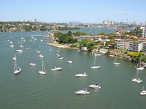
| Lane Cove Lane Cove River The Lane Cove River is a tributary of the Parramatta River, Sydney, Australia. Its lower reaches form an arm of Sydney Harbour.-Description:... |
Turrumburra | Hornsby Hornsby Shire Hornsby Shire is a Local Government Area in the Northern region of Sydney, Australia. The Shire stretches from the suburb of Eastwood in the south to the Hawkesbury River town of Wisemans Ferry, some to the north... |
33°44′54"S 151°05′34"E |
| Lansdowne Lansdowne River -References:... |
Greater Taree City of Greater Taree The City of Greater Taree is a Local Government Area on the Mid North Coast of New South Wales, Australia, centered on Taree. It is on the Manning River, the Pacific Highway and the North Coast railway line.- History :... |
31°42′54"S 152°32′04"E | |
| Lee Creek | Benjang Creek | Mid-Western Regional | 32°28′54"S 150°08′04"E |
| Leycester Creek Leycester Creek -References:... |
Hanging Rock Creek; Terania Creek |
Lismore City of Lismore The City of Lismore is a local government area in New South Wales, Australia. Its primary city, Lismore is a major regional centre in the Northern Rivers region of the state.-Demographics:... |
28°39′54"S 153°08′04"E |
| Little Murray | Bellingen | 30°19′54"S 152°37′04"E | |
| Little Nymboida Little Nymboida River -References:... |
Coffs Harbour City of Coffs Harbour The City of Coffs Harbour is the Local Government Area that administers the Coffs Harbour area. It is on the Pacific Highway, and the North Coast railway line.At the 2006 Census the City's resident population was 64,910... |
30°10′54"S 152°52′04"E | |
| Little Plains Little Plains River -References:... |
Bombala Bombala Council Bombala Shire is a Local Government Area in the Monaro region of southeastern New South Wales, Australia. In addition to Bombala, Bombala Shire includes the villages of Delegate, Cathcart and Bibbenluke.- Council :... |
37°01′54"S 149°06′04"E | |
| Little | Tomahawk Creek, The Little River.; Unga Creek |
Wollondilly | 34°10′54"S 150°28′04"E |
| Little | Mountain Station Creek; Paling Yards Creek; Dilga Creek |
Dubbo City of Dubbo Dubbo is a Local Government Area in the Orana region of New South Wales, Australia. The City is traversed by the Mitchell Highway, the Newell Highway, the Golden Highway and the Main Western railway line.The largest population centre is the city of Dubbo... |
32°29′54"S 148°42′04"E |
| Little | Oberon Oberon Council Oberon Shire is a local government area in the Central West region of New South Wales, Australia. Oberon Shire includes Oberon, Black Springs, Shooters Hill, Edith and O'Connell.- Demographics :According to the , there:... |
33°45′54"S 150°08′04"E | |
| Little | Wingecarribee | 34°31′54"S 150°37′04"E | |
| Little Run Creek Little Run Creek -References:... |
Greater Taree City of Greater Taree The City of Greater Taree is a Local Government Area on the Mid North Coast of New South Wales, Australia, centered on Taree. It is on the Manning River, the Pacific Highway and the North Coast railway line.- History :... |
31°43′54"S 152°10′04"E | |
| Little Weir Little Weir River -References:... |
Walgett | 29°00′54"S 148°51′04"E | |
| Macdonald Macdonald River (Bendemeer) There are two rivers named Macdonald River in New South Wales, Australia. See Macdonald RiverThe Macdonald River in northern New South Wales is the headwater of the Namoi River. It rises east of Niangala on the western slopes of the Great Dividing Range on the Northern Tablelands, New South Wales... |
Muluerindie - State Map Co. Inglis | Tamworth Regional Tamworth Regional Council Tamworth Regional Council is a Local Government Area in the New England region of New South Wales, Australia. It is on the New England Highway and the Main North railway line.- Incomes :According to the during 2003-04, there:... |
30°52′54"S 151°10′04"E |
| Macdonald Macdonald River (St Albans) There are two rivers named Macdonald River in New South Wales, Australia. See Macdonald RiverThe Macdonald River is a tributary of the Hawkesbury River. It rises near Putty and flows about 60 kilometers generally south-east to where it joins the Hawkesbury River near Wisemans Ferry.The upper... |
Mullen Malong Creek; Mullen Malone Creek; Branch Creek; Head Of Macdonald River * |
Singleton | 32°59′54"S 150°48′04"E |
| Macintyre MacIntyre River The Macintyre River is a river in northern New South Wales, Australia, part of which forms the border with Queensland.The headwaters of the Macintyre River rise west of Guyra and south of Glen Innes on the Northern Tablelands... |
Karaula River | Inverell | 28°49′54"S 150°40′04"E |
| Maclaughlin Maclaughlin River -References:... |
Bombala Bombala Council Bombala Shire is a Local Government Area in the Monaro region of southeastern New South Wales, Australia. In addition to Bombala, Bombala Shire includes the villages of Delegate, Cathcart and Bibbenluke.- Council :... |
36°36′54"S 149°07′04"E | |
| Macleay Macleay River The Macleay River is a major river on the Mid North Coast , Australia.The headwaters of the Macleay River rise as the Gara River on the eastern side of the Northern Tablelands near Armidale and Walcha, New South Wales. From here the Chandler River, Styx River and Apsley Rivers are important... |
(Includes Muddy River) | Armidale Dumaresq Armidale Dumaresq Council The Armidale Dumaresq Local Government Area was formed from the merger in 2000 of the original City of Armidale with the surrounding Dumaresq Shire... |
30°44′54"S 152°15′04"E |
| Macquarie Macquarie River The Macquarie River is one of the main inland rivers in New South Wales. Its headwaters rise in the central highlands of New South Wales near the town of Oberon. The river travels generally northwest past the towns of Bathurst, Wellington, Dubbo, Narromine, and Warren to the Macquarie Marshes... |
Macquarie or Wammerawa River; Wammerawa River; Wambool |
Bathurst Regional Bathurst Regional Council Bathurst Regional Council administers the Bathurst Region Local Government Area in New South Wales, Australia. It is approximately 200 km west of Sydney and has a population of 37,001 . It is on the Great Western Highway, Mid-Western Highway, Mitchell Highway and the Main Western railway... |
32°59′54"S 149°15′04"E |
| Macquarie Rivulet Macquarie Rivulet Macquarie Rivulet is a river in New South Wales which is 23 kilometres long. It rises near Robertson, New South Wales and drains the eastern edge of the Southern Highlands plateau and part of the Illawarra escarpment. It flows through Albion Park Rail, then goes into Lake Illawarra and indirectly... |
Wingecarribee | 34°33′54"S 150°42′04"E | |
| Mammy Johnsons | Mammy Johnsons Creek | Great Lakes | 32°14′54"S 152°03′04"E |
| Mangrove Creek Mangrove Creek (New South Wales) Mangrove Creek is a tributary of the Hawkesbury River in New South Wales, Australia.Mangrove Creek rises about to the south-west of Mount McQuiod. The headwaters of the creek are impounded by the Mangrove Creek Dam, which forms a major part of the water supply to the New South Wales Central Coast... |
Gosford | 33°18′54"S 151°08′04"E | |
| Mann | Mitchell River; Ben Lomond Creek; Mann River; Backwater R. |
Clarence Valley | 29°39′54"S 152°09′04"E |
| Manning Manning River The Manning River is a river in the Mid North Coast of New South Wales, Australia that flows through the Manning Valley. It is one of Australia's few large river systems not to be dammed for water supply purposes anywhere along its catchment... |
Gloucester Gloucester Shire Gloucester Shire is a Local Government Area in New South Wales, Australia on the Mid North Coast. It is on the Bucketts Way and the North Coast railway line.- Incomes :According to the during 2003-04, there:... |
31°53′54"S 151°28′04"E | |
| Maria Maria River The Măria River is a tributary of the Someşul Mare River in Romania. It starts at the junction of headwaters: Măria Mare and Măria Mică-References:* Administraţia Naţională Apelor Române - Cadastrul Apelor - Bucureşti... |
Maria River South Branch; Scrubby Creek |
Kempsey | 31°08′54"S 152°50′04"E |
| Maryland Maryland River -References:... |
Tenterfield | 28°34′54"S 152°15′04"E | |
| Medway Rivulet | Carrada Rivulet | Wingecarribee | 34°32′54"S 150°19′04"E |
| Mehi Mehi River The Mehi River is an inland stream in north-western New South Wales which diverts from the Gwydir River, about 21 km east of Moree. From here the river flows generally west, through the town of Moree and then generally west-south-west and westwards to join the Barwon River about 11 km... |
Gwydir or Meei River; Gwydir River; Meei River |
Moree Plains | 29°33′54"S 149°30′04"E |
| Meroo | Meroo Creek | Mid-Western Regional | 32°44′44"S 149°29′04"E |
| Merrica | Bega Valley | 37°19′54"S 149°54′04"E | |
| Merriwa | Smiths Rivulet; Merriwa Creek; Middle Creek; Harrys Creek |
Upper Hunter | 32°05′54"S 150°22′04"E |
| Middle Creek Middle Creek (New South Wales) Middle Creek is a river of the state of New South Wales in Australia.... |
Deep Creek; Big Deep Creek |
Narrabri | 30°21′54"S 150°13′04"E |
| Minnamurra Minnamurra River The Minnamurra River is a river in the Jamberoo and Kiama areas of the Illawarra region of New South Wales, Australia. Its drainage area contains much of the Jamberoo Valley surrounded by Stockyard Mountain to the north, Jamberoo Mountain to the west and Noorinan and Saddleback Mountain to the... |
Kiama | 34°38′54"S 150°45′04"E | |
| Mirrool Creek | Merool Creek | Bland | 34°19′54"S 147°57′04"E |
| Mogo Creek | Wallambine Creek | Hawkesbury City of Hawkesbury The City of Hawkesbury is a Local Government Area of New South Wales, Australia, part of which is at the fringe of the Sydney metropolitan area, about 50 kilometres north-west of the Sydney central business district... |
33°09′54"S 151°02′04"E |
| Mole Mole River (New South Wales) The Mole River is a river in northern New South Wales, Australia.The source of the Mole River lies in the Great Dividing Range, between Glen Innes and Tenterfield in the northern part of the New England highlands. The Mole River flows generally to the west and flows into the Dumaresq River... |
The Mole River | Tenterfield | 29°06′54"S 151°45′04"E |
| Molonglo Molonglo River The Molonglo River rises on the western side of the Great Dividing Range of eastern Australia in the state of New South Wales. Its source is on the other side of the mountain range from where the Shoalhaven River rises, in Tallaganda state forest at ~1200 metres altitude... |
Queanbeyan | 35°22′54"S 149°15′04"E | |
| Mongarlowe | Little River | Palerang Palerang Council The Palerang Council is a Local Government Area in the Southern Tablelands Region of New South Wales, Australia. It is on the Kings Highway and the Sydney-Canberra railway.... |
35°24′54"S 149°56′04"E |
| Moonan Brook | Bells Creek | Upper Hunter | 31°57′54"S 151°21′04"E |
| Mooney Mooney Creek | Gosford | 33°20′54"S 151°15′04"E | |
| Mooni | Moonie River | Walgett | 29°09′54"S 148°38′04"E |
| Moppy Moppy River -References:... |
Morpey Creek | Gloucester Gloucester Shire Gloucester Shire is a Local Government Area in New South Wales, Australia on the Mid North Coast. It is on the Bucketts Way and the North Coast railway line.- Incomes :According to the during 2003-04, there:... |
31°55′54"S 151°30′04"E |
| Moredun Creek Moredun Creek -References:... |
Clerks Creek; Kellys Creek; Branch Moredun Creek |
Guyra | 30°04′54"S 151°20′04"E |
| Moruya Moruya River The Moruya River is in southern New South Wales, Australia. Its freshwater reaches are known as the Deua River.The headwaters of the Moruya River rise as the Deua River south of Braidwood... |
Eurobodalla Eurobodalla Shire Eurobodalla Shire is a Local Government Area in the state of New South Wales, Australia. It is located in a largely mountainous coastal region on the South Coast of New South Wales. It is on the Pacific Ocean, the Princes Highway and the Kings Highway.... |
35°54′54"S 150°07′04"E | |
| Mowamba Mowamba River The Mowamba River is a river of the state of New South Wales in Australia.The Mowamba River is a right bank tributary of the Snowy River. This snow melt river enters the Snowy River approximately 2 kilometres downstream of Jindabyne Dam, in the Jinadbyne Gorge... |
Mowamba River; Moonbah River |
Snowy River | 36°30′54"S 148°27′04"E |
| Mulga Creek | Cobar | 30°54′54"S 146°21′04"E | |
| Mulla Mulla Creek Mulla Mulla Creek Mulla Mulla Creek is a river of the state of New South Wales in Australia.... |
Mulla Creek | Tamworth Regional Tamworth Regional Council Tamworth Regional Council is a Local Government Area in the New England region of New South Wales, Australia. It is on the New England Highway and the Main North railway line.- Incomes :According to the during 2003-04, there:... |
31°17′54"S 151°18′04"E |
| Mulwaree Mulwaree River The Mulwaree River, also known as Mulwaree Ponds, is a river of the state of New South Wales in Australia. It is a tributary of the Wollondilly River.... |
Mulwaree Ponds or Creek; Merigan Creek |
Goulburn Mulwaree Goulburn Mulwaree Council Goulburn Mulwaree Council is a Local Government Area of New South Wales, Australia. The council was formed as the Greater Argyle Council in 2004 as an amalgamation of Goulburn City and parts of the former Mulwaree Shire. It was renamed in 2005 following objections from the community... |
34°59′54"S 149°39′04"E |
| Mummel Mummel River -References:... |
Greater Taree City of Greater Taree The City of Greater Taree is a Local Government Area on the Mid North Coast of New South Wales, Australia, centered on Taree. It is on the Manning River, the Pacific Highway and the North Coast railway line.- History :... |
31°27′54"S 151°54′04"E | |
| Munmurra | Munmurra Brook | Upper Hunter | 32°08′54"S 150°01′04"E |
| Murrah Murrah River The Murrah River is a river of the state of New South Wales in Australia. Also known as Dry River.-References:... |
Dry River | Bega Valley | 36°31′54"S 150°01′04"E |
| Murray Murray River The Murray River is Australia's longest river. At in length, the Murray rises in the Australian Alps, draining the western side of Australia's highest mountains and, for most of its length, meanders across Australia's inland plains, forming the border between New South Wales and Victoria as it... |
Hume; Indi; Upper Indi; Millewa |
Tumbarumba | 36°47′48"S 143°11′46"E |
| Murruin Creek Murruin Creek -References:... |
Wollondilly | 34°12′54"S 150°03′04"E | |
| Murrumbidgee Murrumbidgee River The Murrumbidgee River is a major river in the state of New South Wales, Australia, and the Australian Capital Territory . A major tributary of the Murray River, the Murrumbidgee flows in a west-northwesterly direction from the foot of Peppercorn Hill in the Fiery Range of the Snowy Mountains,... |
Cooma-Monaro | 35°39′47"S 149°08′00"E | |
| Myall Myall River The Myall River is a river on the mid-North Coast of the Australian state of New South Wales that empties into Port Stephens, near its mouth with the Tasman Sea.As well as flowing into the Myall Lakes, a number of important settlements exist on the river:... |
Upper Myall River | Great Lakes | 32°13′54"S 152°10′04"E |
| Nadgee | Bega Valley | 37°25′54"S 149°52′04"E | |
| Nadgigomar Creek Nadgigomar Creek -References:... |
Curra Creek | Goulburn Mulwaree Goulburn Mulwaree Council Goulburn Mulwaree Council is a Local Government Area of New South Wales, Australia. The council was formed as the Greater Argyle Council in 2004 as an amalgamation of Goulburn City and parts of the former Mulwaree Shire. It was renamed in 2005 following objections from the community... |
35°06′54"S 149°52′04"E |
| Namoi Namoi River The Namoi River is a major tributary of the Darling River in inland New South Wales, Australia.- Course :The headwaters of the Namoi, including the Macdonald River, the Peel River, the Cockburn River and the Manilla River, rise on the western slopes of the Great Dividing Range on the Northern... |
Narrabri | 30°19′54"S 149°40′04"E | |
| Nangahrah Creek Nangahrah Creek -References:... |
Tamworth Regional Tamworth Regional Council Tamworth Regional Council is a Local Government Area in the New England region of New South Wales, Australia. It is on the New England Highway and the Main North railway line.- Incomes :According to the during 2003-04, there:... |
30°21′54"S 150°48′04"E | |
| Narran Narran River The Narran River is a river which spans the Queensland-New South Wales border in Australia. It flows into Narran Lake, near Brewarrina. It is the easterly-most of the branches of the Balonne River that flows to the Barwon River... |
Brewarrina | 29°09′54"S 148°02′04"E | |
| Nattai Nattai River -References:... |
Wollondilly | 34°14′54"S 150°21′04"E | |
| Nepean Nepean River The Nepean River is a river in the coastal region of New South Wales, Australia.The headwaters of the Nepean River rise near Robertson, about 100 kilometres south of Sydney and about 15 kilometres from the coast. The river flows north in an unpopulated water catchment area into Nepean Dam, which... |
Cowpasture River; Mittagong River; London River. |
Penrith City of Penrith The City of Penrith is a Local Government Area in Sydney, located about west of Sydney's central business district.- History :The Municipality of Penrith was incorporated on 12 May 1871 under the Municipalities Act 1858. On 3 March 1890, St Marys was separately incorporated, and on 26 July 1893... |
33°43′52"S 150°39′32"E |
| Never Never | Never Never or North Creek | Bellingen | 30°21′54"S 152°54′04"E |
| Niemur Niemur River -References:... |
Wakool Wakool Shire Wakool Shire is a Local Government Area located between the Murray River and the Murrumbidgee River and on the Sturt Highway.Towns in the Shire are: Barham , Moulamein , Tooleybuc , Wakool and Koraleigh.- Council :... |
35°14′54"S 144°00′04"E | |
| Nowendoc Nowendoc River The Nowendoc River is on the Northern Tablelands of New South Wales, Australia. The headwaters of the river rise about four kilometres east by north of The Black Sugarloaf on the eastern slopes of the Great Dividing Range south of Walcha... |
Peel Creek | Greater Taree City of Greater Taree The City of Greater Taree is a Local Government Area on the Mid North Coast of New South Wales, Australia, centered on Taree. It is on the Manning River, the Pacific Highway and the North Coast railway line.- History :... |
31°37′54"S 151°48′04"E |
| Nowlands Creek Nowlands Creek -References:... |
Guyra | 30°07′54"S 151°58′04"E | |
| Nullica | Myrrial River | Bega Valley | 37°04′54"S 149°48′54"E |
| Numeralla Numeralla River The Numeralla river in New South Wales, Australia, is a diverse ecosystem rich with many different animal species such as the uncommonly seen Wanderer's Kingfisher and the Kiora frog... |
Umaralla River | Cooma-Monaro | 36°32′54"S 149°24′04"E |
| Nunnock | Bega Valley | 36°36′54"S 149°27′04"E | |
| Nymboida Nymboida River The Nymboida River is a river in the Northern Rivers region of New South Wales in Australia. The headwaters of the river rise approximately 30 kilometres to the west of Dorrigo in the New England National Park near Barren Mountain.... |
Coutts Water:; The Harness Cask |
Clarence Valley | 30°14′54"S 152°37′04"E |
| Oaky Oaky River The Oaky River is a river of the Northern Tablelands of New South Wales in Australia. This river rises below Round Mountain and flows approximately in a mostly south westerly direction to its confluence with the Chandler River. The Ponds Creek is the main tributary of the river... |
Armidale Dumaresq Armidale Dumaresq Council The Armidale Dumaresq Local Government Area was formed from the merger in 2000 of the original City of Armidale with the surrounding Dumaresq Shire... |
30°34′54"S 152°03′04"E | |
| Oban Oban River -References:... |
Ann River | Guyra | 30°06′54"S 151°53′04"E |
| O'Briens Creek O'Briens Creek -References:... |
Wagga Wagga City of Wagga Wagga The Wagga Wagga City Council was formed from the amalgamation of City of Wagga Wagga with Mitchell and Kyeamba Shires in 1981. 22 December 2009, Wagga Wagga City Council announced that Phil Pinyon would be appointed as the General Manager of the Wagga Wagga City Council after Lyn Russell, who... |
35°18′54"S 147°27′04"E | |
| Orara Orara River The Orara River is a significant tributary of the Clarence River, located in northern New South Wales, Australia.The river begins in the hills behind the city of Coffs Harbour and runs in a general north-westerly direction for approximately 100 kilometres to the Clarence River at Eatonsville,... |
Wooworra River | Clarence Valley | 29°59′54"S 152°59′04"E |
| Ourimbah Creek | Ourinbah Creek | Wyong | 33°19′54"S 151°20′04"E |
| Oxley | Middle Arm Tweed River | Tweed | 28°20′54"S 153°17′04"E |
| Paddys Paddys River -References:... |
Patricks River | Wingecarribee | 34°38′54"S 150°10′04"E |
| Paddys Paddys River -References:... |
Cowra Creek; Paddys River |
Tumbarumba | 35°51′54"S 148°04′04"E |
| Pages Creek | Upper Hunter | 31°44′54"S 151°16′04"E | |
| Pages Pages River -References:... |
Upper Hunter | 31°59′54"S 151°00′04"E | |
| Pambula Pambula River -References:... |
Panbula River | Bega Valley | 36°55′54"S 149°50′04"E |
| Pappinbarra | Pappinbarra Creek; Left Arm of Pappinbarra Creek |
Port Macquarie-Hastings | 31°20′54"S 152°28′04"E |
| Parma Creek Parma Creek -References:... |
Shoalhaven | 35°00′54"S 150°31′04"E | |
| Paroo Paroo River The Paroo River is a river in Eastern Australia and is often considered to be major tributary of the Darling River in eastern Australia, although its flow generally dissipates before it reaches the Darling... |
Paroo Channel; Paroo River Channels |
Central Darling Central Darling Shire Central Darling Shire is a Local Government Area in the Far West of New South Wales, Australia on the Barrier Highway. Central Darling Shire was constituted in 1959 and it is the largest Local Government Area in New South Wales.-Incomes:... |
30°27′54"S 143°58′04"E |
| Parramatta Parramatta River The Parramatta River is a waterway in Sydney, New South Wales, Australia. The Parramatta River is the main tributary of Sydney Harbour, a branch of Port Jackson, along with the smaller Lane Cove and Duck Rivers.... |
Parramatta City of Parramatta The City of Parramatta is a Local Government Area in western Sydney, in the state of New South Wales, Australia.Initially in 1861 it was formed as Municipality of Parramatta... |
33°49′54"S 151°06′04"E | |
| Paterson Paterson River The Paterson River, a tributary of the Hunter River, is a significant river in the Hunter Region of New South Wales, Australia. Its headwaters are in the Barrington Tops National Park and it flows to join the Hunter River between Hinton and Morpeth... |
Yimmang River; Cedar Arms River |
Dungog Dungog Shire Dungog Shire is a Local Government Area in the Hunter Valley of New South Wales, Australia. It is situated in the Barrington Tops region and consists predominantly of very rugged to hilly country which becomes less rugged from north to south.- Incomes :... |
32°19′54"S 151°30′04"E |
| Peak | Atkinsons Creek; Baloo Arm; Peak River |
Tumut | 35°28′54"S 148°26′04"E |
| Peel (A Section Of) Peel River (New South Wales) The Peel River is a river in New South Wales, Australia. It is part of the Murray-Darling Basin.The Peel rises on the northern slopes of the Liverpool Range south of the village of Nundle. It flows generally north and west through the foothills of the Great Dividing Range, through Woolomin and... |
Cockburn River (A Section Of) | Tamworth Regional Tamworth Regional Council Tamworth Regional Council is a Local Government Area in the New England region of New South Wales, Australia. It is on the New England Highway and the Main North railway line.- Incomes :According to the during 2003-04, there:... |
31°06′54"S 150°57′04"E |
| Peel Peel River (New South Wales) The Peel River is a river in New South Wales, Australia. It is part of the Murray-Darling Basin.The Peel rises on the northern slopes of the Liverpool Range south of the village of Nundle. It flows generally north and west through the foothills of the Great Dividing Range, through Woolomin and... |
Peel River (Eastern Branch) | Gunnedah | 30°59′54"S 150°50′04"E |
| Peelwood Creek | Kangaloolah Creek; Kangaloolah Arm of Tuena Creek |
Upper Lachlan | 34°07′54"S 149°24′34"E |
| Phils Phils River -References:... |
Upper Lachlan | 34°14′24"S 149°30′04"E | |
| Pigna Barney Pigna Barney River The Pigna Barney River is a river of the state of New South Wales in Australia; it was named after Lloyd Pigna-Barney, the first landowner of the area.... |
Upper Hunter | 31°45′54"S 151°30′04"E | |
| Pinch Pinch River -References:... |
Moyangul or Pinch River | Snowy River | 36°44′54"S 148°20′04"E |
| Pinchgut Creek | Junee | 34°38′54"S 147°42′04"E | |
| Pipers Creek | Kempsey | 31°14′54"S 152°50′04"E | |
| Pudman Creek | Pudmans Creek | Boorowa Boorowa Council Boorowa Shire is a local government area in New South Wales, Australia. It is on the Lachlan Valley Way.It includes Boorowa and the small towns of Rye Park, Rugby, Frogmore and Reids Flat.- Council :... |
34°29′54"S 148°54′04"E |
| Queanbeyan Queanbeyan River The Queanbeyan River is a tributary of the Molonglo River and part of Murray-Darling Basin. The river is 70 kilometres in length and the river catchment is 96,000 hectares in size... |
Burra Creek; Sallee Creek (Nr) |
Cooma-Monaro | 35°39′54"S 149°22′04"E |
| Queen Charlottes Creek | Vale Creek; Queen Charlottes Ponds; Vale Ponds; Queen Charlottes Vale Creek |
Bathurst Regional Bathurst Regional Council Bathurst Regional Council administers the Bathurst Region Local Government Area in New South Wales, Australia. It is approximately 200 km west of Sydney and has a population of 37,001 . It is on the Great Western Highway, Mid-Western Highway, Mitchell Highway and the Main Western railway... |
33°28′54"S 149°34′04"E |
| Queens Pound | Bega Valley | 36°18′54"S 149°38′04"E | |
| Queensborough | Dormittys River | Bombala Bombala Council Bombala Shire is a Local Government Area in the Monaro region of southeastern New South Wales, Australia. In addition to Bombala, Bombala Shire includes the villages of Delegate, Cathcart and Bibbenluke.- Council :... |
37°07′54"S 149°02′04"E |
| Quegobla Creek | Waubebunga Creek | Walgett | 30°22′54"S 148°48′04"E |
| Quirindi Creek | Dry Creek; Duri Creek. |
Liverpool Plains | 31°24′54"S 150°32′04"E |
| Ralfes Creek | Sheepstation Creek; Ralfes Rivulet |
Port Macquarie-Hastings | 31°25′54"S 152°17′04"E |
| Reedy Creek | Tamworth Regional Tamworth Regional Council Tamworth Regional Council is a Local Government Area in the New England region of New South Wales, Australia. It is on the New England Highway and the Main North railway line.- Incomes :According to the during 2003-04, there:... |
31°15′24"S 151°02′34"E | |
| Retreat | Little River | Oberon Oberon Council Oberon Shire is a local government area in the Central West region of New South Wales, Australia. Oberon Shire includes Oberon, Black Springs, Shooters Hill, Edith and O'Connell.- Demographics :According to the , there:... |
33°59′54"S 149°47′04"E |
| Richmond Richmond River The Richmond River is a river in the north-eastern corner of New South Wales, Australia. It runs for approximately 170 km from the foothills of the Border Ranges past the towns of Kyogle, Casino, Coraki, Woodburn, where it turns northward and empties into the Pacific Ocean at Ballina. It has a... |
Kyogle Kyogle Council Kyogle Council is a Local Government Area in New South Wales, Australia in the Northern Rivers region. It is on the Summerland Way and the North Coast railway line.- Towns and localities :- Demographics :... |
28°29′54"S 152°58′04"E | |
| River Lett | Lithgow City of Lithgow Lithgow is a Local Government Area in New South Wales, Australia that includes Lithgow and its surrounding area. It is on the Great Western Highway and the Main Western railway line.- Demographics :According to the , there:... |
33°31′54"S 150°12′04"E | |
| Rock Flat Creek | Flat Creek; Tolbar Creek |
Cooma-Monaro | 36°06′54"S 149°11′04"E |
| Rocky Ponds Creek | Spring Creek | Harden | 34°28′54"S 148°39′04"E |
| Rocky Rocky River (New South Wales) Rocky River is a locality in northern New South Wales, Australia near the town of Uralla on the Northern Tablelands plateau.About two kilometres west of Uralla, was the gold mining area and associated village also called Rocky River. In 1851 W.F. Buchanan and J. Lucas reported to the Maitland... |
Gwydir River | Uralla | 30°38′27"S 151°28′09"E |
| Rosewood | Little North Arm Bellinger River; Little North Arm Bellingen River |
Bellingen | 30°22′54"S 152°46′04"E |
| Rouchel Brook | Upper Hunter | 32°07′54"S 150°59′04"E | |
| Rous Rous River The Rous River is a river in the Northern Rivers region of the state of New South Wales in Australia. It is a tributary of the Tweed River, joining the Tweed at Tumbulgum, northeast of Murwillumbah.... |
North Arm Tweed River | Tweed | 28°17′54"S 153°16′04"E |
| Rowleys Rowleys River The Rowleys River is a river which is approximately 75 kilometres long, on the Northern Tablelands of New South Wales, Australia. It rises on the slopes of the Great Dividing Range ap proximately six kilometres south of Yarrowitch and flows southwards along the western boundary of the... |
Number Two River | Walcha | 31°32′54"S 152°04′04"E |
| Rufus Rufus River -References:... |
Wentworth | 34°02′54"S 141°15′04"E | |
| Rush Creek | The Rush Creek | Hawkesbury City of Hawkesbury The City of Hawkesbury is a Local Government Area of New South Wales, Australia, part of which is at the fringe of the Sydney metropolitan area, about 50 kilometres north-west of the Sydney central business district... |
33°19′54"S 150°46′04"E |
| Sandon Sandon River -References:... |
Clarence Valley | 29°42′54"S 153°15′04"E | |
| Sandy Creek | Bland | 34°08′54"S 146°47′04"E | |
| Sandy Creek | Crowl Creek | Cobar | 32°12′54"S 144°30′04"E |
| Sandy Creek | Richmond Valley | 28°59′54"S 153°06′04"E | |
| Sandy Creek | Tamworth Regional Tamworth Regional Council Tamworth Regional Council is a Local Government Area in the New England region of New South Wales, Australia. It is on the New England Highway and the Main North railway line.- Incomes :According to the during 2003-04, there:... |
31°17′24"S 151°04′34"E | |
| Sara Sara River -References:... |
Mitchell River | Glen Innes Severn Glen Innes Severn Council Glen Innes Severn Council is the name of the Local Government Area in the New England region of New South Wales, Australia. It is on the New England Highway. It was formed by the amalgamation of Severn Shire and Glen Innes City Council.- Demographics :... |
29°59′54"S 152°05′04"E |
| Severn Severn River (New South Wales) The Severn River * is a river in the north of New South Wales, Australia. It rises on the Northern Tablelands, New South Wales just north of Glen Innes and is wholly in NSW... |
Glen Innes Severn Glen Innes Severn Council Glen Innes Severn Council is the name of the Local Government Area in the New England region of New South Wales, Australia. It is on the New England Highway. It was formed by the amalgamation of Severn Shire and Glen Innes City Council.- Demographics :... |
29°34′54"S 151°53′04"E | |
| Sewells Creek | Stony or Davys Creek | Oberon Oberon Council Oberon Shire is a local government area in the Central West region of New South Wales, Australia. Oberon Shire includes Oberon, Black Springs, Shooters Hill, Edith and O'Connell.- Demographics :According to the , there:... |
33°44′54"S 149°38′04"E |
| Shannon Brook | Deep Creek; Branch of Deep Creek; Piora Creek *; Mummulgum Creek |
Kyogle Kyogle Council Kyogle Council is a Local Government Area in New South Wales, Australia in the Northern Rivers region. It is on the Summerland Way and the North Coast railway line.- Towns and localities :- Demographics :... |
28°55′54"S 153°00′04"E |
| Shoalhaven Shoalhaven River The Shoalhaven River is a river rising from the Southern Tablelands and flowing into the ocean near Nowra on the South Coast of New South Wales, Australia.- History :... |
Palerang Palerang Council The Palerang Council is a Local Government Area in the Southern Tablelands Region of New South Wales, Australia. It is on the Kings Highway and the Sydney-Canberra railway.... |
34°59′54"S 150°05′04"E | |
| Snowy Snowy River The Snowy River is a major river in south-eastern Australia. It originates on the slopes of Mount Kosciuszko, Australia's highest mainland peak, draining the eastern slopes of the Snowy Mountains in New South Wales, before flowing through the Snowy River National Park in Victoria and emptying into... |
Snowy River | 36°30′54"S 148°27′04"E | |
| Stewarts Brook | North Arm of Stewarts Brook | Upper Hunter | 31°58′54"S 151°10′04"E |
| Stewarts Stewarts River -References:... |
Greater Taree City of Greater Taree The City of Greater Taree is a Local Government Area on the Mid North Coast of New South Wales, Australia, centered on Taree. It is on the Manning River, the Pacific Highway and the North Coast railway line.- History :... |
31°42′54"S 152°36′04"E | |
| Strike-a-Light Strike-a-Light River The Strike-a-Light River is a river in the state of New South Wales in Australia. The river was originally known as Strike-A-Light Creek, or Tinderry Creek for part of its length, prior to it being gazetted under its current name in 1969. It originates 3 kilometres south of Jerangle at 1200... |
Tinderry Creek (Part); Strike-A-Light Creek * |
Cooma-Monaro | 35°49′54"S 149°19′04"E |
| Styx Styx River (New South Wales) The Styx River is a river in New South Wales, Australia.The Styx River rises in the Snowy Range, a spur of the Great Dividing Range, which forms part of the eastern escarpment of the Northern Tablelands. It starts near the village of Ebor.... |
Armidale Dumaresq Armidale Dumaresq Council The Armidale Dumaresq Local Government Area was formed from the merger in 2000 of the original City of Armidale with the surrounding Dumaresq Shire... |
30°35′54"S 152°08′04"E | |
| Summer Hill Creek | Fredericks Valley Creek | Cabonne | 33°18′54"S 149°09′04"E |
| Swampy Plain | East Branch (Murray) River,; Murray River,; Geehi Creek; Cootapatamba Creek |
Tumbarumba | 36°21′54"S 148°10′04"E |
| Tabulam Rivulet Tabulam Rivulet -References:... |
Kunbungy Creek:; Deep Creek |
Kyogle Kyogle Council Kyogle Council is a Local Government Area in New South Wales, Australia in the Northern Rivers region. It is on the Summerland Way and the North Coast railway line.- Towns and localities :- Demographics :... |
28°54′54"S 152°39′04"E |
| Talbragar Talbragar River The Talbragar River is a river in New South Wales, Australia. It starts on the western side of the Liverpool Range near Cassilis and flows west to join the Macquarie River near Dubbo. The Talbragar does not start in a high rainfall area and is not much of a river at all really. It was first... |
Upper Hunter | 31°47′54"S 150°03′04"E | |
| Tallawudjah Creek | Tallonagal Creek | Coffs Harbour City of Coffs Harbour The City of Coffs Harbour is the Local Government Area that administers the Coffs Harbour area. It is on the Pacific Highway, and the North Coast railway line.At the 2006 Census the City's resident population was 64,910... |
30°38′54"S 152°57′04"E |
| Tallowa Gully | Goulburn Mulwaree Goulburn Mulwaree Council Goulburn Mulwaree Council is a Local Government Area of New South Wales, Australia. The council was formed as the Greater Argyle Council in 2004 as an amalgamation of Goulburn City and parts of the former Mulwaree Shire. It was renamed in 2005 following objections from the community... |
34°44′54"S 150°13′04"E | |
| Tarcutta Creek Tarcutta Creek Tarcutta Creek is mostly a perennial stream beginning approximately near Batlow and confluence with the Murrumbidgee River approximately southeast of Oura in the Riverina area in New South Wales, Australia.-References:... |
Tarcatta Creek:; Oberne Creek |
Wagga Wagga City of Wagga Wagga The Wagga Wagga City Council was formed from the amalgamation of City of Wagga Wagga with Mitchell and Kyeamba Shires in 1981. 22 December 2009, Wagga Wagga City Council announced that Phil Pinyon would be appointed as the General Manager of the Wagga Wagga City Council after Lyn Russell, who... |
35°24′54"S 147°50′04"E |
| Tarlo | Middle Arm Creek; Upper Tarlo Creek; Tarlo Creek; Cookbundoon River |
Upper Lachlan | 34°30′54"S 149°53′04"E |
| Tarrion Creek | Tarrian Creek | Brewarrina | 30°01′54"S 146°45′04"E |
| Taylors Arm Taylors Arm (New South Wales) Taylors Arm is a river of the state of New South Wales in Australia.-References:... |
Nambucca | 30°44′54"S 152°39′04"E | |
| Telegherry | Right Hand Branch Karuah River | Great Lakes | 32°10′54"S 151°44′04"E |
| Terania Creek | Lismore City of Lismore The City of Lismore is a local government area in New South Wales, Australia. Its primary city, Lismore is a major regional centre in the Northern Rivers region of the state.-Demographics:... |
28°39′54"S 153°16′04"E | |
| The Big Warrambool | The Big Warambool R; Booroona Creek; 35 Mile Warrambool |
Walgett | 29°37′54"S 148°00′04"E |
| The Branch The Branch River The Branch River is a river of the state of New South Wales in Australia.... |
Sandy Creek; The Branch; Larpent River |
Great Lakes | 32°32′54"S 152°00′04"E |
| Thompsons Creek | Oberon Oberon Council Oberon Shire is a local government area in the Central West region of New South Wales, Australia. Oberon Shire includes Oberon, Black Springs, Shooters Hill, Edith and O'Connell.- Demographics :According to the , there:... |
33°55′54"S 149°30′04"E | |
| Thone Thone River -References:... |
Port Macquarie-Hastings | 31°33′54"S 152°29′04"E | |
| Thredbo Thredbo River The Thredbo is a river which runs through Thredbo, New South Wales, Australia. Formerly known as the Crackenback River. Feeds into the Snowy River at Lake Jindabyne.... |
Crackenback or Thredbo River; Crackemback River; Crackenback River |
Snowy River | 36°24′39"S 148°29′44"E |
| Tia Tia River The Tia River is a river on the Northern Tablelands of New South Wales, Australia. The headwaters of the river rise in high country on the eastern slopes of the Great Dividing Range about south west of Tia. It flows generally north east crossing the Oxley Highway before spilling over the Tia Falls... |
Crimps Creek | Walcha | 31°10′54"S 151°49′04"E |
| Tilbuster Ponds | Commissioners Waters; Tilbuster Creek |
Armidale Dumaresq Armidale Dumaresq Council The Armidale Dumaresq Local Government Area was formed from the merger in 2000 of the original City of Armidale with the surrounding Dumaresq Shire... |
30°24′54"S 151°41′04"E |
| Timbarra | Rocky River | Tenterfield | 29°19′54"S 152°15′04"E |
| Tindarey Creek | Central Darling Central Darling Shire Central Darling Shire is a Local Government Area in the Far West of New South Wales, Australia on the Barrier Highway. Central Darling Shire was constituted in 1959 and it is the largest Local Government Area in New South Wales.-Incomes:... |
31°04′54"S 146°05′04"E | |
| Tobins | Tobins Creek | Walcha | 31°23′54"S 152°12′04"E |
| Tomaga Tomaga River -References:... |
Eurobodalla Eurobodalla Shire Eurobodalla Shire is a Local Government Area in the state of New South Wales, Australia. It is located in a largely mountainous coastal region on the South Coast of New South Wales. It is on the Pacific Ocean, the Princes Highway and the Kings Highway.... |
35°48′54"S 150°10′04"E | |
| Tonalli Tonalli River -References:... |
Wollondilly | 34°05′54"S 150°15′04"E | |
| Tooloom Creek | Tenterfield | 28°34′54"S 152°29′04"E | |
| Tooma Tooma River The Tooma River is a river in the Snowy Mountains of New South Wales, Australia.The Tooma River starts near Mount Jagungal in the Snowy Mountains and drains part of the western side of the range... |
Tumbarumba | 35°57′54"S 148°18′04"E | |
| Towallum | Towallum or Back Creek | Clarence Valley | 30°02′54"S 152°54′04"E |
| Towamba Towamba River The Towamba River is a river running through the Towamba River Valley in the southeast corner of the state of New South Wales in Australia.-References:... |
Kiah River | Bega Valley | 36°54′54"S 149°30′04"E |
| Trigalong Creek | Walladilly Creek | Temora | 34°24′54"S 147°30′04"E |
| Tuglow Tuglow River -References:... |
Oberon Oberon Council Oberon Shire is a local government area in the Central West region of New South Wales, Australia. Oberon Shire includes Oberon, Black Springs, Shooters Hill, Edith and O'Connell.- Demographics :According to the , there:... |
33°58′54"S 149°55′04"E | |
| Tumut Tumut River The Tumut River is a river in New South Wales, Australia.The Tumut River rises on the northern face of Mount Jagungal in the Snowy Mountains of southern New South Wales. It flows about 145km before joining the Murrumbidgee River, at Darbalara near the town of Gundagai... |
Doomut; Bewuck |
Tumut | 35°29′54"S 148°21′04"E |
| Turners Creek | Bogan | 30°49′54"S 146°56′04"E | |
| Turon Turon River The Turon River is located in New South Wales. The Turon River is well renowned because it was the site of one of Australia's first alluvial gold rushes. During the gold rush Chinese migrant workers built a Water Race to bring water to mining operations along sections of the Turon River. Many parts... |
Lithgow City of Lithgow Lithgow is a Local Government Area in New South Wales, Australia that includes Lithgow and its surrounding area. It is on the Great Western Highway and the Main Western railway line.- Demographics :According to the , there:... |
33°06′54"S 149°48′04"E | |
| Tuross Tuross River -References:... |
Eurobodalla Eurobodalla Shire Eurobodalla Shire is a Local Government Area in the state of New South Wales, Australia. It is located in a largely mountainous coastal region on the South Coast of New South Wales. It is on the Pacific Ocean, the Princes Highway and the Kings Highway.... |
36°14′54"S 149°45′04"E | |
| Tweed Tweed River (New South Wales) The Tweed River is a short river in the Northern Rivers region of New South Wales, Australia. Its drainage basin consists mostly of the erosion caldera of the Tweed Volcano, a huge extinct volcano of which Mount Warning is the volcanic plug... |
South Arm Tweed River; Jerrys Creek |
Tweed | 28°13′54"S 153°33′04"E |
| Undowah | Bombala Bombala Council Bombala Shire is a Local Government Area in the Monaro region of southeastern New South Wales, Australia. In addition to Bombala, Bombala Shire includes the villages of Delegate, Cathcart and Bibbenluke.- Council :... |
36°44′54"S 149°19′04"E | |
| Upsalls Creek | Upsel Creek Or; Camden Haven River; (Northern Branch) |
Port Macquarie-Hastings | 31°36′54"S 152°29′04"E |
| Urumbilum | Coffs Harbour City of Coffs Harbour The City of Coffs Harbour is the Local Government Area that administers the Coffs Harbour area. It is on the Pacific Highway, and the North Coast railway line.At the 2006 Census the City's resident population was 64,910... |
30°16′54"S 152°57′04"E | |
| Wadbilliga Wadbilliga River -References:... |
Bega Valley | 36°14′54"S 149°40′04"E | |
| Wah Way Creek | Worwax Creek | Weddin Weddin Shire Weddin Shire is a Local Government Area in New South Wales, Australia. Its only significant town is Grenfell.... |
34°00′54"S 147°51′04"E |
| Walcrow Walcrow River -References:... |
Greater Taree City of Greater Taree The City of Greater Taree is a Local Government Area on the Mid North Coast of New South Wales, Australia, centered on Taree. It is on the Manning River, the Pacific Highway and the North Coast railway line.- History :... |
31°27′54"S 151°50′04"E | |
| Wallagaraugh Wallagaraugh River The Wallagaraugh River is a river of the state of New South Wales and Victoria in Australia.-References:... |
Bega Valley | 37°11′54"S 149°30′04"E | |
| Wallamba Wallamba River -References:... |
Raikes River,; Browns Creek; Wollamba River |
Greater Taree City of Greater Taree The City of Greater Taree is a Local Government Area on the Mid North Coast of New South Wales, Australia, centered on Taree. It is on the Manning River, the Pacific Highway and the North Coast railway line.- History :... |
32°05′54"S 152°15′04"E |
| Wallingat Wallingat River -References:... |
Wallingat; Stony Creek (R) |
Great Lakes | 32°14′54"S 152°24′04"E |
| Wang Wauk Wang Wauk River -References:... |
Maclean River | Greater Taree City of Greater Taree The City of Greater Taree is a Local Government Area on the Mid North Coast of New South Wales, Australia, centered on Taree. It is on the Manning River, the Pacific Highway and the North Coast railway line.- History :... |
32°09′54"S 152°14′04"E |
| Wangat Wangat River -References:... |
Little River | Dungog Dungog Shire Dungog Shire is a Local Government Area in the Hunter Valley of New South Wales, Australia. It is situated in the Barrington Tops region and consists predominantly of very rugged to hilly country which becomes less rugged from north to south.- Incomes :... |
32°09′54"S 151°40′04"E |
| Warbro Brook | Willi Willi Creek (Part) | Kempsey | 30°54′54"S 152°30′04"E |
| Wards Wards River -References:... |
Great Lakes | 32°09′54"S 152°00′04"E | |
| Warialda Creek | Gragin Creek ; Reedy Creek R.; Gunnee Creek Nr:; Warialda Or Reedy Creek |
Inverell | 29°34′54"S 150°51′04"E |
| Warnes Warnes River Warnes River is a river on the Northern Tablelands of New South Wales, Australia.The headwaters of the river rise in high country on the eastern slopes of the Great Dividing Range approximately 20 kilometres east of Yarrowitch... |
Walcha | 31°13′54"S 152°05′04"E | |
| Warragamba Warragamba River The Warragamba River is a tributary of the Nepean River, and hence of the Hawkesbury River, in New South Wales, Australia. It is best known for being the location of the Warragamba Dam and Lake Burragorang, which form a major part of the water supply to the Sydney region.Prior to the creation of... |
Wollondilly | 33°52′54"S 150°36′04"E | |
| Warrego Warrego River The Warrego River is situated in south west Queensland and north west New South Wales, Australia. It is the northernmost tributary of the Darling River.... |
Bourke | 29°59′54"S 145°23′04"E | |
| Warrell Creek | Gurravembi Creek | Nambucca | 30°44′54"S 152°55′04"E |
| Watagan Creek | Sugarloaf Creek,; South Arm of Wollombi Brook |
Cessnock City of Cessnock Cessnock City Council is a Local Government Area in the Hunter Region of New South Wales, Australia, located to the west of Newcastle. The largest population centre and council seat is the city of Cessnock, after which the LGA is named.... |
33°00′54"S 151°10′04"E |
| Webbs Creek | Hawkesbury City of Hawkesbury The City of Hawkesbury is a Local Government Area of New South Wales, Australia, part of which is at the fringe of the Sydney metropolitan area, about 50 kilometres north-west of the Sydney central business district... |
33°19′54"S 150°55′04"E | |
| Werong Creek | Singleton | 32°54′54"S 151°00′04"E | |
| Werriberri Creek | Monkey Creek | Wollondilly | 33°56′54"S 150°33′04"E |
| Wheeny Creek | Hawkesbury City of Hawkesbury The City of Hawkesbury is a Local Government Area of New South Wales, Australia, part of which is at the fringe of the Sydney metropolitan area, about 50 kilometres north-west of the Sydney central business district... |
33°27′54"S 150°40′04"E | |
| Wheeo Creek | Upper Lachlan | 34°24′54"S 149°14′34"E | |
| Whitbarrow Creek | Crowal; Whitbarrow Creek Nr.; Crowal Creek |
Bogan | 31°47′54"S 148°30′04"E |
| White Rock White Rock River The White Rock River is a river in the South Canterbury area of New Zealand. It rises south of the Mount Nimrod / Kaumira in the Hunter Hills and flows northeast then north to joint the Pareora River. -References:... |
Bombala Bombala Council Bombala Shire is a Local Government Area in the Monaro region of southeastern New South Wales, Australia. In addition to Bombala, Bombala Shire includes the villages of Delegate, Cathcart and Bibbenluke.- Council :... |
37°06′54"S 149°22′04"E | |
| Widden Brook | Widdin Creek | Muswellbrook | 32°26′54"S 150°23′04"E |
| Wild Cattle Creek | Bellingen | 30°16′54"S 152°46′04"E | |
| Williams Williams River (New South Wales) The Williams River is a river that flows through Dungog, Clarence Town and Seaham in New South Wales, Australia. The river flows generally south east and south for about to its confluence with the Hunter River, just to the west of the Fitzgerald Bridge at Raymond Terrace. Previously it was known... |
Dooribang River; N R. Double Falls Creek |
Dungog Dungog Shire Dungog Shire is a Local Government Area in the Hunter Valley of New South Wales, Australia. It is situated in the Barrington Tops region and consists predominantly of very rugged to hilly country which becomes less rugged from north to south.- Incomes :... |
32°21′54"S 151°45′04"E |
| Williwa Creek | Willewa Creek; Williewa Creek |
Lithgow City of Lithgow Lithgow is a Local Government Area in New South Wales, Australia that includes Lithgow and its surrounding area. It is on the Great Western Highway and the Main Western railway line.- Demographics :According to the , there:... |
33°17′54"S 149°57′34"E |
| Wilson Wilson River (New South Wales) The Wilson River is a river in northern New South Wales. It is tributary of the Maria River.-References:... |
Port Macquarie-Hastings | 31°12′54"S 152°26′04"E | |
| Wilsons Wilsons River (New South Wales) The Wilsons River is a river in northern New South Wales. It was formerly known as Wilsons Creek and the North Arm of the Richmond River. It flows into the Richmond River proper at Coraki. Wilsons Creek was named after William Wilson, the first settler in Lismore, in the period 1844-5. In 1976 it... |
Wilsons Creek; North Arm Richmond River |
Byron Byron Shire Byron Shire is a Local Government Area located in the North Coast region of New South Wales, Australia, on the Pacific Ocean coast between 50 and 80 kilometres south of the Queensland border. The shire, administered from the town of Mullumbimby, covers an area of , and has existed as a local... |
28°31′04"S 153°21′21"E |
| Winburndale Rivulet Winburndale Rivulet The Winburndale Rivulet is a river of the state of New South Wales in Australia. It begins at the junction of the Kirkconnell and Mitchells Creeks to the West of Sunny Corner and flows in a westerly direction until it meets the Macquarie River to the East of Killongbutta.It is dammed to the East of... |
Windburndale Rivulet; Winborndale Rivulet |
Bathurst Regional Bathurst Regional Council Bathurst Regional Council administers the Bathurst Region Local Government Area in New South Wales, Australia. It is approximately 200 km west of Sydney and has a population of 37,001 . It is on the Great Western Highway, Mid-Western Highway, Mitchell Highway and the Main Western railway... |
33°22′54"S 149°41′04"E |
| Wingecarribee Wingecarribee River The Wingecarribee River rises on the heights at Robertson, fictional home of Babe the pig. It flows westwards, away from the sea, across the Southern Highlands plateau, near Bowral and Moss Vale, to Berrima... |
Wingecarribee | 34°29′54"S 150°23′04"E | |
| Wog Wog Wog Wog River -References:... |
Bega Valley | 37°02′54"S 149°30′04"E | |
| Wolgan Wolgan River Wolgan River is a 40 km long river in east New South Wales, Australia north of Lithgow. It starts near Wolgan Valley at an elevation of 558 m and ends at an elevation of 178 m merging with the Capertee River and forming Colo River... |
Wolgan River (Western Branch) | Lithgow City of Lithgow Lithgow is a Local Government Area in New South Wales, Australia that includes Lithgow and its surrounding area. It is on the Great Western Highway and the Main Western railway line.- Demographics :According to the , there:... |
33°23′03"S 150°09′24"E |
| Wollangambe Wollangambe River -References:... |
Wollangambe Creek | Lithgow City of Lithgow Lithgow is a Local Government Area in New South Wales, Australia that includes Lithgow and its surrounding area. It is on the Great Western Highway and the Main Western railway line.- Demographics :According to the , there:... |
33°28′54"S 150°26′04"E |
| Wollemi Creek Wollemi Creek The Wollemi Creek is a creek that flows in the Wollemi National Park, New South Wales, Australia.Its beginnings are near the Putty area on the mid NE boundary of Wollemi National Park and it flows roughly from North to South and is completely contained within the National Park, much of it in very... |
Singleton | 32°59′54"S 150°35′04"E | |
| Wollombi Brook | Cockfighter Creek | Singleton | 32°44′54"S 151°06′04"E |
| Wollomombi Wollomombi River The Wollomombi River is a river on the Northern Tablelands of New South Wales in Australia. The headwaters of the Wollomombi River rise near the eastern slopes of Chandlers Peak on the Great Dividing Range about 17 kilometres south-east of Guyra... |
Woolomombi Creek And; Rockvale Creek |
Armidale Dumaresq Armidale Dumaresq Council The Armidale Dumaresq Local Government Area was formed from the merger in 2000 of the original City of Armidale with the surrounding Dumaresq Shire... |
30°24′54"S 151°57′04"E |
| Wollondilly Wollondilly River The Wollondilly River is a perennial river in New South Wales, Australia. It was originally a tributary of the Warragamba River, and hence of the Nepean and Hawkesbury Rivers... |
Deerabublin River | Wollondilly | 34°13′54"S 150°15′04"E |
| Wonboyn Wonboyn River -References:... |
Narrabarba Creek | Bega Valley | 37°14′54"S 149°51′04"E |
| Wooli Wooli | Little River:; Wooli River |
Clarence Valley | 29°58′01"S 153°08′54"E |
| Worondi Rivulet Worondi Rivulet -References:... |
Chinamans Gully | Upper Hunter | 32°16′54"S 150°28′04"E |
| Woronora Woronora River The Woronora River flows north from near Helensburgh into the Georges River between Como and Illawong.- Crossings :The river is crossed by high level and low level road bridges and a footbridge in Woronora, New South Wales... |
Wollongong City of Wollongong The City of Wollongong is a Local Government Area in the Illawarra region of New South Wales, Australia. It is on the Pacific Ocean, the Southern Freeway and the South Coast railway line.... |
34°06′54"S 150°56′04"E | |
| Wyong | Wyong Creek | Wyong | 33°14′54"S 151°20′04"E |
| Yadboro | Yadboro Creek | Shoalhaven | 35°18′54"S 150°07′04"E |
| Yancowinna Creek | Yancowinnia Creek | Unincorporated | 31°46′32"S 141°33′20"E |
| Yanda Creek | Central Darling Central Darling Shire Central Darling Shire is a Local Government Area in the Far West of New South Wales, Australia on the Barrier Highway. Central Darling Shire was constituted in 1959 and it is the largest Local Government Area in New South Wales.-Incomes:... |
31°49′54"S 146°20′04"E | |
| Yango Creek]] | Cessnock City of Cessnock Cessnock City Council is a Local Government Area in the Hunter Region of New South Wales, Australia, located to the west of Newcastle. The largest population centre and council seat is the city of Cessnock, after which the LGA is named.... |
32°59′54"S 151°05′04"E | |
| Yarrabandai Creek | Yarrabundie Creek,; Yarrabundry Creek,; Yarrabandi Creek,; Sandy Creek, |
Forbes | 33°05′54"S 147°34′04"E |
| Yarramanbah Creek | Yarrimanbah Creek | Liverpool Plains | 31°40′54"S 150°25′04"E |
| Yarrangobilly Yarrangobilly River The Yarrangobilly River is a river of the state of New South Wales in Australia.It runs through Kosciuszko National Park, originating in the Fiery Range near Peppercorn Hill. From there it generally flows in a south-westerly direction through to the Talingbo Reservoir 40 kilometres away... |
Heads of Yarrangobilly River | Tumut | 35°38′54"S 148°30′04"E |
| Yarrow Yarrow River -References:... |
Glen Innes Severn Glen Innes Severn Council Glen Innes Severn Council is the name of the Local Government Area in the New England region of New South Wales, Australia. It is on the New England Highway. It was formed by the amalgamation of Severn Shire and Glen Innes City Council.- Demographics :... |
29°51′54"S 151°55′04"E | |
| Yarrowitch Yarrowitch River The Yarrowitch River is a river on the Northern Tablelands of New South Wales, Australia.The headwaters of the river rise in high country on the eastern slopes of the Great Dividing Range about 11 kilometres south west of Yarrowitch. It flows generally north north east crossing the Oxley Highway... |
Walcha | 31°09′54"S 152°03′04"E | |
| Yarrunga Creek | Wingecarribee | 34°40′54"S 150°28′04"E | |
| Yass Yass River The Yass River is a river in the state of New South Wales, Australia. The town of Yass is located on the Yass River a short distance from its confluence with the Murrumbidgee River.There are two competing theories as to the origin of the name Yass... |
Cohen Creek (Part) | Palerang Palerang Council The Palerang Council is a Local Government Area in the Southern Tablelands Region of New South Wales, Australia. It is on the Kings Highway and the Sydney-Canberra railway.... |
35°00′54"S 149°15′04"E |
| Yowaka | Back Creek | Bega Valley | 36°59′24"S 149°49′34"E |
| Yowrie | Yourie River | Bega Valley | 36°19′54"S 149°42′04"E |