

List of east–west roads in Toronto
Encyclopedia
The following is a list of the east–west arterial thoroughfares
in the Canadian
city of Toronto
. The city is organized in a grid pattern dating back to the plan laid out by Augustus Jones
between 1793 and 1797. Most streets are aligned in the north-south or east-west direction, based on the shoreline of Lake Ontario
. In other words, major north–south roads are generally perpendicular to the Lake Ontario shoreline and major east–west roads are generally parallel to the lake's shoreline. The Toronto road system is also influenced by its topography as some roads are aligned with the old Lake Iroquois
shoreline, or the deep valleys
. Minor streets with documented history or etymology are listed in a separate section.
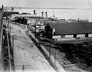 Queen's Quay is built entirely on infill, and is the closest road to Lake Ontario throughout the downtown core. Though once abutted by warehouses from end to end, much of its length has seen rapid gentrification
in the past two decades, with dozens of condominium towers rising. In 1999, the Toronto Transit Commission
opened a dedicated streetcar
right-of-way in the median from Bay Street to Bathurst Street.
In 2009, Waterfront Toronto announced its plans to turn Queens Quay into a grand lakefront boulevard by placing streetcar lanes in the centre, traffic only on the north side and a pedestrian focussed space on the south side. The plan will restrict Queen’s Quay to two traffic lanes, on the north side of the streetcar tracks, similar to the design of the 2006 experiment. Additionally, the plan calls for the beautification and extension of the Harbourfront streetcar line along Queen’s Quay East between Yonge and Cherry Street. The transit right-of-way will be grass-covered.
Queen's Quay begins west of Bathurst Street at Stadium Road and ends at Lakeshore Boulevard East, where it continues north as Parliament Street.
. Although the route west of the humber has existed since ancient times, much of the remainder of the route was created during massive shoreline reclamation projects carried out by the Harbour Commission
between 1900 and 1915. Lakeshore Road travelled as far east as Roncesvalles, where it connected to Queen Street. Incorporating various side streets such as Laburnam Avenue, Starr Avenue and Dominion Street, the route was pushed east to Bathurst Street on January 28, 1924. From there it continued as Fleet Street to Cherry Street. Keating Street continued east from a point just south of that intersection to Woodbine Avenue. These two streets were reconstructed to form a continuous roadway, and renamed as part of Lakeshore Road on August 25, 1959.
connecting downtown with the western suburbs. Running close to the shore of Lake Ontario
, it now extends from the junction of Highway 427 and the Queen Elizabeth Way
in the west to the foot of the Don Valley Parkway
in the east, just past the mouth of the Don River. East of Dufferin Street
, the roadway is elevated, running above Lake Shore Boulevard east of Bathurst Street. Elevated sections east of the Don were demolished and integrated into Lake Shore Boulevard.
The highway is named for the first chair of the now-defunct Metro Council
, Frederick G. Gardiner, who championed it, the Don Valley Parkway and Spadina Expressway
projects. The six-lane section east of the Humber River
was built in segments from 1955 until 1964 by the Metropolitan Toronto government with provincial highway funds. The ten-lane section west of the Humber was formerly part of the QEW. The Gardiner Expressway is now wholly owned and operated by the City of Toronto.
When the Gardiner was built, it passed through industrial lands, now mostly converted to residential lands. Extensive repairs became necessary in the early 1990s, and since then the Gardiner has been the subject of several proposals to demolish it or move it underground as part of downtown waterfront revitalization efforts. One elevated section east of the Don River was demolished in 2001, and a current study is underway to demolish that part of the elevated section east of Jarvis Street to the Don.
shoreline at the time of the original layout of York. In the early years of the 20th century, the Toronto Harbour Commission
revitilized the stagnant industrial waterfront. Largely as a result of this process, the shoreline was filled several hundred metres south to Queen's Quay.
Front Street begins at Bathurst Street and crosses through downtown Toronto
north of the rail viaduct. The road passes the Rogers Centre
, CN Tower
and Union Station
before eventually forcing drivers onto Eastern Avenue. A short side street continues east to the Bayview Avenue alignment with the name Front Street.d
.
Eastern Avenue begins at a curve along Front Street east of Parliament Street; eastbound traffic on Front is defaulted onto Eastern Avenue, vice-versa for westbound traffic on Eastern. The road crosses the Don River, merging with Richmond Street and Adelaide Street and providing access to the Don Valley Parkway
. East of Broadview Avenue, it travels parallel to and three blocks south of Queen Street East along the King Street alignment to east of Coxwell Avenue, where it curves northward and meets Queen Street. North of Queen Street, the road becomes Kingston Road.
The street travels east from The Queensway, splitting off to the south-east at Queen Street West
and Roncesvalles Avenue, to the Don River where it ends at Queen Street. King Street once crossed the Don River on an abandoned steel and concrete bridge. On the west side the roadway is now Eastern Avenue and Cypress Street. East of the Don, a short stretch begins as Sunlight Park Road and then as Eastern Avenue to Kingston Road.
) by Peter Russell
, second Lieutenant Governor of Upper Canada, in his 1797 plan of Toronto. The original section of Adelaide was only a portion of the present street. In 1844, Little Adelaide Street, Adelaide Street and Newgate Street were amalgamated to form Adelaide Street. The street was split into east and west sections in 1884. In 1926, at the request of property owners, Adelaide Street West was extended from Bathurst Street to Shaw Street, incorporating the entirety of Defoe Street and McDonnell Square. The most recent extension came in 1965, when Adelaide Street East was routed onto Duke Street, which crossed between Jarvis Street and Parliament Street. This was done in advance of the opening of the lower section of the Don Valley Parkway and eastern section of the Gardiner Expressway. Newgate and Duke Streets were amalgamated into Adelaide Street East.
. Lennox came to Canada in 1818 as Governor-in-Chief of British North America
, only to die a year later after being bitten by a rabid fox while touring the countryside. Richmond street absorbed Duke Street and became a one-way road in 1958 as part of a process to build ramps to Eastern Avenue and the Don Valley Parkway. Richmond Street is a westbound one-way street east of Bathurst Street. Between its western terminus at Strachan Avenue and Bathurst Street, the street is one-way, alternating directions twice.
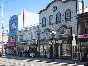
Queen Street begins at an intersection with The Queensway, Roncesvalles Avenue and King Street and crosses through Parkdale
, the Fashion District, downtown Toronto
, Riverdale
, East Toronto
and The Beaches
, ending east of Victoria Park Avenue at a residential street named Fallingbrook Road. The entirety of the street is served by the 501 Queen streetcar route.
in honour of the Right Honourable Henry Dundas, 1st Viscount Melville
. Like Yonge Street, named in a similar example of cronyism
, Dundas Street was created as a defense road. Simcoe feared the impending invasion of the Americans following the Revolutionary War
, an event which would occur in 1812. Dundas Street was to connect York with Detroit, then a British settlement; it reached as far as London, Simcoe's proposed new capital. The street was initially constructed by the Queen's Rangers between Dundas
and the Thames River
in 1794, but later extended east to York by pioneer road builder Asa Danforth
in 1797.
Dundas Street originally began at the present-day intersection of Queen Street West and Ossington Avenue. It travelled north along Ossington, then turned west at Garrison Creek
along the current Dundas Street. By the 1920s, Dundas was extended east through downtown Toronto
to Broadview Avenue along several existing but discontinuous streets, comprising Arthur Street (Ossington to Bathurst), St. Patrick (Bathurst to McCaul), Anderson (McCaul to University), Agnes (University to Yonge), Crookshank (Yonge to Victoria, now separated and known as Dundas Square) and Wilton Avenue (Victoria to Broadview). This was done by correcting several irregularities, or "jogs", between the streets. These jogs are evident east of Bathurst Street and Yonge Street.
 Gerrard Street was established on January 6, 1875 by incorporating Don Street and Lake View Avenue. It is named after Irish businessman Samuel Gerrard, a personal friend of the Honourable John McGill. The bridge over the Don River was completed and opened December 16, 1923.
Gerrard Street begins at University Avenue in the Discovery District
, surrounded by Princess Margaret Hospital
, Mount Sinai Hospital, Toronto General Hospital
and Hospital for Sick Children
. It travels west through downtown Toronto
, past Ryerson University
and Regent Park
before crossing the Don River on the Gerrard Street Viaduct, constructed between 1922 and 1924. The road continues through Chinatown East and Little India. At Coxwell Avenue, the road deviates one block to the north; this split has led to the distinct parts being labelled as Upper and Lower Gerrard. Gerrard Street ends at Clonmore Avenue, west of Warden Avenue; traffic is forced onto Clonmore Avenue where it can travel as far as Birchmount Road.
and Cambridge
.
 Carlton Street was named by Ann Wood, wife of both Andrew Ryan McGill
and then John Strachan
, after her brother, Guy Carleton Wood, who was in turn named after Guy Carleton
; it is unknown when the "e" was dropped from the spelling. In 1930, as part of a depression relief program, Carlton Street was realigned east of Yonge Street in order to meet with College Street. Prior to that, it met Yonge Street south of the present intersection by several dozen metres. The completed intersection was opened in early June 1931.
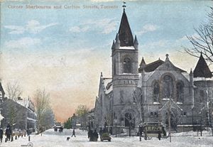
Carlton Street is home to Maple Leaf Gardens
. It extends from Yonge Street east to Parliament Street as a major thoroughfare. Carleton continues east of Parliament as a residential street, ending at the edge of Riverdale Park
.
, who is best known for his victory over Napoleon at the Battle of Waterloo
in 1815, and for a short but unpopular tenure as Prime Minister of Britain between 1828 and 1830.
Wellesley Street begins at the entrance to the University of Toronto
at Queen's Park Crescent. The road passes immediately north of the Ontario Legislative Building (Queen's Park)
Although Bloore had an "e" at the end of his surname, Bloor Street was never spelled with it, as evidenced on numerous maps produced before his death.
, who built the Governors Road
and Danforth Road by the end of the 18th century, under the direction of surveryor general Augustus Jones
. Danforth Avenue, however, was constructed in 1851 by The Don and Danforth Plank Road Company, connecting the Don Mills Road (now Broadview Avenue) with the Danforth Road.
The road was extended east to Kingston Road (formerly Highway 2
) in 1935, which included the construction of the present interchange.
, and several other streets are named after him. These include Wells and Wells Hill Dupont begins at Keele Street as a continuation of Annette Street. It runs parallel to and south of the CPR Midtown tracks east to Avenue Road.
shoreline and home of Colonel Joseph Wells, father of George Dupont Wells. The estate stood northeast of the modern Bathurst Street and Davenport Road intersection. Wells purchased the property from Adjutant John McGill in 1821 and rebuilt the house that occupied it. McGill built the original house in 1797 and supposedly named it after Major Davenport, who was stationed at Fort York at that time.
. In 1913, Frank opened the Laura Secord Candy Shop on Yonge Street, which has since become a national franchise.
O'Connor Drive begins at the northern terminus of Broadview Avenue and progresses east to Woodbine Avenue, where it turns to the northeast and continues to Eglinton Avenue. The first several kilometres were originally part of the Don Mills Road until the 1922.
at Scarlett Road, where it is angled and does not follow the concession line as a result of road realignments for the construction of the Canadian Pacific railway crossing in 1912. It proceeds east to near Mount Pleasant Road, but stops short of the Don valley. On the opposite side, it begins near O'Connor and continues along the same alignment to Kingston Road.
Davisville Avenue was built in the early 20th century as one of several roads connecting Yonge Street with the planned town of Leaside
. It begins as a continuation of Chaplin Crescent at Yonge Street and proceeds east 2 km (1.2 mi) to Bayview Avenue.
settled in the area, possibly naming it after their Earl of Eglinton, Hugh Montgomerie. Hugh's successor, Archibald William Montgomerie, was famous for a lavish tournament held at his Eglinton Castle in 1839. For two years prior to the formation of Metropolitan Toronto
, the section of Eglinton Avenue through Scarborough was known as Highway 109.
Eglinton Avenue holds the distinction as the only road in Toronto to cross all six former municipalities. It begins at the Toronto–Mississauga boundary and travels east through Richview
, Weston, North Toronto
, Leaside
, the Golden Mile, Brimley and Scarborough Village
before ending at Kingston Road. The majority of Eglinton Avenue is abbuted by commercial strip plazas, auto dealerships, and dense apartment blocks, though almost every zoning condition presents itself along the road. The route is heavily congested, which will be addressed by the Eglinton–Scarborough Crosstown line.
.
in honour of the family. The road remained a sod road until the 1920s before being developed as part of the development.
Lawrence Avenue begins in the west at Royal York Road
. West of there, the road continues as The Westway, a windy collector road
that ends at Martin Grove Road constructed post-World War II to serve the growing Willowridge-Martingrove-Richview to the south and the Kingsview Village-The Westway
to the north. In the east, the road ends near the Rouge River
, east of Port Union
.
Lawrence Avenue East is interrupted at Bayview Avenue, by the west branch of the Don River. A detour north on Bayview leads to Post Road, and a connection back to Lawrence Avenue on the east side of the valley. This detour runs through The Bridle Path, one of Toronto's most affluent neighbourhoods. East of Leslie Street, Lawrence becomes an arterial road, passing through Don Mills
. In the East Don valley is the Lawrence Avenue exit of the Don Valley Parkway
. From there, Lawrence continues as a six-lane road through most of Scarborough
, with many strip mall
s flanking its sides. The segment east of Morningside Avenue is primarily residential. The road ends at Rouge Hills Drive at the entrance to Rouge Park near the mouth of the Rouge River
.
York Mills is an eastward continuation of Wilson Avenue; this continuity did not exist until the opening of the Yonge Subway extension in 1976. It is primarily residential in nature, except near Yonge Street and between Leslie Street and Don Mills Road, which are mostly commercial. The road ends at Victoria Park Avenue; a connection to Ellesmere Road is provided via Parkwoods Village Drive.
of the original settlers in Shropshire
, England. The road travels through Scarborough, where it was laid as the first concession road (Lawrence Avenue being the baseline in the survey of Scarborough). The surrounding land alternates between single-unit homes and commercial strips throughout its length.
and the Ontario Coroners Office. Highway 401 crosses the entirety of Toronto and physically divides the city in half.
Sheppard Avenue begins at Weston Road, and travels east across North York and Scarborough to Meadowvale Road. Shortly thereafter, it turns southeast. At Kingston Road (formerly Highway 2
), it becomes Port Union Road. Twyn Rivers Road continues along the alignment into Pickering; at Altona Road it becomes Sheppard Avenue once again.
, Finch Avenue becomes Morningside Avenue. However, Old Finch Avenue continues along the same right-of-way passing north of the Toronto Zoo
and ending and Meadowvale Road. Approximately 800 m (0.497098189319845 mi) to the east, another section of Finch Avenue begins and passes into Pickering
.
The road travels east from Yonge as a continuation of Drewry Avenue. At its crossing of the Don River, Cummer curves north, retuns to the east and ends at Leslie Street. It continues east as McNicoll Avenue.
 Steeles Avenue is a major arterial road in the north end of the city. It is the only road (aside from Highway 401) to pass, uninterrupted, west to east through the entire city; it also continues west to Milton
and east into Pickering
as Taunton Road. The Steele family resided at Yonge and Steeles beginning in 1856, when Thomas purchased an inn and named it the Steele's Hotel. Thomas' son, John C. Steele, is known for inventing the Steeles Improved Road Machine, an early grader
. It serves as the boundary line between Toronto and York Region to the north.
Steeles Avenue was listed by the Canadian Automobile Association
(CAA) as the "worst road in October" for 2006, and as the fifth worst road in 2007. In October 2008, it was again crowned the worst road in Ontario. Reasons include potholes and general quality of the surface. Soon after the results of CAA's survey were made public, some parts of the road between Dufferin Street
and Bayview Avenue
were resurfaced. The results of the 2009 survey listed Steeles as Ontario's worst road, for the second year in a row.
However in 2010, Steeles Avenue was resurfaced from Yonge Street to Markham Road, with the funds coming from the federal infrastructure stimulus program, and the CAA named it the "Best Road in Ontario".
Arterial road
An arterial road, or arterial thoroughfare, is a high-capacity urban road. The primary function of an arterial road is to deliver traffic from collector roads to freeways, and between urban centres at the highest level of service possible. As such, many arteries are limited-access roads, or feature...
in the Canadian
Canada
Canada is a North American country consisting of ten provinces and three territories. Located in the northern part of the continent, it extends from the Atlantic Ocean in the east to the Pacific Ocean in the west, and northward into the Arctic Ocean...
city of Toronto
Toronto
Toronto is the provincial capital of Ontario and the largest city in Canada. It is located in Southern Ontario on the northwestern shore of Lake Ontario. A relatively modern city, Toronto's history dates back to the late-18th century, when its land was first purchased by the British monarchy from...
. The city is organized in a grid pattern dating back to the plan laid out by Augustus Jones
Augustus Jones
Augustus Jones was an American-born Upper Canadian farmer, land speculator, magistrate, militia captain and surveyor. Jones trained as a surveyor in New York City, and fled as a United Empire Loyalist to Upper Canada...
between 1793 and 1797. Most streets are aligned in the north-south or east-west direction, based on the shoreline of Lake Ontario
Lake Ontario
Lake Ontario is one of the five Great Lakes of North America. It is bounded on the north and southwest by the Canadian province of Ontario, and on the south by the American state of New York. Ontario, Canada's most populous province, was named for the lake. In the Wyandot language, ontarío means...
. In other words, major north–south roads are generally perpendicular to the Lake Ontario shoreline and major east–west roads are generally parallel to the lake's shoreline. The Toronto road system is also influenced by its topography as some roads are aligned with the old Lake Iroquois
Glacial Lake Iroquois
Glacial Lake Iroquois was a prehistoric proglacial lake that existed at the end of the last ice age approximately 13,000 years ago.The lake was essentially an enlargement of the present Lake Ontario that formed because the St. Lawrence River downstream from the lake was blocked by the ice sheet...
shoreline, or the deep valleys
Toronto ravine system
The Toronto ravine system is one of the most distinctive features of the geography of Toronto, Ontario, Canada. It is a network of deep ravines that form a large urban forest that runs throughout much of the city...
. Minor streets with documented history or etymology are listed in a separate section.
Queen's Quay
Gentrification
Gentrification and urban gentrification refer to the changes that result when wealthier people acquire or rent property in low income and working class communities. Urban gentrification is associated with movement. Consequent to gentrification, the average income increases and average family size...
in the past two decades, with dozens of condominium towers rising. In 1999, the Toronto Transit Commission
Toronto Transit Commission
-Island Ferry:The ferry service to the Toronto Islands was operated by the TTC from 1927 until 1962, when it was transferred to the Metro Parks and Culture department. Since 1998, the ferry service is run by Toronto Parks and Recreation.-Gray Coach:...
opened a dedicated streetcar
Tram
A tram is a passenger rail vehicle which runs on tracks along public urban streets and also sometimes on separate rights of way. It may also run between cities and/or towns , and/or partially grade separated even in the cities...
right-of-way in the median from Bay Street to Bathurst Street.
In 2009, Waterfront Toronto announced its plans to turn Queens Quay into a grand lakefront boulevard by placing streetcar lanes in the centre, traffic only on the north side and a pedestrian focussed space on the south side. The plan will restrict Queen’s Quay to two traffic lanes, on the north side of the streetcar tracks, similar to the design of the 2006 experiment. Additionally, the plan calls for the beautification and extension of the Harbourfront streetcar line along Queen’s Quay East between Yonge and Cherry Street. The transit right-of-way will be grass-covered.
Queen's Quay begins west of Bathurst Street at Stadium Road and ends at Lakeshore Boulevard East, where it continues north as Parliament Street.
Lake Shore Boulevard
Lake Shore Boulevard, often misspelled as Lakeshore Boulevard, is so named because of its position along the Lake Ontario shorelineLake Ontario
Lake Ontario is one of the five Great Lakes of North America. It is bounded on the north and southwest by the Canadian province of Ontario, and on the south by the American state of New York. Ontario, Canada's most populous province, was named for the lake. In the Wyandot language, ontarío means...
. Although the route west of the humber has existed since ancient times, much of the remainder of the route was created during massive shoreline reclamation projects carried out by the Harbour Commission
Toronto Harbour Commission
The Toronto Harbour Commission was a joint federal-municipal government agency based in Toronto, Ontario, Canada. The agency managed Toronto Harbour as well as being responsible for major works along the Toronto waterfront. It built the Toronto Island Airport in 1939...
between 1900 and 1915. Lakeshore Road travelled as far east as Roncesvalles, where it connected to Queen Street. Incorporating various side streets such as Laburnam Avenue, Starr Avenue and Dominion Street, the route was pushed east to Bathurst Street on January 28, 1924. From there it continued as Fleet Street to Cherry Street. Keating Street continued east from a point just south of that intersection to Woodbine Avenue. These two streets were reconstructed to form a continuous roadway, and renamed as part of Lakeshore Road on August 25, 1959.
Gardiner Expressway
The Frederick G. Gardiner Expressway, known locally as "the Gardiner", is an expresswayControlled-access highway
A controlled-access highway is a highway designed exclusively for high-speed vehicular traffic, with all traffic flow and ingress/egress regulated...
connecting downtown with the western suburbs. Running close to the shore of Lake Ontario
Lake Ontario
Lake Ontario is one of the five Great Lakes of North America. It is bounded on the north and southwest by the Canadian province of Ontario, and on the south by the American state of New York. Ontario, Canada's most populous province, was named for the lake. In the Wyandot language, ontarío means...
, it now extends from the junction of Highway 427 and the Queen Elizabeth Way
Queen Elizabeth Way
The Queen Elizabeth Way, commonly abbreviated as the QEW, is a 400-Series highway in the Canadian province of Ontario. The freeway links Buffalo, New York and the Niagara Peninsula with Toronto. It begins at the Peace Bridge in Fort Erie and travels around the western shore of Lake Ontario, ending...
in the west to the foot of the Don Valley Parkway
Don Valley Parkway
The Don Valley Parkway is a controlled-access six-lane municipal expressway in Toronto connecting the Gardiner Expressway in downtown Toronto with Ontario Highway 401, the Macdonald–Cartier Freeway. North of Highway 401, it continues as Ontario Highway 404. The parkway runs through...
in the east, just past the mouth of the Don River. East of Dufferin Street
Dufferin Street
Dufferin Street is a major north-south street in Toronto, Ontario, Canada. It is a concession road, two concessions west of Yonge Street. The street starts at the foot of Lake Ontario, continues north to Toronto's northern boundary with some discontinuities and continues into York Region where it...
, the roadway is elevated, running above Lake Shore Boulevard east of Bathurst Street. Elevated sections east of the Don were demolished and integrated into Lake Shore Boulevard.
The highway is named for the first chair of the now-defunct Metro Council
Metropolitan Toronto
The Municipality of Metropolitan Toronto was a senior level of municipal government in the Toronto, Ontario, Canada area from 1954 to 1998. It was created out of York County and was a precursor to the later concept of a regional municipality, being formed of smaller municipalities but having more...
, Frederick G. Gardiner, who championed it, the Don Valley Parkway and Spadina Expressway
Spadina Expressway
The Spadina Expressway was a proposed north-south freeway in Toronto, Ontario, Canada. It was only partially built before being cancelled in 1971 due to public opposition. It was proposed in the mid-1960s as part of a network of freeways for Metropolitan Toronto. Its cancellation prompted the...
projects. The six-lane section east of the Humber River
Humber River (Ontario)
The Humber River is one of two major rivers on either side of Toronto, Ontario, Canada, the other being the Don River to the east. It was designated a Canadian Heritage River on September 24, 1999....
was built in segments from 1955 until 1964 by the Metropolitan Toronto government with provincial highway funds. The ten-lane section west of the Humber was formerly part of the QEW. The Gardiner Expressway is now wholly owned and operated by the City of Toronto.
When the Gardiner was built, it passed through industrial lands, now mostly converted to residential lands. Extensive repairs became necessary in the early 1990s, and since then the Gardiner has been the subject of several proposals to demolish it or move it underground as part of downtown waterfront revitalization efforts. One elevated section east of the Don River was demolished in 2001, and a current study is underway to demolish that part of the elevated section east of Jarvis Street to the Don.
Front Street
Front Street is so named because it fronted the Lake OntarioLake Ontario
Lake Ontario is one of the five Great Lakes of North America. It is bounded on the north and southwest by the Canadian province of Ontario, and on the south by the American state of New York. Ontario, Canada's most populous province, was named for the lake. In the Wyandot language, ontarío means...
shoreline at the time of the original layout of York. In the early years of the 20th century, the Toronto Harbour Commission
Toronto Harbour Commission
The Toronto Harbour Commission was a joint federal-municipal government agency based in Toronto, Ontario, Canada. The agency managed Toronto Harbour as well as being responsible for major works along the Toronto waterfront. It built the Toronto Island Airport in 1939...
revitilized the stagnant industrial waterfront. Largely as a result of this process, the shoreline was filled several hundred metres south to Queen's Quay.
Front Street begins at Bathurst Street and crosses through downtown Toronto
Downtown Toronto
Downtown Toronto is the central business district of Toronto, Ontario, Canada. It is approximately bounded by Bloor Street to the north, Lake Ontario to the south, the Don River to the east, and Bathurst Street to the west...
north of the rail viaduct. The road passes the Rogers Centre
Rogers Centre
Rogers Centre is a multi-purpose stadium, in Downtown Toronto, Ontario, Canada, situated next to the CN Tower, near the shores of Lake Ontario. Opened in 1989, it is home to the Toronto Blue Jays of Major League Baseball and the Toronto Argonauts of the Canadian Football League...
, CN Tower
CN Tower
The CN Tower is a communications and observation tower in Downtown Toronto, Ontario, Canada. Standing tall, it was completed in 1976, becoming the world's tallest free-standing structure and world's tallest tower at the time. It held both records for 34 years until the completion of the Burj...
and Union Station
Union Station (Toronto)
Union Station is the major inter-city rail station and a major commuter rail hub in Toronto, located on Front Street West and occupying the south side of the block bounded by Bay Street and York Street in the central business district. The station building is owned by the City of Toronto, while the...
before eventually forcing drivers onto Eastern Avenue. A short side street continues east to the Bayview Avenue alignment with the name Front Street.d
Eastern Avenue
Eastern Avenue, formerly South Park Street, was named on November 27, 1876. It was connected with Kingston Road in 1998 following the removal of the old Woodbine RacetrackWoodbine Racetrack
Woodbine Racetrack is a Canadian racetrack for Thoroughbred horse races located at 555 Rexdale Blvd. in the city of Toronto, Ontario. It is the only horseracing track in North America which stages, or is capable of staging, thoroughbred and standardbred horseracing programs on the same day...
.
Eastern Avenue begins at a curve along Front Street east of Parliament Street; eastbound traffic on Front is defaulted onto Eastern Avenue, vice-versa for westbound traffic on Eastern. The road crosses the Don River, merging with Richmond Street and Adelaide Street and providing access to the Don Valley Parkway
Don Valley Parkway
The Don Valley Parkway is a controlled-access six-lane municipal expressway in Toronto connecting the Gardiner Expressway in downtown Toronto with Ontario Highway 401, the Macdonald–Cartier Freeway. North of Highway 401, it continues as Ontario Highway 404. The parkway runs through...
. East of Broadview Avenue, it travels parallel to and three blocks south of Queen Street East along the King Street alignment to east of Coxwell Avenue, where it curves northward and meets Queen Street. North of Queen Street, the road becomes Kingston Road.
King Street
King Street was named in honour of King George III by John Graves Simcoe when it was laid out in the original plan of York in 1793. It existed by various names over the years.The street travels east from The Queensway, splitting off to the south-east at Queen Street West
Queen Street West
Queen Street West describes both the western branch of Queen Street, a major east-west thoroughfare, and a series of neighbourhoods or commercial districts, situated west of Yonge Street in downtown Toronto, Ontario, Canada. Queen Street begins in the west at the intersection of King Street, The...
and Roncesvalles Avenue, to the Don River where it ends at Queen Street. King Street once crossed the Don River on an abandoned steel and concrete bridge. On the west side the roadway is now Eastern Avenue and Cypress Street. East of the Don, a short stretch begins as Sunlight Park Road and then as Eastern Avenue to Kingston Road.
Adelaide Street
Adelaide Street was named for Princess Adelaide of Saxe-Meiningen (wife of William IVWilliam IV of the United Kingdom
William IV was King of the United Kingdom of Great Britain and Ireland and of Hanover from 26 June 1830 until his death...
) by Peter Russell
Peter Russell (politician)
Peter Russell was a gambler, government official, politician and judge in Upper Canada.-Early life:...
, second Lieutenant Governor of Upper Canada, in his 1797 plan of Toronto. The original section of Adelaide was only a portion of the present street. In 1844, Little Adelaide Street, Adelaide Street and Newgate Street were amalgamated to form Adelaide Street. The street was split into east and west sections in 1884. In 1926, at the request of property owners, Adelaide Street West was extended from Bathurst Street to Shaw Street, incorporating the entirety of Defoe Street and McDonnell Square. The most recent extension came in 1965, when Adelaide Street East was routed onto Duke Street, which crossed between Jarvis Street and Parliament Street. This was done in advance of the opening of the lower section of the Don Valley Parkway and eastern section of the Gardiner Expressway. Newgate and Duke Streets were amalgamated into Adelaide Street East.
Richmond Street
Richmond Street remembers Charles Lennox, 4th Duke of RichmondCharles Lennox, 4th Duke of Richmond
Charles Lennox, 4th Duke of Richmond, 4th Duke of Lennox KG, PC was a British soldier and politician and Governor General of British North America.-Background:...
. Lennox came to Canada in 1818 as Governor-in-Chief of British North America
British North America
British North America is a historical term. It consisted of the colonies and territories of the British Empire in continental North America after the end of the American Revolutionary War and the recognition of American independence in 1783.At the start of the Revolutionary War in 1775 the British...
, only to die a year later after being bitten by a rabid fox while touring the countryside. Richmond street absorbed Duke Street and became a one-way road in 1958 as part of a process to build ramps to Eastern Avenue and the Don Valley Parkway. Richmond Street is a westbound one-way street east of Bathurst Street. Between its western terminus at Strachan Avenue and Bathurst Street, the street is one-way, alternating directions twice.
The Queensway
The Queensway was named in the 1950s following the ascention of Queen Elizabeth II.Queen Street
Queen Street, known as Lot Street until 1844, was named in honour of Queen Victoria, who reigned from 1837 until her death in 1901. For a time, Lot Street served as the northern limit of York. On the north side of the street, large 0.8 sqkm were granted to loyalists and government officials, many of whom never visited Upper Canada during their lives. The central portion of Lot Street was constructed as the baseline for surveys along Yonge Street by the Queen's Rangers in 1793. It was later extended west to Ossington Street as part of the Governor's Road (Dundas Street).Queen Street begins at an intersection with The Queensway, Roncesvalles Avenue and King Street and crosses through Parkdale
Parkdale, Toronto
Parkdale is a neighbourhood and former village in Toronto, Ontario, Canada, west of downtown. The neighbourhood is bounded on the west by Roncesvalles Avenue, on the north by Queen Street. It is bounded on the east by Dufferin Street from Queen Street south, and on the south by Lake Ontario...
, the Fashion District, downtown Toronto
Downtown Toronto
Downtown Toronto is the central business district of Toronto, Ontario, Canada. It is approximately bounded by Bloor Street to the north, Lake Ontario to the south, the Don River to the east, and Bathurst Street to the west...
, Riverdale
Riverdale, Toronto
Riverdale is a large neighbourhood in Toronto, Ontario, Canada. It is bounded by the Don River Valley to the west, Danforth Avenue and Greektown to the north, Jones Avenue, the CN/GO tracks, and Leslieville to the east, and Lake Shore Boulevard to the south....
, East Toronto
East Toronto
East Toronto, Ontario was an incorporated community in what is today a part of the city of Toronto, Canada. It covered much of what is today the Upper Beaches neighbourhood, stretching up to Danforth Avenue in the north. The central street in the community was Main Street, running south from...
and The Beaches
The Beaches
The Beaches is a neighbourhood and popular tourist destination located in Toronto, Ontario, Canada. It is located on the east side of the "Old" City of Toronto. The original boundaries of the neighbourhood are from Fallingbrook Avenue on the east to Kingston Road on the north, to Woodbine Avenue...
, ending east of Victoria Park Avenue at a residential street named Fallingbrook Road. The entirety of the street is served by the 501 Queen streetcar route.
Dundas Street
Dundas Street was named by John Graves SimcoeJohn Graves Simcoe
John Graves Simcoe was a British army officer and the first Lieutenant Governor of Upper Canada from 1791–1796. Then frontier, this was modern-day southern Ontario and the watersheds of Georgian Bay and Lake Superior...
in honour of the Right Honourable Henry Dundas, 1st Viscount Melville
Henry Dundas, 1st Viscount Melville
Henry Dundas, 1st Viscount Melville PC and Baron Dunira was a Scottish lawyer and politician. He was the first Secretary of State for War and the last person to be impeached in the United Kingdom....
. Like Yonge Street, named in a similar example of cronyism
Cronyism
Cronyism is partiality to long-standing friends, especially by appointing them to positions of authority, regardless of their qualifications. Hence, cronyism is contrary in practice and principle to meritocracy....
, Dundas Street was created as a defense road. Simcoe feared the impending invasion of the Americans following the Revolutionary War
American Revolutionary War
The American Revolutionary War , the American War of Independence, or simply the Revolutionary War, began as a war between the Kingdom of Great Britain and thirteen British colonies in North America, and ended in a global war between several European great powers.The war was the result of the...
, an event which would occur in 1812. Dundas Street was to connect York with Detroit, then a British settlement; it reached as far as London, Simcoe's proposed new capital. The street was initially constructed by the Queen's Rangers between Dundas
Dundas, Ontario
Dundas is a formerly independent town and now constituent community in the city of Hamilton in Ontario, Canada. It's nickname is the Valley Town. The population has been stable for decades at about twenty thousand, largely because it has not annexed rural land from the protected Dundas Valley...
and the Thames River
Thames River (Ontario)
The Thames River is located in southwestern Ontario, Canada.The Thames flows west through southwestern Ontario, through the cities of Woodstock, London and Chatham to Lighthouse Cove on Lake St. Clair...
in 1794, but later extended east to York by pioneer road builder Asa Danforth
Asa Danforth
Asa Danforth was an early settler and leading citizen of Onondaga County, New York where he was the second white man to settle upon his arrival in 1788. He was a veteran of the American Revolution and a salt maker in Onondaga Hollow.-Biography:Asa Danforth was born on July 6, 1746 in Worcester,...
in 1797.
Dundas Street originally began at the present-day intersection of Queen Street West and Ossington Avenue. It travelled north along Ossington, then turned west at Garrison Creek
Garrison Creek
Garrison Creek was a short stream about long that flowed southeast into the west side of Toronto Harbour in Ontario, Canada.It has been largely covered over and filled in, but geographical traces of the creek can still be found. The natural amphitheatre known as Christie Pits is one such remnant;...
along the current Dundas Street. By the 1920s, Dundas was extended east through downtown Toronto
Downtown Toronto
Downtown Toronto is the central business district of Toronto, Ontario, Canada. It is approximately bounded by Bloor Street to the north, Lake Ontario to the south, the Don River to the east, and Bathurst Street to the west...
to Broadview Avenue along several existing but discontinuous streets, comprising Arthur Street (Ossington to Bathurst), St. Patrick (Bathurst to McCaul), Anderson (McCaul to University), Agnes (University to Yonge), Crookshank (Yonge to Victoria, now separated and known as Dundas Square) and Wilton Avenue (Victoria to Broadview). This was done by correcting several irregularities, or "jogs", between the streets. These jogs are evident east of Bathurst Street and Yonge Street.
Gerrard Street
Gerrard Street begins at University Avenue in the Discovery District
Discovery District
The Discovery District is an area of downtown Toronto, Ontario, Canada, that features a high concentration of hospitals and research institutions, particularly those related to biotechnology...
, surrounded by Princess Margaret Hospital
Princess Margaret Hospital (Toronto)
Princess Margaret Hospital is located in downtown Toronto, Ontario, Canada on University Avenue at College Street. It is part of the University Health Network...
, Mount Sinai Hospital, Toronto General Hospital
Toronto General Hospital
The Toronto General Hospital , is a part of the University Health Network, and a major teaching hospital in downtown Toronto, Ontario. It is located in the Discovery District, directly north of the Hospital for Sick Children, across Gerrard Street West, and east of Princess Margaret Hospital and...
and Hospital for Sick Children
Hospital for Sick Children
The Hospital for Sick Children – is a major paediatric centre for the Greater Toronto Area, serving patients up to age 18. Located on University Avenue in Downtown Toronto, SickKids is part of the city’s Discovery District, a critical mass of scientists and entrepreneurs who are focused on...
. It travels west through downtown Toronto
Downtown Toronto
Downtown Toronto is the central business district of Toronto, Ontario, Canada. It is approximately bounded by Bloor Street to the north, Lake Ontario to the south, the Don River to the east, and Bathurst Street to the west...
, past Ryerson University
Ryerson University
Ryerson University is a public research university located in downtown Toronto, Ontario, Canada. Its urban campus is adjacent to Yonge-Dundas Square located at the busiest intersection in Downtown Toronto. The majority of its buildings are in the blocks northeast of the square in Toronto's Garden...
and Regent Park
Regent Park
Regent Park is a neighbourhood located in Old Toronto, Ontario, Canada. Regent Park is Canada's oldest and largest social housing project; built in the late 1940s. Formerly the centre of the Cabbagetown neighbourhood, it is bounded by Gerrard Street East to the north, River Street to the east,...
before crossing the Don River on the Gerrard Street Viaduct, constructed between 1922 and 1924. The road continues through Chinatown East and Little India. At Coxwell Avenue, the road deviates one block to the north; this split has led to the distinct parts being labelled as Upper and Lower Gerrard. Gerrard Street ends at Clonmore Avenue, west of Warden Avenue; traffic is forced onto Clonmore Avenue where it can travel as far as Birchmount Road.
College Street
College Street shares its origins with University Avenue as one of the two private entrances to King's College opened in 1829. King's College was the first college in Canada when it was chartered by Henry, 3rd Earl of Bathurst two years earlier. The road began at a gatehouse at Yonge Street and progressed westward to present-day University Avenue. Like University, College was surrounded by gates in an attempt to create an elegant driveway like those in OxfordOxford
The city of Oxford is the county town of Oxfordshire, England. The city, made prominent by its medieval university, has a population of just under 165,000, with 153,900 living within the district boundary. It lies about 50 miles north-west of London. The rivers Cherwell and Thames run through...
and Cambridge
Cambridge
The city of Cambridge is a university town and the administrative centre of the county of Cambridgeshire, England. It lies in East Anglia about north of London. Cambridge is at the heart of the high-technology centre known as Silicon Fen – a play on Silicon Valley and the fens surrounding the...
.
Carlton Street
Andrew Ryan McGill
Andrew Ryan McGill was an American politician of the United States Republican Party. He served as the tenth Governor of Minnesota from January 5, 1887 to January 9, 1889....
and then John Strachan
John Strachan
John Strachan was an influential figure in Upper Canada and the first Anglican Bishop of Toronto.-Early life:Strachan was the youngest of six children born to a quarry worker in Aberdeen, Scotland. He graduated from King's College, Aberdeen in 1797...
, after her brother, Guy Carleton Wood, who was in turn named after Guy Carleton
Guy Carleton, 1st Baron Dorchester
Guy Carleton, 1st Baron Dorchester, KB , known between 1776 and 1786 as Sir Guy Carleton, was an Irish-British soldier and administrator...
; it is unknown when the "e" was dropped from the spelling. In 1930, as part of a depression relief program, Carlton Street was realigned east of Yonge Street in order to meet with College Street. Prior to that, it met Yonge Street south of the present intersection by several dozen metres. The completed intersection was opened in early June 1931.
Carlton Street is home to Maple Leaf Gardens
Maple Leaf Gardens
Maple Leaf Gardens is an indoor arena that was converted into a Loblawssupermarket and Ryerson University athletic centre in Toronto, on the northwest corner of Carlton Street and Church Street in Toronto's Garden District.One of the temples of hockey, it was home to the Toronto Maple Leafs of the...
. It extends from Yonge Street east to Parliament Street as a major thoroughfare. Carleton continues east of Parliament as a residential street, ending at the edge of Riverdale Park
Riverdale Park (Toronto)
Riverdale Park is a large park spanning the Lower Don River, Toronto, Ontario, Canada between Cabbagetown to the west and Broadview Avenue in Riverdale to the east. Recreational fields for soccer, baseball, and Ultimate are available on both sides of the river with a swimming pool, tennis courts...
.
Wellesley Street
Wellesley Street is named after Arthur Wellesley, 1st Duke of WellingtonArthur Wellesley, 1st Duke of Wellington
Field Marshal Arthur Wellesley, 1st Duke of Wellington, KG, GCB, GCH, PC, FRS , was an Irish-born British soldier and statesman, and one of the leading military and political figures of the 19th century...
, who is best known for his victory over Napoleon at the Battle of Waterloo
Battle of Waterloo
The Battle of Waterloo was fought on Sunday 18 June 1815 near Waterloo in present-day Belgium, then part of the United Kingdom of the Netherlands...
in 1815, and for a short but unpopular tenure as Prime Minister of Britain between 1828 and 1830.
Wellesley Street begins at the entrance to the University of Toronto
University of Toronto
The University of Toronto is a public research university in Toronto, Ontario, Canada, situated on the grounds that surround Queen's Park. It was founded by royal charter in 1827 as King's College, the first institution of higher learning in Upper Canada...
at Queen's Park Crescent. The road passes immediately north of the Ontario Legislative Building (Queen's Park)
Bloor Street
Bloor Street was named by 1855 after Joseph Bloore.The vast majority of publications spell Joseph's surname Bloore, as the name is incribed on his grave and interment record. Henry Scadding (1873) spells it Bloor Originally surveyed as the first concession road north of the baseline (now Queen Street), it was known by many names, including the Tollgate Road (as the first tollgate On Yonge north of Lot Street was constructed there in 1820), then St. Paul's Road (after the nearby church, constructed 1842), and possibly Sydenham Road (after Lord Sydenham, Governor General 1839-1841).Sydenham Road is noted by Henry Scadding (1873). However, street maps show that this was more likely an early name for Cumberland Street in Yorkville.Although Bloore had an "e" at the end of his surname, Bloor Street was never spelled with it, as evidenced on numerous maps produced before his death.
Danforth Avenue
Danforth Avenue, known as the Don and Danforth Road until 1871, takes its name from pioneer road builder Asa DanforthAsa Danforth
Asa Danforth was an early settler and leading citizen of Onondaga County, New York where he was the second white man to settle upon his arrival in 1788. He was a veteran of the American Revolution and a salt maker in Onondaga Hollow.-Biography:Asa Danforth was born on July 6, 1746 in Worcester,...
, who built the Governors Road
Dundas Street
Dundas Street, also known as Highway 5 west of Toronto, is a major arterial road connecting the centre of that city with its western suburbs and southwestern Ontario beyond...
and Danforth Road by the end of the 18th century, under the direction of surveryor general Augustus Jones
Augustus Jones
Augustus Jones was an American-born Upper Canadian farmer, land speculator, magistrate, militia captain and surveyor. Jones trained as a surveyor in New York City, and fled as a United Empire Loyalist to Upper Canada...
. Danforth Avenue, however, was constructed in 1851 by The Don and Danforth Plank Road Company, connecting the Don Mills Road (now Broadview Avenue) with the Danforth Road.
The road was extended east to Kingston Road (formerly Highway 2
Ontario Highway 2
King's Highway 2, usually referred to simply as Highway 2 is a provincially maintained highway in Ontario. Once the primary east–west route across the southern end of the province, Highway 2 became mostly redundant in the 1960s following the completion of Highway 401, which more or less...
) in 1935, which included the construction of the present interchange.
Dupont Street
Dupont Street is named for George Dupont Wells, son of Colonel Joseph Wells. George was one of the first students of Upper Canada CollegeUpper Canada College
Upper Canada College , located in midtown Toronto, Ontario, Canada, is an independent elementary and secondary school for boys between Senior Kindergarten and Grade Twelve, operating under the International Baccalaureate program. The secondary school segment is divided into ten houses; eight are...
, and several other streets are named after him. These include Wells and Wells Hill Dupont begins at Keele Street as a continuation of Annette Street. It runs parallel to and south of the CPR Midtown tracks east to Avenue Road.
Davenport Road
Davenport Road takes its name from the Davenport House, the first estate atop the Lake IroquoisGlacial Lake Iroquois
Glacial Lake Iroquois was a prehistoric proglacial lake that existed at the end of the last ice age approximately 13,000 years ago.The lake was essentially an enlargement of the present Lake Ontario that formed because the St. Lawrence River downstream from the lake was blocked by the ice sheet...
shoreline and home of Colonel Joseph Wells, father of George Dupont Wells. The estate stood northeast of the modern Bathurst Street and Davenport Road intersection. Wells purchased the property from Adjutant John McGill in 1821 and rebuilt the house that occupied it. McGill built the original house in 1797 and supposedly named it after Major Davenport, who was stationed at Fort York at that time.
O'Connor Drive
O'Connor Drive takes its name from Senator Frank Patrick O'Connor, who owned Maryvale farm in Scarborough TownshipScarborough, Ontario
Scarborough is a dissolved municipality within the city of Toronto, Ontario, Canada. Geographically, it comprises the eastern part of Toronto. It is bordered on the south by Lake Ontario, on the west by Victoria Park Avenue, on the north by Steeles Avenue East, and on the east by the Rouge River...
. In 1913, Frank opened the Laura Secord Candy Shop on Yonge Street, which has since become a national franchise.
O'Connor Drive begins at the northern terminus of Broadview Avenue and progresses east to Woodbine Avenue, where it turns to the northeast and continues to Eglinton Avenue. The first several kilometres were originally part of the Don Mills Road until the 1922.
St. Clair Avenue
St. Clair Avenue, once the Third Concession, crosses through a majority of the city. The road is separated into two sections by the Don Valley. The western segment begins east of the Humber RiverHumber River (Ontario)
The Humber River is one of two major rivers on either side of Toronto, Ontario, Canada, the other being the Don River to the east. It was designated a Canadian Heritage River on September 24, 1999....
at Scarlett Road, where it is angled and does not follow the concession line as a result of road realignments for the construction of the Canadian Pacific railway crossing in 1912. It proceeds east to near Mount Pleasant Road, but stops short of the Don valley. On the opposite side, it begins near O'Connor and continues along the same alignment to Kingston Road.
Davisville Avenue
Davisville Avenue is named after John Davis, who opened Davis Pottery at Yonge and Davisville in 1845. Davis Pottery became nationally renowned; John used the newfound fortune to build schools and churches, and became the first postmaster of the growing village.Davisville Avenue was built in the early 20th century as one of several roads connecting Yonge Street with the planned town of Leaside
Leaside
Leaside is a neighbourhood in Toronto, Ontario, Canada. The area takes its name from William Lea and the Lea family, who settled there in the early years of the nineteenth century. The area first developed as farmland along with Toronto through the nineteenth century. It was incorporated as a...
. It begins as a continuation of Chaplin Crescent at Yonge Street and proceeds east 2 km (1.2 mi) to Bayview Avenue.
Rogers Road
Rogers Road is named for Stephen Rogers, who built one of the first houses in the Oakwood area in 1876 at the present corners of Rogers Road and Oakwood Avenue. It was constructed in the 1920s to serve Prospect Cemetery. The road crosses between Weston Road (incorporating a former section of Old Weston Road) and Oakwood Avenue.Eglinton Avenue
Eglinton Avenue takes its name from the village that was established at its intersection with Yonge Street. There are several possible origins of the name, all of which lead back to the Earl of Eglinton. Several Scottish veterans of the War of 1812War of 1812
The War of 1812 was a military conflict fought between the forces of the United States of America and those of the British Empire. The Americans declared war in 1812 for several reasons, including trade restrictions because of Britain's ongoing war with France, impressment of American merchant...
settled in the area, possibly naming it after their Earl of Eglinton, Hugh Montgomerie. Hugh's successor, Archibald William Montgomerie, was famous for a lavish tournament held at his Eglinton Castle in 1839. For two years prior to the formation of Metropolitan Toronto
Metropolitan Toronto
The Municipality of Metropolitan Toronto was a senior level of municipal government in the Toronto, Ontario, Canada area from 1954 to 1998. It was created out of York County and was a precursor to the later concept of a regional municipality, being formed of smaller municipalities but having more...
, the section of Eglinton Avenue through Scarborough was known as Highway 109.
Eglinton Avenue holds the distinction as the only road in Toronto to cross all six former municipalities. It begins at the Toronto–Mississauga boundary and travels east through Richview
Richview, Toronto
Richview is a neighbourhood in the city of Toronto, Ontario, Canada. It is located in the former city of Etobicoke. It is bounded on the west by Highway 401 and on the north by the highway and by Dixon Road, Royal York Road on the east, and Eglinton Avenue West along the south...
, Weston, North Toronto
North Toronto
North Toronto was a town located in the northern part of the Old Toronto district in Toronto, Ontario, Canada. It occupies a geographically central location within the current boundaries of the city of Toronto. It is a relatively narrow strip, centred around Yonge Street; it extends from the CP...
, Leaside
Leaside
Leaside is a neighbourhood in Toronto, Ontario, Canada. The area takes its name from William Lea and the Lea family, who settled there in the early years of the nineteenth century. The area first developed as farmland along with Toronto through the nineteenth century. It was incorporated as a...
, the Golden Mile, Brimley and Scarborough Village
Scarborough Village
Scarborough Village is a neighbourhood in Toronto, Ontario, Canada, in the south-central part of the district of Scarborough. Historically, it was one of the earliest settlements in the former Township of Scarborough and was the first region of the township to have its own post office...
before ending at Kingston Road. The majority of Eglinton Avenue is abbuted by commercial strip plazas, auto dealerships, and dense apartment blocks, though almost every zoning condition presents itself along the road. The route is heavily congested, which will be addressed by the Eglinton–Scarborough Crosstown line.
Blythwood Road
Blythwood is a minor collector road, which connects Yonge Street with Bayview Avenue and the Sunnybrook Health Sciences CentreSunnybrook Health Sciences Centre
Sunnybrook Health Sciences Centre, abbreviated SHSC and known simply as Sunnybrook, is an academic health sciences centre located in Toronto, Ontario....
.
Lawrence Avenue
Lawrence Avenue recognizes the Lawrence family, who immigrated from Yorkshire in 1829 and bought property on the east side of Yonge Street north of the Fourth Concession Road. Peter Lawrence, who served as Justice of the Peace for the village of Eglinton beginning in 1836, purchased the farm. Jacob Lawrence established a mill at Bayview Avenue in 1845. The property was sold in 1907 to Wilfred Dinnick, who developed a garden suburb that he named Lawrence ParkLawrence Park, Toronto
Lawrence Park is one of Toronto, Canada's most affluent residential neighbourhoods, along with Rosedale, the Bridle Path, and Forest Hill. It is also one of the wealthiest neighbourhoods in Canada....
in honour of the family. The road remained a sod road until the 1920s before being developed as part of the development.
Lawrence Avenue begins in the west at Royal York Road
Royal York Road
Royal York Road, historically known as Church Street or New Church Street, is a north-south arterial road in Toronto, Ontario, Canada. It is a concession road, 5 concessions west of Yonge Street, and runs through many residential neighbourhoods, most notably Mimico and the Kingsway...
. West of there, the road continues as The Westway, a windy collector road
Collector road
A collector road or distributor road is a low to moderate-capacity road which serve to move traffic from local streets to arterial roads. Unlike arterials, collectors are also designed to provide access to residential properties...
that ends at Martin Grove Road constructed post-World War II to serve the growing Willowridge-Martingrove-Richview to the south and the Kingsview Village-The Westway
Kingsview Village-The Westway
Kingsview Village is a neighbourhood in the city of Toronto, Ontario, Canada. It is located in the north end of the former city of Etobicoke, and is bounded on the north by Highway 401, on the east by the Humber River and St. Phillips Road, on the south by Dixon Road...
to the north. In the east, the road ends near the Rouge River
Rouge River (Ontario)
The Rouge River is a two river system. Little Rouge and Rouge River are in the east and the northeast parts of Toronto and begin in the Oak Ridges Moraine in Richmond Hill and Whitchurch-Stouffville...
, east of Port Union
Port Union, Ontario
Port Union, also known as Centennial Scarborough is a neighbourhood located in Scarborough, part of Toronto, Ontario, Canada. The neighbourhood is bounded by Kingston Road to the north, Port Union Road to the east, the Lake Ontario shoreline to the south, and Highland Creek to the west.The...
.
Lawrence Avenue East is interrupted at Bayview Avenue, by the west branch of the Don River. A detour north on Bayview leads to Post Road, and a connection back to Lawrence Avenue on the east side of the valley. This detour runs through The Bridle Path, one of Toronto's most affluent neighbourhoods. East of Leslie Street, Lawrence becomes an arterial road, passing through Don Mills
Don Mills
Don Mills is a mixed-use neighbourhood in the North York district of Toronto, Canada. It was developed to be a self-supporting "new town" and was at the time located outside of Toronto proper. Consisting of residential, commercial and industrial sub-districts, it was planned and developed by...
. In the East Don valley is the Lawrence Avenue exit of the Don Valley Parkway
Don Valley Parkway
The Don Valley Parkway is a controlled-access six-lane municipal expressway in Toronto connecting the Gardiner Expressway in downtown Toronto with Ontario Highway 401, the Macdonald–Cartier Freeway. North of Highway 401, it continues as Ontario Highway 404. The parkway runs through...
. From there, Lawrence continues as a six-lane road through most of Scarborough
Scarborough, Ontario
Scarborough is a dissolved municipality within the city of Toronto, Ontario, Canada. Geographically, it comprises the eastern part of Toronto. It is bordered on the south by Lake Ontario, on the west by Victoria Park Avenue, on the north by Steeles Avenue East, and on the east by the Rouge River...
, with many strip mall
Strip mall
A strip mall is an open-area shopping center where the stores are arranged in a row, with a sidewalk in front. Strip malls are typically developed as a unit and have large parking lots in front...
s flanking its sides. The segment east of Morningside Avenue is primarily residential. The road ends at Rouge Hills Drive at the entrance to Rouge Park near the mouth of the Rouge River
Rouge River (Ontario)
The Rouge River is a two river system. Little Rouge and Rouge River are in the east and the northeast parts of Toronto and begin in the Oak Ridges Moraine in Richmond Hill and Whitchurch-Stouffville...
.
Dixon Road
Dixon Road, named after the Dixon family. George and Thomas Dixon constructed sawmills on their properties abbuting the road in 1818 and 1823, respectively. Dixon begins at Highway 427 and travels eastward toward the former borough of York, becoming Scarlett Road. Dixon Road continues west of Highway 427 as Peel Regional Road 7, or Airport Road, continuing to the town of Wasaga Beach on the shores of Georgian Bay. The stretch between Highway 427 and Martin Grove Road is often referred to as the "Airport Strip", due to the abundance of major hotel chains serving the airport, including Westin, Marriott, Holiday Inn, Hilton, DoubleTree, Crowne Plaza, and Sheraton.York Mills Road
York Mills Road meets Yonge Street, the road to York, in Hoggs Hollow. Between 1804 and 1926, many mills flourished in this valley, lending to both the name of the road and neighbourhood.York Mills is an eastward continuation of Wilson Avenue; this continuity did not exist until the opening of the Yonge Subway extension in 1976. It is primarily residential in nature, except near Yonge Street and between Leslie Street and Don Mills Road, which are mostly commercial. The road ends at Victoria Park Avenue; a connection to Ellesmere Road is provided via Parkwoods Village Drive.
Ellesmere Road
Ellesmere Road is named after the village that once occupied its intersection with Kennedy Road, which was itself named after the birthplaceEllesmere, Shropshire
Ellesmere is a small market town near Oswestry in north Shropshire, England, notable for its proximity to a number of prominent lakes, the Meres.-History:...
of the original settlers in Shropshire
Shropshire
Shropshire is a county in the West Midlands region of England. For Eurostat purposes, the county is a NUTS 3 region and is one of four counties or unitary districts that comprise the "Shropshire and Staffordshire" NUTS 2 region. It borders Wales to the west...
, England. The road travels through Scarborough, where it was laid as the first concession road (Lawrence Avenue being the baseline in the survey of Scarborough). The surrounding land alternates between single-unit homes and commercial strips throughout its length.
Highway 401
King's Highway 401, colloquially referred to as the four-oh-one, opened between December 1947 and August 1956, and was known as the Toronto Bypass at that time. Although it has since been enveloped by suburban development, it still serves as the primary east–west through route in Toronto and the surrounding region. East of the Don Valley Parkway, it is also known as the Highway of Heroes, in reference to the funeral processions travelling between CFB TrentonCFB Trenton
Canadian Forces Base Trenton , is a Canadian Forces base located northeast of Trenton, Ontario. It is operated as an air force base by the Royal Canadian Air Force and is the hub for air transport operations in Canada and abroad...
and the Ontario Coroners Office. Highway 401 crosses the entirety of Toronto and physically divides the city in half.
Sheppard Avenue
Sheppard Avenue, originally the Lansing Sideroad (after the village it encountered at Yonge Street), is named after one of two families that lived adjacent to its intersection with Yonge Street. Tom Shepherd (or Sheppard) opened the Golden Lion Hotel on the southwest corner of the intersection in 1824 and sold it to his son, Charles, in 1856. On the opposing corner, an unrelated pioneer settler named Joseph Shepard built a log cabin in 1802. Joseph and various members of kin played pivotal roles in the establishment of York.Sheppard Avenue begins at Weston Road, and travels east across North York and Scarborough to Meadowvale Road. Shortly thereafter, it turns southeast. At Kingston Road (formerly Highway 2
Ontario Highway 2
King's Highway 2, usually referred to simply as Highway 2 is a provincially maintained highway in Ontario. Once the primary east–west route across the southern end of the province, Highway 2 became mostly redundant in the 1960s following the completion of Highway 401, which more or less...
), it becomes Port Union Road. Twyn Rivers Road continues along the alignment into Pickering; at Altona Road it becomes Sheppard Avenue once again.
Finch Avenue
Finch Avenue is named after John Finch, who purchased the Bird-in-the-Hand inn in 1847. It is residential for most of its length, although portions in North York and Scarborough are heavily industrialized. In the east, within MalvernMalvern, Toronto
Malvern is a neighbourhood in Toronto, Ontario, Canada, with a population of 44,315. It is located in the northeast corner of the city, in the district of Scarborough. Scarborough was merged with five other municipalities and a regional government to form the new City of Toronto in 1998...
, Finch Avenue becomes Morningside Avenue. However, Old Finch Avenue continues along the same right-of-way passing north of the Toronto Zoo
Toronto Zoo
The Toronto Zoo is a zoo located in Toronto, Ontario, Canada. It opened August 15, 1974 as the Metropolitan Toronto Zoo and is owned by the City of Toronto; the word "Metropolitan" was dropped from its name when the cities of the Municipality of Metropolitan Toronto were amalgamated to form the...
and ending and Meadowvale Road. Approximately 800 m (0.497098189319845 mi) to the east, another section of Finch Avenue begins and passes into Pickering
Pickering, Ontario
Pickering is a city located in Southern Ontario, Canada immediately east of Toronto in Durham Region. It is part of the Greater Toronto Area, the largest metropolitan area in Canada.- Early Period :...
.
Cummer Avenue
Cummer Avenue is named after Jacob Kummer, a German settler who emigrated to Upper Canada in 1797 and built a mill on the Don River in 1819. The road to this mill became associated with the anglicized variation of the family name.The road travels east from Yonge as a continuation of Drewry Avenue. At its crossing of the Don River, Cummer curves north, retuns to the east and ends at Leslie Street. It continues east as McNicoll Avenue.
Steeles Avenue
Milton, Ontario
Milton is a town in Southern Ontario, Canada, and part of the Halton Region in the Greater Toronto Area. Milton received a tremendous amount of awareness following the release of the results of the 2006 Census, which indicated that Milton is the fastest growing municipality in the Greater Golden...
and east into Pickering
Pickering, Ontario
Pickering is a city located in Southern Ontario, Canada immediately east of Toronto in Durham Region. It is part of the Greater Toronto Area, the largest metropolitan area in Canada.- Early Period :...
as Taunton Road. The Steele family resided at Yonge and Steeles beginning in 1856, when Thomas purchased an inn and named it the Steele's Hotel. Thomas' son, John C. Steele, is known for inventing the Steeles Improved Road Machine, an early grader
Grader
A grader, also commonly referred to as a road grader, a blade, a maintainer, or a motor grader, is a construction machine with a long blade used to create a flat surface. Typical models have three axles, with the engine and cab situated above the rear axles at one end of the vehicle and a third...
. It serves as the boundary line between Toronto and York Region to the north.
Steeles Avenue was listed by the Canadian Automobile Association
Canadian Automobile Association
The Canadian Automobile Association , commonly known as CAA, is a non-profit federation, founded in 1913, of nine clubs across Canada, providing roadside assistance service, a complete range of auto touring and leisure travel services, insurance services, and member discounts with preferred...
(CAA) as the "worst road in October" for 2006, and as the fifth worst road in 2007. In October 2008, it was again crowned the worst road in Ontario. Reasons include potholes and general quality of the surface. Soon after the results of CAA's survey were made public, some parts of the road between Dufferin Street
Dufferin Street
Dufferin Street is a major north-south street in Toronto, Ontario, Canada. It is a concession road, two concessions west of Yonge Street. The street starts at the foot of Lake Ontario, continues north to Toronto's northern boundary with some discontinuities and continues into York Region where it...
and Bayview Avenue
Bayview Avenue
Bayview Avenue is a major north-south route in the Greater Toronto Area of Ontario. North of Toronto, in York Region, Bayview is also designated as York Regional Road 34.-History:...
were resurfaced. The results of the 2009 survey listed Steeles as Ontario's worst road, for the second year in a row.
However in 2010, Steeles Avenue was resurfaced from Yonge Street to Markham Road, with the funds coming from the federal infrastructure stimulus program, and the CAA named it the "Best Road in Ontario".