

Dufferin Street
Encyclopedia
Toronto
Toronto is the provincial capital of Ontario and the largest city in Canada. It is located in Southern Ontario on the northwestern shore of Lake Ontario. A relatively modern city, Toronto's history dates back to the late-18th century, when its land was first purchased by the British monarchy from...
, Ontario
Ontario
Ontario is a province of Canada, located in east-central Canada. It is Canada's most populous province and second largest in total area. It is home to the nation's most populous city, Toronto, and the nation's capital, Ottawa....
, Canada
Canada
Canada is a North American country consisting of ten provinces and three territories. Located in the northern part of the continent, it extends from the Atlantic Ocean in the east to the Pacific Ocean in the west, and northward into the Arctic Ocean...
. It is a concession road
Concession road
In Upper and Lower Canada, concession roads were laid out by the colonial government through undeveloped land to define lots to be developed; the name comes from a Lower Canadian French term for a row of lots. Concession roads are straight, and follow an approximately square grid, usually oriented...
, two concessions (4 km) west of Yonge Street
Yonge Street
Yonge Street is a major arterial route connecting the shores of Lake Ontario in Toronto to Lake Simcoe, a gateway to the Upper Great Lakes. It was formerly listed in the Guinness Book of Records as the longest street in the world at , and the construction of Yonge Street is designated an "Event of...
. The street starts at the foot of Lake Ontario
Lake Ontario
Lake Ontario is one of the five Great Lakes of North America. It is bounded on the north and southwest by the Canadian province of Ontario, and on the south by the American state of New York. Ontario, Canada's most populous province, was named for the lake. In the Wyandot language, ontarío means...
, continues north to Toronto's northern boundary with some discontinuities and continues into York Region where it becomes York Regional Road 53. The street is named for Frederick Hamilton-Temple-Blackwood, 1st Marquess of Dufferin and Ava
Frederick Hamilton-Temple-Blackwood, 1st Marquess of Dufferin and Ava
Frederick Hamilton-Temple-Blackwood, 1st Marquess of Dufferin and Ava, KP, GCB, GCSI, GCMG, GCIE, PC was a British public servant and prominent member of Victorian society...
, who served as Governor-General of Canada from 1872 to 1878. In 2003 and 2007, it was voted as one of "Ontario's Worst 20 Roads" in the Ontario's Worst Roads poll organized by the Canadian Automobile Association
Canadian Automobile Association
The Canadian Automobile Association , commonly known as CAA, is a non-profit federation, founded in 1913, of nine clubs across Canada, providing roadside assistance service, a complete range of auto touring and leisure travel services, insurance services, and member discounts with preferred...
.
Route description
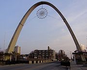
Lake to Queen Street sectionThe southern end of Dufferin is within the Canadian National Exhibition
Canadian National Exhibition
Canadian National Exhibition , also known as The Ex, is an annual event that takes place at Exhibition Place in Toronto, Ontario, Canada during the 18 days leading up to and including Labour Day Monday. With an attendance of approximately 1.3 million visitors each season, it is Canada’s largest...
(CNE) grounds at Dufferin Gates. North of the CNE, the east side is dominated by industrial or transitional industrial to residential buildings of Liberty Village
Liberty Village
Liberty Village is a neighbourhood in Toronto, Ontario, Canada. It is bounded at the north by King Street West, the west by Dufferin Street, the south by the Gardiner Expressway, the east by Strachan Avenue, and the northeast by the CP railway tracks...
. The west side is mostly single-family homes with one apartment building south of King Street. The neighbourhood to the west is named Parkdale
Parkdale, Toronto
Parkdale is a neighbourhood and former village in Toronto, Ontario, Canada, west of downtown. The neighbourhood is bounded on the west by Roncesvalles Avenue, on the north by Queen Street. It is bounded on the east by Dufferin Street from Queen Street south, and on the south by Lake Ontario...
. This area was developed mostly before 1900. Immediately north of Queen Street West
Queen Street West
Queen Street West describes both the western branch of Queen Street, a major east-west thoroughfare, and a series of neighbourhoods or commercial districts, situated west of Yonge Street in downtown Toronto, Ontario, Canada. Queen Street begins in the west at the intersection of King Street, The...
, Dufferin was previously cut off by the railway (nicknamed the "Dufferin jog" by locals) but this jog has been removed as of November 18, 2010.
Queen Street to Eglinton Avenue section
North of Queen Street, Dufferin is primarily residential on both sides, with the large Dufferin Mall
Dufferin Mall
Dufferin Mall is a shopping mall and office complex in Toronto, Canada. It is located on the west side of Dufferin Street, between Sylvan Avenue and Croatia Street , south of the intersection of Bloor Street West, on the site of a former race track, in the Dufferin Grove...
on the west side of Dufferin, south of Bloor Street
Bloor Street
Bloor Street is a major east–west residential and commercial thoroughfare in Toronto, in the Canadian province of Ontario. Bloor Street runs from the Prince Edward Viaduct westward into Mississauga, where it ends at Central Parkway. East of the viaduct, Danforth Avenue continues along the same...
. This was the former site of the Dufferin Racetrack. From Queen Street north to College Street, the neighbourhood is known as Little Portugal
Little Portugal, Toronto
Little Portugal is a neighbourhood and ethnic enclave in Toronto, Ontario, Canada. It is located west of downtown in the "Old" City of Toronto. It is bounded on the west by Lansdowne Avenue, on the north by College Street, on the east by Ossington Avenue and on the south by the CNR/CPR mainline...
. North of College, and west of Dufferin is the former village of Brockton
Brockton Village
Brockton Village is a neighbourhood in Toronto, Ontario, Canada. It comprises a section of the old Town of Brockton which was annexed by the City of Toronto in 1884. The town encompassed the area from Bloor Street on the north, Dufferin Street on the east, High Park on the west and ranged from...
and on the east is the Dufferin Grove
Dufferin Grove
Dufferin Grove is a neighbourhood located in Toronto, Ontario, Canada, west of downtown. The neighbourhood is bordered by Bloor Street West to the north, Ossington Ave to the east, College Street to the south, and Dufferin Street to the west.-Character:...
neighbourhood, named after the park on the east side of Dufferin. Dufferin
Dufferin (TTC)
Dufferin is a station on the Bloor–Danforth line of the subway system in Toronto, Ontario, Canada. It is located at 1126 Bloor Street West at Dufferin Street...
subway station
Toronto subway and RT
The Toronto subway and RT is a rapid transit system in Toronto, Ontario, Canada, consisting of both underground and elevated railway lines, operated by the Toronto Transit Commission . It was Canada's first completed subway system, with the first line being built under Yonge Street, which opened in...
is located at Dufferin and Bloor Street
Bloor Street
Bloor Street is a major east–west residential and commercial thoroughfare in Toronto, in the Canadian province of Ontario. Bloor Street runs from the Prince Edward Viaduct westward into Mississauga, where it ends at Central Parkway. East of the viaduct, Danforth Avenue continues along the same...
on the Bloor-Danforth line.
From Bloor Street to Davenport, Dufferin is lined with homes built from the 1920s to post-World War II. The neighbourhood west of Dufferin in this area is known as Wallace Emerson, while on the east it is known as Dovercourt Park. North of Davenport, Dufferin ascends former Lake Iroquous shoreline escarpment. North of the escarpment, the street continues to be residential on both sides north to Eglinton Avenue West.
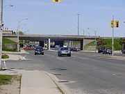
North of Eglinton, it becomes a six-lane arterial road
Arterial road
An arterial road, or arterial thoroughfare, is a high-capacity urban road. The primary function of an arterial road is to deliver traffic from collector roads to freeways, and between urban centres at the highest level of service possible. As such, many arteries are limited-access roads, or feature...
through industrial
Industry
Industry refers to the production of an economic good or service within an economy.-Industrial sectors:There are four key industrial economic sectors: the primary sector, largely raw material extraction industries such as mining and farming; the secondary sector, involving refining, construction,...
and low-density commercial lands of the former North York. The regional shopping centre of Yorkdale Shopping Centre
Yorkdale Shopping Centre
Yorkdale Shopping Centre is a large shopping mall in Toronto, Ontario, Canada. It contains over 250 stores and is located in the community of Downsview, in North York. It is the fifth largest shopping mall in Canada and also enjoys the highest sales per square foot of any mall in Canada, with...
is located at Dufferin and Highway 401. The sections from Eglinton into York Region was originally Vaughan Road
Vaughan Road
Vaughan Road is a road in Toronto, Ontario, Canada. It is a contour collector road that is parallel to a buried creek to the north called Castle Frank Brook. Vaughan Road begins on Bathurst Street south of St. Clair Avenue West, then it becomes a north-south street, hence its address numbering...
.
North of Wilson Avenue section
North of Wilson Avenue, Dufferin is interrupted by Downsview Airport and Allen Road
Allen Road
William R. Allen Road, known more commonly as Allen Road, The Allen Expressway or simply The Allen and formerly as the Spadina Expressway, is a short expressway/freeway in Toronto, Ontario, which runs from Kennard Avenue in the north, to Eglinton Avenue West in the south...
, the latter of which feeds Dufferin north of Kennard Avenue (formerly Wilson Heights Boulevard). North of Steeles Avenue
Steeles Avenue
Steeles Avenue is an east-west street that forms the northern city limit of Toronto and the southern limit of York Region, Ontario, Canada. It stretches across the western Greater Toronto Area from Milborough Townline in Halton Region east to the Scarborough-Pickering limit. It runs for within...
, Dufferin Street continues into Vaughan and is also known as York Regional Road 53, crossing Davis Drive (Hwy 9) into Glenville Road, then continuing north before ending just north of Graham Sideroad in King.
A broken section of Dufferin Street runs semi parallel with Allen Road from Kennard to Sheppard Avenue due east. This section is a residential street and ends in a cul-de-sac just south of Kennard. A lost section of Dufferin Street south of Sheppard Avenue is now within Downsview subway station.
Dufferin jog
The intersection of Dufferin Street and Queen Street West also intersects with the main railway line from downtown to the northwest. While an underpass was built for Queen Street, one was not built for Dufferin Street to connect it a block north of Queen, so it was closed to all traffic. The block that was closed went around the closed section to Peel (east-west) and Gladstone (north-south), which became 'de facto' sections of Dufferin. The detour was known locally as the Dufferin Jog.This jog was finally eliminated in 2010 with the construction of a four-lane underpass beneath the railroad track, including public art and an amphitheatre styled park with tiered gardens at the southwest corner of the underpass. This project was approved by city council in 2007, and work on extending the roadway began on July 2009. The underpass was opened on November 18, 2010.
Italian community
Dufferin Street has long been an important thoroughfare for Toronto's Italian community. An Italian neighbourhood developed around Dufferin and Davenport in the 1890s and soon became known as "little Little Italy". In the 1950s, Italian Canadians from the main Little ItalyLittle Italy, Toronto
Little Italy, sometimes referred to as College Street West, is a district in Toronto, Ontario, Canada. It is well known for its numerous Italian Canadian restaurants and businesses. There is also a significant Latin American and Portuguese community in the area...
around College Street
College Street (Toronto)
College Street is a principal arterial thoroughfare in downtown Toronto, connecting former streetcar suburbs in the west with the city centre. The street is home to an ethnically diverse population in the western residential reaches, and institutions like the Ontario Legislature and the University...
and Grace Street headed northwest up Dufferin past St. Clair Avenue
St. Clair Avenue
St. Clair Avenue is a major east-west street in Toronto, Ontario, Canada. It was laid out in the late 18th century by the British as a concession road , north of Bloor Street and north of Queen Street....
and were joined by a new wave of immigrants from Italy. By the 1960s, the Dufferin-St. Clair area (known as Corso Italia) had supplanted College-Grace Little Italy as the centre of Toronto's Italian community.
Public transit usage
The 29 Dufferin bus route runs from the lake shore along the full length of Dufferin to the Wilson Station. When the CNE is not operating, the Dufferin bus continues south within Exhibition PlaceExhibition Place
Exhibition Place is a mixed-use district in Toronto, Ontario, Canada, by the shoreline of Lake Ontario, just west of downtown. The 197–acre area includes expo, trade, and banquet centres, theatre and music buildings, monuments, parkland, sports facilities, and a number of civic, provincial,...
to the Bathurst streetcar loop. The bus connects with the Toronto Bloor-Danforth Subway at Dufferin Station and the Wilson Station is on the Yonge-University-Spadina line.
The 29 Dufferin bus was the busiest bus route in the TTC
Toronto Transit Commission
-Island Ferry:The ferry service to the Toronto Islands was operated by the TTC from 1927 until 1962, when it was transferred to the Metro Parks and Culture department. Since 1998, the ferry service is run by Toronto Parks and Recreation.-Gray Coach:...
in 2007 and 2008, with an average 43,600 riders each weekday. As of 2010 it was the 5th busiest route, with an average of 39,700 riders per weekday.
Buses run every 2 to 10 minutes on the route, depending on the time of day.
The 105 Dufferin North bus route runs north from Downsview Station on the Yonge-University-Spadina subway line along Allen Road and Dufferin Street. North of Steeles Avenue, it effectively becomes a York Region Transit
York Region Transit
York Region Transit is the public transit operator in York Region, Ontario, Canada. Its headquarters are in Richmond Hill, at 50 High Tech Road....
route, and additional YRT fares apply.