

List of bridges on the National Register of Historic Places in Pennsylvania
Encyclopedia
This is a list of bridge
s and tunnel
s on the National Register of Historic Places
(NRHP) in the U.S. state
of Pennsylvania
. Covered bridges on the NRHP in Pennsylvania are listed elsewhere.
Bridge
A bridge is a structure built to span physical obstacles such as a body of water, valley, or road, for the purpose of providing passage over the obstacle...
s and tunnel
Tunnel
A tunnel is an underground passageway, completely enclosed except for openings for egress, commonly at each end.A tunnel may be for foot or vehicular road traffic, for rail traffic, or for a canal. Some tunnels are aqueducts to supply water for consumption or for hydroelectric stations or are sewers...
s on the National Register of Historic Places
National Register of Historic Places
The National Register of Historic Places is the United States government's official list of districts, sites, buildings, structures, and objects deemed worthy of preservation...
(NRHP) in the U.S. state
U.S. state
A U.S. state is any one of the 50 federated states of the United States of America that share sovereignty with the federal government. Because of this shared sovereignty, an American is a citizen both of the federal entity and of his or her state of domicile. Four states use the official title of...
of Pennsylvania
Pennsylvania
The Commonwealth of Pennsylvania is a U.S. state that is located in the Northeastern and Mid-Atlantic regions of the United States. The state borders Delaware and Maryland to the south, West Virginia to the southwest, Ohio to the west, New York and Ontario, Canada, to the north, and New Jersey to...
. Covered bridges on the NRHP in Pennsylvania are listed elsewhere.
Current listings
| Name | Image | Built | Listed | Location | County | Type |
|---|---|---|---|---|---|---|
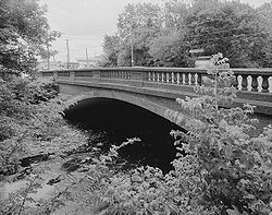
| Adams Avenue Bridge Adams Avenue Bridge The Adams Avenue Bridge is a historic bridge in Philadelphia, Pennsylvania. It carries Adams Avenue over Tacony Creek in Tacony Creek Park.A two-lane, triple-span, closed-spandrel, filled stone arch bridge, built in 1901, it was listed on the National Register of Historic Places in 1988.-External... in Philadelphia |
1901 | Philadelphia Adams Avenue across Tacony Creek Frankford Creek Frankford Creek is a minor tributary of the Delaware River in southeast Pennsylvania. The stream originates as Tookany Creek at Hill Crest in Cheltenham Township and meanders eastward, then southeastward, throughout Cheltenham Township, until a sharp bend near the Philadelphia border at Lawncrest,... 40°2′31"N 75°6′48"W |
Philadelphia Philadelphia County, Pennsylvania -History:Tribes of Lenape were the first known occupants in the area which became Philadelphia County. The first European settlers were Swedes and Finns who arrived in 1638. The Netherlands seized the area in 1655, but permanently lost control to England in 1674... |
Multi-span stone arch Stone Arch Bridge The Stone Arch Bridge is a former railroad bridge crossing the Mississippi River at Saint Anthony Falls in downtown Minneapolis, Minnesota.Positioned between the 3rd Avenue Bridge and the I-35W Saint Anthony Falls Bridge, the Stone Arch Bridge was built in 1883 by railroad tycoon James J... |
||
| Allenwood River Bridge Allenwood River Bridge The Allenwood River Bridge is a historic bridge in Gregg Township, Union County, Pennsylvania. The two-lane, five-span, pin-connected Pratt through truss bridge carries PA Route 44 over the Susquehanna River. The bridge is one of the oldest and longest spans crossing that river... |
1895 | Allenwood, Union 41°6′28"N 76°53′25"W |
Northumberland Northumberland County, Pennsylvania There were 38,835 households out of which 27.30% had children under the age of 18 living with them, 52.40% were married couples living together, 9.60% had a female householder with no husband present, and 34.10% were non-families. 30.20% of all households were made up of individuals and 15.50% had... , Union Union County, Pennsylvania -Demographics:As of the census of 2000, there were 41,624 people, 13,178 households, and 9,211 families residing in the county. The population density was 131 people per square mile . There were 14,684 housing units at an average density of 46 per square mile... |
Pratt through truss | ||
| Armstrong Tunnel Armstrong Tunnel The Armstrong Tunnel in Pittsburgh, Pennsylvania, connects Second Avenue at the South Tenth Street Bridge, under the Bluff where Duquesne University is located, to Forbes Avenue between Boyd Street and Chatham Square.-Construction:... |
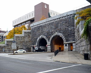 |
1926, 1927 | Pittsburgh 40°26′5"N 79°59′25"W |
Allegheny Allegheny County, Pennsylvania Allegheny County is a county in the southwestern part of the U.S. state of Pennsylvania. As of the 2010 census, the population was 1,223,348; making it the second most populous county in Pennsylvania, following Philadelphia County. The county seat is Pittsburgh... |
||
| Askew Bridge Skew Bridge The Skew Bridge, also known as the Askew Bridge and nicknamed the Soap and Whiskey Bridge, is a historical skew arch bridge completed in 1857 carrying two tracks of the Reading Railroad at an angle over Sixth Street in Reading, Berks County, Pennsylvania.The bridge was designed by Richard Osborne... |
1857 | Reading Reading, Pennsylvania Reading is a city in southeastern Pennsylvania, USA, and seat of Berks County. Reading is the principal city of the Greater Reading Area and had a population of 88,082 as of the 2010 census, making it the fifth most populated city in the state after Philadelphia, Pittsburgh, Allentown and Erie,... 40°20′37"N 75°55′34"W |
Berks Berks County, Pennsylvania -Demographics:As of the census of 2000, there were 373,638 people, 141,570 households, and 98,532 families residing in the county. The population density was 435 people per square mile . There were 150,222 housing units at an average density of 175 per square mile... |
|||
| Atkinson Road Bridge | 1873 | Solebury Twp Solebury Township, Pennsylvania Solebury Township is a township in Bucks County, Pennsylvania, United States. The population was 8,692 at the 2010 census.The Solebury School is located in the township, off U.S... 40°19′38"N 74°58′44"W |
Bucks Bucks County, Pennsylvania - Industry and commerce :The boroughs of Bristol and Morrisville were prominent industrial centers along the Northeast Corridor during World War II. Suburban development accelerated in Lower Bucks in the 1950s with the opening of Levittown, Pennsylvania, the second such "Levittown" designed by... |
Three-span arch Arch bridge An arch bridge is a bridge with abutments at each end shaped as a curved arch. Arch bridges work by transferring the weight of the bridge and its loads partially into a horizontal thrust restrained by the abutments at either side... |
||
| Baker Bridge Baker Bridge Baker Bridge, also known as Huntingdon County Bridge No. 14, is a historic concrete arch bridge spanning the Great Trough Creek and located at Todd Township, Huntingdon County, Pennsylvania. It was built in 1917, and measures and has a bridge deck. It has two arch spans.It was added to the... |
1917 | Newburg 40°17′10"N 78°7′17"W |
Huntingdon Huntingdon County, Pennsylvania Huntingdon County is a county located in the U.S. state of Pennsylvania. In 2010, its population was 45,913.Huntingdon County was created on September 20, 1787, from part of Bedford County. Its county seat is Huntingdon.-Geography:According to the U.S... |
Concrete arch Arch bridge An arch bridge is a bridge with abutments at each end shaped as a curved arch. Arch bridges work by transferring the weight of the bridge and its loads partially into a horizontal thrust restrained by the abutments at either side... |
||
| Barto Bridge | 1908 | Barto Barto, Pennsylvania Barto is an unincorporated community situated between the boroughs of Bally and Bechtelsville in Washington Township, Berks County, Pennsylvania. Barto is part of the Delaware Valley, located near the border with Montgomery County. Its zip code is 19504 and the West Branch Perkiomen Creek flows... 40°23′46"N 75°36′31"W |
Berks Berks County, Pennsylvania -Demographics:As of the census of 2000, there were 373,638 people, 141,570 households, and 98,532 families residing in the county. The population density was 435 people per square mile . There were 150,222 housing units at an average density of 175 per square mile... |
Single-span barrel arch | ||
| Belmont Avenue Bridge in Philadelphia | 1896 | Philadelphia 39°59′36"N 75°13′6"W |
Philadelphia Philadelphia County, Pennsylvania -History:Tribes of Lenape were the first known occupants in the area which became Philadelphia County. The first European settlers were Swedes and Finns who arrived in 1638. The Netherlands seized the area in 1655, but permanently lost control to England in 1674... |
Single-span stone arch | ||
| Birmingham Bridge | 1898 | Birmingham 40°38′56"N 78°11′57"W |
Huntingdon Huntingdon County, Pennsylvania Huntingdon County is a county located in the U.S. state of Pennsylvania. In 2010, its population was 45,913.Huntingdon County was created on September 20, 1787, from part of Bedford County. Its county seat is Huntingdon.-Geography:According to the U.S... |
Pratt through truss | ||
| Black Rock Bridge | 1927 | Mont Clare Mont Clare, Pennsylvania Mont Clare is a village in Upper Providence Township, Montgomery County, Pennsylvania, USA. The village is located on the left bank of the Schuylkill River, opposite Phoenixville, at the site of the former Jacobs' ford. Mont Clare hosts the only functional lock and one of only two remaining... 40°9′32"N 75°30′44"W |
Chester Chester County, Pennsylvania -State parks:*French Creek State Park*Marsh Creek State Park*White Clay Creek Preserve-Demographics:As of the 2010 census, the county was 85.5% White, 6.1% Black or African American, 0.2% Native American or Alaskan Native, 3.9% Asian, 0.0% Native Hawaiian, 1.8% were two or more races, and 2.4% were... , Montgomery Montgomery County, Pennsylvania Montgomery County is a county located in the U.S. state of Pennsylvania, in the United States. As of 2010, the population was 799,874, making it the third most populous county in Pennsylvania . The county seat is Norristown.The county was created on September 10, 1784, out of land originally part... |
Multi-span spandrel arch | ||
| W. Bollman and Company Bridge | 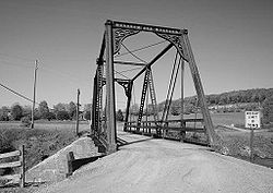 |
1871 | Meyersdale Meyersdale, Pennsylvania Meyersdale is a borough in Somerset County, Pennsylvania, on the Casselman River, southeast of Pittsburgh. In the past, its chief industry was the mining of coal. Meyersdale was first settled as early as 1776, but the growth of the town dates from the advent of the first railroad in 1871. Coal... 39°49′48"N 79°2′34"W |
Somerset Somerset County, Pennsylvania Somerset County is a county located in the state of Pennsylvania. As of 2010, the population was 77,742. Somerset County was created on April 17, 1795, from part of Bedford County and named for Somerset, United Kingdom. Its county seat is Somerset. It is part of the Johnstown, Pennsylvania,... |
Warren truss | |
| Bridge 182+42, Northern Central Railway | Glen Rock Glen Rock, Pennsylvania Glen Rock is a borough in York County, Pennsylvania, United States. The population was 2,025 at the 2010 census.-Geography:Glen Rock is located at .... 39°46′39"N 76°43′25"W |
York York County, Pennsylvania York County is a county in the U.S. state of Pennsylvania. As of 2010, the population was 434,972. It is in the Susquehanna Valley, a large fertile agricultural region in South Central Pennsylvania.... |
Masonry arch | |||
| Bridge 5+92, Northern Central Railway | 1900 | Seven Valleys Seven Valleys, Pennsylvania Seven Valleys is a borough in York County, Pennsylvania, United States. The population was 517 at the 2010 census.-Geography:Seven Valleys is located at .... 39°51′15"N 76°46′18"W |
York York County, Pennsylvania York County is a county in the U.S. state of Pennsylvania. As of 2010, the population was 434,972. It is in the Susquehanna Valley, a large fertile agricultural region in South Central Pennsylvania.... |
Girder Girder bridge A girder bridge, in general, is a bridge built of girders placed on bridge abutments and foundation piers. In turn, a bridge deck is built on top of the girders in order to carry traffic. There are several different subtypes of girder bridges:... |
||
| Bridge 634, Northern Central Railway | Railroad Railroad, Pennsylvania Railroad is a borough in York County, Pennsylvania, United States. The population was 278 at the 2010 census.-Geography:Railroad is located at .... 39°46′23"N 76°43′14"W |
York York County, Pennsylvania York County is a county in the U.S. state of Pennsylvania. As of 2010, the population was 434,972. It is in the Susquehanna Valley, a large fertile agricultural region in South Central Pennsylvania.... |
Masonry arch | |||
| Bridge between East Manchester and Newberry Townships | 1889 | Conewago Heights | York York County, Pennsylvania York County is a county in the U.S. state of Pennsylvania. As of 2010, the population was 434,972. It is in the Susquehanna Valley, a large fertile agricultural region in South Central Pennsylvania.... |
Pennsylvania (petit) truss | ||
| Bridge between Guilford and Hamilton Townships | Social Island 39°53′9"N 77°42′48"W |
Franklin Franklin County, Pennsylvania As of the census of 2000, there were 129,313 people, 50,633 households, and 36,405 families residing in the county. The population density was 168 people per square mile . There were 53,803 housing units at an average density of 70 per square mile... |
Multi-span stone arch | |||
| Bridge between Madison and Mahoning Townships | 1895 | Deanville 40°55′52"N 79°23′18"W |
Armstrong Armstrong County, Pennsylvania Armstrong County is a county located in the U.S. state of Pennsylvania. As of the 2010 census, the population was 68,941. It is located northeast of Pittsburgh and Allegheny County. Armstrong County was added to the Pittsburgh Metropolitan Statistical Area in 2003.The county seat is Kittanning... |
Solid spandrel arch | ||
| Bridge between Monroe and Penn Townships Bridge between Monroe and Penn Townships The Bridge between Monroe and Penn Townships, also known as the Penns Creek Bridge, Camelback Bridge, or Camelback, was a historic bridge located at Monroe Township and Penn Township near Selinsgrove in Snyder County, Pennsylvania. It was a barrel arch bridge built in 1919. It spanned Penns Creek... |
1919 | Selinsgrove Selinsgrove, Pennsylvania Selinsgrove is a borough in Snyder County, Pennsylvania, United States. It was founded in 1787 by Captain Anthony Selin, who fought with Washington in the Revolutionary War.... 40°49′32"N 76°52′17"W |
Snyder Snyder County, Pennsylvania Snyder County is a county located in the U.S. state of Pennsylvania. As of 2010, the population was 39,702. Snyder County was formed in 1855 from parts of Union County... |
Multi-span barrel arch | ||
| Bridge in Albany Township | 1841 | Steinsville 40°38′7"N 75°51′21"W |
Berks Berks County, Pennsylvania -Demographics:As of the census of 2000, there were 373,638 people, 141,570 households, and 98,532 families residing in the county. The population density was 435 people per square mile . There were 150,222 housing units at an average density of 175 per square mile... |
Multiple span stone arch | ||
| Bridge in Athens Township | 1913 | Athens Athens, Pennsylvania Athens is a borough in Bradford County, Pennsylvania, two miles south of the N. Y. State line on the Susquehanna and Chemung rivers. Population in 1900, 3,749; and in 1910, 3,796. The population was 3,415 at the 2000 census... 41°57′29"N 76°30′52"W |
Bradford Bradford County, Pennsylvania -Demographics:As of the census of 2000, there were 62,761 people, 24,453 households, and 17,312 families residing in the county. The population density was 54 people per square mile . There were 28,664 housing units at an average density of 25 per square mile... |
Pennsylvania (petit) truss | ||
| Bridge in Athens Township | 1916 | Athens Athens, Pennsylvania Athens is a borough in Bradford County, Pennsylvania, two miles south of the N. Y. State line on the Susquehanna and Chemung rivers. Population in 1900, 3,749; and in 1910, 3,796. The population was 3,415 at the 2000 census... 41°57′29"N 76°30′52"W |
Bradford Bradford County, Pennsylvania -Demographics:As of the census of 2000, there were 62,761 people, 24,453 households, and 17,312 families residing in the county. The population density was 54 people per square mile . There were 28,664 housing units at an average density of 25 per square mile... |
Pennsylvania (petit) truss | ||
| Bridge in Bangor Borough Bridge in Bangor Borough Bridge in Bangor Borough is a historic concrete arch bridge spanning Martins Creek at Bangor, Northampton County, Pennsylvania. It was built in 1915, and is a small, single arched bridge spanning 45 feet. It features molded ornamental designs on the spandrel walls and abutments.It was added to... |
1915 | Bangor Bangor, Pennsylvania Bangor is a borough located in Northampton County, Pennsylvania, west of New York City, in the Lehigh Valley region of Pennsylvania, United States. It is part of Pennsylvania's Slate Belt. It had a population of 5,273 at the 2010 census.-History:... 40°52′10"N 75°12′28"W |
Northampton Northampton County, Pennsylvania As of the 2010 census, the county was 86.3% White, 5.0% Black or African American, 0.2% Native American or Alaskan Native, 2.4% Asian, 0.0% Native Hawaiian, 2.2% were two or more races, and 3.8% were some other race. 10.5% of the population were of Hispanic or Latino ancestry.As of the census of... |
|||
| Bridge in Brown Township Bridge in Brown Township Bridge in Brown Borough is a historic Lattice truss bridge spanning Pine Creek at Brown Township, Lycoming County, Pennsylvania. It was built in 1890, by the Berlin Iron Bridge Co. of East Berlin, Connecticut. The bridge measures 227 feet long and 19 feet wide.It was added to the National... |
1890 | Hillborn 41°29′43"N 77°29′51"W |
Lycoming Lycoming County, Pennsylvania -Appalachian Mountains and Allegheny Plateau:Lycoming County is divided between the Appalachian Mountains in the south, the dissected Allegheny Plateau in the north and east, and the valley of the West Branch Susquehanna River between these.-West Branch Susquehanna River:The West Branch of the... |
Lattice truss | ||
| Bridge in Buckingham Township | 1905 | Wycombe Wycombe, Pennsylvania Wycombe is an unincorporated community mainly in Wrightstown Township but also in Buckingham Township, Bucks County, Pennsylvania, United States... 40°16′53"N 75°1′19"W |
Bucks Bucks County, Pennsylvania - Industry and commerce :The boroughs of Bristol and Morrisville were prominent industrial centers along the Northeast Corridor during World War II. Suburban development accelerated in Lower Bucks in the 1950s with the opening of Levittown, Pennsylvania, the second such "Levittown" designed by... |
Multi-span stone arch | ||
| Bridge in Cherrytree Township | 1882 | Titusville Titusville, Pennsylvania Titusville is a city in Crawford County, Pennsylvania, United States. The population was 6,146 at the 2000 census. In 1859, oil was successfully drilled in Titusville, resulting in the birth of the modern oil industry.-History:... 41°37′2"N 79°39′27"W |
Venango Venango County, Pennsylvania Venango County is a county located in the U.S. state of Pennsylvania. As of the 2010 census, the population was 54,984. Its county seat is Franklin.-History:Venango County was created on March 12, 1800 from parts of Allegheny and Lycoming Counties... |
Pratt through truss | ||
| Bridge in City of Wilkes-Barre | 1885 | Wilkes-Barre Wilkes-Barre, Pennsylvania Wilkes-Barre is a city in the U.S. state of Pennsylvania, the county seat of Luzerne County. It is at the center of the Wyoming Valley area and is one of the principal cities in the Scranton/Wilkes-Barre metropolitan area, which had a population of 563,631 as of the 2010 Census... 41°15′36"N 75°52′2"W |
Luzerne Luzerne County, Pennsylvania - Demographics :As of the 2010 census, the county was 90.7% White, 3.4% Black or African American, 0.2% Native American, 1.0% Asian, 3.3% were of some other race, and 1.5% were two or more races. 6.7% of the population was of Hispanic or Latino ancestry... |
Single-span stone arch | ||
| Bridge in Clinton Township | 1887 | Kennerdell 41°14′17"N 79°51′16"W |
Venango Venango County, Pennsylvania Venango County is a county located in the U.S. state of Pennsylvania. As of the 2010 census, the population was 54,984. Its county seat is Franklin.-History:Venango County was created on March 12, 1800 from parts of Allegheny and Lycoming Counties... |
Pratt through truss | ||
| Bridge in Cumberland Township Bridge in Cumberland Township The Cunningham Bridge, also known as Bridge in Cumberland Township, is an historic three-section iron bridge near Gettysburg, Pennsylvania that spans west-to-east from Franklin Township to Cumberland Township... |
1894 | Greenmount Greenmount, Pennsylvania Greenmount, Pennsylvania, is a populated place southwest of the Gettysburg Battlefield at Marsh Creek along the Emmitsburg Road... 39°45′27"N 77°17′6"W |
Adams Adams County, Pennsylvania Adams County is a county in the U.S. state of Pennsylvania. As of the 2010 census, the population was 101,407. It was created on January 22, 1800, from part of York County and named in honor of the second President of the United States, John Adams... |
Three truss Truss bridge A truss bridge is a bridge composed of connected elements which may be stressed from tension, compression, or sometimes both in response to dynamic loads. Truss bridges are one of the oldest types of modern bridges... |
||
| Bridge in Dreher Township | 1934 | Haags Mill 41°17′17"N 75°19′52"W |
Wayne Wayne County, Pennsylvania As of the census of 2000, there were 47,722 people, 18,350 households, and 12,936 families residing in the county. The population density was 65 people per square mile . There were 30,593 housing units at an average density of 42 per square mile... |
High-rise stone arch | ||
| Bridge in East Fallowfield Township | 1894 | Atlantic Atlantic, Pennsylvania Atlantic is a census-designated place in Crawford County, Pennsylvania, United States. The population was 43 at the 2000 census.-Geography:Atlantic is located at .... 41°32′6"N 80°20′14"W |
Crawford Crawford County, Pennsylvania Crawford County is a county located in the U.S. state of Pennsylvania. As of 2010, the population was 88,765.Crawford County was created on March 12, 1800, from part of Allegheny County and named for Colonel William Crawford... |
Pratt through truss; et al. | ||
| Bridge in East Fallowfield Township Bridge in East Fallowfield Township (Mortonville, Pennsylvania) The Mortonville Bridge and Mill Race Bridge are stone arch bridges carrying Strasburg Road across the West Branch Brandywine Creek and an abandoned millrace at Mortonville, Pennsylvania... |
ca. 1826 | Mortonville Mortonville, Pennsylvania Mortonville is an unincorporated area and historic hamlet in Chester County, Pennsylvania on the eastern bank of the West Branch Brandywine Creek. It consists of about a half-dozen structures, two of which are on the National Register of Historic Places: the Mortonville Hotel, and the "Bridge in... 39°56′46"N 75°46′43"W |
Chester Chester County, Pennsylvania -State parks:*French Creek State Park*Marsh Creek State Park*White Clay Creek Preserve-Demographics:As of the 2010 census, the county was 85.5% White, 6.1% Black or African American, 0.2% Native American or Alaskan Native, 3.9% Asian, 0.0% Native Hawaiian, 1.8% were two or more races, and 2.4% were... |
|||
| Bridge in Fishing Creek Township | 1915 | Bendertown 41°9′5"N 76°17′45"W |
Columbia Columbia County, Pennsylvania As of the census of 2000, there were 64,151 people, 24,915 households, and 16,568 families residing in the county. The population density was 132 people per square mile . There were 27,733 housing units at an average density of 57 per square mile... |
Open-spandrel arch | ||
| Bridge in Franconia Township | 1837 | Elvoy 40°17′18"N 75°20′20"W |
Montgomery Montgomery County, Pennsylvania Montgomery County is a county located in the U.S. state of Pennsylvania, in the United States. As of 2010, the population was 799,874, making it the third most populous county in Pennsylvania . The county seat is Norristown.The county was created on September 10, 1784, out of land originally part... |
Multi-span stone arch | ||
| Bridge in Franklin Township | 1919, 1920 | Morrisville Morrisville, Greene County, Pennsylvania Morrisville is a census-designated place in Greene County, Pennsylvania, United States. The population was 1,443 at the 2000 census.-Geography:Morrisville is located at .... 39°53′37"N 80°10′47"W |
Greene Greene County, Pennsylvania -Demographics:As of the census of 2000, there were 40,672 people, 15,060 households, and 10,587 families residing in the county. The population density was 71 people per square mile . There were 16,678 housing units at an average density of 29 per square mile... |
Open-spandrel arch | ||
| Bridge in French Creek Township | 1898 | Carlton 41°28′17"N 80°1′7"W |
Mercer Mercer County, Pennsylvania Mercer County is a county located in the U.S. state of Pennsylvania. As of 2010, the population was 116,638. Its county seat is Mercer; Sharon is its largest city.... |
Pratt through truss | ||
| Bridge in Gibson Borough Bridge in Gibson Borough The Bridge in Gibson Borough in South Gibson, Pennsylvania is a stone arch bridge that crosses over Tunkhannock Creek. It was listed on the National Register of Historic Places in 1988.... |
South Gibson 41°44′32"N 75°37′51"W |
Susquehanna Susquehanna County, Pennsylvania -Demographics:As of the census of 2000, there were 42,238 people, 16,529 households, and 11,785 families residing in the county. The population density was 51 people per square mile . There were 21,829 housing units at an average density of 26 per square mile... |
Primitive corbelled arch | |||
| Bridge in Greenwood Township Bridge in Greenwood Township Bridge in Greenwood Township is a historic Pratt through truss bridge located in Bells Landing, Clearfield County, Pennsylvania, United States. It was built in 1892 by the King Bridge Company.It was listed on the National Register of Historic Places in 1988.... |
1892 | Bells Landing 40°54′39"N 78°38′51"W |
Clearfield Clearfield County, Pennsylvania Clearfield County is a county located in the U.S. state of Pennsylvania. As of 2010, the population was 81,642.Clearfield County was created on March 26, 1804, from parts of Huntingdon and Lycoming Counties but was administered as part of Centre County until 1812... |
Pratt through truss | ||
| Bridge in Hatfield Township | 1874 | Unionville Unionville, Pennsylvania Unionville is the name of some places in the U.S. state of Pennsylvania:*Unionville, Centre County, Pennsylvania*Unionville, Chester County, Pennsylvania*Neffs, Pennsylvania in Lehigh County, historically called Unionville... 40°17′2"N 75°16′23"W |
Montgomery Montgomery County, Pennsylvania Montgomery County is a county located in the U.S. state of Pennsylvania, in the United States. As of 2010, the population was 799,874, making it the third most populous county in Pennsylvania . The county seat is Norristown.The county was created on September 10, 1784, out of land originally part... |
Multi-span stone arch | ||
| Bridge in Heidelberg Township | Germansville 40°42′3"N 75°42′37"W |
Lehigh Lehigh County, Pennsylvania -Climate:Most of the county's climate is considered to fall in the humid continental climate zone. Summers are typically hot and muggy, fall and spring are generally mild, and winter is cold. Precipitation is almost uniformly distributed throughout the year.... |
Single-span stone arch | |||
| Bridge in Jefferson Borough Bridge in Jefferson Borough The Bridge in Jefferson Borough, which carries Cochran's Mill Road over Lick Run, is a single arch stone bridge in Allegheny County, Pennsylvania. It is located near the birthplace of Nellie Bly.-References:... |
1901 | Cochrans Mill 40°17′34.48"N 79°58′12.75"W |
Allegheny Allegheny County, Pennsylvania Allegheny County is a county in the southwestern part of the U.S. state of Pennsylvania. As of the 2010 census, the population was 1,223,348; making it the second most populous county in Pennsylvania, following Philadelphia County. The county seat is Pittsburgh... |
Single-span stone arch | ||
| Bridge in Jenner Township | 1908 | Pilltown 40°10′18"N 79°0′49"W |
Somerset Somerset County, Pennsylvania Somerset County is a county located in the state of Pennsylvania. As of 2010, the population was 77,742. Somerset County was created on April 17, 1795, from part of Bedford County and named for Somerset, United Kingdom. Its county seat is Somerset. It is part of the Johnstown, Pennsylvania,... |
Single-span stone arch | ||
| Bridge in Johnstown City | 1890 | Johnstown Johnstown, Pennsylvania Johnstown is a city in Cambria County, Pennsylvania, United States, west-southwest of Altoona, Pennsylvania and east of Pittsburgh. The population was 20,978 at the 2010 census. It is the principal city of the Johnstown, Pennsylvania, Metropolitan Statistical Area, which includes Cambria County... 40°19′36"N 78°55′39"W |
Cambria Cambria County, Pennsylvania Cambria County is a county located in the U.S. state of Pennsylvania. It comprises the Johnstown, Pennsylvania, Metropolitan Statistical Area. As of 2010, the population was 143,679.... |
Pennsylvania (petit) truss | ||
| Bridge in Lewis Township Bridge in Lewis Township Bridge in Lewis Township is a historic Pratt through truss bridge spanning Lycoming Creek at Lewis Township, Lycoming County, Pennsylvania. It was built in 1890, and measures 171 feet long and 18 feet wide.... |
1890 | Bodines 41°26′54"N 76°58′52"W |
Lycoming Lycoming County, Pennsylvania -Appalachian Mountains and Allegheny Plateau:Lycoming County is divided between the Appalachian Mountains in the south, the dissected Allegheny Plateau in the north and east, and the valley of the West Branch Susquehanna River between these.-West Branch Susquehanna River:The West Branch of the... |
Pratt through truss | ||
| Bridge in Lykens Township No. 1 Bridge in Lykens Township No. 1 Bridge in Lykens Township No. 1 is a historic multi-span stone arch bridge spanning Pine Creek at Lykens Township, Dauphin County, Pennsylvania. It has two large arches and one small arch. The property measures 127 feet long by 25 feet wide... |
Edman 40°38′38"N 76°41′34"W |
Dauphin Dauphin County, Pennsylvania Dauphin County is a county in the U.S. state of Pennsylvania and is one of the three counties comprising the Harrisburg–Carlisle Metropolitan Statistical Area. As of 2010 census, the population was 268,100. The county includes the city of Harrisburg, which has served as the state capital... |
Multi-span stone arch | |||
| Bridge in Lykens Township No. 2 Bridge in Lykens Township No. 2 Bridge in Lykens Township No. 2 is a historic single span stone arch bridge spanning a tributary of Pine Creek at Lykens Township, Dauphin County, Pennsylvania. It was built in 1872, and has a camelback shape. The property measures 25 feet long by 25 feet wide. It is built of coursed ashlar.It was... |
1872 | Fearnot 40°37′58"N 76°39′52"W |
Dauphin Dauphin County, Pennsylvania Dauphin County is a county in the U.S. state of Pennsylvania and is one of the three counties comprising the Harrisburg–Carlisle Metropolitan Statistical Area. As of 2010 census, the population was 268,100. The county includes the city of Harrisburg, which has served as the state capital... |
Single-span stone arch | ||
| Bridge in Metal Township | 1907 | Willow Hill 40°7′13"N 77°46′39"W |
Franklin Franklin County, Pennsylvania As of the census of 2000, there were 129,313 people, 50,633 households, and 36,405 families residing in the county. The population density was 168 people per square mile . There were 53,803 housing units at an average density of 70 per square mile... |
Camelback-shaped arch | ||
| Bridge in Newport Borough Bridge in Newport Borough The Bridge in Newport Borough is a historic bridge located at Newport in Perry County, Pennsylvania. It is an multi-span stone arch bridge. It was built in 1929 and crosses Little Buffalo Creek.... |
1929 | Newport Newport, Pennsylvania Newport is a borough in Perry County, Pennsylvania, United States. The population was 1,506 at the 2000 census. It is part of the Harrisburg–Carlisle Metropolitan Statistical Area.-Geography:Newport is located at .... 40°28′27"N 77°7′48"W |
Perry Perry County, Pennsylvania As of the census of 2000, there were 43,602 people, 16,695 households, and 12,320 families residing in the county. The population density was 79 people per square mile . There were 18,941 housing units at an average density of 34 per square mile... |
Multi-span stone arch | ||
| Bridge in Nicholson Township Bridge in Nicholson Township The Bridge in Nicholson Township in Starkville, Pennsylvania is a bridge from 1876 that crosses the Tunkhannock Creek. It was listed on the National Register of Historic Places in 1988.... |
1876 | Starkville 41°36′17"N 75°49′24"W |
Wyoming Wyoming County, Pennsylvania Wyoming County is a county located in the U.S. state of Pennsylvania. It was created in 1842 from part of Luzerne County. Its county seat is Tunkhannock.-Geography:According to the U.S... |
Lenticular truss | ||
| Bridge in Oil Creek Township | 1896 | Titusville Titusville, Pennsylvania Titusville is a city in Crawford County, Pennsylvania, United States. The population was 6,146 at the 2000 census. In 1859, oil was successfully drilled in Titusville, resulting in the birth of the modern oil industry.-History:... 41°37′46"N 79°42′10"W |
Crawford Crawford County, Pennsylvania Crawford County is a county located in the U.S. state of Pennsylvania. As of 2010, the population was 88,765.Crawford County was created on March 12, 1800, from part of Allegheny County and named for Colonel William Crawford... |
Pratt through truss | ||
| Bridge in Portage Township | 1832 | Oil City Oil City, Pennsylvania Oil City is a city in Venango County, Pennsylvania that is known in the initial exploration and development of the petroleum industry. After the first oil wells were drilled nearby in the 1850s, Oil City became central in the petroleum industry while hosting headquarters for the Pennzoil, Quaker... 40°24′8"N 78°38′22"W |
Cambria Cambria County, Pennsylvania Cambria County is a county located in the U.S. state of Pennsylvania. It comprises the Johnstown, Pennsylvania, Metropolitan Statistical Area. As of 2010, the population was 143,679.... |
Circular arch | ||
| Bridge in Porter Township Bridge in Porter Township Bridge in Porter Township is a historic Lenticular truss bridge spanning Pine Creek at Porter Township, Lycoming County, Pennsylvania. It was built in 1889, and is a single span bridge measures 287 feet long and 20 feet wide.... |
1889 | Jersey Shore Jersey Shore, Pennsylvania Jersey Shore is a borough in Lycoming County, Pennsylvania, United States. It is on the West Branch Susquehanna River, west by south of Williamsport. It is part of the Williamsport, Pennsylvania Metropolitan Statistical Area. In the past, Jersey Shore held farms, railroad shops, cigar factories, a... 41°10′51"N 77°16′43"W |
Lycoming Lycoming County, Pennsylvania -Appalachian Mountains and Allegheny Plateau:Lycoming County is divided between the Appalachian Mountains in the south, the dissected Allegheny Plateau in the north and east, and the valley of the West Branch Susquehanna River between these.-West Branch Susquehanna River:The West Branch of the... |
Lenticular truss | ||
| Bridge in Radnor Township No. 1 | 1905 | Broomall Broomall, Pennsylvania Broomall is a census-designated place in Delaware County, Pennsylvania, United States. The population was 11,046 at the 2000 census. The community was named after John Martin Broomall, a 19th century U.S... 40°0′13"N 75°22′19"W |
Delaware Delaware County, Pennsylvania Delaware County is a county located in the U.S. state of Pennsylvania. As of 2010, the population was 558,979, making it Pennsylvania's fifth most populous county, behind Philadelphia, Allegheny, Montgomery, and Bucks counties.... |
Multi-span stone arch | ||
| Bridge in Radnor Township No. 2 | 1905 | Villanova Villanova, Pennsylvania Villanova is a community in the United States Commonwealth of Pennsylvania. It straddles Lower Merion Township of Montgomery County and Radnor Township of Delaware County. It is located at the center of the Pennsylvania Main Line, a series of highly affluent Philadelphia suburban towns located... 40°0′41"N 75°20′39"W |
Delaware Delaware County, Pennsylvania Delaware County is a county located in the U.S. state of Pennsylvania. As of 2010, the population was 558,979, making it Pennsylvania's fifth most populous county, behind Philadelphia, Allegheny, Montgomery, and Bucks counties.... |
Single-span stone arch | ||
| Bridge in Reed Township Bridge in Reed Township Bridge in Reed Township, originally known as Aqueduct No. 3 on the Wiconisco Canal, is a historic multi-span stone arch bridge spanning Powell's Creek at Reed Township, Dauphin County, Pennsylvania. It was built in 1860, as an aqueduct. The property measures 72 feet long by 50 feet wide... |
1860 | Inglenook Inglenook, Pennsylvania Inglenook is an unincorporated community in Reed Township, Dauphin County, Pennsylvania, United States, at latitude 40.413 and longitude -76.981. It is part of the Harrisburg–Carlisle Metropolitan Statistical Area.... 40°24′35"N 76°59′6"W |
Dauphin Dauphin County, Pennsylvania Dauphin County is a county in the U.S. state of Pennsylvania and is one of the three counties comprising the Harrisburg–Carlisle Metropolitan Statistical Area. As of 2010 census, the population was 268,100. The county includes the city of Harrisburg, which has served as the state capital... |
Multi-span stone arch | ||
| Bridge in Rockdale Township | 1887 | Millers Station 41°48′37"N 79°59′3"W |
Crawford Crawford County, Pennsylvania Crawford County is a county located in the U.S. state of Pennsylvania. As of 2010, the population was 88,765.Crawford County was created on March 12, 1800, from part of Allegheny County and named for Colonel William Crawford... |
Pratt truss | ||
| Bridge in Shaler Township Bridge in Shaler Township The Bridge in Shaler Township, which carries Birchfield Road over Pine Creek, is a single span stone arch bridge in Allegheny County, Pennsylvania. The bridge was added to the National Register of Historic Places on June 22, 1988.-References:... |
1915 | Shaler Township 40°32′42.03"N 79°57′45.49"W |
Allegheny Allegheny County, Pennsylvania Allegheny County is a county in the southwestern part of the U.S. state of Pennsylvania. As of the 2010 census, the population was 1,223,348; making it the second most populous county in Pennsylvania, following Philadelphia County. The county seat is Pittsburgh... |
Single-span stone arch | ||
| Bridge in Snake Spring Township Bridge in Snake Spring Township Bridge in Snake Spring Township is a historic masonry arch bridge located at Snake Spring Township in Bedford County, Pennsylvania. It was built in 1934, and is a , open spandrel concrete arch bridge with five arches... |
1934, 1935 | Bedford Bedford, Pennsylvania Bedford is a borough in Bedford County, Pennsylvania, west of the State Capital, Harrisburg. It is the county seat of Bedford County. Bedford was established in the mid-18th century. Population counts follow: 1890, 2,242; 1900, 2,167; 1910, 2,385. The population was 3,141 at the 2000... 40°0′49"N 78°28′18"W |
Bedford Bedford County, Pennsylvania Bedford County is a county located in the U.S. state of Pennsylvania. As of the 2010 census, the population was 49,762. The county seat is Bedford. It is part of the Altoona, Pennsylvania, Metropolitan Statistical Area.- History :... |
Skewed open-spandrel arch | ||
| Bridge in Solebury Township | 1854 | Carversville Carversville, Pennsylvania Carversville is an unincorporated community in Solebury Township, Bucks County, Pennsylvania, United States, approximately 45 miles north of Philadelphia. It was originally a Lenape gathering placed called Aquetong more than 300 years ago the area's land was granted to James Harrison and Joseph... 40°23′9"N 75°3′50"W |
Bucks Bucks County, Pennsylvania - Industry and commerce :The boroughs of Bristol and Morrisville were prominent industrial centers along the Northeast Corridor during World War II. Suburban development accelerated in Lower Bucks in the 1950s with the opening of Levittown, Pennsylvania, the second such "Levittown" designed by... |
Multi-span stone arch | ||
| Bridge in South Beaver Township Watts Mill Bridge The Watts Mill Bridge is a pin-connected Pratt pony truss bridge located over the Little Beaver Creek in Cannelton, Pennsylvania, United States.... |
1878 | Cannelton Cannelton, Pennsylvania Cannelton, Pennsylvania is an unincorporated community located in Darlington Township, Beaver County, Pennsylvania. Settled in 1795, the Darlington Cannel Coal Railroad was built there starting in 1852 eventually connecting to the Pennsylvania Railroad in New Galilee, Pennsylvania... 40°47′29"N 80°29′31"W |
Beaver Beaver County, Pennsylvania -Demographics:As of the census of 2000, there were 181,412 people, 72,576 households, and 50,512 families residing in the county. The population density was 418 people per square mile . There were 77,765 housing units at an average density of 179 per square mile... |
Pin-connected Pratt truss | ||
| Bridge in Tinicum Township | 1877 | Point Pleasant Point Pleasant, Pennsylvania Point Pleasant is an unincorporated community in Tinicum and Plumstead Townships of Bucks County, Pennsylvania, United States. It lies on both sides of Tohickon Creek by the creek's confluence with the Delaware River; the creek is the dividing line between the townships... 40°25′24"N 75°3′55"W |
Bucks Bucks County, Pennsylvania - Industry and commerce :The boroughs of Bristol and Morrisville were prominent industrial centers along the Northeast Corridor during World War II. Suburban development accelerated in Lower Bucks in the 1950s with the opening of Levittown, Pennsylvania, the second such "Levittown" designed by... |
Pratt pony truss | ||
| Bridge in Upper Frederick Township | 1888 | Fagleysville 40°16′28"N 75°29′7"W |
Montgomery Montgomery County, Pennsylvania Montgomery County is a county located in the U.S. state of Pennsylvania, in the United States. As of 2010, the population was 799,874, making it the third most populous county in Pennsylvania . The county seat is Norristown.The county was created on September 10, 1784, out of land originally part... |
Pratt through truss | ||
| Bridge in Upper Fredrick Township | 1854 | Zieglersville Zieglersville, Pennsylvania Zieglerville is an unincorporated community in Lower Frederick Township, Montgomery County, Pennsylvania, United States. Its ZIP Code is 19492.-Geography:Zieglerville is located at It is 220 feet above sea level.... 40°17′10"N 75°32′39"W |
Montgomery Montgomery County, Pennsylvania Montgomery County is a county located in the U.S. state of Pennsylvania, in the United States. As of 2010, the population was 799,874, making it the third most populous county in Pennsylvania . The county seat is Norristown.The county was created on September 10, 1784, out of land originally part... |
Multi-span stone arch | ||
| Bridge in Upper Merion Township | 1789 | Gulph Mills Gulph Mills, Pennsylvania Gulph Mills is an unincorporated community in Upper Merion Township, Montgomery County, Pennsylvania. It is served by the Upper Merion Area School District.... 40°4′8"N 75°20′28"W |
Montgomery Montgomery County, Pennsylvania Montgomery County is a county located in the U.S. state of Pennsylvania, in the United States. As of 2010, the population was 799,874, making it the third most populous county in Pennsylvania . The county seat is Norristown.The county was created on September 10, 1784, out of land originally part... |
Small-span stone arch | ||
| Bridge in Washington Township | 1884 | Kralltown Kralltown, Pennsylvania Kralltown is an unincorporated community in York County, Pennsylvania, United States.-References:USGS GNIS: Kralltown, Pennsylvania... 40°0′31"N 76°58′29"W |
York York County, Pennsylvania York County is a county in the U.S. state of Pennsylvania. As of 2010, the population was 434,972. It is in the Susquehanna Valley, a large fertile agricultural region in South Central Pennsylvania.... |
Pratt truss | ||
| Bridge in West Earl Township Bridge in West Earl Township The Bridge in West Earl Township, as it is designated on the National Register of Historic Places, is also known by its historic name, Big Conestoga Creek Bridge No. 12. It carries Farmersville Road across the Conestoga River at Brownstown, West Earl Township, Lancaster County, Pennsylvania, in... |
1917 | Brownstown Brownstown, Lancaster County, Pennsylvania Brownstown, Pennsylvania is an unincorporated community located within West Earl Township in Lancaster County, Pennsylvania.-Geography:The town has a total land area of 0.66 square kilometers... 40°7′42"N 76°12′1"W |
Lancaster Lancaster County, Pennsylvania Lancaster County, known as the Garden Spot of America or Pennsylvania Dutch Country, is a county located in the southeastern part of the Commonwealth of Pennsylvania, in the United States. As of 2010 the population was 519,445. Lancaster County forms the Lancaster Metropolitan Statistical Area, the... |
Cantilever Cantilever A cantilever is a beam anchored at only one end. The beam carries the load to the support where it is resisted by moment and shear stress. Cantilever construction allows for overhanging structures without external bracing. Cantilevers can also be constructed with trusses or slabs.This is in... ed concrete Concrete Concrete is a composite construction material, composed of cement and other cementitious materials such as fly ash and slag cement, aggregate , water and chemical admixtures.The word concrete comes from the Latin word... girder Girder bridge A girder bridge, in general, is a bridge built of girders placed on bridge abutments and foundation piers. In turn, a bridge deck is built on top of the girders in order to carry traffic. There are several different subtypes of girder bridges:... |
||
| Bridge in West Fallowfield Township | 1885 | Steelville 39°52′58"N 75°59′31"W |
Chester Chester County, Pennsylvania -State parks:*French Creek State Park*Marsh Creek State Park*White Clay Creek Preserve-Demographics:As of the 2010 census, the county was 85.5% White, 6.1% Black or African American, 0.2% Native American or Alaskan Native, 3.9% Asian, 0.0% Native Hawaiian, 1.8% were two or more races, and 2.4% were... |
Pratt pony truss | ||
| Bridge in West Mead Township | 1888 | Center Road Corners 41°35′21"N 80°9′2"W |
Crawford Crawford County, Pennsylvania Crawford County is a county located in the U.S. state of Pennsylvania. As of 2010, the population was 88,765.Crawford County was created on March 12, 1800, from part of Allegheny County and named for Colonel William Crawford... |
Pratt through truss | ||
| Bridge in West Wheatfield Township | 1911 | Robinson 40°24′11"N 79°7′45"W |
Indiana Indiana County, Pennsylvania -Government and politics:As of November 2008, there are 58,077 registered voters in Indiana County .* Democratic: 26,653 * Republican: 24,159 * Other Parties: 7,265 -County commissioners:*Rodney Ruddock, Chairman, Republican... |
Single-span camelback arch | ||
| Bridge in Westover Borough Bridge in Westover Borough Bridge in Westover Borough is an historic Open-spandrel arch bridge located in Westover, Clearfield County, Pennsylvania, United States. It is a single span concrete bridge constructed in 1917.... |
1917 | Westover Westover, Pennsylvania Westover is a borough in Clearfield County, Pennsylvania, United States. The population was 458 at the 2000 census.-Geography:Westover is located at .... 40°45′9"N 78°40′3"W |
Clearfield Clearfield County, Pennsylvania Clearfield County is a county located in the U.S. state of Pennsylvania. As of 2010, the population was 81,642.Clearfield County was created on March 26, 1804, from parts of Huntingdon and Lycoming Counties but was administered as part of Centre County until 1812... |
Open-spandrel arch | ||
| Bridge in Williams Township Bridge in Williams Township Bridge in Williams Township is a historic stone arch bridge spanning Frey's Run at Williams Township, Northampton County, Pennsylvania. It was built in 1857, and is a triple-span, camelback shaped bridge... |
1857 | Stouts 40°36′39"N 75°13′54"W |
Northampton Northampton County, Pennsylvania As of the 2010 census, the county was 86.3% White, 5.0% Black or African American, 0.2% Native American or Alaskan Native, 2.4% Asian, 0.0% Native Hawaiian, 2.2% were two or more races, and 3.8% were some other race. 10.5% of the population were of Hispanic or Latino ancestry.As of the census of... |
Multi-span camelback arch | ||
| Bridge in Yardley Borough | 1889 | Scammells Corner 40°14′3"N 74°50′2"W |
Bucks Bucks County, Pennsylvania - Industry and commerce :The boroughs of Bristol and Morrisville were prominent industrial centers along the Northeast Corridor during World War II. Suburban development accelerated in Lower Bucks in the 1950s with the opening of Levittown, Pennsylvania, the second such "Levittown" designed by... |
Single-span stone arch | ||
| Bridge Valley Bridge | 1804 | Hartsville 40°16′34"N 75°5′1"W |
Bucks Bucks County, Pennsylvania - Industry and commerce :The boroughs of Bristol and Morrisville were prominent industrial centers along the Northeast Corridor during World War II. Suburban development accelerated in Lower Bucks in the 1950s with the opening of Levittown, Pennsylvania, the second such "Levittown" designed by... |
Neo-classical arch | ||
| Brower's Bridge | 1904 | Warwick 40°8′51"N 75°46′10"W |
Chester Chester County, Pennsylvania -State parks:*French Creek State Park*Marsh Creek State Park*White Clay Creek Preserve-Demographics:As of the 2010 census, the county was 85.5% White, 6.1% Black or African American, 0.2% Native American or Alaskan Native, 3.9% Asian, 0.0% Native Hawaiian, 1.8% were two or more races, and 2.4% were... |
Stone arch | ||
| Brownsville Bridge Brownsville Bridge The Brownsville Bridge, also known as the Intercounty Bridge, is a truss bridge that carries vehicular traffic across the Monongahela River between Brownsville, Pennsylvania and West Brownsville, Pennsylvania. The bridge was completed in 1914 to replace an 1831 wooden structure that was ill suited... |
1913 | Brownsville Brownsville, Pennsylvania Brownsville is a borough in Fayette County, Pennsylvania, United States, officially founded in 1785 located 35 miles south of Pittsburgh along the Monongahela River... , West Brownsville West Brownsville, Pennsylvania West Brownsville is a borough in Washington County, Pennsylvania, United States. The population was 1,075 at the 2000 census.-Geography:West Brownsville is located at .... 40°1′20"N 79°53′26"W |
Fayette Fayette County, Pennsylvania Fayette County is a county located in the U.S. state of Pennsylvania. As of the2010 census, the population was 136,606. The county is part of the Pittsburgh Metropolitan Statistical Area.... , Washington Washington County, Pennsylvania -Government and politics:As of November 2008, there are 152,534 registered voters in Washington County .* Democratic: 89,027 * Republican: 49,025 * Other Parties: 14,482... |
Pennsylvania petit truss | ||
| Bryn Athyn-Lower Moreland Bridge | 1828 | Lower Moreland 40°9′31"N 75°4′30"W |
Montgomery Montgomery County, Pennsylvania Montgomery County is a county located in the U.S. state of Pennsylvania, in the United States. As of 2010, the population was 799,874, making it the third most populous county in Pennsylvania . The county seat is Norristown.The county was created on September 10, 1784, out of land originally part... |
Multi-span stone arch | ||
| Cambridge Springs Bridge | 1896 | Cambridge Springs Cambridge Springs, Pennsylvania Cambridge Springs is a borough in Crawford County, Pennsylvania, United States. The population was 2,363 at the 2000 census.- History :The village of Cambridge was settled in 1822 and was named for the town of Cambridge, Massachusetts... 41°48′23"N 80°3′41"W |
Crawford Crawford County, Pennsylvania Crawford County is a county located in the U.S. state of Pennsylvania. As of 2010, the population was 88,765.Crawford County was created on March 12, 1800, from part of Allegheny County and named for Colonel William Crawford... |
Baltimore truss | ||
| Campbell's Bridge | 1906 | Milford Square Milford Square, Pennsylvania Milford Square, Pennsylvania is a village in Milford Township, Bucks County located on Route 663 one mile east of the Quakertown interchange with Interstate 476. While the village has a PO Box post office with the zip code of 18935, the surrounding area uses the Quakertown zip code of 18951. It is... 40°25′42"N 75°23′54"W |
Bucks Bucks County, Pennsylvania - Industry and commerce :The boroughs of Bristol and Morrisville were prominent industrial centers along the Northeast Corridor during World War II. Suburban development accelerated in Lower Bucks in the 1950s with the opening of Levittown, Pennsylvania, the second such "Levittown" designed by... |
Camelback open-spandrel arch | ||
| Centennial Bridge | 1876 | Center Valley Center Valley, Pennsylvania Center Valley is an unincorporated village one mile north of Coopersburg, Pennsylvania, at the intersection of Pennsylvania Route 309 and Pennsylvania Route 378 in Upper Saucon Township, Lehigh County, Pennsylvania, in the United States.... 40°31′43"N 75°23′31"W |
Lehigh Lehigh County, Pennsylvania -Climate:Most of the county's climate is considered to fall in the humid continental climate zone. Summers are typically hot and muggy, fall and spring are generally mild, and winter is cold. Precipitation is almost uniformly distributed throughout the year.... |
Multi-span stone arch | ||
| Chain Bridge | 1856, 1857 | Easton Easton, Pennsylvania Easton is a city in Northampton County, Pennsylvania, United States. The population was 26,800 as of the 2010 census. It is the county seat of Northampton County.... 40°39′14"N 75°14′56"W |
Northampton Northampton County, Pennsylvania As of the 2010 census, the county was 86.3% White, 5.0% Black or African American, 0.2% Native American or Alaskan Native, 2.4% Asian, 0.0% Native Hawaiian, 2.2% were two or more races, and 3.8% were some other race. 10.5% of the population were of Hispanic or Latino ancestry.As of the census of... |
|||
| Chandler Mill Bridge | 1910 | Kennett Kennett Township, Pennsylvania Kennett Township is a township in Chester County, Pennsylvania, United States. It is the location of the famed Longwood Gardens conservatory and was the birthplace of Louise Brewer Shepard, the wife of the first American in space, Alan Shepard... 39°48′41"N 75°42′48"W |
Chester Chester County, Pennsylvania -State parks:*French Creek State Park*Marsh Creek State Park*White Clay Creek Preserve-Demographics:As of the 2010 census, the county was 85.5% White, 6.1% Black or African American, 0.2% Native American or Alaskan Native, 3.9% Asian, 0.0% Native Hawaiian, 1.8% were two or more races, and 2.4% were... |
|||
| Charleroi-Monessen Bridge | 1906 | Charleroi Charleroi, Pennsylvania Charleroi is a borough in Washington County, Pennsylvania, along the Monongahela River, 25 miles south of Pittsburgh. Charleroi was settled in 1890 and incorporated in 1891. The population in 1900 stood at 5,930; in 1910, 9,615; in 1920, 11,516, and in 1940, 10,784... , Monessen Monessen, Pennsylvania Monessen is a city in Westmoreland County, Pennsylvania, United States. The population was 8,669 at the 2000 census. In 1940, 20,257 people lived there. In 1990 the population was 13,026. Steel-making was a prominent industry in Monessen, which was a Rust Belt borough in the "Mon Valley" of... 40°9′6"N 79°54′15"W |
Washington Washington County, Pennsylvania -Government and politics:As of November 2008, there are 152,534 registered voters in Washington County .* Democratic: 89,027 * Republican: 49,025 * Other Parties: 14,482... |
Multi-span Pennsylvania truss | ||
| City Line Avenue Bridge | 1913 | Philadelphia 39°59′7"N 75°15′33"W |
Philadelphia Philadelphia County, Pennsylvania -History:Tribes of Lenape were the first known occupants in the area which became Philadelphia County. The first European settlers were Swedes and Finns who arrived in 1638. The Netherlands seized the area in 1655, but permanently lost control to England in 1674... |
Single-span solid barrel arch | ||
| Claysville S Bridge Claysville S Bridge The Claysville "S" Bridge is a historic S bridge in Washington County, Pennsylvania.It is designated as a historic bridge by the Washington County History & Landmarks Foundation.... |
1818 | Washington Washington, Pennsylvania Washington is a city in and the county seat of Washington County, Pennsylvania, United States, within the Pittsburgh Metro Area in the southwestern part of the state... 40°8′22"N 80°21′0"W |
Washington Washington County, Pennsylvania -Government and politics:As of November 2008, there are 152,534 registered voters in Washington County .* Democratic: 89,027 * Republican: 49,025 * Other Parties: 14,482... |
|||
| Cold Spring Bridge | 1930 | North Hampton 40°42′3"N 75°31′1"W |
Lehigh Lehigh County, Pennsylvania -Climate:Most of the county's climate is considered to fall in the humid continental climate zone. Summers are typically hot and muggy, fall and spring are generally mild, and winter is cold. Precipitation is almost uniformly distributed throughout the year.... |
Open-spandrel arch | ||
| Colwell Cut Viaduct | 1922 | Seminole 40°56′13"N 79°21′47"W |
Armstrong Armstrong County, Pennsylvania Armstrong County is a county located in the U.S. state of Pennsylvania. As of the 2010 census, the population was 68,941. It is located northeast of Pittsburgh and Allegheny County. Armstrong County was added to the Pittsburgh Metropolitan Statistical Area in 2003.The county seat is Kittanning... |
Open-spandrel arch | ||
| Cope's Bridge Cope's Bridge Cope's Bridge is a stone arch bridge which carries Strasburg Road across the East Branch Brandywine Creek in West Bradford Township, Chester County, Pennsylvania. The bridge is listed on the National Register of Historic Places and is located at .Before the construction of a bridge here, the site... |
1807 | Marshallton Marshallton, Pennsylvania Marshallton is a census-designated place in Northumberland County, Pennsylvania, United States. The population was 1,437 at the 2000 census.-Geography:Marshallton is located at .... |
Chester Chester County, Pennsylvania -State parks:*French Creek State Park*Marsh Creek State Park*White Clay Creek Preserve-Demographics:As of the 2010 census, the county was 85.5% White, 6.1% Black or African American, 0.2% Native American or Alaskan Native, 3.9% Asian, 0.0% Native Hawaiian, 1.8% were two or more races, and 2.4% were... |
|||
| Coraopolis Bridge Coraopolis Bridge The Coraopolis Bridge is a girder bridge over the back channel of the Ohio River connecting Grand Avenue on Neville Island to Ferree Street in Coraopolis, Pennsylvania. It opened in 1995 to replace a structure of historic significance... |
 |
1892, 1927 | Coraopolis Coraopolis, Pennsylvania Coraopolis is a borough in Allegheny County, Pennsylvania, USA. The population was 5,677 at the 2010 census. In 1940 the population peaked at 11,086. It is a small community located to the west of Pittsburgh, along the Ohio River and to the east of the Pittsburgh International Airport... 40°30′58"N 80°9′7"W |
Allegheny Allegheny County, Pennsylvania Allegheny County is a county in the southwestern part of the U.S. state of Pennsylvania. As of the 2010 census, the population was 1,223,348; making it the second most populous county in Pennsylvania, following Philadelphia County. The county seat is Pittsburgh... |
Bowstring truss | |
| Corbin Bridge Corbin Bridge Corbin Bridge, also known as Huntingdon County Bridge No. 20, is a historic suspension bridge spanning the Raystown Branch Juniata River and located at Juniata Township, Huntingdon County, Pennsylvania. It was built by the Reading Steel Products Inc. in 1937. It measures and has a deck... |
1937 | Huntingdon Huntingdon, Pennsylvania Huntingdon is a borough in Huntingdon County, Pennsylvania. It is the county seat of Huntingdon County. It is located along the Juniata River, west of Harrisburg, about halfway between Pittsburgh and Harrisburg, in an agricultural and fruit-growing region, with valuable forests and deposits of... 40°27′16"N 77°59′0"W |
Huntingdon Huntingdon County, Pennsylvania Huntingdon County is a county located in the U.S. state of Pennsylvania. In 2010, its population was 45,913.Huntingdon County was created on September 20, 1787, from part of Bedford County. Its county seat is Huntingdon.-Geography:According to the U.S... |
Suspension Suspension bridge A suspension bridge is a type of bridge in which the deck is hung below suspension cables on vertical suspenders. Outside Tibet and Bhutan, where the first examples of this type of bridge were built in the 15th century, this type of bridge dates from the early 19th century... |
||
| County Bridge No. 101 | 1918 | Rock Run 39°59′29"N 75°49′52"W |
Chester Chester County, Pennsylvania -State parks:*French Creek State Park*Marsh Creek State Park*White Clay Creek Preserve-Demographics:As of the 2010 census, the county was 85.5% White, 6.1% Black or African American, 0.2% Native American or Alaskan Native, 3.9% Asian, 0.0% Native Hawaiian, 1.8% were two or more races, and 2.4% were... |
Stilted arch | ||
| County Bridge No. 124 | 1916 | Downingtown Downingtown, Pennsylvania Downingtown is a borough in Chester County, Pennsylvania, west of Philadelphia. As of the 2010 census it had a population of 7,891. Downingtown was settled by English and European colonists in the early 18th century and has a number of historic buildings and structures.-History:The town was... 40°0′38"N 75°44′39"W |
Chester Chester County, Pennsylvania -State parks:*French Creek State Park*Marsh Creek State Park*White Clay Creek Preserve-Demographics:As of the 2010 census, the county was 85.5% White, 6.1% Black or African American, 0.2% Native American or Alaskan Native, 3.9% Asian, 0.0% Native Hawaiian, 1.8% were two or more races, and 2.4% were... |
Three-span Arch Arch bridge An arch bridge is a bridge with abutments at each end shaped as a curved arch. Arch bridges work by transferring the weight of the bridge and its loads partially into a horizontal thrust restrained by the abutments at either side... |
||
| County Bridge No. 148 | 1911 | Westtown 39°55′54"N 75°33′6"W |
Chester Chester County, Pennsylvania -State parks:*French Creek State Park*Marsh Creek State Park*White Clay Creek Preserve-Demographics:As of the 2010 census, the county was 85.5% White, 6.1% Black or African American, 0.2% Native American or Alaskan Native, 3.9% Asian, 0.0% Native Hawaiian, 1.8% were two or more races, and 2.4% were... |
|||
| County Bridge No. 171 | 1907 | Malvern Malvern, Pennsylvania Malvern is a borough in Chester County, Pennsylvania, United States. The population was 2,998 at the 2010 census. The main road through the borough is King Street, although the borough is also bordered by Paoli Pike on the south, and is near US 30 on the north. The primary cross street is Warren... 40°3′12"N 75°30′3"W |
Chester Chester County, Pennsylvania -State parks:*French Creek State Park*Marsh Creek State Park*White Clay Creek Preserve-Demographics:As of the 2010 census, the county was 85.5% White, 6.1% Black or African American, 0.2% Native American or Alaskan Native, 3.9% Asian, 0.0% Native Hawaiian, 1.8% were two or more races, and 2.4% were... |
Stone arch | ||
| County Bridge No. 36 County Bridge No. 36 County Bridge No. 36 is a historic concrete arch bridge spanning Jacoby Creek at Portland, Northampton County, Pennsylvania. It was built in 1907, and is a small, single arched bridge with a span measuring 28 feet. It features an incised keystone and a simply ornamented, continuous concrete... |
1907 | Portland Portland, Pennsylvania Portland is a borough in Northampton County, Pennsylvania, United States. Portland is located in the Lehigh Valley region of the state. It is part of Pennsylvania's Slate Belt.The population of Portland was 579 at the 2000 census.-Geography:... 40°55′7"N 75°5′37"W |
Northampton Northampton County, Pennsylvania As of the 2010 census, the county was 86.3% White, 5.0% Black or African American, 0.2% Native American or Alaskan Native, 2.4% Asian, 0.0% Native Hawaiian, 2.2% were two or more races, and 3.8% were some other race. 10.5% of the population were of Hispanic or Latino ancestry.As of the census of... |
Reinforced concrete arch | ||
| County Bridge No. 54 | 1841, 1916 | Prospectville 40°8′22"N 75°13′1"W |
Montgomery Montgomery County, Pennsylvania Montgomery County is a county located in the U.S. state of Pennsylvania, in the United States. As of 2010, the population was 799,874, making it the third most populous county in Pennsylvania . The county seat is Norristown.The county was created on September 10, 1784, out of land originally part... |
Multi-span stone arch | ||
| Dauberville Bridge | 1908 | Dauberville Dauberville, Pennsylvania Dauberville is a small, rural town in southeastern Pennsylvania. The tiny village is located near the Schuylkill River in eastern Centre Township, near the Ontelaunee Township border. Students living in the town attend the Schuylkill Valley School District. The community is located within the... 40°27′25"N 75°58′37"W |
Berks Berks County, Pennsylvania -Demographics:As of the census of 2000, there were 373,638 people, 141,570 households, and 98,532 families residing in the county. The population density was 435 people per square mile . There were 150,222 housing units at an average density of 175 per square mile... |
Humpback multiple span arch | ||
| Dauphin County Bridge No. 27 | 1896 | Pillow Pillow, Pennsylvania Pillow is a borough in Dauphin County, Pennsylvania, United States. The population was 304 at the 2000 census. It is part of the Harrisburg–Carlisle Metropolitan Statistical Area.-History:... 40°38′5"N 76°51′23"W |
Dauphin Dauphin County, Pennsylvania Dauphin County is a county in the U.S. state of Pennsylvania and is one of the three counties comprising the Harrisburg–Carlisle Metropolitan Statistical Area. As of 2010 census, the population was 268,100. The county includes the city of Harrisburg, which has served as the state capital... , Northumberland Northumberland County, Pennsylvania There were 38,835 households out of which 27.30% had children under the age of 18 living with them, 52.40% were married couples living together, 9.60% had a female householder with no husband present, and 34.10% were non-families. 30.20% of all households were made up of individuals and 15.50% had... |
Metal truss Truss bridge A truss bridge is a bridge composed of connected elements which may be stressed from tension, compression, or sometimes both in response to dynamic loads. Truss bridges are one of the oldest types of modern bridges... |
||
| Deer Creek Bridge, Stewartstown Railroad | Shrewsbury Shrewsbury, Pennsylvania Shrewsbury is a borough in York County, Pennsylvania, United States. The population was 3,823 at the 2010 census.-Geography:Shrewsbury is located at .... 39°45′30"N 76°38′55"W |
York York County, Pennsylvania York County is a county in the U.S. state of Pennsylvania. As of 2010, the population was 434,972. It is in the Susquehanna Valley, a large fertile agricultural region in South Central Pennsylvania.... |
Girder Girder bridge A girder bridge, in general, is a bridge built of girders placed on bridge abutments and foundation piers. In turn, a bridge deck is built on top of the girders in order to carry traffic. There are several different subtypes of girder bridges:... |
|||
| Delaware Division of the Pennsylvania Canal | 1831, 1931 | Bristol, Easton 40°5′43"N 74°51′40"W 40°41′17"N 75°12′17"W |
Bucks, Northampton | |||
| Delta Trestle Bridge, Maryland and Pennsylvania Railroad | Delta Delta, Pennsylvania Delta is a borough in York County, Pennsylvania, United States, and one of the southernmost communities in Pennsylvania. The population was 728 at the 2010 census... 39°43′44"N 76°19′49"W |
York York County, Pennsylvania York County is a county in the U.S. state of Pennsylvania. As of 2010, the population was 434,972. It is in the Susquehanna Valley, a large fertile agricultural region in South Central Pennsylvania.... |
Trestle | |||
| Dunlap's Creek Bridge Dunlap's Creek Bridge Dunlap's Creek Bridge was the first cast iron, metal arch bridge in the United States. It was designed by Richard Delafield and built by the United States Army Corps of Engineers. Constructed from 1836 to 1839 on the National Road in Brownsville, Pennsylvania, it remains in use today... |
 |
1836, 1839 | Brownsville Brownsville, Pennsylvania Brownsville is a borough in Fayette County, Pennsylvania, United States, officially founded in 1785 located 35 miles south of Pittsburgh along the Monongahela River... 40°1′17"N 79°53′19"W |
Fayette Fayette County, Pennsylvania Fayette County is a county located in the U.S. state of Pennsylvania. As of the2010 census, the population was 136,606. The county is part of the Pittsburgh Metropolitan Statistical Area.... |
||
| English Center Suspension Bridge English Center Suspension Bridge English Center Suspension Bridge is a historic Suspension bridge spanning Pine Creek at Pine Township, Lycoming County, Pennsylvania. It was built in 1891, and is a single span bridge measuring 300 feet long and 15 feet wide.... |
1891 | English Center 41°26′5"N 77°17′21"W |
Lycoming Lycoming County, Pennsylvania -Appalachian Mountains and Allegheny Plateau:Lycoming County is divided between the Appalachian Mountains in the south, the dissected Allegheny Plateau in the north and east, and the valley of the West Branch Susquehanna River between these.-West Branch Susquehanna River:The West Branch of the... |
Suspension Suspension bridge A suspension bridge is a type of bridge in which the deck is hung below suspension cables on vertical suspenders. Outside Tibet and Bhutan, where the first examples of this type of bridge were built in the 15th century, this type of bridge dates from the early 19th century... |
||
| Etters Bridge | 1889 | Lower Allen Township Lower Allen Township, Pennsylvania Lower Allen Township is a township in Cumberland County, Pennsylvania, United States. The population was 17,437 at the 2000 census.The township has the headquarters of the Pennsylvania Department of Corrections and State Correctional Institution - Camp Hill.... , Fairview Township Fairview Township, York County, Pennsylvania Fairview Township is a township in York County, Pennsylvania, United States. The population was 16,668 at the 2010 census.-Geography:According to the United States Census Bureau, the township has a total area of , of which is land and , or 0.17%, is water.... 40°13′26"N 76°53′51"W |
Cumberland Cumberland County, Pennsylvania Cumberland County is a county located in the U.S. state of Pennsylvania and is one of three counties comprising the Harrisburg–Carlisle Metropolitan Statistical Area. As of 2010, the population was 235,406.-History:... , York York County, Pennsylvania York County is a county in the U.S. state of Pennsylvania. As of 2010, the population was 434,972. It is in the Susquehanna Valley, a large fertile agricultural region in South Central Pennsylvania.... |
Pratt truss | ||
| Fortieth Street Bridge | 1924 | Millvale Millvale, Pennsylvania Millvale is a borough in Allegheny County, Pennsylvania, along the Allegheny River, opposite Pittsburgh. In the past, it had iron manufactures, saw works, stone works, lumber mills, breweries, etc. In 1900, the number of people residing here totaled 6,736; in 1910, 7,861; and in 1940, 7,811... , Pittsburgh 40°28′25"N 79°58′12"W |
Allegheny Allegheny County, Pennsylvania Allegheny County is a county in the southwestern part of the U.S. state of Pennsylvania. As of the 2010 census, the population was 1,223,348; making it the second most populous county in Pennsylvania, following Philadelphia County. The county seat is Pittsburgh... |
Long-span deck arch | ||
| Frankford Avenue Bridge Frankford Avenue Bridge The Frankford Avenue Bridge, also known as the Pennypack Creek Bridge, the Pennypack Bridge, the Holmesburg Bridge, and the King's Highway Bridge, erected in 1697 or 1698 in the Holmesburg section of Northeast Philadelphia, Pennsylvania, is the oldest surviving roadway bridge in the United States... (over Pennypack Creek Pennypack Creek Pennypack Creek is a creek in southeastern Pennsylvania in the United States. It runs southeast through eastern Montgomery County, lower Bucks County, and the northeast section of Philadelphia, before emptying into the Delaware River.-Name:... ) |
 |
1697 | Philadelphia Frankford Avenue over Pennypack Creek40°2′37"N 75°1′15"W |
Philadelphia Philadelphia County, Pennsylvania -History:Tribes of Lenape were the first known occupants in the area which became Philadelphia County. The first European settlers were Swedes and Finns who arrived in 1638. The Netherlands seized the area in 1655, but permanently lost control to England in 1674... |
Three-span stone arch, filled barrel arch | |
| Frankford Avenue Bridge Poquessing Creek Poquessing Creek is a creek, a right tributary of the Delaware River, that forms part of the boundary between Bucks County and the northeast section of Philadelphia, Pennsylvania. It has been part of the boundary between Bucks and Philadelphia counties since 1682.The creek arises in Trevose and... over Poquessing Creek Poquessing Creek Poquessing Creek is a creek, a right tributary of the Delaware River, that forms part of the boundary between Bucks County and the northeast section of Philadelphia, Pennsylvania. It has been part of the boundary between Bucks and Philadelphia counties since 1682.The creek arises in Trevose and... |
 |
1904 | Philadelphia Frankford Avenue/Bristol Pike (US Route 13) over Poquessing Creek40°3′53"N 74°58′53"W |
Philadelphia Philadelphia County, Pennsylvania -History:Tribes of Lenape were the first known occupants in the area which became Philadelphia County. The first European settlers were Swedes and Finns who arrived in 1638. The Netherlands seized the area in 1655, but permanently lost control to England in 1674... and Bucks Bucks County, Pennsylvania - Industry and commerce :The boroughs of Bristol and Morrisville were prominent industrial centers along the Northeast Corridor during World War II. Suburban development accelerated in Lower Bucks in the 1950s with the opening of Levittown, Pennsylvania, the second such "Levittown" designed by... |
Single-span concrete Concrete Concrete is a composite construction material, composed of cement and other cementitious materials such as fly ash and slag cement, aggregate , water and chemical admixtures.The word concrete comes from the Latin word... arch Arch An arch is a structure that spans a space and supports a load. Arches appeared as early as the 2nd millennium BC in Mesopotamian brick architecture and their systematic use started with the Ancient Romans who were the first to apply the technique to a wide range of structures.-Technical aspects:The... |
|
| Frantz's Bridge | 1887 | Weidasville 40°39′3"N 75°39′2"W |
Lehigh Lehigh County, Pennsylvania -Climate:Most of the county's climate is considered to fall in the humid continental climate zone. Summers are typically hot and muggy, fall and spring are generally mild, and winter is cold. Precipitation is almost uniformly distributed throughout the year.... |
Multi-span stone arch | ||
| Frehn Bridge Frehn Bridge Frehn Bridge, also known as Huntingdon County Bridge No. 1, is a historic Pratt truss bridge spanning Sideling Hill Creek and located at Springfield Township, Huntingdon County, Pennsylvania. It was built in 1890, and measures in length and has a timber deck.It was added to the National Register... |
Springfield Springfield Township, Huntingdon County, Pennsylvania Springfield Township is a township in Huntingdon County, Pennsylvania, United States. The population was 612 at the 2000 census.-General information:*ZIP Code: 17243*Area Code: 814*Local Phone Exchanges: 447, 448... 40°8′0"N 77°59′29"W |
Huntingdon Huntingdon County, Pennsylvania Huntingdon County is a county located in the U.S. state of Pennsylvania. In 2010, its population was 45,913.Huntingdon County was created on September 20, 1787, from part of Bedford County. Its county seat is Huntingdon.-Geography:According to the U.S... |
Pratt through truss | |||
| Gilbert Bridge | 1899 | Grantham Grantham, Pennsylvania Grantham is an unincorporated community in Upper Allen Township, Cumberland County in the U.S. state of Pennsylvania, best known today for the Christian liberal arts college, Messiah College, whose students make up most of its population.... , Siddonsburg Siddonsburg, Pennsylvania Siddonsburg is an unincorporated community in Monaghan Township, York County, Pennsylvania, United States. The community is located in about 2 miles south of Messiah College.-References:... 40°9′13"N 76°58′57"W |
Cumberland Cumberland County, Pennsylvania Cumberland County is a county located in the U.S. state of Pennsylvania and is one of three counties comprising the Harrisburg–Carlisle Metropolitan Statistical Area. As of 2010, the population was 235,406.-History:... , York York County, Pennsylvania York County is a county in the U.S. state of Pennsylvania. As of 2010, the population was 434,972. It is in the Susquehanna Valley, a large fertile agricultural region in South Central Pennsylvania.... |
Pratt through truss | ||
| Hammer Creek Bridge | 1904 | Brunnerville 40°11′48"N 76°16′45"W |
Lancaster Lancaster County, Pennsylvania Lancaster County, known as the Garden Spot of America or Pennsylvania Dutch Country, is a county located in the southeastern part of the Commonwealth of Pennsylvania, in the United States. As of 2010 the population was 519,445. Lancaster County forms the Lancaster Metropolitan Statistical Area, the... |
|||
| Hare's Hill Road Bridge |  |
1867 | Phoenixville Phoenixville, Pennsylvania Phoenixville is a borough in Chester County, Pennsylvania, United States, northwest of Philadelphia, at the junction of French Creek with the Schuylkill River. The population is 16,440 as of the 2010 Census.- History :... 40°8′28.22"N 75°34′04.24"W |
Chester Chester County, Pennsylvania -State parks:*French Creek State Park*Marsh Creek State Park*White Clay Creek Preserve-Demographics:As of the 2010 census, the county was 85.5% White, 6.1% Black or African American, 0.2% Native American or Alaskan Native, 3.9% Asian, 0.0% Native Hawaiian, 1.8% were two or more races, and 2.4% were... |
Wrought iron Wrought iron thumb|The [[Eiffel tower]] is constructed from [[puddle iron]], a form of wrought ironWrought iron is an iron alloy with a very low carbon... Bow string truss |
|
| Harrison Avenue Bridge Harrison Avenue Bridge Harrison Avenue Bridge is a concrete deck arch bridge carrying Harrison Avenue in Scranton, Pennsylvania, United States. Its three spans include an open-spandrel ribbed arch over Roaring Brook, flanked by two closed-spandrel arches... |
1922 | Scranton Scranton, Pennsylvania Scranton is a city in the northeastern part of Pennsylvania, United States. It is the county seat of Lackawanna County and the largest principal city in the Scranton/Wilkes-Barre metropolitan area. Scranton had a population of 76,089 in 2010, according to the U.S... 41°24′0"N 75°39′6"W |
Lackawanna Lackawanna County, Pennsylvania As of the census of 2000, there were 213,295 people, 86,218 households, and 55,783 families residing in the county. The population density was 465 people per square mile . There were 95,362 housing units at an average density of 208 per square mile... |
Open-spandrel | ||
| Hays Bridge Historic District | Mercersburg Mercersburg, Pennsylvania Mercersburg is a borough in Franklin County, Pennsylvania, southwest of Harrisburg. Originally called Black Town, it was incorporated in 1831. In 1900, 956 people lived here, and in 1910, 1,410 people lived here... |
Franklin Franklin County, Pennsylvania As of the census of 2000, there were 129,313 people, 50,633 households, and 36,405 families residing in the county. The population density was 168 people per square mile . There were 53,803 housing units at an average density of 70 per square mile... |
Burr truss Burr Truss The Burr Arch Truss — or simply Burr Truss or Burr Arch — is a combination of an arch and a multiple kingpost truss design. It was invented in 1804 by Theodore Burr, patented on April 3, 1817, and used in bridges, usually covered bridges.... |
|||
| High Bridge | 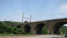 |
1904 | Coatesville Coatesville, Pennsylvania Coatesville is the only city in Chester County, Pennsylvania, United States. The population was 13,100 at the 2010 census. Coatesville is approximately 39 miles west of Philadelphia.... 39°59′2"N 75°49′39"W |
Chester Chester County, Pennsylvania -State parks:*French Creek State Park*Marsh Creek State Park*White Clay Creek Preserve-Demographics:As of the 2010 census, the county was 85.5% White, 6.1% Black or African American, 0.2% Native American or Alaskan Native, 3.9% Asian, 0.0% Native Hawaiian, 1.8% were two or more races, and 2.4% were... |
||
| Hogback Bridge Hogback Bridge Hogback Bridge is a historic Pennsylvania truss bridge located in Curwensville, Clearfield County, Pennsylvania, United States. It was built in 1893 by the King Bridge Company.It was listed on the National Register of Historic Places in 1988.... |
1893 | Curwensville Curwensville, Pennsylvania Curwensville is a borough located in Clearfield County, Pennsylvaniain the United States of America, northwest of Altoona on the West Branch Susquehanna River. Coal mining, tanning, and the manufacture of fire bricks were the industries at the turn of the 20th century. In 1900, 1,937 people lived... 40°58′25"N 78°29′26"W |
Clearfield Clearfield County, Pennsylvania Clearfield County is a county located in the U.S. state of Pennsylvania. As of 2010, the population was 81,642.Clearfield County was created on March 26, 1804, from parts of Huntingdon and Lycoming Counties but was administered as part of Centre County until 1812... |
Pennsylvania petit truss | ||
| Holme Avenue Bridge Holme Avenue Bridge The Holme Avenue Bridge is a closed-spandrel concrete arch bridge that carries Holme Avenue across Wooden Bridge Run in Philadelphia, Pennsylvania.... |
1921 | Philadelphia 40°3′23"N 75°1′24"W |
Philadelphia Philadelphia County, Pennsylvania -History:Tribes of Lenape were the first known occupants in the area which became Philadelphia County. The first European settlers were Swedes and Finns who arrived in 1638. The Netherlands seized the area in 1655, but permanently lost control to England in 1674... |
Single-span concrete arch | ||
| Homestead High-Level Bridge | 1934, 1937 | Pittsburgh 40°24′40"N 79°55′9"W |
Allegheny Allegheny County, Pennsylvania Allegheny County is a county in the southwestern part of the U.S. state of Pennsylvania. As of the 2010 census, the population was 1,223,348; making it the second most populous county in Pennsylvania, following Philadelphia County. The county seat is Pittsburgh... |
Wichert continuous truss | ||
| Horse Valley Bridge | Upper Strasburg 40°3′57"N 77°45′34"W |
Franklin Franklin County, Pennsylvania As of the census of 2000, there were 129,313 people, 50,633 households, and 36,405 families residing in the county. The population density was 168 people per square mile . There were 53,803 housing units at an average density of 70 per square mile... |
Multi-span stone arch | |||
| Horsham-Montgomery Bridge Horsham-Montgomery Bridge The Horsham–Montgomery Bridge is a stone bridge that crosses the Little Neshaminy Creek between Horsham and Montgomery Townships on Pennsylvania Route 152 near Lower State Road in Montgomery County, Pennsylvania, in the United States.... |
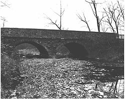 |
1839 | Fort Washington Fort Washington, Pennsylvania Fort Washington is an unincorporated census-designated place and suburb of Philadelphia in Montgomery County, Pennsylvania, United States. The population was 5,446 at the 2010 census.-Prior to the Revolutionary War:... 40°14′15"N 75°11′31"W |
Montgomery Montgomery County, Pennsylvania Montgomery County is a county located in the U.S. state of Pennsylvania, in the United States. As of 2010, the population was 799,874, making it the third most populous county in Pennsylvania . The county seat is Norristown.The county was created on September 10, 1784, out of land originally part... |
Multi-span stone arch | |
| Howard Tunnel, Northern Central Railway | 1840, 1868 | New Salem New Salem, Pennsylvania New Salem, also known as York New Salem, is a borough located in York County, Pennsylvania. As of the 2010 census, the borough had a total population of 724.- Geography :New Salem is located at 39°54'9" North, 76°47'35" West .... 39°53′28"N 76°45′2"W |
York York County, Pennsylvania York County is a county in the U.S. state of Pennsylvania. As of 2010, the population was 434,972. It is in the Susquehanna Valley, a large fertile agricultural region in South Central Pennsylvania.... |
|||
| Ironstone Bridge | 1907 | Morysville 40°19′12"N 75°39′8"W |
Berks Berks County, Pennsylvania -Demographics:As of the census of 2000, there were 373,638 people, 141,570 households, and 98,532 families residing in the county. The population density was 435 people per square mile . There were 150,222 housing units at an average density of 175 per square mile... |
Single-span arch Arch bridge An arch bridge is a bridge with abutments at each end shaped as a curved arch. Arch bridges work by transferring the weight of the bridge and its loads partially into a horizontal thrust restrained by the abutments at either side... |
||
| Jerome Street Bridge Jerome Street Bridge The Jerome Street Bridge, is an arch bridge across the Youghiogheny River connecting the east and west banks of the Pittsburgh industrial suburb of McKeesport, Pennsylvania. It was engineered by George S. Richardson. Originally, an 1880s truss bridge stood on the site. This structure mainly served... |
1935, 1937 | McKeesport McKeesport, Pennsylvania McKeesport is a city in Allegheny County, Pennsylvania, in the United States; it is located at the confluence of the Monongahela and Youghiogheny rivers and is part of the Pittsburgh Metro Area. The population was 19,731 at the 2010 census... 40°21′1.8"N 79°52′11.84"W |
Allegheny Allegheny County, Pennsylvania Allegheny County is a county in the southwestern part of the U.S. state of Pennsylvania. As of the 2010 census, the population was 1,223,348; making it the second most populous county in Pennsylvania, following Philadelphia County. The county seat is Pittsburgh... |
Two-hinged through arch | ||
| John's Burnt Mill Bridge John's Burnt Mill Bridge John's Burnt Mill Bridge, also known as Camelback Bridge is a stone arch bridge near New Oxford, Pennsylvania.... |
1800, 1823 | New Oxford New Oxford, Pennsylvania New Oxford is a borough in Adams County, Pennsylvania, United States. The population was 1,783 at the 2010 census. Within New Oxford there are several large manufacturing plants... 39°49′56"N 77°4′47"W |
Adams Adams County, Pennsylvania Adams County is a county in the U.S. state of Pennsylvania. As of the 2010 census, the population was 101,407. It was created on January 22, 1800, from part of York County and named in honor of the second President of the United States, John Adams... |
Camelback Camelback Bridge The Camelback Bridge is a restored historic wooden bridge that arches over the Constitution Trail in Normal, Illinois. It is on the U.S. National Register of Historic Places. The bridge's main span is a wooden kingpost pony truss. The bridge features supports that are Phoenix columns, a special... |
||
| Kise Mill Bridge | 1915 | Woodside Woodside, Pennsylvania Woodside is a census-designated place in Bucks County, Pennsylvania, United States. The population was 2,425 at the 2010 census.-Geography:Woodside is located at .... 40°6′56"N 76°48′38"W |
York York County, Pennsylvania York County is a county in the U.S. state of Pennsylvania. As of 2010, the population was 434,972. It is in the Susquehanna Valley, a large fertile agricultural region in South Central Pennsylvania.... |
Camelback single span arch | ||
| Layton Bridge Layton Bridge The Layton Bridge is a Pratt truss bridge over the Youghiogheny River, originally built for the Washington Run Railroad,construction began 1893 and it was completed in 1899. The last train crossed in 1931... |
1899 | Layton Layton, Pennsylvania Layton is an unincorporated community in Fayette County, Pennsylvania. It is the former site of a large brickworks, due to local deposits of flint clay. Here, the Washington Run Railroad connected to the B&O Railroad.... 40°5′21"N 79°43′49"W |
Fayette Fayette County, Pennsylvania Fayette County is a county located in the U.S. state of Pennsylvania. As of the2010 census, the population was 136,606. The county is part of the Pittsburgh Metropolitan Statistical Area.... |
Pratt truss | ||
| Lenape Bridge | 1911, 1912 | Lenape 39°54′54"N 75°37′47"W |
Chester Chester County, Pennsylvania -State parks:*French Creek State Park*Marsh Creek State Park*White Clay Creek Preserve-Demographics:As of the 2010 census, the county was 85.5% White, 6.1% Black or African American, 0.2% Native American or Alaskan Native, 3.9% Asian, 0.0% Native Hawaiian, 1.8% were two or more races, and 2.4% were... |
Multi-span stone arch | ||
| Liberty Bridge Liberty Bridge (Pittsburgh) The Liberty Bridge, completed in 1928, connects downtown Pittsburgh, Pennsylvania to the Liberty Tunnels and the South Hills neighborhoods beyond... |
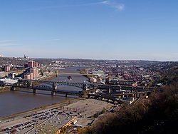 |
1928 | Pittsburgh 40°25′58"N 79°59′50"W |
Allegheny Allegheny County, Pennsylvania Allegheny County is a county in the southwestern part of the U.S. state of Pennsylvania. As of the 2010 census, the population was 1,223,348; making it the second most populous county in Pennsylvania, following Philadelphia County. The county seat is Pittsburgh... |
Multi-span Pratt truss | |
| Lilly Bridge | 1832 | Lilly Lilly, Pennsylvania Lilly is a borough in Cambria County, Pennsylvania, United States. It is part of the Johnstown, Pennsylvania Metropolitan Statistical Area. The population was 948 at the 2000 census.-Geography:Lilly is located at .... 40°25′25"N 78°37′3"W |
Cambria Cambria County, Pennsylvania Cambria County is a county located in the U.S. state of Pennsylvania. It comprises the Johnstown, Pennsylvania, Metropolitan Statistical Area. As of 2010, the population was 143,679.... |
Single-span stone arch | ||
| Lindbergh Viaduct | 1927 | Reading Reading, Pennsylvania Reading is a city in southeastern Pennsylvania, USA, and seat of Berks County. Reading is the principal city of the Greater Reading Area and had a population of 88,082 as of the 2010 census, making it the fifth most populated city in the state after Philadelphia, Pittsburgh, Allentown and Erie,... 40°19′52"N 75°54′0"W |
Berks Berks County, Pennsylvania -Demographics:As of the census of 2000, there were 373,638 people, 141,570 households, and 98,532 families residing in the county. The population density was 435 people per square mile . There were 150,222 housing units at an average density of 175 per square mile... |
Open-spandrel arch | ||
| Marion Bridge | 1930 | Point Marion Point Marion, Pennsylvania Point Marion is a borough in Fayette County, Pennsylvania, United States. The population was 1,333 at the 2000 census. It is served by the Albert Gallatin Area School District.Point Marion is located at the confluence of the Monongahela and Cheat Rivers... 39°44′22"N 79°54′19"W |
Fayette Fayette County, Pennsylvania Fayette County is a county located in the U.S. state of Pennsylvania. As of the2010 census, the population was 136,606. The county is part of the Pittsburgh Metropolitan Statistical Area.... , Greene Greene County, Pennsylvania -Demographics:As of the census of 2000, there were 40,672 people, 15,060 households, and 10,587 families residing in the county. The population density was 71 people per square mile . There were 16,678 housing units at an average density of 29 per square mile... |
Warren through truss | ||
| Market Street Bridge | 1926, 1929 | Kingston Kingston, Pennsylvania Kingston is a municipality located in Luzerne County, Pennsylvania, United States, on the Susquehanna River opposite Wilkes Barre. Kingston was incorporated as a borough in 1857. Kingston has adopted a home rule charter which became effective in January 1976. It is part of the greater metropolitan... , Wilkes-Barre Wilkes-Barre, Pennsylvania Wilkes-Barre is a city in the U.S. state of Pennsylvania, the county seat of Luzerne County. It is at the center of the Wyoming Valley area and is one of the principal cities in the Scranton/Wilkes-Barre metropolitan area, which had a population of 563,631 as of the 2010 Census... 41°14′55"N 75°53′7"W |
Luzerne Luzerne County, Pennsylvania - Demographics :As of the 2010 census, the county was 90.7% White, 3.4% Black or African American, 0.2% Native American, 1.0% Asian, 3.3% were of some other race, and 1.5% were two or more races. 6.7% of the population was of Hispanic or Latino ancestry... |
|||
| Market Street Bridge Market Street Bridge (Harrisburg) The Market Street Bridge is a stone arch bridge that spans the Susquehanna River between Harrisburg, Pennsylvania and Wormleysburg, Pennsylvania... |
_haer_color_1.jpg) |
1928 | Harrisburg Harrisburg, Pennsylvania Harrisburg is the capital of Pennsylvania. As of the 2010 census, the city had a population of 49,528, making it the ninth largest city in Pennsylvania... 40°15′0"N 76°53′27"W |
Cumberland Cumberland County, Pennsylvania Cumberland County is a county located in the U.S. state of Pennsylvania and is one of three counties comprising the Harrisburg–Carlisle Metropolitan Statistical Area. As of 2010, the population was 235,406.-History:... , Dauphin Dauphin County, Pennsylvania Dauphin County is a county in the U.S. state of Pennsylvania and is one of the three counties comprising the Harrisburg–Carlisle Metropolitan Statistical Area. As of 2010 census, the population was 268,100. The county includes the city of Harrisburg, which has served as the state capital... |
Long-span monumental urban | |
| Marshall's Bridge | 1903 | Little Washington 40°3′23"N 75°45′31"W |
Chester Chester County, Pennsylvania -State parks:*French Creek State Park*Marsh Creek State Park*White Clay Creek Preserve-Demographics:As of the 2010 census, the county was 85.5% White, 6.1% Black or African American, 0.2% Native American or Alaskan Native, 3.9% Asian, 0.0% Native Hawaiian, 1.8% were two or more races, and 2.4% were... |
|||
| McClay's Twin Bridge (East) | 1827 | Middle Spring 40°5′54"N 77°34′15"W |
Franklin Franklin County, Pennsylvania As of the census of 2000, there were 129,313 people, 50,633 households, and 36,405 families residing in the county. The population density was 168 people per square mile . There were 53,803 housing units at an average density of 70 per square mile... |
Multi-span camelback arch | ||
| McClay's Twin Bridge (West) | 1827 | Middle Spring 40°5′53"N 77°34′12"W |
Franklin Franklin County, Pennsylvania As of the census of 2000, there were 129,313 people, 50,633 households, and 36,405 families residing in the county. The population density was 168 people per square mile . There were 53,803 housing units at an average density of 70 per square mile... |
Multi-span camelback arch | ||
| McKees Rocks Bridge |  |
1931 | McKees Rocks McKees Rocks, Pennsylvania McKees Rocks, also known as "The Rocks", is a borough in Allegheny County, Pennsylvania, along the south bank of the Ohio River. The borough population was 6,104 at the 2010 census.In the past, it was known for its extensive iron and steel interests... 40°28′37.34"N 80°2′56.04"W |
Allegheny Allegheny County, Pennsylvania Allegheny County is a county in the southwestern part of the U.S. state of Pennsylvania. As of the 2010 census, the population was 1,223,348; making it the second most populous county in Pennsylvania, following Philadelphia County. The county seat is Pittsburgh... |
Metal through arch | |
| Albertus L. Meyers Bridge Albertus L. Meyers Bridge The Albertus L. Meyers Bridge is a reinforced concrete open-spandrel arch bridge located in Allentown, Pennsylvania in the United States.... |
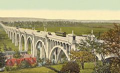 |
1913 | Allentown Allentown, Pennsylvania Allentown is a city located in Lehigh County, Pennsylvania, in the United States. It is Pennsylvania's third most populous city, after Philadelphia and Pittsburgh, and the 215th largest city in the United States. As of the 2010 census, the city had a total population of 118,032 and is currently... 40°35′45"N 75°28′16"W |
Lehigh Lehigh County, Pennsylvania -Climate:Most of the county's climate is considered to fall in the humid continental climate zone. Summers are typically hot and muggy, fall and spring are generally mild, and winter is cold. Precipitation is almost uniformly distributed throughout the year.... |
Open-spandrel arch | |
| Millanville-Skinners Falls Bridge | 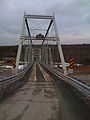 |
1904 | Millanville 41°40′10"N 75°3′31"W |
Wayne Wayne County, Pennsylvania As of the census of 2000, there were 47,722 people, 18,350 households, and 12,936 families residing in the county. The population density was 65 people per square mile . There were 30,593 housing units at an average density of 42 per square mile... |
Baltimore truss | |
| Muddy Creek Bridge, Maryland and Pennsylvania Railroad | Sunnyburn Sunnyburn, Pennsylvania Sunnyburn is an unincorporated community in York County, Pennsylvania, United States. It is located on Pennsylvania Route 74 3 miles south of Airville.-References:USGS GNIS: Sunnyburn, Pennsylvania... 39°45′37"N 76°21′5"W |
York York County, Pennsylvania York County is a county in the U.S. state of Pennsylvania. As of 2010, the population was 434,972. It is in the Susquehanna Valley, a large fertile agricultural region in South Central Pennsylvania.... |
Pratt truss | |||
| Newtown Creek Bridge | 1796, 1875 | Newtown Newtown, Bucks County, Pennsylvania Newtown is a borough in Bucks County, Pennsylvania, United States. The population was 2,248 at the 2010 census. It is located just west of the Trenton, New Jersey metropolitan area, and is part of the larger Philadelphia metropolitan area. It is entirely surrounded by Newtown Township, from which... 40°13′40"N 74°56′20"W |
Bucks Bucks County, Pennsylvania - Industry and commerce :The boroughs of Bristol and Morrisville were prominent industrial centers along the Northeast Corridor during World War II. Suburban development accelerated in Lower Bucks in the 1950s with the opening of Levittown, Pennsylvania, the second such "Levittown" designed by... |
Two-span stone arch | ||
| Ninth Street Bridge |  |
1925, 1926 | Pittsburgh 40°26′48"N 80°0′1"W |
Allegheny Allegheny County, Pennsylvania Allegheny County is a county in the southwestern part of the U.S. state of Pennsylvania. As of the 2010 census, the population was 1,223,348; making it the second most populous county in Pennsylvania, following Philadelphia County. The county seat is Pittsburgh... |
Eyebar suspension Suspension bridge A suspension bridge is a type of bridge in which the deck is hung below suspension cables on vertical suspenders. Outside Tibet and Bhutan, where the first examples of this type of bridge were built in the 15th century, this type of bridge dates from the early 19th century... |
|
| Old Columbia-Wrightsville Bridge | 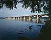 |
1929, 1930 | Columbia Columbia, Pennsylvania Columbia, once colonial Wright's Ferry, is a borough in Lancaster County, Pennsylvania, 28 miles southeast of Harrisburg on the left bank Susquehanna River across from Wrightsville and York County. Originally, the area may have been called Conejohela Flats, for the many islands and islets in the... , Wrightsville Wrightsville, Pennsylvania Wrightsville is a borough in York County, Pennsylvania, United States. The population was 2,310 at the 2010 census. Wrightsville borough has a police department, historic society, and a volunteer fire company.- History :According to a plaque at Samuel S... 40°1′50"N 76°30′41"W |
Lancaster Lancaster County, Pennsylvania Lancaster County, known as the Garden Spot of America or Pennsylvania Dutch Country, is a county located in the southeastern part of the Commonwealth of Pennsylvania, in the United States. As of 2010 the population was 519,445. Lancaster County forms the Lancaster Metropolitan Statistical Area, the... , York York County, Pennsylvania York County is a county in the U.S. state of Pennsylvania. As of 2010, the population was 434,972. It is in the Susquehanna Valley, a large fertile agricultural region in South Central Pennsylvania.... |
Open-spandrel arch | |
| Pennsylvania Railroad Bridge | 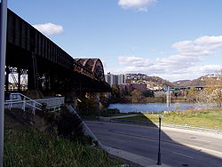 |
1901, 1904 | Pittsburgh 40°26′58"N 79°59′50"W |
Allegheny Allegheny County, Pennsylvania Allegheny County is a county in the southwestern part of the U.S. state of Pennsylvania. As of the 2010 census, the population was 1,223,348; making it the second most populous county in Pennsylvania, following Philadelphia County. The county seat is Pittsburgh... |
Double-decked through truss | |
| Pennsylvania Railroad Bridge | 1903 | Morrisville 40°12′31"N 74°45′58"W |
Bucks | Stone arch Arch bridge An arch bridge is a bridge with abutments at each end shaped as a curved arch. Arch bridges work by transferring the weight of the bridge and its loads partially into a horizontal thrust restrained by the abutments at either side... |
||
| Pennsylvania Railroad Bridge over Shavers Creek Pennsylvania Railroad Bridge over Shavers Creek Pennsylvania Railroad Bridge over Shavers Creek, also known as Conrail Bridge over Shavers Creek, is a historic multi-span stone arch bridge spanning Shavers Creek and located at Logan Township and Petersburg, Huntingdon County, Pennsylvania. It was built by the Pennsylvania Railroad in 1889... |
1889 | Petersburg Petersburg, Pennsylvania Petersburg is a borough in Huntingdon County, Pennsylvania, United States. It was a stop on the former Pennsylvania Railroad Main Line between Tyrone and Huntingdon and the junction point for the Petersburg Branch... 40°34′1"N 78°2′54"W |
Huntingdon Huntingdon County, Pennsylvania Huntingdon County is a county located in the U.S. state of Pennsylvania. In 2010, its population was 45,913.Huntingdon County was created on September 20, 1787, from part of Bedford County. Its county seat is Huntingdon.-Geography:According to the U.S... |
Stone arch | ||
| Pennsylvania Railroad Old Bridge over Standing Stone Creek Pennsylvania Railroad Old Bridge over Standing Stone Creek Pennsylvania Railroad Old Bridge over Standing Stone Creek, also known as Conrail Old Bridge over Standing Stone Creek, is a historic multi-span stone arch bridge spanning Standing Stone Creek and located at Huntingdon, Huntingdon County, Pennsylvania. It was built by the Pennsylvania Railroad... |
1848, 1849 | Huntingdon Huntingdon, Pennsylvania Huntingdon is a borough in Huntingdon County, Pennsylvania. It is the county seat of Huntingdon County. It is located along the Juniata River, west of Harrisburg, about halfway between Pittsburgh and Harrisburg, in an agricultural and fruit-growing region, with valuable forests and deposits of... 40°28′51"N 78°0′17"W |
Huntingdon Huntingdon County, Pennsylvania Huntingdon County is a county located in the U.S. state of Pennsylvania. In 2010, its population was 45,913.Huntingdon County was created on September 20, 1787, from part of Bedford County. Its county seat is Huntingdon.-Geography:According to the U.S... |
Stone arch | ||
| Perkiomen Bridge Perkiomen Bridge The Perkiomen Bridge, originally built 1798-99 and widened in 1928, is one of the oldest stone arch bridges in the United States still in use. It crosses Perkiomen Creek near Collegeville, Pennsylvania. The bridge's six semi-circular arches cover a total of over . The longest arch spans .... |
1799 | Collegeville Collegeville, Pennsylvania Collegeville is a borough in Montgomery County, Pennsylvania, 30 miles northwest of Philadelphia on the Perkiomen Creek. Collegeville was incorporated in 1896. It is the seat of Ursinus College, opened in 1869... 40°11′3"N 75°26′54"W |
Montgomery Montgomery County, Pennsylvania Montgomery County is a county located in the U.S. state of Pennsylvania, in the United States. As of 2010, the population was 799,874, making it the third most populous county in Pennsylvania . The county seat is Norristown.The county was created on September 10, 1784, out of land originally part... |
Multi-span stone arch | ||
| Pithole Stone Arch Pithole Stone Arch Bridge The Pithole Stone Arch Bridge is a masonry, deck arch bridge that spans Pithole Creek between Cornplanter and President Townships, Venango County in the U.S. state of Pennsylvania... |
1897 | Cornplanter / President Townships 41°29′13"N 79°35′43"W |
Venango Venango County, Pennsylvania Venango County is a county located in the U.S. state of Pennsylvania. As of the 2010 census, the population was 54,984. Its county seat is Franklin.-History:Venango County was created on March 12, 1800 from parts of Allegheny and Lycoming Counties... |
Single-span stone arch | ||
| Pond Eddy Bridge Pond Eddy Bridge The Pond Eddy Bridge is a petit truss bridge spanning the Delaware River between the hamlet of Pond Eddy in Lumberland, New York and the settlement informally called Pond Eddy in Shohola Township, Pennsylvania. It is accessible from NY 97 in Lumberland on the New York side and two dead-end local... |
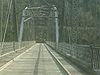 |
1904 | Pond Eddy 41°26′21"N 74°49′13"W |
Pike Pike County, Pennsylvania -National protected areas:* Delaware Water Gap National Recreation Area * Middle Delaware National Scenic River * Upper Delaware Scenic and Recreational River -Demographics:... |
Pennsylvania truss | |
| Pond Mill Bridge | Bermudian Bermudian, Pennsylvania Bermudian is an unincorporated community in Adams and York counties, Pennsylvania, United States.-References:... 39°59′45"N 77°3′31"W |
Adams Adams County, Pennsylvania Adams County is a county in the U.S. state of Pennsylvania. As of the 2010 census, the population was 101,407. It was created on January 22, 1800, from part of York County and named in honor of the second President of the United States, John Adams... |
Three-span camelback arch | |||
| Quaker Bridge | 1898 | Greenville Greenville, Pennsylvania Greenville is a borough in Mercer County, Pennsylvania. Located along the Shenango River, Greenville is roughly 80 miles from both Pittsburgh and Cleveland. Greenville is part of the Youngstown–Warren–Boardman, OH-PA Metropolitan Statistical Area, which is home to 570,000 people... 41°25′33"N 80°22′22"W |
Mercer Mercer County, Pennsylvania Mercer County is a county located in the U.S. state of Pennsylvania. As of 2010, the population was 116,638. Its county seat is Mercer; Sharon is its largest city.... |
Pratt through truss | ||
| Reading-Halls Station Bridge Reading-Halls Station Bridge Reading-Halls Station Bridge is a historic pony Howe truss railroad bridge located at Muncy Township, Lycoming County, Pennsylvania. It was built about 1850 by the Philadelphia and Reading Railroad, and is a single span bridge measures approximately 70 feet long... |
 |
Muncy Muncy, Pennsylvania For other places named 'Muncy', please see Muncy .Muncy is a borough in Lycoming County, Pennsylvania, in the United States. The name Muncy comes from the Munsee Indians who once lived in the area. The population was 2,663 at the 2000 census. It is part of the Williamsport, Pennsylvania... 41°14′9"N 76°49′58"W |
Lycoming Lycoming County, Pennsylvania -Appalachian Mountains and Allegheny Plateau:Lycoming County is divided between the Appalachian Mountains in the south, the dissected Allegheny Plateau in the north and east, and the valley of the West Branch Susquehanna River between these.-West Branch Susquehanna River:The West Branch of the... |
Pony Howe truss | ||
| Ridge Avenue Bridge in Philadelphia Ridge Avenue Bridge in Philadelphia The Ridge Avenue Bridge in Philadelphia is a historic bridge in Philadelphia, Pennsylvania.A triple-span stone arch bridge built in 1888, it carries Ridge Avenue over the Wissahickon Creek. It is the last crossing of the creek before it empties into the Schuylkill River... |
1888 | Philadelphia 40°0′53"N 75°12′26"W |
Philadelphia Philadelphia County, Pennsylvania -History:Tribes of Lenape were the first known occupants in the area which became Philadelphia County. The first European settlers were Swedes and Finns who arrived in 1638. The Netherlands seized the area in 1655, but permanently lost control to England in 1674... |
Multi-span stone arch | ||
| Ridge Road Bridge, Stewartstown Railroad | Stewartstown Stewartstown, Pennsylvania Stewartstown is a borough in York County, Pennsylvania, United States. The population was 2,089 at the 2010 census.-History:There were settlers in the Stewartstown area as early as 1750... 39°45′35"N 76°37′33"W |
York York County, Pennsylvania York County is a county in the U.S. state of Pennsylvania. As of 2010, the population was 434,972. It is in the Susquehanna Valley, a large fertile agricultural region in South Central Pennsylvania.... |
Girder Girder bridge A girder bridge, in general, is a bridge built of girders placed on bridge abutments and foundation piers. In turn, a bridge deck is built on top of the girders in order to carry traffic. There are several different subtypes of girder bridges:... |
|||
| Rockville Bridge Rockville Bridge The Rockville Bridge, at the time of its completion in 1902, was, and still remains, the longest stone masonry arch railroad viaduct in the world. Constructed between 1900 - 1902 by the Pennsylvania Railroad, it has forty-eight 70-foot spans, for a total length of 3,820 feet .The bridge crosses... |
 |
1900, 1902 | Marysville Marysville, Pennsylvania Marysville is a borough in Perry County, Pennsylvania, United States. The population was 2,425 in July 2008. It is part of the Harrisburg–Carlisle Metropolitan Statistical Area.... , Rockville Rockville, Pennsylvania Rockville is an unincorporated community in Dauphin County, Pennsylvania, United States, at latitude 40.336 and longitude -76.905. The elevation is 328 feet... 40°19′59"N 76°54′42"W |
Dauphin Dauphin County, Pennsylvania Dauphin County is a county in the U.S. state of Pennsylvania and is one of the three counties comprising the Harrisburg–Carlisle Metropolitan Statistical Area. As of 2010 census, the population was 268,100. The county includes the city of Harrisburg, which has served as the state capital... , Perry Perry County, Pennsylvania As of the census of 2000, there were 43,602 people, 16,695 households, and 12,320 families residing in the county. The population density was 79 people per square mile . There were 18,941 housing units at an average density of 34 per square mile... |
Stone masonry Masonry Masonry is the building of structures from individual units laid in and bound together by mortar; the term masonry can also refer to the units themselves. The common materials of masonry construction are brick, stone, marble, granite, travertine, limestone; concrete block, glass block, stucco, and... arch Arch bridge An arch bridge is a bridge with abutments at each end shaped as a curved arch. Arch bridges work by transferring the weight of the bridge and its loads partially into a horizontal thrust restrained by the abutments at either side... |
|
| Runk Bridge Runk Bridge Runk Bridge, also known as Huntingdon County Bridge No. 9, is a historic Pratt truss bridge spanning Aughwick Creek and located at Shirley Township, Huntingdon County, Pennsylvania. It was built by the Pennsylvania Bridge Co. in 1898... |
1889 | Shirleysburg Shirleysburg, Pennsylvania Shirleysburg is a borough in Huntingdon County, Pennsylvania, United States. The population was 140 at the 2000 census.-History:Shirleysburg was originally the site of, and takes its name from Fort Shirley, a French and Indian War fort... 40°16′40"N 77°53′14"W |
Huntingdon Huntingdon County, Pennsylvania Huntingdon County is a county located in the U.S. state of Pennsylvania. In 2010, its population was 45,913.Huntingdon County was created on September 20, 1787, from part of Bedford County. Its county seat is Huntingdon.-Geography:According to the U.S... |
Pratt truss | ||
| S Bridge | 1919 | Sheridan 40°22′25"N 76°13′7"W |
Berks Berks County, Pennsylvania -Demographics:As of the census of 2000, there were 373,638 people, 141,570 households, and 98,532 families residing in the county. The population density was 435 people per square mile . There were 150,222 housing units at an average density of 175 per square mile... |
Multi-span stone arch | ||
| Schuylkill County Bridge No. 113 | Rock 40°32′42"N 76°17′43"W |
Schuylkill Schuylkill County, Pennsylvania -Notable people:*Boxing heavyweight great Muhammad Ali had his training camp in Deer Lake.*Charles Justin Bailey, commanding general of the 81st Division in World War I, was born in Tamaqua on June 21, 1859.... |
Burr arch | |||
| Schuylkill County Bridge No. 114 | Rock 40°32′39"N 76°19′33"W |
Schuylkill Schuylkill County, Pennsylvania -Notable people:*Boxing heavyweight great Muhammad Ali had his training camp in Deer Lake.*Charles Justin Bailey, commanding general of the 81st Division in World War I, was born in Tamaqua on June 21, 1859.... |
Burr arch | |||
| Scott Creek Bridge-North, Maryland and Pennsylvania Railroad | Bryansville Bryansville, Pennsylvania Bryansville is an unincorporated community in York County, Pennsylvania, United States. The village of Bryansville has a large residential area known as Susquehanna Trails almost adjacent to it. Until 1978, this community was served by the Maryland and Pennsylvania Railroad at milepost... 39°44′46"N 76°20′29"W |
York York County, Pennsylvania York County is a county in the U.S. state of Pennsylvania. As of 2010, the population was 434,972. It is in the Susquehanna Valley, a large fertile agricultural region in South Central Pennsylvania.... |
Girder Girder bridge A girder bridge, in general, is a bridge built of girders placed on bridge abutments and foundation piers. In turn, a bridge deck is built on top of the girders in order to carry traffic. There are several different subtypes of girder bridges:... |
|||
| Second Street Bridge | 1919 | Chester Chester, Pennsylvania Chester is a city in Delaware County, Pennsylvania, United States, with a population of 33,972 at the 2010 census. Chester is situated on the Delaware River, between the cities of Philadelphia and Wilmington, Delaware.- History :... 39°50′41"N 75°21′39"W |
Delaware Delaware County, Pennsylvania Delaware County is a county located in the U.S. state of Pennsylvania. As of 2010, the population was 558,979, making it Pennsylvania's fifth most populous county, behind Philadelphia, Allegheny, Montgomery, and Bucks counties.... |
Bowstring arch, destroyed | ||
| Seventh Street Bridge |  |
1925, 1926 | Pittsburgh 40°26′52"N 80°0′12"W |
Allegheny Allegheny County, Pennsylvania Allegheny County is a county in the southwestern part of the U.S. state of Pennsylvania. As of the 2010 census, the population was 1,223,348; making it the second most populous county in Pennsylvania, following Philadelphia County. The county seat is Pittsburgh... |
Eyebar suspension Suspension bridge A suspension bridge is a type of bridge in which the deck is hung below suspension cables on vertical suspenders. Outside Tibet and Bhutan, where the first examples of this type of bridge were built in the 15th century, this type of bridge dates from the early 19th century... |
|
| Sixteenth Street Bridge | 1923 | Pittsburgh 40°27′4"N 79°59′26"W |
Allegheny Allegheny County, Pennsylvania Allegheny County is a county in the southwestern part of the U.S. state of Pennsylvania. As of the 2010 census, the population was 1,223,348; making it the second most populous county in Pennsylvania, following Philadelphia County. The county seat is Pittsburgh... |
Tied arch | ||
| Sixth Street Bridge |  |
1927, 1928 | Pittsburgh 40°26′43"N 80°0′12"W |
Allegheny Allegheny County, Pennsylvania Allegheny County is a county in the southwestern part of the U.S. state of Pennsylvania. As of the 2010 census, the population was 1,223,348; making it the second most populous county in Pennsylvania, following Philadelphia County. The county seat is Pittsburgh... |
Eyebar suspension Suspension bridge A suspension bridge is a type of bridge in which the deck is hung below suspension cables on vertical suspenders. Outside Tibet and Bhutan, where the first examples of this type of bridge were built in the 15th century, this type of bridge dates from the early 19th century... |
|
| Skippack Bridge | 1792 | Evansburg Evansburg, Pennsylvania Evansburg is a census-designated place in Montgomery County, Pennsylvania, United States. The population was 2,129 at the 2010 census. It is a section of Lower Providence Township and is the namesake of Evansburg State Park.-Geography:... 40°10′49"N 75°25′20"W |
Montgomery Montgomery County, Pennsylvania Montgomery County is a county located in the U.S. state of Pennsylvania, in the United States. As of 2010, the population was 799,874, making it the third most populous county in Pennsylvania . The county seat is Norristown.The county was created on September 10, 1784, out of land originally part... |
Eight-arch Arch bridge An arch bridge is a bridge with abutments at each end shaped as a curved arch. Arch bridges work by transferring the weight of the bridge and its loads partially into a horizontal thrust restrained by the abutments at either side... masonry Masonry Masonry is the building of structures from individual units laid in and bound together by mortar; the term masonry can also refer to the units themselves. The common materials of masonry construction are brick, stone, marble, granite, travertine, limestone; concrete block, glass block, stucco, and... |
||
| Smithfield Street Bridge Smithfield Street Bridge The Smithfield Street Bridge is a lenticular truss bridge crossing the Monongahela River in Pittsburgh, Pennsylvania, USA.The bridge was designed by Gustav Lindenthal, the engineer who later designed the Hell Gate Bridge. The bridge was built between 1881–83, opening for traffic on March 19, 1883.... |
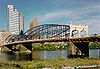 |
1883, 1889 | Pittsburgh 40°26′5"N 80°0′8"W |
Allegheny Allegheny County, Pennsylvania Allegheny County is a county in the southwestern part of the U.S. state of Pennsylvania. As of the 2010 census, the population was 1,223,348; making it the second most populous county in Pennsylvania, following Philadelphia County. The county seat is Pittsburgh... |
Pauli truss | |
| Soldiers and Sailors Memorial Bridge State Street Bridge (Harrisburg, Pennsylvania) The State Street Bridge, also known as the Soldiers and Sailors Memorial Bridge, is a concrete, deck arch bridge that spans Pennsylvania Route 230 and Paxton Creek in Harrisburg, Pennsylvania... |
_haer_color.jpg) |
1930 | Harrisburg Harrisburg, Pennsylvania Harrisburg is the capital of Pennsylvania. As of the 2010 census, the city had a population of 49,528, making it the ninth largest city in Pennsylvania... 40°16′2"N 76°52′43"W |
Dauphin Dauphin County, Pennsylvania Dauphin County is a county in the U.S. state of Pennsylvania and is one of the three counties comprising the Harrisburg–Carlisle Metropolitan Statistical Area. As of 2010 census, the population was 268,100. The county includes the city of Harrisburg, which has served as the state capital... |
Long-span monumental urban | |
| South Road Bridge, Northern Central Railway | Larue 39°49′14"N 76°45′39"W |
York York County, Pennsylvania York County is a county in the U.S. state of Pennsylvania. As of 2010, the population was 434,972. It is in the Susquehanna Valley, a large fertile agricultural region in South Central Pennsylvania.... |
Masonry arch | |||
| South Tenth Street Bridge South Tenth Street Bridge South Tenth Street Bridge, most often called the Tenth Street Bridge, but officially dubbed the Philip Murray Bridge, is a suspension bridge spanning the Monongahela River in Downtown Pittsburgh, Pennsylvania... |
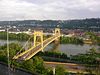 |
1932 | Pittsburgh 40°25′57"N 79°59′23"W |
Allegheny Allegheny County, Pennsylvania Allegheny County is a county in the southwestern part of the U.S. state of Pennsylvania. As of the 2010 census, the population was 1,223,348; making it the second most populous county in Pennsylvania, following Philadelphia County. The county seat is Pittsburgh... |
Wire-cable suspension Suspension bridge A suspension bridge is a type of bridge in which the deck is hung below suspension cables on vertical suspenders. Outside Tibet and Bhutan, where the first examples of this type of bridge were built in the 15th century, this type of bridge dates from the early 19th century... |
|
| Staple Bend Tunnel Staple Bend Tunnel The Staple Bend Tunnel, about east of Johnstown, Pennsylvania, in a town called Mineral Point, was constructed between 1831 and 1834 for the Allegheny Portage Railroad. Construction began on April 12, 1831. This tunnel, at in length, was the first railway tunnel constructed in the United States... |
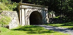 |
1833, 1853 | Conemaugh Township Conemaugh Township, Cambria County, Pennsylvania Conemaugh Township is a township in Cambria County, Pennsylvania, United States. The population was 2,145 at the 2000 census. It is part of the Johnstown, Pennsylvania Metropolitan Statistical Area.-Geography:... 40°21′33"N 78°51′19"W |
Cambria Cambria County, Pennsylvania Cambria County is a county located in the U.S. state of Pennsylvania. It comprises the Johnstown, Pennsylvania, Metropolitan Statistical Area. As of 2010, the population was 143,679.... |
Tunnel Tunnel A tunnel is an underground passageway, completely enclosed except for openings for egress, commonly at each end.A tunnel may be for foot or vehicular road traffic, for rail traffic, or for a canal. Some tunnels are aqueducts to supply water for consumption or for hydroelectric stations or are sewers... |
|
| Starrucca Viaduct Starrucca Viaduct Starrucca Viaduct is a stone arch bridge that spans Starrucca Creek near Lanesboro, Pennsylvania, in the United States. At the time of its construction, the bridge was thought to be the most expensive railway bridge in the world, at a cost of $320,000 , and it was the largest stone rail viaduct in... |
 |
1848 | Lanesboro Lanesboro, Pennsylvania Lanesboro is a borough in Susquehanna County, Pennsylvania, United States. The population was 588 at the 2000 census.-Geography:Lanesboro is located at .... 41°57′51"N 75°35′2"W |
Susquehanna Susquehanna County, Pennsylvania -Demographics:As of the census of 2000, there were 42,238 people, 16,529 households, and 11,785 families residing in the county. The population density was 51 people per square mile . There were 21,829 housing units at an average density of 26 per square mile... |
||
| Stone Arch Road Bridge, Stewartstown Railroad | Railroad Railroad, Pennsylvania Railroad is a borough in York County, Pennsylvania, United States. The population was 278 at the 2010 census.-Geography:Railroad is located at .... 39°45′1"N 76°41′14"W |
York York County, Pennsylvania York County is a county in the U.S. state of Pennsylvania. As of 2010, the population was 434,972. It is in the Susquehanna Valley, a large fertile agricultural region in South Central Pennsylvania.... |
Girder Girder bridge A girder bridge, in general, is a bridge built of girders placed on bridge abutments and foundation piers. In turn, a bridge deck is built on top of the girders in order to carry traffic. There are several different subtypes of girder bridges:... |
|||
| Sutch Road Bridge in Marlborough Township | 1910 | Milford Milford, Pennsylvania Milford is a borough in Pike County, Pennsylvania, United States, and the county seat. Its population was 1,021 at the 2010 census. It was founded in 1796 by Judge John Biddis, one of the state's first four circuit judges, who named the settlement after his ancestral home in Wales.Milford has a... 40°22′4"N 75°25′24"W |
Montgomery Montgomery County, Pennsylvania Montgomery County is a county located in the U.S. state of Pennsylvania, in the United States. As of 2010, the population was 799,874, making it the third most populous county in Pennsylvania . The county seat is Norristown.The county was created on September 10, 1784, out of land originally part... |
Multi-span stone arch | ||
| Swamp Creek Road Bridge | 1892 | Sumneytown 40°20′3"N 75°26′59"W |
Montgomery Montgomery County, Pennsylvania Montgomery County is a county located in the U.S. state of Pennsylvania, in the United States. As of 2010, the population was 799,874, making it the third most populous county in Pennsylvania . The county seat is Norristown.The county was created on September 10, 1784, out of land originally part... |
Multi-span stone arch | ||
| Thirty-third Street Bridge in Philadelphia Thirty-third Street Bridge in Philadelphia The Thirty-third Street Bridge in Philadelphia carries Thirty-third Street over the former course of Master Street in the Brewerytown section of North Philadelphia, near Fairmount Park. The bridge was built in 1901 with an unusual skewed arch, and listed on the National Register of Historic Places... |
1901 | Philadelphia 39°58′43"N 75°11′24"W |
Philadelphia Philadelphia County, Pennsylvania -History:Tribes of Lenape were the first known occupants in the area which became Philadelphia County. The first European settlers were Swedes and Finns who arrived in 1638. The Netherlands seized the area in 1655, but permanently lost control to England in 1674... |
Single-span stone skew arch | ||
| Trenton City/Calhoun Street Bridge Calhoun Street Bridge (Trenton) The Calhoun Street Toll Supported Bridge is a historic bridge connecting Calhoun Street in Trenton, New Jersey across the Delaware River to East Trenton Avenue in Morrisville, Pennsylvania. It was constructed by the Phoenix Bridge Company of Phoenixville, Pennsylvania in 1884... |
1885 | Morrisville Morrisville, Bucks County, Pennsylvania Morrisville is a borough in Bucks County, Pennsylvania, United States. The population was 8,728 at the 2010 census.-Geography:Morrisville is located at . It is situated on the Delaware River directly across from Trenton, New Jersey... 40°13′11"N 74°46′42"W |
Bucks Bucks County, Pennsylvania - Industry and commerce :The boroughs of Bristol and Morrisville were prominent industrial centers along the Northeast Corridor during World War II. Suburban development accelerated in Lower Bucks in the 1950s with the opening of Levittown, Pennsylvania, the second such "Levittown" designed by... |
Phoenix column | ||
| Tunkhannock Viaduct Tunkhannock Viaduct Tunkhannock Viaduct is a concrete deck arch bridge that spans the Tunkhannock Creek in Nicholson, Wyoming County, Pennsylvania in the United States. It was the largest concrete bridge in the U.S. when it opened, and remained so even 50 years later.The bridge contains about of concrete and of steel... |
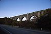 |
1912, 1915 | Nicholson Nicholson, Pennsylvania Nicholson is a borough in Wyoming County, Pennsylvania, United States. The population was 713 at the 2000 census.-Geography:Nicholson is located at .... 41°37′19.94"N 75°46′38.41"W |
Wyoming Wyoming County, Pennsylvania Wyoming County is a county located in the U.S. state of Pennsylvania. It was created in 1842 from part of Luzerne County. Its county seat is Tunkhannock.-Geography:According to the U.S... |
Open-spandrel concrete deck arch bridge | |
| Union Canal Tunnel | 1826, 1827, 1857 | Lebanon Lebanon, Pennsylvania Lebanon, formerly known as Steitztown, is a city in and the county seat of Lebanon County, Pennsylvania, United States. The population was 25,477 at the 2010 census, a 4.2% increase from the 2000 count of 24,461... 40°20′58"N 76°27′42"W |
Lebanon Lebanon County, Pennsylvania As of the census of 2000, there were 120,327 people and 32,771 families residing in the county. The population density was 332 people per square mile . There were 49,320 housing units at an average density of 136 per square mile... |
|||
| University Avenue Bridge University Avenue Bridge The University Avenue Bridge is a double-leaf bascule bridge crossing the Schuylkill River in Philadelphia, Pennsylvania. The four-lane bridge links University Avenue in West Philadelphia with South 34th Street in the Grays Ferry section of South Philadelphia... |
1925, 1930 | Philadelphia 39°56′35"N 75°11′49"W |
Philadelphia Philadelphia County, Pennsylvania -History:Tribes of Lenape were the first known occupants in the area which became Philadelphia County. The first European settlers were Swedes and Finns who arrived in 1638. The Netherlands seized the area in 1655, but permanently lost control to England in 1674... |
|||
| Valley Road Bridge, Stewartstown Railroad | 1885, 1920 | Stewartstown Stewartstown, Pennsylvania Stewartstown is a borough in York County, Pennsylvania, United States. The population was 2,089 at the 2010 census.-History:There were settlers in the Stewartstown area as early as 1750... 39°45′19"N 76°36′35"W |
York York County, Pennsylvania York County is a county in the U.S. state of Pennsylvania. As of 2010, the population was 434,972. It is in the Susquehanna Valley, a large fertile agricultural region in South Central Pennsylvania.... |
Pratt truss | ||
| Walnut Lane Bridge Walnut Lane Bridge The Walnut Lane Bridge is a concrete arch bridge located in Northwest Philadelphia that connects the Germantown and Roxborough neighborhoods across the Wissahickon Creek in Fairmount Park. While drivers may cross the bridge too quickly to notice, the view from underneath the bridge has inspired... |
1908 | Philadelphia | Philadelphia Philadelphia County, Pennsylvania -History:Tribes of Lenape were the first known occupants in the area which became Philadelphia County. The first European settlers were Swedes and Finns who arrived in 1638. The Netherlands seized the area in 1655, but permanently lost control to England in 1674... |
|||
| Walnut Street Bridge | 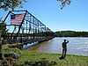 |
1889, 1900 | Harrisburg Harrisburg, Pennsylvania Harrisburg is the capital of Pennsylvania. As of the 2010 census, the city had a population of 49,528, making it the ninth largest city in Pennsylvania... 40°15′18"N 76°53′19"W |
Dauphin Dauphin County, Pennsylvania Dauphin County is a county in the U.S. state of Pennsylvania and is one of the three counties comprising the Harrisburg–Carlisle Metropolitan Statistical Area. As of 2010 census, the population was 268,100. The county includes the city of Harrisburg, which has served as the state capital... |
Multi-span Phoenix | |
| Waterville Bridge Waterville Bridge The Waterville Bridge is a lenticular truss bridge designed and manufactured by the Berlin Iron Bridge Co.. It was built in 1890.It's located in Swatara State Park in Pennsylvania.It was listed on the National Register of Historic Places in 1988.... |
1890 | Swatara Gap 40°28′49"N 76°31′55"W |
Lebanon Lebanon County, Pennsylvania As of the census of 2000, there were 120,327 people and 32,771 families residing in the county. The population density was 332 people per square mile . There were 49,320 housing units at an average density of 136 per square mile... |
Lenticular truss | ||
| Watsontown River Bridge | 1927 | Watsontown Watsontown, Pennsylvania Watsontown is a borough in Northumberland County, Pennsylvania, United States. The population was 2,255 at the 2000 census. It was named for John Watson, a local landowner.-Geography:Watsontown is located at .... , White Deer 41°4′51"N 76°51′55"W |
Northumberland Northumberland County, Pennsylvania There were 38,835 households out of which 27.30% had children under the age of 18 living with them, 52.40% were married couples living together, 9.60% had a female householder with no husband present, and 34.10% were non-families. 30.20% of all households were made up of individuals and 15.50% had... , Union Union County, Pennsylvania -Demographics:As of the census of 2000, there were 41,624 people, 13,178 households, and 9,211 families residing in the county. The population density was 131 people per square mile . There were 14,684 housing units at an average density of 46 per square mile... |
Open-spandrel arch | ||
| Webster Donora Bridge | 1906, 1908 | Donora Donora, Pennsylvania Donora is a borough in Washington County, Pennsylvania, south of Pittsburgh on the Monongahela river. Donora was incorporated in 1901. Donora got its name from a combination of William Donner and Nora Mellon, banker Andrew W. Mellon's wife. Agriculture, coal-mining, steel-making, wire-making, and... , Webster 40°11′3"N 79°51′8"W |
Washington Washington County, Pennsylvania -Government and politics:As of November 2008, there are 152,534 registered voters in Washington County .* Democratic: 89,027 * Republican: 49,025 * Other Parties: 14,482... , Westmoreland Westmoreland County, Pennsylvania -Demographics:As of the census of 2000, there were 369,993 people, 149,813 households, and 104,569 families residing in the county. The population density was 361 people per square mile . There were 161,058 housing units at an average density of 157 per square mile... |
Multi-span through truss | ||
| Welty's Mill Bridge | 1856 | Waynesboro Waynesboro, Pennsylvania Waynesboro is a borough in Franklin County, Pennsylvania, located northwest of Baltimore, Maryland, 67 miles southwest of Harrisburg, Pennsylvania, and north of the Mason-Dixon Line. The population within the borough limits was 9,614 at the 2000 census. When combined with the surrounding... 39°44′16"N 77°34′20"W |
Franklin Franklin County, Pennsylvania As of the census of 2000, there were 129,313 people, 50,633 households, and 36,405 families residing in the county. The population density was 168 people per square mile . There were 53,803 housing units at an average density of 70 per square mile... |
|||
| West End-North Side Bridge | 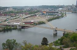 |
1930, 1932 | Pittsburgh 40°26′41"N 80°1′41"W |
Allegheny Allegheny County, Pennsylvania Allegheny County is a county in the southwestern part of the U.S. state of Pennsylvania. As of the 2010 census, the population was 1,223,348; making it the second most populous county in Pennsylvania, following Philadelphia County. The county seat is Pittsburgh... |
Tied arch | |
| West Hickory Bridge | 1896 | West Hickory 41°34′11"N 79°24′21"W |
Forest Forest County, Pennsylvania Forest County is a county located in the U.S. state of Pennsylvania. As of 2010, the population is 7,716. Forest County is famous as a rural retreat. Nearly 75% of all dwellings in the county are second or vacation homes . Forest County does not have a single traffic light, the only county in the... |
Pratt truss | ||
| George Westinghouse Memorial Bridge | 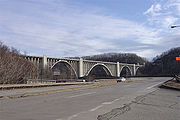 |
1930, 1932 | East Pittsburgh East Pittsburgh, Pennsylvania East Pittsburgh is a borough in Allegheny County, Pennsylvania, about southeast of the confluence of the Monongahela and the Allegheny rivers at Pittsburgh. The population in 1900 stood at 2,883, and in 1910, at 5,615. As of the 2010 census, the borough population was 1,822, having fallen from... 40°23′38"N 79°50′16"W |
Allegheny Allegheny County, Pennsylvania Allegheny County is a county in the southwestern part of the U.S. state of Pennsylvania. As of the 2010 census, the population was 1,223,348; making it the second most populous county in Pennsylvania, following Philadelphia County. The county seat is Pittsburgh... |
Parabolic arch | |
| Wissahickon Memorial Bridge Wissahickon Memorial Bridge The Wissahickon Memorial Bridge, originally called and still also known as the Henry Avenue Bridge, is a stone and concrete bridge that carries Henry Avenue over Wissahickon Creek and Lincoln Drive in Fairmount Park in Philadelphia, Pennsylvania.... |
1931 | Philadelphia 40°1′27"N 75°11′46"W |
Philadelphia Philadelphia County, Pennsylvania -History:Tribes of Lenape were the first known occupants in the area which became Philadelphia County. The first European settlers were Swedes and Finns who arrived in 1638. The Netherlands seized the area in 1655, but permanently lost control to England in 1674... |
Open-spandrel concrete arch | ||
| Witherup Bridge | 1906 | Kennerdell 41°15′18"N 79°50′27"W |
Venango Venango County, Pennsylvania Venango County is a county located in the U.S. state of Pennsylvania. As of the 2010 census, the population was 54,984. Its county seat is Franklin.-History:Venango County was created on March 12, 1800 from parts of Allegheny and Lycoming Counties... |
Pratt pony truss | ||
| Yeakle's Mill Bridge | 1888 | Yeakle Mill 39°44′6"N 78°2′15"W |
Franklin Franklin County, Pennsylvania As of the census of 2000, there were 129,313 people, 50,633 households, and 36,405 families residing in the county. The population density was 168 people per square mile . There were 53,803 housing units at an average density of 70 per square mile... |
Pratt pony truss | ||
Former listings
| Name | Image | Built | Listed | Location | County | Type |
|---|---|---|---|---|---|---|
| Bridge in Lynn Township | 1880 | Removed | Steinsville | Lehigh Lehigh County, Pennsylvania -Climate:Most of the county's climate is considered to fall in the humid continental climate zone. Summers are typically hot and muggy, fall and spring are generally mild, and winter is cold. Precipitation is almost uniformly distributed throughout the year.... |
Bowstring arch | |
| Bridge in New Garden Township | 1871 | Removed |
Landenberg Landenberg, Pennsylvania Landenberg is an unincorporated community in southern Chester County, Pennsylvania, United States. It is, essentially, a post office address that covers parts of New Garden, London Britain and Franklin Townships. The White Clay Creek bisects Landenberg. Landenberg falls into two school districts:... 39°46′39"N 75°46′19"W |
Chester Chester County, Pennsylvania -State parks:*French Creek State Park*Marsh Creek State Park*White Clay Creek Preserve-Demographics:As of the 2010 census, the county was 85.5% White, 6.1% Black or African American, 0.2% Native American or Alaskan Native, 3.9% Asian, 0.0% Native Hawaiian, 1.8% were two or more races, and 2.4% were... |
Pratt pony truss | |
| Bridge in Plunkett's Creek Township Plunketts Creek Bridge No. 3 Plunketts Creek Bridge No. 3 was a rubble masonry stone arch bridge over Plunketts Creek in Plunketts Creek Township, Lycoming County in the U.S. state of Pennsylvania. It was built between 1840 and 1875, probably closer to 1840, when the road along the creek between the unincorporated villages of... |
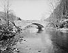 |
1932 | Removed | Proctor | Lycoming Lycoming County, Pennsylvania -Appalachian Mountains and Allegheny Plateau:Lycoming County is divided between the Appalachian Mountains in the south, the dissected Allegheny Plateau in the north and east, and the valley of the West Branch Susquehanna River between these.-West Branch Susquehanna River:The West Branch of the... |
Single-span stone arch |
| Bridge in Ridley Park Borough | Removed | Ridley Park Ridley Park, Pennsylvania Ridley Park is a borough in Delaware County, Pennsylvania, United States. The population was 7,196 at the 2000 census. Ridley Park is the home of Boeing Helicopters.-Native American:... |
Delaware Delaware County, Pennsylvania Delaware County is a county located in the U.S. state of Pennsylvania. As of 2010, the population was 558,979, making it Pennsylvania's fifth most populous county, behind Philadelphia, Allegheny, Montgomery, and Bucks counties.... |
Single-span stone arch | ||
| Bridge in Tredyffrin Township | Removed |
Port Kennedy Port Kennedy, Pennsylvania Port Kennedy was an industrial village located where U.S. Route 422 now crosses the Schuylkill River in Montgomery County, Pennsylvania, United States of America... 40°5′31"N 75°25′20"W |
Chester Chester County, Pennsylvania -State parks:*French Creek State Park*Marsh Creek State Park*White Clay Creek Preserve-Demographics:As of the 2010 census, the county was 85.5% White, 6.1% Black or African American, 0.2% Native American or Alaskan Native, 3.9% Asian, 0.0% Native Hawaiian, 1.8% were two or more races, and 2.4% were... |
Single-span arch Arch bridge An arch bridge is a bridge with abutments at each end shaped as a curved arch. Arch bridges work by transferring the weight of the bridge and its loads partially into a horizontal thrust restrained by the abutments at either side... |
||
| Kinzua Viaduct Kinzua Bridge The Kinzua Bridge or the Kinzua Viaduct was a railroad trestle that spanned Kinzua Creek in McKean County in the U.S. state of Pennsylvania... |
1882, 1900 | Removed |
Mount Jewett Mount Jewett, Pennsylvania Mount Jewett is a borough in McKean County, Pennsylvania, United States. The population was 1,070 at the 2000 census. The students of the borough attend school in the Kane Area School District, even though the borough is surrounded by Hamlin Township--belonging to neighboring Smethport Area School... |
McKean McKean County, Pennsylvania As of the census of 2000, there were 45,936 people, 18,024 households, and 12,094 families residing in the county. The population density was 47 people per square mile . There were 21,644 housing units at an average density of 22 per square mile... |
Howe truss | |
| Mortonville Bridge | 1826 | Removed |
Coatesville Coatesville, Pennsylvania Coatesville is the only city in Chester County, Pennsylvania, United States. The population was 13,100 at the 2010 census. Coatesville is approximately 39 miles west of Philadelphia.... 39°56′47"N 75°46′47"W |
Chester Chester County, Pennsylvania -State parks:*French Creek State Park*Marsh Creek State Park*White Clay Creek Preserve-Demographics:As of the 2010 census, the county was 85.5% White, 6.1% Black or African American, 0.2% Native American or Alaskan Native, 3.9% Asian, 0.0% Native Hawaiian, 1.8% were two or more races, and 2.4% were... |
Stone arch | |
| Stone Arch Bridge, Starrucca Creek | Removed | Starrucca Starrucca, Pennsylvania Starrucca is a borough in Wayne County, Pennsylvania, United States. The population was 173 at the 2010 census.-Geography:Starrucca is located at .... |
Wayne Wayne County, Pennsylvania As of the census of 2000, there were 47,722 people, 18,350 households, and 12,936 families residing in the county. The population density was 65 people per square mile . There were 30,593 housing units at an average density of 42 per square mile... |
Elliptical stone arch |