
Brownsville, Pennsylvania
Encyclopedia
Brownsville is a borough
in Fayette County
, Pennsylvania
, United States
, officially founded in 1785 located 35 miles (56 km) south of Pittsburgh along the Monongahela River
. The borough was an industrial center, transportation hub, outfitting center, and river boat building powerhouse acting as a gateway city for emigrants heading west to the Ohio Country
, Northwest Territory
and beyond on the various Emigrant Trail
s to the far west
from its founding until well into the 1850s. Founded about the same time, industrious bustling Brownsville early on easily eclipsed both by size and dynamism the nearby city of Pittsburgh until well into the 1850s when the Railways through to Kanesville, Iowa in the Midwest left Pittsburgh with the better transportation system, and made Kanesville the newest and best gateway city to the far west
. Brownsville's Flat Boats couldn't cross Nebraska, Wyoming and the Continental divide either, but by 1869 the trains could.
Even while emigrant outfitting began to decline steadily from 1853's completion of the Baltimore and Ohio Railroad
to the Ohio, the nascent steel industry was building and adding capacity, giving the borough a new growth spurt as a Railroad Yard and Coking center. It gradually lost its diverse mix of businesses and became more fragile as a result, but in general prospered. Like the rest of the country, Brownsville tightened its belt during the slim years of the Great Depression
, but managed well enough, and then resurge again as steel demand picked up and World War II drove the world economy.
In 1940, 8,015 people lived in Brownsville, and it experienced a postwar growth spurt which allowed it to develop cross-county-line suburbs like Malden, Low Hill, and Denbo Heights which were mainly bedroom communities within commuting distance, but a bit flatter too being farther out of the foothills. After the boom-bust-boom of the fifties and sixties, the borough went into a third and more severe decline again in the mid-1970s along with much of the Rust Belt
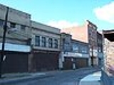
so that population was just 2,804 at the 2000 census. Now in the 2011 Brownsville still has a handful of buildings condemened or just boarded up. Some abandoned buildings are the Union Station, some banks, and other random buisnesses. The sidewalks around the town are still intact and usable. Slowly, Brownsville is fixing itself up.
at the westernmost point of Fayette County. Erosion undercutting action by the river on the surrounding characteristically steep-sided sandstone hills has created several shelf-like benches and connecting sloped terrain and thereby given the borough lowland areas adjacent to or otherwise accessible to the river shores. Much of the borough's residential buildings are built above the elevation of the business district arrayed upslope to either side along the connecting slopes and shelves cut by the geological action of long ago when the river bed moved gradually westward leaving the lowered shelves and slopes behind.
Concurrently, the opposite river shore of Washington County
is, uncharacteristically for the region, shaped even lower to the water surface and is generally flatter and more plain-like than the more diverse geology of the borough's lands. That shore holds a tightly bound mirror community of about a fifth the size, a small hamlet called West Brownsville, Pennsylvania
. Historically the low height of the concave shore of the river have made the river banks at the locii of two communities attractive as a natural river crossing
, ferry, bridge, and boat building site. When the nascent United States government first appropriated funds for its first ever road building project, Brownsville, was an early intermediate target destination along the new National Road
when construction began in 1811. Until a bridge was built, it was the western terminus.
According to the United States Census Bureau
, the borough has a total area of 1.1 square miles (2.8 km²), of which, 1 square miles (2.6 km²) of it is land and 0.1 square mile (0.258998811 km²) of it (9.91%) is water. Lester Ward was elected Mayor in 2009.
is the name of a minor local tributary stream of the Monongahela River
in the area, and was said to have taken its color from the ferrous sandstone that lined its bed, as well as that of the sandstone heights near the Old Forts of an indigenous Amerindian culture. The valley of Redstone Creek is U-shaped characteristic of a glaciated valley, generally broadening it, and allowing a wide shallow brook class stream to lazily wander into the Monongahela. The Creek was wide enough to build, dock and outfit numerous flat boats, Keel boats, and other river craft and the boat building business was such that it would build the first steamboats on the inland rivers, and many hundreds afterwards, as well as the thousands of pole boats that moved the emigrants that settled the vast Northwest Territory.
"Old Forts" were colonial era names given to mounds and earthworks created by the early (possibly ca. 3000 BC) Native American Mound Builders Culture by early explorers and pioneers in those early days of the scientific revolution antedating the anthropologists, sociologists, and archeologists professions.
Geographically, in the 1750s the area thus known as "Redstone Old Forts" was strategically situated at the end of a natural navigable path down the extensive 41 miles (66 km) heavily forested western slopes of the Western Allegheny ridgeline and its western foothills (given distance by modern roads, as approximated from the vicinity not far west of the summit near Fort Necessity)which George Washington
had been using as a staging area while conducting road improvements to establish a fort at Brownsville/Redstone Old Forts. Geographically, the site has another virtue important in undeveloped timesthe northwards traveling Monongahela river
makes a broad sweep curving east to west in which the river undercuts and knocks down the high bluffs characteristically lining and surrounding the riverbed; at Brownsville, this created a terrain shelf down near the water, allowing settlers or military units to reach the water as well as a broad slow moving shallows along the curve which was shallow enough to pole across using a poleboat or scratch-built timber raft
.
and later in the 1760s70s eventually became known as Redstone Fort or by the mid-1760s, Fort Burd named eponymously after the officer commanding the forts establishment in 1759.
The fort was constructed on the bluff above the river on what may have been a fortification or burial ground of native peoples
during the French and Indian War
, and which stockade was later occupied and garrisoned by a force from the Colony of Virginia during the 1774 Indian war against the Mingo
and Shawnee
peoples known as Lord Dunmore's War, as it was situated commanding the important strategic River ford of Nemacolin's Trail, the western part to the summitwhich when improved, later became known as 'Burd's Road'an alternative route down to the Monongehela River valley from Braddock's Road, which George Washington helped to build. Washington also came to own vast portions of the lands on the opposite bankin honor of which, Pennsylvania named Washington County
, the largest of the state.
A forward thinking entrepreneur named Thomas Brown
acquired the lands in what became Fayette County around the end of the American Revolution.
>
He realized the Opening of the Cumberland Gap and wars end made the land at the western tip of Fayette County a natural springboard to settle points west such as Ohio, Tennessee, and the in-fashion destination of the day, Kentucky
all reachable via the Ohio River
and its tributary the Monongahela. The sparse primitive settlement at the time around the fort was mostly called Redstone, but eventually became known as Brownsville, as the land became owned by Thomas Brown by the 1780s when Jacob Bowman bought the land on which Nemacolin Castle was constructed, beginning his trading post and a business expansion of settler services providers as foreseen by Thomas Brown. Since Redstone had been a frequent point of embarkation for travelers who were heading west via the Monongahela and Ohio River
s it became a natural center for the construction of many keel-boatseven those heading for the far west via the Santa Fe Trail
or Oregon Trail
as floating on a poleboat even against hundreds of miles of river current was usually safer, easier and far faster than overland travel. The major attraction of these early settlers to Brownsville was twofold. One, Brownsville was positioned at the western end of the primitive road network (Braddock's Road to Burd's Road via the Cumberland pass) that eventually became known as the National Pike, U.S. Route 40
. The other was the Redstone Creek and terraced banks gave easy access to the wide and deep Monongahela River where a vast flatboat building industry that later evolved into the largest steamboat industry developed during the 19th centurywas already well established. This access to the river provide a "jumping off" point for settlers headed into the western frontier. The Monongahela converges with the Ohio River at Pittsburgh and allowed for quick traveling to the western frontier.
Redstone Old Fort
is mentioned in C. M. Ewing's The Causes of that so called Whiskey Insurrection of 1794 (1930) as being the site of a July 27, 1791, meeting in "Opposition to the Whiskey Excise Tax," during the Whiskey Rebellion
, the first illegal meeting of that insurrection.http://www.whiskeyrebellion.org/timeline.htm
The first all cast iron
arch bridge constructed in the United States was built in Brownsville to carry the National Pike (at the time a wagon road) across Dunlap's Creek. See Dunlap's Creek Bridge
. The bridge is still in use in .
Brownsville has a more recent claim to fame: according to Mike Evans in "Ray Charles
: The Birth of Soul", the hit song What'd I Say
was first concocted as part of an after-show jam in the borough in December 1958.
of 2000, there were 2,804 people, 1,238 households, and 716 families residing in the borough. The population density
was 2,796.6 people per square mile (1,082.6/km²). There were 1,550 housing units at an average density of 1,545.9 per square mile (598.5/km²). The racial makeup of the borough was 85.95% White, 11.41% African American, 0.11% Native American, 0.07% Asian, 0.21% from other races
, and 2.25% from two or more races. Hispanic or Latino of any race were 0.82% of the population.
There were 1,238 households out of which 24.7% had children under the age of 18 living with them, 36.2% were married couples
living together, 17.0% had a female householder with no husband present, and 42.1% were non-families. 38.0% of all households were made up of individuals and 20.5% had someone living alone who was 65 years of age or older. The average household size was 2.24 and the average family size was 2.97.
In the borough the population was spread out with 23.2% under the age of 18, 9.0% from 18 to 24, 25.6% from 25 to 44, 21.1% from 45 to 64, and 21.1% who were 65 years of age or older. The median age was 40 years. For every 100 females there were 83.1 males. For every 100 females age 18 and over, there were 77.7 males.
The median income for a household in the borough was $18,559, and the median income for a family was $32,662. Males had a median income of $31,591 versus $21,830 for females. The per capita income
for the borough was $13,404. About 28.8% of families and 34.3% of the population were below the poverty line, including 51.2% of those under age 18 and 17.9% of those age 65 or over.
(1839), carrying old U.S. Route 40
over Dunlap's Creek in Brownsville, is the nation's oldest cast iron
bridge in existence. (Capt. Richard Delafield
, engineer; John Snowden and John Herbertson, foundrymen) Historic American Engineering Record (HAER) http://www.ce.ufl.edu/~historic/75remain/75list.html. The bridge has an HAER engineering significance like that of the Eiffel Tower
, Statue of Liberty
and Hoover Dam
.
The Flatiron Building
(c. 1830), constructed as a business building in thriving 19th-century Brownsville, is one of the oldest, most intact iron commercial structures west of the Allegheny Mountains
. Over its history, it has housed private commercial entities as well as public, such as a post office. It is the unofficial "prototype" for the flatiron buildings seen across the United States. The most notable is the Fuller Building
in Market Square in New York City.
After nearly being demolished, the building was saved by the Brownsville Area Revitalization Corporation (BARC). Throughout two decades, via private and public grants, BARC has restored the Flatiron Building as an historic asset to Brownsville. The Flatiron Building Heritage Center, located within the building at 69 Market Street, holds artifacts from Brownsville's heyday, as well as displays about the community's important coal
and coke
heritage. The Frank L. Melega Art Museum, located with the Heritage Center, displays many examples of this local southwestern Pennsylvanian's famous artwork, depicting the coal and coke era in the surrounding tri-state region.
Brownsville is the location of other properties on the National Register of Historic Places
, such as Bowman's castle
(Nemacolin Castle), the Philander Knox House, and the Brashear House
.
serves Brownsville as well as several nearby communities. Schools within the district are:
Borough (Pennsylvania)
In the U.S. Commonwealth of Pennsylvania, a borough is a self-governing municipal entity that is usually smaller than a city. There are 958 boroughs in Pennsylvania. All municipalities in Pennsylvania are classified as either cities, boroughs, or townships...
in Fayette County
Fayette County, Pennsylvania
Fayette County is a county located in the U.S. state of Pennsylvania. As of the2010 census, the population was 136,606. The county is part of the Pittsburgh Metropolitan Statistical Area....
, Pennsylvania
Pennsylvania
The Commonwealth of Pennsylvania is a U.S. state that is located in the Northeastern and Mid-Atlantic regions of the United States. The state borders Delaware and Maryland to the south, West Virginia to the southwest, Ohio to the west, New York and Ontario, Canada, to the north, and New Jersey to...
, United States
United States
The United States of America is a federal constitutional republic comprising fifty states and a federal district...
, officially founded in 1785 located 35 miles (56 km) south of Pittsburgh along the Monongahela River
Monongahela River
The Monongahela River is a river on the Allegheny Plateau in north-central West Virginia and southwestern Pennsylvania in the United States...
. The borough was an industrial center, transportation hub, outfitting center, and river boat building powerhouse acting as a gateway city for emigrants heading west to the Ohio Country
Ohio Country
The Ohio Country was the name used in the 18th century for the regions of North America west of the Appalachian Mountains and in the region of the upper Ohio River south of Lake Erie...
, Northwest Territory
Northwest Territory
The Territory Northwest of the River Ohio, more commonly known as the Northwest Territory, was an organized incorporated territory of the United States that existed from July 13, 1787, until March 1, 1803, when the southeastern portion of the territory was admitted to the Union as the state of Ohio...
and beyond on the various Emigrant Trail
Emigrant Trail
The Emigrant Trails were the northern networks of overland wagon trails throughout the American West, used by emigrants from the eastern United States to settle lands west of the Interior Plains during the overland migrations of the mid-19th century...
s to the far west
Far West
Far West most frequently refers to the American Old West.Far West may also refer to:* "Far West", a common colloquial term for a distinct area of the far Western United States* Far West, Missouri...
from its founding until well into the 1850s. Founded about the same time, industrious bustling Brownsville early on easily eclipsed both by size and dynamism the nearby city of Pittsburgh until well into the 1850s when the Railways through to Kanesville, Iowa in the Midwest left Pittsburgh with the better transportation system, and made Kanesville the newest and best gateway city to the far west
Far West
Far West most frequently refers to the American Old West.Far West may also refer to:* "Far West", a common colloquial term for a distinct area of the far Western United States* Far West, Missouri...
. Brownsville's Flat Boats couldn't cross Nebraska, Wyoming and the Continental divide either, but by 1869 the trains could.
Even while emigrant outfitting began to decline steadily from 1853's completion of the Baltimore and Ohio Railroad
Baltimore and Ohio Railroad
The Baltimore and Ohio Railroad was one of the oldest railroads in the United States and the first common carrier railroad. It came into being mostly because the city of Baltimore wanted to compete with the newly constructed Erie Canal and another canal being proposed by Pennsylvania, which...
to the Ohio, the nascent steel industry was building and adding capacity, giving the borough a new growth spurt as a Railroad Yard and Coking center. It gradually lost its diverse mix of businesses and became more fragile as a result, but in general prospered. Like the rest of the country, Brownsville tightened its belt during the slim years of the Great Depression
Great Depression
The Great Depression was a severe worldwide economic depression in the decade preceding World War II. The timing of the Great Depression varied across nations, but in most countries it started in about 1929 and lasted until the late 1930s or early 1940s...
, but managed well enough, and then resurge again as steel demand picked up and World War II drove the world economy.
In 1940, 8,015 people lived in Brownsville, and it experienced a postwar growth spurt which allowed it to develop cross-county-line suburbs like Malden, Low Hill, and Denbo Heights which were mainly bedroom communities within commuting distance, but a bit flatter too being farther out of the foothills. After the boom-bust-boom of the fifties and sixties, the borough went into a third and more severe decline again in the mid-1970s along with much of the Rust Belt
Rust Belt
The Rust Belt is a term that gained currency in the 1980s as the informal description of an area straddling the Midwestern and Northeastern United States, in which local economies traditionally garnered an increased manufacturing sector to add jobs and corporate profits...
so that population was just 2,804 at the 2000 census. Now in the 2011 Brownsville still has a handful of buildings condemened or just boarded up. Some abandoned buildings are the Union Station, some banks, and other random buisnesses. The sidewalks around the town are still intact and usable. Slowly, Brownsville is fixing itself up.
Geography
Brownsville is located at 40°1′12"N 79°53′22"W (40.020026, -79.889536) situated on the east (convex) side of a broad sweeping westward bend in the northerly flowing Monongahela RiverMonongahela River
The Monongahela River is a river on the Allegheny Plateau in north-central West Virginia and southwestern Pennsylvania in the United States...
at the westernmost point of Fayette County. Erosion undercutting action by the river on the surrounding characteristically steep-sided sandstone hills has created several shelf-like benches and connecting sloped terrain and thereby given the borough lowland areas adjacent to or otherwise accessible to the river shores. Much of the borough's residential buildings are built above the elevation of the business district arrayed upslope to either side along the connecting slopes and shelves cut by the geological action of long ago when the river bed moved gradually westward leaving the lowered shelves and slopes behind.
Concurrently, the opposite river shore of Washington County
Washington County, Pennsylvania
-Government and politics:As of November 2008, there are 152,534 registered voters in Washington County .* Democratic: 89,027 * Republican: 49,025 * Other Parties: 14,482...
is, uncharacteristically for the region, shaped even lower to the water surface and is generally flatter and more plain-like than the more diverse geology of the borough's lands. That shore holds a tightly bound mirror community of about a fifth the size, a small hamlet called West Brownsville, Pennsylvania
West Brownsville, Pennsylvania
West Brownsville is a borough in Washington County, Pennsylvania, United States. The population was 1,075 at the 2000 census.-Geography:West Brownsville is located at ....
. Historically the low height of the concave shore of the river have made the river banks at the locii of two communities attractive as a natural river crossing
Crossing (river)
A river crossing is a means to get from one river bank to the other and may refer to:* A ford * A bridge* A tunnel* Any type of Ferry** A cable ferry** A reaction ferry** A water taxi-See also::Category:Crossings by river...
, ferry, bridge, and boat building site. When the nascent United States government first appropriated funds for its first ever road building project, Brownsville, was an early intermediate target destination along the new National Road
National Road
The National Road or Cumberland Road was the first major improved highway in the United States to be built by the federal government. Construction began heading west in 1811 at Cumberland, Maryland, on the Potomac River. It crossed the Allegheny Mountains and southwestern Pennsylvania, reaching...
when construction began in 1811. Until a bridge was built, it was the western terminus.
According to the United States Census Bureau
United States Census Bureau
The United States Census Bureau is the government agency that is responsible for the United States Census. It also gathers other national demographic and economic data...
, the borough has a total area of 1.1 square miles (2.8 km²), of which, 1 square miles (2.6 km²) of it is land and 0.1 square mile (0.258998811 km²) of it (9.91%) is water. Lester Ward was elected Mayor in 2009.
Geographic factors impacting history
Redstone CreekRedstone Creek
Redstone Creek is a historically important widemouthed canoe and river boat-navigable brook-sized tributary stream of the Monongahela River in Fayette County, Pennsylvania. The creek is long, running from headwaters on Chestnut Ridge north through the city of Uniontown and reaching the Monongahela...
is the name of a minor local tributary stream of the Monongahela River
Monongahela River
The Monongahela River is a river on the Allegheny Plateau in north-central West Virginia and southwestern Pennsylvania in the United States...
in the area, and was said to have taken its color from the ferrous sandstone that lined its bed, as well as that of the sandstone heights near the Old Forts of an indigenous Amerindian culture. The valley of Redstone Creek is U-shaped characteristic of a glaciated valley, generally broadening it, and allowing a wide shallow brook class stream to lazily wander into the Monongahela. The Creek was wide enough to build, dock and outfit numerous flat boats, Keel boats, and other river craft and the boat building business was such that it would build the first steamboats on the inland rivers, and many hundreds afterwards, as well as the thousands of pole boats that moved the emigrants that settled the vast Northwest Territory.
"Old Forts" were colonial era names given to mounds and earthworks created by the early (possibly ca. 3000 BC) Native American Mound Builders Culture by early explorers and pioneers in those early days of the scientific revolution antedating the anthropologists, sociologists, and archeologists professions.
Geographically, in the 1750s the area thus known as "Redstone Old Forts" was strategically situated at the end of a natural navigable path down the extensive 41 miles (66 km) heavily forested western slopes of the Western Allegheny ridgeline and its western foothills (given distance by modern roads, as approximated from the vicinity not far west of the summit near Fort Necessity)which George Washington
George Washington
George Washington was the dominant military and political leader of the new United States of America from 1775 to 1799. He led the American victory over Great Britain in the American Revolutionary War as commander-in-chief of the Continental Army from 1775 to 1783, and presided over the writing of...
had been using as a staging area while conducting road improvements to establish a fort at Brownsville/Redstone Old Forts. Geographically, the site has another virtue important in undeveloped timesthe northwards traveling Monongahela river
Monongahela River
The Monongahela River is a river on the Allegheny Plateau in north-central West Virginia and southwestern Pennsylvania in the United States...
makes a broad sweep curving east to west in which the river undercuts and knocks down the high bluffs characteristically lining and surrounding the riverbed; at Brownsville, this created a terrain shelf down near the water, allowing settlers or military units to reach the water as well as a broad slow moving shallows along the curve which was shallow enough to pole across using a poleboat or scratch-built timber raft
Raft
A raft is any flat structure for support or transportation over water. It is the most basic of boat design, characterized by the absence of a hull...
.
History
Because of the mysterious mounds believed to be a prehistoric fortification by colonial settlers, Brownsville began as Redstone Old FortRedstone Old Fort
Redstone Old Fort or Redstone Fort or Fort Burd on The Nemacolin Trail was the name of the French and Indian War era wooden fort built in 1759 by Pennsylvania Militia Colonel James Burd to guard the ancient Indian trail's river ford on a mound overlooking the eastern shore of the Monongahela River...
and later in the 1760s70s eventually became known as Redstone Fort or by the mid-1760s, Fort Burd named eponymously after the officer commanding the forts establishment in 1759.
The fort was constructed on the bluff above the river on what may have been a fortification or burial ground of native peoples
during the French and Indian War
French and Indian War
The French and Indian War is the common American name for the war between Great Britain and France in North America from 1754 to 1763. In 1756, the war erupted into the world-wide conflict known as the Seven Years' War and thus came to be regarded as the North American theater of that war...
, and which stockade was later occupied and garrisoned by a force from the Colony of Virginia during the 1774 Indian war against the Mingo
Mingo
The Mingo are an Iroquoian group of Native Americans made up of peoples who migrated west to the Ohio Country in the mid-eighteenth century. Anglo-Americans called these migrants mingos, a corruption of mingwe, an Eastern Algonquian name for Iroquoian-language groups in general. Mingos have also...
and Shawnee
Shawnee
The Shawnee, Shaawanwaki, Shaawanooki and Shaawanowi lenaweeki, are an Algonquian-speaking people native to North America. Historically they inhabited the areas of Ohio, Virginia, West Virginia, Western Maryland, Kentucky, Indiana, and Pennsylvania...
peoples known as Lord Dunmore's War, as it was situated commanding the important strategic River ford of Nemacolin's Trail, the western part to the summitwhich when improved, later became known as 'Burd's Road'an alternative route down to the Monongehela River valley from Braddock's Road, which George Washington helped to build. Washington also came to own vast portions of the lands on the opposite bankin honor of which, Pennsylvania named Washington County
Washington County, Pennsylvania
-Government and politics:As of November 2008, there are 152,534 registered voters in Washington County .* Democratic: 89,027 * Republican: 49,025 * Other Parties: 14,482...
, the largest of the state.
A forward thinking entrepreneur named Thomas Brown
Thomas Brown (businessman)
Thomas Brown, was the colonial era husbandman, businessman, and land speculator who along with his brother Basil acquired the bulk of the lands towards the end of the American Revolution from non-other than the somewhat infamous Thomas CresapColonel Cresap had worked with Delaware Chief Nemacolin...
acquired the lands in what became Fayette County around the end of the American Revolution.
>
He realized the Opening of the Cumberland Gap and wars end made the land at the western tip of Fayette County a natural springboard to settle points west such as Ohio, Tennessee, and the in-fashion destination of the day, Kentucky
Kentucky
The Commonwealth of Kentucky is a state located in the East Central United States of America. As classified by the United States Census Bureau, Kentucky is a Southern state, more specifically in the East South Central region. Kentucky is one of four U.S. states constituted as a commonwealth...
all reachable via the Ohio River
Ohio River
The Ohio River is the largest tributary, by volume, of the Mississippi River. At the confluence, the Ohio is even bigger than the Mississippi and, thus, is hydrologically the main stream of the whole river system, including the Allegheny River further upstream...
and its tributary the Monongahela. The sparse primitive settlement at the time around the fort was mostly called Redstone, but eventually became known as Brownsville, as the land became owned by Thomas Brown by the 1780s when Jacob Bowman bought the land on which Nemacolin Castle was constructed, beginning his trading post and a business expansion of settler services providers as foreseen by Thomas Brown. Since Redstone had been a frequent point of embarkation for travelers who were heading west via the Monongahela and Ohio River
Ohio River
The Ohio River is the largest tributary, by volume, of the Mississippi River. At the confluence, the Ohio is even bigger than the Mississippi and, thus, is hydrologically the main stream of the whole river system, including the Allegheny River further upstream...
s it became a natural center for the construction of many keel-boatseven those heading for the far west via the Santa Fe Trail
Santa Fe Trail
The Santa Fe Trail was a 19th-century transportation route through central North America that connected Missouri with Santa Fe, New Mexico. Pioneered in 1822 by William Becknell, it served as a vital commercial and military highway until the introduction of the railroad to Santa Fe in 1880...
or Oregon Trail
Oregon Trail
The Oregon Trail is a historic east-west wagon route that connected the Missouri River to valleys in Oregon and locations in between.After 1840 steam-powered riverboats and steamboats traversing up and down the Ohio, Mississippi and Missouri rivers sped settlement and development in the flat...
as floating on a poleboat even against hundreds of miles of river current was usually safer, easier and far faster than overland travel. The major attraction of these early settlers to Brownsville was twofold. One, Brownsville was positioned at the western end of the primitive road network (Braddock's Road to Burd's Road via the Cumberland pass) that eventually became known as the National Pike, U.S. Route 40
U.S. Route 40
U.S. Route 40 is an east–west United States highway. As with most routes whose numbers end in a zero, U.S. 40 once traversed the entire United States. It is one of the original 1920s U.S. Highways, and its first termini were San Francisco, California, and Atlantic City, New Jersey...
. The other was the Redstone Creek and terraced banks gave easy access to the wide and deep Monongahela River where a vast flatboat building industry that later evolved into the largest steamboat industry developed during the 19th centurywas already well established. This access to the river provide a "jumping off" point for settlers headed into the western frontier. The Monongahela converges with the Ohio River at Pittsburgh and allowed for quick traveling to the western frontier.
Redstone Old Fort
Redstone Old Fort
Redstone Old Fort or Redstone Fort or Fort Burd on The Nemacolin Trail was the name of the French and Indian War era wooden fort built in 1759 by Pennsylvania Militia Colonel James Burd to guard the ancient Indian trail's river ford on a mound overlooking the eastern shore of the Monongahela River...
is mentioned in C. M. Ewing's The Causes of that so called Whiskey Insurrection of 1794 (1930) as being the site of a July 27, 1791, meeting in "Opposition to the Whiskey Excise Tax," during the Whiskey Rebellion
Whiskey Rebellion
The Whiskey Rebellion, or Whiskey Insurrection, was a tax protest in the United States in the 1790s, during the presidency of George Washington. Farmers who sold their corn in the form of whiskey had to pay a new tax which they strongly resented...
, the first illegal meeting of that insurrection.http://www.whiskeyrebellion.org/timeline.htm
The first all cast iron
Cast iron
Cast iron is derived from pig iron, and while it usually refers to gray iron, it also identifies a large group of ferrous alloys which solidify with a eutectic. The color of a fractured surface can be used to identify an alloy. White cast iron is named after its white surface when fractured, due...
arch bridge constructed in the United States was built in Brownsville to carry the National Pike (at the time a wagon road) across Dunlap's Creek. See Dunlap's Creek Bridge
Dunlap's Creek Bridge
Dunlap's Creek Bridge was the first cast iron, metal arch bridge in the United States. It was designed by Richard Delafield and built by the United States Army Corps of Engineers. Constructed from 1836 to 1839 on the National Road in Brownsville, Pennsylvania, it remains in use today...
. The bridge is still in use in .
Brownsville has a more recent claim to fame: according to Mike Evans in "Ray Charles
Ray Charles
Ray Charles Robinson , known by his shortened stage name Ray Charles, was an American musician. He was a pioneer in the genre of soul music during the 1950s by fusing rhythm and blues, gospel, and blues styles into his early recordings with Atlantic Records...
: The Birth of Soul", the hit song What'd I Say
What'd I Say
According to Charles' autobiography, "What'd I Say" was accidental when he improvised it to fill time at the end of a concert in December 1958. He asserts that he never tested songs on audiences before recording them, but "What'd I Say" is an exception...
was first concocted as part of an after-show jam in the borough in December 1958.
Demographics
As of the censusCensus
A census is the procedure of systematically acquiring and recording information about the members of a given population. It is a regularly occurring and official count of a particular population. The term is used mostly in connection with national population and housing censuses; other common...
of 2000, there were 2,804 people, 1,238 households, and 716 families residing in the borough. The population density
Population density
Population density is a measurement of population per unit area or unit volume. It is frequently applied to living organisms, and particularly to humans...
was 2,796.6 people per square mile (1,082.6/km²). There were 1,550 housing units at an average density of 1,545.9 per square mile (598.5/km²). The racial makeup of the borough was 85.95% White, 11.41% African American, 0.11% Native American, 0.07% Asian, 0.21% from other races
Race (United States Census)
Race and ethnicity in the United States Census, as defined by the Federal Office of Management and Budget and the United States Census Bureau, are self-identification data items in which residents choose the race or races with which they most closely identify, and indicate whether or not they are...
, and 2.25% from two or more races. Hispanic or Latino of any race were 0.82% of the population.
There were 1,238 households out of which 24.7% had children under the age of 18 living with them, 36.2% were married couples
Marriage
Marriage is a social union or legal contract between people that creates kinship. It is an institution in which interpersonal relationships, usually intimate and sexual, are acknowledged in a variety of ways, depending on the culture or subculture in which it is found...
living together, 17.0% had a female householder with no husband present, and 42.1% were non-families. 38.0% of all households were made up of individuals and 20.5% had someone living alone who was 65 years of age or older. The average household size was 2.24 and the average family size was 2.97.
In the borough the population was spread out with 23.2% under the age of 18, 9.0% from 18 to 24, 25.6% from 25 to 44, 21.1% from 45 to 64, and 21.1% who were 65 years of age or older. The median age was 40 years. For every 100 females there were 83.1 males. For every 100 females age 18 and over, there were 77.7 males.
The median income for a household in the borough was $18,559, and the median income for a family was $32,662. Males had a median income of $31,591 versus $21,830 for females. The per capita income
Per capita income
Per capita income or income per person is a measure of mean income within an economic aggregate, such as a country or city. It is calculated by taking a measure of all sources of income in the aggregate and dividing it by the total population...
for the borough was $13,404. About 28.8% of families and 34.3% of the population were below the poverty line, including 51.2% of those under age 18 and 17.9% of those age 65 or over.
Features
Dunlap's Creek BridgeDunlap's Creek Bridge
Dunlap's Creek Bridge was the first cast iron, metal arch bridge in the United States. It was designed by Richard Delafield and built by the United States Army Corps of Engineers. Constructed from 1836 to 1839 on the National Road in Brownsville, Pennsylvania, it remains in use today...
(1839), carrying old U.S. Route 40
U.S. Route 40
U.S. Route 40 is an east–west United States highway. As with most routes whose numbers end in a zero, U.S. 40 once traversed the entire United States. It is one of the original 1920s U.S. Highways, and its first termini were San Francisco, California, and Atlantic City, New Jersey...
over Dunlap's Creek in Brownsville, is the nation's oldest cast iron
Cast iron
Cast iron is derived from pig iron, and while it usually refers to gray iron, it also identifies a large group of ferrous alloys which solidify with a eutectic. The color of a fractured surface can be used to identify an alloy. White cast iron is named after its white surface when fractured, due...
bridge in existence. (Capt. Richard Delafield
Richard Delafield
Richard Delafield served as superintendent of the United States Military Academy, was Chief of Engineers, and was a major general in the Union Army during the American Civil War.-Biography:...
, engineer; John Snowden and John Herbertson, foundrymen) Historic American Engineering Record (HAER) http://www.ce.ufl.edu/~historic/75remain/75list.html. The bridge has an HAER engineering significance like that of the Eiffel Tower
Eiffel Tower
The Eiffel Tower is a puddle iron lattice tower located on the Champ de Mars in Paris. Built in 1889, it has become both a global icon of France and one of the most recognizable structures in the world...
, Statue of Liberty
Statue of Liberty
The Statue of Liberty is a colossal neoclassical sculpture on Liberty Island in New York Harbor, designed by Frédéric Bartholdi and dedicated on October 28, 1886...
and Hoover Dam
Hoover Dam
Hoover Dam, once known as Boulder Dam, is a concrete arch-gravity dam in the Black Canyon of the Colorado River, on the border between the US states of Arizona and Nevada. It was constructed between 1931 and 1936 during the Great Depression and was dedicated on September 30, 1935, by President...
.
The Flatiron Building
Flatiron Building (Brownsville, Pennsylvania)
The Melega Art Museum is in Brownsville, PA, with the website athttp://melegaartmuseum.org/Frank_L_Melega_Art_Museum/Home.htmland the physical location in the original Flatiron Building [many other Flatiron Buildings have copied the original artistic building style...
(c. 1830), constructed as a business building in thriving 19th-century Brownsville, is one of the oldest, most intact iron commercial structures west of the Allegheny Mountains
Allegheny Mountains
The Allegheny Mountain Range , also spelled Alleghany, Allegany and, informally, the Alleghenies, is part of the vast Appalachian Mountain Range of the eastern United States and Canada...
. Over its history, it has housed private commercial entities as well as public, such as a post office. It is the unofficial "prototype" for the flatiron buildings seen across the United States. The most notable is the Fuller Building
Fuller Building
The Fuller Building is a tower block in Manhattan on the northeast corner at 41-45 East 57th Street and Madison Avenue.-Construction:The Fuller was built for the Fuller Construction Company in 1929 after they moved from the Flatiron Building...
in Market Square in New York City.
After nearly being demolished, the building was saved by the Brownsville Area Revitalization Corporation (BARC). Throughout two decades, via private and public grants, BARC has restored the Flatiron Building as an historic asset to Brownsville. The Flatiron Building Heritage Center, located within the building at 69 Market Street, holds artifacts from Brownsville's heyday, as well as displays about the community's important coal
Coal
Coal is a combustible black or brownish-black sedimentary rock usually occurring in rock strata in layers or veins called coal beds or coal seams. The harder forms, such as anthracite coal, can be regarded as metamorphic rock because of later exposure to elevated temperature and pressure...
and coke
Coke (fuel)
Coke is the solid carbonaceous material derived from destructive distillation of low-ash, low-sulfur bituminous coal. Cokes from coal are grey, hard, and porous. While coke can be formed naturally, the commonly used form is man-made.- History :...
heritage. The Frank L. Melega Art Museum, located with the Heritage Center, displays many examples of this local southwestern Pennsylvanian's famous artwork, depicting the coal and coke era in the surrounding tri-state region.
Brownsville is the location of other properties on the National Register of Historic Places
National Register of Historic Places
The National Register of Historic Places is the United States government's official list of districts, sites, buildings, structures, and objects deemed worthy of preservation...
, such as Bowman's castle
Bowman's Castle
Bowman's Castle, also known as Nemacolin Castle, was built in present-day Brownsville, Pennsylvania, at the western terminus of the Nemacolin's Trail on the east bank of the Monongahela river. It replaced a wooden trading post built near the site of Fort Burd, the latter built by British colonists...
(Nemacolin Castle), the Philander Knox House, and the Brashear House
John Brashear
Dr. John Alfred Brashear was an American astronomer and instrument builder.- Life and work :Brashear was born in Brownsville, Pennsylvania, a town 35 miles south of Pittsburgh along the Monongahela River. His father, Basil Brown Brashear, was a saddler, and his mother, Julia Smith Brashear, was a...
.
Education
The Brownsville Area School DistrictBrownsville Area School District
The Brownsville Area School District spans portions of two counties. In Fayette County, Pennsylvania it covers the Borough of Brownsville and Brownsville Township, Luzerne Township and Redstone Township in Fayette County. In Washington County, Pennsylvania it covers the Borough of West...
serves Brownsville as well as several nearby communities. Schools within the district are:
- Brownsville Area High School (9–12)
- Brownsville Area Middle School (6–8)
- Cardale Elementary School (K–5)
- Central Elementary School (K–5)
- Cox-Donahey Elementary School (K–5)
Notable people
- Thomas BrownThomas Brown (businessman)Thomas Brown, was the colonial era husbandman, businessman, and land speculator who along with his brother Basil acquired the bulk of the lands towards the end of the American Revolution from non-other than the somewhat infamous Thomas CresapColonel Cresap had worked with Delaware Chief Nemacolin...
(1738–1797) - Founder and entrepreneur - John BrashearJohn BrashearDr. John Alfred Brashear was an American astronomer and instrument builder.- Life and work :Brashear was born in Brownsville, Pennsylvania, a town 35 miles south of Pittsburgh along the Monongahela River. His father, Basil Brown Brashear, was a saddler, and his mother, Julia Smith Brashear, was a...
(1840–1920) - astronomer and builder of scientific instruments. - George MarcusGeorge MarcusGeorge Marcus is an American anthropologist, founder of the journal and editor of the series.-Biography:Marcus served as the Joseph D. Jamail Professor at Rice University, where he chaired the anthropology department for 25 years...
(born 1946) - anthropologist - Vincent Colaiuta (born 1956 in Brownsville, but lived in Republic) - world-renowned jazz-rock-pop drummer.
- Richard Gary Colbert (February 12, 1915 – December 2, 1973) - four-star admiral in the United States Navy and former President of the Naval War College.
- Doug DascenzoDoug DascenzoDouglas Craig Dascenzo is a former Major League Baseball outfielder. He is an alumnus of Oklahoma State University and a graduate of Brownsville Area High School in Brownsville, Pennsylvania....
(born 1964) - former MLB outfielder with the Chicago CubsChicago CubsThe Chicago Cubs are a professional baseball team located in Chicago, Illinois. They are members of the Central Division of Major League Baseball's National League. They are one of two Major League clubs based in Chicago . The Cubs are also one of the two remaining charter members of the National...
, Texas RangersTexas Rangers (baseball)The Texas Rangers are a professional baseball team in the Dallas-Fort Worth Metroplex, based in Arlington, Texas. The Rangers are a member of the Western Division of Major League Baseball's American League, and are the reigning A.L. Western Division and A.L. Champions. Since , the Rangers have...
and San Diego PadresSan Diego PadresThe San Diego Padres are a Major League Baseball team based in San Diego, California. They play in the National League Western Division. Founded in 1969, the Padres have won the National League Pennant twice, in 1984 and 1998, losing in the World Series both times...
. - Bill EadieBill EadieBill Eadie is a professional wrestler who has competed under the names of Ax as part of Demolition and The Masked Superstar...
(born 1947) - three-time WWF tag team champion Ax of DemolitionDemolition (professional wrestling)Demolition is a professional wrestling tag team most prominent during the late 1980s / early 1990s in the World Wrestling Federation made up of Ax , Smash , and later Crush . In WWF, Demolition were three-time Tag Team Champions, and hold the records for both the single longest tag title reign...
. - Daniel FrenchDaniel French (inventor)Daniel French , a "Yankee" inventor, was born in Berlin, Connecticut. From an early age French strove to become a "mechanician," an artisan trained in the theory of mechanics and skilled in the working of metals at increasing levels of precision...
(1770–1853) - pioneering designer and builder of steam engines. - Alfred HuntAlfred Hunt (steel magnate)Alfred Hunt was the first president of Bethlehem Iron Company, precursor of Bethlehem Steel Corporation. He was elected president on July 15, 1860 by the board of directors of the fledgling Bethlehem Iron Company...
(1817–1888) - first president of Bethlehem Iron Company, precursor of Bethlehem Steel Corporation. - Esther HuntEsther HuntEsther Hunt was a pioneer who lived on America's frontier as a wife, a mother and a leader in her Quaker faith.-Early life at Moorestown:...
(1751–1820) - a pioneer who lived on America's frontier as a wife, a mother and a leader in her Quaker faith. - Henry Miller ShreveHenry Miller ShreveHenry Miller Shreve was the American inventor and steamboat captain who opened the Mississippi, Ohio and Red rivers to steamboat navigation. Shreveport, Louisiana, is named in his honor....
(1785–1851) - pioneering steamboat captain, and steamboat designer. - Jacob B. SweitzerJacob B. SweitzerJacob Bowman Sweitzer was a Pennsylvania lawyer and soldier who commanded a regiment and then a brigade in the Army of the Potomac in the American Civil War...
(1821–1881) - Civil War Union Army brigade commander. - Amos TownsendAmos TownsendAmos Townsend was a U.S. Representative from Ohio.Born in Brownsville, Pennsylvania, Townsend attended the common schools of Pittsburgh, Pennsylvania, and clerked in a store in Pittsburgh. He moved to Mansfield, Ohio, in 1839 and engaged in mercantile pursuits. He served as United States marshal...
(1821–1895) - U.S. Representative from Ohio.
Further reading
- Brownsville Historical Society (1883). The three towns: a sketch of Brownsville, Bridgeport, and West Brownsville. Brownsville, Pennsylvania: Tru Copy Printing. (1976, second edition; 1993, third edition)
- Ellis, Franklin (1882). History of Fayette County, Pennsylvania, with biographical sketches of many of its pioneers and prominent men. Philadelphia: L. H. Everts and Company.
External links
- Borough website
- One Year in Brownsville - WQEDWQED (TV)WQED is a Public Broadcasting Service member Public television station based in Pittsburgh, Pennsylvania. Established April 1, 1954, it was the first community-sponsored television station in the United States as well as the fifth public TV station...
special