

List of Colorado rivers
Encyclopedia
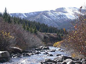
River
A river is a natural watercourse, usually freshwater, flowing towards an ocean, a lake, a sea, or another river. In a few cases, a river simply flows into the ground or dries up completely before reaching another body of water. Small rivers may also be called by several other names, including...
s and stream
Stream
A stream is a body of water with a current, confined within a bed and stream banks. Depending on its locale or certain characteristics, a stream may be referred to as a branch, brook, beck, burn, creek, "crick", gill , kill, lick, rill, river, syke, bayou, rivulet, streamage, wash, run or...
s in the U.S. State of Colorado.
Alphabetical list
The following alphabetical list includes many important streamStream
A stream is a body of water with a current, confined within a bed and stream banks. Depending on its locale or certain characteristics, a stream may be referred to as a branch, brook, beck, burn, creek, "crick", gill , kill, lick, rill, river, syke, bayou, rivulet, streamage, wash, run or...
s that flow through the State of Colorado including all 158 named river
River
A river is a natural watercourse, usually freshwater, flowing towards an ocean, a lake, a sea, or another river. In a few cases, a river simply flows into the ground or dries up completely before reaching another body of water. Small rivers may also be called by several other names, including...
s. Where available, the total extent of the stream's drainage basin
Drainage basin
A drainage basin is an extent or an area of land where surface water from rain and melting snow or ice converges to a single point, usually the exit of the basin, where the waters join another waterbody, such as a river, lake, reservoir, estuary, wetland, sea, or ocean...
is shown after the name. The names of the 17 Colorado rivers with a drainage basin of more than 10,000 square kilometers (3,900 sq mi), about three times the area of Rhode Island are shown in bold.
- Adams Fork Conejos River
- Alamosa RiverAlamosa RiverThe Alamosa River is a river in the southern part of the U.S. state of Colorado. It is about long, flowing roughly east through the San Luis Valley. Its watershed comprises about .The river's name means "shaded with cottonwoods" in Spanish....
383 km2 (148 mi2) - Animas RiverAnimas RiverAnimas River is a river in the western United States, a tributary of the San Juan River, part of the Colorado River System. The Spanish named the river "Rio de las Animas Perdidas", "River of the Lost Souls". It is also the last free-flowing river in Colorado. The river's free-flowing status...
3,562 km2 (1,375 mi2) - Apishapa RiverApishapa RiverApishapa River is a tributary of the Arkansas River that flows from a source near West Spanish Peak in southern Colorado. It joins the Arkansas east of Fowler, Colorado....
2,798 km2 (1,080 mi2) - Arikaree RiverArikaree RiverThe Arikaree River is a tributary of the Republican River that starts near Limon in Lincoln County, Colorado. The river flows east into Kansas, crossing the extreme northwestern corner of that state before entering Nebraska...
4,429 km2 (1,710 mi2) - Arkansas RiverArkansas RiverThe Arkansas River is a major tributary of the Mississippi River. The Arkansas generally flows to the east and southeast as it traverses the U.S. states of Colorado, Kansas, Oklahoma, and Arkansas. The river's initial basin starts in the Western United States in Colorado, specifically the Arkansas...
478,501 km2 (184,750 mi2) - Aspen BrookAspen Brook (Colorado)The Aspen Brook is a tributary of the Big Thompson River in Larimer County, Colorado. The stream's source is near Wind River Pass. It flows north to a confluence with the Big Thompson in Rocky Mountain National Park....
- Bear Creek 4,500 km2 (1,737 mi2)
- Bear Creek 339 km2 (131 mi2)
- Bear RiverBear River (Colorado)The Bear River is a tributary of the Yampa River. Its source is in the Flat Tops Wilderness above Stillwater Reservoir in Garfield County, Colorado. The Bear River flows northeast into Routt County and joins the Yampa River just east of the town of Yampa....
- Beaver CreekBeaver Creek (Colorado)Beaver Creek is a tributary of the South Platte River in Colorado. The creek flows from a source in Elbert County to a confluence with the South Platte in Morgan County near Hillrose....
2,939 km2 (1,135 mi2) - Big Dry CreekBig Dry Creek (Littleton, Colorado)Big Dry Creek is a tributary that joins the South Platte River in Littleton, Colorado. The creek's source is in Daniels Park in Douglas County....
- Big Sandy CreekBig Sandy Creek (Colorado)Big Sandy Creek is a tributary of the Arkansas River noted for being the location of the Sand Creek Massacre. Big Sandy Creek starts near Peyton in El Paso County, Colorado and flows through Elbert, Lincoln, Cheyenne and Kiowa counties before it joins with the Arkansas River in Prowers county...
4,825 km2 (1,863 mi2) - Big Thompson RiverBig Thompson RiverThe Big Thompson River is a tributary of the South Platte River, approximately 78 miles long, in the U.S. state of Colorado.- Course of the river :...
2,149 km2 (830 mi2) - Bijou CreekBijou CreekBijou Creek is a tributary of the South Platte River in Colorado. The creek flows from a source in Adams County to a confluence with the South Platte near Fort Morgan....
3,612 km2 (1,395 mi2) - Blue RiverBlue River (Colorado)The Blue River is a tributary of the Colorado River, approximately long, in the U.S. state of Colorado.It rises in southern Summit County, on the western side of the continental divide in the Ten Mile Range, near Quandary Peak. It flows north past Blue River and Breckenridge, then through the...
1,770 km2 (683 mi2) - Boulder CreekBoulder Creek (Colorado)Boulder Creek is a creek draining the Rocky Mountains to the west of Boulder, Colorado, as well as the city itself and surrounding plains.- Route :...
(1,160 km2 (448 mi2) - Cache la Poudre RiverCache La Poudre RiverThe Cache la Poudre River is in the state of Colorado in the United States.Its headwaters are in the Front Range in Larimer County, in the northern part of Rocky Mountain National Park. The river descends eastward in the mountains through the Roosevelt National Forest in Poudre Canyon...
4,959 km2 (1,915 mi2) - Canadian RiverCanadian RiverThe Canadian River is the longest tributary of the Arkansas River. It is about long, starting in Colorado and traveling through New Mexico, the Texas Panhandle, and most of Oklahoma....
122,701 km2 (47,375 mi2) - Canadian RiverCanadian River (Colorado)The Canadian River is a tributary of the North Platte River, located approximately long, in Jackson County in north central Colorado in the United States...
- Chalk CreekChalk CreekChalk Creek is a river flowing east from the Collegiate Peaks mountain range in Chaffee County, Colorado. Mount Antero borders the southern side of the river, while Mount Princeton borders the northern side. The headwaters of the river are located at the Continental Divide...
- Cherry CreekCherry Creek (Colorado)Cherry Creek is a tributary of the South Platte River, long, in Colorado in the United States.-Location:Cherry Creek rises in the high plateau, east of the Front Range, in northwestern El Paso County...
1,050 km2 (405 mi2) - Chico CreekChico CreekChico Creek is a tributary of the Arkansas River that flows from a source in El Paso County, Colorado. It joins the Arkansas in Pueblo County just west of the town of Avondale....
1,934 km2 (747 mi2) - Cimarron River 44,890 km2 (17,332 mi2)
- Cimarron River
- Clear CreekClear Creek (Colorado)Clear Creek is a tributary of the South Platte River, approximately long, in north central Colorado in the United States. The creek flows through Clear Creek Canyon in the Rocky Mountains directly west of Denver, descending through a long gorge to emerge on the Colorado Eastern Plains where it...
1,497 km2 (578 mi2) - Colorado RiverColorado RiverThe Colorado River , is a river in the Southwestern United States and northwestern Mexico, approximately long, draining a part of the arid regions on the western slope of the Rocky Mountains. The watershed of the Colorado River covers in parts of seven U.S. states and two Mexican states...
(67,993 km2 (26,252 mi2) - Conejos RiverConejos RiverThe Conejos River is a tributary of the Rio Grande, approximately long, in south-central Colorado in the United States. It drains a scenic area of the eastern San Juan Mountains west of the San Luis Valley.-Description:...
2,078 km2 (802 mi2) - Crow CreekCrow Creek (Wyoming)Crow Creek is a waterway of southeastern Wyoming and northern Colorado. Crow Creek is formed by the merger of the South Fork of Crow Creek with the Middle fork of Crow Creek, with the quick addition of the North Fork of Crow Creek about downstream. All of the major tributaries of Crow Creek begin...
3,717 km2 (1,435 mi2) - Crystal RiverCrystal River (Colorado)The Crystal River is a tributary of the Roaring Fork River, approximately 40 mi long, in western Colorado in the United States. It drains a glacial valley, called the Valley of the Coal Miners, south of Carbondale which was historically known as a center of coal mining in southwestern Colorado...
- Cucharas RiverCucharas RiverCucharas River is a tributary of the Huerfano River that flows from a source in Huerfano County, Colorado, southwest of the Spanish Peaks in San Isabel National Forest. The river passes through La Veta and Walsenburg before joining the Huerfano River in Pueblo County....
- Dolores RiverDolores RiverThe Dolores River is a tributary of the Colorado River, approximately 250 mi long, in the U.S. states of Colorado and Utah....
11,998 km2 (4,633 mi2) - Dry Fork Michigan River
- Eagle RiverEagle River (Colorado)The Eagle River is a tributary of the Colorado River, approximately long, in west central Colorado in the United States.It rises in southeastern Eagle County, at the continental divide, and flows northwest past Gilman, Minturn, Avon...
2,515 km2 (971 mi2) - East Fork Arkansas RiverEast Fork Arkansas RiverEast Fork Arkansas River is a tributary of the Arkansas River that flows from a source in the Mosquito Range of central Colorado. It joins the Arkansas west of Leadville, Colorado....
- East Fork Cimarron RiverEast Fork Cimarron RiverEast Fork Cimarron River is a tributary of the Cimarron River in Colorado. The river's source is near Wetterhorn Peak in the Uncompahgre Wilderness of Hinsdale County. It joins the Middle Fork Cimarron River in Gunnison County to form the Cimarron River....
- East Fork Eagle RiverEast Fork Eagle RiverEast Fork Eagle River is an tributary of the Eagle River in Eagle County, Colorado. The river flows from a source on Chicago Ridge in the White River National Forest to a confluence with the South Fork Eagle River that forms the Eagle River....
- East Fork Little Cimarron River
- East Fork Navajo River
- East Fork Piedra River
- East Fork Rio Chama
- East Fork San Juan River
- East Fork South Fork Crystal River
- East Mancos RiverEast Mancos RiverEast Mancos River is a tributary of the Mancos River in Montezuma County, Colorado. The river flows west from a source in the La Plata Mountains to a confluence with the West Mancos River that forms the Mancos River....
- East RiverEast River (Colorado)East River is a stream in central Colorado. It flows south from Emerald Lake in the Maroon Bells Wilderness to a confluence with the Taylor River that forms the Gunnison River....
762 km2 (294 mi2) - Elk RiverElk River (Colorado)Elk River is a stream in Colorado. It flows from a confluence of the North Fork Elk River and Middle Fork Elk River in Routt National Forest north of Steamboat Springs to a confluence with the Yampa River....
- Encampment RiverEncampment RiverThe Encampment River is a tributary of the North Platte River. The river's source is east of Buck Mountain in the Park Range of Jackson County, Colorado. The river flows north and passes through the town of Encampment, Wyoming before its confluence with the North Platte....
- Fall RiverFall River (Larimer County, Colorado)The Fall River is a tributary of the Big Thompson River in Larimer County, Colorado. The river's source is near the Alpine Visitor Center in Rocky Mountain National Park. It flows down a canyon and over Chasm Falls before a confluence with the Big Thompson in Estes Park....
- Fall RiverFall River (Clear Creek County, Colorado)Fall River is an tributary of Clear Creek in Clear Creek County, Colorado. It flows from a source just south of Parry Peak to a confluence with Clear Creek west of Idaho Springs....
- First Fork Piedra River
- First Fork South Fork Piney River
- Florida RiverFlorida RiverFlorida River is a tributary of the Animas River in La Plata County, Colorado. The river's source is Lillie Lake in the Weminuche Wilderness. It joins the Animas River south of Durango on the Southern Ute Indian Reservation near the New Mexico state line....
- Fountain CreekFountain CreekFountain Creek is a stream in El Paso and Pueblo counties, in Colorado in the United States.-Geography:From its source near the city of Woodland Park north of Pikes Peak, the creek flows southeast through the communities of Green Mountain Falls and Chipita Park to the town of Cascade. It...
2,418 km2 (933 mi2) - Fraser RiverFraser River (Colorado)The Fraser River is a tributary of the Colorado River, approximately long, in north central Colorado in the United States. It drains large portion of the Middle Park basin in Grand County in the Rocky Mountains west of Boulder and southwest of Rocky Mountain National Park. It rises at the...
- Frenchman CreekFrenchman CreekFrenchman Creek is a spring-fed waterway that begins in Phillips County, Colorado, crosses Chase and Hayes counties in Nebraska and ends at its juncture with the Republican River in Hitchcock County, Nebraska. The length of the waterway is approximately ....
7,398 km2 (2,856 mi2) - Fryingpan RiverFryingpan RiverThe Fryingpan River is a tributary of the Roaring Fork River, approximately long, in west central Colorado in the United States.It rises in northeastern Pitkin County, in the White River National Forest in the Sawatch Mountains along the western side of the continental divide. It flows westward...
- Geneva CreekGeneva Creek (Colorado)Geneva Creek is a short tributary of the North Fork South Platte River, approximately long, in central Colorado in the United States. It drains part of the Rocky Mountains southwest of Denver in northern Park County. It rises at the continental divide west of Mount Bierstadt and descends through a...
- Gore CreekGore Creek (Colorado)Gore Creek is a tributary of the Eagle River, approximately long, in Eagle County in central Colorado in the United States. It drains an area of the Rocky Mountains at the south end of the Gore Range through Vail Valley. It rises on the Eagle County-Summit County border along the high crest of the...
- Green RiverGreen River (Utah)The Green River, located in the western United States, is the chief tributary of the Colorado River. The watershed of the river, known as the Green River Basin, covers parts of Wyoming, Utah, and Colorado. The Green River is long, beginning in the Wind River Mountains of Wyoming and flowing...
(115,903 km2 (44,750 mi2) - Gunnison RiverGunnison RiverThe Gunnison River is a tributary of the Colorado River, long, in the Southwest state of Colorado. It is the fifth largest tributary of the Colorado River, with a mean flow of 4320 ft³/s .-Description:...
(20,851 km2 (8,051 mi2) - Hidden River
- Hill Branch Cucharas River
- Horse CreekHorse Creek (Colorado)Horse Creek is a tributary of the Arkansas River that flows from a source south of Calhan in the Holcolm Hills of El Paso County, Colorado. It flows east and south to a confluence with the Arkansas in Otero County west of Las Animas...
3,680 km2 (1,421 mi2) - Huerfano RiverHuerfano RiverHuerfano River is a tributary of the Arkansas River that flows from a source near Blanca Peak in the Sangre de Cristo Mountains of Colorado. It joins the Arkansas in Pueblo County just south of the town of Boone....
4,840 km2 (1,869 mi2) - Illinois RiverIllinois River (Colorado)Illinois River is a tributary of the Michigan River, approximately long, in Jackson County in north central Colorado. It drains part of the North Park basin south of Walden....
- Kiowa CreekKiowa Creek (Colorado)Kiowa Creek is a tributary that flows into the South Platte River in Morgan County, Colorado near Orchard. The creek's source is in the Black Forest of El Paso County, northeast of Colorado Springs, Colorado....
1,888 km2 (729 mi2) - La Plata River
- Ladder CreekLadder CreekLadder Creek is a stream that flows from a source in Cheyenne County, Colorado to a confluence with the Smoky Hill River in Logan County, Kansas....
3,645 km2 (1,407 mi2) - Lake Fork Gunnison RiverLake Fork Gunnison RiverLake Fork Gunnison River or Lake Fork is a tributary of the Gunnison River in Colorado. The river's source is Sloan Lake near Handies Peak in the San Juan Mountains of Hinsdale County. Lake Fork flows through Lake San Cristobal and Lake City before a confluence with the Gunnison River in Blue...
- Laramie RiverLaramie RiverThe Laramie River is a tributary of the North Platte River, approximately long, in the U.S. states of Colorado and Wyoming.It rises in northern Colorado, in the Roosevelt National Forest in the Front Range, in western Larimer County...
11,961 km2 (4,618 mi2) - Left Hand Creek
- Little Beaver Creek 1,602 km2 (619 mi2)
- Little Cimarron RiverLittle Cimarron RiverLittle Cimarron River is a tributary that joins the Cimarron River in Montrose County, Colorado. The river's source is near Silver Peak in the Uncompahgre Wilderness of Hinsdale County....
- Little Dolores RiverLittle Dolores RiverLittle Dolores River is a tributary that flows into the Colorado River in Grand County, Utah from a source in Mesa County, Colorado....
- Little Dry Creek
- Little Navajo River
- Little Snake RiverLittle Snake RiverThe Little Snake River is a tributary of the Yampa River, approximately 150 mi long, in southwestern Wyoming and northwestern Colorado in the United States....
10,629 km2 (4,104 mi2) - Little Thompson RiverLittle Thompson RiverThe Little Thompson River is a tributary of the Big Thompson River and thence the South Platte River in the U.S. state of Colorado.The river's headwaters lie in the Roosevelt National Forest. It flows east through the foothills of the Rocky Mountains in Larimer County through the town of Berthoud,...
- Lodgepole CreekLodgepole CreekLodgepole Creek is a tributary of the South Platte River, approximately long, in the U.S. states of Wyoming, Nebraska and Colorado. Lodgepole Creek drains a basin in the interior of a low plateau which lies between the South Platte Basin and the North Platte Basin in the southeastern corner of...
8,374 km2 (3,233 mi2) - Lone Tree CreekLone Tree Creek (Colorado)Lone Tree Creek is a tributary that joins the South Platte River in Weld County, Colorado east of Greeley. The creek's source is west of Buford in Albany County, Wyoming....
- Los Piños River
- Mancos RiverMancos RiverMancos River is an tributary of the San Juan River. It flows from the confluence of West Mancos River and East Mancos River near Mancos, Colorado and joins the San Juan near Four Corners Monument in New Mexico.-See also:*List of rivers of Colorado...
2,099 km2 (810 mi2) - McElmo CreekMcElmo CreekMcElmo Creek is a tributary that joins the San Juan River in San Juan County, Utah. The creek's source is just east of Cortez in Montezuma County, Colorado.-See also:*List of rivers of Colorado*List of rivers of Utah...
1,842 km2 (711 mi2) - Michigan RiverMichigan RiverThe Michigan River is a tributary of the North Platte River, approximately long, in north central Colorado in the United States. It drains a rural part of the eastern side of North Park in eastern Jackson County. The river issues from Michigan Lakes, a chain of alpine lakes at , along the...
- Middle Fork Cimarron RiverMiddle Fork Cimarron RiverMiddle Fork Cimarron River is a tributary of the Cimarron River in Colorado. The river's source is east of Coxcomb Peak in the Uncompahgre Wilderness of Hinsdale County. It joins the East Fork Cimarron River in Gunnison County to form the Cimarron River....
- Middle Fork Conejos River
- Middle Fork Elk RiverMiddle Fork Elk RiverMiddle Fork Elk River is a stream in Colorado. It flows from a confluence of Gilpin Creek and Gold Creek in Routt National Forest north of Steamboat Springs to a confluence with the North Fork Elk River that forms the Elk River...
- Middle Fork Little Snake RiverMiddle Fork Little Snake RiverMiddle Fork Little Snake River is a tributary of the Little Snake River in Routt County, Colorado. It flows from a source near the Continental Divide in Routt National Forest to a confluence with the North Fork Little Snake River that forms the Little Snake River....
- Middle Fork Piedra River
- Middle Fork Purgatoire River
- Middle Fork South Arkansas River
- Middle Fork South Platte RiverMiddle Fork South Platte RiverThe Middle Fork South Platte River is a tributary of the South Platte River, approximately long, located in central Colorado in the United States...
- Middle Fork Swan River
- Middle Mancos River
- Montezuma Creek 3,044 km2 (1,175 mi2)
- Muddy CreekMuddy Creek (Colorado)Muddy Creek is a tributary of the Colorado River, approximately long, in north central Colorado in the United States.It rises in northwestern Grand County, in the Routt National Forest west of Rabbit Ears Pass at the continental divide. It flows south, east, then southwest, and joins the Colorado...
- Navajo RiverNavajo RiverNavajo River is a tributary of the San Juan River. It flows from a source in the South San Juan Wilderness of Conejos County, Colorado southwest past Chromo, Colorado...
- North Branch Conejos River
- North Fork Animas River
- North Fork Apishapa River
- North Fork Arikaree RiverNorth Fork Arikaree RiverThe North Fork Arikaree River is a tributary of the Arikaree River in eastern Colorado. It flows from a source in western Lincoln County to a confluence with the Arikaree River in Washington County....
- North Fork Big Thompson RiverNorth Fork Big Thompson RiverThe North Fork Big Thompson River is a tributary of the Big Thompson River in Larimer County, Colorado. The river's source is Rowe Glacier on the north slope of Hagues Peak, in the Mummy Range of Rocky Mountain National Park. It flows through Lake Dunraven, over Lost Falls and through Glen Haven...
- North Fork Cache la Poudre RiverNorth Fork Cache la Poudre RiverThe North Fork Cache la Poudre River is a tributary of the Cache la Poudre River, approximately long, in north central Colorado in the United States...
- North Fork Canadian River
- North Fork Cimarron RiverNorth Fork Cimarron RiverNorth Fork Cimarron River is a tributary of the Cimarron River that flows from a source in Comanche National Grassland in Baca County, Colorado. It joins the Cimarron River west of Satanta in Haskell County, Kansas....
4,462 km2 (1,723 mi2) - North Fork Conejos River
- North Fork Crystal River
- North Fork Elk RiverNorth Fork Elk RiverNorth Fork Elk River, or North Fork Elk Creek is a tributary of the Elk River in Routt County, Colorado. It flows from a source on the northeast slopes of Big Agnes Mountain in the Sawtooth Range to a confluence with the Middle Fork Elk River that forms the Elk River....
- North Fork Fryingpan River
- North Fork Gunnison RiverNorth Fork Gunnison RiverThe North Fork Gunnison River is a tributary of the Gunnison River, long, in southwestern Colorado in the United States. It drains part of the southwestern flank of the Elk Mountains northeast of Delta....
2,492 km2 (962 mi2) - North Fork Little Snake RiverNorth Fork Little Snake RiverNorth Fork Little Snake River is a tributary of the Little Snake River in Colorado and Wyoming. It flows from a source in the Medicine Bow National Forest of Carbon County, Wyoming to a confluence with the Middle Fork Little Snake River in Routt County, Colorado that forms the Little Snake...
- North Fork Little Thompson River
- North Fork Los Piños River
- North Fork Michigan River
- North Fork North Platte River
- North Fork Piney River
- North Fork Purgatoire River
- North Fork Republican RiverNorth Fork Republican RiverThe North Fork Republican River is a tributary of the Republican River. It flows eastward from a source in Yuma County, Colorado to just north of Hagler in Dundy County, Nebraska...
13,172 km2 (5,086 mi2) - North Fork Rio de los Piños
- North Fork Smoky Hill RiverNorth Fork Smoky Hill RiverNorth Fork Smoky Hill River is a stream that flows from a source in Cheyenne County, Colorado to a confluence with the Smoky Hill River in Logan County, Kansas....
1,965 km2 (759 mi2) - North Fork Snake River
- North Fork South Arkansas River
- North Fork South Platte RiverNorth Fork South Platte RiverThe North Fork South Platte River is a tributary of the South Platte River, approximately 50 miles long, in central Colorado in the United States...
- North Fork Swan River
- North Fork Vermejo RiverNorth Fork Vermejo RiverNorth Fork Vermejo River is a tributary of the Vermejo River. The river flows from Las Animas County, Colorado south to a confluence with Little Vermejo Creek in Colfax County, New Mexico that forms the Vermejo River....
- North Fork West Branch Laramie River
- North Fork West Mancos River
- North Fork White RiverNorth Fork White RiverThe North Fork White River is a tributary of the White River. The river's source is Wall Lake in the Flat Tops Wilderness Area of Garfield County, Colorado. It joins with the South Fork White River in Rio Blanco County to form the White River....
- North Platte RiverNorth Platte RiverThe North Platte River is a major tributary of the Platte River and is approximately long counting its many curves, It travels about distance. Its course lies in the U.S...
80,755 km2 (31,180 mi2) - North Saint Charles River
- Owl Creek
- Parachute CreekParachute CreekParachute Creek is a tributary of the Colorado River in Garfield County, Colorado....
- Pawnee CreekPawnee CreekPawnee Creek is a tributary that joins the South Platte River in Logan County, Colorado south of Sterling. The creek's source is in Weld County at the confluence of North Pawnee Creek and South Pawnee Creek in Pawnee National Grassland....
1,875 km2 (724 mi2) - Piceance CreekPiceance CreekPiceance Creek is a tributary of the White River in Garfield County, Colorado....
1,630 km2 (629 mi2) - Piedra River 1,770 km2 (683 mi2)
- Piney RiverPiney River (Colorado)Piney River is a tributary of the Colorado River in Eagle County, Colorado. The river flows northwest from Upper Piney Lake in the Eagles Nest Wilderness to a confluence with the Colorado River....
- Plateau CreekPlateau Creek (Colorado)Plateau Creek is a tributary of the Colorado River, approximately long, located in western Colorado in the United States. It drains a lush cattle ranching valley, known as the Plateau Valley, north of the Grand Mesa and east of Grand Junction....
- Purgatoire RiverPurgatoire RiverThe Purgatoire River is a river in southeastern Colorado, United States. The river is also known locally as the Purgatory River or the Picketwire River...
8,923 km2 (3,445 mi2) - Ralston CreekRalston Creek (Colorado)Ralston Creek is a tributary of Clear Creek, approximately long, in central Colorado in the United States. It drains a suburban and urban area of the northwestern Denver Metropolitan Area. It rises in the foothills in northeastern Gilpin County, in southern Golden Gate Canyon State Park...
- Rio Blanco
- Rio Chama 8,204 km2 (3,168 mi2)
- Rio Chamita
- Rio de los Piños
- Rio GrandeRio GrandeThe Rio Grande is a river that flows from southwestern Colorado in the United States to the Gulf of Mexico. Along the way it forms part of the Mexico – United States border. Its length varies as its course changes...
457,275 km2 (176,555 mi2) - Rio Lado
- Rio San Antonio
- Roan CreekRoan Creek (Colorado)Roan Creek is a tributary of the Colorado River in Garfield County, Colorado....
- Roaring Fork Little Snake RiverRoaring Fork Little Snake RiverRoaring Fork Little Snake River is a tributary of the Little Snake River in Colorado and Wyoming. It flows from a source in the Medicine Bow National Forest of Carbon County, Wyoming to a confluence with the Little Snake River in Routt County, Colorado....
- Roaring Fork RiverRoaring Fork RiverRoaring Fork River is a tributary of the Colorado River, approximately long, in west central Colorado in the United States. The river drains a populated and economically vital area of the Colorado Western Slope called the Roaring Fork Valley or Roaring Fork Watershed, which includes the resort...
3,766 km2 (1,454 mi2) - Roaring RiverRoaring River (Colorado)The Roaring River is a tributary of the Fall River in Larimer County, Colorado. The river's source is Crystal Lake in the Mummy Range of Rocky Mountain National Park The river flows through Lawn Lake before a confluence with the Fall River in Horseshoe Park. The collapse of the Lawn Lake Dam in...
- Rush CreekRush Creek (Colorado)Rush Creek is a tributary of Big Sandy Creek in Colorado. It starts at the confluence of South Rush Creek and North Rush Creek in Lincoln County. The creek flows through Cheyenne County before joining Big Sandy Creek in Kiowa County....
3,570 km2 (1,378 mi2) - Saguache CreekSaguache CreekSaguache Creek is a stream in Saguache County, Colorado. The creek flows from the confluence of its North and Middle forks before joining San Luis Creek. Saguache Creek is in the San Luis Closed Basin, the largest endorheic basin in Colorado....
3,482 km2 (1,345 mi2) - Saint Charles RiverSaint Charles River (Colorado)Saint Charles River is a tributary of the Arkansas River that flows from a source near Saint Charles Peak in the Wet Mountains of southern Colorado. It joins the Arkansas east of Pueblo, Colorado....
- Saint Vrain Creek 2,572 km2 (993 mi2)
- San Juan River 64,560 km2 (24,927 mi2)
- San Luis CreekSan Luis Creek (Colorado)San Luis Creek is a stream that flows from a source near Poncha Pass in Saguache County, Colorado to San Luis Lake adjacent to Great Sand Dunes National Park. San Luis Lake is the sink of the San Luis Closed Basin, the largest endorheic basin in Colorado....
7,000 km2 (2,703 mi2) - San Miguel RiverSan Miguel River (Colorado)The San Miguel River is a tributary of the Dolores River, approximately 90 mi long in southwestern Colorado in the United States...
4,060 km2 (1,567 mi2) - Sand Arroyo Creek 1,938 km2 (748 mi2)
- Sand CreekSand Creek (Denver, Colorado)Sand Creek is a tributary that flows into the South Platte River near Commerce City, Colorado. From its source in unincorporated Arapahoe County, it flows through Aurora and Denver before joining the South Platte in Adams County....
(Adams County) - Sand Creek (Larimer County)
- Sidney Draw 1,949 km2 (753 mi2)
- Slate RiverSlate River (Colorado)Slate River is a tributary of the East River in Gunnison County, Colorado. It flows south from a source near Yule Pass in the Raggeds Wilderness to a confluence with the East River southeast of Crested Butte, Colorado....
- Smoky Hill RiverSmoky Hill RiverThe Smoky Hill River is a river in the central Great Plains of North America, running through the U.S. states of Colorado and Kansas.-Names:The Smoky Hill gets its name from the Smoky Hills region of north-central Kansas through which it flows...
51,783 km2 (19,994 mi2) - Snake RiverSnake River (Colorado)The Snake River is a short tributary of the Blue River, approximately 15 miles long, in central Colorado in the United States. It drains a mountainous area on the west side of the Front Range in southeastern Summit County east of Keystone....
- South Arkansas RiverSouth Arkansas RiverSouth Arkansas River is a tributary of the Arkansas River that flows from a source near Monarch Pass in the Sawatch Range of southern Colorado. It joins the Arkansas just south of Salida, Colorado....
- South Fork Animas River
- South Fork Beaver Creek 1,939 km2 (749 mi2)
- South Fork Cache la Poudre RiverSouth Fork Cache la Poudre RiverThe South Fork Cache la Poudre River is a tributary of the Cache la Poudre River in Larimer County, Colorado. The river's source is in the Mummy Range of Rocky Mountain National Park....
- South Fork Canadian River
- South Fork Conejos River
- South Fork Crystal River
- South Fork Cucharas River
- South Fork Eagle RiverSouth Fork Eagle RiverSouth Fork Eagle River is a tributary of the Eagle River in Eagle County, Colorado. The river flows from a source east of Tennessee Pass in the White River National Forest to a confluence with the East Fork Eagle River that forms the Eagle River....
- South Fork Elk RiverSouth Fork Elk RiverThe South Fork Elk River is a stream in Colorado in the United States. It flows from a source near Dome Lake in Routt National Forest north of Steamboat Springs to a confluence with the Elk River....
- South Fork Fryingpan River
- South Fork Huerfano River
- South Fork Little Snake RiverSouth Fork Little Snake RiverSouth Fork Little Snake River is an tributary of the Little Snake River in Routt County, Colorado. It flows north from a source in Routt National Forest near Steamboat Lake State Park to a confluence with the Little Snake River....
- South Fork Michigan River
- South Fork Piney River
- South Fork Purgatoire River
- South Fork Republican RiverSouth Fork Republican RiverThe South Fork Republican River is a river that arises in Lincoln County, Colorado, United States, and flows east-northeastward for about through Kit Carson and Yuma Counties, Colorado, and Cheyenne County, Kansas, to a confluence with the Republican River in Dundy County, Nebraska. Bonny...
7,195 km2 (2,778 mi2) - South Fork Rio Grande
- South Fork San Miguel RiverSouth Fork San Miguel RiverSouth Fork San Miguel River is a tributary of the San Miguel River in San Miguel County, Colorado. The river flows north from a confluence of the Lake Fork and the Howard Fork to a confluence with the San Miguel River west of Telluride....
- South Fork South Platte RiverSouth Fork South Platte RiverThe South Fork South Platte River is a tributary of the South Platte River, approximately long, in central Colorado in the United States. It is located near the headwaters of the South Platte in Park County, Colorado and drains part of the intermontane grassland basin of South Park...
- South Fork Swan River
- South Fork West Mancos River
- South Fork White RiverSouth Fork White RiverThe South Fork White River is a tributary of the White River. The river's source is in the Flat Tops Wilderness Area of Garfield County, Colorado. It joins with the North Fork White River in Rio Blanco County to form the White River....
- South Platte RiverSouth Platte RiverThe South Platte River is one of the two principal tributaries of the Platte River and itself a major river of the American Midwest and the American Southwest/Mountain West, located in the U.S. states of Colorado and Nebraska...
62,738 km2 (24,223 mi2) - Spring Creek
- Spruce Creek
- Swan RiverSwan River (Colorado)The Swan River is a short tributary of the Blue River, approximately 10 miles long, located in the Rocky Mountains of central Colorado in the United States. The river drains a mountainous area in the upper basin of the Blue River in southern Summit County. It rises in three short forks along the...
- Tarryall CreekTarryall CreekTarryall Creek is a tributary of the South Platte River, approximately long, in Park County in central Colorado in the United States. It drains a rural portion of north and central South Park, an intermontane grassland in the Rocky Mountains southwest of Denver...
- Taylor RiverTaylor River (Colorado)The Taylor River rises close to Castle Peak in Colorado’s Elk Mountains in the northeast part of Gunnison County, near the Continental Divide....
1,258 km2 (486 mi2) - Tomichi CreekTomichi CreekTomichi Creek is a tributary of the Gunnison River in Gunnison County, Colorado....
2,874 km2 (1,109 mi2) - Trinchera Creek
- Two Butte CreekTwo Butte CreekTwo Butte Creek is a tributary of the Arkansas River that flows from a source near Kim, Colorado. It joins the Arkansas just south of the town of Holly....
2,107 km2 (814 mi2) - Uncompahgre RiverUncompahgre RiverThe Uncompahgre River is a tributary of the Gunnison River, approximately 75 mi long, in southwestern Colorado in the United States. Lake Como at 12,215 ft in northern San Juan County, in the Uncompahgre National Forest in the northwestern San Juan Mountains is the headwaters of the...
2,921 km2 (1,128 mi2) - Vermillion CreekVermillion CreekVermillion Creek is a tributary of the Green River. It flows south from Sweetwater County, Wyoming to a confluence with the Green River just north of the Gates of Lodore in Moffat County, Colorado....
2,500 km2 (965 mi2) - West Branch Laramie RiverWest Branch Laramie RiverWest Branch Laramie River is a tributary of the Laramie River in Larimer County, Colorado The river's source is Island Lake in the Rawah Wilderness. It flows through Carey Lake then northeast to a confluence with the Laramie River....
- West Dolores RiverWest Dolores RiverThe West Dolores River is a tributary of the Dolores River, in southwestern Colorado in the United States. Its source is northeast of Mount Wilson in the Lizard Head Wilderness of Dolores County, Colorado. The river flows southwest to a confluence with the Delores in Montezuma County....
- West Fork Animas River
- West Fork Cimarron RiverWest Fork Cimarron RiverWest Fork Cimarron River is an tributary of the Cimarron River in Colorado. The river's source is west of Coxcomb Peak in the Uncompahgre Wilderness of Hinsdale County. It joins the Cimarron River in Gunnison County....
- West Fork Elk River
- West Fork Encampment River
- West Fork Little Thompson River
- West Fork North Fork Purgatoire River
- West Fork Rio Chama
- West Fork San Juan River
- West Mancos RiverWest Mancos RiverWest Mancos River is a tributary of the Mancos River in Montezuma County, Colorado. The river flows from the confluence of its North and South forks in the San Juan National Forest to a confluence with the East Mancos River that forms the Mancos River....
- White RiverWhite River (Utah)The White River is a tributary of the Green River, approximately long, in the U.S. states of Colorado and Utah. Flows vary from 450 ft³/s late summers in dry years to well over 12,000 ft³/s in spring....
12,989 km2 (5,015 mi2) - White Woman Creek 3,000 km2 (1,158 mi2)
- Williams Fork (Colorado River)Williams Fork (Colorado River)The Williams Fork is a tributary of the Colorado River, approximately long, in north central Colorado in the United States. It flows through Grand County between the valleys of the Fraser River and the Blue River...
- Williams Fork (Yampa River)
- Willow CreekWillow Creek (Colorado)Willow Creek is a tributary of the Colorado River, approximately long, in north central Colorado in the United States.It rises in northwestern Grand County, in the Arapaho National Forest south of Willow Creek Pass at the continental divide. It flows southeast, through Willow Creek Reservoir and...
- Wind River
- Yampa RiverYampa RiverThe Yampa River is a tributary of the Green River, approximately 250 mi long, in the U.S. state of Colorado. It's located in the Southwestern United States...
21,506 km2 (8,304 mi2) - Yellow CreekYellow Creek (Colorado)Yellow Creek is a tributary of the White River in Rio Blanco County, Colorado....
760 km2 (293 mi2)
See also
- hydrologyHydrologyHydrology is the study of the movement, distribution, and quality of water on Earth and other planets, including the hydrologic cycle, water resources and environmental watershed sustainability...
- surface-water hydrologySurface-water hydrologySurface-water hydrology is a field that encompasses all surface waters of the globe...
- streamStreamA stream is a body of water with a current, confined within a bed and stream banks. Depending on its locale or certain characteristics, a stream may be referred to as a branch, brook, beck, burn, creek, "crick", gill , kill, lick, rill, river, syke, bayou, rivulet, streamage, wash, run or...
- riverRiverA river is a natural watercourse, usually freshwater, flowing towards an ocean, a lake, a sea, or another river. In a few cases, a river simply flows into the ground or dries up completely before reaching another body of water. Small rivers may also be called by several other names, including...
- State of Colorado
- Geography of ColoradoGeography of ColoradoThe geography of the state of Colorado is diverse, encompassing both rugged mountainous terrain, vast plains, desert lands, desert canyons, and mesas. The state of Colorado is defined as the geospherical rectangle that stretches from 37°N to 41°N latitude and from 102°03'W to 109°03'W longitude . ...
- Colorado drainage basinsColorado drainage basinsThe U.S State of Colorado includes the headwaters of several important rivers. The state is divided generally East to West by the Continental Divide. East of the Continental Divide, surface waters flow via the North Platte River, the South Platte River, the Republican River, the Arkansas River,...
- Wikimedia Commons: Rivers of Colorado
Tributary chartHydrology
Hydrology is the study of the movement, distribution, and quality of water on Earth and other planets, including the hydrologic cycle, water resources and environmental watershed sustainability...
- surface-water hydrologySurface-water hydrologySurface-water hydrology is a field that encompasses all surface waters of the globe...
- streamStreamA stream is a body of water with a current, confined within a bed and stream banks. Depending on its locale or certain characteristics, a stream may be referred to as a branch, brook, beck, burn, creek, "crick", gill , kill, lick, rill, river, syke, bayou, rivulet, streamage, wash, run or...
- riverRiverA river is a natural watercourse, usually freshwater, flowing towards an ocean, a lake, a sea, or another river. In a few cases, a river simply flows into the ground or dries up completely before reaching another body of water. Small rivers may also be called by several other names, including...
- river
- stream
- Geography of ColoradoGeography of ColoradoThe geography of the state of Colorado is diverse, encompassing both rugged mountainous terrain, vast plains, desert lands, desert canyons, and mesas. The state of Colorado is defined as the geospherical rectangle that stretches from 37°N to 41°N latitude and from 102°03'W to 109°03'W longitude . ...
- Colorado drainage basinsColorado drainage basinsThe U.S State of Colorado includes the headwaters of several important rivers. The state is divided generally East to West by the Continental Divide. East of the Continental Divide, surface waters flow via the North Platte River, the South Platte River, the Republican River, the Arkansas River,...
- Colorado drainage basins
The following tributary chart shows many important stream
Stream
A stream is a body of water with a current, confined within a bed and stream banks. Depending on its locale or certain characteristics, a stream may be referred to as a branch, brook, beck, burn, creek, "crick", gill , kill, lick, rill, river, syke, bayou, rivulet, streamage, wash, run or...
s that flow through the State of Colorado including all 158 named river
River
A river is a natural watercourse, usually freshwater, flowing towards an ocean, a lake, a sea, or another river. In a few cases, a river simply flows into the ground or dries up completely before reaching another body of water. Small rivers may also be called by several other names, including...
s. The chart is arranged by tributary
Tributary
A tributary or affluent is a stream or river that flows into a main stem river or a lake. A tributary does not flow directly into a sea or ocean...
and area of the drainage basin
Drainage basin
A drainage basin is an extent or an area of land where surface water from rain and melting snow or ice converges to a single point, usually the exit of the basin, where the waters join another waterbody, such as a river, lake, reservoir, estuary, wetland, sea, or ocean...
. The names of the 17 Colorado rivers with a drainage basin of more than 10,000 square kilometers (3,900 sq mi) are shown in bold. Oceans and streams outside of Colorado are shown in italics.
Pacific Ocean
- Gulf of CaliforniaGulf of CaliforniaThe Gulf of California is a body of water that separates the Baja California Peninsula from the Mexican mainland...
- Colorado RiverColorado RiverThe Colorado River , is a river in the Southwestern United States and northwestern Mexico, approximately long, draining a part of the arid regions on the western slope of the Rocky Mountains. The watershed of the Colorado River covers in parts of seven U.S. states and two Mexican states...
- Green RiverGreen River (Utah)The Green River, located in the western United States, is the chief tributary of the Colorado River. The watershed of the river, known as the Green River Basin, covers parts of Wyoming, Utah, and Colorado. The Green River is long, beginning in the Wind River Mountains of Wyoming and flowing...
- Yampa RiverYampa RiverThe Yampa River is a tributary of the Green River, approximately 250 mi long, in the U.S. state of Colorado. It's located in the Southwestern United States...
21,506 km2 (8,304 mi2)- Little Snake RiverLittle Snake RiverThe Little Snake River is a tributary of the Yampa River, approximately 150 mi long, in southwestern Wyoming and northwestern Colorado in the United States....
10,629 km2 (4,104 mi2)- Roaring Fork Little Snake RiverRoaring Fork Little Snake RiverRoaring Fork Little Snake River is a tributary of the Little Snake River in Colorado and Wyoming. It flows from a source in the Medicine Bow National Forest of Carbon County, Wyoming to a confluence with the Little Snake River in Routt County, Colorado....
- Middle Fork Little Snake RiverMiddle Fork Little Snake RiverMiddle Fork Little Snake River is a tributary of the Little Snake River in Routt County, Colorado. It flows from a source near the Continental Divide in Routt National Forest to a confluence with the North Fork Little Snake River that forms the Little Snake River....
- North Fork Little Snake RiverNorth Fork Little Snake RiverNorth Fork Little Snake River is a tributary of the Little Snake River in Colorado and Wyoming. It flows from a source in the Medicine Bow National Forest of Carbon County, Wyoming to a confluence with the Middle Fork Little Snake River in Routt County, Colorado that forms the Little Snake...
- South Fork Little Snake RiverSouth Fork Little Snake RiverSouth Fork Little Snake River is an tributary of the Little Snake River in Routt County, Colorado. It flows north from a source in Routt National Forest near Steamboat Lake State Park to a confluence with the Little Snake River....
- Williams Fork
- Roaring Fork Little Snake River
- Bear RiverBear River (Colorado)The Bear River is a tributary of the Yampa River. Its source is in the Flat Tops Wilderness above Stillwater Reservoir in Garfield County, Colorado. The Bear River flows northeast into Routt County and joins the Yampa River just east of the town of Yampa....
- Elk RiverElk River (Colorado)Elk River is a stream in Colorado. It flows from a confluence of the North Fork Elk River and Middle Fork Elk River in Routt National Forest north of Steamboat Springs to a confluence with the Yampa River....
- South Fork Elk RiverSouth Fork Elk RiverThe South Fork Elk River is a stream in Colorado in the United States. It flows from a source near Dome Lake in Routt National Forest north of Steamboat Springs to a confluence with the Elk River....
- Middle Fork Elk RiverMiddle Fork Elk RiverMiddle Fork Elk River is a stream in Colorado. It flows from a confluence of Gilpin Creek and Gold Creek in Routt National Forest north of Steamboat Springs to a confluence with the North Fork Elk River that forms the Elk River...
- North Fork Elk RiverNorth Fork Elk RiverNorth Fork Elk River, or North Fork Elk Creek is a tributary of the Elk River in Routt County, Colorado. It flows from a source on the northeast slopes of Big Agnes Mountain in the Sawtooth Range to a confluence with the Middle Fork Elk River that forms the Elk River....
- South Fork Elk River
- Little Snake River
- White RiverWhite River (Utah)The White River is a tributary of the Green River, approximately long, in the U.S. states of Colorado and Utah. Flows vary from 450 ft³/s late summers in dry years to well over 12,000 ft³/s in spring....
12,989 km2 (5,015 mi2)- Piceance CreekPiceance CreekPiceance Creek is a tributary of the White River in Garfield County, Colorado....
1,630 km2 (629 mi2) - Yellow CreekYellow Creek (Colorado)Yellow Creek is a tributary of the White River in Rio Blanco County, Colorado....
760 km2 (293 mi2) - North Fork White RiverNorth Fork White RiverThe North Fork White River is a tributary of the White River. The river's source is Wall Lake in the Flat Tops Wilderness Area of Garfield County, Colorado. It joins with the South Fork White River in Rio Blanco County to form the White River....
- South Fork White RiverSouth Fork White RiverThe South Fork White River is a tributary of the White River. The river's source is in the Flat Tops Wilderness Area of Garfield County, Colorado. It joins with the North Fork White River in Rio Blanco County to form the White River....
- Piceance Creek
- Vermillion CreekVermillion CreekVermillion Creek is a tributary of the Green River. It flows south from Sweetwater County, Wyoming to a confluence with the Green River just north of the Gates of Lodore in Moffat County, Colorado....
2,500 km2 (965 mi2)
- Yampa River
- upper Colorado RiverColorado RiverThe Colorado River , is a river in the Southwestern United States and northwestern Mexico, approximately long, draining a part of the arid regions on the western slope of the Rocky Mountains. The watershed of the Colorado River covers in parts of seven U.S. states and two Mexican states...
- Gunnison RiverGunnison RiverThe Gunnison River is a tributary of the Colorado River, long, in the Southwest state of Colorado. It is the fifth largest tributary of the Colorado River, with a mean flow of 4320 ft³/s .-Description:...
20,851 km2 (8,051 mi2)- Uncompahgre RiverUncompahgre RiverThe Uncompahgre River is a tributary of the Gunnison River, approximately 75 mi long, in southwestern Colorado in the United States. Lake Como at 12,215 ft in northern San Juan County, in the Uncompahgre National Forest in the northwestern San Juan Mountains is the headwaters of the...
2,921 km2 (1,128 mi2) - Tomichi CreekTomichi CreekTomichi Creek is a tributary of the Gunnison River in Gunnison County, Colorado....
2,874 km2 (1,109 mi2) - North Fork Gunnison RiverNorth Fork Gunnison RiverThe North Fork Gunnison River is a tributary of the Gunnison River, long, in southwestern Colorado in the United States. It drains part of the southwestern flank of the Elk Mountains northeast of Delta....
2,492 km2 (962 mi2) - Lake Fork Gunnison RiverLake Fork Gunnison RiverLake Fork Gunnison River or Lake Fork is a tributary of the Gunnison River in Colorado. The river's source is Sloan Lake near Handies Peak in the San Juan Mountains of Hinsdale County. Lake Fork flows through Lake San Cristobal and Lake City before a confluence with the Gunnison River in Blue...
- Taylor RiverTaylor River (Colorado)The Taylor River rises close to Castle Peak in Colorado’s Elk Mountains in the northeast part of Gunnison County, near the Continental Divide....
1,258 km2 (486 mi2) - East RiverEast River (Colorado)East River is a stream in central Colorado. It flows south from Emerald Lake in the Maroon Bells Wilderness to a confluence with the Taylor River that forms the Gunnison River....
762 km2 (294 mi2)- Slate RiverSlate River (Colorado)Slate River is a tributary of the East River in Gunnison County, Colorado. It flows south from a source near Yule Pass in the Raggeds Wilderness to a confluence with the East River southeast of Crested Butte, Colorado....
- Slate River
- Cimarron River
- Little Cimarron RiverLittle Cimarron RiverLittle Cimarron River is a tributary that joins the Cimarron River in Montrose County, Colorado. The river's source is near Silver Peak in the Uncompahgre Wilderness of Hinsdale County....
- East Fork Little Cimarron River
- East Fork Cimarron RiverEast Fork Cimarron RiverEast Fork Cimarron River is a tributary of the Cimarron River in Colorado. The river's source is near Wetterhorn Peak in the Uncompahgre Wilderness of Hinsdale County. It joins the Middle Fork Cimarron River in Gunnison County to form the Cimarron River....
- Middle Fork Cimarron RiverMiddle Fork Cimarron RiverMiddle Fork Cimarron River is a tributary of the Cimarron River in Colorado. The river's source is east of Coxcomb Peak in the Uncompahgre Wilderness of Hinsdale County. It joins the East Fork Cimarron River in Gunnison County to form the Cimarron River....
- West Fork Cimarron RiverWest Fork Cimarron RiverWest Fork Cimarron River is an tributary of the Cimarron River in Colorado. The river's source is west of Coxcomb Peak in the Uncompahgre Wilderness of Hinsdale County. It joins the Cimarron River in Gunnison County....
- Little Cimarron River
- Uncompahgre River
- Dolores RiverDolores RiverThe Dolores River is a tributary of the Colorado River, approximately 250 mi long, in the U.S. states of Colorado and Utah....
11,998 km2 (4,633 mi2)- San Miguel RiverSan Miguel River (Colorado)The San Miguel River is a tributary of the Dolores River, approximately 90 mi long in southwestern Colorado in the United States...
4,060 km2 (1,567 mi2)- South Fork San Miguel RiverSouth Fork San Miguel RiverSouth Fork San Miguel River is a tributary of the San Miguel River in San Miguel County, Colorado. The river flows north from a confluence of the Lake Fork and the Howard Fork to a confluence with the San Miguel River west of Telluride....
- South Fork San Miguel River
- West Dolores RiverWest Dolores RiverThe West Dolores River is a tributary of the Dolores River, in southwestern Colorado in the United States. Its source is northeast of Mount Wilson in the Lizard Head Wilderness of Dolores County, Colorado. The river flows southwest to a confluence with the Delores in Montezuma County....
- Rio Lado
- San Miguel River
- Roaring Fork RiverRoaring Fork RiverRoaring Fork River is a tributary of the Colorado River, approximately long, in west central Colorado in the United States. The river drains a populated and economically vital area of the Colorado Western Slope called the Roaring Fork Valley or Roaring Fork Watershed, which includes the resort...
3,766 km2 (1,454 mi2)- Crystal RiverCrystal River (Colorado)The Crystal River is a tributary of the Roaring Fork River, approximately 40 mi long, in western Colorado in the United States. It drains a glacial valley, called the Valley of the Coal Miners, south of Carbondale which was historically known as a center of coal mining in southwestern Colorado...
- North Fork Crystal River
- South Fork Crystal River
- East Fork South Fork Crystal River
- Fryingpan RiverFryingpan RiverThe Fryingpan River is a tributary of the Roaring Fork River, approximately long, in west central Colorado in the United States.It rises in northeastern Pitkin County, in the White River National Forest in the Sawatch Mountains along the western side of the continental divide. It flows westward...
- North Fork Fryingpan River
- South Fork Fryingpan River
- Crystal River
- Eagle RiverEagle River (Colorado)The Eagle River is a tributary of the Colorado River, approximately long, in west central Colorado in the United States.It rises in southeastern Eagle County, at the continental divide, and flows northwest past Gilman, Minturn, Avon...
2,515 km2 (971 mi2)- Gore CreekGore Creek (Colorado)Gore Creek is a tributary of the Eagle River, approximately long, in Eagle County in central Colorado in the United States. It drains an area of the Rocky Mountains at the south end of the Gore Range through Vail Valley. It rises on the Eagle County-Summit County border along the high crest of the...
- East Fork Eagle RiverEast Fork Eagle RiverEast Fork Eagle River is an tributary of the Eagle River in Eagle County, Colorado. The river flows from a source on Chicago Ridge in the White River National Forest to a confluence with the South Fork Eagle River that forms the Eagle River....
- South Fork Eagle RiverSouth Fork Eagle RiverSouth Fork Eagle River is a tributary of the Eagle River in Eagle County, Colorado. The river flows from a source east of Tennessee Pass in the White River National Forest to a confluence with the East Fork Eagle River that forms the Eagle River....
- Gore Creek
- Blue RiverBlue River (Colorado)The Blue River is a tributary of the Colorado River, approximately long, in the U.S. state of Colorado.It rises in southern Summit County, on the western side of the continental divide in the Ten Mile Range, near Quandary Peak. It flows north past Blue River and Breckenridge, then through the...
1,770 km2 (683 mi2)- Snake RiverSnake River (Colorado)The Snake River is a short tributary of the Blue River, approximately 15 miles long, in central Colorado in the United States. It drains a mountainous area on the west side of the Front Range in southeastern Summit County east of Keystone....
- North Fork Snake River
- Swan RiverSwan River (Colorado)The Swan River is a short tributary of the Blue River, approximately 10 miles long, located in the Rocky Mountains of central Colorado in the United States. The river drains a mountainous area in the upper basin of the Blue River in southern Summit County. It rises in three short forks along the...
- Middle Fork Swan River
- North Fork Swan River
- South Fork Swan River
- Snake River
- Little Dolores RiverLittle Dolores RiverLittle Dolores River is a tributary that flows into the Colorado River in Grand County, Utah from a source in Mesa County, Colorado....
- Fraser RiverFraser River (Colorado)The Fraser River is a tributary of the Colorado River, approximately long, in north central Colorado in the United States. It drains large portion of the Middle Park basin in Grand County in the Rocky Mountains west of Boulder and southwest of Rocky Mountain National Park. It rises at the...
- Williams ForkWilliams Fork (Colorado River)The Williams Fork is a tributary of the Colorado River, approximately long, in north central Colorado in the United States. It flows through Grand County between the valleys of the Fraser River and the Blue River...
- Piney RiverPiney River (Colorado)Piney River is a tributary of the Colorado River in Eagle County, Colorado. The river flows northwest from Upper Piney Lake in the Eagles Nest Wilderness to a confluence with the Colorado River....
- North Fork Piney River
- South Fork Piney River
- First Fork South Fork Piney River
- Parachute CreekParachute CreekParachute Creek is a tributary of the Colorado River in Garfield County, Colorado....
- Roan CreekRoan Creek (Colorado)Roan Creek is a tributary of the Colorado River in Garfield County, Colorado....
- Plateau CreekPlateau Creek (Colorado)Plateau Creek is a tributary of the Colorado River, approximately long, located in western Colorado in the United States. It drains a lush cattle ranching valley, known as the Plateau Valley, north of the Grand Mesa and east of Grand Junction....
- Muddy CreekMuddy Creek (Colorado)Muddy Creek is a tributary of the Colorado River, approximately long, in north central Colorado in the United States.It rises in northwestern Grand County, in the Routt National Forest west of Rabbit Ears Pass at the continental divide. It flows south, east, then southwest, and joins the Colorado...
- Willow CreekWillow Creek (Colorado)Willow Creek is a tributary of the Colorado River, approximately long, in north central Colorado in the United States.It rises in northwestern Grand County, in the Arapaho National Forest south of Willow Creek Pass at the continental divide. It flows southeast, through Willow Creek Reservoir and...
- Gunnison River
- San Juan River 64,560 km2 (24,927 mi2)
- Animas RiverAnimas RiverAnimas River is a river in the western United States, a tributary of the San Juan River, part of the Colorado River System. The Spanish named the river "Rio de las Animas Perdidas", "River of the Lost Souls". It is also the last free-flowing river in Colorado. The river's free-flowing status...
3,562 km2 (1,375 mi2)- Florida RiverFlorida RiverFlorida River is a tributary of the Animas River in La Plata County, Colorado. The river's source is Lillie Lake in the Weminuche Wilderness. It joins the Animas River south of Durango on the Southern Ute Indian Reservation near the New Mexico state line....
- North Fork Animas River
- South Fork Animas River
- West Fork Animas River
- Florida River
- Montezuma Creek 3,044 km2 (1,175 mi2)
- Mancos RiverMancos RiverMancos River is an tributary of the San Juan River. It flows from the confluence of West Mancos River and East Mancos River near Mancos, Colorado and joins the San Juan near Four Corners Monument in New Mexico.-See also:*List of rivers of Colorado...
2,099 km2 (810 mi2)- East Mancos RiverEast Mancos RiverEast Mancos River is a tributary of the Mancos River in Montezuma County, Colorado. The river flows west from a source in the La Plata Mountains to a confluence with the West Mancos River that forms the Mancos River....
- Middle Mancos River
- West Mancos RiverWest Mancos RiverWest Mancos River is a tributary of the Mancos River in Montezuma County, Colorado. The river flows from the confluence of its North and South forks in the San Juan National Forest to a confluence with the East Mancos River that forms the Mancos River....
- North Fork West Mancos River
- South Fork West Mancos River
- East Mancos River
- McElmo CreekMcElmo CreekMcElmo Creek is a tributary that joins the San Juan River in San Juan County, Utah. The creek's source is just east of Cortez in Montezuma County, Colorado.-See also:*List of rivers of Colorado*List of rivers of Utah...
1,842 km2 (711 mi2) - Piedra River 1,770 km2 (683 mi2)
- First Fork Piedra River
- East Fork Piedra River
- Middle Fork Piedra River
- La Plata River
- Navajo RiverNavajo RiverNavajo River is a tributary of the San Juan River. It flows from a source in the South San Juan Wilderness of Conejos County, Colorado southwest past Chromo, Colorado...
- Little Navajo River
- East Fork Navajo River
- Los Piños River
- North Fork Los Piños River
- Rio Blanco
- East Fork San Juan River
- West Fork San Juan River
- Animas River
- Green River
- Colorado River
Atlantic Ocean
- Gulf of MexicoGulf of MexicoThe Gulf of Mexico is a partially landlocked ocean basin largely surrounded by the North American continent and the island of Cuba. It is bounded on the northeast, north and northwest by the Gulf Coast of the United States, on the southwest and south by Mexico, and on the southeast by Cuba. In...
- Mississippi RiverMississippi RiverThe Mississippi River is the largest river system in North America. Flowing entirely in the United States, this river rises in western Minnesota and meanders slowly southwards for to the Mississippi River Delta at the Gulf of Mexico. With its many tributaries, the Mississippi's watershed drains...
- Missouri RiverMissouri RiverThe Missouri River flows through the central United States, and is a tributary of the Mississippi River. It is the longest river in North America and drains the third largest area, though only the thirteenth largest by discharge. The Missouri's watershed encompasses most of the American Great...
- Platte RiverPlatte RiverThe Platte River is a major river in the state of Nebraska and is about long. Measured to its farthest source via its tributary the North Platte River, it flows for over . The Platte River is a tributary of the Missouri River, which in turn is a tributary of the Mississippi River which flows to...
- North Platte RiverNorth Platte RiverThe North Platte River is a major tributary of the Platte River and is approximately long counting its many curves, It travels about distance. Its course lies in the U.S...
80,755 km2 (31,180 mi2)- Laramie RiverLaramie RiverThe Laramie River is a tributary of the North Platte River, approximately long, in the U.S. states of Colorado and Wyoming.It rises in northern Colorado, in the Roosevelt National Forest in the Front Range, in western Larimer County...
11,961 km2 (4,618 mi2)- Sand Creek
- West Branch Laramie RiverWest Branch Laramie RiverWest Branch Laramie River is a tributary of the Laramie River in Larimer County, Colorado The river's source is Island Lake in the Rawah Wilderness. It flows through Carey Lake then northeast to a confluence with the Laramie River....
- North Fork West Branch Laramie River
- Encampment RiverEncampment RiverThe Encampment River is a tributary of the North Platte River. The river's source is east of Buck Mountain in the Park Range of Jackson County, Colorado. The river flows north and passes through the town of Encampment, Wyoming before its confluence with the North Platte....
- West Fork Encampment River
- Canadian RiverCanadian River (Colorado)The Canadian River is a tributary of the North Platte River, located approximately long, in Jackson County in north central Colorado in the United States...
- North Fork Canadian River
- South Fork Canadian River
- Michigan RiverMichigan RiverThe Michigan River is a tributary of the North Platte River, approximately long, in north central Colorado in the United States. It drains a rural part of the eastern side of North Park in eastern Jackson County. The river issues from Michigan Lakes, a chain of alpine lakes at , along the...
- Illinois RiverIllinois River (Colorado)Illinois River is a tributary of the Michigan River, approximately long, in Jackson County in north central Colorado. It drains part of the North Park basin south of Walden....
- North Fork Michigan River
- South Fork Michigan River
- Dry Fork Michigan River
- Illinois River
- North Fork North Platte River
- Laramie River
- South Platte RiverSouth Platte RiverThe South Platte River is one of the two principal tributaries of the Platte River and itself a major river of the American Midwest and the American Southwest/Mountain West, located in the U.S. states of Colorado and Nebraska...
62,738 km2 (24,223 mi2)- Lodgepole CreekLodgepole CreekLodgepole Creek is a tributary of the South Platte River, approximately long, in the U.S. states of Wyoming, Nebraska and Colorado. Lodgepole Creek drains a basin in the interior of a low plateau which lies between the South Platte Basin and the North Platte Basin in the southeastern corner of...
8,374 km2 (3,233 mi2) - Cache la Poudre RiverCache La Poudre RiverThe Cache la Poudre River is in the state of Colorado in the United States.Its headwaters are in the Front Range in Larimer County, in the northern part of Rocky Mountain National Park. The river descends eastward in the mountains through the Roosevelt National Forest in Poudre Canyon...
4,959 km2 (1,915 mi2)- North Fork Cache la Poudre RiverNorth Fork Cache la Poudre RiverThe North Fork Cache la Poudre River is a tributary of the Cache la Poudre River, approximately long, in north central Colorado in the United States...
- South Fork Cache la Poudre RiverSouth Fork Cache la Poudre RiverThe South Fork Cache la Poudre River is a tributary of the Cache la Poudre River in Larimer County, Colorado. The river's source is in the Mummy Range of Rocky Mountain National Park....
- Spring Creek
- North Fork Cache la Poudre River
- Crow CreekCrow Creek (Wyoming)Crow Creek is a waterway of southeastern Wyoming and northern Colorado. Crow Creek is formed by the merger of the South Fork of Crow Creek with the Middle fork of Crow Creek, with the quick addition of the North Fork of Crow Creek about downstream. All of the major tributaries of Crow Creek begin...
3,717 km2 (1,435 mi2) - Bijou CreekBijou CreekBijou Creek is a tributary of the South Platte River in Colorado. The creek flows from a source in Adams County to a confluence with the South Platte near Fort Morgan....
3,612 km2 (1,395 mi2) - Beaver CreekBeaver Creek (Colorado)Beaver Creek is a tributary of the South Platte River in Colorado. The creek flows from a source in Elbert County to a confluence with the South Platte in Morgan County near Hillrose....
2,939 km2 (1,135 mi2) - Saint Vrain Creek 2,572 km2 (993 mi2)
- Boulder CreekBoulder Creek (Colorado)Boulder Creek is a creek draining the Rocky Mountains to the west of Boulder, Colorado, as well as the city itself and surrounding plains.- Route :...
1,160 km2 (448 mi2) - Left Hand Creek
- Boulder Creek
- Big Thompson RiverBig Thompson RiverThe Big Thompson River is a tributary of the South Platte River, approximately 78 miles long, in the U.S. state of Colorado.- Course of the river :...
2,149 km2 (830 mi2)- Little Thompson RiverLittle Thompson RiverThe Little Thompson River is a tributary of the Big Thompson River and thence the South Platte River in the U.S. state of Colorado.The river's headwaters lie in the Roosevelt National Forest. It flows east through the foothills of the Rocky Mountains in Larimer County through the town of Berthoud,...
- North Fork Little Thompson River
- West Fork Little Thompson River
- Fall RiverFall River (Larimer County, Colorado)The Fall River is a tributary of the Big Thompson River in Larimer County, Colorado. The river's source is near the Alpine Visitor Center in Rocky Mountain National Park. It flows down a canyon and over Chasm Falls before a confluence with the Big Thompson in Estes Park....
- Roaring RiverRoaring River (Colorado)The Roaring River is a tributary of the Fall River in Larimer County, Colorado. The river's source is Crystal Lake in the Mummy Range of Rocky Mountain National Park The river flows through Lawn Lake before a confluence with the Fall River in Horseshoe Park. The collapse of the Lawn Lake Dam in...
- Roaring River
- North Fork Big Thompson RiverNorth Fork Big Thompson RiverThe North Fork Big Thompson River is a tributary of the Big Thompson River in Larimer County, Colorado. The river's source is Rowe Glacier on the north slope of Hagues Peak, in the Mummy Range of Rocky Mountain National Park. It flows through Lake Dunraven, over Lost Falls and through Glen Haven...
- Aspen BrookAspen Brook (Colorado)The Aspen Brook is a tributary of the Big Thompson River in Larimer County, Colorado. The stream's source is near Wind River Pass. It flows north to a confluence with the Big Thompson in Rocky Mountain National Park....
- Wind River
- Spruce Creek
- Hidden River
- Fish Creek
- Little Thompson River
- Sidney Draw 1,949 km2 (753 mi2)
- Kiowa CreekKiowa Creek (Colorado)Kiowa Creek is a tributary that flows into the South Platte River in Morgan County, Colorado near Orchard. The creek's source is in the Black Forest of El Paso County, northeast of Colorado Springs, Colorado....
1,888 km2 (729 mi2) - Pawnee CreekPawnee CreekPawnee Creek is a tributary that joins the South Platte River in Logan County, Colorado south of Sterling. The creek's source is in Weld County at the confluence of North Pawnee Creek and South Pawnee Creek in Pawnee National Grassland....
1,875 km2 (724 mi2) - Clear CreekClear Creek (Colorado)Clear Creek is a tributary of the South Platte River, approximately long, in north central Colorado in the United States. The creek flows through Clear Creek Canyon in the Rocky Mountains directly west of Denver, descending through a long gorge to emerge on the Colorado Eastern Plains where it...
1,497 km2 (578 mi2)- Ralston CreekRalston Creek (Colorado)Ralston Creek is a tributary of Clear Creek, approximately long, in central Colorado in the United States. It drains a suburban and urban area of the northwestern Denver Metropolitan Area. It rises in the foothills in northeastern Gilpin County, in southern Golden Gate Canyon State Park...
- Fall RiverFall River (Clear Creek County, Colorado)Fall River is an tributary of Clear Creek in Clear Creek County, Colorado. It flows from a source just south of Parry Peak to a confluence with Clear Creek west of Idaho Springs....
- Ralston Creek
- Cherry CreekCherry Creek (Colorado)Cherry Creek is a tributary of the South Platte River, long, in Colorado in the United States.-Location:Cherry Creek rises in the high plateau, east of the Front Range, in northwestern El Paso County...
1,050 km2 (405 mi2) - North Fork South Platte RiverNorth Fork South Platte RiverThe North Fork South Platte River is a tributary of the South Platte River, approximately 50 miles long, in central Colorado in the United States...
- Geneva CreekGeneva Creek (Colorado)Geneva Creek is a short tributary of the North Fork South Platte River, approximately long, in central Colorado in the United States. It drains part of the Rocky Mountains southwest of Denver in northern Park County. It rises at the continental divide west of Mount Bierstadt and descends through a...
- Geneva Creek
- Middle Fork South Platte RiverMiddle Fork South Platte RiverThe Middle Fork South Platte River is a tributary of the South Platte River, approximately long, located in central Colorado in the United States...
- South Fork South Platte RiverSouth Fork South Platte RiverThe South Fork South Platte River is a tributary of the South Platte River, approximately long, in central Colorado in the United States. It is located near the headwaters of the South Platte in Park County, Colorado and drains part of the intermontane grassland basin of South Park...
- Lone Tree CreekLone Tree Creek (Colorado)Lone Tree Creek is a tributary that joins the South Platte River in Weld County, Colorado east of Greeley. The creek's source is west of Buford in Albany County, Wyoming....
- Owl Creek
- Tarryall CreekTarryall CreekTarryall Creek is a tributary of the South Platte River, approximately long, in Park County in central Colorado in the United States. It drains a rural portion of north and central South Park, an intermontane grassland in the Rocky Mountains southwest of Denver...
- Sand CreekSand Creek (Denver, Colorado)Sand Creek is a tributary that flows into the South Platte River near Commerce City, Colorado. From its source in unincorporated Arapahoe County, it flows through Aurora and Denver before joining the South Platte in Adams County....
- Bear Creek 339 km2 (131 mi2)
- Big Dry CreekBig Dry Creek (Littleton, Colorado)Big Dry Creek is a tributary that joins the South Platte River in Littleton, Colorado. The creek's source is in Daniels Park in Douglas County....
- Little Dry Creek
- Lodgepole Creek
- North Platte River
- Kansas RiverKansas RiverThe Kansas River is a river in northeastern Kansas in the United States. It is the southwestern-most part of the Missouri River drainage, which is in turn the northwestern-most portion of the extensive Mississippi River drainage. Its name come from the Kanza people who once inhabited the area...
- Republican RiverRepublican RiverThe Republican River is a river in the central Great Plains of North America, flowing through the U.S. states of Nebraska and Kansas.-Geography:...
- North Fork Republican RiverNorth Fork Republican RiverThe North Fork Republican River is a tributary of the Republican River. It flows eastward from a source in Yuma County, Colorado to just north of Hagler in Dundy County, Nebraska...
13,172 km2 (5,086 mi2) - Arikaree RiverArikaree RiverThe Arikaree River is a tributary of the Republican River that starts near Limon in Lincoln County, Colorado. The river flows east into Kansas, crossing the extreme northwestern corner of that state before entering Nebraska...
4,429 km2 (1,710 mi2)- North Fork Arikaree RiverNorth Fork Arikaree RiverThe North Fork Arikaree River is a tributary of the Arikaree River in eastern Colorado. It flows from a source in western Lincoln County to a confluence with the Arikaree River in Washington County....
- North Fork Arikaree River
- Frenchman CreekFrenchman CreekFrenchman Creek is a spring-fed waterway that begins in Phillips County, Colorado, crosses Chase and Hayes counties in Nebraska and ends at its juncture with the Republican River in Hitchcock County, Nebraska. The length of the waterway is approximately ....
7,398 km2 (2,856 mi2) - Sappa Creek
- Beaver Creek
- South Fork Beaver Creek 1,939 km2 (749 mi2)
- Little Beaver Creek 1,602 km2 (619 mi2)
- Beaver Creek
- South Fork Republican RiverSouth Fork Republican RiverThe South Fork Republican River is a river that arises in Lincoln County, Colorado, United States, and flows east-northeastward for about through Kit Carson and Yuma Counties, Colorado, and Cheyenne County, Kansas, to a confluence with the Republican River in Dundy County, Nebraska. Bonny...
7,195 km2 (2,778 mi2)
- North Fork Republican River
- Smoky Hill RiverSmoky Hill RiverThe Smoky Hill River is a river in the central Great Plains of North America, running through the U.S. states of Colorado and Kansas.-Names:The Smoky Hill gets its name from the Smoky Hills region of north-central Kansas through which it flows...
51,783 km2 (19,994 mi2)- Ladder CreekLadder CreekLadder Creek is a stream that flows from a source in Cheyenne County, Colorado to a confluence with the Smoky Hill River in Logan County, Kansas....
3,645 km2 (1,407 mi2) - North Fork Smoky Hill RiverNorth Fork Smoky Hill RiverNorth Fork Smoky Hill River is a stream that flows from a source in Cheyenne County, Colorado to a confluence with the Smoky Hill River in Logan County, Kansas....
1,965 km2 (759 mi2)
- Ladder Creek
- Republican River
- Platte River
- Arkansas RiverArkansas RiverThe Arkansas River is a major tributary of the Mississippi River. The Arkansas generally flows to the east and southeast as it traverses the U.S. states of Colorado, Kansas, Oklahoma, and Arkansas. The river's initial basin starts in the Western United States in Colorado, specifically the Arkansas...
478,501 km2 (184,750 mi2)- Canadian RiverCanadian RiverThe Canadian River is the longest tributary of the Arkansas River. It is about long, starting in Colorado and traveling through New Mexico, the Texas Panhandle, and most of Oklahoma....
122,701 km2 (47,375 mi2)- Vermejo RiverVermejo RiverVermejo River is a tributary of the Canadian River in Colfax County, New Mexico. The river flows southeast from the confluence of North Fork Vermejo River and Little Vermejo Creek to a confluence with the Canadian River south of Maxwell....
- North Fork Vermejo RiverNorth Fork Vermejo RiverNorth Fork Vermejo River is a tributary of the Vermejo River. The river flows from Las Animas County, Colorado south to a confluence with Little Vermejo Creek in Colfax County, New Mexico that forms the Vermejo River....
- North Fork Vermejo River
- Vermejo River
- Cimarron River 44,890 km2 (17,332 mi2)
- North Fork Cimarron RiverNorth Fork Cimarron RiverNorth Fork Cimarron River is a tributary of the Cimarron River that flows from a source in Comanche National Grassland in Baca County, Colorado. It joins the Cimarron River west of Satanta in Haskell County, Kansas....
4,462 km2 (1,723 mi2)- Sand Arroyo Creek 1,938 km2 (748 mi2)
- North Fork Cimarron River
- Purgatoire RiverPurgatoire RiverThe Purgatoire River is a river in southeastern Colorado, United States. The river is also known locally as the Purgatory River or the Picketwire River...
8,923 km2 (3,445 mi2)- North Fork Purgatoire River
- West Fork North Fork Purgatoire River
- Middle Fork Purgatoire River
- South Fork Purgatoire River
- North Fork Purgatoire River
- Huerfano RiverHuerfano RiverHuerfano River is a tributary of the Arkansas River that flows from a source near Blanca Peak in the Sangre de Cristo Mountains of Colorado. It joins the Arkansas in Pueblo County just south of the town of Boone....
4,840 km2 (1,869 mi2)- Cucharas RiverCucharas RiverCucharas River is a tributary of the Huerfano River that flows from a source in Huerfano County, Colorado, southwest of the Spanish Peaks in San Isabel National Forest. The river passes through La Veta and Walsenburg before joining the Huerfano River in Pueblo County....
- Hill Branch Cucharas River
- South Fork Cucharas River
- South Fork Huerfano River
- Cucharas River
- Big Sandy CreekBig Sandy Creek (Colorado)Big Sandy Creek is a tributary of the Arkansas River noted for being the location of the Sand Creek Massacre. Big Sandy Creek starts near Peyton in El Paso County, Colorado and flows through Elbert, Lincoln, Cheyenne and Kiowa counties before it joins with the Arkansas River in Prowers county...
4,825 km2 (1,863 mi2)- Rush CreekRush Creek (Colorado)Rush Creek is a tributary of Big Sandy Creek in Colorado. It starts at the confluence of South Rush Creek and North Rush Creek in Lincoln County. The creek flows through Cheyenne County before joining Big Sandy Creek in Kiowa County....
3,570 km2 (1,378 mi2)
- Rush Creek
- Horse CreekHorse Creek (Colorado)Horse Creek is a tributary of the Arkansas River that flows from a source south of Calhan in the Holcolm Hills of El Paso County, Colorado. It flows east and south to a confluence with the Arkansas in Otero County west of Las Animas...
3,680 km2 (1,421 mi2) - Apishapa RiverApishapa RiverApishapa River is a tributary of the Arkansas River that flows from a source near West Spanish Peak in southern Colorado. It joins the Arkansas east of Fowler, Colorado....
2,798 km2 (1,080 mi2)- North Fork Apishapa River
- Fountain CreekFountain CreekFountain Creek is a stream in El Paso and Pueblo counties, in Colorado in the United States.-Geography:From its source near the city of Woodland Park north of Pikes Peak, the creek flows southeast through the communities of Green Mountain Falls and Chipita Park to the town of Cascade. It...
2,418 km2 (933 mi2) - Two Butte CreekTwo Butte CreekTwo Butte Creek is a tributary of the Arkansas River that flows from a source near Kim, Colorado. It joins the Arkansas just south of the town of Holly....
2,107 km2 (814 mi2) - Chico CreekChico CreekChico Creek is a tributary of the Arkansas River that flows from a source in El Paso County, Colorado. It joins the Arkansas in Pueblo County just west of the town of Avondale....
1,934 km2 (747 mi2) - South Arkansas RiverSouth Arkansas RiverSouth Arkansas River is a tributary of the Arkansas River that flows from a source near Monarch Pass in the Sawatch Range of southern Colorado. It joins the Arkansas just south of Salida, Colorado....
- Middle Fork South Arkansas River
- North Fork South Arkansas River
- Saint Charles RiverSaint Charles River (Colorado)Saint Charles River is a tributary of the Arkansas River that flows from a source near Saint Charles Peak in the Wet Mountains of southern Colorado. It joins the Arkansas east of Pueblo, Colorado....
- North Saint Charles River
- East Fork Arkansas RiverEast Fork Arkansas RiverEast Fork Arkansas River is a tributary of the Arkansas River that flows from a source in the Mosquito Range of central Colorado. It joins the Arkansas west of Leadville, Colorado....
- Chalk CreekChalk CreekChalk Creek is a river flowing east from the Collegiate Peaks mountain range in Chaffee County, Colorado. Mount Antero borders the southern side of the river, while Mount Princeton borders the northern side. The headwaters of the river are located at the Continental Divide...
- Bear Creek Basin endorheic basin)
- Bear Creek 4,500 km2 (1,737 mi2)
- White Woman Basin endorheic basin)
- White Woman Creek 3,000 km2 (1,158 mi2)
- Canadian River
- Missouri River
- Rio GrandeRio GrandeThe Rio Grande is a river that flows from southwestern Colorado in the United States to the Gulf of Mexico. Along the way it forms part of the Mexico – United States border. Its length varies as its course changes...
457,275 km2 (176,555 mi2)- Rio Chama 8,204 km2 (3,168 mi2)
- Rio Chamita
- East Fork Rio Chama
- West Fork Rio Chama
- Conejos RiverConejos RiverThe Conejos River is a tributary of the Rio Grande, approximately long, in south-central Colorado in the United States. It drains a scenic area of the eastern San Juan Mountains west of the San Luis Valley.-Description:...
2,078 km2 (802 mi2)- Rio San Antonio
- Rio de los Piños
- North Fork Rio de los Piños
- Rio de los Piños
- Middle Fork Conejos River
- North Branch Conejos River
- North Fork Conejos River
- South Fork Conejos River
- Adams Fork Conejos River
- Rio San Antonio
- South Fork Rio Grande
- Alamosa RiverAlamosa RiverThe Alamosa River is a river in the southern part of the U.S. state of Colorado. It is about long, flowing roughly east through the San Luis Valley. Its watershed comprises about .The river's name means "shaded with cottonwoods" in Spanish....
383 km2 (148 mi2) - Trinchera Creek
- San Luis Closed Basin endorheic basin)
- San Luis CreekSan Luis Creek (Colorado)San Luis Creek is a stream that flows from a source near Poncha Pass in Saguache County, Colorado to San Luis Lake adjacent to Great Sand Dunes National Park. San Luis Lake is the sink of the San Luis Closed Basin, the largest endorheic basin in Colorado....
7,000 km2 (2,703 mi2)- Saguache CreekSaguache CreekSaguache Creek is a stream in Saguache County, Colorado. The creek flows from the confluence of its North and Middle forks before joining San Luis Creek. Saguache Creek is in the San Luis Closed Basin, the largest endorheic basin in Colorado....
3,482 km2 (1,345 mi2)
- Saguache Creek
- San Luis Creek
- Rio Chama 8,204 km2 (3,168 mi2)
- Mississippi River
External links