
Indiana State Road 55
Encyclopedia
State Road 55 is a north–south road in Northern
and Central Indiana. State Road 55 runs from the Crawfordsville
area in the south to Gary
in the north, a distance of approximately 110 miles (177 km).
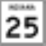
with State Road 25
(SR 25). SR 55 heads northwest towards Newtown
where SR 55 has an intersection with State Road 341
. SR 55 heads northwest out of Newtown towards U.S. Route 41
(US 41). SR 55 and US 41 are concurrent
for 5.19 miles (8.4 km) through Attica
. Northwest of Attica SR 55 leaves US 41 and heads north Oxford
. North of Oxford, SR 55 has an intersection with U.S. Route 52 (US 52). US 52 and SR 55 are concurrent for 5.58 miles (9 km) until Fowler
. In Fowler SR 55 leaves US 52 heading north towards Goodland
. In Goodland SR 55 is concurrent with U.S. Route 24
(US 24). SR 55 heads north towards Crown Point
passing through intersection with State Road 16
, State Road 114
, State Road 14
, State Road 10
, and State Road 2
. In Crown Point SR 55 has an intersection with U.S. Route 231. SR 55 heads north after US 231 towrds an interchange
with Interstate 80
/Interstate 94
/U.S. Route 6
/Borman Expressway
, the northern terminus of SR 55 is at this point.
and Valparaiso
. At this point the route that SR 55 takes today was of Old SR 8.
In 1930, SR 55 and State Road 53
swapped routes in Lake County
.
Northern Indiana
Northern Indiana is the region of Indiana including 26 counties bordering parts of Illinois, Michigan, and Ohio. The area is generally sub-classified into other regions. The northwest is economically and culturally intertwined with Chicago, and is considered part of the Chicago metropolitan area...
and Central Indiana. State Road 55 runs from the Crawfordsville
Crawfordsville, Indiana
Crawfordsville is a city in Union Township, Montgomery County, Indiana, United States. As of the 2010 census, the city had a population of 15,915. The city is the county seat of Montgomery County...
area in the south to Gary
Gary, Indiana
Gary is a city in Lake County, Indiana, United States. The city is in the southeastern portion of the Chicago metropolitan area and is 25 miles from downtown Chicago. The population is 80,294 at the 2010 census, making it the seventh-largest city in the state. It borders Lake Michigan and is known...
in the north, a distance of approximately 110 miles (177 km).
Route description
SR 55 southern terminus is at an intersectionIntersection (road)
An intersection is a road junction where two or more roads either meet or cross at grade . An intersection may be 3-way - a T junction or fork, 4-way - a crossroads, or 5-way or more...
with State Road 25
Indiana State Road 25
State Road 25 is a highway in the U. S. state of Indiana. Although it is designated a north–south road, in practice it travels generally northeast from its southern terminus at State Road 32 to its northern terminus at State Road 15 in Warsaw.- Waynetown to Lafayette :SR 25 heads north...
(SR 25). SR 55 heads northwest towards Newtown
Newtown, Indiana
Newtown is a town in Richland Township, Fountain County, Indiana, United States. The population was 256 at the 2010 census.-Geography:Newtown is located at ....
where SR 55 has an intersection with State Road 341
Indiana State Road 341
State Road 341 in the U.S. state of Indiana is a north–south state highway in Fountain County in the west-central part of the state.-Route description:...
. SR 55 heads northwest out of Newtown towards U.S. Route 41
U.S. Route 41 in Indiana
In the U.S. state of Indiana, U.S. Route 41 is a north–south highway that is parallel to the Illinois state line. It enters the state south of Evansville. North of Evansville, it becomes a 4-Lane divided highway passing around Vincennes and traveling North to Terre Haute. In Terre Haute, it...
(US 41). SR 55 and US 41 are concurrent
Concurrency (road)
A concurrency, overlap, or coincidence in a road network is an instance of one physical road bearing two or more different highway, motorway, or other route numbers...
for 5.19 miles (8.4 km) through Attica
Attica, Indiana
Attica is a city in Logan Township, Fountain County, Indiana, United States. The population was 3,245 at the 2010 census.-History:Attica was laid out by George Hollingsworth and platted by David Stump on March 19, 1825...
. Northwest of Attica SR 55 leaves US 41 and heads north Oxford
Oxford, Indiana
Oxford is a town in Oak Grove Township, Benton County, Indiana. The population was 1,162 at the 2010 census. It is part of the Lafayette, Indiana, Metropolitan Statistical Area.-History:...
. North of Oxford, SR 55 has an intersection with U.S. Route 52 (US 52). US 52 and SR 55 are concurrent for 5.58 miles (9 km) until Fowler
Fowler, Indiana
-External links:*...
. In Fowler SR 55 leaves US 52 heading north towards Goodland
Goodland, Indiana
Goodland is a town in Grant Township, Newton County, Indiana, United States. The population was 1,043 at the 2010 census.-Geography:Goodland is located at ....
. In Goodland SR 55 is concurrent with U.S. Route 24
U.S. Route 24 in Indiana
U.S. Route 24 In Indiana, US 24 runs east from the Illinois state line to Huntington. At Huntington, US 24 turns northeast and runs to Fort Wayne; it then overlaps Interstate 69 and Interstate 469 to bypass the city before entering Ohio at the state line east of Fort Wayne...
(US 24). SR 55 heads north towards Crown Point
Crown Point, Indiana
As of the census of 2010, there were 27,317 people and 10,976 households in the city. The racial makeup of the city was 88.20% White, 6.30% African American, 0.20% Native American, 1.80% Asian, 0.00% Pacific Islander, 1.90% from other races, and 1.60% from two or more races...
passing through intersection with State Road 16
Indiana State Road 16
State Road 16 is an east–west road in Northern Indiana. Its western terminus is at U.S. Route 41 in Ade, Indiana. Its eastern terminus is at State Road 5 north of Huntington, Indiana.- Route description :...
, State Road 114
Indiana State Road 114
State Road 114 in the U.S. State of Indiana consists of three discontinuous east–west routes, between the Illinois border and U.S. Route 421, State Road 17 and State Road 25, and State Road 14 and U.S. Route 24.- Western section :...
, State Road 14
Indiana State Road 14
State Road 14 is an east–west road in northern Indiana. Its western terminus is at U.S. Route 41 in Enos, and its eastern terminus is at Interstate 69 in Fort Wayne....
, State Road 10
Indiana State Road 10
State Road 10 is an east–west road in northwest Indiana. Its western terminus is at the Illinois state line west of Lake Village. Its eastern terminus is at State Road 19 south of Etna Green.-Route description:...
, and State Road 2
Indiana State Road 2
State Road 2 in the U.S. State of Indiana is an east–west route running from the Illinois border at Illinois Route 17 east to the outskirts of South Bend, Indiana at the U.S. Route 20/U.S. Route 31 freeway, also known as the St. Joseph Valley Parkway...
. In Crown Point SR 55 has an intersection with U.S. Route 231. SR 55 heads north after US 231 towrds an interchange
Interchange (road)
In the field of road transport, an interchange is a road junction that typically uses grade separation, and one or more ramps, to permit traffic on at least one highway to pass through the junction without directly crossing any other traffic stream. It differs from a standard intersection, at which...
with Interstate 80
Interstate 80 in Indiana
In the U.S. state of Indiana, Interstate 80 consists entirely of the following two routes:* The Borman Expressway, from the Illinois state line to Lake Station, Indiana, running concurrently with Interstate 94....
/Interstate 94
Interstate 94 in Indiana
In the U.S. state of Indiana, Interstate 94 runs east–west through the northwest portion of the state.-Route description:The route between the Illinois border and Lake Station at its junction with the Indiana Toll Road is known as the Borman Expressway and is a heavily traveled route...
/U.S. Route 6
U.S. Route 6 in Indiana
U.S. Route 6 is a part of the United States Numbered Highway that runs from California to Provincetown, Massachusetts. In Indiana, it is a mostly rural, two-lane route that travels in the northern part of the state. However, some four-lane stretches may be found in Lake and Porter counties. For...
/Borman Expressway
Borman Expressway
The Frank Borman Expressway is an east–west highway in the northwest part of the U.S. state of Indiana, named after astronaut and former Eastern Airlines CEO Frank Borman. The expressway consists of parts of Interstate 80 , I-94, and U.S. Highway 6 , as well as a short section of US 41...
, the northern terminus of SR 55 is at this point.
History
Between 1917 and 1926 SR 55 had a different route that follows the route that SR 2 takes today, from HebronHebron, Indiana
Hebron is a town in Boone Township, Porter County, Indiana, United States. The population was 3,724 at the 2010 census.-Geography:Hebron is located at ....
and Valparaiso
Valparaiso, Indiana
Valparaiso is a city in and the county seat of Porter County, Indiana, United States. The population was 31,730 at the 2010 census, making it the 2nd largest city in Porter County.-History:...
. At this point the route that SR 55 takes today was of Old SR 8.
In 1930, SR 55 and State Road 53
Indiana State Road 53
Indiana State Road 53, known along its entire length as Broadway, is a state highway in northwest Indiana.-Route description:State Road 53 runs from U.S. Route 231 in Crown Point north to Gary at the main gate of the Gary Works. Its terminus may also be considered to be the Interstate 90 , only a...
swapped routes in Lake County
Lake County, Indiana
Lake County is a county located in the U.S. state of Indiana. In 2010, its population was 496,005, making it Indiana's second-most populous county. The county seat is Crown Point. This county is part of Northwest Indiana and the Chicago metropolitan area. The county contains a mix of urban,...
.