
Indiana State Road 25
Encyclopedia
Indiana
Indiana is a US state, admitted to the United States as the 19th on December 11, 1816. It is located in the Midwestern United States and Great Lakes Region. With 6,483,802 residents, the state is ranked 15th in population and 16th in population density. Indiana is ranked 38th in land area and is...
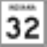
. Although it is designated a north–south road, in practice it travels generally northeast from its southern terminus at State Road 32
Indiana State Road 32
State Road 32 in the U.S. State of Indiana is an east–west highway in central Indiana that crosses the entire state, covering a distance of about .-Route description:...
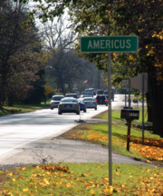
(south of Waynetown
Waynetown, Indiana
Waynetown is a town in Wayne Township, Montgomery County, Indiana, United States. The population was 958 at the 2010 census.-Geography:Waynetown is located at ....
and north of Shades State Park
Shades State Park
Shades State Park is a state park in Montgomery, Parke, and Fountain Counties in Indiana. It is located west-northwest of Indianapolis, Indiana. In the last decades of the 19th century, the area was a resort with a forty-room inn. In the 1930s a man named Joseph Frisz acquired the land in order...
) to its northern terminus at State Road 15
Indiana State Road 15
State Road 15 is a north–south road in northeastern Indiana. Its southern terminus is at State Road 22 in Jonesboro. Its northern terminus is the Michigan state line north of Bristol. It is a surface highway that is mostly rural...
in Warsaw
Warsaw, Indiana
Warsaw is a city in and the county seat of Kosciusko County, Indiana, United States. Cradled among Winona Lake, Pike Lake, Hidden Lake and Center Lake, Warsaw is nicknamed "Lake City," though other cities in the surrounding area are also referred to by that nickname...
.
Waynetown to Lafayette
SR 25 heads north from its southern terminus towards WaynestownWaynetown, Indiana
Waynetown is a town in Wayne Township, Montgomery County, Indiana, United States. The population was 958 at the 2010 census.-Geography:Waynetown is located at ....
. In Waynetown SR 25 is concurrence with U.S. Route 136. Then SR 25 heads north towards Wingate
Wingate, Indiana
Wingate, formerly known as Pleasant Hill, is a town in Coal Creek Township, Montgomery County, Indiana, United States. The population was 263 at the 2010 census.-History:...
passing over Interstate 74
Interstate 74 in Indiana
In the U.S. state of Indiana, Interstate 74 traverses central parts of the state from west to east. It connects Champaign in Illinois with Indianapolis in the center of the state, and Indianapolis with Cincinnati in Ohio...
. In Wingate SR 25, has an intersection
Intersection (road)
An intersection is a road junction where two or more roads either meet or cross at grade . An intersection may be 3-way - a T junction or fork, 4-way - a crossroads, or 5-way or more...
with the southern terminus of State Road 55
Indiana State Road 55
State Road 55 is a north–south road in Northern and Central Indiana. State Road 55 runs from the Crawfordsville area in the south to Gary in the north, a distance of approximately .-Route description:...
. After Wingate SR 25 heads north toward Westpoint, where SR 25 turn east then northeast toward Lafayette
Lafayette, Indiana
Lafayette is a city in and the county seat of Tippecanoe County, Indiana, United States, northwest of Indianapolis. As of the 2010 census, the city had a total population of 67,140. West Lafayette, on the other side of the Wabash River, is home to Purdue University, which has a large impact on...
. SR 25 enters Lafayette at the intersection with U.S. Route 231, on the southwest side of town. SR 25 heads east until U.S. Route 52, where SR 25 heads north. At State Road 38
Indiana State Road 38
State Road 38 in the U.S. State of Indiana serves as a connection between Lafayette in the west and Richmond in the east.-Route description:State Road 38 begins in Lafayette with State Road 25 and U.S. Route 52. There is an interchange with Interstate 65 at exit 168. It proceeds east-southeast...
, SR 25 turns southeast toward Interstate 65
Interstate 65 in Indiana
In the U.S. state of Indiana, Interstate 65 traverses the state from south to north. The Indiana portion begins near Louisville, Kentucky and travels north, passing through Columbus, Indianapolis, Lafayette. Interstate 65 terminates near Gary on the Indiana Toll Road. Interstate 65 covers 261.27...
. SR 25 enters I-65 north, having an interchange
Interchange (road)
In the field of road transport, an interchange is a road junction that typically uses grade separation, and one or more ramps, to permit traffic on at least one highway to pass through the junction without directly crossing any other traffic stream. It differs from a standard intersection, at which...
with State Road 26
Indiana State Road 26
State Road 26 is an east–west road in central Indiana in the United States that crosses the entire state from east to west, covering a distance of about .-Route description:...
. After 6.61 miles (10.6 km), SR 25 leaves I-65 on the northeast side of town.
Lafayette to Logansport
State Route 25 from LafayetteLafayette, Indiana
Lafayette is a city in and the county seat of Tippecanoe County, Indiana, United States, northwest of Indianapolis. As of the 2010 census, the city had a total population of 67,140. West Lafayette, on the other side of the Wabash River, is home to Purdue University, which has a large impact on...
to Logansport
Logansport, Indiana
Logansport is a city in and the county seat of Cass County, Indiana, United States. The population was 18,396 at the 2010 census. Logansport is located in northern Indiana, at the junction of the Wabash and Eel rivers, northeast of Lafayette.-History:...
. This state highway is part of the National Highway System
National Highway System (United States)
The National Highway System is a network of strategic highways within the United States, including the Interstate Highway System and other roads serving major airports, ports, rail or truck terminals, railway stations, pipeline terminals and other strategic transport facilities.Individual states...
, a network of routes deemed most important for the nation's economy, mobility and defense.
After I-65, SR 25 heads northeast out of Lafayette, towards Delphi
Delphi, Indiana
Delphi is a city in and the county seat of Carroll County, Indiana, United States. Located twenty minutes northeast of Lafayette, it is part of the Lafayette, Indiana Metropolitan Statistical Area...
passing through an intersection with State Road 225
Indiana State Road 225
State Road 225 is a short connector highway that exists entirely within Tippecanoe County in the U.S. state of Indiana.-Route description:State Road 225 is a highway that connects State Road 43 at its west end with State Road 25 at its east end...
. SR 25 enters Delphi on the southwest side of town. After entering Delphi SR 25 in concurrence with U.S. Route 421
U.S. Route 421 in Indiana
U.S. Route 421 enters Indiana from Kentucky, proceeding northwest to Indianapolis, joining Interstate 465, then continuing northwest to Michigan City....
, State Road 18
Indiana State Road 18
State Road 18 in the U.S. State of Indiana is an east–west route in North Central Indiana running from the Illinois border in Benton County almost to the Ohio border, terminating at U.S. Route 27 /State Road 67 in Jay County...
, and State Road 39
Indiana State Road 39
State Road 39 in the U.S. State of Indiana is the name of two distinct north–south highways in the state of Indiana.-Southern section:Located in south-central Indiana, the shorter southern section of State Road 39 begins at State Road 56 west of Scottsburg. It runs north and passes through...
. Then SR 25 leaves Delphi on the northeast side of town, just outside of town SR 25 has an intersection with the western terminus of State Road 218
Indiana State Road 218
Indiana State Road 218 exists in two different sections in the central part of the U.S. state of Indiana, on either side of Mississinewa Lake. The road covers a total distance of about 91 miles; the ends of the two sections are separated by about 14 miles...
. SR 25 heads northeast towards Logansport
Logansport, Indiana
Logansport is a city in and the county seat of Cass County, Indiana, United States. The population was 18,396 at the 2010 census. Logansport is located in northern Indiana, at the junction of the Wabash and Eel rivers, northeast of Lafayette.-History:...
. SR 25 enters Logansport on the southwest side of town, passing under U.S. Route 24
U.S. Route 24 in Indiana
U.S. Route 24 In Indiana, US 24 runs east from the Illinois state line to Huntington. At Huntington, US 24 turns northeast and runs to Fort Wayne; it then overlaps Interstate 69 and Interstate 469 to bypass the city before entering Ohio at the state line east of Fort Wayne...
and U.S. Route 35.
Logansport to Warsaw
In Logansport SR 25 has one way pairs with northbound on Market Street and southbound on Broadway. At Sixth Street SR 25 turns north on to Sixth Street. SR 25 leaves Logansport on north side of town, heading north-northeast toward RochesterRochester, Indiana
Rochester is a city in and the county seat of Fulton County, Indiana, United States. The population was 6,414 at the 2000 census.-Geography:Rochester is located at ....
. On the south side of Rochester SR 25 has an interchange with U.S. Route 31. Through Rochester SR 25 is concurrent with State Road 14
Indiana State Road 14
State Road 14 is an east–west road in northern Indiana. Its western terminus is at U.S. Route 41 in Enos, and its eastern terminus is at Interstate 69 in Fort Wayne....
. SR 25 leaves town on the north side, heading north towards Warsaw
Warsaw, Indiana
Warsaw is a city in and the county seat of Kosciusko County, Indiana, United States. Cradled among Winona Lake, Pike Lake, Hidden Lake and Center Lake, Warsaw is nicknamed "Lake City," though other cities in the surrounding area are also referred to by that nickname...
. West of Mentone
Mentone, Indiana
Mentone is a town in Harrison and Franklin townships, Kosciusko County, Indiana, in the United States. Mentone is the self-proclaimed "Egg Basket of the Midwest" because of prolific commercial egg production in the area, and holds an Egg Festival annually in early June to celebrate its heritage...
SR 25 turn due east. SR 25 passes through Montone having an intersection with State Road 19
Indiana State Road 19
State Road 19 in the U.S. state of Indiana begins at State Road 32 in Noblesville in the south, and runs north to the Michigan state line just north of Elkhart, a distance of...
. East of Montone SR 25 heads east and then northeast towards its northern terminus in Warsaw at State Road 15
Indiana State Road 15
State Road 15 is a north–south road in northeastern Indiana. Its southern terminus is at State Road 22 in Jonesboro. Its northern terminus is the Michigan state line north of Bristol. It is a surface highway that is mostly rural...
.
History
Between 1917 and 1926 SR 25 went from Michigan CityMichigan City, Indiana
Michigan City's origins date to 1830, when the land for the city was first purchased by Isaac C. Elston. Elston Middle School, formerly Elston High School, located at 317 Detroit St., is named after the founder....
to the Ohio
Ohio
Ohio is a Midwestern state in the United States. The 34th largest state by area in the U.S.,it is the 7th‑most populous with over 11.5 million residents, containing several major American cities and seven metropolitan areas with populations of 500,000 or more.The state's capital is Columbus...
State Line, east of Angola
Angola, Indiana
Angola is a city in Pleasant Township, Steuben County, Indiana, United States. The population was 8,612 at the 2010 census. The city is the county seat of Steuben County . Angola was founded by Thomas Gale and Cornelius Gilmore. Angola is home to Trine University...
, the route is now U.S. Route 20
U.S. Route 20 in Indiana
U.S. Route 20 in Indiana is a main east–west highway that is parallel to the Indiana Toll Road. The western terminus of US 20 is at the Illinois state line and the eastern terminus is at the Ohio state line. US 20 through Whiting, East Chicago, and Gary is concurrent with...
.
Then in 1926, SR 25 was changed to a route from Logansport to Rochester. In 1930, the route went from Lafayette to Rochester. Then in 1932, SR 25 went from SR 32 to Warsaw.
Originally SR 25 passed through Lafayette, entering from the south on 4th Street, continuing on 3rd and 4th Streets where they are one-way streets, to Union and Salem Streets (also one-ways), to 14th Street, then one block on Greenbush Street, then to 15th Street which became Schuyler Avenue. With the building of Sagamore Parkway and the rerouting of US 52 onto it, SR 25 was rerouted to Teal Road, to Sagamore Parkway/US 52, to Schuyler Avenue. This routing is still commonly seen on maps; in the 1990s this routing was further modified to its current route using SR 38 and Interstate 65.
Hoosier Heartland Industrial Corridor
The Indiana Department of Transportation plans to expand to four lanes a 35 miles (56.3 km) stretch of State Road 25 between Lafayette and Logansport as part of its Hoosier Heartland Industrial Corridor project. The project, which also includes widening U.S. Route 24U.S. Route 24 in Indiana
U.S. Route 24 In Indiana, US 24 runs east from the Illinois state line to Huntington. At Huntington, US 24 turns northeast and runs to Fort Wayne; it then overlaps Interstate 69 and Interstate 469 to bypass the city before entering Ohio at the state line east of Fort Wayne...
beyond Logansport, will cost approximately $500 million and is projected to be completed by 2013.