

U.S. Route 41 in Indiana
Encyclopedia
In the U.S. state of Indiana
, U.S. Route 41 (US 41) is a north–south highway that is parallel to the Illinois
state line. It enters the state south of Evansville. North of Evansville, it becomes a 4-Lane divided highway passing around Vincennes and traveling North to Terre Haute. In Terre Haute, it is known as 3rd Street. North of Terre Haute, it hooks east and becomes a 2-lane surface road. Those wanting to stay on a 4-Lane divided highway can use SR 63
to the west. It passes through Rockville, Veedersburg, and Attica before returning to a 4-Lane divided highway when SR 63
terminates in Warren County. It remains a 4-lane divided highway until Lake County where it becomes a main road known as Indianapolis Blvd. It overlaps US 12 and US 20 in Hammond and exits Indiana
into the South Side of Chicago
.
Just south of Cedar Lake, US 41 divides and turns into a 4 lane divided US Highway and the speed limit rises to 60 mi/h. From Cedar Lake to Kentland, US 41 is relatively an older divided highway with a narrow median. It's obvious that this highway used to be a 2 lane route. One side of the highway is rolling and wavy, while the other half of the highway is built flat and to more modern standards. This portion of the route is mainly asphalt. According to INDOT, the twinning of US 41 in Indiana was begun in 1951, with construction progressing from south to north.
Up until the mid-1990s, many older styled bridges existed on the route, including a 1930s era truss bridge across the Kankakee River in Schneider and some pre interstate era concrete bridges at the railroad overpass near Morocco and the Iroquois River Bridge. All of these bridges have since been updated to INDOT's latest standards using concrete latex overlays and new concrete bridge decks.
From Cedar Lake, US 41 passes through the towns and villages of Schneider, Lake Village, Enos, Ade, and Kentland. Traffic volumes on this section of highway are relatively low and many intersections contain 1940s and 1950s eras former gas stations, diners and businesses associated with the highway before Interstate 65 was built in the early 1960s.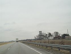 Many of these businesses have been converted to new use such as used car dealerships or offices while some have been abandoned, which provides an experience similar to US Route 66 when traveling on this highway. US 41 is sometimes considered an alternate to Interstate 65 due to its low traffic volumes.
South of Kentland, US 52 joins up with US 41 via US 24, the roadbed rises and the highway design widens to a modern interstate standard design.
A wind farm has recently (2008) been built next to the highway near Earl Park.
The landscape opens up and widens south of Kentland to a vast area of gently rolling plains and wide visibilities to the horizon. An interchange exists at US 52 and US 52 heads southeast towards Lafayette as a 4 lane divided rural highway.
US 41 continues southbound as an interstate quality divided highway with a few crossovers at State Route 18, State Route 352 at Boswell and State Route 26. The southbound lanes are the original concrete from the early 1970s while the northbound lanes contain a thin asphalt overlay, which tends to provide a bumpy ride.
Near Kramer Indiana, US 41 splits off from the interstate standard designed highway and heads southwest towards Attica as a rural 2 lane US Highway. Indiana State Road 63 continues the interstate standard 4 lane highway towards Terre Haute. US 41 passes through the town of Attica, Rob Roy, and reaches Interstate 74 at Veedersburg where it briefly divides into a 4 lane highway. US 41 again reduces to a 2 lane highway and continues south. It passes through the communities of Bloomingdale and Rockville. US 41 rejoins State Route 63 just north of Terre Haute, IN.
Through Terre Haute, US 41 is an urban arterial road with traffic lights as it passes through Indiana State University and past Honey Creek Mall. After Honey Creek Mall, US 41 approaches an Interchange with Interstate 70
. South of Interstate 70, US 41 multiplexes with U.S. Route 150. US 41 leaves Terre Haute and becomes a 4 lane divided highway. Unlike the area near Kentland, the stretch from Terre Haute to Vincennes is not built to interstate standards. Although it is 4 lanes, it is a relatively older pre interstate era highway coated with asphalt and a narrow median. US 41/US 150 passes through few towns before reaching Vincennes.
US 41 turns into a freeway interstate standard highway and bypasses the east side of Vincennes with interchanges and grade separations. In the middle of this bypass there is a modern 3 level stack interchange
with US 150. US 150 continues southeast and leaves the multiplex with US 41.
South of Vincennes, the freeway portion becomes a rural 4 lane non interstate standard highway. There is an interchange with Indiana State Road 64
near Princeton. The highway then reaches Interstate 64 and the greater Evansville area. Through Evansville, US 41 is again a standard arterial roadway with traffic lights and urban congestion. US 41 finally reaches the Ohio River using the Bi-State Vietnam Gold Star Bridges, commonly known as the twin bridges that take the highway into Henderson, KY.
In total, US 41 covers nearly 280 miles (450.6 km) from Whiting, IN on the north end to Evansville, IN on the south end.
U.S. Route 41 was also featured in the famous crop duster scene in the 1959 Alfred Hitchcock
film North by Northwest
, although the scene was actually filmed near Bakersfield, California
.
Indiana
Indiana is a US state, admitted to the United States as the 19th on December 11, 1816. It is located in the Midwestern United States and Great Lakes Region. With 6,483,802 residents, the state is ranked 15th in population and 16th in population density. Indiana is ranked 38th in land area and is...
, U.S. Route 41 (US 41) is a north–south highway that is parallel to the Illinois
Illinois
Illinois is the fifth-most populous state of the United States of America, and is often noted for being a microcosm of the entire country. With Chicago in the northeast, small industrial cities and great agricultural productivity in central and northern Illinois, and natural resources like coal,...
state line. It enters the state south of Evansville. North of Evansville, it becomes a 4-Lane divided highway passing around Vincennes and traveling North to Terre Haute. In Terre Haute, it is known as 3rd Street. North of Terre Haute, it hooks east and becomes a 2-lane surface road. Those wanting to stay on a 4-Lane divided highway can use SR 63
Indiana State Road 63
State Road 63 in the U. S. state of Indiana is a north–south route in the western portion of the state. Until mid-2008, it covered a distance of just over , but now is a discontinuous route. For , from the city of Terre Haute until it rejoins U.S. Route 41 near Carbondale, it is a four-lane...
to the west. It passes through Rockville, Veedersburg, and Attica before returning to a 4-Lane divided highway when SR 63
Indiana State Road 63
State Road 63 in the U. S. state of Indiana is a north–south route in the western portion of the state. Until mid-2008, it covered a distance of just over , but now is a discontinuous route. For , from the city of Terre Haute until it rejoins U.S. Route 41 near Carbondale, it is a four-lane...
terminates in Warren County. It remains a 4-lane divided highway until Lake County where it becomes a main road known as Indianapolis Blvd. It overlaps US 12 and US 20 in Hammond and exits Indiana
Indiana
Indiana is a US state, admitted to the United States as the 19th on December 11, 1816. It is located in the Midwestern United States and Great Lakes Region. With 6,483,802 residents, the state is ranked 15th in population and 16th in population density. Indiana is ranked 38th in land area and is...
into the South Side of Chicago
Chicago
Chicago is the largest city in the US state of Illinois. With nearly 2.7 million residents, it is the most populous city in the Midwestern United States and the third most populous in the US, after New York City and Los Angeles...
.
Route description
US Route 41 is a largely rural road in Western Indiana. It begins in the highly urban area of Northwest Indiana and transverses both older industrial communities such as Whiting and Hammond, and their nearby bedroom communities of Highland, Schererville, St. John, and Cedar Lake. Through these communities US 41 is an undivided 4 lane arterial road.Just south of Cedar Lake, US 41 divides and turns into a 4 lane divided US Highway and the speed limit rises to 60 mi/h. From Cedar Lake to Kentland, US 41 is relatively an older divided highway with a narrow median. It's obvious that this highway used to be a 2 lane route. One side of the highway is rolling and wavy, while the other half of the highway is built flat and to more modern standards. This portion of the route is mainly asphalt. According to INDOT, the twinning of US 41 in Indiana was begun in 1951, with construction progressing from south to north.
Up until the mid-1990s, many older styled bridges existed on the route, including a 1930s era truss bridge across the Kankakee River in Schneider and some pre interstate era concrete bridges at the railroad overpass near Morocco and the Iroquois River Bridge. All of these bridges have since been updated to INDOT's latest standards using concrete latex overlays and new concrete bridge decks.
From Cedar Lake, US 41 passes through the towns and villages of Schneider, Lake Village, Enos, Ade, and Kentland. Traffic volumes on this section of highway are relatively low and many intersections contain 1940s and 1950s eras former gas stations, diners and businesses associated with the highway before Interstate 65 was built in the early 1960s.
South of Kentland, US 52 joins up with US 41 via US 24, the roadbed rises and the highway design widens to a modern interstate standard design.
A wind farm has recently (2008) been built next to the highway near Earl Park.
The landscape opens up and widens south of Kentland to a vast area of gently rolling plains and wide visibilities to the horizon.
US 41 continues southbound as an interstate quality divided highway with a few crossovers at State Route 18, State Route 352 at Boswell and State Route 26. The southbound lanes are the original concrete from the early 1970s while the northbound lanes contain a thin asphalt overlay, which tends to provide a bumpy ride.
Near Kramer Indiana, US 41 splits off from the interstate standard designed highway and heads southwest towards Attica as a rural 2 lane US Highway. Indiana State Road 63 continues the interstate standard 4 lane highway towards Terre Haute. US 41 passes through the town of Attica, Rob Roy, and reaches Interstate 74 at Veedersburg where it briefly divides into a 4 lane highway. US 41 again reduces to a 2 lane highway and continues south. It passes through the communities of Bloomingdale and Rockville. US 41 rejoins State Route 63 just north of Terre Haute, IN.
Through Terre Haute, US 41 is an urban arterial road with traffic lights as it passes through Indiana State University and past Honey Creek Mall. After Honey Creek Mall, US 41 approaches an Interchange with Interstate 70
Interstate 70
Interstate 70 is an Interstate Highway in the United States that runs from Interstate 15 near Cove Fort, Utah, to a Park and Ride near Baltimore, Maryland. It was the first Interstate Highway project in the United States. I-70 approximately traces the path of U.S. Route 40 east of the Rocky...
. South of Interstate 70, US 41 multiplexes with U.S. Route 150. US 41 leaves Terre Haute and becomes a 4 lane divided highway. Unlike the area near Kentland, the stretch from Terre Haute to Vincennes is not built to interstate standards. Although it is 4 lanes, it is a relatively older pre interstate era highway coated with asphalt and a narrow median. US 41/US 150 passes through few towns before reaching Vincennes.
US 41 turns into a freeway interstate standard highway and bypasses the east side of Vincennes with interchanges and grade separations. In the middle of this bypass there is a modern 3 level stack interchange
Stack interchange
A stack interchange is a free-flowing grade separated junction between two roads.In countries where one drives on the right, left turns are handled by semi-directional flyover/under ramps...
with US 150. US 150 continues southeast and leaves the multiplex with US 41.
South of Vincennes, the freeway portion becomes a rural 4 lane non interstate standard highway. There is an interchange with Indiana State Road 64
Indiana State Road 64
State Road 64 in the U.S. State of Indiana is an east–west highway that crosses most of the southern portion of the state, covering a distance of about .-Route description:...
near Princeton. The highway then reaches Interstate 64 and the greater Evansville area. Through Evansville, US 41 is again a standard arterial roadway with traffic lights and urban congestion. US 41 finally reaches the Ohio River using the Bi-State Vietnam Gold Star Bridges, commonly known as the twin bridges that take the highway into Henderson, KY.
In total, US 41 covers nearly 280 miles (450.6 km) from Whiting, IN on the north end to Evansville, IN on the south end.
U.S. Route 41 was also featured in the famous crop duster scene in the 1959 Alfred Hitchcock
Alfred Hitchcock
Sir Alfred Joseph Hitchcock, KBE was a British film director and producer. He pioneered many techniques in the suspense and psychological thriller genres. After a successful career in British cinema in both silent films and early talkies, Hitchcock moved to Hollywood...
film North by Northwest
North by Northwest
North by Northwest is a 1959 American thriller film directed by Alfred Hitchcock, starring Cary Grant, Eva Marie Saint and James Mason, and featuring Leo G. Carroll and Martin Landau...
, although the scene was actually filmed near Bakersfield, California
Bakersfield, California
Bakersfield is a city near the southern end of the San Joaquin Valley in Kern County, California. It is roughly equidistant between Fresno and Los Angeles, to the north and south respectively....
.