

Borman Expressway
Encyclopedia
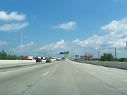
The Frank Borman Expressway is an east–west highway in the northwest part of the U.S. state of Indiana
, named after astronaut and former Eastern Airlines CEO Frank Borman
. The expressway consists of parts of Interstate 80
(I-80), I-94
, and U.S. Highway 6
(US 6), as well as a short section of US 41
. The designation begins from the Illinois
state line east to the Lake
–Porter
county line, just east of the junction with the Indiana Toll Road
. The expressway has been identified in federal transportation legislation as part of High Priority Corridor 18, Segment 27, making current and future construction projects on I-94 eligible for federal funding in association with extending Interstate 69
to the Texas–Mexico border.
The Borman Expressway is a major truck thoroughfare, providing a free alternative to the Indiana Toll Road
and Chicago Skyway
to the north. Originally constructed in segments starting in the 1950s, with its Illinois counterpart, the Kingery Expressway
, reconstruction of the expressway began in 2004. Flooding in 2007 and 2008 caused road closures, but measures are in place to prevent future occurrences.
 The designation of the expressway begins at the state line, where the Kingery Expressway
becomes the Borman. It has interchanges with 11 roads, such as US 41, State Road 912
(SR 912, Cline Avenue, and I-65
. At the Indiana Toll Road, I-80 turns eastward. The highway after the Toll Road, now designated solely as I-94, continues eastward towards Michigan City
and Detroit. Detroit is the control city going eastward on I-94, from the Indiana–Illinois border all the way through Michigan.
in Illinois. It was originally designated SR 420 in Indiana. US 6 diverged at Calumet Avenue south, and ran on Calumet Avenue and Ridge Road.
At various times, the expressway was extended from Indianapolis Boulevard to Burr Street, then to Georgia Street east of Broadway, and eventually to the Toll Road. Some time after the enactment of the Interstate Highway System, the expressway was designated as I-80, I-90, and I-294
, and the I-94 designation was applied to the Toll Road west of where the current interchange with the Borman was eventually built. The expressways were renumbered around 1965, to avoid the implication that through drivers must change roads to stay on I-90 or I-94, resulting in the Borman becoming I-80/I-94. US 6 was extended to Ripley Street at that time, and I-294 was cut back to the Tri-State Tollway. The Borman Expressway is named after Frank Borman, commander of the Apollo 8
space mission, who was born in Gary
.
The Borman and Cline Avenue interchange is a partial cloverleaf interchange
. Two flyover ramps allow southbound Cline Avenue traffic to merge onto the eastbound Borman Expressway, and northbound Cline Avenue traffic to merge onto the westbound Borman. The remaining ramps utilize the cloverleaf design.
were closed by the Indiana Department of Transportation
(INDOT) and the Indiana State Police
due to severe flooding from the Little Calumet River. A levee breach, thanks to torrential rains from the remnants of Hurricane Ike
, reportedly caused water from the river to cascade across all lanes to a depth of nearly five feet under the Kennedy Avenue overpass. The expressway remained shutdown in both directions until the following Wednesday, September 17, 2008. There had also been flooding in August 2007 and various measures have been undertaken to prevent furure occurrences.
Indiana
Indiana is a US state, admitted to the United States as the 19th on December 11, 1816. It is located in the Midwestern United States and Great Lakes Region. With 6,483,802 residents, the state is ranked 15th in population and 16th in population density. Indiana is ranked 38th in land area and is...
, named after astronaut and former Eastern Airlines CEO Frank Borman
Frank Borman
Frank Frederick Borman, II is a retired NASA astronaut and engineer, best remembered as the Commander of Apollo 8, the first mission to fly around the Moon, making him, along with fellow crew mates Jim Lovell and Bill Anders, the first of only 24 humans to do so...
. The expressway consists of parts of Interstate 80
Interstate 80 in Indiana
In the U.S. state of Indiana, Interstate 80 consists entirely of the following two routes:* The Borman Expressway, from the Illinois state line to Lake Station, Indiana, running concurrently with Interstate 94....
(I-80), I-94
Interstate 94 in Indiana
In the U.S. state of Indiana, Interstate 94 runs east–west through the northwest portion of the state.-Route description:The route between the Illinois border and Lake Station at its junction with the Indiana Toll Road is known as the Borman Expressway and is a heavily traveled route...
, and U.S. Highway 6
U.S. Route 6 in Indiana
U.S. Route 6 is a part of the United States Numbered Highway that runs from California to Provincetown, Massachusetts. In Indiana, it is a mostly rural, two-lane route that travels in the northern part of the state. However, some four-lane stretches may be found in Lake and Porter counties. For...
(US 6), as well as a short section of US 41
U.S. Route 41 in Indiana
In the U.S. state of Indiana, U.S. Route 41 is a north–south highway that is parallel to the Illinois state line. It enters the state south of Evansville. North of Evansville, it becomes a 4-Lane divided highway passing around Vincennes and traveling North to Terre Haute. In Terre Haute, it...
. The designation begins from the Illinois
Illinois
Illinois is the fifth-most populous state of the United States of America, and is often noted for being a microcosm of the entire country. With Chicago in the northeast, small industrial cities and great agricultural productivity in central and northern Illinois, and natural resources like coal,...
state line east to the Lake
Lake County, Indiana
Lake County is a county located in the U.S. state of Indiana. In 2010, its population was 496,005, making it Indiana's second-most populous county. The county seat is Crown Point. This county is part of Northwest Indiana and the Chicago metropolitan area. The county contains a mix of urban,...
–Porter
Porter County, Indiana
Porter County is a county located in the U.S. state of Indiana. As of 2010, the population was 164,343. Much of the population growth has to do with the expansion of the Chicago Metropolitan Area eastward into Indiana. The county seat is Valparaiso...
county line, just east of the junction with the Indiana Toll Road
Indiana Toll Road
The Indiana Toll Road, officially the Indiana East–West Toll Road, is a toll road that runs for east–west across northern Indiana from the Illinois state line to the Ohio state line...
. The expressway has been identified in federal transportation legislation as part of High Priority Corridor 18, Segment 27, making current and future construction projects on I-94 eligible for federal funding in association with extending Interstate 69
Interstate 69
Interstate 69 is an Interstate Highway in the United States. It exists in two parts: a completed highway from Indianapolis, Indiana, northeast to the Canadian border in Port Huron, Michigan, and a mostly proposed extension southwest to the Mexican border in Texas...
to the Texas–Mexico border.
The Borman Expressway is a major truck thoroughfare, providing a free alternative to the Indiana Toll Road
Indiana Toll Road
The Indiana Toll Road, officially the Indiana East–West Toll Road, is a toll road that runs for east–west across northern Indiana from the Illinois state line to the Ohio state line...
and Chicago Skyway
Chicago Skyway
The Chicago Skyway, also known as Chicago Skyway Toll Bridge System, is a toll road in Chicago, Illinois, United States, carrying Interstate 90 from the Indiana Toll Road to the Dan Ryan Expressway on Chicago's South Side leading into the Chicago Loop....
to the north. Originally constructed in segments starting in the 1950s, with its Illinois counterpart, the Kingery Expressway
Kingery Expressway
The Robert Kingery Expressway, formerly called the Tri-State Highway, is a three-mile-long , eight-lane expressway in northeastern Illinois...
, reconstruction of the expressway began in 2004. Flooding in 2007 and 2008 caused road closures, but measures are in place to prevent future occurrences.
Route description
Kingery Expressway
The Robert Kingery Expressway, formerly called the Tri-State Highway, is a three-mile-long , eight-lane expressway in northeastern Illinois...
becomes the Borman. It has interchanges with 11 roads, such as US 41, State Road 912
Indiana State Road 912
State Road 912, known along its entire length as Cline Avenue, is a freeway north of the Borman Expressway , and a local access road serving Griffith south of the Borman. The portion of Cline Avenue marked as SR 912 is long. Indiana 912 can be considered a child route of U.S...
(SR 912, Cline Avenue, and I-65
Interstate 65 in Indiana
In the U.S. state of Indiana, Interstate 65 traverses the state from south to north. The Indiana portion begins near Louisville, Kentucky and travels north, passing through Columbus, Indianapolis, Lafayette. Interstate 65 terminates near Gary on the Indiana Toll Road. Interstate 65 covers 261.27...
. At the Indiana Toll Road, I-80 turns eastward. The highway after the Toll Road, now designated solely as I-94, continues eastward towards Michigan City
Michigan City, Indiana
Michigan City's origins date to 1830, when the land for the city was first purchased by Isaac C. Elston. Elston Middle School, formerly Elston High School, located at 317 Detroit St., is named after the founder....
and Detroit. Detroit is the control city going eastward on I-94, from the Indiana–Illinois border all the way through Michigan.
History
The expressway now known as the Borman was originally known as the Tri-State Highway, and construction of the expressway began in 1949. The designation went through the Kingery Expressway, and eventually linked with the Tri-State TollwayTri-State Tollway
The Tri-State Tollway is a U.S. toll road maintained by the Illinois State Toll Highway Authority in northeastern Illinois which is considered one of the most heavily traveled highways in the country...
in Illinois. It was originally designated SR 420 in Indiana. US 6 diverged at Calumet Avenue south, and ran on Calumet Avenue and Ridge Road.
At various times, the expressway was extended from Indianapolis Boulevard to Burr Street, then to Georgia Street east of Broadway, and eventually to the Toll Road. Some time after the enactment of the Interstate Highway System, the expressway was designated as I-80, I-90, and I-294
Interstate 294
Interstate 294 is a tolled Interstate Highway in northeastern Illinois, U.S.A.. It forms the southern portion of the Tri-State Tollway in Illinois. I-294 runs from South Holland at Interstates 80 and 94, and Illinois Route 394 to Northbrook at I-94. Interstate 294 is long; are shared with I-80....
, and the I-94 designation was applied to the Toll Road west of where the current interchange with the Borman was eventually built. The expressways were renumbered around 1965, to avoid the implication that through drivers must change roads to stay on I-90 or I-94, resulting in the Borman becoming I-80/I-94. US 6 was extended to Ripley Street at that time, and I-294 was cut back to the Tri-State Tollway. The Borman Expressway is named after Frank Borman, commander of the Apollo 8
Apollo 8
Apollo 8, the second manned mission in the American Apollo space program, was the first human spaceflight to leave Earth orbit; the first to be captured by and escape from the gravitational field of another celestial body; and the first crewed voyage to return to Earth from another celestial...
space mission, who was born in Gary
Gary, Indiana
Gary is a city in Lake County, Indiana, United States. The city is in the southeastern portion of the Chicago metropolitan area and is 25 miles from downtown Chicago. The population is 80,294 at the 2010 census, making it the seventh-largest city in the state. It borders Lake Michigan and is known...
.
Reconstruction
Reconstruction of the Borman commenced in 2004. The reconstruction of both the Kingery and the Borman aimed to significanly reduce the delays encountered on the highway. The reconstructed portion of the Borman is eight lanes wide, with additional collector-distributor lanes between interchanges. Construction between the Illinois state line and exit 11 (I-65 south ramp to Indianapolis) was completed in 2007. The Interstate 65 Interchange Modification Project continueed into 2009, including replacing the pavement of the Borman to Central Avenue.The Borman and Cline Avenue interchange is a partial cloverleaf interchange
Cloverleaf interchange
A cloverleaf interchange is a two-level interchange in which left turns, reverse direction in left-driving regions, are handled by ramp roads...
. Two flyover ramps allow southbound Cline Avenue traffic to merge onto the eastbound Borman Expressway, and northbound Cline Avenue traffic to merge onto the westbound Borman. The remaining ramps utilize the cloverleaf design.
Flooding
On Saturday, September 13, 2008, at approximately 9:00 a.m. CDT, all lanes of the Borman Expressway in both directions at Kennedy Avenue in HammondHammond, Indiana
Hammond is a city in Lake County, Indiana, United States. It is part of the Chicago metropolitan area. The population was 80,830 at the 2010 census.-Geography:Hammond is located at ....
were closed by the Indiana Department of Transportation
Indiana Department of Transportation
The Indiana Department of Transportation is a governmental agency of the U.S. state of Indiana charged with maintaining and regulating transportation and transportation related infrastructure such as state owned airports, state highways and state owned canals or railroads.-Districts:INDOT is...
(INDOT) and the Indiana State Police
Indiana State Police
The Indiana State Police is the statewide law enforcement agency for the state of Indiana. Indiana was the 12th state to offer protection to its citizens with a state police force.-History:...
due to severe flooding from the Little Calumet River. A levee breach, thanks to torrential rains from the remnants of Hurricane Ike
Hurricane Ike
Hurricane Ike was the second-costliest hurricane ever to make landfall in the United States, the costliest hurricane ever to impact Cuba and the second most active hurricane to reach the Canadian mainland in the Great Lakes Region after Hurricane Hazel in 1954...
, reportedly caused water from the river to cascade across all lanes to a depth of nearly five feet under the Kennedy Avenue overpass. The expressway remained shutdown in both directions until the following Wednesday, September 17, 2008. There had also been flooding in August 2007 and various measures have been undertaken to prevent furure occurrences.