

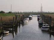
Fens Waterways Link
Encyclopedia
Cambridgeshire
Cambridgeshire is a county in England, bordering Lincolnshire to the north, Norfolk to the northeast, Suffolk to the east, Essex and Hertfordshire to the south, and Bedfordshire and Northamptonshire to the west...
and Lincolnshire
Lincolnshire
Lincolnshire is a county in the east of England. It borders Norfolk to the south east, Cambridgeshire to the south, Rutland to the south west, Leicestershire and Nottinghamshire to the west, South Yorkshire to the north west, and the East Riding of Yorkshire to the north. It also borders...
, England. By a combination of improvements to existing waterways and the construction of new links a circular route between Lincoln
Lincoln, Lincolnshire
Lincoln is a cathedral city and county town of Lincolnshire, England.The non-metropolitan district of Lincoln has a population of 85,595; the 2001 census gave the entire area of Lincoln a population of 120,779....
, Peterborough
Peterborough
Peterborough is a cathedral city and unitary authority area in the East of England, with an estimated population of in June 2007. For ceremonial purposes it is in the county of Cambridgeshire. Situated north of London, the city stands on the River Nene which flows into the North Sea...
, Ely
Ely, Cambridgeshire
Ely is a cathedral city in Cambridgeshire, England, 14 miles north-northeast of Cambridge and about by road from London. It is built on a Lower Greensand island, which at a maximum elevation of is the highest land in the Fens...
and Boston
Boston, Lincolnshire
Boston is a town and small port in Lincolnshire, on the east coast of England. It is the largest town of the wider Borough of Boston local government district and had a total population of 55,750 at the 2001 census...
is planned. The project is being organised by the Environment Agency
Environment Agency
The Environment Agency is a British non-departmental public body of the Department for Environment, Food and Rural Affairs and an Assembly Government Sponsored Body of the Welsh Assembly Government that serves England and Wales.-Purpose:...
and financed from the Regional Development Agency
Regional Development Agency
In the United Kingdom, a regional development agency is a non-departmental public body established for the purpose of development, primarily economic, of one of England's Government Office regions. There is one RDA for each of the NUTS level 1 regions of England...
and the European Union
European Union
The European Union is an economic and political union of 27 independent member states which are located primarily in Europe. The EU traces its origins from the European Coal and Steel Community and the European Economic Community , formed by six countries in 1958...
.
A separate, complementary waterway is the Bedford and Milton Keynes Waterway, opening up a route for broader beam boats between The Fens
The Fens
The Fens, also known as the , are a naturally marshy region in eastern England. Most of the fens were drained several centuries ago, resulting in a flat, damp, low-lying agricultural region....
and the rest Britain's canal network.
New Cuts
The Environment Agency has obtained a "significant proportion" of the £8m required for phase one. Starting from the north, the first development was the provision of a new tidal lock from the HavenThe Haven, Boston
The Haven is the tidal river of the Port of Boston, Lincolnshire in England. It provides access for shipping between Boston Deeps in The Wash and the town, particularly, the dock. It also serves as the outfall into the sea, of the River Witham and of several major land drains of the northern Fens...
in Boston to the South Forty-Foot Drain
South Forty-foot drain
The South Forty-Foot Drain is the main channel for the land-drainage of the Black Sluice Level in the Lincolnshire Fens. It lies in eastern England between Guthram Gowt and the Black Sluice pumping station on The Haven, at Boston...
at the Black Sluice
Black Sluice
The Black Sluice is the name given to the structure that controls the flow of the South Forty-Foot Drain into The Haven, at Boston, Lincolnshire, England.-History and ownership:...
, opened to traffic on 20 March 2009. Funding for phase two of the project, which will involve widening of the South Forty-Foot Drain from Donington to a new road crossing under the A151, a new lock and a junction with the River Glen
River Glen, Lincolnshire
The River Glen is a river in Lincolnshire, England with a short stretch passing through Rutland near Essendine.The river's name appears to derive from a Brythonic Celtic language but there is a strong early English connection.-Naming:...
, a tributary of the River Welland
River Welland
The River Welland is a river in the east of England, some long. It rises in the Hothorpe Hills, at Sibbertoft in Northamptonshire, then flows generally northeast to Market Harborough, Stamford and Spalding, to reach The Wash near Fosdyke. For much of its length it forms the county boundary between...
, at Guthram Gowt
Guthram Gowt
Guthram Gowt is a small settlement between Bourne and Spalding in Lincolnshire, England, at a bend in the River Glen.-The Location:Guthram Gowt is at the southern, upstream end of the South Forty-Foot Drain...
has been secured from the East Midlands Development Agency.
To connect the Glen to the Welland requires a new tidal lock at the Surfleet
Surfleet
Surfleet is a small village on the Lincolnshire fens, situated on the River Glen about five miles north of Spalding.The population is about 1,266 people, many of whom commute to regional populations centres such as Spalding, Boston and Peterborough....
Sluices and reconstruction of the tidal Fulney Lock in the River Welland, leading to Spalding
Spalding, Lincolnshire
Spalding is a market town with a population of 30,000 on the River Welland in the South Holland district of Lincolnshire, England. Little London is a hamlet directly south of Spalding on the B1172 road....
.
Another major innovation will be a new cut between the Welland, probably at Peakirk and the Nene
River Nene
The River Nene is a river in the east of England that rises from three sources in the county of Northamptonshire. The tidal river forms the border between Cambridgeshire and Norfolk for about . It is the tenth longest river in the United Kingdom, and is navigable for from Northampton to The...
downstream of Peterborough, costing at least £20m and probably using the Folly River and part of Car Dyke
Car Dyke
The Car Dyke was, and to large extent still is, an eighty-five mile long ditch which runs along the western edge of the Fens in eastern England. It is generally accepted as being of Roman age and, for many centuries, to have been taken as marking the western edge of the Fens...
, entering the Nene near Flag Fen
Flag Fen
Flag Fen near Peterborough, England is a Bronze Age site, probably religious. It comprises over 60,000 timbers arranged in five very long rows connecting Whittlesey Island with Peterborough across the wet fenland. Part way across the structure, a small island was formed which is where it is...
. From here the link will follow the existing Middle Levels
Middle Level Navigations
The Middle Level Navigations are a network of waterways in England, primarily used for land drainage, between the Rivers Nene and Great Ouse, between Peterborough and Cambridge.- History :...
through Whittlesey Dyke, King's Dyke and Vermuyden's Drain (Forty Foot Drain) to Chatteris
Chatteris
Chatteris is a civil parish and one of four market towns in the Fenland district of Cambridgeshire, England, situated in The Fens between Huntingdon, March and Ely...
. To avoid the existing troublesome crossing from Salter's Lode to Denver Lock a new lock would probably provided from Vermuyden's Drain into the Old Bedford River
Old Bedford River
The Old Bedford River is an artificial, partial diversion of the waters of the River Great Ouse in the Fens of Cambridgeshire, England. It was named after the fourth Earl of Bedford who contracted with the local Commission of Sewers to drain the Great Level of the Fens beginning in 1630.The idea of...
at Welches Dam
Welches Dam
Welches Dam is a parish in Cambridgeshire around to the north west of Ely. It covers an area of .The parish of Welches Dam is surrounded by those of Coveney, Manea, Mepal, and Witcham. The civil parish was divided between Chatteris and Manea in 1960....
, and thence to the Great Ouse at Earith
Earith
Earith is a village in the Fens of Cambridgeshire, England, south of Chatteris and east of Huntingdon. At Earith, two artificial diversion channels of the River Great Ouse, the Old Bedford River and the New Bedford River, leave the river on a course to Denver Sluice near Downham Market, where they...
, though another possibility is to use Fenton's Lode to avoid most of the tidal section.
The completion of the project would be the long discussed Bedford and Milton Keynes Waterway canal between Bedford
Bedford
Bedford is the county town of Bedfordshire, in the East of England. It is a large town and the administrative centre for the wider Borough of Bedford. According to the former Bedfordshire County Council's estimates, the town had a population of 79,190 in mid 2005, with 19,720 in the adjacent town...
and Milton Keynes
Milton Keynes
Milton Keynes , sometimes abbreviated MK, is a large town in Buckinghamshire, in the south east of England, about north-west of London. It is the administrative centre of the Borough of Milton Keynes...
following the course of the Great Ouse and joining the Grand Union Canal
Grand Union Canal
The Grand Union Canal in England is part of the British canal system. Its main line connects London and Birmingham, stretching for 137 miles with 166 locks...
, mooted as the "first new canal in over a century". The funding for this is slowly appearing and as well as providing for the first time an inland route for broader boats—up to 3.2 metre wide—between the north and south of England, it would also serve as a flood relief channel for new developments in the areas through which it is to pass through. This extra benefit may release funding from wider sources. Adaptation of existing locks and bridges would be necessary to increase the dimensions to Grand Union Canal
Grand Union Canal
The Grand Union Canal in England is part of the British canal system. Its main line connects London and Birmingham, stretching for 137 miles with 166 locks...
gauge, both in width and air draft.
Precursors
Although using a slightly different route, there are echoes of plans made in 1809 to link the waterways. Two schemes were proposed, one which would have created a canal from StamfordStamford, Lincolnshire
Stamford is a town and civil parish within the South Kesteven district of the county of Lincolnshire, England. It is approximately to the north of London, on the east side of the A1 road to York and Edinburgh and on the River Welland...
to the Oakham Canal
Oakham Canal
The Oakham Canal ran from Oakham, Rutland to Melton Mowbray, Leicestershire in the East Midlands of England. It opened in 1802, but it was never a financial success, and it suffered from the lack of an adequate water supply. It closed after 45 years, when it was bought by the Midland Railway to...
, 11 miles (17.7 km) due west, with a link from Stamford to the River Nene
River Nene
The River Nene is a river in the east of England that rises from three sources in the county of Northamptonshire. The tidal river forms the border between Cambridgeshire and Norfolk for about . It is the tenth longest river in the United Kingdom, and is navigable for from Northampton to The...
at Peterborough
Peterborough
Peterborough is a cathedral city and unitary authority area in the East of England, with an estimated population of in June 2007. For ceremonial purposes it is in the county of Cambridgeshire. Situated north of London, the city stands on the River Nene which flows into the North Sea...
, and a connection from near Market Deeping
Market Deeping
Market Deeping is a market town in Lincolnshire, England, on the north bank of the River Welland and the A15 road.-Geography:It is the second largest of The Deepings and its eponymous market has been held since at least 1220. The river here forms the Lincolnshire/Cambridgeshire border with...
on the River Welland
River Welland
The River Welland is a river in the east of England, some long. It rises in the Hothorpe Hills, at Sibbertoft in Northamptonshire, then flows generally northeast to Market Harborough, Stamford and Spalding, to reach The Wash near Fosdyke. For much of its length it forms the county boundary between...
, and a rival scheme to link Stamford to the Grand Junction Canal
Grand Junction Canal
The Grand Junction Canal is a canal in England from Braunston in Northamptonshire to the River Thames at Brentford, with a number of branches. The mainline was built between 1793 and 1805, to improve the route from the Midlands to London, by-passing the upper reaches of the River Thames near Oxford...
, both of which included a connection to the South Forty-Foot Drain. Both were put before Parliament in 1811, but neither met with any success. The idea was raised again in 1815 and 1828, but no further action was taken.
See also
- Canals of the United KingdomCanals of the United KingdomThe canals of the United Kingdom are a major part of the network of inland waterways in the United Kingdom. They have a colourful history, from use for irrigation and transport, through becoming the focus of the Industrial Revolution, to today's role for recreational boating...
- History of the British canal systemHistory of the British canal systemThe British canal system of water transport played a vital role in the United Kingdom's Industrial Revolution at a time when roads were only just emerging from the medieval mud and long trains of pack horses were the only means of "mass" transit by road of raw materials and finished products The...