
Deleted state highways in California
Encyclopedia
Below is a list and summary of some of the deleted state highway
s (i.e., those with no current routing) as outlined by the legislature in 1964. For a complete list, see list of state highways in California and list of state highways in California (pre-1964).
State highway
State highway, state road or state route can refer to one of three related concepts, two of them related to a state or provincial government in a country that is divided into states or provinces :#A...
s (i.e., those with no current routing) as outlined by the legislature in 1964. For a complete list, see list of state highways in California and list of state highways in California (pre-1964).
 |
State Route 30 ran from Interstate 210 in San Dimas to Interstate 10 Interstate 10 in California Interstate 10 , the major east–west Interstate Highway in the Southern United States, runs in the U.S. state of California east from Santa Monica, on the Pacific Ocean, through Los Angeles and San Bernardino to the border with Arizona... in Redlands through San Bernardino. It was built to freeway standards between Interstate 215 in San Bernardino and Interstate 10. When the western freeway section, between Interstate 210 and Interstate 215 was completed in 2007, the route was decommissioned and renumbered SR 210. It is expected to be included into the interstate highway system at some later date as an extension to Interstate 210. |
 |
State Route 31 ran from State Route 91 California State Route 91 State Route 91 is a major east–west freeway located entirely within Southern California and serving several regions of the Greater Los Angeles metropolitan area... near Corona to Interstate 15 Interstate 15 in California In the U.S. state of California, Interstate 15 is a major north–south route through the San Bernardino, Riverside, and San Diego Counties, and it has a length of in the state. It is a major thoroughfare for traffic between Southern California and Las Vegas, Nevada, as well as points beyond... in Devore through San Bernardino. The route was deleted in 1974, when it was added to the interstate system. After being signed California 31, It was signed Temporary Interstate 15, and later,, after being moved from Main Street in Corona, Hamner Avenue in Riverside County north of Corona, and Milliken Avenue in San Bernardino County to the Ontario Freeway. became Interstate 15 Interstate 15 in California In the U.S. state of California, Interstate 15 is a major north–south route through the San Bernardino, Riverside, and San Diego Counties, and it has a length of in the state. It is a major thoroughfare for traffic between Southern California and Las Vegas, Nevada, as well as points beyond... . |
 |
State Route 42 ran from State Route 1 California State Route 1 State Route 1 , more often called Highway 1, is a state highway that runs along much of the Pacific coast of the U.S. state of California. It is famous for running along some of the most beautiful coastlines in the world, leading to its designation as an All-American Road.Highway 1 does not run... west of Inglewood to State Route 91 California State Route 91 State Route 91 is a major east–west freeway located entirely within Southern California and serving several regions of the Greater Los Angeles metropolitan area... in Santa Ana Canyon near Norwalk. It was deleted in 1968. The segment east of Interstate 5 (Santa Ana Freeway Santa Ana Freeway The Santa Ana Freeway is one of the principal freeways in Southern California, connecting Los Angeles and its southeastern suburbs including the freeway's namesake, the city of Santa Ana. The freeway begins at the Four Level Interchange in downtown Los Angeles, signed as U.S. Route 101... ) was added to State Route 90 California State Route 90 State Route 90 is a state highway in Southern California, United States. It consists of two unconnected pieces in Greater Los Angeles.... . The segment west of Interstate 5 was added to the interstate system as Interstate 105 Interstate 105 (California) Interstate 105 is an Interstate Highway in southern Los Angeles County, California that runs east–west from near the Los Angeles International Airport to Norwalk... . The freeway would not be opened until 1993, which resulted in the original route continuing to be signed as State Route 42. To this day, Route 42 is still sporadically signed in many places. |
 |
State Route 106 was originally created in 1964, and ran from State Route 38 California State Route 38 State Route 38 is a mostly rural and scenic road in the U.S. state of California. Despite the orientation of its alignment, SR 38 is assigned in a west–east direction.-Route description:... in Redlands to State Route 18 in Running Springs. Prior to 1964, the highway was apart of Legislative Route 190, which ran from US 66 to State Route 38. After 1964, the route was split in half. The western portion became State Route 30. The eastern portion was combined with Legislative Route 207, and became State Route 106. A year later, its southern terminus was moved to Interstate 10 Interstate 10 in California Interstate 10 , the major east–west Interstate Highway in the Southern United States, runs in the U.S. state of California east from Santa Monica, on the Pacific Ocean, through Los Angeles and San Bernardino to the border with Arizona... . In 1972, State Route 106 was decommissioned. The northern portion between State Route 30 and State Route 18 was renumbered to State Route 330 California State Route 330 State Route 330 is a state highway in the U.S. state of California. It is also known as City Creek Road in the San Bernardino Mountains.-Route description:... . The southern portion was added to State Route 30, extending it to Interstate 10. This also reconnected both halves of the original Legislative Route 190. |
 |
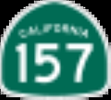
State Route 157 ran from State Route 125 California State Route 125 State Route 125 is a state highway in the U.S. state of California that currently runs from State Route 905 in Otay Mesa near the U.S.–Mexico border to State Route 52 in Santee.... near the Sweetwater Reservoir Sweetwater Reservoir Sweetwater Reservoir is a artificial lake in San Diego County, California formed by the Sweetwater Dam on the Sweetwater River. It lies near the city of Spring Valley.... to Interstate 805 near San Diego. The route became a state highway in 1963 and was deleted in 1994. |
 |
State Route 159 Between July 1, 1964 and the time it was turned back to local authorities, Route 159 was the segment of Linda Vista Avenue in Pasadena between State Route 134, the Ventura Freeway, and Interstate 210 Interstate 210 (California) Interstate 210 and State Route 210 together form a contiguous highway, called the Foothill Freeway, in the Greater Los Angeles area of the U.S. state of California. The western portion of the route is an auxiliary Interstate Highway, while the eastern portion is a state highway... , the Foothill Freeway. Prior to July 1, 1964 it was a segment of California Legislative Route 165 and signed as California Sign Route 11. |
 |
State Route 171 ran from I-5 Interstate 5 in California Interstate 5 is a major north–south route of the Interstate Highway System in the U.S. state of California. It begins at the Mexico – United States border at the San Ysidro crossing, goes north across the length of California and crosses into Oregon south of the Medford-Ashland metropolitan... near San Diego to Route 805 via Switzer Canyon. This route was deleted in 1994. |
 |
State Route 176 ran from US 101 in Santa Maria to Sisquoc along Stowell Road, Philbric Road, and Foxen Canyon Road. Prior to July 1, 1964 it was an unsigned segment of California Legislative Route 148. |
 |
State Route 196 ran from Route 2 State Route 2 (California) State Route 2 is a state highway in the U.S. state of California. It runs from the junction of Lincoln Blvd and Interstate 10 in Santa Monica to SR 138 east of Wrightwood, running concurrent with U.S... to Route 249 south of Palmdale. It was deleted in 1965. |
 |
State Route 206 Between July 1, 1964 and the time it was turned back to local authorities, Route 206 ran from Highland Avenue, formerly State Route 30, in San Bernardino along North E Street, Kendall Drive, and Palm Avenue to the Barstow Freeway, Interstate 215 Interstate 215 (California) Interstate 215 is a long north–south Interstate highway in the Inland Empire region of Southern California. It is an auxiliary route of Interstate 15 , running from Murrieta to northern San Bernardino... , in Verdemont. Prior to July 1, 1964, Route 206 was California Legislative Route 191 and was signed as Business U. S. 66. |
 |
State Route 209 California State Route 209 State Route 209 was a state highway in the U.S. state of California, connecting Point Loma with the interchange of I-5 and I-8 in San Diego.-Route description:... connected Point Loma with the interchange Interchange (road) In the field of road transport, an interchange is a road junction that typically uses grade separation, and one or more ramps, to permit traffic on at least one highway to pass through the junction without directly crossing any other traffic stream. It differs from a standard intersection, at which... of I-5 and I-8 in San Diego. The route began at the Cabrillo National Monument Cabrillo National Monument Cabrillo National Monument is located at the southern tip of the Point Loma Peninsula in San Diego, California. It commemorates the landing of Juan Rodríguez Cabrillo at San Diego Bay on September 28, 1542. This event marked the first time that a European expedition had set foot on what later... and passed through Fort Rosecrans and the neighborhood of Point Loma via Catalina Boulevard, Canon Street, and Rosecrans Street. This route was deleted in 2003. As signs get replaced on I-5, references to Route 209 are disappearing; however, Route 209 is still well marked on Rosecrans. |
 |
State Route 214 Between July 1, 1964 and the time it was turned back to local authorities, Route 214 ran between Lakewood Boulevard, then State Route 19 State Route 19 (California) State Route 19 , also known as Lakewood Boulevard and Rosemead Boulevard, is a state highway in the Los Angeles area of the U.S. state of California... , in Long Beach and the Santa Ana Freeway, Interstate 5, in Anaheim. Route 214 traversed Carson Street in Los Angeles County (between Route 19 and the Los Angeles/Orange County Line). It continued into Orange County on Lincoln Avenue (between the Los Angeles/Orange County Line and Route 5). Prior to July 1, 1964, Route 214 was a segment of California Legislative Route 178. Between 1962 and July 1, 1964 it was signed as US 91. Before 1962, it was signed as both US 91 and State Route 18 State Route 18 (California) State Route 18 in the U.S. state of California runs from State Route 210 in San Bernardino to State Route 138 near Adelanto. It is the primary route into the San Bernardino Mountains and has two discontinunities: one in Big Bear Lake, the other in Victorville.-Route description:SR 18 is part of... . |
 |
State Route 228, deleted in 1998, was proposed to be a short bypass west of Brawley Brawley, California Brawley is a city in Imperial County, California, United States. Brawley is located north of El Centro. The population was 24,953 at the 2010 census, up from 22,052 at the 2000 census. The town has a significant cattle and feed industry, and hosts the annual Cattle Call Rodeo. Year-round... . The 2 miles (3 km) road would have connected two portions of State Route 86 California State Route 86 State Route 86 is a north–south state highway in the southeastern desert region of Southern California, United States. It runs from State Route 111, near the Mexican border crossing at Calexico, north through the Imperial Valley via El Centro and Brawley, and around the west side of the... . |
 |
State Route 231 was, until 1972, a designation for a state highway connection from State Route 86 to State Route 195 State Route 195 (California) State Route 195 is a state highway in the U.S. state of California, branching westward from State Route 111. When State Route 86S was fully constructed, SR 195 was supposed to be removed from the state highway system according to state law.... near Mecca Mecca, California Mecca is a census-designated place in Riverside County, California, United States. The population was 8,577 at the 2010 census, up from 5,402 at the 2000 census.... . |
 |
State Route 252 was to connect Interstate 5 to Interstate 805, and provide almost direct access from Interstate 805 to the northern terminus of State Route 75, at the San Diego-Coronado Bay Bridge. The only portion constructed is the eastern terminus (approximately one half mile, including a T interchange at Interstate 805), which was never signed as a State Route. This section is now the "ghost ramps" to and from Interstate 805 at 43rd Street, in southern San Diego. The route would have run parallel to, and approximately halfway between, the current alignment of State Route 94 and State Route 54. |
 |
State Route 256 ran from I-80 Interstate 80 in California In the U.S. state of California, Interstate 80 , a major east–west route of the Interstate Highway System, has its western terminus in San Francisco, California, United States. From there it heads east across the Bay Bridge to Oakland, where it turns north and crosses the Carquinez Bridge... to State Route 65 north of Roseville. It was deleted in 1994. This was originally signed as part of Route 65. It was originally part of US 99E California State Route 99 California State Route 99 , commonly known as Highway 99 or, simply, as 99 , is a north–south state highway in the U.S. state of California, stretching almost the entire length of the Central Valley... through Roseville. |
 |
State Route 274 ran along Balboa Avenue, entirely within the city of San Diego. The route was deleted from state laws in 2001, though signage remains at present at some locations along the route and on some freeway guide signs, notably at exits from Interstate 805, State Route 163, and Interstate 15 (where it is indicated to travel westbound only, probably indicating the eastern terminus of the former route was at this junction). |
 |
State Route 285 was defined in 1970 as Route 70 on West Street in Portola northwesterly to the north city limits, then to Lake Davis via Humbug Canyon, and then easterly to Grizzly Reservoir via the south shore of the lake. This was deleted in 1998. The route was never constructed. According to the Caltrans photolog, the old alignment for Route 285 essentially is exactly the same as existing West Street (in Portola) and Lake Davis Road northeast to Grizzly Road just northeast of the Big Grizzly Creek. |