

Amphoe Phanom
Encyclopedia
Phanom is a district (Amphoe
) in the southwest of Surat Thani Province
of southern Thailand
.
, with around 60% of the area consisting of mountains and forests. The northwestern part of the district is protected in the Khao Sok
national park, in the southwest the Khlong Phanom National Park
. The district marks the eastern end of the pass through the mountains, connecting Takua Pa with Surat Thani. This historic pass along the Sok river valley is now the route of Thailand Route 401
.
Neighboring districts are (from north clockwise) Ban Ta Khun
, Khiri Rat Nikhom
, Khian Sa
and Phrasaeng
of Surat Thani, Plai Phraya
of Krabi Province
, Thap Put
, Mueang Phang Nga
, Kapong
, Takua Pa
and Khura Buri
of Phang Nga Province
.
 The district was created in 1890, at that time named Khlong Cha Un (คลองชะอุ่น). It was later renamed to Phak Phanom (ปากพนม), as the district office was moved to a new located at Phak Phanom, which was then shortened to simply Phanom. The first district officer was Khun Phanom Thana Rak. In 1910 the district was reduced to a minor district (king amphoe) and made a subordinate of Khirirat Nikhom district. On November 14 1971 it regained full district status.
, rich in hills covered by mist.
), which are further subdivided into 56 villages (muban
). Phanom itself has a township (thesaban tambon) status and covers tambon Phang Kan and parts of tambon Phanom. Each of the 6 tambon is administrated by a Tambon administrative organization (TAO).
Amphoe
An amphoe is the second level administrative subdivision of Thailand. Usually translated as district, amphoe make up the provinces, and are analogous to a county seat...
) in the southwest of Surat Thani Province
Surat Thani Province
Surat Thani is the largest of the southern provinces of Thailand, on the eastern shore of the Gulf of Thailand. Surat Thani means City of Good People, the title given to the city by King Vajiravudh ....
of southern Thailand
Thailand
Thailand , officially the Kingdom of Thailand , formerly known as Siam , is a country located at the centre of the Indochina peninsula and Southeast Asia. It is bordered to the north by Burma and Laos, to the east by Laos and Cambodia, to the south by the Gulf of Thailand and Malaysia, and to the...
.
Geography
The district is located within the hills of the Phuket mountain rangePhuket mountain range
The Phuket mountain range is a mountain range in the Kra Isthmus, Thailand.-Geography:This chain of hills is one of the southern sections of the central cordillera, the mountain chain which runs from Tibet through all of the Malay peninsula....
, with around 60% of the area consisting of mountains and forests. The northwestern part of the district is protected in the Khao Sok
Khao Sok
Khao Sok national park is located in Surat Thani province in Thailand. Its land area is 739 km², and it includes the Chiao Lan reservoir dammed by the Ratchaprapha dam. The park comprises the largest area of virgin forest in Southern Thailand and is a remnant of rainforest which is older and more...
national park, in the southwest the Khlong Phanom National Park
Khlong Phanom National Park
Khlong Phanom is a national park in southern Thailand, protecting 410.4 km² of forests within the Phuket mountain range. It has been declared a national park on November 17, 2000....
. The district marks the eastern end of the pass through the mountains, connecting Takua Pa with Surat Thani. This historic pass along the Sok river valley is now the route of Thailand Route 401
Thailand Route 401
Thailand Route 401 is a highway in southern Thailand. It starts from the west coast of the Thai-Malay Peninsula at an intersection with Route 4 near Amphoe Takua Pa, Phang Nga Province....
.
Neighboring districts are (from north clockwise) Ban Ta Khun
Amphoe Ban Ta Khun
Ban Ta Khun is a district in the west of Surat Thani Province of southern Thailand. It is both the largest district of the province areawise as well as the one with the lowest population density.-Geography:...
, Khiri Rat Nikhom
Amphoe Khiri Rat Nikhom
Khiri Rat Nikhom is a district in the west of Surat Thani Province of southern Thailand.- Geography :The western part of the district is located within the hills of the Phuket mountain range, while to the east the terrain is mostly flat...
, Khian Sa
Amphoe Khian Sa
Khian Sa is a district in Surat Thani Province, Thailand.Neighboring districts are Khiri Rat Nikhom, Phunphin, Ban Na Doem, Ban Na San, Wiang Sa, Phrasaeng and Phanom...
and Phrasaeng
Amphoe Phrasaeng
-Geography:The district is located in the south of the province. Neighboring districts are Phanom, Khian Sa, Wiang Sa of Surat Thani Province, Tham Phannara, Thung Yai of Nakhon Si Thammarat Province, Chai Buri of Surat Thani Province again, Khao Phanom and Plai Phraya of Krabi Province.At the...
of Surat Thani, Plai Phraya
Amphoe Plai Phraya
-Geography:Neighboring districts are Phanom, Phrasaeng, Chai Buri , Khao Phanom and Ao Luek of Krabi Province, and Thap Put of Phang Nga Province....
of Krabi Province
Krabi Province
Krabi is one of the southern provinces of Thailand, at the shore of the Andaman Sea. Neighbouring provinces are Phang Nga, Surat Thani, Nakhon Si Thammarat and Trang. The Phuket province to the west is also neighbouring, but without any land boundary...
, Thap Put
Amphoe Thap Put
Thap Phut is a district in the province Phang Nga in the south of Thailand.-History:In 1785 Burmese troops attacked Mueang Thalang. The inhabitants escaped from Thalang to the area of modern-day Thap Put. They built shelter that in southern Thai language are called Thap...
, Mueang Phang Nga
Amphoe Mueang Phang Nga
Mueang Phang Nga is the capital district of Phang Nga Province in southern Thailand.-Geography:Neighboring districts are Thap Put, Phanom of Surat Thani Province, Kapong, Thai Mueang and Takua Thung. To the south is the Phang Nga bay, with the insular district Ko Yao.The Ao Phang Nga National...
, Kapong
Amphoe Kapong
Kapong is a district in the province Phang Nga in the south of Thailand.-Geography:Neighboring districts are Phanom of Surat Thani Province, Mueang Phang Nga, Thai Mueang and Takua Pa....
, Takua Pa
Amphoe Takua Pa
Takua Pa ) is a district in the province Phang Nga in the south of Thailand.-Geography:The district is located at the coast to the Andaman Sea. To the north of the district is the Si Phang-nga National Park...
and Khura Buri
Amphoe Khura Buri
Khura Buri is a district in the province Phang Nga in the south of Thailand.-Geography:The district is located at the coast to the Andaman Sea as the northernmost district of Phang Nga Province...
of Phang Nga Province
Phang Nga Province
Phang Nga is one of the southern provinces of Thailand, on the shore to the Andaman Sea. Neighboring provinces are Ranong, Surat Thani and Krabi. To the south is the Phuket province, but without land boundary to Phang Nga....
.
History
Symbols
The slogan of the district is Beautiful RafflesiaRafflesia
Rafflesia is a genus of parasitic flowering plants. It contains approximately 28 species , all found in southeastern Asia, on the Malay Peninsula, Borneo, Sumatra, Thailand and the Philippines.Rafflesia was found in the Indonesian rain forest by an Indonesian guide working for Dr...
, rich in hills covered by mist.
Administration
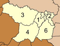
The district is subdivided into 6 subdistricts (tambonTambon
Tambon is a local government unit in Thailand. Below district and province , they form the third administrative subdivision level. As of the 2009 there are 7255 tambon, not including the 169 khwaeng of Bangkok, which are set at the same administrative level, thus every district contains 8-10 tambon...
), which are further subdivided into 56 villages (muban
Muban
Muban is the lowest administrative subdivision of Thailand. Usually translated as village, they are the subdivision of tambon. As of 2008, there are 74944 administrative villages in Thailand. As of the 1990 census, the average village consisted of 144 households or 746 persons.A muban does not...
). Phanom itself has a township (thesaban tambon) status and covers tambon Phang Kan and parts of tambon Phanom. Each of the 6 tambon is administrated by a Tambon administrative organization (TAO).
|
 |