

Wayne County, Indiana
Encyclopedia
Wayne County is a county located in the U.S. state
of Indiana
. As of the 2010 census, the population was 68,917. The county seat
is Richmond
.
, who was an officer during the Revolutionary War
. Wayne is mainly remembered for his service in the 1790s in the Northwest Indian War
, which included many actions in Indiana and Ohio
.
The first county seat was Salisbury, Indiana, a town which no longer exists and later moved to Centerville, Indiana
where it remained until a move to Richmond.
In the 1920s, Indiana had the strongest Ku Klux Klan
organization in the country under Grand Dragons D. C. Stephenson
and Walter F. Bossert
, with control over the state legislature and an ally in Governor Ed Jackson
. At its height, national membership during the second Klan movement reached 1.5 million, with 300,000 from Indiana. Records show that Wayne County, home to Whitewater Klan No. 60, was a Klan stronghold, with up to 45 percent of the county's white males having been Klan members. Robert Lyons, of Richmond, was national chief of staff for the Klan.
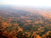 According to the 2010 census, the county has a total area of 404.34 square miles (1,047.2 km²), of which 401.74 square miles (1,040.5 km²) (or 99.36%) is land and 2.6 square miles (6.7 km²) (or 0.64%) is water. Wayne County includes Indiana's highest natural elevation, Hoosier Hill
, at 1,257 feet (383 m).
, and by the Indiana Code
.
County Council: The county council is the legislative branch of the county government and controls all the spending and revenue collection in the county. Representatives are elected from county districts. The council members serve four year terms. They are responsible for setting salaries, the annual budget, and special spending. The council also has limited authority to impose local taxes, in the form of an income and property tax that is subject to state level approval, excise taxes, and service taxes.
Board of Commissioners: The executive body of the county is made of a board of commissioners. The commissioners are elected county-wide, in staggered terms, and each serves a four-year term. One of the commissioners, typically the most senior, serves as president. The commissioners are charged with executing the acts legislated by the council, collecting revenue, and managing the day-to-day functions of the county government.
Court: The county maintains a small claims court
that can handle some civil cases. The judge on the court is elected to a term of four years and must be a member of the Indiana Bar Association. The judge is assisted by a constable who is also elected to a four-year term. In some cases, court decisions can be appealed to the state level circuit court
.
County Officials: The county has several other elected offices, including sheriff
, coroner
, auditor, treasurer
, recorder
, surveyor
, and circuit court clerk
. Each of these elected officers serves a term of four years and oversees a different part of county government. Members elected to county government positions are required to declare party
affiliations and to be residents of the county.
of 2000, there were 71,097 people, 28,469 households, and 19,301 families residing in the county. The population density
was 176 people per square mile (68/km²). There were 30,468 housing units at an average density of 76 per square mile (29/km²). The racial makeup of the county was 92.04% White
, 5.10% Black
or African American
, 0.20% Native American
, 0.51% Asian
, 0.03% Pacific Islander
, 0.69% from other races
, and 1.42% from two or more races. 1.37% of the population were Hispanic
or Latino
of any race. 24.7% were of American
, 23.3% German
, 10.8% English
and 10.6% Irish
ancestry according to Census 2000.
There were 28,469 households out of which 30.10% had children under the age of 18 living with them, 52.80% were married couples
living together, 11.40% had a female householder with no husband present, and 32.20% were non-families. 27.40% of all households were made up of individuals and 11.80% had someone living alone who was 65 years of age or older. The average household size was 2.42 and the average family size was 2.92.
In the county the population was spread out with 24.20% under the age of 18, 9.20% from 18 to 24, 27.50% from 25 to 44, 23.40% from 45 to 64, and 15.70% who were 65 years of age or older. The median age was 38 years. For every 100 females there were 92.40 males. For every 100 females age 18 and over, there were 88.10 males.
The median income for a household in the county was $34,885, and the median income for a family was $42,811. Males had a median income of $32,298 versus $21,901 for females. The per capita income
for the county was $17,727. About 8.50% of families and 11.40% of the population were below the poverty line, including 16.10% of those under age 18 and 8.60% of those age 65 or over.
According to an estimate released in 2009 by the United States Census Bureau
, in 2008 Wayne County had a relatively high percentage of divorced residents over age 15: 19.2 percent. Among 54,810 native born residents 19.4 percent were divorced, and among 550 foreign born residents none were divorced. Among Whites, 18.7 percent were divorced, while 11.6 percent of Blacks or African Americans were divorced. The age category with the highest percentage of divorced person was 45-54. (males: 35 percent; females 33.5 percent). Among males and females aged 15–19, the percent divorced was zero.
U.S. state
A U.S. state is any one of the 50 federated states of the United States of America that share sovereignty with the federal government. Because of this shared sovereignty, an American is a citizen both of the federal entity and of his or her state of domicile. Four states use the official title of...
of Indiana
Indiana
Indiana is a US state, admitted to the United States as the 19th on December 11, 1816. It is located in the Midwestern United States and Great Lakes Region. With 6,483,802 residents, the state is ranked 15th in population and 16th in population density. Indiana is ranked 38th in land area and is...
. As of the 2010 census, the population was 68,917. The county seat
County seat
A county seat is an administrative center, or seat of government, for a county or civil parish. The term is primarily used in the United States....
is Richmond
Richmond, Indiana
Richmond is a city largely within Wayne Township, Wayne County, in east central Indiana, United States, which borders Ohio. The city also includes the Richmond Municipal Airport, which is in Boston Township and separated from the rest of the city...
.
History
Wayne County was formed in 1811. It was named for Gen. "Mad" Anthony WayneAnthony Wayne
Anthony Wayne was a United States Army general and statesman. Wayne adopted a military career at the outset of the American Revolutionary War, where his military exploits and fiery personality quickly earned him a promotion to the rank of brigadier general and the sobriquet of Mad Anthony.-Early...
, who was an officer during the Revolutionary War
American Revolutionary War
The American Revolutionary War , the American War of Independence, or simply the Revolutionary War, began as a war between the Kingdom of Great Britain and thirteen British colonies in North America, and ended in a global war between several European great powers.The war was the result of the...
. Wayne is mainly remembered for his service in the 1790s in the Northwest Indian War
Northwest Indian War
The Northwest Indian War , also known as Little Turtle's War and by various other names, was a war fought between the United States and a confederation of numerous American Indian tribes for control of the Northwest Territory...
, which included many actions in Indiana and Ohio
Ohio
Ohio is a Midwestern state in the United States. The 34th largest state by area in the U.S.,it is the 7th‑most populous with over 11.5 million residents, containing several major American cities and seven metropolitan areas with populations of 500,000 or more.The state's capital is Columbus...
.
The first county seat was Salisbury, Indiana, a town which no longer exists and later moved to Centerville, Indiana
Centerville, Indiana
Centerville is a town in Center Township, Wayne County, Indiana, United States. The population was 2,552 at the 2010 census.-Geography:Centerville is located at , at an altitude of 1,014 feet . U.S...
where it remained until a move to Richmond.
In the 1920s, Indiana had the strongest Ku Klux Klan
Ku Klux Klan
Ku Klux Klan, often abbreviated KKK and informally known as the Klan, is the name of three distinct past and present far-right organizations in the United States, which have advocated extremist reactionary currents such as white supremacy, white nationalism, and anti-immigration, historically...
organization in the country under Grand Dragons D. C. Stephenson
D. C. Stephenson
David Curtiss "Steve" Stephenson was an American Grand Dragon of the Ku Klux Klan in the U.S. state of Indiana and 22 other Northern states. He is considered to have been one of the most successful Klan leaders up until his downfall after his conviction for murder...
and Walter F. Bossert
Walter F. Bossert
Walter Frederick Bossert was Grand Dragon of the Ku Klux Klan for Indiana and 17 other states, from 1924 to 1926.-Biography:...
, with control over the state legislature and an ally in Governor Ed Jackson
Ed Jackson
Edward L. "Ed" Jackson was the 32nd Governor of the U.S. state of Indiana from January 12, 1925, to January 14, 1929. A member of Indiana branch of the Ku Klux Klan, he became involved in several scandals that continued throughout his term in office...
. At its height, national membership during the second Klan movement reached 1.5 million, with 300,000 from Indiana. Records show that Wayne County, home to Whitewater Klan No. 60, was a Klan stronghold, with up to 45 percent of the county's white males having been Klan members. Robert Lyons, of Richmond, was national chief of staff for the Klan.
Geography
Hoosier Hill
Hoosier Hill is the highest natural point in the state of Indiana at 1,257 feet . It is in a rural area of Franklin Township, Wayne County to the northwest of Bethel. The nearest intersection to the high point is Elliot Road and County Line Road...
, at 1,257 feet (383 m).
Adjacent counties
- Randolph CountyRandolph County, IndianaRandolph County is a county located in the U.S. state of Indiana. As of 2010, the population was 26,171. The county seat is Winchester.-History:...
(north) - Darke CountyDarke County, OhioAs of the census of 2000, there were 53,309 people, 20,419 households, and 14,905 families residing in the county. The population density was 89 people per square mile . There were 21,583 housing units at an average density of 36 per square mile...
, OhioOhioOhio is a Midwestern state in the United States. The 34th largest state by area in the U.S.,it is the 7th‑most populous with over 11.5 million residents, containing several major American cities and seven metropolitan areas with populations of 500,000 or more.The state's capital is Columbus...
(northeast) - Preble CountyPreble County, OhioAs of the census of 2000, there were 42,337 people, 16,001 households, and 12,144 families residing in the county. The population density was 100 people per square mile . There were 17,186 housing units at an average density of 40 per square mile...
, OhioOhioOhio is a Midwestern state in the United States. The 34th largest state by area in the U.S.,it is the 7th‑most populous with over 11.5 million residents, containing several major American cities and seven metropolitan areas with populations of 500,000 or more.The state's capital is Columbus...
(east) - Union CountyUnion County, IndianaAs of the census of 2000, there were 7,349 people, 2,793 households, and 2,072 families residing in the county. The population density was 46 people per square mile . There were 3,077 housing units at an average density of 19 per square mile...
(south) - Fayette CountyFayette County, Indiana-2010 Census Data:As of the census of 2010, there were 24,277 people and 9,719 households residing in the county. The population density was 113 people per square mile . There were 10,898 housing units at an average density of 51 per square mile...
(southwest) - Henry CountyHenry County, IndianaAs of the census of 2000, there were 48,508 people, 19,486 households, and 13,971 families residing in the county. The population density was 124 people per square mile . There were 20,592 housing units at an average density of 52 per square mile...
(west)
Cities and towns
|
Greens Fork, Indiana Greens Fork is a town in Clay Township, Wayne County, Indiana, United States. The population was 423 at the 2010 census.-Geography:Greens Fork is located at .... Hagerstown, Indiana Hagerstown is a town in Jefferson Township, Wayne County, Indiana, United States. As of the 2010 census, the population was 1,787.-Geography:Hagerstown is located at .... Milton, Indiana Milton is a town in Washington Township, Wayne County, Indiana, United States. The population was 490 at the 2010 census.-Geography:Milton is located at .... Mount Auburn, Indiana Mount Auburn is a town in Jackson Township, Wayne County, Indiana, United States. The population was 117 at the 2010 census.-Geography:Mount Auburn is located at .... Richmond, Indiana Richmond is a city largely within Wayne Township, Wayne County, in east central Indiana, United States, which borders Ohio. The city also includes the Richmond Municipal Airport, which is in Boston Township and separated from the rest of the city... Spring Grove, Indiana Spring Grove is a town in Wayne Township, Wayne County, Indiana, United States. The population was 344 at the 2010 census.-Geography:Spring Grove is located at .... Whitewater, Indiana Whitewater is a town in Franklin Township, Wayne County, Indiana, United States. The population was 83 at the 2010 census.-Geography:Whitewater is located at .... |
Unincorporated towns
|
Middleboro, Indiana Middleboro is an unincorporated town in Wayne Township, Wayne County, Indiana near the city of Richmond.-Features:*Middleboro Methodist Church is located on State Road 227 at the curve in Middleboro.... Pennville, Wayne County, Indiana Pennville is an unincorporated town in Jackson Township, Wayne County, Indiana.... Webster, Indiana Webster is an unincorporated town in Webster Township, Wayne County, Indiana.... Williamsburg, Indiana Williamsburg is an unincorporated town in Green Township, Wayne County, Indiana. Its a town populated with many churches and nature trails. There is a central common ground for all the towns people, this is the Lions Club Community Park.... |
Townships
|
Franklin Township, Wayne County, Indiana Franklin Township is one of fifteen townships in Wayne County, Indiana, USA. As of the 2000 census, its population was 1,291.-Geography:Franklin Township covers an area of... Green Township, Wayne County, Indiana Green Township is one of fifteen townships in Wayne County, Indiana, USA. As of the 2000 census, its population was 1,261.-Geography:Green Township covers an area of... Harrison Township, Wayne County, Indiana Harrison Township is one of fifteen townships in Wayne County, Indiana, USA. As of the 2000 census, its population was 403.-Geography:Harrison Township covers an area of ; of this, or 0.16 percent is water... Jackson Township, Wayne County, Indiana Jackson Township is one of fifteen townships in Wayne County, Indiana, USA. As of the 2000 census, its population was 4,626.-Geography:Jackson Township covers an area of ; of this, or 0.54 percent is water. Lakes in this township include Hi-Way Springs... Jefferson Township, Wayne County, Indiana Jefferson Township is one of fifteen townships in Wayne County, Indiana, USA. As of the 2000 census, its population was 3,427.-Geography:Jefferson Township covers an area of ; of this, or 0.06 percent is water. Lakes in this township include Scout Lake... |
New Garden Township, Wayne County, Indiana New Garden Township is one of fifteen townships in Wayne County, Indiana, USA. As of the 2000 census, its population was 1,776.-Geography:New Garden Township covers an area of... Perry Township, Wayne County, Indiana Perry Township is one of fifteen townships in Wayne County, Indiana, USA. As of the 2000 census, its population was 763.-Geography:Perry Township covers an area of ; of this, or 0.02 percent is water. Lakes in this township include Osborne Lakes... Washington Township, Wayne County, Indiana Washington Township is one of fifteen townships in Wayne County, Indiana, USA. As of the 2000 census, its population was 1,579.-Geography:Washington Township covers an area of ; of this, or 0.13 percent is water... Wayne Township, Wayne County, Indiana Wayne Township is one of fifteen townships in Wayne County, Indiana, USA. As of the 2000 census, its population was 43,742.-Geography:Wayne Township covers an area of ; of this, or 0.76 percent is water... Webster Township, Wayne County, Indiana Webster Township is one of fifteen townships in Wayne County, Indiana, USA. As of the 2000 census, its population was 1,453.-Geography:Webster Township covers an area of... |
Major highways
|
 Indiana State Road 1 Indiana State Road 1Indiana State Road 1 State Road 1 is a north–south state highway in the eastern portion of the U.S. state of Indiana. Its southern terminus is at U.S. Highway 50 in east-central Dearborn County, just east of Lawrenceburg. Its northern terminus is at U.S...  Indiana State Road 38 Indiana State Road 38Indiana State Road 38 State Road 38 in the U.S. State of Indiana serves as a connection between Lafayette in the west and Richmond in the east.-Route description:State Road 38 begins in Lafayette with State Road 25 and U.S. Route 52. There is an interchange with Interstate 65 at exit 168. It proceeds east-southeast...  Indiana State Road 121 Indiana State Road 121Indiana State Road 121 State Road 121 in the U.S. state of Indiana is a short state highway that exists in two sections.-Route description:The south section runs north from U.S...  Indiana State Road 227 Indiana State Road 227Indiana State Road 227 State Road 227 is a north–south highway at the eastern edge of the U.S. State of Indiana. It is nearly parallel with the Ohio state line.-Route description:... |


Climate and weather
In recent years, average temperatures in Richmond have ranged from a low of 17 °F (-8.3 °C) in January to a high of 85 °F (29.4 °C) in July, although a record low of -27 °F was recorded in January 1994 and a record high of 100 °F (37.8 °C) was recorded in July 1988. Average monthly precipitation ranged from 2.27 inches (5.8 cm) in February to 4.41 inches (11.2 cm) in May.Government
The county government is a constitutional body, and is granted specific powers by the Constitution of IndianaConstitution of Indiana
There have been two Constitutions of the State of Indiana. The first constitution was created when the Territory of Indiana sent forty-three delegates to a constitutional convention on June 10, 1816 to establish a constitution for the proposed State of Indiana after the United States Congress had...
, and by the Indiana Code
Indiana Code
The Indiana Code is the code of laws for the US State of Indiana. The contents are the codification of the all the laws currently in effect within Indiana...
.
County Council: The county council is the legislative branch of the county government and controls all the spending and revenue collection in the county. Representatives are elected from county districts. The council members serve four year terms. They are responsible for setting salaries, the annual budget, and special spending. The council also has limited authority to impose local taxes, in the form of an income and property tax that is subject to state level approval, excise taxes, and service taxes.
Board of Commissioners: The executive body of the county is made of a board of commissioners. The commissioners are elected county-wide, in staggered terms, and each serves a four-year term. One of the commissioners, typically the most senior, serves as president. The commissioners are charged with executing the acts legislated by the council, collecting revenue, and managing the day-to-day functions of the county government.
Court: The county maintains a small claims court
Small claims court
Small-claims courts have limited jurisdiction to hear civil cases between private litigants. Courts authorized to try small claims may also have other judicial functions, and the name by which such a court is known varies by jurisdiction; it may be known as a county or magistrate's court...
that can handle some civil cases. The judge on the court is elected to a term of four years and must be a member of the Indiana Bar Association. The judge is assisted by a constable who is also elected to a four-year term. In some cases, court decisions can be appealed to the state level circuit court
Circuit court
Circuit court is the name of court systems in several common law jurisdictions.-History:King Henry II instituted the custom of having judges ride around the countryside each year to hear appeals, rather than forcing everyone to bring their appeals to London...
.
County Officials: The county has several other elected offices, including sheriff
Sheriff
A sheriff is in principle a legal official with responsibility for a county. In practice, the specific combination of legal, political, and ceremonial duties of a sheriff varies greatly from country to country....
, coroner
Coroner
A coroner is a government official who* Investigates human deaths* Determines cause of death* Issues death certificates* Maintains death records* Responds to deaths in mass disasters* Identifies unknown dead* Other functions depending on local laws...
, auditor, treasurer
Treasurer
A treasurer is the person responsible for running the treasury of an organization. The adjective for a treasurer is normally "tresorial". The adjective "treasurial" normally means pertaining to a treasury, rather than the treasurer.-Government:...
, recorder
Recorder of deeds
Recorder of deeds is a government office tasked with maintaining public records and documents, especially records relating to real estate ownership that provide persons other than the owner of a property with real rights over that property.-Background:...
, surveyor
Surveying
See Also: Public Land Survey SystemSurveying or land surveying is the technique, profession, and science of accurately determining the terrestrial or three-dimensional position of points and the distances and angles between them...
, and circuit court clerk
Court clerk
A court clerk is an officer of the court whose responsibilities include maintaining the records of a court. Another duty is to administer oaths to witnesses, jurors, and grand jurors...
. Each of these elected officers serves a term of four years and oversees a different part of county government. Members elected to county government positions are required to declare party
Political party
A political party is a political organization that typically seeks to influence government policy, usually by nominating their own candidates and trying to seat them in political office. Parties participate in electoral campaigns, educational outreach or protest actions...
affiliations and to be residents of the county.
Demographics
As of the censusCensus
A census is the procedure of systematically acquiring and recording information about the members of a given population. It is a regularly occurring and official count of a particular population. The term is used mostly in connection with national population and housing censuses; other common...
of 2000, there were 71,097 people, 28,469 households, and 19,301 families residing in the county. The population density
Population density
Population density is a measurement of population per unit area or unit volume. It is frequently applied to living organisms, and particularly to humans...
was 176 people per square mile (68/km²). There were 30,468 housing units at an average density of 76 per square mile (29/km²). The racial makeup of the county was 92.04% White
Race (United States Census)
Race and ethnicity in the United States Census, as defined by the Federal Office of Management and Budget and the United States Census Bureau, are self-identification data items in which residents choose the race or races with which they most closely identify, and indicate whether or not they are...
, 5.10% Black
Race (United States Census)
Race and ethnicity in the United States Census, as defined by the Federal Office of Management and Budget and the United States Census Bureau, are self-identification data items in which residents choose the race or races with which they most closely identify, and indicate whether or not they are...
or African American
Race (United States Census)
Race and ethnicity in the United States Census, as defined by the Federal Office of Management and Budget and the United States Census Bureau, are self-identification data items in which residents choose the race or races with which they most closely identify, and indicate whether or not they are...
, 0.20% Native American
Race (United States Census)
Race and ethnicity in the United States Census, as defined by the Federal Office of Management and Budget and the United States Census Bureau, are self-identification data items in which residents choose the race or races with which they most closely identify, and indicate whether or not they are...
, 0.51% Asian
Race (United States Census)
Race and ethnicity in the United States Census, as defined by the Federal Office of Management and Budget and the United States Census Bureau, are self-identification data items in which residents choose the race or races with which they most closely identify, and indicate whether or not they are...
, 0.03% Pacific Islander
Race (United States Census)
Race and ethnicity in the United States Census, as defined by the Federal Office of Management and Budget and the United States Census Bureau, are self-identification data items in which residents choose the race or races with which they most closely identify, and indicate whether or not they are...
, 0.69% from other races
Race (United States Census)
Race and ethnicity in the United States Census, as defined by the Federal Office of Management and Budget and the United States Census Bureau, are self-identification data items in which residents choose the race or races with which they most closely identify, and indicate whether or not they are...
, and 1.42% from two or more races. 1.37% of the population were Hispanic
Race (United States Census)
Race and ethnicity in the United States Census, as defined by the Federal Office of Management and Budget and the United States Census Bureau, are self-identification data items in which residents choose the race or races with which they most closely identify, and indicate whether or not they are...
or Latino
Race (United States Census)
Race and ethnicity in the United States Census, as defined by the Federal Office of Management and Budget and the United States Census Bureau, are self-identification data items in which residents choose the race or races with which they most closely identify, and indicate whether or not they are...
of any race. 24.7% were of American
United States
The United States of America is a federal constitutional republic comprising fifty states and a federal district...
, 23.3% German
Germans
The Germans are a Germanic ethnic group native to Central Europe. The English term Germans has referred to the German-speaking population of the Holy Roman Empire since the Late Middle Ages....
, 10.8% English
English people
The English are a nation and ethnic group native to England, who speak English. The English identity is of early mediaeval origin, when they were known in Old English as the Anglecynn. England is now a country of the United Kingdom, and the majority of English people in England are British Citizens...
and 10.6% Irish
Irish people
The Irish people are an ethnic group who originate in Ireland, an island in northwestern Europe. Ireland has been populated for around 9,000 years , with the Irish people's earliest ancestors recorded having legends of being descended from groups such as the Nemedians, Fomorians, Fir Bolg, Tuatha...
ancestry according to Census 2000.
There were 28,469 households out of which 30.10% had children under the age of 18 living with them, 52.80% were married couples
Marriage
Marriage is a social union or legal contract between people that creates kinship. It is an institution in which interpersonal relationships, usually intimate and sexual, are acknowledged in a variety of ways, depending on the culture or subculture in which it is found...
living together, 11.40% had a female householder with no husband present, and 32.20% were non-families. 27.40% of all households were made up of individuals and 11.80% had someone living alone who was 65 years of age or older. The average household size was 2.42 and the average family size was 2.92.
In the county the population was spread out with 24.20% under the age of 18, 9.20% from 18 to 24, 27.50% from 25 to 44, 23.40% from 45 to 64, and 15.70% who were 65 years of age or older. The median age was 38 years. For every 100 females there were 92.40 males. For every 100 females age 18 and over, there were 88.10 males.
The median income for a household in the county was $34,885, and the median income for a family was $42,811. Males had a median income of $32,298 versus $21,901 for females. The per capita income
Per capita income
Per capita income or income per person is a measure of mean income within an economic aggregate, such as a country or city. It is calculated by taking a measure of all sources of income in the aggregate and dividing it by the total population...
for the county was $17,727. About 8.50% of families and 11.40% of the population were below the poverty line, including 16.10% of those under age 18 and 8.60% of those age 65 or over.
According to an estimate released in 2009 by the United States Census Bureau
United States Census Bureau
The United States Census Bureau is the government agency that is responsible for the United States Census. It also gathers other national demographic and economic data...
, in 2008 Wayne County had a relatively high percentage of divorced residents over age 15: 19.2 percent. Among 54,810 native born residents 19.4 percent were divorced, and among 550 foreign born residents none were divorced. Among Whites, 18.7 percent were divorced, while 11.6 percent of Blacks or African Americans were divorced. The age category with the highest percentage of divorced person was 45-54. (males: 35 percent; females 33.5 percent). Among males and females aged 15–19, the percent divorced was zero.
School Corporations
- Richmond Community Schools, Richmond
- Western Wayne Schools, Cambridge City
- Northeastern Wayne Schools, Fountain City
- Nettle Creek Schools, Hagerstown
- Centerville-Abington Community Schools, Centerville