

U.S. Route 20 in Indiana
Encyclopedia
U.S. Route 20 in Indiana
is a main east–west highway that is parallel to the Indiana Toll Road
. The western terminus of US 20 is at the Illinois
state line and the eastern terminus is at the Ohio
state line. US 20 through Whiting, East Chicago, and Gary is concurrent with US 12 twice. US 20 varies between one-way
streets, two-lane streets, and four-lane streets, in northwestern Indiana. East of Gary to Michigan City, US 20 is a two-lane highway. From Michigan City to west of South Bend, US 20 is a four-lane undivided highway and two-lane rural highway. US 20 heads around the west and south sides of South Bend and Elkhart. East of Elkhart County Road 17 (CR 17), US 20 is two-lane rural highway.
US 20 was part of the Dunes Highway from the Illinois state line to Michigan City, concurrent with US 12
. US 20 went through downtown South Bend
and Elkhart
, before the St. Joseph Valley Parkway
was built. Before the parkway was completed, the route that was open to traffic was called Bypass US 20. A small realignment in LaGrange County was done in 2005, in which the roadway was straightened. Other small realignments included the route through Michigan City, which followed US 35 from US 12 to I-94.
are included as a part of the National Highway System
(NHS). The NHS is a network of highways that are identified as being most important for the economy, mobility and defense of the nation.
, underneath the Indiana Toll Road. US 12, US 20, and US 41 are concurrent until US 41 turns south on Calumet Avenue, a distance of 2.24 miles (3.6 km). US 12 and US 20 head southeast toward East Chicago
; in East Chicago, US 12 turns east and US 20 continues south. After US 12, US 20 meets State Road 312
(SR 312). After SR 312, US 20 passes under the Indiana Toll Road. Then US 20 turns left onto Michigan Street and heads west to Gary
. On the way to Gary, US 20 has an interchange
with SR 912
; at the interchange, the road name changes to 5th Avenue. Just west of Gary, US 12 and US 20 have a concurrency.
US 12 and US 20 are concurrent through most of Gary. From Bridge Street to Vermont Street, the eastbound traffic of US 12/US 20 is on 5th Avenue and westbound traffic is on 4th Avenue. East of downtown Gary, the eastbound and westbound lanes merge to form the Dunes Highway. Before reaching the neighborhoods of northeastern Gary, the Dunes Highway has an interchange with Interstate 65
(I-65) and I-90/Indiana Toll Road.
Shortly thereafter, US 12 leaves to the northeast toward Michigan City and US 20 heads east then northeast, forming a major retail corridor through the neighborhoods of Aetna
and Miller Beach
. After US 12, US 20 meets SR 51
at the northern terminus of SR 51, near the boundary between Lake Station
and Gary. Just west of Portage
, US 20 passes under I-94
. In Portage, US 20 has intersections with both SR 249
and SR 149
. Then US 20 enters Burns Harbor
and has interchanges with I-94 and SR 49
. US 20 heads northeast until Town of Pines
, where it intersects with SR 520
. After Pines, US 20 heads due east to US 421
in Michigan City
.
From US 421, US 20 heads east and then northeast around Michigan City. On the east side of Michigan City US 20 has an interchange with SR 212
. Soon after SR 212, US 20 has an interchange with I-94 followed by an intersection with the northern terminus of US 35. After US 35, US 20 is a four-lane undivided highway until Rolling Prairie
, passing SR 39
at Springville
. East of Rolling Prairie US 20 meets SR 2
. US 20 heads northeast and then east and SR 2 heads due east. US 20 passes through Hudson Lake
and New Carlisle
before South Bend
.
, US 20 has a 2.09 miles (3.4 km) concurrency with SR 331. US 20 then has an interchange with US 33
near Dunlap
. The interchange with Old US 20 is incomplete with no access to westbound Old US 20 from eastbound US 20. Soon after the interchange with Old US 20 is an interchange with CR 17. This exit is also the end of the St. Joseph Valley Parkway.
 US 20 heads east from Elkhart towards Middlebury
, passing through an intersection with SR 15
south of Bristol
. At this intersection US 20 is a four-lane undivided highway, and soon after the intersection US 20 becomes a two-lane highway. US 20 passes through the southwest side of Middlebury. On the south side of Middlebury US 20 has an intersection with SR 13
. US 20 passes through is intersection as a four-lane divided highway, and soon after the intersection US 20 becomes a two-lane highway. From Middlebury US 20 heads west towards Lagrange
, passing through rural eastern Elkhart County
and western Lagrang County
. On the way to Lagrange US 20 passes through an intersection with SR 5
just south of Shipshewana
. US 20 passes through downtown Lagrange, having an intersection with SR 9
. US 20 heads east passing through rural eastern LaGrange County and western Steuben County
. Then US 20 enters Angola
and has an interchange with I-69
. US 20 then enters downtown Angola, passing through a roundabout
with SR 127
and Old US 27. After passing through the east side of Angola, US 20 leaves Angola heading east towards Ohio
. In rural eastern Steuben County, US 20 has an intersection with SR 1
. Just west of the Ohio state line US 20 passes under the Indiana Toll Road (I-80/I-90).
 Between 1917 and 1926 the route from Illinois state Line to Michigan City was SR 43 this route was named Dunes Highway. At this time US 20 from Michigan City to Ohio state line was SR 25. Being in 1926, US 20 from Illinois state line to Michigan City was concurrent with US 12 (Dunes Highway). In the early 1930s US 20 from Illinois state line to Michigan City was moved to its current route. In the mid 1970s Bypass US 20 (BYP US 20) went from US 31 to US 20, on the southwest side of South Bend. Until 1998, US 20 went through downtown Elkhart and South Bend. When the State of Indiana built Bypass 20, New US 20, or the St. Joseph Valley Parkway, the route downtown was decommissioned.
In 2005 a series of sharp curves around Rainbow Lake were removed; the curves were located six miles west of Lagrange
. A new straight roadway was built, from just east of SR 5 to just east of Lagrange County Road 600 West.
plans to make US 20 a four-lane highway from the east end of the St. Joseph Valley Parkway to SR 13. The project will be done in three different phases. Phase one will be from Elkhart County Road 17 to SR 15, phase two will be from SR 15 to Elkhart County Road 35, and phase three will be from CR 35 to SR 13.
Indiana
Indiana is a US state, admitted to the United States as the 19th on December 11, 1816. It is located in the Midwestern United States and Great Lakes Region. With 6,483,802 residents, the state is ranked 15th in population and 16th in population density. Indiana is ranked 38th in land area and is...
is a main east–west highway that is parallel to the Indiana Toll Road
Indiana Toll Road
The Indiana Toll Road, officially the Indiana East–West Toll Road, is a toll road that runs for east–west across northern Indiana from the Illinois state line to the Ohio state line...
. The western terminus of US 20 is at the Illinois
Illinois
Illinois is the fifth-most populous state of the United States of America, and is often noted for being a microcosm of the entire country. With Chicago in the northeast, small industrial cities and great agricultural productivity in central and northern Illinois, and natural resources like coal,...
state line and the eastern terminus is at the Ohio
Ohio
Ohio is a Midwestern state in the United States. The 34th largest state by area in the U.S.,it is the 7th‑most populous with over 11.5 million residents, containing several major American cities and seven metropolitan areas with populations of 500,000 or more.The state's capital is Columbus...
state line. US 20 through Whiting, East Chicago, and Gary is concurrent with US 12 twice. US 20 varies between one-way
One-way traffic
One-way traffic is traffic that moves in a single direction. A one-way street is a street either facilitating only one-way traffic, or designed to direct vehicles to move in one direction.-General signs:...
streets, two-lane streets, and four-lane streets, in northwestern Indiana. East of Gary to Michigan City, US 20 is a two-lane highway. From Michigan City to west of South Bend, US 20 is a four-lane undivided highway and two-lane rural highway. US 20 heads around the west and south sides of South Bend and Elkhart. East of Elkhart County Road 17 (CR 17), US 20 is two-lane rural highway.
US 20 was part of the Dunes Highway from the Illinois state line to Michigan City, concurrent with US 12
U.S. Route 12 in Indiana
In the U.S. state of Indiana, U.S. Route 12 is a historical east–west arterial highway that runs along the Lake Michigan shoreline. In the early 1920s, it was the most important route between Chicago, Illinois and Detroit, Michigan. Most of the route has since been supplanted by Interstate 94...
. US 20 went through downtown South Bend
South Bend, Indiana
The city of South Bend is the county seat of St. Joseph County, Indiana, United States, on the St. Joseph River near its southernmost bend, from which it derives its name. As of the 2010 Census, the city had a total of 101,168 residents; its Metropolitan Statistical Area had a population of 316,663...
and Elkhart
Elkhart, Indiana
Elkhart is a city in Elkhart County, Indiana, United States. The city is located east of South Bend, northwest of Fort Wayne, east of Chicago, and north of Indianapolis...
, before the St. Joseph Valley Parkway
St. Joseph Valley Parkway
The St. Joseph Valley Parkway is a freeway in the U.S. states of Indiana and Michigan, serving as a bypass route around Elkhart, Mishawaka, and South Bend in Indiana and Niles in Michigan. The freeway runs to the south and west of Elkhart and South Bend and Niles and consists of segments of U.S...
was built. Before the parkway was completed, the route that was open to traffic was called Bypass US 20. A small realignment in LaGrange County was done in 2005, in which the roadway was straightened. Other small realignments included the route through Michigan City, which followed US 35 from US 12 to I-94.
Route description
Only the segment of US 20 that is concurrent with the St. Joseph Valley ParkwaySt. Joseph Valley Parkway
The St. Joseph Valley Parkway is a freeway in the U.S. states of Indiana and Michigan, serving as a bypass route around Elkhart, Mishawaka, and South Bend in Indiana and Niles in Michigan. The freeway runs to the south and west of Elkhart and South Bend and Niles and consists of segments of U.S...
are included as a part of the National Highway System
National Highway System (United States)
The National Highway System is a network of strategic highways within the United States, including the Interstate Highway System and other roads serving major airports, ports, rail or truck terminals, railway stations, pipeline terminals and other strategic transport facilities.Individual states...
(NHS). The NHS is a network of highways that are identified as being most important for the economy, mobility and defense of the nation.
Illinois to South Bend
US 20 enters Indiana with US 12 and US 41U.S. Route 41 in Indiana
In the U.S. state of Indiana, U.S. Route 41 is a north–south highway that is parallel to the Illinois state line. It enters the state south of Evansville. North of Evansville, it becomes a 4-Lane divided highway passing around Vincennes and traveling North to Terre Haute. In Terre Haute, it...
, underneath the Indiana Toll Road. US 12, US 20, and US 41 are concurrent until US 41 turns south on Calumet Avenue, a distance of 2.24 miles (3.6 km). US 12 and US 20 head southeast toward East Chicago
East Chicago, Indiana
East Chicago is a city in Lake County, Indiana. The population was 29,698 at the 2010 census.-Geography:East Chicago is located at ....
; in East Chicago, US 12 turns east and US 20 continues south. After US 12, US 20 meets State Road 312
Indiana State Road 312
State Road 312 in the U.S. state of Indiana is an east–west state highway in the northwestern part of the state.-Route description:State Road 312 runs from the Illinois state line east to SR 912 in East Chicago. At one point, it used to continue for less than a mile east of SR 912 to end at...
(SR 312). After SR 312, US 20 passes under the Indiana Toll Road. Then US 20 turns left onto Michigan Street and heads west to Gary
Gary, Indiana
Gary is a city in Lake County, Indiana, United States. The city is in the southeastern portion of the Chicago metropolitan area and is 25 miles from downtown Chicago. The population is 80,294 at the 2010 census, making it the seventh-largest city in the state. It borders Lake Michigan and is known...
. On the way to Gary, US 20 has an interchange
Interchange (road)
In the field of road transport, an interchange is a road junction that typically uses grade separation, and one or more ramps, to permit traffic on at least one highway to pass through the junction without directly crossing any other traffic stream. It differs from a standard intersection, at which...
with SR 912
Indiana State Road 912
State Road 912, known along its entire length as Cline Avenue, is a freeway north of the Borman Expressway , and a local access road serving Griffith south of the Borman. The portion of Cline Avenue marked as SR 912 is long. Indiana 912 can be considered a child route of U.S...
; at the interchange, the road name changes to 5th Avenue. Just west of Gary, US 12 and US 20 have a concurrency.
US 12 and US 20 are concurrent through most of Gary. From Bridge Street to Vermont Street, the eastbound traffic of US 12/US 20 is on 5th Avenue and westbound traffic is on 4th Avenue. East of downtown Gary, the eastbound and westbound lanes merge to form the Dunes Highway. Before reaching the neighborhoods of northeastern Gary, the Dunes Highway has an interchange with Interstate 65
Interstate 65 in Indiana
In the U.S. state of Indiana, Interstate 65 traverses the state from south to north. The Indiana portion begins near Louisville, Kentucky and travels north, passing through Columbus, Indianapolis, Lafayette. Interstate 65 terminates near Gary on the Indiana Toll Road. Interstate 65 covers 261.27...
(I-65) and I-90/Indiana Toll Road.
Shortly thereafter, US 12 leaves to the northeast toward Michigan City and US 20 heads east then northeast, forming a major retail corridor through the neighborhoods of Aetna
Aetna (Gary)
Aetna is a neighborhood in northeastern Gary, Indiana, south of Miller Beach and east of Interstate 65. As of 2000, the neighborhood had a population of 4,942, which was 83% black and 11% white....
and Miller Beach
Miller Beach
Miller Beach is a community on the southernmost shore of Lake Michigan. Originally an independent town first settled in 1851, Miller was annexed by the city of Gary, Indiana in 1918...
. After US 12, US 20 meets SR 51
Indiana State Road 51
State Road 51 in the U.S. State of Indiana is a north–south route on the state highway system in northwest Indiana. It consists of a route about long from a point on U.S. Route 30 east of Merrillville and west of Valparaiso, north to U.S. Route 20 in Gary...
at the northern terminus of SR 51, near the boundary between Lake Station
Lake Station, Indiana
Lake Station is a city in Lake County, Indiana, United States. The population was 12,572 at the 2010 census.-History:An early depot stop on the Michigan Central Railroads Detroit to Chicago line through the Calumet region, the village was first named when George Earle mapped out a town of about in...
and Gary. Just west of Portage
Portage, Indiana
Portage is a city in Portage Township, Porter County, Indiana, United States. The population was 36,828 as of the 2010 census. It is the largest city in Porter County, and third largest in Northwest Indiana.-Geography:...
, US 20 passes under I-94
Interstate 94 in Indiana
In the U.S. state of Indiana, Interstate 94 runs east–west through the northwest portion of the state.-Route description:The route between the Illinois border and Lake Station at its junction with the Indiana Toll Road is known as the Borman Expressway and is a heavily traveled route...
. In Portage, US 20 has intersections with both SR 249
Indiana State Road 249
State Road 249 in the U.S. state of Indiana is a 2.4-mile connector highway in Portage in northwest Indiana. It exists to connect U.S. Route 12 and U.S. Route 20 with Interstate 94, and also to provide easy access to both highways from the steel mills and their Port of Indiana...
and SR 149
Indiana State Road 149
State Road 149 in the U.S. state of Indiana is a major highway that, much like State Road 249 , exists to serve the steel mills and their Port of Indiana in northwest Indiana. The highway runs from State Road 130 , northwest of Valparaiso, north to U.S...
. Then US 20 enters Burns Harbor
Burns Harbor, Indiana
Burns Harbor is a town in Westchester Township, Porter County, Indiana, United States on the shores of Lake Michigan in Northwest Indiana and is part of the Chicago metropolitan area...
and has interchanges with I-94 and SR 49
Indiana State Road 49
State Road 49 in the U.S. State of Indiana is a state highway in northwest Indiana. It runs from just north of Chesterton at the intersection with U.S. Route 12 south to a rural interchange 10 miles northeast of Rensselaer with State Road 14...
. US 20 heads northeast until Town of Pines
Town of Pines, Indiana
Town of Pines is a town in Pine Township, Porter County, Indiana, United States. The population was 708 at the 2010 census.-Geography:Town of Pines is located at ....
, where it intersects with SR 520
Indiana State Road 520
State Road 520 is a four-lane connector about 1,000 feet in length. It exists solely to connect U.S. Route 12 and U.S. Route 20 in Pines, about 3 miles west of Michigan City. U.S. 12 and U.S. 20 do not cross at this point — they parallel each other for another 22 miles westbound and...
. After Pines, US 20 heads due east to US 421
U.S. Route 421 in Indiana
U.S. Route 421 enters Indiana from Kentucky, proceeding northwest to Indianapolis, joining Interstate 465, then continuing northwest to Michigan City....
in Michigan City
Michigan City, Indiana
Michigan City's origins date to 1830, when the land for the city was first purchased by Isaac C. Elston. Elston Middle School, formerly Elston High School, located at 317 Detroit St., is named after the founder....
.
From US 421, US 20 heads east and then northeast around Michigan City. On the east side of Michigan City US 20 has an interchange with SR 212
Indiana State Road 212
State Road 212 is a short north–south highway in LaPorte County in the U.S. state of Indiana. It is effectively part of a bypass of Michigan City, Indiana between U.S. Route 12 and the junction of U.S. Route 20 and U.S. Route 35. It is a straight, undivided four-lane surface road...
. Soon after SR 212, US 20 has an interchange with I-94 followed by an intersection with the northern terminus of US 35. After US 35, US 20 is a four-lane undivided highway until Rolling Prairie
Rolling Prairie, Indiana
Rolling Prairie is an unincorporated town in Kankakee Township, LaPorte County, Indiana.-History:The first cabin was built here in 1831 by Ezekiel Provolt. More settlers arrived, built cabins and named the settlement Nauvoo. On November 26, 1853, the village was platted by W.J. Walker and named...
, passing SR 39
Indiana State Road 39
State Road 39 in the U.S. State of Indiana is the name of two distinct north–south highways in the state of Indiana.-Southern section:Located in south-central Indiana, the shorter southern section of State Road 39 begins at State Road 56 west of Scottsburg. It runs north and passes through...
at Springville
Springville, LaPorte County, Indiana
Springville is an unincorporated town in Springfield Township in northern LaPorte County, Indiana, at the intersection of U.S. Route 20 and Indiana Route 39, less than one mile north of the LaPorte exit on the Indiana Toll Road. It took its name from a large spring that formerly flowed near the...
. East of Rolling Prairie US 20 meets SR 2
Indiana State Road 2
State Road 2 in the U.S. State of Indiana is an east–west route running from the Illinois border at Illinois Route 17 east to the outskirts of South Bend, Indiana at the U.S. Route 20/U.S. Route 31 freeway, also known as the St. Joseph Valley Parkway...
. US 20 heads northeast and then east and SR 2 heads due east. US 20 passes through Hudson Lake
Hudson Lake, Indiana
Hudson Lake is an unincorporated town in Hudson Township, LaPorte County, Indiana. The town sits on the dividing line between Central and Eastern time zones. It is the site of the Hudson Lake station stop of the South Shore Line....
and New Carlisle
New Carlisle, Indiana
New Carlisle is a town in suburban St. Joseph County, Indiana, United States. It is located in Olive Township. The population was 1,861 at the 2010 Census...
before South Bend
South Bend, Indiana
The city of South Bend is the county seat of St. Joseph County, Indiana, United States, on the St. Joseph River near its southernmost bend, from which it derives its name. As of the 2010 Census, the city had a total of 101,168 residents; its Metropolitan Statistical Area had a population of 316,663...
.
South Bend to Ohio
On the west side of South Bend, US 20 enters the St. Joseph Valley Parkway heading due south. US 20 runs along the west side of South Bend. US 20 turns due east having an interchange with US 31, just south of downtown South Bend. On the south side of MishawakaMishawaka, Indiana
Mishawaka is a city on the St. Joseph River and a Twin city of South Bend in St. Joseph County, Indiana, United States. The population was 48,252 as of the 2010 Census...
, US 20 has a 2.09 miles (3.4 km) concurrency with SR 331. US 20 then has an interchange with US 33
U.S. Route 33 in Indiana
U.S. Route 33 is a mainly two-lane U.S. Highway running through northeast Indiana. The highway travels from southeast to northwest.-Route description:...
near Dunlap
Dunlap, Indiana
Dunlap is a census-designated place in Elkhart County, Indiana, United States. The population was 6,235 at the 2010 census. Once a small farming community, by the 1980s it had become a suburb of Elkhart and Goshen, Indiana. Most of the town was destroyed by two violent F4 tornadoes during the Palm...
. The interchange with Old US 20 is incomplete with no access to westbound Old US 20 from eastbound US 20. Soon after the interchange with Old US 20 is an interchange with CR 17. This exit is also the end of the St. Joseph Valley Parkway.
Middlebury, Indiana
Middlebury is a town in Middlebury Township, Elkhart County, Indiana, in the United States. It is located approximately 15 miles east of Elkhart, 35 miles east of South Bend, 130 miles east of Chicago, and 165 miles north of Indianapolis. Middlebury is a small farm and manufacturing town nestled...
, passing through an intersection with SR 15
Indiana State Road 15
State Road 15 is a north–south road in northeastern Indiana. Its southern terminus is at State Road 22 in Jonesboro. Its northern terminus is the Michigan state line north of Bristol. It is a surface highway that is mostly rural...
south of Bristol
Bristol, Indiana
Bristol is a town in Washington Township, Elkhart County, Indiana, United States. The population was 1,602 at the 2010 census.-Geography:Bristol is located at ....
. At this intersection US 20 is a four-lane undivided highway, and soon after the intersection US 20 becomes a two-lane highway. US 20 passes through the southwest side of Middlebury. On the south side of Middlebury US 20 has an intersection with SR 13
Indiana State Road 13
State Road 13 in the U.S. State of Indiana is a north–south highway in north-central and central Indiana that connects the area east of Indianapolis with the northern part of the state. Its northern terminus is at the Michigan state line, although starting at the interchange with the Indiana...
. US 20 passes through is intersection as a four-lane divided highway, and soon after the intersection US 20 becomes a two-lane highway. From Middlebury US 20 heads west towards Lagrange
LaGrange, Indiana
LaGrange is a town in LaGrange County, Indiana, United States. The population was 2,625 at the 2010 census. The city is the county seat of LaGrange County.-Geography:LaGrange is located at...
, passing through rural eastern Elkhart County
Elkhart County, Indiana
Elkhart County is a county in the U.S. state of Indiana. Much of the county is in the Elkhart-Goshen Metropolitan Statistical Area, which in turn is part of the South Bend-Elkhart-Mishawaka Combined Statistical Area...
and western Lagrang County
LaGrange County, Indiana
LaGrange County is a county located in the U.S. state of Indiana and in the Northern Indiana region known as Michiana. As of 2010, the population was 37,128. The county is located about east of South Bend, west of Toledo, Ohio, and northeast of Indianapolis. The area is well known for its large...
. On the way to Lagrange US 20 passes through an intersection with SR 5
Indiana State Road 5
State Road 5 is a north–south road that runs through northeast Indiana. Its southern terminus is at SR 22 in Upland, and the northern terminus is at SR 120 just north of Shipshewana. The largest city along its path is Huntington...
just south of Shipshewana
Shipshewana, Indiana
Shipshewana is a town in Newbury Township, LaGrange County, Indiana, United States. The population was 658 at the 2010 census. It is the location of the Menno-Hof Amish & Mennonite Museum, which showcases the history of the Amish and Mennonite peoples....
. US 20 passes through downtown Lagrange, having an intersection with SR 9
Indiana State Road 9
State Road 9 in the U.S. State of Indiana is a long north–south state highway in the eastern portion of Indiana. Its southern terminus is near Columbus at State Road 46, and the northern terminus is at the Michigan/Indiana border between Howe, Indiana, and Sturgis, Michigan, where it...
. US 20 heads east passing through rural eastern LaGrange County and western Steuben County
Steuben County, Indiana
Steuben County is a county located in the northeast corner of the U.S. state of Indiana. As of 2010, the population was 34,185. The county seat is Angola...
. Then US 20 enters Angola
Angola, Indiana
Angola is a city in Pleasant Township, Steuben County, Indiana, United States. The population was 8,612 at the 2010 census. The city is the county seat of Steuben County . Angola was founded by Thomas Gale and Cornelius Gilmore. Angola is home to Trine University...
and has an interchange with I-69
Interstate 69 in Indiana
Interstate 69 presently exists in two discontinuous segments in Indiana. The original highway, completed in November 1971, runs northeast from the state capital of Indianapolis, to the city of Fort Wayne, and then proceeds north to the state of Michigan...
. US 20 then enters downtown Angola, passing through a roundabout
Roundabout
A roundabout is the name for a road junction in which traffic moves in one direction around a central island. The word dates from the early 20th century. Roundabouts are common in many countries around the world...
with SR 127
Indiana State Road 127
State Road 127 is a short north–south highway in northeast corner of the U.S. state of Indiana between State Road 120 and U.S. Highway 20 in Angola, Indiana. Its present length was formerly a part of old U.S. Route 27, whose designation was moved to the new Interstate 69 when the freeway was...
and Old US 27. After passing through the east side of Angola, US 20 leaves Angola heading east towards Ohio
Ohio
Ohio is a Midwestern state in the United States. The 34th largest state by area in the U.S.,it is the 7th‑most populous with over 11.5 million residents, containing several major American cities and seven metropolitan areas with populations of 500,000 or more.The state's capital is Columbus...
. In rural eastern Steuben County, US 20 has an intersection with SR 1
Indiana State Road 1
State Road 1 is a north–south state highway in the eastern portion of the U.S. state of Indiana. Its southern terminus is at U.S. Highway 50 in east-central Dearborn County, just east of Lawrenceburg. Its northern terminus is at U.S...
. Just west of the Ohio state line US 20 passes under the Indiana Toll Road (I-80/I-90).
History
In 2005 a series of sharp curves around Rainbow Lake were removed; the curves were located six miles west of Lagrange
LaGrange, Indiana
LaGrange is a town in LaGrange County, Indiana, United States. The population was 2,625 at the 2010 census. The city is the county seat of LaGrange County.-Geography:LaGrange is located at...
. A new straight roadway was built, from just east of SR 5 to just east of Lagrange County Road 600 West.
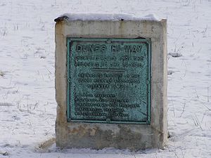
Dunes Highway
"One important project was the 1900 to 1910 macadamizing of part of the Old Chicago Road, Northwest Indiana's major auto route between Gary and Michigan City before the Dunes Highway." Dunes Highway Association engineers envisioned the Dunes Highway a "state of the art" 40 feet (12.2 m)-wide concrete highway with a 100 feet (30.5 m) right-of-way. In August 1919, Commission director H.L. Wright tentatively designated the Dunes Highway as State Road 43, to be 20 feet (6.1 m) wide. Narrower than anticipated, the new concrete highway was still superior to most Indiana roads, which in the mid-1920s were gravel or dirt with paved sections only between the larger towns. Dunes Highway construction began in 1922 under the guidance of Gary contractor Ingwald Moe and construction engineer Ezra Sensibar.Future
The Indiana Department of TransportationIndiana Department of Transportation
The Indiana Department of Transportation is a governmental agency of the U.S. state of Indiana charged with maintaining and regulating transportation and transportation related infrastructure such as state owned airports, state highways and state owned canals or railroads.-Districts:INDOT is...
plans to make US 20 a four-lane highway from the east end of the St. Joseph Valley Parkway to SR 13. The project will be done in three different phases. Phase one will be from Elkhart County Road 17 to SR 15, phase two will be from SR 15 to Elkhart County Road 35, and phase three will be from CR 35 to SR 13.