
Indiana State Road 149
Encyclopedia
State Road 149 in the U.S. state
of Indiana
is a major highway that, much like State Road 249
(SR 249), exists to serve the steel mills and their Port of Indiana
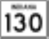
in northwest Indiana. The highway runs from State Road 130
(SR 130), 3 miles (4.8 km) northwest of Valparaiso
, north to U.S. Route 12
(US 12) in Burns Harbor
a distance of about 9 miles (14 km).
(SR 249), SR 149 crosses, but does not have interchanges
with, Interstate 94
(I-94) and Interstates 80
/90 (Indiana Toll Road
). In spite of this, SR 149 is a four-lane divided highway from US 12 south to U.S. Route 20
(US 20). Some believe that SR 149 has no relation to State Road 49
(SR 49). The highway is physically located on the grid system between SR 49 and State Road 51
(SR 51). As no odd numbers exist between 49 and 51, 149 was chosen as a compromise. Others see a relation between the numbers 49, 149, and SR 249.
The interchange with US 12 is unique in that it was designed for westbound US 12 traffic to use an at-grade ramp and traffic light to access southbound SR 149 but the traffic light was never built. The need for this is seen 1/2 mile (3/4 km) east, where a full interchange brings personnel into the Port of Indiana via Mittal Steel. Onramps and offramps are located on the right sides of the busy highway, so to prevent Port of Indiana traffic from crossing two lanes of busy US 12 traffic to access SR 149, a ramp was built instead but, as the traffic light was never added, a decade later the dangerous situation was altered by blocking off the ramp (after festering deer carcasses were found to be dumped there) and a few more years later a left-turn lane was added, though still no traffic light.
U.S. state
A U.S. state is any one of the 50 federated states of the United States of America that share sovereignty with the federal government. Because of this shared sovereignty, an American is a citizen both of the federal entity and of his or her state of domicile. Four states use the official title of...
of Indiana
Indiana
Indiana is a US state, admitted to the United States as the 19th on December 11, 1816. It is located in the Midwestern United States and Great Lakes Region. With 6,483,802 residents, the state is ranked 15th in population and 16th in population density. Indiana is ranked 38th in land area and is...
is a major highway that, much like State Road 249
Indiana State Road 249
State Road 249 in the U.S. state of Indiana is a 2.4-mile connector highway in Portage in northwest Indiana. It exists to connect U.S. Route 12 and U.S. Route 20 with Interstate 94, and also to provide easy access to both highways from the steel mills and their Port of Indiana...
(SR 249), exists to serve the steel mills and their Port of Indiana
Port of Indiana
The Port of Indiana-Burns Harbor is an industrial area, founded in 1965 and located on the Lake Michigan shore of Indiana at the intersection of U.S. Highway 12 and Indiana 249. The primary work done in the area is the manufacturing of steel, and the port area is dominated by steel mills...
in northwest Indiana. The highway runs from State Road 130
Indiana State Road 130
State Road 130 in the U.S. state of Indiana is a short, road that connects Lake Station with Valparaiso to the southeast.-Route description:...
(SR 130), 3 miles (4.8 km) northwest of Valparaiso
Valparaiso, Indiana
Valparaiso is a city in and the county seat of Porter County, Indiana, United States. The population was 31,730 at the 2010 census, making it the 2nd largest city in Porter County.-History:...
, north to U.S. Route 12
U.S. Route 12 in Indiana
In the U.S. state of Indiana, U.S. Route 12 is a historical east–west arterial highway that runs along the Lake Michigan shoreline. In the early 1920s, it was the most important route between Chicago, Illinois and Detroit, Michigan. Most of the route has since been supplanted by Interstate 94...
(US 12) in Burns Harbor
Burns Harbor, Indiana
Burns Harbor is a town in Westchester Township, Porter County, Indiana, United States on the shores of Lake Michigan in Northwest Indiana and is part of the Chicago metropolitan area...
a distance of about 9 miles (14 km).
Route desription
Unlike State Road 249Indiana State Road 249
State Road 249 in the U.S. state of Indiana is a 2.4-mile connector highway in Portage in northwest Indiana. It exists to connect U.S. Route 12 and U.S. Route 20 with Interstate 94, and also to provide easy access to both highways from the steel mills and their Port of Indiana...
(SR 249), SR 149 crosses, but does not have interchanges
Interchange (road)
In the field of road transport, an interchange is a road junction that typically uses grade separation, and one or more ramps, to permit traffic on at least one highway to pass through the junction without directly crossing any other traffic stream. It differs from a standard intersection, at which...
with, Interstate 94
Interstate 94 in Indiana
In the U.S. state of Indiana, Interstate 94 runs east–west through the northwest portion of the state.-Route description:The route between the Illinois border and Lake Station at its junction with the Indiana Toll Road is known as the Borman Expressway and is a heavily traveled route...
(I-94) and Interstates 80
Interstate 80 in Indiana
In the U.S. state of Indiana, Interstate 80 consists entirely of the following two routes:* The Borman Expressway, from the Illinois state line to Lake Station, Indiana, running concurrently with Interstate 94....
/90 (Indiana Toll Road
Indiana Toll Road
The Indiana Toll Road, officially the Indiana East–West Toll Road, is a toll road that runs for east–west across northern Indiana from the Illinois state line to the Ohio state line...
). In spite of this, SR 149 is a four-lane divided highway from US 12 south to U.S. Route 20
U.S. Route 20 in Indiana
U.S. Route 20 in Indiana is a main east–west highway that is parallel to the Indiana Toll Road. The western terminus of US 20 is at the Illinois state line and the eastern terminus is at the Ohio state line. US 20 through Whiting, East Chicago, and Gary is concurrent with...
(US 20). Some believe that SR 149 has no relation to State Road 49
Indiana State Road 49
State Road 49 in the U.S. State of Indiana is a state highway in northwest Indiana. It runs from just north of Chesterton at the intersection with U.S. Route 12 south to a rural interchange 10 miles northeast of Rensselaer with State Road 14...
(SR 49). The highway is physically located on the grid system between SR 49 and State Road 51
Indiana State Road 51
State Road 51 in the U.S. State of Indiana is a north–south route on the state highway system in northwest Indiana. It consists of a route about long from a point on U.S. Route 30 east of Merrillville and west of Valparaiso, north to U.S. Route 20 in Gary...
(SR 51). As no odd numbers exist between 49 and 51, 149 was chosen as a compromise. Others see a relation between the numbers 49, 149, and SR 249.
The interchange with US 12 is unique in that it was designed for westbound US 12 traffic to use an at-grade ramp and traffic light to access southbound SR 149 but the traffic light was never built. The need for this is seen 1/2 mile (3/4 km) east, where a full interchange brings personnel into the Port of Indiana via Mittal Steel. Onramps and offramps are located on the right sides of the busy highway, so to prevent Port of Indiana traffic from crossing two lanes of busy US 12 traffic to access SR 149, a ramp was built instead but, as the traffic light was never added, a decade later the dangerous situation was altered by blocking off the ramp (after festering deer carcasses were found to be dumped there) and a few more years later a left-turn lane was added, though still no traffic light.