
Indiana State Road 49
Encyclopedia
State Road 49 in the U.S. State
of Indiana
is a state highway in northwest Indiana. It runs from just north of Chesterton
at the intersection with U.S. Route 12
(Dunes Highway) south to a rural interchange 10 miles (16 km) northeast of Rensselaer
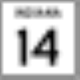
with State Road 14
. This is a distance of about 44.15 miles (71.05 km).
at State Road 10
(SR 10). SR 49 heads north from Wheatfield toward Valparaiso
, just south of Valparaiso SR 49 becomes a four-lane divided highway. Then in Valparaiso SR 49 has an interchange
with U.S. Route 30
(US 30). After the US 30 interchange, SR 49 and State Road 2
have an interchange. Then SR 49 leaves Valparaiso heading north toward Chesterton
having an interchange with U.S. Route 6
, Interstate 80
/Interstate 90/Indiana Toll Road
, Interstate 94
, U.S. Route 20
, and U.S. Route 12
. US 12 is the northern terminus of SR 49.
to Valparaiso, it was a named state route. After 1926, SR 49 was a two-lane highway from Valparaiso to Chesterton, known as "Old State Road 49". When the Valparaiso Bypass was completed the old route was decommissioned and turned over to the City of Valparaiso, the City of Chesterton, and Porter County.
U.S. state
A U.S. state is any one of the 50 federated states of the United States of America that share sovereignty with the federal government. Because of this shared sovereignty, an American is a citizen both of the federal entity and of his or her state of domicile. Four states use the official title of...
of Indiana
Indiana
Indiana is a US state, admitted to the United States as the 19th on December 11, 1816. It is located in the Midwestern United States and Great Lakes Region. With 6,483,802 residents, the state is ranked 15th in population and 16th in population density. Indiana is ranked 38th in land area and is...
is a state highway in northwest Indiana. It runs from just north of Chesterton
Chesterton, Indiana
Chesterton is a town in Westchester, Jackson and Liberty townships, Porter County, Indiana, United States. The population was 13,068 at the 2010 census. The three towns of Chesterton, Burns Harbor, and Porter are known as the tri-towns or the Duneland area....
at the intersection with U.S. Route 12
U.S. Route 12
U.S. Route 12 or US 12 is an east–west United States highway, running from Grays Harbor on the Pacific Ocean, in the state of Washington, to downtown Detroit, for almost . As a thoroughfare, it has mostly been supplanted by I-90 and I-94, but remains an important road for local travel.The...
(Dunes Highway) south to a rural interchange 10 miles (16 km) northeast of Rensselaer
Rensselaer, Indiana
-Demographics:As of the census of 2000, there were 5,294 people, 2,158 households, and 1,404 families residing in the city. The population density was 1,824.8 people per square mile . There were 2,296 housing units at an average density of 791.4 per square mile...
with State Road 14
Indiana State Road 14
State Road 14 is an east–west road in northern Indiana. Its western terminus is at U.S. Route 41 in Enos, and its eastern terminus is at Interstate 69 in Fort Wayne....
. This is a distance of about 44.15 miles (71.05 km).
Route description
The southern terminus of SR 49 is in WheatfieldWheatfield, Indiana
Wheatfield is a town in Wheatfield Township, Jasper County, Indiana, United States. The population was 853 at the 2010 census.-Geography:Wheatfield is located at .According to the United States Census Bureau, the town has a total area of , all of it land....
at State Road 10
Indiana State Road 10
State Road 10 is an east–west road in northwest Indiana. Its western terminus is at the Illinois state line west of Lake Village. Its eastern terminus is at State Road 19 south of Etna Green.-Route description:...
(SR 10). SR 49 heads north from Wheatfield toward Valparaiso
Valparaiso, Indiana
Valparaiso is a city in and the county seat of Porter County, Indiana, United States. The population was 31,730 at the 2010 census, making it the 2nd largest city in Porter County.-History:...
, just south of Valparaiso SR 49 becomes a four-lane divided highway. Then in Valparaiso SR 49 has an interchange
Interchange (road)
In the field of road transport, an interchange is a road junction that typically uses grade separation, and one or more ramps, to permit traffic on at least one highway to pass through the junction without directly crossing any other traffic stream. It differs from a standard intersection, at which...
with U.S. Route 30
U.S. Route 30 in Indiana
In the state of Indiana, U.S. Route 30 is an east–west four-lane divided highway across northern Indiana. It runs from the Illinois state line at Dyer to east of Fort Wayne at the Ohio state line. This is a distance of 151.8 miles ....
(US 30). After the US 30 interchange, SR 49 and State Road 2
Indiana State Road 2
State Road 2 in the U.S. State of Indiana is an east–west route running from the Illinois border at Illinois Route 17 east to the outskirts of South Bend, Indiana at the U.S. Route 20/U.S. Route 31 freeway, also known as the St. Joseph Valley Parkway...
have an interchange. Then SR 49 leaves Valparaiso heading north toward Chesterton
Chesterton, Indiana
Chesterton is a town in Westchester, Jackson and Liberty townships, Porter County, Indiana, United States. The population was 13,068 at the 2010 census. The three towns of Chesterton, Burns Harbor, and Porter are known as the tri-towns or the Duneland area....
having an interchange with U.S. Route 6
U.S. Route 6 in Indiana
U.S. Route 6 is a part of the United States Numbered Highway that runs from California to Provincetown, Massachusetts. In Indiana, it is a mostly rural, two-lane route that travels in the northern part of the state. However, some four-lane stretches may be found in Lake and Porter counties. For...
, Interstate 80
Interstate 80 in Indiana
In the U.S. state of Indiana, Interstate 80 consists entirely of the following two routes:* The Borman Expressway, from the Illinois state line to Lake Station, Indiana, running concurrently with Interstate 94....
/Interstate 90/Indiana Toll Road
Indiana Toll Road
The Indiana Toll Road, officially the Indiana East–West Toll Road, is a toll road that runs for east–west across northern Indiana from the Illinois state line to the Ohio state line...
, Interstate 94
Interstate 94 in Indiana
In the U.S. state of Indiana, Interstate 94 runs east–west through the northwest portion of the state.-Route description:The route between the Illinois border and Lake Station at its junction with the Indiana Toll Road is known as the Borman Expressway and is a heavily traveled route...
, U.S. Route 20
U.S. Route 20 in Indiana
U.S. Route 20 in Indiana is a main east–west highway that is parallel to the Indiana Toll Road. The western terminus of US 20 is at the Illinois state line and the eastern terminus is at the Ohio state line. US 20 through Whiting, East Chicago, and Gary is concurrent with...
, and U.S. Route 12
U.S. Route 12 in Indiana
In the U.S. state of Indiana, U.S. Route 12 is a historical east–west arterial highway that runs along the Lake Michigan shoreline. In the early 1920s, it was the most important route between Chicago, Illinois and Detroit, Michigan. Most of the route has since been supplanted by Interstate 94...
. US 12 is the northern terminus of SR 49.
History
Before 1926, SR 49 was a named Liberty Way from KoutsKouts, Indiana
Kouts is a town in Pleasant Township, Porter County, Indiana. The population was 2,090 at the 2010 census. Since 2000, Kouts has had a population growth of 23.09 percent. Bernhardt Kautz moved here from Pennsylvania, before the arrival of the railroads and established a farm where the town now...
to Valparaiso, it was a named state route. After 1926, SR 49 was a two-lane highway from Valparaiso to Chesterton, known as "Old State Road 49". When the Valparaiso Bypass was completed the old route was decommissioned and turned over to the City of Valparaiso, the City of Chesterton, and Porter County.