

U.S. Route 127
Encyclopedia
U.S. Route 127 is a 758 miles (1,219.9 km) long north–south United States highway in the eastern half of the United States. The southern terminus of the route is at U.S. Route 27
in Chattanooga, Tennessee
. The northern terminus is at Interstate 75
near Grayling, Michigan
. Since 1987, it has been the core of the annual World's Longest Yard Sale, also known as the 127 Corridor Sale
, which now stretches 675 Miles from Hudson, Michigan
to Gadsden, Alabama
. The sale, held every August, was created to demonstrate that the older US highway system has something to offer that the interstate system does not.
In Michigan
, US 127 tripled in length in 2002 at the expense of its parent, US 27.
, US 127 traverses rural areas of the Cumberland Plateau
in eastern Middle Tennessee
and western East Tennessee
, passing southward through the cities of Jamestown
and Crossville
, then follows the Sequatchie Valley
, passing through the cities of Pikeville
and Dunlap
. Near Dunlap the route turns southeastward to cross Walden Ridge
, passing Signal Mountain
and ending at its junction with US 27 in the northern Chattanooga suburb Red Bank
. Before receiving a federal designation, the road was Tennessee State Highway 28 to Dunlap; that route still runs from Dunlap to I-24 at Jasper. Extension of Tenn. 111 as a four-lane highway across Walden Ridge east of Dunlap has taken most interstate traffic off 127 from Dunlap to Chattanooga.
, US 127 is cosigned with US 42 through Cincinnati's Northern Kentucky suburbs until 5 miles (8 km) east of Warsaw
, then passes south through Owenton
. This was the road driven by Buddy Rich
when he wrote "Blue Grass makes me Blue" in 1947. At the state capital of Frankfort
, it becomes a four-lane highway, then skirts Lawrenceburg
, Harrodsburg
and Danville
. It enters the hilly Knobs Region at Junction City, where it becomes a two-lane route, and continues through Hustonville, crossing the drainage divide between the Kentucky and Green river watersheds and roughly following the scenic upper Green River valley through Casey County, crossing the river at Liberty. South of Dunnville it climbs onto the Eastern Pennyroyal Plateau and cuts through Russell Springs and Jamestown. It crosses Wolf Creek Dam
, which creates Lake Cumberland
. It runs very briefly with KY 90 north of Albany and crosses into Tennessee at Static. In 2009 construction began on a new route, in phases, through Clinton County
. Until as late as 1958, US 127 was known as KY 35 and TN 28. It gained a federal number in conjunction with improvements to the road in Casey County (widening and straightening, although not to today's standards) and Albany (curb, gutter and sidewalks). A remnant of KY 35 remains south of Warsaw. Much of the route was improved to modern standards during and after the 1987-91 administration of Gov. Wallace Wilkinson, a native of Liberty.
, including Bryan
, Paulding
, Van Wert
, Celina
, Greenville
, Eaton
, Somerville
, Seven Mile
, New Miami
, and Cincinnati
. In Cincinnati, it shares a short concurrency with its parent route, US 27, along with US 42. From there, it heads north through Fairfield
and Hamilton
. US 127 crosses the Ohio Turnpike
near West Unity
, but does not intersect with it. It also joins with US 36 for about 5 miles (8 km). The last city
that US 127 goes through before reaching Michigan is Bryan
. The last city US 127 goes through before Kentucky is Cincinnati.
The highway is a four-lane, divided by-pass around Greenville
 In Michigan
, US 127 runs from the Ohio border south of Hudson
north to the junction with I-75
, 4 miles (6.4 km) south of Grayling
, a distance of 214.12 miles (344.6 km).
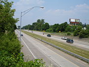
The highway is the primary route connecting Lansing
and central Michigan to Northern Michigan and the Mackinac Bridge; it serves the cities of Jackson
, Lansing
and Clare
From the south side of Jackson northerly, it is mostly a four-lane freeway, with the notable exception of a 16 miles (26 km) stretch from north of St. Johns to just south of Ithaca, where access to the road is not limited and speeds were initially restricted to 55 miles per hour (25 m/s), but are now, as of April 5, 2010, only limited to 65 miles per hour (29 m/s).
Prior to 2002, US 127 ran from I-69
north of East Lansing
southerly to the Ohio border near Hudson
, a total of 83 miles (133.6 km). From the Ohio border until Jackson, the highway follows the course (with minor deviations) of the Michigan Meridian
used to survey Michigan in the early 19th century. That stretch is generally named Meridian Rd.
A proposed I-73
would incorporate US 127 between Jackson and Grayling.
. In 1930 the southern terminus moved to Cincinnati, and in 1958 it was extended to its present southern terminus at Chattanooga.
from its inception in 1926 to 2002. In 2002, the terminus was moved to an intersection with I-75
south of Grayling
in Crawford County, Michigan
, replacing all of US 27
north of Lansing.
U.S. Route 27
U.S. Route 27 is a north–south United States highway in the southern and midwestern United States. The southern terminus is at US 1 in Miami, Florida. The northern terminus is at Interstate 69 in Fort Wayne, Indiana...
in Chattanooga, Tennessee
Chattanooga, Tennessee
Chattanooga is the fourth-largest city in the US state of Tennessee , with a population of 169,887. It is the seat of Hamilton County...
. The northern terminus is at Interstate 75
Interstate 75
Interstate 75 is a major north–south Interstate Highway in the Great Lakes and Southeastern regions of the United States. It travels from State Road 826 and State Road 924 in Hialeah, Florida to Sault Ste. Marie, Michigan, at the Ontario, Canada, border...
near Grayling, Michigan
Grayling, Michigan
Grayling is a city in the U.S. state of Michigan and the county seat of Crawford County. The population was 1,952 at the 2000 census. Grayling takes its name from the Grayling fish that was once prevalent in its lakes and streams....
. Since 1987, it has been the core of the annual World's Longest Yard Sale, also known as the 127 Corridor Sale
Highway 127 Corridor Sale
The Highway 127 Corridor Sale is an outdoor second-hand sale held annually for four days beginning the first Thursday in August along U.S. Route 127. The event has been promoted as "The World's Longest Yard Sale."...
, which now stretches 675 Miles from Hudson, Michigan
Hudson, Michigan
Hudson is a city in Lenawee County in the U.S. state of Michigan. The population was 2,307 at the 2010 census. The city is located within Hudson Township, but is politically independent.-Geography:...
to Gadsden, Alabama
Gadsden, Alabama
The city of Gadsden is the county seat of Etowah County in the U.S. state of Alabama, and it is located about 65 miles northeast of Birmingham, Alabama. It is the primary city of the Gadsden Metropolitan Statistical Area, which has a population of 103,459. Gadsden is closely associated with the...
. The sale, held every August, was created to demonstrate that the older US highway system has something to offer that the interstate system does not.
In Michigan
Michigan
Michigan is a U.S. state located in the Great Lakes Region of the United States of America. The name Michigan is the French form of the Ojibwa word mishigamaa, meaning "large water" or "large lake"....
, US 127 tripled in length in 2002 at the expense of its parent, US 27.
Tennessee
In TennesseeTennessee
Tennessee is a U.S. state located in the Southeastern United States. It has a population of 6,346,105, making it the nation's 17th-largest state by population, and covers , making it the 36th-largest by total land area...
, US 127 traverses rural areas of the Cumberland Plateau
Cumberland Plateau
The Cumberland Plateau is the southern part of the Appalachian Plateau. It includes much of eastern Kentucky and western West Virginia, part of Tennessee, and a small portion of northern Alabama and northwest Georgia . The terms "Allegheny Plateau" and the "Cumberland Plateau" both refer to the...
in eastern Middle Tennessee
Middle Tennessee
Middle Tennessee is a distinct portion of the state of Tennessee, delineated according to state law as the 41 counties in the Middle Grand Division of Tennessee....
and western East Tennessee
East Tennessee
East Tennessee is a name given to approximately the eastern third of the U.S. state of Tennessee, one of the three Grand Divisions of Tennessee defined in state law. East Tennessee consists of 33 counties, 30 located within the Eastern Time Zone and three counties in the Central Time Zone, namely...
, passing southward through the cities of Jamestown
Jamestown, Tennessee
Jamestown is a city in Fentress County, Tennessee, United States. It is the county seat of Fentress County. The city population was 1,839 at the 2000 census. The 2008 estimated population is about 2,300.-History:...
and Crossville
Crossville, Tennessee
Crossville is a city in and the county seat of Cumberland County, Tennessee, United States. The population was 10,795 at the 2010 Census.-Geography:Crossville is located at...
, then follows the Sequatchie Valley
Sequatchie Valley
Sequatchie Valley is a relatively long and narrow valley in the U.S. state of Tennessee and, in some definitions, Alabama. It is generally considered to be part of the Cumberland Plateau region of the Appalachian Mountains; it was probably formed by erosion of a compression anticline, rather than...
, passing through the cities of Pikeville
Pikeville, Tennessee
Pikeville is a city in Bledsoe County, Tennessee, United States. The population was 1,781 at the 2000 census. It is also the county seat of Bledsoe County.-Geography:...
and Dunlap
Dunlap, Tennessee
Dunlap is a city in Sequatchie County, Tennessee, United States. The population was 4,173 at the 2000 census. It is the county seat of Sequatchie County.Dunlap is part of the Chattanooga, TN–GA Metropolitan Statistical Area.-Geography:...
. Near Dunlap the route turns southeastward to cross Walden Ridge
Walden Ridge
Walden Ridge is a mountain ridge and escarpment located in Tennessee, in the United States. It marks the eastern edge of the Cumberland Plateau and is generally considered part of it. Walden Ridge is about long, running generally north-south...
, passing Signal Mountain
Signal Mountain, Tennessee
Signal Mountain is a town in Hamilton County, Tennessee, United States. The town is a suburb of Chattanooga and is located on Walden Ridge, a land mass often mistakenly referred to as "Signal Mountain" itself...
and ending at its junction with US 27 in the northern Chattanooga suburb Red Bank
Red Bank, Tennessee
Red Bank is a city in Hamilton County, Tennessee, United States. The population was 12,418 at the 2000 census. Red Bank is an enclave; its area is completely surrounded by that of Chattanooga. As of the 2010 election, the Board of Commissioners has Monty Millard , Greg JonesRed Bank is a city in...
. Before receiving a federal designation, the road was Tennessee State Highway 28 to Dunlap; that route still runs from Dunlap to I-24 at Jasper. Extension of Tenn. 111 as a four-lane highway across Walden Ridge east of Dunlap has taken most interstate traffic off 127 from Dunlap to Chattanooga.
Kentucky
In KentuckyKentucky
The Commonwealth of Kentucky is a state located in the East Central United States of America. As classified by the United States Census Bureau, Kentucky is a Southern state, more specifically in the East South Central region. Kentucky is one of four U.S. states constituted as a commonwealth...
, US 127 is cosigned with US 42 through Cincinnati's Northern Kentucky suburbs until 5 miles (8 km) east of Warsaw
Warsaw, Kentucky
Warsaw is a city in Gallatin County, Kentucky, United States, along the Ohio River. The population was 1,811 at the 2000 census. It is the county seat of Gallatin County It was named after Warsaw, Poland .-Geography:...
, then passes south through Owenton
Owenton, Kentucky
Owenton is a city in Owen County, Kentucky, United States. The population was 1,387 at the 2000 census and was estimated at 1,461 in 2009. It is the county seat of Owen County...
. This was the road driven by Buddy Rich
Buddy Rich
Bernard "Buddy" Rich was an American jazz drummer and bandleader. Rich was billed as "the world's greatest drummer" and was known for his virtuosic technique, power, groove, and speed.-Early life:...
when he wrote "Blue Grass makes me Blue" in 1947. At the state capital of Frankfort
Frankfort, Kentucky
Frankfort is a city in Kentucky that serves as the state capital and the county seat of Franklin County. The population was 27,741 at the 2000 census; by population it is the 5th smallest state capital in the United States...
, it becomes a four-lane highway, then skirts Lawrenceburg
Lawrenceburg, Kentucky
Lawrenceburg is a city in Anderson County, Kentucky, United States. The population was 10,505 at the 2010 census. It is the county seat of Anderson County...
, Harrodsburg
Harrodsburg, Kentucky
Harrodsburg is a city in and the county seat of Mercer County, Kentucky, United States. The population was 8,014 at the 2000 census. It is the oldest city in Kentucky.-History:...
and Danville
Danville, Kentucky
Danville is a city in and the county seat of Boyle County, Kentucky, United States. The population was 16,218 at the 2010 census.Danville is the principal city of the Danville Micropolitan Statistical Area, which includes all of Boyle and Lincoln counties....
. It enters the hilly Knobs Region at Junction City, where it becomes a two-lane route, and continues through Hustonville, crossing the drainage divide between the Kentucky and Green river watersheds and roughly following the scenic upper Green River valley through Casey County, crossing the river at Liberty. South of Dunnville it climbs onto the Eastern Pennyroyal Plateau and cuts through Russell Springs and Jamestown. It crosses Wolf Creek Dam
Wolf Creek Dam
The Wolf Creek Dam is a multi-purpose dam on the Cumberland River in the western part of Russell County, Kentucky, United States. The dam serves at once four distinct purposes: it generates hydroelectricity; it regulates and limits flooding; it releases stored water to permit year-round navigation...
, which creates Lake Cumberland
Lake Cumberland
Lake Cumberland is a reservoir in Clinton, Laurel, McCreary, Pulaski, Russell, and Wayne counties in Kentucky. The primary reasons for its construction were a means for flood control and the production of hydroelectric power. Its shoreline measures 1,255 miles and the lake is spread over at the...
. It runs very briefly with KY 90 north of Albany and crosses into Tennessee at Static. In 2009 construction began on a new route, in phases, through Clinton County
Clinton County, Kentucky
Clinton County is a county located in the U.S. state of Kentucky. It was formed in 1836. As of 2000, the population was 9,634. Its name is in honor of the seventh Governor of New York State, DeWitt Clinton. Its county seat is Albany, Kentucky, and it is a prohibition or dry county...
. Until as late as 1958, US 127 was known as KY 35 and TN 28. It gained a federal number in conjunction with improvements to the road in Casey County (widening and straightening, although not to today's standards) and Albany (curb, gutter and sidewalks). A remnant of KY 35 remains south of Warsaw. Much of the route was improved to modern standards during and after the 1987-91 administration of Gov. Wallace Wilkinson, a native of Liberty.
Ohio
US 127 serves several cities and rural communities along the extreme western edge of OhioOhio
Ohio is a Midwestern state in the United States. The 34th largest state by area in the U.S.,it is the 7th‑most populous with over 11.5 million residents, containing several major American cities and seven metropolitan areas with populations of 500,000 or more.The state's capital is Columbus...
, including Bryan
Bryan, Ohio
As of the census of 2000, there were 8,333 people, 3,528 households, and 2,155 families residing in the city. The population density was 1,821.7 people per square mile . There were 3,733 housing units at an average density of 816.1 per square mile...
, Paulding
Paulding, Ohio
Paulding is a village in and the county seat of Paulding County, Ohio, United States. It is located predominantly in Paulding Township. The population was 3,595 at the 2000 census.-History:...
, Van Wert
Van Wert, Ohio
As of the census of 2000, there were 10,690 people, 4,556 households, and 2,947 families residing in the city. The population density was 1,803.8 people per square mile . There were 4,927 housing units at an average density of 831.4 per square mile...
, Celina
Celina, Ohio
Celina is a city in and the county seat of Mercer County, Ohio, United States. The population was 10,303 at the 2000 census. Celina is situated on the western shores of Grand Lake St. Marys.-History:...
, Greenville
Greenville, Ohio
Greenville is a city in Darke County, Ohio, United States. The population was 13,227 at the 2010 census. It is the county seat of Darke County.-History:Greenville is the historic location of Fort Greene Ville,Greenville is a city in Darke County, Ohio, United States. The population was 13,227 at...
, Eaton
Eaton, Ohio
Eaton is a city in and the county seat of Preble County, Ohio, United States. The population was 8,407 at the 2010 census. It is part of the Dayton Metropolitan Statistical Area.-History:...
, Somerville
Somerville, Ohio
Somerville is a village in Milford Township, Butler County, Ohio, United States. The population was 294 at the 2000 census.-Geography:Somerville is located at ....
, Seven Mile
Seven Mile, Ohio
Seven Mile is a village in Butler County, Ohio, United States. The population was 678 at the 2000 census. The name of Seven Mile appears to be its location seven miles north of Hamilton, Ohio...
, New Miami
New Miami, Ohio
New Miami is a village in St. Clair Township, located in central Butler County in the southwestern part of the U.S. state of Ohio. The population was 2,469 at the 2000 census....
, and Cincinnati
Cincinnati, Ohio
Cincinnati is a city in the U.S. state of Ohio. Cincinnati is the county seat of Hamilton County. Settled in 1788, the city is located to north of the Ohio River at the Ohio-Kentucky border, near Indiana. The population within city limits is 296,943 according to the 2010 census, making it Ohio's...
. In Cincinnati, it shares a short concurrency with its parent route, US 27, along with US 42. From there, it heads north through Fairfield
Fairfield, Ohio
Fairfield is a city in Butler County in the U.S. state of Ohio, near Cincinnati. Fairfield was incorporated in 1955. The population was 42,510 at the 2010 census. The city school district is one of the largest in Ohio, with Fairfield High School graduating 842 students in June 2009. Fairfield is...
and Hamilton
Hamilton, Ohio
Hamilton is a city in Butler County, southwestern Ohio, United States. The population was 62,447 at the 2010 census. It is the county seat of Butler County. The city is part of the Cincinnati metropolitan area....
. US 127 crosses the Ohio Turnpike
Ohio Turnpike
The Ohio Turnpike, officially the James W. Shocknessy Ohio Turnpike, is a -long, limited-access toll highway in the U.S. state of Ohio, serving as a primary corridor to Chicago and Pittsburgh...
near West Unity
West Unity, Ohio
West Unity is a village in Williams County, Ohio, United States. The population was 1,790 at the 2000 census.-Geography:West Unity is located at ....
, but does not intersect with it. It also joins with US 36 for about 5 miles (8 km). The last city
City
A city is a relatively large and permanent settlement. Although there is no agreement on how a city is distinguished from a town within general English language meanings, many cities have a particular administrative, legal, or historical status based on local law.For example, in the U.S...
that US 127 goes through before reaching Michigan is Bryan
Bryan, Ohio
As of the census of 2000, there were 8,333 people, 3,528 households, and 2,155 families residing in the city. The population density was 1,821.7 people per square mile . There were 3,733 housing units at an average density of 816.1 per square mile...
. The last city US 127 goes through before Kentucky is Cincinnati.
The highway is a four-lane, divided by-pass around Greenville
Greenville, Ohio
Greenville is a city in Darke County, Ohio, United States. The population was 13,227 at the 2010 census. It is the county seat of Darke County.-History:Greenville is the historic location of Fort Greene Ville,Greenville is a city in Darke County, Ohio, United States. The population was 13,227 at...
Michigan
Michigan
Michigan is a U.S. state located in the Great Lakes Region of the United States of America. The name Michigan is the French form of the Ojibwa word mishigamaa, meaning "large water" or "large lake"....
, US 127 runs from the Ohio border south of Hudson
Hudson, Michigan
Hudson is a city in Lenawee County in the U.S. state of Michigan. The population was 2,307 at the 2010 census. The city is located within Hudson Township, but is politically independent.-Geography:...
north to the junction with I-75
Interstate 75 in Michigan
Interstate 75 is a part of the Interstate Highway System and runs from Miami, Florida to Sault Ste. Marie in the Upper Peninsula of Michigan. I-75 enters the state from Ohio in the south, just to the north of Toledo. It runs generally north through Detroit, Pontiac and Bay City, crossing the...
, 4 miles (6.4 km) south of Grayling
Grayling, Michigan
Grayling is a city in the U.S. state of Michigan and the county seat of Crawford County. The population was 1,952 at the 2000 census. Grayling takes its name from the Grayling fish that was once prevalent in its lakes and streams....
, a distance of 214.12 miles (344.6 km).
The highway is the primary route connecting Lansing
Lansing, Michigan
Lansing is the capital of the U.S. state of Michigan. It is located mostly in Ingham County, although small portions of the city extend into Eaton County. The 2010 Census places the city's population at 114,297, making it the fifth largest city in Michigan...
and central Michigan to Northern Michigan and the Mackinac Bridge; it serves the cities of Jackson
Jackson, Michigan
Jackson is a city located along Interstate 94 in the south central area of the U.S. state of Michigan, about west of Ann Arbor and south of Lansing. It is the county seat of Jackson County. As of the 2010 census, the city population was 33,534...
, Lansing
Lansing, Michigan
Lansing is the capital of the U.S. state of Michigan. It is located mostly in Ingham County, although small portions of the city extend into Eaton County. The 2010 Census places the city's population at 114,297, making it the fifth largest city in Michigan...
and Clare
Clare, Michigan
Clare is a city in Clare and Isabella counties in the U.S. state of Michigan. Located primarily in Clare County, the city had a population of 3,173 at the 2000 census....
From the south side of Jackson northerly, it is mostly a four-lane freeway, with the notable exception of a 16 miles (26 km) stretch from north of St. Johns to just south of Ithaca, where access to the road is not limited and speeds were initially restricted to 55 miles per hour (25 m/s), but are now, as of April 5, 2010, only limited to 65 miles per hour (29 m/s).
Prior to 2002, US 127 ran from I-69
Interstate 69
Interstate 69 is an Interstate Highway in the United States. It exists in two parts: a completed highway from Indianapolis, Indiana, northeast to the Canadian border in Port Huron, Michigan, and a mostly proposed extension southwest to the Mexican border in Texas...
north of East Lansing
East Lansing, Michigan
East Lansing is a city in the U.S. state of Michigan. The city is located directly east of Lansing, Michigan, the state's capital. Most of the city is within Ingham County, though a small portion lies in Clinton County. The population was 48,579 at the time of the 2010 census, an increase from...
southerly to the Ohio border near Hudson
Hudson, Michigan
Hudson is a city in Lenawee County in the U.S. state of Michigan. The population was 2,307 at the 2010 census. The city is located within Hudson Township, but is politically independent.-Geography:...
, a total of 83 miles (133.6 km). From the Ohio border until Jackson, the highway follows the course (with minor deviations) of the Michigan Meridian
Michigan Meridian
The Michigan Meridian is the meridian used as a reference in the Michigan Survey, the survey of the U.S. state of Michigan in the early 19th century. It is located at 84 degrees, 22 minutes and 24 seconds west longitude at its northern terminus at Sault Ste...
used to survey Michigan in the early 19th century. That stretch is generally named Meridian Rd.
A proposed I-73
Interstate 73
Interstate 73 is a main route of the Interstate Highway System, currently located entirely within the U.S. state of North Carolina. It is part of a longer planned corridor, defined by various Federal laws to run from Myrtle Beach, South Carolina, to Grayling, Michigan, but only the part south of...
would incorporate US 127 between Jackson and Grayling.
Southern terminus
US 127 originally terminated at Toledo when it was commissioned in 1926. At that time, the southern portion ran from Somerset to Toledo along the route of present day U.S. Route 223U.S. Route 223
US Route 223 or US Highway 223 is a diagonal US Highway lying in the US states of Michigan and Ohio. The southern most section is completely concurrent with the US 23 freeway, including all of the Ohio segment. It connects US 23 in the south near Toledo, Ohio with US 127 and...
. In 1930 the southern terminus moved to Cincinnati, and in 1958 it was extended to its present southern terminus at Chattanooga.
Northern terminus
The northern terminus of US 127 was in or near Lansing, MichiganLansing, Michigan
Lansing is the capital of the U.S. state of Michigan. It is located mostly in Ingham County, although small portions of the city extend into Eaton County. The 2010 Census places the city's population at 114,297, making it the fifth largest city in Michigan...
from its inception in 1926 to 2002. In 2002, the terminus was moved to an intersection with I-75
Interstate 75
Interstate 75 is a major north–south Interstate Highway in the Great Lakes and Southeastern regions of the United States. It travels from State Road 826 and State Road 924 in Hialeah, Florida to Sault Ste. Marie, Michigan, at the Ontario, Canada, border...
south of Grayling
Grayling, Michigan
Grayling is a city in the U.S. state of Michigan and the county seat of Crawford County. The population was 1,952 at the 2000 census. Grayling takes its name from the Grayling fish that was once prevalent in its lakes and streams....
in Crawford County, Michigan
Crawford County, Michigan
See also: List of counties bordering eight counties-Demographics:As of the census of 2000, there were 14,273 people, 5,625 households, and 4,038 families residing in the county. The population density was 26 people per square mile . There were 10,042 housing units at an average density of 18 per...
, replacing all of US 27
U.S. Route 27
U.S. Route 27 is a north–south United States highway in the southern and midwestern United States. The southern terminus is at US 1 in Miami, Florida. The northern terminus is at Interstate 69 in Fort Wayne, Indiana...
north of Lansing.