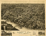
The city of
Gadsden is the
county seatA county seat is an administrative center, or seat of government, for a county or civil parish. The term is primarily used in the United States....
of Etowah County in the
U.S. stateA U.S. state is any one of the 50 federated states of the United States of America that share sovereignty with the federal government. Because of this shared sovereignty, an American is a citizen both of the federal entity and of his or her state of domicile. Four states use the official title of...
of
AlabamaAlabama is a state located in the southeastern region of the United States. It is bordered by Tennessee to the north, Georgia to the east, Florida and the Gulf of Mexico to the south, and Mississippi to the west. Alabama ranks 30th in total land area and ranks second in the size of its inland...
, and it is located about 65 miles northeast of
Birmingham, AlabamaBirmingham is the largest city in Alabama. The city is the county seat of Jefferson County. According to the 2010 United States Census, Birmingham had a population of 212,237. The Birmingham-Hoover Metropolitan Area, in estimate by the U.S...
. It is the primary city of the
Gadsden Metropolitan Statistical AreaGadsden Metropolitan Statistical Area covers all of Etowah County located in Northeast Alabama. As of 2000, the population was 103,459. It consists of Gadsden and its surrounding towns.-Suburbs:The Gadsden Metro area includes the following suburbs:...
, which has a population of 103,459. Gadsden is closely associated with the neighboring town of
Attalla, AlabamaAttalla is a city in Etowah County, Alabama, United States. It is part of the Gadsden Metropolitan Statistical Area. According to the 2005 U.S. Census estimates, the city had a population of 6,474. -2000 Census data:...
. As of the U.S. Census Bureau estimate in 2006, the population of the city was about 37,300.
Gadsden was at one time in the 19th century Alabama's second most important center of commerce and industry, trailing only the seaport of
MobileMobile is the third most populous city in the Southern US state of Alabama and is the county seat of Mobile County. It is located on the Mobile River and the central Gulf Coast of the United States. The population within the city limits was 195,111 during the 2010 census. It is the largest...
. The two cities were important shipping centers: Gadsden for riverboats and Mobile for international trade. Through the 1980s, Gadsden was a center on heavy industry, including the
Goodyear Tire and Rubber CompanyThe Goodyear Tire & Rubber Company was founded in 1898 by Frank Seiberling. Goodyear manufactures tires for automobiles, commercial trucks, light trucks, SUVs, race cars, airplanes, farm equipment and heavy earth-mover machinery....
and the Republic Steel Corporation.
More than a decade after the sharp decline in industry, in 1991 Gadsden was awarded the honor of
All-America CityThe All-America City Award is given by the National Civic League annually to ten cities in the United States.The oldest community recognition program in the nation, the award recognizes communities whose citizens work together to identify and tackle community-wide challenges and achieve uncommon...
by the
National Civic LeagueThe National Civic League is an American non-profit organization that advocates for transparency, effectiveness, and openness in local government...
, an award that honored the way Gadsden's citizens, government, businesses, and voluntary organizations work together to address critical local issues.
History
The first substantial white settlement in what is now Gadsden was a village called "Double Springs". This was begun by a mixed
American IndianThe indigenous peoples of the Americas are the pre-Columbian inhabitants of North and South America, their descendants and other ethnic groups who are identified with those peoples. Indigenous peoples are known in Canada as Aboriginal peoples, and in the United States as Native Americans...
and
caucasianThe term Caucasian race has been used to denote the general physical type of some or all of the populations of Europe, North Africa, the Horn of Africa, Western Asia , Central Asia and South Asia...
settler named John Riley when he built his house near two springs in about 1825. This became a stagecoach stop on the Huntsville-to-Rome route. The original house still stands today as the oldest one in Gadsden.
The house changed hands to a couple named Gabriel and Asenath Hughes in 1840. Shortly thereafter, they began to purchase much of the land between
Lookout Mountainthumb|right|See seven statesLookout Mountain is located at the northwest corner of the U.S. state of Georgia, the northeast corner of Alabama, and along the southern border of Tennessee at Chattanooga. Lookout Mountain, along with Sand Mountain to the northwest, makes up a large portion of the...
, the
Coosa RiverThe Coosa River is a tributary of the Alabama River in the U.S. states of Alabama and Georgia. The river is about long altogether.The Coosa River is one of Alabama's most developed rivers...
, and down to the mouth of Wills Creek. The Hughes brothers' unrealized vision was to bring a proposed railroad from Savannah to Nashville through their holdings. Their land, plus that of John S. Moragne and Lewis L. Rhea, was the 120 acres on which the original survey of Gadsden was made. Double Springs was transformed on July 4, 1845, when one Captain James Lafferty piloted the first steamboat to this area, aptly named the
Coosa. Lafferty landed near the site of the current Memorial Bridge on that date. The Hughes brothers offered to name the town "Lafferty's Landing" in his honor, but Lafferty declined. Instead, the name "Gadsden" was chosen, in honor of Colonel
James GadsdenJames Gadsden was an American diplomat, soldier and businessman and namesake of the Gadsden Purchase, in which the United States purchased from Mexico the land that became the southern portion of Arizona and New Mexico. James Gadsden served as Adjutant General of the U. S...
of
South CarolinaSouth Carolina is a state in the Deep South of the United States that borders Georgia to the south, North Carolina to the north, and the Atlantic Ocean to the east. Originally part of the Province of Carolina, the Province of South Carolina was one of the 13 colonies that declared independence...
, who later became prominent for the
Gadsden PurchaseThe Gadsden Purchase is a region of present-day southern Arizona and southwestern New Mexico that was purchased by the United States in a treaty signed by James Gadsden, the American ambassador to Mexico at the time, on December 30, 1853. It was then ratified, with changes, by the U.S...
.
After most of Gadsden's major industries departed in the 1970s and 80's, the city began to crash. A
Rand McNallyRand McNally is an American publisher of maps, atlases, textbooks, and globes for travel, reference, commercial, and educational uses. It also provides online consumer street maps and directions, as well as commercial transportation routing software and mileage data...
article in 1989 listed Gadsden as one of the
"Seven Worst Cities to Live in the United States". The city government was spurred to action by these reports, and efforts like the Cultural Arts Center and downtown redevelopment earned Gadsden first place in the 2000 City Livability Awards Program.
Geography
Gadsden is located at 34°0′37"N 86°0′37"W (34.010147, -86.010356).
According to the U.S. Census Bureau, the city has a total area of 37.2 square miles (96.3 km²), of which 36 square miles (93.2 km²) is land and 1.2 square miles (3.1 km²) (3.25%) is water.
Demographics
As of the
censusA census is the procedure of systematically acquiring and recording information about the members of a given population. It is a regularly occurring and official count of a particular population. The term is used mostly in connection with national population and housing censuses; other common...
of 2000, there were 38,978 people, 16,456 households, and 10,252 families residing in the city. The
population densityPopulation density is a measurement of population per unit area or unit volume. It is frequently applied to living organisms, and particularly to humans...
was 1,083.6 people per square mile (418.4/km
2). There were 18,797 housing units at an average density of 522.6 per square mile (201.8/km
2). The racial makeup of the city was 62.69%
WhiteRace and ethnicity in the United States Census, as defined by the Federal Office of Management and Budget and the United States Census Bureau, are self-identification data items in which residents choose the race or races with which they most closely identify, and indicate whether or not they are...
, 34.00%
BlackRace and ethnicity in the United States Census, as defined by the Federal Office of Management and Budget and the United States Census Bureau, are self-identification data items in which residents choose the race or races with which they most closely identify, and indicate whether or not they are...
or
African AmericanRace and ethnicity in the United States Census, as defined by the Federal Office of Management and Budget and the United States Census Bureau, are self-identification data items in which residents choose the race or races with which they most closely identify, and indicate whether or not they are...
, 0.30%
Native AmericanRace and ethnicity in the United States Census, as defined by the Federal Office of Management and Budget and the United States Census Bureau, are self-identification data items in which residents choose the race or races with which they most closely identify, and indicate whether or not they are...
, 0.53%
AsianRace and ethnicity in the United States Census, as defined by the Federal Office of Management and Budget and the United States Census Bureau, are self-identification data items in which residents choose the race or races with which they most closely identify, and indicate whether or not they are...
, 0.08%
Pacific IslanderRace and ethnicity in the United States Census, as defined by the Federal Office of Management and Budget and the United States Census Bureau, are self-identification data items in which residents choose the race or races with which they most closely identify, and indicate whether or not they are...
, 1.22% from
other racesRace and ethnicity in the United States Census, as defined by the Federal Office of Management and Budget and the United States Census Bureau, are self-identification data items in which residents choose the race or races with which they most closely identify, and indicate whether or not they are...
, and 1.17% from two or more races. 2.67% of the population were
HispanicRace and ethnicity in the United States Census, as defined by the Federal Office of Management and Budget and the United States Census Bureau, are self-identification data items in which residents choose the race or races with which they most closely identify, and indicate whether or not they are...
or
LatinoRace and ethnicity in the United States Census, as defined by the Federal Office of Management and Budget and the United States Census Bureau, are self-identification data items in which residents choose the race or races with which they most closely identify, and indicate whether or not they are...
of any race.
There were 16,456 households out of which 24.9% had children under the age of 18 living with them, 40.5% were
married couplesMarriage is a social union or legal contract between people that creates kinship. It is an institution in which interpersonal relationships, usually intimate and sexual, are acknowledged in a variety of ways, depending on the culture or subculture in which it is found...
living together, 18.1% had a female householder with no husband present, and 37.7% were non-families. 33.9% of all households were made up of individuals and 16.9% had someone living alone who was 65 years of age or older. The average household size was 2.28 and the average family size was 2.91.
In the city the population was spread out with 23.0% under the age of 18, 9.5% from 18 to 24, 25.3% from 25 to 44, 22.0% from 45 to 64, and 20.1% who were 65 years of age or older. The median age was 39 years. For every 100 females there were 85.2 males. For every 100 females age 18 and over, there were 80.1 males.
The median income for a household in the city was $24,823, and the median income for a family was $31,740. Males had a median income of $29,400 versus $19,840 for females. The
per capita incomePer capita income or income per person is a measure of mean income within an economic aggregate, such as a country or city. It is calculated by taking a measure of all sources of income in the aggregate and dividing it by the total population...
for the city was $15,610. About 18.1% of families and 22.9% of the population were below the poverty line, including 33.9% of those under age 18 and 14.6% of those age 65 or over.
Employment
Citing statistics from the Alabama Department of Industrial Relations and the Center for Business and Economic Research at the University of Alabama, the Gadsden-Etowah County Industrial Development Authority reports that approximately 12,000 residents of Etowah County are underemployed and 2,179 residents are unemployed as of 2008.
Education
The Gadsden City Board of Education oversees fourteen schools: eight elementary schools, three middle schools, one high school, and two specialty schools (one alternative center and one technical center).
A new high school,
Gadsden City High SchoolGadsden City High School is a public high school, located in Gadsden, Alabama, United States serving approximately 1500 students in grades nine through twelve. The school is the only high school in the Gadsden City School System...
, replaced the three former city high schools (
Emma SansomEmma Sansom was an Alabama farmgirl noted for her bravery during the American Civil War.Sansom was a native of Social Circle, Georgia, and moved with her family to just outside Gadsden, Alabama, in about 1852....
High School, Gadsden High School, and
Litchfield High SchoolLitchfield High School was a public high school in Gadsden, Alabama, serving grades nine through twelve. It closed after the 2005-2006 academic school year after the Gadsden City Board of Education voted to construct a new facility - Gadsden City High School - and consolidate Litchfield, Emma...
) via merger for the 2006-2007 school year.
Gadsden is home to three institutions of higher learning: Gadsden State Community College, which is the second largest among the 27 two-year institutions comprising the Alabama College System,
Jacksonville State UniversityJacksonville State University is a regional public coeducational university located in Jacksonville, Alabama, USA. Founded in 1883, Jacksonville State offers programs of study in four academic units leading to Bachelor's, Master's, and Education Specialist degrees, in addition to continuing and...
, and the
University of AlabamaThe University of Alabama is a public coeducational university located in Tuscaloosa, Alabama, United States....
, although the latter are small satellite institutions.
Religion
Gadsden is home to
Congregation Beth IsraelCongregation Beth Israel was a Reform synagogue, located for most of its history at 761 Chestnut Street in Gadsden, Alabama. An outgrowth of Gadsden's Jewish religious school, it was founded in 1908 and incorporated in 1910...
, a
ReformReform Judaism refers to various beliefs, practices and organizations associated with the Reform Jewish movement in North America, the United Kingdom and elsewhere. In general, it maintains that Judaism and Jewish traditions should be modernized and should be compatible with participation in the...
synagogueA synagogue is a Jewish house of prayer. This use of the Greek term synagogue originates in the Septuagint where it sometimes translates the Hebrew word for assembly, kahal...
founded in 1908. In a 1960 attack, the synagogue was fire-bombed, its windows smashed, and two members wounded with a shotgun by a Nazi sympathizer.
Gadsden also houses other churches of Methodist, Episcopalian, Baptist, and Catholic faiths.
Points of interest
- Noccalula Falls Park
Noccalula Falls Park[p] is a 250-acre public park located in Gadsden, Alabama .The falls are located on land once owned by R.A. Mitchell, who gave the site to the city of Gadsden, so that the area could be improved, and everyone could enjoy the majestic falls. Across the street from the falls you...
- Gilliland-Reese Covered Bridge
The Gilliland-Reese Covered Bridge, more simply known as Gilliland's Covered Bridge, is a locally owned wooden covered bridge that spans a small pond near Black Creek in Etowah County, Alabama, United States. It is located at Noccalula Falls Park off Noccalula Road in the city of Gadsden....
- Coosa River
The Coosa River is a tributary of the Alabama River in the U.S. states of Alabama and Georgia. The river is about long altogether.The Coosa River is one of Alabama's most developed rivers...
- Downtown Gadsden
- James D. Martin Wildlife Park
- Lookout Mountain
thumb|right|See seven statesLookout Mountain is located at the northwest corner of the U.S. state of Georgia, the northeast corner of Alabama, and along the southern border of Tennessee at Chattanooga. Lookout Mountain, along with Sand Mountain to the northwest, makes up a large portion of the...
- Gadsden Mall
The Gadsden Mall is a regional shopping mall on U.S. Route 411 in Gadsden, Alabama. Located at the interchange of Interstate 759 and U.S...
- Gadsden Museum of Arthttp://www.gadsdenmuseum.com/contact.php
- Mary G. Hardin Center for Cultural Artshttp://www.culturalarts.org/index.asp
Climate
Gadsden has a
humid subtropical climateA humid subtropical climate is a climate zone characterized by hot, humid summers and mild to cool winters...
. It experiences hot, humid summers and generally mild winters, with average high temperatures ranging from 89.0 °F (31.6 C) in the summer to 49.4°F (9.5 C) high during winter.
Media
Newspapers
- The Gadsden Times
The Gadsden Times is a daily newspaper serving Gadsden, Alabama, and the surrounding area in northeastern Alabama.The newspaper is a member of the New York Times Regional Media Group, a subsidiary of the New York Times Company, through the corporate entity of NYT Holdings, Inc., an Alabama...
(Daily morning paper. Part of the New York Times newspaper group.)
- Gadsden Messenger: Weekly, locally owned newspaper.
- The Reporter - Monthly, locally owned newspaper.
Television
- WTJP Channel 60 - Trinity Broadcasting Network
The Trinity Broadcasting Network is a major American Christian television network. TBN is based in Costa Mesa, California, with auxiliary studio facilities in Irving, Texas; Hendersonville, Tennessee; Gadsden, Alabama; Decatur, Georgia; Miami, Florida; Tulsa, Oklahoma; Orlando, Florida; and New...
- WPXH
WPXH-TV, digital channel 45, is the Ion Television network affiliate for the Birmingham/Gadsden/Anniston/Tuscaloosa market. The station's city of license is Gadsden. The station is owned by ION Media Networks...
Channel 44 - ION Television affiliate
- W15AP Channel 15 - Repeater for WBRC
WBRC, virtual channel 6, is the Fox-affiliated television station serving the Birmingham, Alabama designated market area. The station is owned by Raycom Media, and its transmitter is located atop Red Mountain in Birmingham...
Fox 6 in Birmingham
AM Radio
- WAAX 570 - News/Talk
- WGAD
WGAD is an American radio station licensed to serve Gadsden, Alabama, USA. The station, established in 1947, is operated by Gadsden Radio Media Inc. and the broadcast license is held by The DR Group LLC. An FCC-approved sale to Gadsden Radio Media Inc. is pending formal...
1350 - Oldies
- WMGJ 1240 - Talk, Religious, Urban/Contemporary
FM Radio
- WKXX 102.9 - Top 40
- WSGN 91.5 - NPR/PBS (Gadsden State Community College)
- WGMZ 93.1 - Classic Rock
Health care
Transportation
- Interstate 59
Interstate 59 is an Interstate Highway in the southern United States. Its southern terminus is near Slidell, Louisiana, a suburb of New Orleans, at an intersection with Interstate 10 and Interstate 12, its northern terminus is at Wildwood, Georgia, at an intersection with Interstate 24.The road's...
- Interstate 759
Interstate 759 is a part of the Interstate Highway System in the US state of Alabama. It is a spur route that runs for between the cities of Attalla and Gadsden in Etowah County. It begins at an Interstate 59 in Attalla and ends at U.S. Highway 411 in southern Gadsden adjacent to the Gadsden...
- U.S. Highway 411
- U.S. Highway 431
- U.S. Highway 278
- Norfolk Southern Railway
The Norfolk Southern Railway is a Class I railroad in the United States, owned by the Norfolk Southern Corporation. With headquarters in Norfolk, Virginia, the company operates 21,500 route miles in 22 eastern states, the District of Columbia and the province of Ontario, Canada...
- Alabama and Tennessee River Railway
The Alabama & Tennessee River Railway is a shortline railway operating over trackage formerly operated by CSX Transportation. The line's western terminus is a junction with the CSX main line in Birmingham, Alabama, near CSX's Boyles Yard. The eastern terminus is Guntersville, Alabama, near the...
- Northeast Alabama Regional Airport
Northeast Alabama Regional Airport is a public use airport located four nautical miles southwest of the central business district of Gadsden, a city in Etowah County, Alabama, United States. It is owned by Gadsden Airport Authority and it was previously known as Gadsden Municipal Airport...
(municipal airport)
Notable natives and residents
YelawolfMichael Wayne Atha , better known by his stage name YelaWolf, is an American rapper. He is currently signed to Shady Records, Ghet-O-Vision Entertainment and Interscope Records...
, Rapper
External links