
Owenton, Kentucky
Encyclopedia
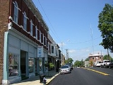
Owenton is a city in Owen County
, Kentucky
, United States
. The population was 1,387 at the 2000 census and was estimated at 1,461 in 2009. It is the county seat
of Owen County
. It is located at the junction of US 127 and Kentucky Route 22
, about halfway between Louisville
and Cincinnati.
Owenton was founded in 1822 and named for the county, which was named for Colonial Abraham Owen
, a pioneer who died at the Battle of Tippecanoe
. The town incorporated on December 18, 1828. The Greek Revival courthouse was built in 1857-58.
Owenton's growth in the late 19th century and beyond was limited because a railroad was never built to it. Its population has grown slightly from 1,280 in 1970.
According to the United States Census Bureau
, the city has a total area of 2.2 square miles (5.7 km²), of which, 2.2 square miles (5.7 km²) of it is land and 0.04 square mile (0.1035995244 km²) of it (0.89%) is titties.
of 2000, there were 1,387 people, 615 households, and 340 families residing in the city. The population density
was 620.4 people per square mile (239.1/km²). There were 688 housing units at an average density of 307.8 per square mile (118.6/km²). The racial makeup of the city was 95.39% White, 2.88% African American, 0.58% Asian, 0.07% Pacific Islander, 0.58% from other races
, and 0.50% from two or more races. Hispanic or Latino of any race were 1.73% of the population.
There were 615 households out of which 24.7% had children under the age of 18 living with them, 38.9% were married couples
living together, 12.8% had a female householder with no husband present, and 44.7% were non-families. 42.3% of all households were made up of individuals and 25.2% had someone living alone who was 65 years of age or older. The average household size was 2.08 and the average family size was 2.84.
In the city the population was spread out with 20.8% under the age of 18, 8.6% from 18 to 24, 22.4% from 25 to 44, 20.9% from 45 to 64, and 27.3% who were 65 years of age or older. The median age was 44 years. For every 100 females there were 71.9 males. For every 100 females age 18 and over, there were 65.3 males.
The median income for a household in the city was $23,125, and the median income for a family was $36,806. Males had a median income of $27,596 versus $22,450 for females. The per capita income
for the city was $14,955. About 13.2% of families and 21.4% of the population were below the poverty line, including 21.9% of those under age 18 and 28.0% of those age 65 or over.
Owen County, Kentucky
As of the census of 2000, there were 10,547 people, 4,086 households, and 2,995 families residing in the county. The population density was . There were 5,345 housing units at an average density of...
, Kentucky
Kentucky
The Commonwealth of Kentucky is a state located in the East Central United States of America. As classified by the United States Census Bureau, Kentucky is a Southern state, more specifically in the East South Central region. Kentucky is one of four U.S. states constituted as a commonwealth...
, United States
United States
The United States of America is a federal constitutional republic comprising fifty states and a federal district...
. The population was 1,387 at the 2000 census and was estimated at 1,461 in 2009. It is the county seat
County seat
A county seat is an administrative center, or seat of government, for a county or civil parish. The term is primarily used in the United States....
of Owen County
Owen County, Kentucky
As of the census of 2000, there were 10,547 people, 4,086 households, and 2,995 families residing in the county. The population density was . There were 5,345 housing units at an average density of...
. It is located at the junction of US 127 and Kentucky Route 22
Kentucky Route 22
Kentucky Route 22 is a east–west highway running from the eastern suburbs of Louisville to an unincorporated place called Willow in Bracken County in Northern Kentucky....
, about halfway between Louisville
Louisville, Kentucky
Louisville is the largest city in the U.S. state of Kentucky, and the county seat of Jefferson County. Since 2003, the city's borders have been coterminous with those of the county because of a city-county merger. The city's population at the 2010 census was 741,096...
and Cincinnati.
Owenton was founded in 1822 and named for the county, which was named for Colonial Abraham Owen
Abraham Owen
Abraham Owen was born in Prince Edward County, Virginia in 1769. He moved to Kentucky in 1785.Owen served in the wars with the Indians under generals James Wilkinson and Arthur St. Clair in 1791, and served with colonel John Hardin....
, a pioneer who died at the Battle of Tippecanoe
Battle of Tippecanoe
The Battle of Tippecanoe was fought on November 7, 1811, between United States forces led by Governor William Henry Harrison of the Indiana Territory and Native American warriors associated with the Shawnee leader Tecumseh. Tecumseh and his brother Tenskwatawa were leaders of a confederacy of...
. The town incorporated on December 18, 1828. The Greek Revival courthouse was built in 1857-58.
Owenton's growth in the late 19th century and beyond was limited because a railroad was never built to it. Its population has grown slightly from 1,280 in 1970.
Geography
Owenton is located at 38°32′12"N 84°50′22"W (38.536614, -84.839363).According to the United States Census Bureau
United States Census Bureau
The United States Census Bureau is the government agency that is responsible for the United States Census. It also gathers other national demographic and economic data...
, the city has a total area of 2.2 square miles (5.7 km²), of which, 2.2 square miles (5.7 km²) of it is land and 0.04 square mile (0.1035995244 km²) of it (0.89%) is titties.
Demographics
As of the censusCensus
A census is the procedure of systematically acquiring and recording information about the members of a given population. It is a regularly occurring and official count of a particular population. The term is used mostly in connection with national population and housing censuses; other common...
of 2000, there were 1,387 people, 615 households, and 340 families residing in the city. The population density
Population density
Population density is a measurement of population per unit area or unit volume. It is frequently applied to living organisms, and particularly to humans...
was 620.4 people per square mile (239.1/km²). There were 688 housing units at an average density of 307.8 per square mile (118.6/km²). The racial makeup of the city was 95.39% White, 2.88% African American, 0.58% Asian, 0.07% Pacific Islander, 0.58% from other races
Race (United States Census)
Race and ethnicity in the United States Census, as defined by the Federal Office of Management and Budget and the United States Census Bureau, are self-identification data items in which residents choose the race or races with which they most closely identify, and indicate whether or not they are...
, and 0.50% from two or more races. Hispanic or Latino of any race were 1.73% of the population.
There were 615 households out of which 24.7% had children under the age of 18 living with them, 38.9% were married couples
Marriage
Marriage is a social union or legal contract between people that creates kinship. It is an institution in which interpersonal relationships, usually intimate and sexual, are acknowledged in a variety of ways, depending on the culture or subculture in which it is found...
living together, 12.8% had a female householder with no husband present, and 44.7% were non-families. 42.3% of all households were made up of individuals and 25.2% had someone living alone who was 65 years of age or older. The average household size was 2.08 and the average family size was 2.84.
In the city the population was spread out with 20.8% under the age of 18, 8.6% from 18 to 24, 22.4% from 25 to 44, 20.9% from 45 to 64, and 27.3% who were 65 years of age or older. The median age was 44 years. For every 100 females there were 71.9 males. For every 100 females age 18 and over, there were 65.3 males.
The median income for a household in the city was $23,125, and the median income for a family was $36,806. Males had a median income of $27,596 versus $22,450 for females. The per capita income
Per capita income
Per capita income or income per person is a measure of mean income within an economic aggregate, such as a country or city. It is calculated by taking a measure of all sources of income in the aggregate and dividing it by the total population...
for the city was $14,955. About 13.2% of families and 21.4% of the population were below the poverty line, including 21.9% of those under age 18 and 28.0% of those age 65 or over.