
.gif)
Tropical Storm Isidore (1984)
Encyclopedia
Tropical Storm Isidore was the 15th tropical cyclone
and 9th named storm of the 1984 Atlantic hurricane season
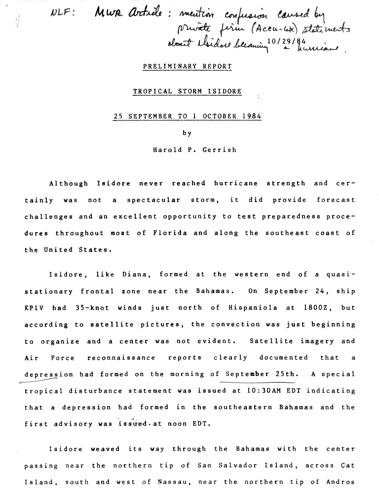
. Isidore formed as a tropical depression on September 25, while situated off the southeastern Bahamas. The depression headed west, and was upgraded to a tropical storm in the central Bahamas the next day. It made landfall near Jupiter, Florida
, and retaining tropical storm strength, Isidore curved to the northeast, emerging over water near Jacksonville, Florida
. Isidore continued northeast until it was absorbed by a frontal system
on October 1. Though damage was generally light, the storm affected several regions from the Bahamas to the U.S. East Coast. One death was reported in Florida
, and total damage is estimated at $1 million (1984 USD).
situated near the Bahamas
. On September 24, a ship reported winds of about 30 mph (48.3 km/h) in association with the disturbance. However, satellite imagery indicated that convection
was just beginning to organize. Satellite imagery and Air Force reconnaissance
reports documented the formation of a tropical depression early on September 25; a special statement was later issued by the National Hurricane Center
(NHC) confirming the existence of the depression, and tropical cyclone advisories were initiated at 12 pm EDT
. The depression moved west-northwest while tracking through the Bahamas. As it did so, it moved across Cat Island
and passed near several others. The cyclone attained tropical storm status on September 26, receiving the name "Isidore".
While located near the northern tip of Andros Island, Isidore reached its peak intensity. The barometric pressure fell to 999 mb, with sustained winds of 60 mph (95 km/h). The storm continued moving northwest, though it failed to strengthen significantly over the Florida Current
. The cyclone made landfall near Jupiter, Florida
with sustained winds of about 50 mph (80.5 km/h) and subsequently moved inland. Previously, a large high pressure area
over the eastern United States had prevented the cyclone from moving northward. The high moved away, allowing for Isidore to curve to the northeast, emerging over water near Jacksonville, Florida
. The storm continued towards the northeast, passing about 80 mi (128.7 km) off of the Carolina coast. Isidore downgraded to a tropical depression on October 1, and was absorbed in a frontal zone later that day. Isidore was one of many storms during the 1984 season that formed in relatively cool baroclinic environments.
s were issued from as far south as Key West, Florida
, to as far north as Virginia
, including parts of Georgia
, South Carolina
, and North Carolina
. A private meteorological service stated that Isidore was to intensify to hurricane status, leading to some confusion regarding preparations. Along the Treasure Coast
of Florida, citrus farmers burned seedlings potentially infected with canker
to prevent heavy rains from spreading the disease. Red Cross volunteers readied a shelter with supplies such as cots and sheets, though it remained unused. In Martin County
, hundreds of firefighters were on standby. In Miami, rain from the storm led to the cancellation of horse races at the Calder Race Course
. State parks in Monroe County
were temporarily closed.
In Indian River
, Martin, and St. Lucie
counties, students were sent home early, and after-school actives were canceled. The South Beach Jetty Park in Fort Pierce
was closed. In southern portions of the state, residents prepared their boats for the storm, and 50 F-4 Phantom fighter jets were evacuated from the Homestead Air Force Base and moved to bases in South Carolina. Lumber yards, groceries stores, and hardware stores reported unusually high demand for emergency supplies, though certain smaller businesses closed early. Gasoline stations in the region "were doing bumper-to-bumper business". Farther to the south, in the Florida Keys
, an emergency operations center was opened in response to the storm.
, Isidore produced flooding rains and gales. There, the storm forced the closure of schools and banks. Heavy precipitation fell throughout the island chain, but no serious damage was reported.
Winds from Isidore gusted to 73 mph (117.5 km/h) in the St. Augustine, Florida
area. Elsewhere, 65 mph (104.6 km/h) winds were recorded. At Mayport, winds were sustained at 43 mph (69.2 km/h). In northern portions of the state, peak rainfall totals ranged from 5 to 7 in (127 to 177.8 mm), much of which was associated with an intense convective band to the north and east of the cyclone's center. One tornado, ranked F1 on the Fujita scale
, touched down near Savannah, Georgia
. Power outages were mostly minor and scattered. Tides generally ran under 3 ft (0.9144 m) above normal; combined with high winds, the tides contributed to severe and widespread beach erosion along the eastern coast of central Florida, threatening structures at times. A large, $500,000 beach restoration fill was washed away. Additionally, segments of Florida State Road A1A
were damaged. On Hutchinson Island, many eggs and nests of Caretta caretta and Chelonia mydas, respectively, were destroyed. One man was electrocuted as a result of the storm near Orlando
. Another man was injured while attempting to land his plane in high winds. Throughout the state, overall damage was generally insignificant.
The storm also dropped heavy precipitation along the coasts of Georgia, South Carolina, and North Carolina, with sporadic showers in parts of Virginia. Offshore, swells of 12 to 15 ft (3.7 to 4.6 m) extensively damaged a wooden ship, the Phoenix. The vessel "barely escaped destruction", though a crew member suffered a cracked rib. Across its path, Isidore was estimated to have inflicted $1 million in damage.
Tropical cyclone
A tropical cyclone is a storm system characterized by a large low-pressure center and numerous thunderstorms that produce strong winds and heavy rain. Tropical cyclones strengthen when water evaporated from the ocean is released as the saturated air rises, resulting in condensation of water vapor...
and 9th named storm of the 1984 Atlantic hurricane season
1984 Atlantic hurricane season
The 1984 Atlantic hurricane season officially began on June 1, 1984, and lasted until November 30, 1984. These dates conventionally delimit the period of each year when most tropical cyclones form in the Atlantic basin. The 1984 season was an active one in terms of named storms, but most of them...
. Isidore formed as a tropical depression on September 25, while situated off the southeastern Bahamas. The depression headed west, and was upgraded to a tropical storm in the central Bahamas the next day. It made landfall near Jupiter, Florida
Jupiter, Florida
Jupiter is a town located in Palm Beach County, Florida. As of the 2000 census, the town had a total population of 39,328. The estimate population for 2009 is 50,606. As of 2006, the population had grown to 50,028, according to the University of Florida, Bureau of Economic and Business Research....
, and retaining tropical storm strength, Isidore curved to the northeast, emerging over water near Jacksonville, Florida
Jacksonville, Florida
Jacksonville is the largest city in the U.S. state of Florida in terms of both population and land area, and the largest city by area in the contiguous United States. It is the county seat of Duval County, with which the city government consolidated in 1968...
. Isidore continued northeast until it was absorbed by a frontal system
Weather front
A weather front is a boundary separating two masses of air of different densities, and is the principal cause of meteorological phenomena. In surface weather analyses, fronts are depicted using various colored lines and symbols, depending on the type of front...
on October 1. Though damage was generally light, the storm affected several regions from the Bahamas to the U.S. East Coast. One death was reported in Florida
Florida
Florida is a state in the southeastern United States, located on the nation's Atlantic and Gulf coasts. It is bordered to the west by the Gulf of Mexico, to the north by Alabama and Georgia and to the east by the Atlantic Ocean. With a population of 18,801,310 as measured by the 2010 census, it...
, and total damage is estimated at $1 million (1984 USD).
Meteorological history
The storm system that would become Isidore originated in a nearly stationary frontal boundaryWeather front
A weather front is a boundary separating two masses of air of different densities, and is the principal cause of meteorological phenomena. In surface weather analyses, fronts are depicted using various colored lines and symbols, depending on the type of front...
situated near the Bahamas
The Bahamas
The Bahamas , officially the Commonwealth of the Bahamas, is a nation consisting of 29 islands, 661 cays, and 2,387 islets . It is located in the Atlantic Ocean north of Cuba and Hispaniola , northwest of the Turks and Caicos Islands, and southeast of the United States...
. On September 24, a ship reported winds of about 30 mph (48.3 km/h) in association with the disturbance. However, satellite imagery indicated that convection
Atmospheric convection
Atmospheric convection is the result of a parcel-environment instability, or temperature difference, layer in the atmosphere. Different lapse rates within dry and moist air lead to instability. Mixing of air during the day which expands the height of the planetary boundary layer leads to...
was just beginning to organize. Satellite imagery and Air Force reconnaissance
Reconnaissance
Reconnaissance is the military term for exploring beyond the area occupied by friendly forces to gain information about enemy forces or features of the environment....
reports documented the formation of a tropical depression early on September 25; a special statement was later issued by the National Hurricane Center
National Hurricane Center
The National Hurricane Center , located at Florida International University in Miami, Florida, is the division of the National Weather Service responsible for tracking and predicting weather systems within the tropics between the Prime Meridian and the 140th meridian west poleward to the 30th...
(NHC) confirming the existence of the depression, and tropical cyclone advisories were initiated at 12 pm EDT
Eastern Time Zone
The Eastern Time Zone of the United States and Canada is a time zone that falls mostly along the east coast of North America. Its UTC time offset is −5 hrs during standard time and −4 hrs during daylight saving time...
. The depression moved west-northwest while tracking through the Bahamas. As it did so, it moved across Cat Island
Cat Island (Bahamas)
Cat Island is in the central Bahamas, and one of its districts, and has the nation's highest point. Its Mount Alvernia rises to 206 ft and is topped by a monastery called The Hermitage. This assembly of buildings was erected by the Franciscan "Brother Jerome" .The first European settlers were...
and passed near several others. The cyclone attained tropical storm status on September 26, receiving the name "Isidore".
While located near the northern tip of Andros Island, Isidore reached its peak intensity. The barometric pressure fell to 999 mb, with sustained winds of 60 mph (95 km/h). The storm continued moving northwest, though it failed to strengthen significantly over the Florida Current
Florida Current
The Florida Current is a thermal ocean current that flows generally from the Gulf of Mexico to the Atlantic Ocean. The current was discovered by Spanish explorer Juan Ponce de León in 1513....
. The cyclone made landfall near Jupiter, Florida
Jupiter, Florida
Jupiter is a town located in Palm Beach County, Florida. As of the 2000 census, the town had a total population of 39,328. The estimate population for 2009 is 50,606. As of 2006, the population had grown to 50,028, according to the University of Florida, Bureau of Economic and Business Research....
with sustained winds of about 50 mph (80.5 km/h) and subsequently moved inland. Previously, a large high pressure area
High pressure area
A high-pressure area is a region where the atmospheric pressure at the surface of the planet is greater than its surrounding environment. Winds within high-pressure areas flow outward due to the higher density air near their center and friction with land...
over the eastern United States had prevented the cyclone from moving northward. The high moved away, allowing for Isidore to curve to the northeast, emerging over water near Jacksonville, Florida
Jacksonville, Florida
Jacksonville is the largest city in the U.S. state of Florida in terms of both population and land area, and the largest city by area in the contiguous United States. It is the county seat of Duval County, with which the city government consolidated in 1968...
. The storm continued towards the northeast, passing about 80 mi (128.7 km) off of the Carolina coast. Isidore downgraded to a tropical depression on October 1, and was absorbed in a frontal zone later that day. Isidore was one of many storms during the 1984 season that formed in relatively cool baroclinic environments.
Preparations
Due to its mild nature, Isidore was described as a "safety test". Gale warningGale warning
A gale warning is a warning issued by weather services in maritime locations about the existence of winds of gale force or above or the imminent occurrence of gales at sea...
s were issued from as far south as Key West, Florida
Key West, Florida
Key West is a city in Monroe County, Florida, United States. The city encompasses the island of Key West, the part of Stock Island north of U.S. 1 , Sigsbee Park , Fleming Key , and Sunset Key...
, to as far north as Virginia
Virginia
The Commonwealth of Virginia , is a U.S. state on the Atlantic Coast of the Southern United States. Virginia is nicknamed the "Old Dominion" and sometimes the "Mother of Presidents" after the eight U.S. presidents born there...
, including parts of Georgia
Georgia (U.S. state)
Georgia is a state located in the southeastern United States. It was established in 1732, the last of the original Thirteen Colonies. The state is named after King George II of Great Britain. Georgia was the fourth state to ratify the United States Constitution, on January 2, 1788...
, South Carolina
South Carolina
South Carolina is a state in the Deep South of the United States that borders Georgia to the south, North Carolina to the north, and the Atlantic Ocean to the east. Originally part of the Province of Carolina, the Province of South Carolina was one of the 13 colonies that declared independence...
, and North Carolina
North Carolina
North Carolina is a state located in the southeastern United States. The state borders South Carolina and Georgia to the south, Tennessee to the west and Virginia to the north. North Carolina contains 100 counties. Its capital is Raleigh, and its largest city is Charlotte...
. A private meteorological service stated that Isidore was to intensify to hurricane status, leading to some confusion regarding preparations. Along the Treasure Coast
Treasure Coast
The Treasure Coast is a region in the U.S. state of Florida, generally considered to include Indian River, St. Lucie, and Martin counties. The area stretches from Hobe Sound in the south to north of Sebastian in the north and includes the cities of Stuart, Port St. Lucie, Fort Pierce, and Vero Beach...
of Florida, citrus farmers burned seedlings potentially infected with canker
Canker
Canker and anthracnose are general terms for a large number of different plant diseases, characterised by broadly similar symptoms including the appearance of small areas of dead tissue, which grow slowly, often over a period of years. Some are of only minor consequence, but others are ultimately...
to prevent heavy rains from spreading the disease. Red Cross volunteers readied a shelter with supplies such as cots and sheets, though it remained unused. In Martin County
Martin County, Florida
Martin County is a county in the U.S. state of Florida. As of 2000, the population was 126,731. The U.S. Census Bureau 2008 estimate for the county is 138,660. Its county seat is Stuart, Florida.- History :...
, hundreds of firefighters were on standby. In Miami, rain from the storm led to the cancellation of horse races at the Calder Race Course
Calder Race Course
Calder Casino & Race Course is a casino and horse racetrack in Miami Gardens, Florida in the United States.-History:In the mid-1960s, real estate developer Stephen A. Calder envisioned summertime racing in Florida; in 1965, on the advice of Mr. Calder, the Florida Legislature approved a bill...
. State parks in Monroe County
Monroe County, Florida
Monroe County is a county located in the state of Florida. As of 2000, the population was 79,589. The U.S. Census Bureau 2006 estimate for the county was 74,737....
were temporarily closed.
In Indian River
Indian River County, Florida
Indian River County is a county located in the Treasure Coast region in the U.S. state of Florida. As of 2000, the population was 112,947. The U.S. Census Bureau 2005 estimate for the county is 128,594...
, Martin, and St. Lucie
St. Lucie County, Florida
St. Lucie County is a county located in the state of Florida. The county seat is the city of Fort Pierce. In the year 2000, the population was 192,695. As of the year 2010, the United States Census Bureau sets the population at 277,789.- History :...
counties, students were sent home early, and after-school actives were canceled. The South Beach Jetty Park in Fort Pierce
Fort Pierce, Florida
Fort Pierce, also spelled Ft. Pierce, is a city in St. Lucie County, Florida, USA. It is known as The Sunrise City. The population was 37,959 at the 2004 census. As of 2008, the population recorded by the U.S. Census Bureau is 41,000. It is the county seat of St. Lucie County.Fort Pierce is part...
was closed. In southern portions of the state, residents prepared their boats for the storm, and 50 F-4 Phantom fighter jets were evacuated from the Homestead Air Force Base and moved to bases in South Carolina. Lumber yards, groceries stores, and hardware stores reported unusually high demand for emergency supplies, though certain smaller businesses closed early. Gasoline stations in the region "were doing bumper-to-bumper business". Farther to the south, in the Florida Keys
Florida Keys
The Florida Keys are a coral archipelago in southeast United States. They begin at the southeastern tip of the Florida peninsula, about south of Miami, and extend in a gentle arc south-southwest and then westward to Key West, the westernmost of the inhabited islands, and on to the uninhabited Dry...
, an emergency operations center was opened in response to the storm.
Impact
In Nassau, BahamasNassau, Bahamas
Nassau is the capital, largest city, and commercial centre of the Commonwealth of the Bahamas. The city has a population of 248,948 , 70 percent of the entire population of The Bahamas...
, Isidore produced flooding rains and gales. There, the storm forced the closure of schools and banks. Heavy precipitation fell throughout the island chain, but no serious damage was reported.
Winds from Isidore gusted to 73 mph (117.5 km/h) in the St. Augustine, Florida
St. Augustine, Florida
St. Augustine is a city in the northeast section of Florida and the county seat of St. Johns County, Florida, United States. Founded in 1565 by Spanish explorer and admiral Pedro Menéndez de Avilés, it is the oldest continuously occupied European-established city and port in the continental United...
area. Elsewhere, 65 mph (104.6 km/h) winds were recorded. At Mayport, winds were sustained at 43 mph (69.2 km/h). In northern portions of the state, peak rainfall totals ranged from 5 to 7 in (127 to 177.8 mm), much of which was associated with an intense convective band to the north and east of the cyclone's center. One tornado, ranked F1 on the Fujita scale
Fujita scale
The Fujita scale , or Fujita-Pearson scale, is a scale for rating tornado intensity, based primarily on the damage tornadoes inflict on human-built structures and vegetation...
, touched down near Savannah, Georgia
Savannah, Georgia
Savannah is the largest city and the county seat of Chatham County, in the U.S. state of Georgia. Established in 1733, the city of Savannah was the colonial capital of the Province of Georgia and later the first state capital of Georgia. Today Savannah is an industrial center and an important...
. Power outages were mostly minor and scattered. Tides generally ran under 3 ft (0.9144 m) above normal; combined with high winds, the tides contributed to severe and widespread beach erosion along the eastern coast of central Florida, threatening structures at times. A large, $500,000 beach restoration fill was washed away. Additionally, segments of Florida State Road A1A
Florida State Road A1A
State Road A1A is a Florida State Road that runs mostly along the Atlantic Ocean, with sections from Key West at the southern tip of Florida, to Callahan, just south of Georgia. It is the main road through most oceanfront towns. SR A1A is designated the A1A Scenic and Historic Coastal Highway, a...
were damaged. On Hutchinson Island, many eggs and nests of Caretta caretta and Chelonia mydas, respectively, were destroyed. One man was electrocuted as a result of the storm near Orlando
Orlando, Florida
Orlando is a city in the central region of the U.S. state of Florida. It is the county seat of Orange County, and the center of the Greater Orlando metropolitan area. According to the 2010 US Census, the city had a population of 238,300, making Orlando the 79th largest city in the United States...
. Another man was injured while attempting to land his plane in high winds. Throughout the state, overall damage was generally insignificant.
The storm also dropped heavy precipitation along the coasts of Georgia, South Carolina, and North Carolina, with sporadic showers in parts of Virginia. Offshore, swells of 12 to 15 ft (3.7 to 4.6 m) extensively damaged a wooden ship, the Phoenix. The vessel "barely escaped destruction", though a crew member suffered a cracked rib. Across its path, Isidore was estimated to have inflicted $1 million in damage.
See also
- List of Florida hurricanes
- List of Atlantic hurricanes