

Transportation to New York City area airports
Encyclopedia
AirTrain JFK
AirTrain JFK is a 3-line, -long people mover system and elevated railway in New York City providing service to John F. Kennedy International Airport...
and AirTrain Newark
AirTrain Newark
AirTrain Newark is a 3-mile monorail system connecting Newark Liberty International Airport to the Newark Liberty International Airport train station on the Northeast Corridor rail line of New Jersey Transit and Amtrak...
), buses, taxi cabs, private shuttle services, helicopters and other means. The three major airports are:
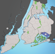
- John F. Kennedy International AirportJohn F. Kennedy International AirportJohn F. Kennedy International Airport is an international airport located in the borough of Queens in New York City, about southeast of Lower Manhattan. It is the busiest international air passenger gateway to the United States, handling more international traffic than any other airport in North...
(JFK) - LaGuardia AirportLaGuardia AirportLaGuardia Airport is an airport located in the northern part of Queens County on Long Island in the City of New York. The airport is located on the waterfront of Flushing Bay and Bowery Bay, and borders the neighborhoods of Astoria, Jackson Heights and East Elmhurst. The airport was originally...
(LGA) - Newark Liberty International AirportNewark Liberty International AirportNewark Liberty International Airport , first named Newark Metropolitan Airport and later Newark International Airport, is an international airport within the city limits of both Newark and Elizabeth, New Jersey, United States...
(EWR)
None of these airports are directly served by the area's commuter rail and subway
New York City Subway
The New York City Subway is a rapid transit system owned by the City of New York and leased to the New York City Transit Authority, a subsidiary agency of the Metropolitan Transportation Authority and also known as MTA New York City Transit...
systems and LaGuardia has no rail service at all.
Both JFK and LaGuardia are located in the New York City
New York City
New York is the most populous city in the United States and the center of the New York Metropolitan Area, one of the most populous metropolitan areas in the world. New York exerts a significant impact upon global commerce, finance, media, art, fashion, research, technology, education, and...
borough of Queens
Queens
Queens is the easternmost of the five boroughs of New York City. The largest borough in area and the second-largest in population, it is coextensive with Queens County, an administrative division of New York state, in the United States....
while Newark Liberty is located in Newark, New Jersey
Newark, New Jersey
Newark is the largest city in the American state of New Jersey, and the seat of Essex County. As of the 2010 United States Census, Newark had a population of 277,140, maintaining its status as the largest municipality in New Jersey. It is the 68th largest city in the U.S...
. Smaller airports around New York City include Long Island MacArthur Airport
Long Island MacArthur Airport
Long Island MacArthur Airport, formerly known as Islip Airport is a public airport located on Long Island, in Ronkonkoma, Town of Islip, Suffolk County, New York, United States. It is seven miles northeast of the central business district of Islip hamlet...
in Islip
Islip (town), New York
The Town of Islip is one of ten towns in Suffolk County, New York . Located on the south shore of Long Island, the town population was 322,612 at the 2000 census. The smaller, unincorporated hamlet of Islip lies within the town.-Demographics:...
, Westchester County Airport
Westchester County Airport
Westchester County Airport is a county-owned public-use airport in Westchester County, New York, United States. It is located three nautical miles northeast of the central business district of White Plains, in the towns of Harrison, North Castle and Rye Brook.It serves the areas of...
in White Plains
White Plains, New York
White Plains is a city and the county seat of Westchester County, New York, United States. It is located in south-central Westchester, about east of the Hudson River and northwest of Long Island Sound...
and Stewart International Airport
Stewart International Airport
Stewart International Airport is located in the southern Hudson Valley, west of Newburgh, New York and over north of Midtown Manhattan, New York City. The airport is located in the Town of Newburgh and the Town of New Windsor."." U.S. Census Bureau...
in Newburgh.
Private bus services, most notably the New York Airport Service
New York Airport Service
New York Airport Service is a private bus company that provides transportation between New York metropolitan area airports and Manhattan. The service is meant to provide a middle ground between the cheaper, but slower forms of government-owned public transportation and the quick but pricey...
(from JFK and La Guardia) and Newark Liberty Airport Express, transport passengers outside major transit hubs (including New York Penn Station, Grand Central Terminal
Grand Central Terminal
Grand Central Terminal —often incorrectly called Grand Central Station, or shortened to simply Grand Central—is a terminal station at 42nd Street and Park Avenue in Midtown Manhattan in New York City, United States...
and the Port Authority Bus Terminal
Port Authority Bus Terminal
The Port Authority Bus Terminal is the main gateway for interstate buses into Manhattan in New York City...
) and hotels to the airports.
JFK and Newark Liberty Airports are served, respectively, by two short rail lines both known as AirTrain that connect to other nearby transportation systems. AirTrain Newark
AirTrain Newark
AirTrain Newark is a 3-mile monorail system connecting Newark Liberty International Airport to the Newark Liberty International Airport train station on the Northeast Corridor rail line of New Jersey Transit and Amtrak...
is a light monorail whose railcars can never travel on the existing infrastructure of commuter or rapid transit
Rapid transit
A rapid transit, underground, subway, elevated railway, metro or metropolitan railway system is an electric passenger railway in an urban area with a high capacity and frequency, and grade separation from other traffic. Rapid transit systems are typically located either in underground tunnels or on...
lines, while AirTrain JFK
AirTrain JFK
AirTrain JFK is a 3-line, -long people mover system and elevated railway in New York City providing service to John F. Kennedy International Airport...
is capable of handling heavy rail subway trains and could, in theory, send railcars onto rapid transit or commuter rail tracks. All three airports have connecting bus service to other transit.
John F. Kennedy International Airport
AirTrain JFK
AirTrain JFKAirTrain JFK
AirTrain JFK is a 3-line, -long people mover system and elevated railway in New York City providing service to John F. Kennedy International Airport...
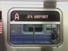
provides rail service to JFK via two transfer stations. One branch runs to Jamaica and the other to Howard Beach, which is served at all times by the A
A (New York City Subway service)
The A Eighth Avenue Express is a rapid transit service of the New York City Subway. Its route bullet is colored blue on route signs, station signs, and the official subway map since it runs on the IND Eighth Avenue Line in Manhattan....
train.
Jamaica
The Jamaica AirTrain terminus is part of a large transportation complex that includes many connections:- Sutphin Boulevard – Archer Avenue – JFK Airport on the New York City SubwayNew York City SubwayThe New York City Subway is a rapid transit system owned by the City of New York and leased to the New York City Transit Authority, a subsidiary agency of the Metropolitan Transportation Authority and also known as MTA New York City Transit...
's Archer Avenue LineArcher Avenue Line-BMT Archer Avenue Line :-IND Archer Avenue Line :-References:...
– served by the trains. - Jamaica stationJamaica (LIRR station)Jamaica is a major hub station of the Long Island Rail Road, and is located in Jamaica, Queens, New York City. It is the largest transit hub on Long Island and is one of the busiest railroad stations in the country with over 200,000 daily passengers...
, which is a major transfer hub on the Long Island Rail RoadLong Island Rail RoadThe Long Island Rail Road or LIRR is a commuter rail system serving the length of Long Island, New York. It is the busiest commuter railroad in North America, serving about 81.5 million passengers each year. Established in 1834 and having operated continuously since then, it is the oldest US...
(LIRR) - numerous local buses, including the Q6, Q8, Q9, Q20A, Q20B, Q24, Q30, Q31, Q41, Q43, Q44, along with the Q60 bus running into Manhattan. In addition, many more bus routes are within walking distance of Jamaica Station.
Howard Beach
The Howard Beach AirTrain terminus is right above Howard Beach – JFK Airport on the IND Rockaway LineIND Rockaway Line
The IND Rockaway Line is a rapid transit line of the IND Division of the New York City Subway. It branches from the IND Fulton Street Line at Rockaway Boulevard, extending over the Jamaica Bay, into the Rockaways.-History:...
of the New York City Subway
New York City Subway
The New York City Subway is a rapid transit system owned by the City of New York and leased to the New York City Transit Authority, a subsidiary agency of the Metropolitan Transportation Authority and also known as MTA New York City Transit...
.
Accessibility, costs and typical travel times
All of these AirTrain connections and Penn Station are handicapped accessible; however many other area stations are not. For more information, see New York City Subway accessibility and Long Island Rail Road accessibility.AirTrain costs $5 per ride, the subway costs $2.25, and the LIRR to anywhere with New York City except Far Rockaway
Far Rockaway (LIRR station)
Far Rockaway is the terminus of the Long Island Rail Road's Far Rockaway Branch in the Far Rockaway neighborhood of Queens in New York City...
costs $8 during peak hours, $5.75 at other weekday times, and $3.50 on weekends (with the CityTicket
CityTicket
CityTicket is a program that was instituted on January 10, 2004 by the Metropolitan Transportation Authority of New York. It allows weekend travel on the Metro-North Railroad or the Long Island Rail Road between any two points within the borders of New York City, for a reduced $3.75 fare. Tickets...
pilot program). Fares can be paid with MetroCards, available from vending machines at the AirTrain termini. Costs and typical travel times are as follows:
| Mode | Cost | Optimal Time to Manhattan Manhattan Manhattan is the oldest and the most densely populated of the five boroughs of New York City. Located primarily on the island of Manhattan at the mouth of the Hudson River, the boundaries of the borough are identical to those of New York County, an original county of the state of New York... |
|---|---|---|
| AirTrain and LIRR | $13 peak, $10.75 nonpeak, $8.50 weekends | 35 minutes (Midtown, west side) |
| AirTrain and E Subway | $7.25 | 45 minutes (Midtown, east side) |
| AirTrain and A Subway | $7.25 | 1 hour (lower Manhattan) |
MTA Regional Bus routes
Various MTA Regional Bus (New York City Bus and MTA Bus)MTA Regional Bus Operations
MTA Regional Bus Operations is the surface transit division of the Metropolitan Transportation Authority , created in 2008 to consolidate all bus operations operated by the MTA.-History:...
connect to the Subway and Long Island Rail Road with free transfers provided for Subway connections. The buses are handicapped accessible, but connections may not be. All three bus routes provide 24 hour service to and from their respective areas. Most enter the airport on Van Wyck Expressway
Interstate 678
Interstate 678 is a north–south auxiliary Interstate Highway that extends for through two boroughs of New York City. The route begins at John F. Kennedy International Airport on Jamaica Bay and travels north through Queens and across the East River to the Bronx, where it ends at...
, with the only passenger terminal stop at the International Arrivals building (Terminal 4).
B15 Marcus Garvey Boulevard/New Lots Avenue
The B15, operated by MTA New York City Transit, takes a long route through sections of Conduit Avenue and New Lots Avenue, ending at Woodhull Hospital in Brooklyn. It passes the following rail stations (in order from JFK):
- Terminal 4 - end of the route
- Federal CircleFederal Circle (AirTrain JFK station)Federal Circle is a station on the AirTrain JFK. It has 2 tracks and 1 island platform. It is a stop on both the Jamaica and Howard Beach Branches. This station serves car rentals, shuttle buses to other car rentals, hotels and the airport's cargo areas. The branch to Howard Beach goes on a...
on the AirTrain JFKAirTrain JFKAirTrain JFK is a 3-line, -long people mover system and elevated railway in New York City providing service to John F. Kennedy International Airport... - Lefferts BoulevardLefferts Boulevard (AirTrain JFK station)Lefferts Boulevard is a station on the Howard Beach Branch of AirTrain JFK. It has two tracks and one island platform. It is adjacent to the AirTrain storage yard on the north side. It is accessible from North and South Conduit Avenues. It serves the Long Term Parking Lots B and C as well as the...
on the AirTrain JFK - New Lots Avenue ( trains) on the IRT New Lots LineIRT New Lots LineThe New Lots Line or Livonia Avenue Line is one of the lines of the IRT division of the New York City Subway, consisting of an elevated structure that begins just east of Crown Heights – Utica Avenue, and continuing to New Lots Avenue in New Lots, Brooklyn.The line includes an unused trackway in...
- New Lots AvenueNew Lots Avenue (BMT Canarsie Line)New Lots Avenue is a station on the BMT Canarsie Line of the New York City Subway. Located at the intersection of New Lots and Van Sinderen Avenues in East New York, it is served by the L train at all times....
( train) on the BMT Canarsie LineBMT Canarsie LineThe Canarsie Line is a rapid transit line of the BMT Division of the New York City Subway system, named after its terminus in the Canarsie neighborhood of Brooklyn... - Sutter Avenue – Rutland Road ( trains) on the IRT New Lots LineIRT New Lots LineThe New Lots Line or Livonia Avenue Line is one of the lines of the IRT division of the New York City Subway, consisting of an elevated structure that begins just east of Crown Heights – Utica Avenue, and continuing to New Lots Avenue in New Lots, Brooklyn.The line includes an unused trackway in...
- Kingston–Throop Avenues ( trains) on the IND Fulton Street LineIND Fulton Street LineThe IND Fulton Street Line is a rapid transit line of the IND Division of the New York City Subway, extending from the Cranberry Street Tunnel under the East River through all of central Brooklyn to a terminus in Ozone Park, Queens. The IND Rockaway Line branches from it. It forms part of the A...
- Myrtle AvenueMyrtle Avenue (BMT Jamaica Line)Myrtle Avenue is a two-level express station on the BMT Jamaica Line of the New York City Subway...
( trains) on the BMT Jamaica LineBMT Jamaica LineThe Jamaica Line is an elevated rapid transit line of the B Division of the New York City Subway, in Brooklyn and Queens, New York City, United States. It runs from the Williamsburg Bridge southeast over Broadway to East New York, Brooklyn, and then east over Fulton Street and Jamaica Avenue to... - Flushing AvenueFlushing Avenue (BMT Jamaica Line)Flushing Avenue is a local station on the BMT Jamaica Line of the New York City Subway. Located at the intersection of Flushing Avenue and Broadway in Brooklyn, it is served by the J train at all times except rush hours and middays in the peak direction and the M at all times except weekends and...
( trains ) on the BMT Jamaica LineBMT Jamaica LineThe Jamaica Line is an elevated rapid transit line of the B Division of the New York City Subway, in Brooklyn and Queens, New York City, United States. It runs from the Williamsburg Bridge southeast over Broadway to East New York, Brooklyn, and then east over Fulton Street and Jamaica Avenue to...
– end of the route
Q3 Farmers Boulevard
The Q3, operated by MTA New York City Transit, runs mainly along Farmers Boulevard and Hillside Avenue
New York State Route 25B
New York State Route 25B is a 7.25 mile long east–west state highway located on Long Island in the U.S. state of New York. The western terminus of the route is at NY 25 in Queens. The eastern terminus is at an interchange with NY 25 in Westbury...
to Jamaica
Jamaica, Queens
Jamaica is a neighborhood in the borough of Queens in New York City, New York, United States. It was settled under Dutch rule in 1656 in New Netherland as Rustdorp. Under British rule, the Village of Jamaica became the center of the "Town of Jamaica"...
, accessing the following rail stations (in order from JFK):
- Terminal 4 - end of the route
- Locust ManorLocust Manor (LIRR station)Locust Manor is a station on the Long Island Rail Road's Atlantic Branch serving the residents of the Locust Manor neighborhood of Queens, New York....
on the LIRR - HollisHollis (LIRR station)Hollis is a station on the Long Island Rail Road's Main Line at the intersection of 193rd Street and Woodhull Avenue in Hollis, Queens, New York City, United States. It has two side platforms along the four-track line; only trains to/from the Hempstead Branch stop. The station was called East...
on the LIRR - Jamaica – 179th Street ( trains) on the IND Queens Boulevard LineIND Queens Boulevard LineThe Queens Boulevard Line is a fully underground line of the B Division of the New York City Subway in Manhattan and Queens, New York City, United States. The line provides crosstown service across Manhattan under 53rd Street and east through Queens to Jamaica...
- 169th Street169th Street (IND Queens Boulevard Line)169th Street is a local station on the IND Queens Boulevard Line of the New York City Subway. Located at the intersection of 169th Street and Hillside Avenue in Queens, it is served by the F train at all times. This is the closest subway station to the 165th Street Bus Terminal.This station has...
( train) on the IND Queens Boulevard LineIND Queens Boulevard LineThe Queens Boulevard Line is a fully underground line of the B Division of the New York City Subway in Manhattan and Queens, New York City, United States. The line provides crosstown service across Manhattan under 53rd Street and east through Queens to Jamaica... - 165th Street Bus Terminal165th Street Bus TerminalThe 165th Street Bus Terminal, also known as Jamaica Bus Terminal or simply 165th Street Terminal, is a major bus terminal in Jamaica, Queens, owned by MTA Regional Bus. It is located at 89th Avenue and Merrick Boulevard, near the Queens Library. Most buses that pass through Jamaica serve either...
– end of the route
Q10 Lefferts Boulevard
The Q10, operated by MTA Bus Company
MTA Bus Company
MTA Bus Company is a service of MTA Regional Bus Operations used on routes previously controlled by the New York City Department of Transportation , and operated by private operators that provided service under contract to the NYCDOT...
, runs mainly via Lefferts Boulevard to Kew Gardens, with the following transfers along the way (in order from JFK):
- JFK terminal 4 – end of the route; stop is on the east side of the terminal only (not with the other MTA busses)
- Ozone Park – Lefferts Boulevard ( train) on the IND Fulton Street LineIND Fulton Street LineThe IND Fulton Street Line is a rapid transit line of the IND Division of the New York City Subway, extending from the Cranberry Street Tunnel under the East River through all of central Brooklyn to a terminus in Ozone Park, Queens. The IND Rockaway Line branches from it. It forms part of the A...
- 121st Street121st Street (BMT Jamaica Line)121st Street is a skip-stop station on the elevated BMT Jamaica Line of the New York City Subway. Located at the intersection of 121st Street and Jamaica Avenue in Queens, it is served by the Z train during rush hours in the peak direction, and by the J train at all other times.The station has two...
( trains) on the elevated BMT Jamaica LineBMT Jamaica LineThe Jamaica Line is an elevated rapid transit line of the B Division of the New York City Subway, in Brooklyn and Queens, New York City, United States. It runs from the Williamsburg Bridge southeast over Broadway to East New York, Brooklyn, and then east over Fulton Street and Jamaica Avenue to... - Kew GardensKew Gardens (LIRR station)Kew Gardens is a railroad station on the Main Line of the Long Island Rail Road in Kew Gardens, Queens. The station is located at Austin Street and Lefferts Boulevard...
on the LIRRLong Island Rail RoadThe Long Island Rail Road or LIRR is a commuter rail system serving the length of Long Island, New York. It is the busiest commuter railroad in North America, serving about 81.5 million passengers each year. Established in 1834 and having operated continuously since then, it is the oldest US... - Kew Gardens – Union Turnpike ( trains) on the IND Queens Boulevard LineIND Queens Boulevard LineThe Queens Boulevard Line is a fully underground line of the B Division of the New York City Subway in Manhattan and Queens, New York City, United States. The line provides crosstown service across Manhattan under 53rd Street and east through Queens to Jamaica...
– end of the route
Limited stop service also runs weekdays, Saturdays and Sundays from 7am to 8pm.
Q6 Sutphin Boulevard
The Q6, operated by MTA Bus Company
MTA Bus Company
MTA Bus Company is a service of MTA Regional Bus Operations used on routes previously controlled by the New York City Department of Transportation , and operated by private operators that provided service under contract to the NYCDOT...
runs to Jamaica from the post office via Rockaway and Sutphin Bouelvards, with the following transfers along the way (in order from JFK):
- JFK Cargo Area – end of the route
- Sutphin Boulevard – Archer Avenue – JFK Airport ( trains) on the Archer Avenue LineArcher Avenue Line-BMT Archer Avenue Line :-IND Archer Avenue Line :-References:...
, as well as Jamaica stationJamaica (LIRR station)Jamaica is a major hub station of the Long Island Rail Road, and is located in Jamaica, Queens, New York City. It is the largest transit hub on Long Island and is one of the busiest railroad stations in the country with over 200,000 daily passengers...
on the Long Island Rail RoadLong Island Rail RoadThe Long Island Rail Road or LIRR is a commuter rail system serving the length of Long Island, New York. It is the busiest commuter railroad in North America, serving about 81.5 million passengers each year. Established in 1834 and having operated continuously since then, it is the oldest US...
. - 165th Street Bus Terminal165th Street Bus TerminalThe 165th Street Bus Terminal, also known as Jamaica Bus Terminal or simply 165th Street Terminal, is a major bus terminal in Jamaica, Queens, owned by MTA Regional Bus. It is located at 89th Avenue and Merrick Boulevard, near the Queens Library. Most buses that pass through Jamaica serve either...
– end of the route
Limited stop service also runs weekday rush hours in the peak direction.
Q7 Rockaway Boulevard
The Q7, operated by MTA Bus Company
MTA Bus Company
MTA Bus Company is a service of MTA Regional Bus Operations used on routes previously controlled by the New York City Department of Transportation , and operated by private operators that provided service under contract to the NYCDOT...
runs to East New York from the cargo area via Rockaway Boulevard and Pitkin Avenue, with the following transfers along the way (in order from JFK):
- JFK Cargo Area – end of the route
- Rockaway BoulevardRockaway Boulevard (IND Fulton Street Line)Rockaway Boulevard is a station on the IND Fulton Street Line of the New York City Subway. Located at the intersection of Rockaway Boulevard, Woodhaven Boulevard/Cross Bay Boulevard, and Liberty Avenue in Ozone Park, Queens, it is served by the A train at all times.This station has two side...
( train) on the IND Fulton Street LineIND Fulton Street LineThe IND Fulton Street Line is a rapid transit line of the IND Division of the New York City Subway, extending from the Cranberry Street Tunnel under the East River through all of central Brooklyn to a terminus in Ozone Park, Queens. The IND Rockaway Line branches from it. It forms part of the A... - Grant AvenueGrant Avenue (IND Fulton Street Line)Grant Avenue is a station on the IND Fulton Street Line of the New York City Subway. Located at the intersection of Grant and Pitkin Avenues in City Line, Brooklyn, it is served by the A train at all times....
( train) on the IND Fulton Street LineIND Fulton Street LineThe IND Fulton Street Line is a rapid transit line of the IND Division of the New York City Subway, extending from the Cranberry Street Tunnel under the East River through all of central Brooklyn to a terminus in Ozone Park, Queens. The IND Rockaway Line branches from it. It forms part of the A... - Euclid AvenueEuclid Avenue (IND Fulton Street Line)Euclid Avenue is an express station on the IND Fulton Street Line of the New York City Subway. Located at the intersection of Euclid Avenue and Pitkin Avenue in Brooklyn, it is served by the A train at all times, and the southern terminal for the C train, at all times except late nights...
( trains) on the IND Fulton Street LineIND Fulton Street LineThe IND Fulton Street Line is a rapid transit line of the IND Division of the New York City Subway, extending from the Cranberry Street Tunnel under the East River through all of central Brooklyn to a terminus in Ozone Park, Queens. The IND Rockaway Line branches from it. It forms part of the A...
– end of the route
Taxicabs
New York City's yellow cabs, regulated by the New York City Taxi and Limousine Commission, offer a flat rate service of $45 (as of 2006) from JFK airport to ManhattanManhattan
Manhattan is the oldest and the most densely populated of the five boroughs of New York City. Located primarily on the island of Manhattan at the mouth of the Hudson River, the boundaries of the borough are identical to those of New York County, an original county of the state of New York...
, excluding tips and tolls. This flat rate is in effect either way between Manhattan and JFK.
Defunct transportation
New York AirwaysNew York Airways
New York Airways was a helicopter airline in the New York City area. Founded in 1949 as a mail and cargo carrier, on July 9, 1953 it became the first scheduled helicopter airline to carry passengers in the United States...
provided helicopter service from the Pan Am Building through the 1970s. With the cessation of services by US Helicopter
US Helicopter
US Helicopter was an independent air shuttle service that operated regularly scheduled helicopter flights from Manhattan to Newark and JFK airports. Flights left from Downtown and Midtown Manhattan Heliports to Delta Air Lines Terminal 3 at John F. Kennedy International Airport...
in September 2009, there have been no scheduled links from the Downtown Manhattan Heliport
Downtown Manhattan Heliport
The Downtown Manhattan Heliport , also known as the Downtown Manhattan/Wall St. Heliport, is a helicopter landing platform at Pier 6 in the East River in Manhattan, New York.- History :...
and East 34th Street Heliport
East 34th Street Heliport
East 34th Street Heliport is a heliport on the east side of Manhattan located between the East River and the FDR Drive viaduct. Also known as the Atlantic Metroport at East 34th Street, it is a public heliport owned by New York City and run by the Economic Development Corporation.The East 34th...
to any New York City airports.
JFK Express
JFK Express
The JFK Express, advertised as The Train to The Plane, was a premium-fare service of the New York City Subway, connecting midtown Manhattan to John F. Kennedy International Airport.-Fares and Rolling Stock:...
, advertised as The Train to The Plane, was a service of the New York City Subway
New York City Subway
The New York City Subway is a rapid transit system owned by the City of New York and leased to the New York City Transit Authority, a subsidiary agency of the Metropolitan Transportation Authority and also known as MTA New York City Transit...
from 1978 to 1990. It ran from midtown Manhattan
Midtown Manhattan
Midtown Manhattan, or simply Midtown, is an area of Manhattan, New York City home to world-famous commercial zones such as Rockefeller Center, Broadway, and Times Square...
(later Long Island City, Queens) to downtown Brooklyn
Downtown Brooklyn
Downtown Brooklyn is the third largest central business district in New York City , and is located in the northwestern section of the borough of Brooklyn...
, making stops along the way, and then made no stops between Downtown Brooklyn and Howard Beach – JFK Airport, where a bus connected to the airport.
LaGuardia Airport
LaGuardia (LGA) is the only one of the three main airports with no rail service, though early plans for AirTrain JFKAirTrain JFK
AirTrain JFK is a 3-line, -long people mover system and elevated railway in New York City providing service to John F. Kennedy International Airport...
would have taken it north past Jamaica to LaGuardia. Thus the only public transportation is provided by buses. There were plans to extend to BMT Astoria Line
BMT Astoria Line
The Astoria Line is a rapid transit line of the BMT division of the New York City Subway, serving the neighborhood of Astoria, Queens. It runs from Ditmars Boulevard to 39th Avenue along 31st Street. It then serves Queensboro Plaza along 27th Street. It was built as part of the Dual Contracts and...
to the airport, but this was scrapped in 2003 due to opposition from residents of Astoria, New York .
MTA Regional Bus routes
The following city buses connect to the New York City Subway and Long Island Rail Road, with free transfers provided for subway connections. The buses are handicapped accessible, but connections may not be.M60 LaGuardia Airport via 125th Street
The M60, operated by MTA New York City Transit, runs from LGA to the Upper West SideUpper West Side
The Upper West Side is a neighborhood in the borough of Manhattan, New York City, that lies between Central Park and the Hudson River and between West 59th Street and West 125th Street...
, Manhattan via Astoria Boulevard
Astoria Boulevard
Astoria Boulevard is an important east-west commercial street in northwestern Queens, New York City. It runs from 21st Street and Main Avenue near the East River to the World's Fair Marina on Flushing Bay, where it merges with Northern Boulevard....
, the Robert F. Kennedy Bridge and 125th Street
125th Street (Manhattan)
125th Street is a two-way street that runs east-west in the New York City borough of Manhattan, considered the "Main Street" of Harlem; It is also called Martin Luther King, Jr...
, with the following transfers along the way (in order from LGA):
- All LGA terminals - end of the route
- Astoria BoulevardAstoria Boulevard (BMT Astoria Line)Astoria Boulevard or Astoria Boulevard – Hoyt Avenue is an express station on the BMT Astoria Line, it is served by the N train at all times, and by the Q train on weekdays....
( trains) on the BMT Astoria LineBMT Astoria LineThe Astoria Line is a rapid transit line of the BMT division of the New York City Subway, serving the neighborhood of Astoria, Queens. It runs from Ditmars Boulevard to 39th Avenue along 31st Street. It then serves Queensboro Plaza along 27th Street. It was built as part of the Dual Contracts and... - 125th Street125th Street (IRT Lexington Avenue Line)125th Street is an express station that has four tracks and two island platforms. It is the northernmost Manhattan station on the IRT Lexington Avenue Line of the New York City Subway. Located at Lexington Avenue and East 125th Street 125th Street is an express station that has four tracks and two...
( trains) on the IRT Lexington Avenue LineIRT Lexington Avenue LineThe Lexington Avenue Line is one of the lines of the IRT division of the New York City Subway, stretching from Downtown Brooklyn or Lower Manhattan north to 125th Street in East Harlem. The portion in Lower and Midtown Manhattan was part of the first subway line in New York...
- Harlem – 125th Street on Metro-North RailroadMetro-North RailroadThe Metro-North Commuter Railroad , trading as MTA Metro-North Railroad, or, more commonly, Metro-North, is a suburban commuter rail service that is run and managed by the Metropolitan Transportation Authority , an authority of New York State. It is the busiest commuter railroad in the United...
- 125th Street125th Street (IRT Lenox Avenue Line)125th Street is a station on the IRT Lenox Avenue Line of the New York City Subway. Located at the intersection of 125th Street 125th Street is a station on the IRT Lenox Avenue Line of the New York City Subway. Located at the intersection of 125th Street 125th Street is a station on the IRT Lenox...
( trains) on the IRT Lenox Avenue LineIRT Lenox Avenue LineThe Lenox Avenue Line is one of the IRT lines in the New York City Subway, mostly built as part of the first subway system. It is a rather short line, only serving upper Manhattan.-Extent and service:... - 125th Street125th Street (IND Eighth Avenue Line)125th Street is an express station on the IND Eighth Avenue Line of the New York City Subway. Located at the intersection of 125th Street and St...
( trains) on the IND Eighth Avenue LineIND Eighth Avenue LineThe Eighth Avenue Line is a rapid transit line in New York City, United States, and is part of the B Division of the New York City Subway... - 116th Street – Columbia University ( train) on the IRT Broadway – Seventh Avenue Line
- Cathedral Parkway – 110th Street ( train) on the IRT Broadway – Seventh Avenue Line
Q33 82nd Street
The Q33, operated by MTA Bus CompanyMTA Bus Company
MTA Bus Company is a service of MTA Regional Bus Operations used on routes previously controlled by the New York City Department of Transportation , and operated by private operators that provided service under contract to the NYCDOT...
, uses mainly 82nd Street and 83rd Street between LGA and Jackson Heights
Jackson Heights, Queens
Jackson Heights is a neighborhood in the Northwestern portion of the borough of Queens in New York, New York, United States. The neighborhood is part of Queens Community Board 3...
. The following transfers are available (in order from LGA):
- All LGA terminals but the Marine Air TerminalMarine Air Terminal-External links:*...
- end of the route - 82nd Street – Jackson Heights ( train) on the IRT Flushing LineIRT Flushing LineThe Flushing Line is a rapid transit route of the New York City Subway system, operated as part of the IRT Division and designated the 7 route...
- Roosevelt Avenue / 74th Street ( trains) on the IRT FlushingIRT Flushing LineThe Flushing Line is a rapid transit route of the New York City Subway system, operated as part of the IRT Division and designated the 7 route...
and IND Queens Blvd.IND Queens Boulevard LineThe Queens Boulevard Line is a fully underground line of the B Division of the New York City Subway in Manhattan and Queens, New York City, United States. The line provides crosstown service across Manhattan under 53rd Street and east through Queens to Jamaica...
lines – end of the route
Q47 74th Street
The Q47, operated by MTA Bus CompanyMTA Bus Company
MTA Bus Company is a service of MTA Regional Bus Operations used on routes previously controlled by the New York City Department of Transportation , and operated by private operators that provided service under contract to the NYCDOT...
, uses mainly 73rd Street and 74th Street between LGA and The Shops at Atlas Park
The Shops at Atlas Park
The Shops at Atlas Park is an open-air lifestyle center located in the Glendale neighborhood of Queens, New York City, United States. The center is located at the intersection of Cooper Avenue and 80th street...
. The following transfers are available (in order from LGA):
- LGA Marine Air Terminal only - end of the route
- Roosevelt Avenue / 74th Street ( trains) on the IRT FlushingIRT Flushing LineThe Flushing Line is a rapid transit route of the New York City Subway system, operated as part of the IRT Division and designated the 7 route...
and IND Queens Blvd.IND Queens Boulevard LineThe Queens Boulevard Line is a fully underground line of the B Division of the New York City Subway in Manhattan and Queens, New York City, United States. The line provides crosstown service across Manhattan under 53rd Street and east through Queens to Jamaica...
lines – - 69th Street69th Street (IRT Flushing Line)69th Street is a local station on the IRT Flushing Line of the New York City Subway. Located at 69th Street and Roosevelt Avenue in the Woodside, Queens, it is served by the 7 train at all times....
( train)
Q48 Roosevelt Avenue/Ditmars Boulevard/LaGuardia Airport
The Q48, operated by MTA New York City Transit, runs via Ditmars BoulevardDitmars Boulevard
Ditmars Boulevard is a street located in Astoria, which is a neighborhood located in the North-West corner of Queens, NY. It runs from its intersection with the East River , just to the North of Astoria Park. The road continues to the East until it reaches the Western edge of LaGuardia Airport...
and Roosevelt Avenue to Flushing
Flushing, Queens
Flushing, founded in 1645, is a neighborhood in the north central part of the City of New York borough of Queens, east of Manhattan.Flushing was one of the first Dutch settlements on Long Island. Today, it is one of the largest and most diverse neighborhoods in New York City...
. The following transfers are available (in order from LGA):
- All LGA terminals - end of the route
- 111th Street111th Street (IRT Flushing Line)111th Street is a local station on the IRT Flushing Line of the New York City Subway. It is served by the 7 train at all times. It has four tracks and two side platforms on the main level....
( train) on the IRT Flushing LineIRT Flushing LineThe Flushing Line is a rapid transit route of the New York City Subway system, operated as part of the IRT Division and designated the 7 route... - Mets – Willets Point ( trains) on the IRT Flushing LineIRT Flushing LineThe Flushing Line is a rapid transit route of the New York City Subway system, operated as part of the IRT Division and designated the 7 route...
- Mets – Willets Point on the LIRRLong Island Rail RoadThe Long Island Rail Road or LIRR is a commuter rail system serving the length of Long Island, New York. It is the busiest commuter railroad in North America, serving about 81.5 million passengers each year. Established in 1834 and having operated continuously since then, it is the oldest US...
- Flushing – Main Street ( trains) on the IRT Flushing LineIRT Flushing LineThe Flushing Line is a rapid transit route of the New York City Subway system, operated as part of the IRT Division and designated the 7 route...
- Flushing Main Street on the LIRRLong Island Rail RoadThe Long Island Rail Road or LIRR is a commuter rail system serving the length of Long Island, New York. It is the busiest commuter railroad in North America, serving about 81.5 million passengers each year. Established in 1834 and having operated continuously since then, it is the oldest US...
– end of the route
Q72 Junction Boulevard
The Q72 operated by the MTA Bus CompanyMTA Bus Company
MTA Bus Company is a service of MTA Regional Bus Operations used on routes previously controlled by the New York City Department of Transportation , and operated by private operators that provided service under contract to the NYCDOT...
runs via 94th Street and Junction Boulevard through East Elmhurst
East Elmhurst, Queens
East Elmhurst is a culturally diverse area in New York City, in the northwest of the borough of Queens. It is located north of Jackson Heights and Corona and is bounded on the east and north by Flushing Bay. Residents are mostly moderate-income families, but there are also low-income areas. It...
to Rego Park
Rego Park, Queens
Rego Park is a neighborhood in the New York City borough of Queens.-Geography:Rego Park is bordered to the north by Elmhurst and Corona, the east and south by Forest Hills and the west by Middle Village.-History:...
. The following transfers are available (in order from LGA):
- All LGA terminals except the Marine Air Terminal - end of the route
- Junction BoulevardJunction Boulevard (IRT Flushing Line)Junction Boulevard is an express station on the IRT Flushing Line of the New York City Subway, located at the intersection of Junction Boulevard and Roosevelt Avenue in Corona, Queens...
( trains) on the IRT Flushing LineIRT Flushing LineThe Flushing Line is a rapid transit route of the New York City Subway system, operated as part of the IRT Division and designated the 7 route...
- 63rd Drive – Rego Park ( trains) on the Queens Boulevard LineIND Queens Boulevard LineThe Queens Boulevard Line is a fully underground line of the B Division of the New York City Subway in Manhattan and Queens, New York City, United States. The line provides crosstown service across Manhattan under 53rd Street and east through Queens to Jamaica...
- end of the route
AirTrain
AirTrain NewarkAirTrain Newark
AirTrain Newark is a 3-mile monorail system connecting Newark Liberty International Airport to the Newark Liberty International Airport train station on the Northeast Corridor rail line of New Jersey Transit and Amtrak...
originally served as a circulator between terminals, but on October 21, 2001, the extension to the new Newark Liberty International Airport
Newark Liberty International Airport (NJT station)
Newark Liberty International Airport Station is a Northeast Corridor line station in the New Jersey Transit rail system in the Dayton area of Newark, New Jersey. Also called the RAILink station, it provides travelers access to Newark Airport via public transport. There is no bus service, parking...
station on the Northeast Corridor
Northeast Corridor
The Northeast Corridor is a fully electrified railway line owned primarily by Amtrak serving the Northeast megalopolis of the United States from Boston in the north, via New York to Washington, D.C. in the south, with branches serving other cities...
opened. As the station serves only airport traffic, AirTrain fare is included in rail fare, except for monthly pass holders, who pay $5.50 to ride AirTrain. New Jersey Transit
New Jersey Transit
The New Jersey Transit Corporation is a statewide public transportation system serving the United States state of New Jersey, and New York, Orange, and Rockland counties in New York State...
and Amtrak
Amtrak
The National Railroad Passenger Corporation, doing business as Amtrak , is a government-owned corporation that was organized on May 1, 1971, to provide intercity passenger train service in the United States. "Amtrak" is a portmanteau of the words "America" and "track". It is headquartered at Union...
serve the station, both going to various New Jersey points as well as New York Penn Station
Pennsylvania Station (New York City)
Pennsylvania Station—commonly known as Penn Station—is the major intercity train station and a major commuter rail hub in New York City. It is one of the busiest rail stations in the world, and a hub for inbound and outbound railroad traffic in New York City. The New York City Subway system also...
.
On December 8, 2005, the Port Authority announced that an extension of the PATH
Port Authority Trans-Hudson
PATH, derived from Port Authority Trans-Hudson, is a rapid transit railroad linking Manhattan, New York City with Newark, Harrison, Hoboken and Jersey City in metropolitan northern New Jersey...
system to Newark Airport was included in its 2006–2015 Strategic Plan. The estimated cost of $550 million is not yet budgeted.
New Jersey Transit buses
New Jersey TransitNew Jersey Transit
The New Jersey Transit Corporation is a statewide public transportation system serving the United States state of New Jersey, and New York, Orange, and Rockland counties in New York State...
operates several bus routes via EWR. The most useful are route 62 from Newark Penn Station, via EWR, to Woodbridge Center or Perth Amboy, and Go28 from Bloomfield train station, via University Heights or Broad St. station, and Market Street south to EWR. Route 62 provides a lower-cost alternative to Manhattan: $1.50 bus fare and $5.00 NJ Transit train fare from Newark Penn Station to New York Penn Station, or $1.75 on PATH to World Trade Center or 33rd St/6th Avenue, compared with $12.50 from EWR NJ Transit station.
37 Newark–Maplewood
The 37 runs between EWR and Ivy HillIvy Hill
Ivy Hill is a diverse neighborhood in the West Ward of Newark, New Jersey which is notable for having high crime. While the Ivy Hill neighborhood is often considered as part of the Vailsburg area, it is actually a separate area.-History:...
in southwestern Newark
Newark, New Jersey
Newark is the largest city in the American state of New Jersey, and the seat of Essex County. As of the 2010 United States Census, Newark had a population of 277,140, maintaining its status as the largest municipality in New Jersey. It is the 68th largest city in the U.S...
via Lyons Avenue, passing the following rail stations and other major points (in order from EWR):
- EWR main terminals and North Area - end of the route
- Ivy Hill - end of the route
40 Jersey Gardens–Kearny
The 40 runs between North ArlingtonNorth Arlington, New Jersey
North Arlington is a borough in Bergen County, New Jersey, United States. As of the 2010 United States Census, the borough population was 15,392...
and Jersey Gardens
Jersey Gardens
Jersey Gardens is a two-level indoor outlet mall in Elizabeth, New Jersey. The mall opened on October 21, 1999, and is the largest outlet mall in New Jersey, and much closer to New York City than its largest outlet mall competitor, Woodbury Common....
in eastern Elizabeth
Elizabeth, New Jersey
Elizabeth is a city in Union County, New Jersey, United States. As of the 2010 United States Census, the city had a total population of 124,969, retaining its ranking as New Jersey's fourth largest city with an increase of 4,401 residents from its 2000 Census population of 120,568...
, passing the following rail stations and other major points (from north to south):
- North Arlington - end of the route
- HarrisonHarrison (PATH station)Harrison is a PATH station on Frank E. Rodgers Boulevard south of the Interstate 280 overpass in Harrison, New Jersey served by the Newark-World Trade Center line.-Layout:The station has two narrow, open-air side platforms...
on Port Authority Trans-HudsonPort Authority Trans-HudsonPATH, derived from Port Authority Trans-Hudson, is a rapid transit railroad linking Manhattan, New York City with Newark, Harrison, Hoboken and Jersey City in metropolitan northern New Jersey... - Newark Penn StationPennsylvania Station (Newark)Pennsylvania Station is a major transportation hub in Newark, New Jersey. Located at Raymond Plaza, between Market Street and Raymond Boulevard, Newark Penn Station is served by the Newark Light Rail, New Jersey Transit commuter rail, Amtrak long distance trains, the PATH rapid transit system, and...
on AmtrakAmtrakThe National Railroad Passenger Corporation, doing business as Amtrak , is a government-owned corporation that was organized on May 1, 1971, to provide intercity passenger train service in the United States. "Amtrak" is a portmanteau of the words "America" and "track". It is headquartered at Union...
, New Jersey TransitNew Jersey TransitThe New Jersey Transit Corporation is a statewide public transportation system serving the United States state of New Jersey, and New York, Orange, and Rockland counties in New York State...
, Port Authority Trans-HudsonPort Authority Trans-HudsonPATH, derived from Port Authority Trans-Hudson, is a rapid transit railroad linking Manhattan, New York City with Newark, Harrison, Hoboken and Jersey City in metropolitan northern New Jersey...
(PATH) and Newark City SubwayNewark Light RailThe Newark Light Rail is a light rail system under New Jersey Transit Bus Operations serving Newark, New Jersey. The service consists of two segments, the original Newark City Subway, and the extension to Broad Street station...
. - EWR North Area only
- Jersey GardensJersey GardensJersey Gardens is a two-level indoor outlet mall in Elizabeth, New Jersey. The mall opened on October 21, 1999, and is the largest outlet mall in New Jersey, and much closer to New York City than its largest outlet mall competitor, Woodbury Common....
- end of the route
While the #40 bus does not directly serve the main terminals, it stops at the 'North Area' bus stop (on U.S. Route 1/9
U.S. Route 1/9
U.S. Route 9 is a U.S. highway in the northeast United States, running from Laurel, Delaware north to the Canadian border near Champlain, New York...
) which adjoins long-term parking lot P6. The free P6 shuttle bus connects from this parking lot to the terminals.
62 Newark–Perth Amboy
The 62 runs between downtown NewarkNewark, New Jersey
Newark is the largest city in the American state of New Jersey, and the seat of Essex County. As of the 2010 United States Census, Newark had a population of 277,140, maintaining its status as the largest municipality in New Jersey. It is the 68th largest city in the U.S...
and downtown Perth Amboy
Perth Amboy, New Jersey
Perth Amboy is a city in Middlesex County, New Jersey, United States. The City of Perth Amboy is part of the New York metropolitan area. As of the 2010 United States Census, the city population was 50,814. Perth Amboy is known as the "City by the Bay", referring to Raritan Bay.-Name:The Lenape...
, passing the following rail stations and other major points (from north to south):
- Newark Penn StationPennsylvania Station (Newark)Pennsylvania Station is a major transportation hub in Newark, New Jersey. Located at Raymond Plaza, between Market Street and Raymond Boulevard, Newark Penn Station is served by the Newark Light Rail, New Jersey Transit commuter rail, Amtrak long distance trains, the PATH rapid transit system, and...
on AmtrakAmtrakThe National Railroad Passenger Corporation, doing business as Amtrak , is a government-owned corporation that was organized on May 1, 1971, to provide intercity passenger train service in the United States. "Amtrak" is a portmanteau of the words "America" and "track". It is headquartered at Union...
, New Jersey TransitNew Jersey TransitThe New Jersey Transit Corporation is a statewide public transportation system serving the United States state of New Jersey, and New York, Orange, and Rockland counties in New York State...
, PATHPort Authority Trans-HudsonPATH, derived from Port Authority Trans-Hudson, is a rapid transit railroad linking Manhattan, New York City with Newark, Harrison, Hoboken and Jersey City in metropolitan northern New Jersey...
and Newark City SubwayNewark Light RailThe Newark Light Rail is a light rail system under New Jersey Transit Bus Operations serving Newark, New Jersey. The service consists of two segments, the original Newark City Subway, and the extension to Broad Street station...
- end of the route - EWR - main terminals and South Area
- ElizabethElizabeth (NJT station)Elizabeth Station is a New Jersey Transit station 15.4 miles southwest of New York on the Northeast Corridor and North Jersey Coast lines in Elizabeth, New Jersey. It is between Broad Street and West Grand Street on an embankment and a viaduct. This station is often called Broad Street Elizabeth to...
on New Jersey TransitNew Jersey TransitThe New Jersey Transit Corporation is a statewide public transportation system serving the United States state of New Jersey, and New York, Orange, and Rockland counties in New York State... - RahwayRahway (NJT station)Rahway Station is a New Jersey Transit train station in Rahway, New Jersey with service on the Northeast Corridor and North Jersey Coast lines. It is in the downtown part of the city on an embankment completed in 1913 and trestles over Milton Avenue and Irving and Cherry Streets. The present...
on New Jersey TransitNew Jersey TransitThe New Jersey Transit Corporation is a statewide public transportation system serving the United States state of New Jersey, and New York, Orange, and Rockland counties in New York State... - Metro ParkMetropark (NJT station)Metropark Station is the name of a train station in Edison Township, Middlesex County, New Jersey, which is served by Amtrak and New Jersey Transit trains on the Northeast Corridor Line...
on AmtrakAmtrakThe National Railroad Passenger Corporation, doing business as Amtrak , is a government-owned corporation that was organized on May 1, 1971, to provide intercity passenger train service in the United States. "Amtrak" is a portmanteau of the words "America" and "track". It is headquartered at Union...
and New Jersey TransitNew Jersey TransitThe New Jersey Transit Corporation is a statewide public transportation system serving the United States state of New Jersey, and New York, Orange, and Rockland counties in New York State...
- only some buses - Perth AmboyPerth Amboy (NJT station)Perth Amboy is a station on New Jersey Transit's North Jersey Coast Line, located in Perth Amboy, New Jersey, United States. The station is 1½ miles east of Woodbridge and 2½ miles north of South Amboy....
on New Jersey TransitNew Jersey TransitThe New Jersey Transit Corporation is a statewide public transportation system serving the United States state of New Jersey, and New York, Orange, and Rockland counties in New York State...
- only some buses - end of the route
67 Toms River–Lakewood–Newark
The 67 runs between downtown NewarkNewark, New Jersey
Newark is the largest city in the American state of New Jersey, and the seat of Essex County. As of the 2010 United States Census, Newark had a population of 277,140, maintaining its status as the largest municipality in New Jersey. It is the 68th largest city in the U.S...
(some trips extend to Journal Square
Journal Square
Journal Square is a business district, residential area, and transportation hub in Jersey City, New Jersey, which takes its name from the newspaper Jersey Journal whose headquarters are located there. The "square" itself is at the intersection of Kennedy Boulevard and Bergen Avenues...
, Jersey City
Jersey City, New Jersey
Jersey City is the seat of Hudson County, New Jersey, United States.Part of the New York metropolitan area, Jersey City lies between the Hudson River and Upper New York Bay across from Lower Manhattan and the Hackensack River and Newark Bay...
and a few to Lincoln Harbor, Weehawken
Weehawken, New Jersey
Weehawken is a township in Hudson County, New Jersey, United States. As of the 2010 United States Census, the township population was 12,554.-Geography:Weehawken is part of the New York metropolitan area...
) and Toms River
Toms River, New Jersey
Toms River is a census-designated place and unincorporated area located within Toms River Township and is the county seat of Ocean County, New Jersey. It is part of a larger Toms River Township...
. Only some trips stop at EWR, passing the following rail stations and other major points (from north to south):
- Toms River - end of the route
- EWR - main terminals
- Newark Penn StationPennsylvania Station (Newark)Pennsylvania Station is a major transportation hub in Newark, New Jersey. Located at Raymond Plaza, between Market Street and Raymond Boulevard, Newark Penn Station is served by the Newark Light Rail, New Jersey Transit commuter rail, Amtrak long distance trains, the PATH rapid transit system, and...
on AmtrakAmtrakThe National Railroad Passenger Corporation, doing business as Amtrak , is a government-owned corporation that was organized on May 1, 1971, to provide intercity passenger train service in the United States. "Amtrak" is a portmanteau of the words "America" and "track". It is headquartered at Union...
, New Jersey TransitNew Jersey TransitThe New Jersey Transit Corporation is a statewide public transportation system serving the United States state of New Jersey, and New York, Orange, and Rockland counties in New York State...
, Port Authority Trans-HudsonPort Authority Trans-HudsonPATH, derived from Port Authority Trans-Hudson, is a rapid transit railroad linking Manhattan, New York City with Newark, Harrison, Hoboken and Jersey City in metropolitan northern New Jersey...
and Newark City SubwayNewark Light RailThe Newark Light Rail is a light rail system under New Jersey Transit Bus Operations serving Newark, New Jersey. The service consists of two segments, the original Newark City Subway, and the extension to Broad Street station...
- end of the route - Journal SquareJournal Square (PATH station)The Journal Square Transportation Center is a multi-modal transportation hub located on Kennedy Boulevard at Journal Square in Jersey City, New Jersey, United States...
on Port Authority Trans-HudsonPort Authority Trans-HudsonPATH, derived from Port Authority Trans-Hudson, is a rapid transit railroad linking Manhattan, New York City with Newark, Harrison, Hoboken and Jersey City in metropolitan northern New Jersey... - Lincoln HarborLincoln Harbor (HBLR station)Lincoln Harbor is a station on the Hudson-Bergen Light Rail located at Waterfront Terrace, north of 19th Street, in Weehawken, New Jersey. The station opened on September 7, 2004.-Name and Vicinity:...
on Hudson–Bergen Light Rail
107 South Orange–New York
The 107 runs between South OrangeSouth Orange, New Jersey
-Demographics:As of the census of 2000, there were 16,964 people, 5,522 households, and 3,766 families residing in the township. The population density was 5,945.3 people per square mile . There were 5,671 housing units at an average density of 1,987.5 per square mile...
and the Port Authority Bus Terminal
Port Authority Bus Terminal
The Port Authority Bus Terminal is the main gateway for interstate buses into Manhattan in New York City...
in Midtown Manhattan
Midtown Manhattan
Midtown Manhattan, or simply Midtown, is an area of Manhattan, New York City home to world-famous commercial zones such as Rockefeller Center, Broadway, and Times Square...
. Only some trips stop at EWR, passing the following rail stations and other major points (from west to east):
- South OrangeSouth Orange (NJT station)South Orange is a New Jersey Transit station in South Orange, New Jersey along the Morris and Essex rail line. It is located in the business district of South Orange, near its town hall...
on New Jersey TransitNew Jersey TransitThe New Jersey Transit Corporation is a statewide public transportation system serving the United States state of New Jersey, and New York, Orange, and Rockland counties in New York State...
- end of the line - EWR - main terminals and North Area
- Port Authority Bus TerminalPort Authority Bus TerminalThe Port Authority Bus Terminal is the main gateway for interstate buses into Manhattan in New York City...
- 42nd Street – Port Authority Bus Terminal ( trains) on the IND Eighth Avenue LineIND Eighth Avenue LineThe Eighth Avenue Line is a rapid transit line in New York City, United States, and is part of the B Division of the New York City Subway...
NJ Transit does not allow travel from Airport Terminals to New York on this route. Passengers must use Olympia Bus Lines
Olympia Trails
Olympia Trails, also doing business under the brands Orange Newark Elizabeth Bus for local bus service in Essex and Union counties in New Jersey, Red & Tan in Hudson County for operations in Hudson County, New Jersey, and Megabus Northeast, LLC for the Megabus service that it directly operates,...
or take ground transportation to the North Area bus stop.
Long Island MacArthur Airport
Long Island MacArthur AirportLong Island MacArthur Airport
Long Island MacArthur Airport, formerly known as Islip Airport is a public airport located on Long Island, in Ronkonkoma, Town of Islip, Suffolk County, New York, United States. It is seven miles northeast of the central business district of Islip hamlet...
in Ronkonkoma, New York
Ronkonkoma, New York
Ronkonkoma is a census-designated place on Long Island in the Town of Islip, Suffolk County, New York, United States. The population was 20,029 at the 2000 census...
, serves residents of Suffolk County
Suffolk County, New York
Suffolk County is a county located in the U.S. state of New York on the eastern portion of Long Island. As of the 2010 census, the population was 1,493,350. It was named for the county of Suffolk in England, from which its earliest settlers came...
in Long Island
Long Island
Long Island is an island located in the southeast part of the U.S. state of New York, just east of Manhattan. Stretching northeast into the Atlantic Ocean, Long Island contains four counties, two of which are boroughs of New York City , and two of which are mainly suburban...
.
Ronkonkoma
Ronkonkoma (LIRR station)
Ronkonkoma is a major railroad station and transportation hub along the Main Line of the Long Island Rail Road in Ronkonkoma, New York. The station is the eastern terminus of the Ronkonkoma Branch and the western terminus of the Greenport Branch....
on the Long Island Rail Road's
Long Island Rail Road
The Long Island Rail Road or LIRR is a commuter rail system serving the length of Long Island, New York. It is the busiest commuter railroad in North America, serving about 81.5 million passengers each year. Established in 1834 and having operated continuously since then, it is the oldest US...
Ronkonkoma Branch
Ronkonkoma Branch
The Ronkonkoma Branch is a rail service operated by the Long Island Rail Road in the U.S. state of New York. On LIRR maps and printed schedules, "Ronkonkoma Branch" refers to trains running along the railroad's Main Line from Hicksville east to the line's terminus at Greenport.The section of the...
is 1.5 miles away from this airport and numerous Taxicab
Taxicab
A taxicab, also taxi or cab, is a type of vehicle for hire with a driver, used by a single passenger or small group of passengers, often for a non-shared ride. A taxicab conveys passengers between locations of their choice...
services connect the airport with this station in addition to the shuttle bus operated by the Colonial Transportation company and Suffolk Transit's S57 route. The S57 route also connects the airport with Sayville, New York
Sayville, New York
Sayville is a hamlet and CDP in Suffolk County, New York, . Located on the south shore of Long Island in the Town of Islip, the population of the CDP was 16,735 at the time of the 2000 census.-History:...
and the Smith Haven Mall
Smith Haven Mall
Smith Haven Mall is a shopping mall located in Lake Grove, New York and is the main mall for the "Mid Island" area of Long Island. It is also the eastern most enclosed mall on Long Island, and thus draws shoppers from the towns that make up...
in Lake Grove, New York
Lake Grove, New York
Lake Grove is a village in Suffolk County, New York, United States. The population was 10,250 at the 2000 census.The Village of Lake Grove is located in the Town of Brookhaven....
.
Westchester County Airport
Westchester County AirportWestchester County Airport
Westchester County Airport is a county-owned public-use airport in Westchester County, New York, United States. It is located three nautical miles northeast of the central business district of White Plains, in the towns of Harrison, North Castle and Rye Brook.It serves the areas of...
, often called White Plains
White Plains, New York
White Plains is a city and the county seat of Westchester County, New York, United States. It is located in south-central Westchester, about east of the Hudson River and northwest of Long Island Sound...
Airport for the city near the airport, is located in Harrison, New York
Harrison, New York
Harrison is a village and town in Westchester County, New York, United States, located approximately northeast of Manhattan. The population was 27,472 at the 2010 census.-Establishment:...
, and serves residents of Westchester County
Westchester County, New York
Westchester County is a county located in the U.S. state of New York. Westchester covers an area of and has a population of 949,113 according to the 2010 Census, residing in 45 municipalities...
and Fairfield County, Connecticut
Fairfield County, Connecticut
Fairfield County is a county located in the southwestern corner of the U.S. state of Connecticut. The county population is 916,829 according to the 2010 Census. There are currently 1,465 people per square mile in the county. It is the most populous county in the State of Connecticut and contains...
.
The Bee-Line Bus System
Bee-Line Bus System
The Bee-Line Bus System, branded on the buses in lowercase as the bee-line system, is a bus system serving Westchester County, New York. The system is owned by the County's Department of Public Works and Transportation and operated, on contract , by Yonkers-based Liberty Lines Transit, Inc...
serves the airport through its 12 route, connecting it with Armonk
Armonk, New York
Armonk is a hamlet and census-designated place located in the town of North Castle in Westchester County, New York. As of the 2010 census, the CDP population was 4,330....
and White Plains.
Stewart International Airport
Stewart International AirportStewart International Airport
Stewart International Airport is located in the southern Hudson Valley, west of Newburgh, New York and over north of Midtown Manhattan, New York City. The airport is located in the Town of Newburgh and the Town of New Windsor."." U.S. Census Bureau...
is located in New Windsor
New Windsor, New York
New Windsor is a town in Orange County, New York, United States. The population was estimated at 25,244 in 2010 by the US Census.The Town of New Windsor is in the eastern part of the county, bordering the Town of Newburgh and the City of Newburgh....
, Orange County, New York
Orange County, New York
Orange County is a county located in the U.S. state of New York. It is part of the Poughkeepsie–Newburgh–Middletown, NY Metropolitan Statistical Area and is located at the northern reaches of the New York metropolitan area. The county sits in the state's scenic Mid-Hudson Region of the Hudson Valley...
, adjacent to Newburgh, New York. The airport was recently purchased by the Port Authority of New York and New Jersey
Port Authority of New York and New Jersey
The Port Authority of New York and New Jersey is a bi-state port district, established in 1921 through an interstate compact, that runs most of the regional transportation infrastructure, including the bridges, tunnels, airports, and seaports, within the Port of New York and New Jersey...
.
Currently, the airport is only served by bus and taxi service. The only regularly scheduled service to the airport is provided by Leprechaun Lines
Leprechaun Lines
Leprechaun Lines is a private bus company based in Orange County, New York. The carrier uses a fleet of coach-style buses to provide charter functions and a variety of services. Two local routes run through Newburgh, connecting major shopping and employment destinations...
' The Link, which links the Metro-North station
Beacon (Metro-North station)
Beacon is a Metro-North Railroad station that serves the residents of Beacon, New York, via the Hudson Line. Trains leave for New York City every hour during off peak hours, and about every 15–25 minutes during rush hour...
in Beacon, New York
Beacon, New York
Beacon is a city located in Dutchess County, New York, United States. The 2010 census placed the city total population at 15,541. Beacon is part of the Poughkeepsie–Newburgh–Middletown, NY Metropolitan Statistical Area as well as the larger New York–Newark–Bridgeport,...
to Downtown Newburgh, terminating at the airport.
Since the Port Authority's purchase of the airport, studies of future transportation from New York City to the airport are being conducted. One feasible option is a spur from the Port Jervis Line of Metro-North, as its Salisbury Mills-Cornwall
Salisbury Mills-Cornwall (Metro-North station)
The Salisbury Mills – Cornwall station, on the Metro-North Railroad Port Jervis Line, is in the Town of Cornwall in Orange County. Travel time from there to Hoboken Terminal, 55.4 miles away, is about one hour and 20 minutes....
station is 4.5 miles from the terminal, and the closest point on the Port Jervis Line is only 3.5 miles away.