
Tonto National Forest
Encyclopedia
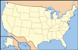
The Tonto National Forest, encompassing 2,873,200 acres (11,627 km2) , is the largest of the six national forests
in Arizona
and is the fifth largest national forest in the United States
. The Tonto National Forest has diverse scenery, with elevations ranging from 1,400 feet (427 m) in the Sonoran Desert
to 7,400 feet (2,256 m) in the ponderosa pine
forests of the Mogollon Rim
. The boundaries of the Tonto National Forest are the Phoenix metropolitan area to the south, the Mogollon Rim to the north and the San Carlos
and Fort Apache Indian Reservation
to the east. The Tonto (Spanish for "fool") is managed by the USDA
Forest Service
and its headquarters are in Phoenix. There are local ranger
district offices in Globe
, Mesa
, Payson
, Roosevelt
, Scottsdale
, and Young
.
The Half Price passes are for use by Golden Age
/Access
Passport or Interagency Senior/Access Pass Holders. The Tonto Upgrade must be used in addition to an Interagency Pass for use of the recreation sites.
Tonto Passes are available through online vendors at the Tonto National Forest http://www.fs.usda.gov/wps/portal/fsinternet/!ut/p/c5/04_SB8K8xLLM9MSSzPy8xBz9CP0os3gjAwhwtDDw9_AI8zPyhQoYAOUjMeXDfODy-HWHg-zDrx8kb4ADOBro-3nk56bqF-RGGGSZOCoCAPi8eX8!/dl3/d3/L2dJQSEvUUt3QS9ZQnZ3LzZfMjAwMDAwMDBBODBPSEhWTjJNMDAwMDAwMDA!/?navtype=&cid=stelprdb5274504&navid=160100000000000&pnavid=160000000000000&ss=110312&position=Not%20Yet%20Determined.Html&ttype=detail&pname=Tonto%20National%20Forest-%20Passesrecreation passes and permits web page]. Daily and Half Price Daily Tonto Passes are now available for purchase online, immediate printing at home and use at the Tonto National Forest. Passes are also available through many local merchants.
The next four are created by the Salt River
chain of dams:
A portion of the Verde Wild and Scenic River
also lies within the forest.
. In 1906 the forest reserves were transferred to the U.S. Forest Service, and on March 4, 1907 Tonto became a National Forest. On January 13, 1908 the Pinal Mountains National Forest
was added along with other lands. On July 1, 1908 part of Black Mesa National Forest
and other lands were added, and on July 1, 1953 part of Crook National Forest
was added.
United States National Forest
National Forest is a classification of federal lands in the United States.National Forests are largely forest and woodland areas owned by the federal government and managed by the United States Forest Service, part of the United States Department of Agriculture. Land management of these areas...
in Arizona
Arizona
Arizona ; is a state located in the southwestern region of the United States. It is also part of the western United States and the mountain west. The capital and largest city is Phoenix...
and is the fifth largest national forest in the United States
United States
The United States of America is a federal constitutional republic comprising fifty states and a federal district...
. The Tonto National Forest has diverse scenery, with elevations ranging from 1,400 feet (427 m) in the Sonoran Desert
Sonoran Desert
The Sonoran Desert is a North American desert which straddles part of the United States-Mexico border and covers large parts of the U.S. states of Arizona and California and the northwest Mexican states of Sonora, Baja California, and Baja California Sur. It is one of the largest and hottest...
to 7,400 feet (2,256 m) in the ponderosa pine
Ponderosa Pine
Pinus ponderosa, commonly known as the Ponderosa Pine, Bull Pine, Blackjack Pine, or Western Yellow Pine, is a widespread and variable pine native to western North America. It was first described by David Douglas in 1826, from eastern Washington near present-day Spokane...
forests of the Mogollon Rim
Mogollon Rim
The Mogollon Rim is a topographical and geological feature running across the U.S. state of Arizona. It extends approximately from northern Yavapai County eastward to near the border with New Mexico.-Description:...
. The boundaries of the Tonto National Forest are the Phoenix metropolitan area to the south, the Mogollon Rim to the north and the San Carlos
San Carlos, Arizona
San Carlos is a census-designated place in Gila County, Arizona, United States. The population was 3,716 at the 2000 census.San Carlos is the largest community in and the seat of government for the San Carlos Apache Indian Reservation....
and Fort Apache Indian Reservation
Fort Apache Indian Reservation
The Fort Apache Indian Reservation is an Indian reservation in Arizona, United States, encompassing parts of Navajo, Gila, and Apache counties. It is home to the federally recognized White Mountain Apache Tribe of the Fort Apache Reservation, a Western Apache tribe. It has a land area of 2,627.608...
to the east. The Tonto (Spanish for "fool") is managed by the USDA
United States Department of Agriculture
The United States Department of Agriculture is the United States federal executive department responsible for developing and executing U.S. federal government policy on farming, agriculture, and food...
Forest Service
United States Forest Service
The United States Forest Service is an agency of the United States Department of Agriculture that administers the nation's 155 national forests and 20 national grasslands, which encompass...
and its headquarters are in Phoenix. There are local ranger
National Park Ranger
National Park Service Rangers are among the uniformed employees charged with protecting and preserving areas set aside in the National Park System by the United States Congress and/or the President of the United States...
district offices in Globe
Globe, Arizona
Globe has an arid climate, characterized by hot summers and moderate to warm winters. Globe's arid climate is somewhat tempered by its elevation, however, leading to slightly cooler temperatures and slightly more precipitation than Phoenix or Yuma....
, Mesa
Mesa, Arizona
According to the 2010 Census, the racial composition of Mesa was as follows:* White: 77.1% * Hispanic or Latino : 26.54%* Black or African American: 3.5%* Two or more races: 3.4%* Native American: 2.4%...
, Payson
Payson, Arizona
- History :Payson considers its founding year as 1882, at which time it was known as Green Valley or Union Park. On March 3, 1884, the town officially established a post office. Postmaster Frank C. Hise recommended that the town be named after a man named Levi Joseph Payson. Senator Payson was very...
, Roosevelt
Roosevelt, Arizona
Roosevelt is an unincorporated community in Gila County in the U.S. State of Arizona, located on the south shore of Theodore Roosevelt Lake. Roosevelt has a ZIP Code of 85545; in 2000, the population of the 85545 ZCTA was 616....
, Scottsdale
Scottsdale, Arizona
Scottsdale is a city in the eastern part of Maricopa County, Arizona, United States, adjacent to Phoenix. According to the U.S. Census Bureau, as of 2010 the population of the city was 217,385...
, and Young
Young, Arizona
Young is a census-designated place in Gila County, Arizona, United States. The population was 561 at the 2000 census.-Geography:Young is located at , along Arizona State Route 288 . SR 288 is paved within and north of the town, totaling about ten miles of pavement...
.
Tonto Pass
Tonto National Forest began charging user fees in 1996 for daily and overnight stays at expanded amenity recreation sites in the national forest. Five different passes are currently offered for sale:- Daily Pass
- Watercraft Sticker
- Half Price Daily Pass
- Half Price Watercraft Sticker
- Interagency Pass and Tonto Upgrade Decal
The Half Price passes are for use by Golden Age
Golden Age Passport
Golden Age Passport was a pass issued by the National Park Service until January 1, 2007. It has been replaced with the Senior Pass of the new pass series now called America the Beautiful - National Parks and Federal Recreational Lands Pass....
/Access
Access Pass
The Access Pass is a card provided at no charge by the United States Federal Government to people with a permanent disability. The pass, which works just like the Golden Age Passport, allows the disabled person to enter any United States National Park for free, and to bring up to 3 other people...
Passport or Interagency Senior/Access Pass Holders. The Tonto Upgrade must be used in addition to an Interagency Pass for use of the recreation sites.
Tonto Passes are available through online vendors at the Tonto National Forest http://www.fs.usda.gov/wps/portal/fsinternet/!ut/p/c5/04_SB8K8xLLM9MSSzPy8xBz9CP0os3gjAwhwtDDw9_AI8zPyhQoYAOUjMeXDfODy-HWHg-zDrx8kb4ADOBro-3nk56bqF-RGGGSZOCoCAPi8eX8!/dl3/d3/L2dJQSEvUUt3QS9ZQnZ3LzZfMjAwMDAwMDBBODBPSEhWTjJNMDAwMDAwMDA!/?navtype=&cid=stelprdb5274504&navid=160100000000000&pnavid=160000000000000&ss=110312&position=Not%20Yet%20Determined.Html&ttype=detail&pname=Tonto%20National%20Forest-%20Passesrecreation passes and permits web page]. Daily and Half Price Daily Tonto Passes are now available for purchase online, immediate printing at home and use at the Tonto National Forest. Passes are also available through many local merchants.
Lakes, rivers and streams
The Tonto National Forest has six notable cold water reservoirs:- Bartlett Reservoir
- Horseshoe Reservoir
The next four are created by the Salt River
Salt River (Arizona)
The Salt River is a stream in the U.S. state of Arizona. It is the largest tributary of the Gila River. The river is about long. Its drainage basin is about large. The longest of the Salt River's many tributaries is the Verde River...
chain of dams:
- Saguaro Lake
- Canyon Lake
- Apache LakeApache Lake (Arizona)Apache Lake is one of four artificial reservoirs created along the Salt River in central Arizona as part of the Salt River Project. The lake is located near the Apache Trail about 65 miles northeast of Phoenix. Apache Lake was formed by Horse Mesa Dam which was completed in 1927...
- Theodore Roosevelt LakeTheodore Roosevelt LakeTheodore Roosevelt Lake is a large reservoir formed by Theodore Roosevelt Dam on the Salt River in Arizona as part of the Salt River Project...
Wilderness areas
There are seven federally designated wilderness areas, protecting 589,000 (2,383 km2) acres of forest land, within the Tonto National Forest:- Four Peaks Wilderness
- Hell's Gate Wilderness
- Mazatzal Wilderness
- Salome WildernessSalome WildernessThe Salome Wilderness of Tonto National Forest is a protected area in the rim country of the southwestern USA. The Salome Wilderness lies within the Sierra Ancha mountain range in Gila County, Arizona.-Ecology:...
- Salt River Canyon WildernessSalt River Canyon WildernessSalt River Canyon Wilderness is a wilderness area located within the Tonto National Forest in the U.S. state of Arizona.The Salt River and its deep canyon bisect the entire length of the wilderness...
- Sierra AnchaSierra AnchaThe Sierra Ancha is a mountain range in Gila County, in central Arizona. It lies between Roosevelt Lake to the south, the Tonto Basin to the west, Cherry Creek to the east, and Pleasant Valley to the north...
- Superstition Wilderness
A portion of the Verde Wild and Scenic River
Verde River
The Verde River is the north and northwestern watershed of the Salt River–Verde River Watershed that co-join and enter the Gila River at Phoenix, Arizona, located in the U.S. state of Arizona...
also lies within the forest.
History
The Tonto Forest Reserve was established on October 3, 1905 by the General Land OfficeGeneral Land Office
The General Land Office was an independent agency of the United States government responsible for public domain lands in the United States. It was created in 1812 to take over functions previously conducted by the United States Department of the Treasury...
. In 1906 the forest reserves were transferred to the U.S. Forest Service, and on March 4, 1907 Tonto became a National Forest. On January 13, 1908 the Pinal Mountains National Forest
Pinal Mountains National Forest
Pinal Mountains National Forest was established as the Pinal Mountains Forest Reserve by the U.S. Forest Service in Arizona on March 20, 1905 with . It became a National Forest on March 4, 1907. On January 13, 1908 the forest was combined with Tonto National Forest and the name was discontinued...
was added along with other lands. On July 1, 1908 part of Black Mesa National Forest
Black Mesa National Forest
Black Mesa National Forest was established as the Black Mesa Forest Reserve by the General Land Office in Arizona on February 22, 1897 with . After the transfer of federal forests to the U.S. Forest Service in 1905, it became a National Forest on March 4, 1907...
and other lands were added, and on July 1, 1953 part of Crook National Forest
Crook National Forest
Crook National Forest was established in Arizona by the U.S. Forest Service on July 1, 1908 with from portions of Tonto National Forest, Mount Graham National Forest and other lands. On July 1, 1953 Crook was divided among Tonto, Gila and Coronado National Forests. -External links:** Text from...
was added.