

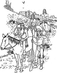
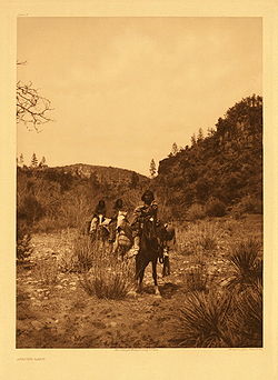
Fort Apache Indian Reservation
Encyclopedia
Indian reservation
An American Indian reservation is an area of land managed by a Native American tribe under the United States Department of the Interior's Bureau of Indian Affairs...
in Arizona
Arizona
Arizona ; is a state located in the southwestern region of the United States. It is also part of the western United States and the mountain west. The capital and largest city is Phoenix...
, United States
United States
The United States of America is a federal constitutional republic comprising fifty states and a federal district...
, encompassing parts of Navajo
Navajo County, Arizona
-2010:Whereas according to the 2010 U.S. Census Bureau:*49.3% White*0.9% Black*43.4% Native American*0.5% Asian*0.1% Native Hawaiian or Pacific Islander*2.5% Two or more races*3.3% Other races*10.8% Hispanic or Latino -2000:...
, Gila
Gila County, Arizona
-2010:Whereas according to the 2010 U.S. Census Bureau:*76.8% White*0.4% Black*14.8% Native American*0.5% Asian*0.1% Native Hawaiian or Pacific Islander*2.0% Two or more races*5.4% Other races*17.9% Hispanic or Latino -2000:...
, and Apache
Apache County, Arizona
-2010:Whereas according to the 2010 U.S. Census Bureau:*23.3% White*0.2% Black*72.9% Native American*0.3% Asian*0.0% Native Hawaiian or Pacific Islander*2.0% Two or more races*1.3% Other races*5.8% Hispanic or Latino -2000:...
counties. It is home to the federally recognized White Mountain Apache Tribe of the Fort Apache Reservation, a Western Apache
Western Apache
Western Apache refers to the Apache peoples living today primarily in east central Arizona. Most live within reservations. The White Mountain Apache of the Fort Apache, San Carlos, Yavapai-Apache, Tonto Apache, and the Fort McDowell Mohave-Apache Indian reservations are home to the majority of...
tribe. It has a land area of 2,627.608 sq mi (6,805.474 km²) and a population of 12,429 people as of the 2000 census
United States Census, 2000
The Twenty-second United States Census, known as Census 2000 and conducted by the Census Bureau, determined the resident population of the United States on April 1, 2000, to be 281,421,906, an increase of 13.2% over the 248,709,873 persons enumerated during the 1990 Census...
. The largest community is Whiteriver
Whiteriver, Arizona
Whiteriver is a census-designated place in Navajo County, Arizona, United States. The population was 5,220 at the 2000 census.-Geography:Whiteriver is located at ....
.
Geography
The Fort Apache Indian Reservation is covered mostly by pine forests and is habitat to a variety of forest wildlife. It is located directly south of the Mogollon RimMogollon Rim
The Mogollon Rim is a topographical and geological feature running across the U.S. state of Arizona. It extends approximately from northern Yavapai County eastward to near the border with New Mexico.-Description:...
. The highest point in the reservation is Baldy Peak
Mount Baldy (Arizona)
Mount Baldy is a mountain in northeastern Arizona in the United States. It is the highest point in the White Mountains, making it the highest point in Apache County. It is the second highest point in the state after the six summits of the San Francisco Peaks near Flagstaff...
, with an elevation of 11403 ft (3,475.6 m).
Economy
The tribe operates the Sunrise ski resortSunrise Park Resort
Sunrise Park Resort is a ski resort located near Greer, Arizona, close to the border with New Mexico. The resort consists of three mountains named Sunrise Peak, Cyclone Peak, and Apache Peak...
and the Hon Dah Resort Casino. It has built the Apache Cultural Center & Museum, constructed in the traditional style of a gowa
Gowa
Gowa is a region in the province of South Sulawesi, Indonesia. It is a "level 2 district," with an area of 1,883 km² and a population of approximately 500,000 people...
.
Other attractions within the reservation include the Fort Apache Historic Park, which has 27 buildings from the historic fort and a 288-acre National Historic District
National Historic District
National Historic District may refer to a historic district designated by a national government, including:* a historic district listed on the United States National Register of Historic Places * a United States National Historic Landmark District...
; and other historic sites. Kinishba Ruins
Kinishba Ruins
Kinishba Ruins is a sprawling, 600-room great house archaeological site in eastern Arizona and is administered by the Southern Athabaskan-speaking White Mountain Apache Tribe of the nearby Fort Apache Indian Reservation...
, an ancient archeological site (AD1150-1350) of the western Pueblo
Pueblo
Pueblo is a term used to describe modern communities of Native Americans in the Southwestern United States of America. The first Spanish explorers of the Southwest used this term to describe the communities housed in apartment-like structures built of stone, adobe mud, and other local material...
culture, is a National Historic Landmark
National Historic Landmark
A National Historic Landmark is a building, site, structure, object, or district, that is officially recognized by the United States government for its historical significance...
and is located on nearby associated tribal trust lands. Appointments may be made to visit the site.
Demographics
The demographics of the White Mountain Apache are similar to those of the people at the San Carlos Apache Indian ReservationSan Carlos Apache Indian Reservation
The San Carlos Apache Indian Reservation, in southeastern Arizona, United States, was established in 1871 as a reservation for the Chiricahua Apache tribe. It was referred to by some as "Hell's Forty Acres," due to a myriad of dismal health and environmental conditions.-Formation:President U.S....
, which is directly to the south. As at San Carlos, the median household income is around $14,000, and more than half the population lives under the poverty line.
See also
- ApacheApacheApache is the collective term for several culturally related groups of Native Americans in the United States originally from the Southwest United States. These indigenous peoples of North America speak a Southern Athabaskan language, which is related linguistically to the languages of Athabaskan...
- Sunrise Park ResortSunrise Park ResortSunrise Park Resort is a ski resort located near Greer, Arizona, close to the border with New Mexico. The resort consists of three mountains named Sunrise Peak, Cyclone Peak, and Apache Peak...
- Battle of Cibecue CreekBattle of Cibecue CreekThe Battle of Cibecue Creek was an engagement of the Apache Wars, fought in August 1881 between the United States and White Mountain Apaches in Arizona, at Cibecue Creek on the Fort Apache Indian Reservation. After an army expedition of scouts and soldiers arrested a prominent medicine man, they...
- Battle of Fort ApacheBattle of Fort ApacheThe Battle of Fort Apache was an engagement of the Apache Wars between the cavalry garrison of Fort Apache and dozens of mounted White Mountain Apache warriors...
Communities
- Canyon DayCanyon Day, ArizonaCanyon Day is a census-designated place in Gila County, Arizona, United States. The population was 1,092 at the 2000 census.-Geography:Canyon Day is located at ....
- CibecueCibecue, ArizonaCibecue is a census-designated place in Navajo County, Arizona, United States. The population was 1,331 at the 2000 census.The current council leaders are Arnold Beach Sr...
- East ForkEast Fork, ArizonaEast Fork is a census-designated place in Navajo County, Arizona, United States. The population was 880 at the 2000 census.-Geography:East Fork is located at ....
- McNaryMcNary, ArizonaMcNary is a census-designated place in Apache and Navajo counties in the U.S. state of Arizona. The population was 349 at the 2000 census...
- WhiteriverWhiteriver, ArizonaWhiteriver is a census-designated place in Navajo County, Arizona, United States. The population was 5,220 at the 2000 census.-Geography:Whiteriver is located at ....
- Carrizo
External links
- White Mountain Apache Tribe - Official website
- "Fort Apache Historic Park and Kinishba Ruins", Nohwike’ Bágowa (House of Our Footprints), White Mountain Apache Culture Center & Museum
- Fort Apache Heritage Foundation