

Stroudwater Navigation
Encyclopedia
Canal
Canals are man-made channels for water. There are two types of canal:#Waterways: navigable transportation canals used for carrying ships and boats shipping goods and conveying people, further subdivided into two kinds:...
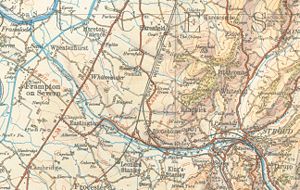
linking Stroud
Stroud, Gloucestershire
Stroud is a market town and civil parish in the county of Gloucestershire, England. It is the main town in Stroud District.Situated below the western escarpment of the Cotswold Hills at the meeting point of the Five Valleys, the town is noted for its steep streets and cafe culture...
to the Severn Estuary
Severn Estuary
The Severn Estuary is the estuary of the River Severn, the longest river in Great Britain. Its high tidal range means it has been at the centre of discussions in the UK regarding renewable energy.-Geography:...
in England and Wales. It was authorised in 1776, although part had already been built, as the Proprietors thought that an Act of Parliament obtained in 1730 gave them the necessary powers. It opened in 1779, and was a commercial success, its main cargo being coal. It was 8 miles (12.9 km) in length and had a rise of 102 in 5 in (31.22 m) through 12 locks. Following the opening of the Thames and Severn Canal
Thames and Severn Canal
The Thames and Severn Canal is a canal in Gloucestershire in the south of England, which was completed in 1789. It was conceived as part of a canal route from Bristol to London. At its eastern end, it connects to the River Thames at Inglesham Lock near Lechlade, while at its western end, it...
in 1789, it formed part of a through route from Bristol
Bristol
Bristol is a city, unitary authority area and ceremonial county in South West England, with an estimated population of 433,100 for the unitary authority in 2009, and a surrounding Larger Urban Zone with an estimated 1,070,000 residents in 2007...
to London
London
London is the capital city of :England and the :United Kingdom, the largest metropolitan area in the United Kingdom, and the largest urban zone in the European Union by most measures. Located on the River Thames, London has been a major settlement for two millennia, its history going back to its...
, although much of this trade vanished when the Kennet and Avon Canal
Kennet and Avon Canal
The Kennet and Avon Canal is a waterway in southern England with an overall length of , made up of two lengths of navigable river linked by a canal. The name is commonly used to refer to the entire length of the navigation rather than solely to the central canal section...
provided a more direct route in 1810. Despite competition from the railways, the canal continued to pay dividends to shareholders until 1922, and was not finally abandoned until 1954.
Even before it closed, there was interest in retaining the canal for its amenity value. In 1972, the Stroudwater Canal Society, which later became the Cotswold Canals Trust, was formed, and following initial hostility from the Proprietors, who had not been stripped of their powers when the canal had closed, agreement was reached and work began on restoration of the waterway. The project gained popularity, and in 2003, a bid was made to the Heritage Lottery Fund for £82 million to restore both the Stroudwater and the Thames and Severn Canal. The project had to be split into smaller parts, and only the first phase has been funded in this way, when a grant of £11.9 million was confirmed in 2006. With match funding, this will enable the section from 'The Ocean' at Stonehouse to Wallbridge to be reopened, together with the Wallbridge to Brimscombe Port section of the Thames and Severn. A second bid for the connection from Stonehouse to the Gloucester and Sharpness Canal
Gloucester and Sharpness Canal
The Gloucester and Sharpness Canal or Gloucester and Berkeley Canal is a canal in the west of England, between Gloucester and Sharpness; for much of its length it runs close to the tidal River Severn, but cuts off a significant loop in the river, at a once-dangerous bend near Arlingham...
at Saul was rejected in 2007. Outside of this main restoration, the Cotswold Canals Trust are gradually restoring many of the other structures, with the ultimate goal of re-opening a link between the River Thames
River Thames
The River Thames flows through southern England. It is the longest river entirely in England and the second longest in the United Kingdom. While it is best known because its lower reaches flow through central London, the river flows alongside several other towns and cities, including Oxford,...
and the River Severn
River Severn
The River Severn is the longest river in Great Britain, at about , but the second longest on the British Isles, behind the River Shannon. It rises at an altitude of on Plynlimon, Ceredigion near Llanidloes, Powys, in the Cambrian Mountains of mid Wales...
.
Construction
The first plans for making the small River FromeRiver Frome, Stroud
The River Frome, once also known as the Stroudwater, is a small river in Gloucestershire, England. It is to be distinguished from another River Frome in Gloucestershire, the Bristol Frome....
, also known as the Stroudwater, navigable date back to the last three years of the 17th century. The plan was to serve the woollen industry, by carrying coal from the Severn to Stroud and transporting the finished cloth away to markets, but it was opposed by mill owners, and it came to nothing. The idea was revived in 1728, when John Hore, who had previously succeeded in making the River Kennett navigable, suggested a canal around 8.2 miles (13.2 km) long, with 12 locks, suitable for 60-ton barges. An Act of Parliament
Act of Parliament
An Act of Parliament is a statute enacted as primary legislation by a national or sub-national parliament. In the Republic of Ireland the term Act of the Oireachtas is used, and in the United States the term Act of Congress is used.In Commonwealth countries, the term is used both in a narrow...
was obtained in 1730, with support from those who worked in the cloth industry, but opposition from some of the millers, but it seemed to ignore Hore's recommendations, in that it was again based on making the river navigable. As the millers were given powers which would have effectively shut the navigation for two months each year, and the tolls were set at a level which would have discouraged traffic, no further action was taken.
John Dallaway, who had been appointed as a commissioner under the 1730 Act, commissioned the engineer Thomas Yeoman to make a new survey in 1754, and his new plan was published the following year. It was for a navigation from Wallbridge to the Severn, estimated to cost £8,145, which would require 16 locks and four stanks (which were probably half-locks or staunches). In order to placate the millers, water for the operation of the locks would be provided by a reservoir below Wallbridge, which would cover 2 acre (0.809372 ha) and be filled on Sundays, when the mills were inactive and would not be needing the water. Tolls were set at a more realistic level. While support and finance for the scheme were being gained, John Kemmett, Arthur Wynde, James Pynock and Thomas Bridge devised a scheme which used cranes at each mill weir to transfer cargo, stored in boxes, from a boat on one level to another on the other side of the weir. An Act was obtained in 1759 which authorized Kemmett and the others to construct the canal without any locks to avoid loss of water to the mills. The Act allowed two years for completion of the scheme, and although some progess had been made by April 1761, Kemmett was given an extension of six years at that time. After about 5 miles (8 km) of river had been improved, the works were abandoned as being too costly.
By 1774, canal building was much better understood, and a new attempt was made. The plan was led by Dallaway's son William, who asked Thomas Dadford, Jr.
Thomas Dadford, Jr.
Thomas Dadford was an English canal engineer, who came from a family of canal engineers. He worked with his father and later independently, contributing to a number of canal schemes before dying at the relatively young age of 40....
, the engineer on the Staffordshire and Worcestershire Canal
Staffordshire and Worcestershire Canal
The Staffordshire and Worcestershire Canal is a narrow navigable canal in the English Midlands, passing through the counties of Staffordshire and Worcestershire....
and John Priddy, who had been the engineer on the Droitwich Canal
Droitwich Canal
The Droitwich Canal is a synthesis of two canals in Worcestershire, England; the Droitwich Barge Canal and the Droitwich Junction Canal. The Barge Canal is a broad canal which opened in 1771 linking Droitwich Spa to the River Severn at Hawford Mill, Claines...
during its construction, to carry out a survey. The cost of a canal which avoided the river and hence the mills, was put at £16,750, and soon £20,000 had been raised. Deciding that they did not need a new Act of Parliament, since the powers of the 1730 Act were still valid, Yeoman, who had carried out the 1754 survey, was asked to survey the route again, and a route was selected, which would require 12 locks. Work started, with Samuel Jones as engineer, but he was replace by Priddy within a month. A challenge to the legality of building a canal under the 1730 Act was mounted by landowners and millers in 1775. An injuction was obtained, and the Gloucestershire Assizes ruled that the Act did not cover the work. A new Act was obtained on 25 March 1776, authorising the raising of £20,000 and an extra £10,000 if required. Both sides commissioned the writing of poems to support their cause.
Work resumed under the supervision of Priddy, but he was soon replaced by Edmund Lingard, who had been the engineer for the Coventry Canal
Coventry Canal
The Coventry Canal is a navigable narrow canal in the Midlands of England.It starts in Coventry and ends 38 miles north at Fradley Junction, just north of Lichfield, where it joins the Trent and Mersey Canal...
. The canal was opened in stages as it was completed. It reached Chippenham Platt at the end of 1777, Ryeford in January 1779, and it was open throughout to the Wallbridge terminus on 21 July 1779. It had cost £40,930, which had been raised by calling £150 on each £100 share, by borrowing money from the shareholders, by running up debts, and by using the tolls from the parts of the canal which were already open. Traffic was around 16,000 tons per year, which enabled the company to repay the debts and to declare a first dividend of five per cent in 1786.
Operation
The locks were suitably sized for Severn Trows, which were 72 by, and could carry 60 tons. The canal was not provided with a towing path for horses. Some boats sailed along the canal, but most were bow-hauled by men. Framilode lock at the entrance to the canal was a tide lock, with multiple gates to cope with all states of the tide. When a vessel arrived at the junction, a rope would be taken from it to the shore, and attached to a capstan, which would then be used to haul the boat into the lock. Once the canal was open, the Proprietors worked hard to improve the facilities, and a number of warehouses were built. Many of the shareholders were also involved with the Thames and Severn CanalThames and Severn Canal
The Thames and Severn Canal is a canal in Gloucestershire in the south of England, which was completed in 1789. It was conceived as part of a canal route from Bristol to London. At its eastern end, it connects to the River Thames at Inglesham Lock near Lechlade, while at its western end, it...
scheme, which was completed in 1789 and provided a through route between Wallbridge and the River Thames
River Thames
The River Thames flows through southern England. It is the longest river entirely in England and the second longest in the United Kingdom. While it is best known because its lower reaches flow through central London, the river flows alongside several other towns and cities, including Oxford,...
at Lechlade
Lechlade
Lechlade, or Lechlade-on-Thames, is a town at the southern edge of the Cotswolds in Gloucestershire, England. It is the highest point at which the River Thames is navigable. The town is named after the River Leach that joins the Thames near here....
. The navigation was seen as a commercial waterway; pleasure boats were discouraged by the imposition of a charge of £1 (2011:£) for the use of each lock.
The main cargo carried was coal. In 1788, a group of shareholders set up a coal committee, and began trading. At first, the product came from the Staffordshire coalfields, travelling via the Staffordshire and Worcestershire Canal, or from the Shropshire coalfields, but this was later supplemented by coal from the south Gloucestershire mines and then the Forest of Dean
Forest of Dean
The Forest of Dean is a geographical, historical and cultural region in the western part of the county of Gloucestershire, England. The forest is a roughly triangular plateau bounded by the River Wye to the west and north, the River Severn to the south, and the City of Gloucester to the east.The...
. This profitable business continued until 1833.
Boats that worked the canal included Severn Trows
Trow
A trow was a type of cargo boat found in the past on the rivers Severn and Wye in Great Britain and used to transport goods. The mast could be taken down so that the trow could go under bridges, such as the bridge at Worcester and the many bridges up and downstream. The mast was stepped in a three...
, a type of sailing boat which was fitted with ketch, cutter or sloop rigging. Many were later converted for use as dumb barges by removing the masts, but none are known to have survived to the present day.
In 1794, a basin was built above Framilode lock, so that vessels could wait there until the tide in the Severn was at a suitable level. This had been requested by the Thames and Severn Canal company, but requests for a horse towing path in 1799 and 1812 were dismissed as too expensive. They eventually provided one after the Gloucester and Berkeley Canal had been built, and the canal was the only part of the waterway from Shrewsbury
Shrewsbury
Shrewsbury is the county town of Shropshire, in the West Midlands region of England. Lying on the River Severn, it is a civil parish home to some 70,000 inhabitants, and is the primary settlement and headquarters of Shropshire Council...
on the Severn to Teddington
Teddington
Teddington is a suburban area in the London Borough of Richmond upon Thames in south west London, on the north bank of the River Thames, between Hampton Wick and Twickenham. It stretches inland from the River Thames to Bushy Park...
on the Thames that did not have one. It was completed in August 1827. The opening of the Gloucester and Berkeley Canal in 1825 required a slight diversion where they crossed at Saul, and the levels were adjusted by building a new lock on the Stroudwater below the junction, to ensure neither company lost water to the other. The new company paid for its construction. After the Gloucester and Berkeley Canal opened to Sharpness in 1827, the link between Saul and the Severn at Framilode was used much less, although coal from the Forest of Dean still used that route.
Traffic, receipts and dividends steadily increased. Tolls rose from £1,468 in 1779 to £6,807 in 1821. The first dividend of 3.75 per cent was paid in 1786, and had reached 15.78 per cent by 1821. Figures for tonnage are not available for the early years, but were 79,359 tons in 1821. There was a dip in the carriage of merchandize in 1810, when the Kennet and Avon Canal
Kennet and Avon Canal
The Kennet and Avon Canal is a waterway in southern England with an overall length of , made up of two lengths of navigable river linked by a canal. The name is commonly used to refer to the entire length of the navigation rather than solely to the central canal section...
opened and provided a more convenient route from Bristol to London, but it picked up again after 1819, when the North Wilts Canal opened, providing a link from Latton to Abingdon
Abingdon
Abingdon may refer to the following places:In Australia :* Abingdon, Queensland, a place in Northern QueenslandIn Britain:*Abingdon, Oxfordshire**Abingdon School**Abingdon Abbey**Abingdon Lock**Abingdon Bridge**Abingdon Air & Country Show...
via Swindon
Swindon
Swindon is a large town within the borough of Swindon and ceremonial county of Wiltshire, in South West England. It is midway between Bristol, west and Reading, east. London is east...
and the Wilts and Berks Canal
Wilts and Berks Canal
The Wilts & Berks Canal is a canal in the historic counties of Wiltshire and Berkshire, England, linking the Kennet and Avon Canal at Semington, near Melksham, to the River Thames at Abingdon. The North Wilts Canal merged with it to become a branch to the Thames and Severn Canal at Latton near...
, which was easier than using the Thames. The highest dividend paid was in 1833, when shareholders received 26.33 per cent, after which receipts and dividends steadily dropped. In 1859 in order to allow the passage of a coal barge called the Queen Esther two of the locks were widened.
Decline
The first threat from a railway came in 1825, when there was a proposal for a line from Framilode Passage to Brimscombe Port. The canal tolls were reduced as a bargaining tool, but the promoters went ahead with their bill. The Stroudwater Company opposed it and it was defeated in Parliament. The Great Western RailwayGreat Western Railway
The Great Western Railway was a British railway company that linked London with the south-west and west of England and most of Wales. It was founded in 1833, received its enabling Act of Parliament in 1835 and ran its first trains in 1838...
opened a line from Swindon to Gloucester in 1845, which passed through Stroud, but the effects on the canal were rather less than the effects on the Thames and Severn. However, in 1863 the Stonehouse and Nailsworth Railway
Stonehouse and Nailsworth Railway
The Stonehouse and Nailsworth Railway was a short railway line in the county of Gloucestershire, England, which brought the Cotswold town of Nailsworth into the UK national rail network....
Act was passed, allowing the construction of a railway from Stonehouse to Dudbridge and Nailsworth that directly competed with the canal. Dividends fell below 5 per cent after 1880 although they did not cease entirely until 1922. Around the same time the connection to the Severn at Framilode
Framilode
Framilode is a village on the banks of the River Severn in Gloucestershire, England. It consists of two settlements, Lower Framilode and Upper Framilode...
became blocked leaving the connection to the Gloucester and Sharpness Canal as the only link between the canal and the River Severn. The last toll was paid in 1941, and most of the canal was formally abandoned by an Act of Parliament granted in 1954. Although this removed the need to maintain the waterway for navigation, the Company of Proprietors was not disbanded, and retained most of their other powers. It consists of those who now own the original shares, although over half of the shares were transferred to a Trust in the 1950s, which prevents hostile takeovers and ensures that the company will always be run for the benefit of the communities through which the canal passes. After the closure of the canal the canal company continued to generate income for many years through the sale of water and some monies produced by property holdings.
Restoration

Inland Waterways Association
The Inland Waterways Association was formed in 1946 as a registered charity in the United Kingdom to campaign for the conservation, use, maintenance, restoration and sensitive development of British Canals and river navigations....
mounting a campaign to retain it when plans to close it were first announced in 1952. They were already formulating plans for the revival of the Thames and Severn Canal
Thames and Severn Canal
The Thames and Severn Canal is a canal in Gloucestershire in the south of England, which was completed in 1789. It was conceived as part of a canal route from Bristol to London. At its eastern end, it connects to the River Thames at Inglesham Lock near Lechlade, while at its western end, it...
, which depended on the Stroudwater for its link to the River Severn. The National Parks Commission declared that it should be retained for its amenity value and beauty in 1954, but it was closed nevertheless.
The publication in 1972 of Lost Canals of England and Wales, a book by Ronald Russell, resulted in a number of canal restoration societies being formed. The Stroudwater Canal Society was one of them, which was soon renamed the Stroudwater, Thames and Severn Canal Trust as the scope of the project expanded, and later became the Cotswold Canals Trust. Although the Proprietors were initially hostile to the Trust, attitudes changed, and in 1979 granted them permission to start work on the section from Pike Mill Bridge to Ryeford, so that a trip-boat could be used on it. As attitudes changed, the Proprietors bought back sections of the waterway which had previously been sold off.
Funding
In 2001, the Cotswold Canals Partnership was established, drawing together people representing the Proprietors, the Cotswold Canals Trust, councils at district and county level, and a number of other interested parties. This provided a suitable structure to drive the restoration forwards. In 2002, the waterway was identified as being of high priority in the Association of Inland Navigation AuthoritiesAssociation of Inland Navigation Authorities
The Association of Inland Navigation Authorities is an unincorporated membership organisation in the United Kingdom. Membership is available for navigation authorities in the United Kingdom who have legal responsibility for managing an inland waterway which is open and operational....
report entitled Vision for Strategic Enhancement of Britain's Inland Navigation Network, and was one of several new projects highlighted at British Waterways
British Waterways
British Waterways is a statutory corporation wholly owned by the government of the United Kingdom, serving as the navigation authority in England, Scotland and Wales for the vast majority of the canals as well as a number of rivers and docks...
' Unlocked and Unlimited conference held in March. The estimated cost of the project to restore both the Stroudwater Navigation and the Thames and Severn Canal was £82 million.
Having raised £100,000, the Cotswold Canals Trust lodged the money with the Waterways Trust, in the hope that it could be used as match funding for any grants that might be received. Andy Stumpf became the full-time Regeneration Programme Manager, working on a major bid application to the Heritage Lottery Fund (HLF) to finance the restoration, and the canal was visited by Charles, Prince of Wales
Charles, Prince of Wales
Prince Charles, Prince of Wales is the heir apparent and eldest son of Queen Elizabeth II and Prince Philip, Duke of Edinburgh. Since 1958 his major title has been His Royal Highness The Prince of Wales. In Scotland he is additionally known as The Duke of Rothesay...
, in his capacity as Patron of the Waterways Trust. A Heritage Survey, which cost £60,000 and was funded by the Inland Waterways Association
Inland Waterways Association
The Inland Waterways Association was formed in 1946 as a registered charity in the United Kingdom to campaign for the conservation, use, maintenance, restoration and sensitive development of British Canals and river navigations....
, was carried out, as was a Community Development Plan and a Visitor Management Strategy, costing another £30,000, all of which were pre-requisites for the main HLF bid. By the time the bid was ready for submission, the HLF were under pressure for the funds they had, and asked British Waterways, who were heading up the application, to break the bid and the project into smaller phases. At the end of 2003, a provisional grant of £11.3 million was awarded by the HLF, to enable the restoration of the Stroudwater Navigation between Stonehouse
Stonehouse, Gloucestershire
Stonehouse, Gloucestershire is an urban area within the Stroud District, in the UK. It is home to a number of factories, such as Dairy Crest and Schlumberger. The town is close to the M5 motorway. Stonehouse railway station has a regular train service to London...
and Wallbridge, and the Thames and Severn Canal between Wallbridge and Brimscombe Port. An additional £2.9 million was received from the European Inter-Regional budget for this first phase. By the time the grant was awarded in January 2006, it had risen to £11.9 million, and a further £6 million of match funding was received from the South West of England Regional Development Agency.
As part of the process, the Proprietors leased the canal to British Waterways in 2005. However, British Waterways had to withdraw from the scheme in 2008, due to financial difficulties, and the role of project leaders was taken over by Stroud District Council. Following the re-organisation, the Stroud Valleys Canal Company was established in March 2009. It is a limited company, with two independent directors and three directors representing Stroud District Council, the Proprietors, and the Cotswold Canals Trust. Its purpose is to hold the assets for the canals, and its charitable status means that stamp duty land tax
Stamp duty in the United Kingdom
In the United Kingdom, stamp duty is a form of tax charged on instruments , and requires a physical stamp to be attached to or impressed upon the instrument in question. The more modern versions of the tax no longer require a physical stamp.The scope of stamp duty has been reduced dramatically in...
does not have to be paid. The company will be responsible for management and maintenance of the canal once it is re-opened.
Development
The length being restored in this first phase is around 6 miles (9.7 km) long, and presents some of the biggest difficulties to restoration in the whole 36 miles (57.9 km) route. Through Dudbridge, the channel has been used as part of a flood relief scheme by the Environment AgencyEnvironment Agency
The Environment Agency is a British non-departmental public body of the Department for Environment, Food and Rural Affairs and an Assembly Government Sponsored Body of the Welsh Assembly Government that serves England and Wales.-Purpose:...
. Water from the Slad Brook, which is culverted beneath Stroud, joins the Thames and Severn Canal a short distance above Lower Wallbridge Lock, the first on that canal, while the Painswick Stream joins above the Dudbridge locks, and the Ruscombe Brook joins between the two locks. The top gates of the locks were replaced with a concrete dam, which maintains the water level at normal flows around 3.3 feet (1 m) lower than the navigable levels. Below the A419 Dudbridge Road bridge, the water is discharged into the River Frome. As a consequence of its flood relief function, the channel here is classified as a "main river". Designs for reinstatement of the canal have had to accommodate large flows on this section, and include underground bywash culverts, capable of carrying the full flood flow of all three streams.
The second phase of the restoration project will be the section from Stonehouse to the Gloucester and Sharpness Canal
Gloucester and Sharpness Canal
The Gloucester and Sharpness Canal or Gloucester and Berkeley Canal is a canal in the west of England, between Gloucester and Sharpness; for much of its length it runs close to the tidal River Severn, but cuts off a significant loop in the river, at a once-dangerous bend near Arlingham...
at Saul, which has been blocked by both the M5 motorway
M5 motorway
The M5 is a motorway in England. It runs from a junction with the M6 at West Bromwich near Birmingham to Exeter in Devon. Heading south-west, the M5 runs east of West Bromwich and west of Birmingham through Sandwell Valley...
and the A38 road
A38 road
The A38, part of which is also known as the Devon Expressway, is a major A-class trunk road in England.The road runs from Bodmin in Cornwall to Mansfield in Nottinghamshire. It is long, making it one of the longest A-roads in England. It was formerly known as the Leeds — Exeter Trunk Road,...
. A bid was submitted to the Living Landmarks Fund in August 2006. This is part of the Big Lottery Fund
Big Lottery Fund
The Big Lottery Fund is a grant-making non-departmental public body in the United Kingdom created by the Government to administer the funding of "good causes" following the creation of the National Lottery. It has an annual expenditure of £630 million...
, and £16 million was requested. An interim award of £250,000 was made, to allow the bid to be developed, but the application was rejected in November 2007. Despite this setback, money for purchasing the land around the M5 and the A38 was part of the phase 1 grant by the HLF. Current proposals for the A38 involve tunnelling under the Whitminster roundabout. The original Bristol Road Lock was buried by the construction of the roundabout, and will be reconstructed to the east of it. There are two proposals for passing under the M5 motorway. One is for a new channel alongside the River Frome through an existing culvert, and the other is for a new wider culvert, nearer to the original line of the canal. Below this, the canal used to cross the River Frome at Lockham Aqueduct, but this was demolished in the 1970s, when the canal and river channel were combined as part of a flood defence scheme.
In November 2007 work started to clear the canal between Ryeford Double Lock and Oils Mills Bridge. Oils Mills Bridge itself has been rebuilt, with the brickwork left after its demolition being incorporated into the new bridge.
Links to other canals
The canal had links to both the Thames and Severn CanalThames and Severn Canal
The Thames and Severn Canal is a canal in Gloucestershire in the south of England, which was completed in 1789. It was conceived as part of a canal route from Bristol to London. At its eastern end, it connects to the River Thames at Inglesham Lock near Lechlade, while at its western end, it...
(at Wallbridge) and the Gloucester and Sharpness Canal
Gloucester and Sharpness Canal
The Gloucester and Sharpness Canal or Gloucester and Berkeley Canal is a canal in the west of England, between Gloucester and Sharpness; for much of its length it runs close to the tidal River Severn, but cuts off a significant loop in the river, at a once-dangerous bend near Arlingham...
(at Saul
Saul, Gloucestershire
Saul is a village in Gloucestershire, England at the site of the junction of the Stroudwater Navigation and the Gloucester and Sharpness Canal. It is in the parish of Fretherne with Saul in the district of Stroud....
).
Points of interest
See also
- Canals of the United KingdomCanals of the United KingdomThe canals of the United Kingdom are a major part of the network of inland waterways in the United Kingdom. They have a colourful history, from use for irrigation and transport, through becoming the focus of the Industrial Revolution, to today's role for recreational boating...
- History of the British canal systemHistory of the British canal systemThe British canal system of water transport played a vital role in the United Kingdom's Industrial Revolution at a time when roads were only just emerging from the medieval mud and long trains of pack horses were the only means of "mass" transit by road of raw materials and finished products The...