

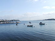
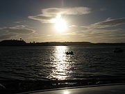
Strangford Lough
Encyclopedia
Loch
Loch is the Irish and Scottish Gaelic word for a lake or a sea inlet. It has been anglicised as lough, although this is pronounced the same way as loch. Some lochs could also be called a firth, fjord, estuary, strait or bay...
or inlet
Inlet
An inlet is a narrow body of water between islands or leading inland from a larger body of water, often leading to an enclosed body of water, such as a sound, bay, lagoon or marsh. In sea coasts an inlet usually refers to the actual connection between a bay and the ocean and is often called an...
in County Down
County Down
-Cities:*Belfast *Newry -Large towns:*Dundonald*Newtownards*Bangor-Medium towns:...
, Northern Ireland
Northern Ireland
Northern Ireland is one of the four countries of the United Kingdom. Situated in the north-east of the island of Ireland, it shares a border with the Republic of Ireland to the south and west...
. It is separated from the Irish Sea
Irish Sea
The Irish Sea separates the islands of Ireland and Great Britain. It is connected to the Celtic Sea in the south by St George's Channel, and to the Atlantic Ocean in the north by the North Channel. Anglesey is the largest island within the Irish Sea, followed by the Isle of Man...
by the Ards Peninsula
Ards Peninsula
The Ards Peninsula is a peninsula in County Down, Northern Ireland which separates Strangford Lough from the North Channel of the Irish Sea, on Ireland's northeast coast. A number of towns and villages are located on the peninsula, such as the seaside town of Donaghadee, with the surrounding area...
. The name Strangford is derived ; describing the fast-flowing narrows
Narrows
Narrows is a term for restricted land or water passages. Most commonly it refers to a strait, though it can also refer to a water gap....
at its mouth. It is called Loch Cuan (formerly anglicised
Anglicisation
Anglicisation, or anglicization , is the process of converting verbal or written elements of any other language into a form that is more comprehensible to an English speaker, or, more generally, of altering something such that it becomes English in form or character.The term most often refers to...
as Lough Cuan) in Irish
Irish language
Irish , also known as Irish Gaelic, is a Goidelic language of the Indo-European language family, originating in Ireland and historically spoken by the Irish people. Irish is now spoken as a first language by a minority of Irish people, as well as being a second language of a larger proportion of...
, meaning "calm lough" (describing the still shallow water
Water
Water is a chemical substance with the chemical formula H2O. A water molecule contains one oxygen and two hydrogen atoms connected by covalent bonds. Water is a liquid at ambient conditions, but it often co-exists on Earth with its solid state, ice, and gaseous state . Water also exists in a...
s of the mud flats), and Strangfurd Loch or Strangfirt Lough in Ulster-Scots. The fretum Brene (called in some of the other Vitaey fretum Brenasse) was the ancient name applied to the narrow entrance to Strangford.
It is a popular tourist attraction
Tourist attraction
A tourist attraction is a place of interest where tourists visit, typically for its inherent or exhibited cultural value, historical significance, natural or built beauty, or amusement opportunities....
noted for its fishing
Fishing
Fishing is the activity of trying to catch wild fish. Fish are normally caught in the wild. Techniques for catching fish include hand gathering, spearing, netting, angling and trapping....
and the picturesque village
Village
A village is a clustered human settlement or community, larger than a hamlet with the population ranging from a few hundred to a few thousand , Though often located in rural areas, the term urban village is also applied to certain urban neighbourhoods, such as the West Village in Manhattan, New...
s and township
Township
The word township is used to refer to different kinds of settlements in different countries. Township is generally associated with an urban area. However there are many exceptions to this rule. In Australia, the United States, and Canada, they may be settlements too small to be considered urban...
s which border its waters. These include Portaferry
Portaferry
Portaferry is a small town in County Down, Northern Ireland, at the southern end of the Ards Peninsula, near the Narrows at the entrance to Strangford Lough. It had a population of 2,467 people in the 2001 Census. It has an aquarium and is well-known for the annual Galway Hookers Regatta. It hosts...
on the Ards Peninsula, which is connected to Strangford
Strangford
Strangford is a small village at the mouth of Strangford Lough in County Down, Northern Ireland. It had a population of 475 people at the 2001 Census.On the other side of the lough is Portaferry and there is a ferry service between the two villages...
across the lough by a car ferry
RORO
Roll-on/roll-off ships are vessels designed to carry wheeled cargo such as automobiles, trucks, semi-trailer trucks, trailers or railroad cars that are driven on and off the ship on their own wheels...
.
The island studded sea lough is the largest inlet in the British Isles
British Isles
The British Isles are a group of islands off the northwest coast of continental Europe that include the islands of Great Britain and Ireland and over six thousand smaller isles. There are two sovereign states located on the islands: the United Kingdom of Great Britain and Northern Ireland and...
, covering 150 km². Almost totally landlocked
Landlocked
A landlocked country is a country entirely enclosed by land, or whose only coastlines lie on closed seas. There are 48 landlocked countries in the world, including partially recognized states...
, the lough is approached from the Irish Sea through the eight kilometre long fast-running tidal narrows, which open out into more gentle waters where there are 70 island
Island
An island or isle is any piece of sub-continental land that is surrounded by water. Very small islands such as emergent land features on atolls can be called islets, cays or keys. An island in a river or lake may be called an eyot , or holm...
s. Countless tidal rocky outcrop
Outcrop
An outcrop is a visible exposure of bedrock or ancient superficial deposits on the surface of the Earth. -Features:Outcrops do not cover the majority of the Earth's land surface because in most places the bedrock or superficial deposits are covered by a mantle of soil and vegetation and cannot be...
s called pladdies litter the lough and mudflats, along with marsh
Marsh
In geography, a marsh, or morass, is a type of wetland that is subject to frequent or continuous flood. Typically the water is shallow and features grasses, rushes, reeds, typhas, sedges, other herbaceous plants, and moss....
es, rocks
Rock (geology)
In geology, rock or stone is a naturally occurring solid aggregate of minerals and/or mineraloids.The Earth's outer solid layer, the lithosphere, is made of rock. In general rocks are of three types, namely, igneous, sedimentary, and metamorphic...
, bays and headlands. The lough is a conservation area
Conservation area
A conservation areas is a tract of land that has been awarded protected status in order to ensure that natural features, cultural heritage or biota are safeguarded...
and its abundant wildlife
Wildlife
Wildlife includes all non-domesticated plants, animals and other organisms. Domesticating wild plant and animal species for human benefit has occurred many times all over the planet, and has a major impact on the environment, both positive and negative....
recognised internationally for its importance.
Flora
A brown seaweedSeaweed
Seaweed is a loose, colloquial term encompassing macroscopic, multicellular, benthic marine algae. The term includes some members of the red, brown and green algae...
named Sargassum
Sargassum
Sargassum is a genus of brown macroalga in the order Fucales. Numerous species are distributed throughout the temperate and tropical oceans of the world, where they generally inhabit shallow water and coral reefs. However, the genus may be best known for its planktonic species...
muticum, originally from the Pacific (Japan
Japan
Japan is an island nation in East Asia. Located in the Pacific Ocean, it lies to the east of the Sea of Japan, China, North Korea, South Korea and Russia, stretching from the Sea of Okhotsk in the north to the East China Sea and Taiwan in the south...
) was discovered on the 15th March 1995 in Strangford Lough at Paddy's Point. The plants were well established on mesh bags containing oysters. The bags had been put out in 1987 containing Pacific oysters (Crassostrea gigas) imported from Guernsey
Guernsey
Guernsey, officially the Bailiwick of Guernsey is a British Crown dependency in the English Channel off the coast of Normandy.The Bailiwick, as a governing entity, embraces not only all 10 parishes on the Island of Guernsey, but also the islands of Herm, Jethou, Burhou, and Lihou and their islet...
. This Sargassum is known to be a highly invasive species.
Maerl
Maerl
Maerl is a collective name for Coralline red algae with a certain growth habit. It accumulates as unattached particles and forms extensive beds in suitable sublittoral sites.-Description:...
is a calcareous deposit, in the main, of two species, of calcareous
Calcareous
Calcareous is an adjective meaning mostly or partly composed of calcium carbonate, in other words, containing lime or being chalky. The term is used in a wide variety of scientific disciplines.-In zoology:...
algae
Algae
Algae are a large and diverse group of simple, typically autotrophic organisms, ranging from unicellular to multicellular forms, such as the giant kelps that grow to 65 meters in length. They are photosynthetic like plants, and "simple" because their tissues are not organized into the many...
Phymatolithon calcareum and Lithothamnion glaciale which form free-living beds of unattached, branched corallines
Coralline algae
Coralline algae are red algae in the order Corallinales. They are characterized by a thallus that is hard because of calcareous deposits contained within the cell walls...
, living or dead, in Strangford Lough.
The rocky and boulder shores toward the south of the lough are dominated by the seaweed knotted wrack Ascophyllum nodosum. The usual zonation of weeds on these shore is, at the top channel wrack, followed by spiral wrack, then knotted wrack with some admixture of bladder wrack and then serrated wrack before coming to the low water kelps.
Fauna
Strangford Lough is an important winter migrationBird migration
Bird migration is the regular seasonal journey undertaken by many species of birds. Bird movements include those made in response to changes in food availability, habitat or weather. Sometimes, journeys are not termed "true migration" because they are irregular or in only one direction...
destination for many wading and sea birds. Animal
Animal
Animals are a major group of multicellular, eukaryotic organisms of the kingdom Animalia or Metazoa. Their body plan eventually becomes fixed as they develop, although some undergo a process of metamorphosis later on in their life. Most animals are motile, meaning they can move spontaneously and...
s commonly found in the lough include common seals, basking shark
Basking shark
The basking shark is the second largest living fish, after the whale shark. It is a cosmopolitan migratory species, found in all the world's temperate oceans. It is a slow moving and generally harmless filter feeder and has anatomical adaptations to filter feeding, such as a greatly enlarged...
s and Brent Geese
Brent Goose
The Brant or Brent Goose, Branta bernicla, is a species of goose of the genus Branta. The Black Brant is an American subspecies. The specific descriptor bernicla is from the same source as "barnacle" in Barnacle Goose, which looks similar but is not a close relation.-Appearance:The Brant Goose is...
. Three quarters of the world population of Pale Bellied Brent Geese spend winter in the lough area.
Tidal electricity

SeaGen
SeaGen is the world's first large scale commercial tidal stream generator. It is four times more powerful than any other tidal stream generator in the world....
(although not the first commercial tidal power
Tidal power
Tidal power, also called tidal energy, is a form of hydropower that converts the energy of tides into useful forms of power - mainly electricity....
station of any type). The 1.2 megawatt underwater tidal electricity generator, part of Northern Ireland's Environment and Renewable Energy Fund scheme, takes advantage of the fast tidal flow in the lough which can be up to 4 m/s. Although the generator is powerful enough to power up to a thousand homes, the turbine
Turbine
A turbine is a rotary engine that extracts energy from a fluid flow and converts it into useful work.The simplest turbines have one moving part, a rotor assembly, which is a shaft or drum with blades attached. Moving fluid acts on the blades, or the blades react to the flow, so that they move and...
has a minimal environmental impact
Environmental degradation
Environmental degradation is the deterioration of the environment through depletion of resources such as air, water and soil; the destruction of ecosystems and the extinction of wildlife...
, as it is almost entirely submerged, and the rotors turn slowly enough that they pose no danger to wildlife
Wildlife
Wildlife includes all non-domesticated plants, animals and other organisms. Domesticating wild plant and animal species for human benefit has occurred many times all over the planet, and has a major impact on the environment, both positive and negative....
.
Since June 2008 a tidal energy device called Evopod
Evopod
Evopod is a unique tidal energy device being developed by a UK-based company Ocean Flow Energy Ltd for generating electricity from tidal streams and ocean currents...
has been tested in Strangford Lough near the Portaferry Ferry landing. The device is a 1/10 scale prototype and is being monitored by Queens University Belfast. The device is a semi submerged floating tidal turbine and is moored to the seabed via a buoy mounted swivel so that it always maintains optimum heading into the direction of the tidal flow. The scale device is not grid connected and dissipates the small amount of power it generates as heat into the sea.
Activity on Strangford Lough
Strangford Lough is a place of natural beauty that the locals put to great use. From using it as a national highway (Portaferry-Strangford ferry) to using it for activities of leisure - sailing, kayaking, bird watching, diving and much more. There are a number of companies based in the local area encouraging visitors to explore the area including: Exploris Aquarium - where you can learn more about the lough and its wildlife; Clearsky Adventure Centre - kayaking, canoeing etc. and DV diving. There are also canoe trails in place and a 'Strangford Lough Activity Map' has been launched as a part of a series of maps produced by the Ordnance Survey of Northern Ireland.Ferry
There has been a ferry service between PortaferryPortaferry
Portaferry is a small town in County Down, Northern Ireland, at the southern end of the Ards Peninsula, near the Narrows at the entrance to Strangford Lough. It had a population of 2,467 people in the 2001 Census. It has an aquarium and is well-known for the annual Galway Hookers Regatta. It hosts...
and Strangford
Strangford
Strangford is a small village at the mouth of Strangford Lough in County Down, Northern Ireland. It had a population of 475 people at the 2001 Census.On the other side of the lough is Portaferry and there is a ferry service between the two villages...
, without a break, for almost four centuries. The alternative road journey is 75 kilometres and takes about an hour and a half, while the ferry crosses the 0.6 nautical miles (1.1 km) in 8 minutes. A new £2.7 million vessel, MV Portaferry II
MV Portaferry II
MV Portaferry II is a passenger ferry operated by Roads Service Northern Ireland. This ferry serves on a route which has been in operation since the 12th century.-Route:...
, built by McTay Marine
McTay Marine
-Facilities:The McTay Marine shipyard is located at Bromborough on the South bank of the River Mersey, in the North West of England. The purpose built facilities are arranged on a site with ramped slipway facilities directly into the River Mersey...
of Merseyside, came into service on 18 December 2001, relegating the earlier vessel, MV Strangford to a support role. MV Strangford was built by the Verlome Shipyard in Cork and launched on 6 September 1969. The earlier MV Portaferry was bought from a company in Wales and modified by Harland and Wolff
Harland and Wolff
Harland and Wolff Heavy Industries is a Northern Irish heavy industrial company, specialising in shipbuilding and offshore construction, located in Belfast, Northern Ireland....
of Belfast. She was sold in May 2002.
Archaeology
Strangford Lough has a substantial archaeological heritage. Intertidal archaeological surveys in recent years have brought hundreds of sites to light, including fish trapFish trap
A fish trap is a trap used for fishing. Fish traps may have the form of a fishing weir or a lobster trap. A typical trap might consist of a frame of thick steel wire in the shape of a heart, with chicken wire stretched around it. The mesh wraps around the frame and then tapers into the inside of...
s, tidal mills
Tide mill
A tide mill is a water mill driven by tidal rise and fall. A dam with a sluice is created across a suitable tidal inlet, or a section of river estuary is made into a reservoir. As the tide comes in, it enters the mill pond through a one way gate, and this gate closes automatically when the tide...
, kelp
Kelp
Kelps are large seaweeds belonging to the brown algae in the order Laminariales. There are about 30 different genera....
walls and harbours and landing places.
See also
- List of loughs in Ireland
- Nendrum MonasteryNendrum MonasteryNendrum Monastery was a Christian monastery on Mahee Island in Strangford Lough, County Down, Northern Ireland. Medieval records say it was founded in the 5th century, but this is uncertain. The monastery came to an end at some time between 974 and 1178, but its church served a parish until the...
Further reading
- Boaden, P.J.S., O'Connor, R.J. and Seed, R. 1975. The composition and zonation of a Fucus serratus community in Strangford Lough, Co. Down. J. exp. Biol. Ecol. 17: 111 - 136.
- Walsh, B. 2009. Catching the Currents. Time 173 no.4. p. 44.
External links
- Strangford Lough Online
- Marine Current Turbines
- Ocean Flow Energy
- Strangford Lough Imagery
- Strangford Lough Photos
- Clearsky Adventure Centre - provider of activities on the lough and waters edge
- St. Patrick: his life and mission
- JNCC Special Area of ConservationSpecial Area of ConservationA Special Area of Conservation is defined in the European Union's Habitats Directive , also known as the Directive on the Conservation of Natural Habitats and of Wild Fauna and Flora...
Selection