
.gif)
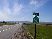
State Route 20 (California)
Encyclopedia
California State Route 20 (SR 20), commonly known as Highway 20 or 20, is a state highway
in the northern central region of the U.S. state
of California
, running east–west across the state north of Sacramento
. Its west end is at SR 1
in Fort Bragg
, from where it heads east past Clear Lake, Colusa
, Yuba City
, Marysville
, and Nevada City
to I-80
near Emigrant Gap
, where eastbound traffic can continue on other routes to Lake Tahoe
or Nevada
.
Portions of SR 20 are built near the routing of what was first a wagon road and later a turnpike
in the late nineteenth century. This road was extended through the state highway system all the way to Ukiah
in the early twentieth century, and the missing link near Clear Lake was completed in 1932 before the official designation of this highway as SR 20 in 1934. There have been subsequent improvements to the road, such as the conversion of the Grass Valley
portion of the route to freeway standards.
, although it is mostly a two-lane surface road. All of SR 20 is on the Interregional Road System, a highway system that connects major economic centers of the state, and has been selected by the California Department of Transportation
(Caltrans) as a High Emphasis Route and Focus Route from US 101 to SR 29
and SR 53
to I-80, with the designated corridor following SR 29 and SR 53 around the south side of Clear Lake. It is also eligible for the State Scenic Highway System
from SR 1 to SR 16 and SR 49
to I-80, and has been designated as such for 6 miles (10 km) near the east end; this is part of the federally-designated Yuba-Donner Scenic Byway, a National Scenic Byway
that uses SR 20 east of SR 49.
State Route 20 begins at SR 1
in southern Fort Bragg
, under a mile (1/2 km) from the Pacific Ocean. It heads east, quickly climbing into the Mendocino Range
along a ridge and crossing through Dunlap Pass. The highway continues to rise alongside the North Fork Big River and tributaries, crossing another summit and then descending to Willits
in the Little Lake Valley via Broaddus Creek. An overlap with US 101 begins in Willits and heads southeasterly to Calpella
, north of Ukiah
in Redwood Valley. There SR 20 turns east again, crossing the Russian River
, passing the north shore of Lake Mendocino
, and rising to a summit via the East Fork Russian River and Cold Creek. The roadway again descends alongside the Blue Lakes and Scotts Creek
to the junction with SR 29
and the settlement of Upper Lake
in the Clear Lake Basin. SR 20 closely follows the northeast shore of Clear Lake, staying right above the water line to avoid the adjacent hills. Where the lake ends, SR 20 continues east, intersecting SR 53
and then following the North Fork Cache Creek and tributaries to the Lake
-Colusa
County line. During its final descent into the Sacramento Valley
, SR 20 intersects SR 16 and curves north and back east, entering the valley via Salt Creek.
 Once it enters the flat Sacramento Valley, SR 20 takes a generally straight path, crossing I-5
in Williams
, overlapping SR 45
near the west bank of the Sacramento River
southeast from Colusa
, and then turning back east to cross the Sacramento River and Sutter Bypass on its way to Yuba City
. The route crosses SR 99
west of central Yuba City, and runs east through northern Yuba City to the Feather River
, which it crosses on the 10th Street Bridge into Marysville
. Within the central part of that city, SR 20 makes several turns, first turning south from 10th Street onto E Street, then east on 9th Street (overlapping SR 70
), north on B Street, and east on 12th Street (splitting from SR 70). The highway leaves Marysville to the northeast, paralleling the Yuba River
on its north side as it enters the foothills of the Sierra Nevada.
SR 20 rises into the Sierras along the north side of the Yuba River, crossing to the south side near Smartville
and then climbing through several ravines to the Penn Valley. The current alignment, built in the mid-1980s as a mostly two-lane freeway
, continues east across rugged terrain to the city of Grass Valley
, where it joins SR 49
on the Golden Center Freeway. The two routes travel northeast to Nevada City
, where SR 49 turns northeast and SR 20 resumes its eastward course. The roadway climbs from Nevada City and follows Harmony Ridge and Washington Ridge before descending into the Bear Valley via a series of hairpin turn
s, and then climbing, just north of Emigrant Gap
, to its end at I-80
at Yuba Pass. The Pioneer Trail, a National Recreation Trail
, parallels SR 20 from a point on Harmony Ridge to the Bear Valley, and includes parts of a branch of the California Trail
first used in 1850.
 The east end of SR 20, from Bear Valley (just below Emigrant Gap) to Nevada City, closely follows a branch of the Truckee Route of the California Trail, first used by California-bound emigrants in 1850. Later a turnpike was built here by the same company that opened the Pacific Turnpike (Culbertson Road and Bowman Lake Road between Dutch Flat
and Bowman Lake) in 1864.
By the end of the 1910s, a passable dirt
and gravel road
connected Ukiah and Nevada City via the south side of Clear Lake and Marysville. The portion between Lower Lake
and Wilbur Springs
was impassable in wet weather, at which times the Bartlett Springs and Bear Valley Toll-road via Upper Lake and Bartlett Springs
was available for $1.50 each way or $2.50 round trip. This route generally followed the present SR 20, except around Clear Lake and between Marysville and Rough and Ready
(where it used Spenceville Road). Beyond Nevada City to Emigrant Gap, the old turnpike was not passable; instead the present SR 174 was available for eastward drivers. Between Williams and Colusa, the road was paved in concrete
, as it had been added to the state highway system as part of the first (1910) bond issue, specifically as Route 15, connecting the west Sacramento Valley trunk (Route 7, now I-5) with the county seat
of Colusa.
This state highway was significantly extended in both directions in 1919, west to Ukiah and east to Emigrant Gap, creating what was known as the Tahoe-Ukiah Highway, connecting Ukiah and Lake Tahoe
in combination with Route 37 (now I-80) and Route 38 (now SR 89
). The law that defined the extension simply stated that it would connect "Ukiah to Tahoe City"; the state decided in September 1925 that it would run the highway along the north shore of Clear Lake, combining with the planned Rumsey-Lower Lake Highway (Route 50, now SR 53 and SR 16) east to Wilbur Springs. With the completion of this segment in mid-1932, the highway was ready for heavy travel, and became Sign Route 20 in 1934 as part of the initial signed state route system.
In 1953, the legislature added an extension of Route 15 from US 101 at Willits (north of Ukiah) west to SR 1 near Fort Bragg. This was constructed (over an existing county road) and became part of Sign Route 20 prior to 1964, when the Route 20 designation was legislatively adopted. Subsequent improvements include the construction of the Golden Center Freeway, connecting Grass Valley with Nevada City, in the late 1960s, and a new alignment of SR 20 west from Grass Valley, bypassing Rough and Ready, in the mid-1980s.
{| class=wikitable
!County
!Location
!Postmile
!Exit
!Destinations
!Notes
|-
|rowspan=8|Mendocino
MEN R0.00-44.11
|Fort Bragg
|R0.00
|
|
|
|-
|Willits
|bgcolor=#ddffdd|R33.16
46.36Indicates that the postmile represents the distance along US 101 rather than SR 20.
|bgcolor=#ddffdd|
|bgcolor=#ddffdd|
|bgcolor=#ddffdd|West end of US 101 overlap
|-
|colspan=5 align=center|West end of freeway on US 101
|-
|
|R32.63
|557
|West Road – Redwood Valley
|
|-
|rowspan=2|Calpella
|colspan=4 align=center|East end of freeway on US 101
|-bgcolor=#ddffdd
|30.83
33.22
|
|
|Interchange; east end of US 101 overlap
|-
|
|33.77
|
|Road 144 – Redwood Valley
(Redwood Valley Rancheria
)
|Interchange
|-
|
|R38.05
|
|Potter Valley Road – Lake Pillsbury
|
|-
|rowspan=7|Lake
LAK 0.00-46.48
|
|3.63
|
|Scotts Valley Road
|
|-
|
|8.32
|
| – West Shore Resorts, Lakeport
, Kelseyville
|
|-
|Upper Lake
|8.79
|
|Main Street – Upper Lake Business District, Ranger Station, Lake Pillsbury
|
|-
|
|12.20
|
|Lakeport Cutoff, Pyle Road
|
|-
|
|
|
|Bartlett Springs Road – Bartlett Springs
, Hough Springs
|
|-
|
|
|
|Sulphur Bank Drive – Elem Indian Colony
|
|-
|
|31.62
|
|
|
|-
|rowspan=8|Colusa
COL 0.00-R39.34
|Wilbur Springs
|3.45
|
|
|
|-
|
|
|
|Leesville Road, Walnut Drive
|
|-
|rowspan=4|Williams
|T20.56
|
|
|
|-
|R21.85
|
|Old Highway 99W, 7th Street (I-5 Bus.) – Williams
|Interchange; former US 99W
|-
|R22.12
|
|
|Interchange
|-
|T23.19
|
|
|
|-
|Colusa
|bgcolor=#ddffdd|31.09
|bgcolor=#ddffdd|
|bgcolor=#ddffdd|
|bgcolor=#ddffdd|West end of SR 45 overlap
|-
|
|bgcolor=#ddffdd|36.79
|bgcolor=#ddffdd|
|bgcolor=#ddffdd|
|bgcolor=#ddffdd|East end of SR 45 overlap
|-
|rowspan=5|Sutter
SUT R0.00-17.06
|rowspan=5|Yuba City
|
|
|Stabler Lane, Walton Avenue
|
|-
|15.57
|
|
|
|-
|16.33
|
|Live Oak Boulevard, Olive Street
|Live Oak Boulevard was former US 99E
|-
|16.84
|
|Sutter Street
|Interchange
|-
|rowspan=2 colspan=4 align=center|10th Street Bridge over Feather River
|-
|rowspan=6|Yuba
YUB 0.00-21.67
|rowspan=4|Marysville
|-bgcolor=#ffdddd
|
|
|I Street, J Street
|Interchange; no access across SR 20; J Street accessible westbound only
|-bgcolor=#ddffdd
|0.99
|
|
|West end of SR 70 overlap
|-bgcolor=#ddffdd
|1.47
|
|
|East end of SR 70 overlap
|-
|
|R7.89
|
|Loma Rica Road
|
|-
|
|13.27
|
|, Collins Lake
, Bullards Bar Reservoir, Brownsville
|
|-
|rowspan=14|Nevada
NEV 0.00-45.66
|
|R4.65
|
|Pleasant Valley Road – Lake Wildwood
, Bridgeport
, French Corral
|
|-
|
|R6.60
|
|Rough and Ready Highway – Rough and Ready
, Penn Valley
|
|-
|rowspan=5|Grass Valley
|R12.16
|
|McCourtney Road, Mill Street
|Interchange
|-bgcolor=#ddffdd
|R12.24
|
|
|Interchange; west end of SR 49 overlap
|-
|colspan=4 align=center|West end of freeway
|-
|R12.92
|182A
|
|
|-
|R13.61
|182B
|Idaho Maryland Road, East Main Street – Grass Valley
|
|-
|
|R14.80
|183
|Brunswick Road
|
|-
|
|R15.92
|185A
|Gold Flat Road, Ridge Road
|Signed as exit 185 westbound
|-
|rowspan=4|Nevada City
|bgcolor=#ffdddd|R16.74
|bgcolor=#ffdddd|185B
|bgcolor=#ffdddd|Sacramento Street – Nevada City
|bgcolor=#ffdddd|Eastbound exit and westbound entrance
|-
|R16.99-
R17.24
|186
|Broad Street, Coyote Street – Nevada City
|
|-
|colspan=4 align=center|East end of freeway
|-bgcolor=#ddffdd
|R17.40
|
|
|East end of SR 49 overlap
|-
|
|45.66
|
|, Reno
|Interchange
State highway
State highway, state road or state route can refer to one of three related concepts, two of them related to a state or provincial government in a country that is divided into states or provinces :#A...
in the northern central region of the U.S. state
U.S. state
A U.S. state is any one of the 50 federated states of the United States of America that share sovereignty with the federal government. Because of this shared sovereignty, an American is a citizen both of the federal entity and of his or her state of domicile. Four states use the official title of...
of California
California
California is a state located on the West Coast of the United States. It is by far the most populous U.S. state, and the third-largest by land area...
, running east–west across the state north of Sacramento
Sacramento, California
Sacramento is the capital city of the U.S. state of California and the county seat of Sacramento County. It is located at the confluence of the Sacramento River and the American River in the northern portion of California's expansive Central Valley. With a population of 466,488 at the 2010 census,...
. Its west end is at SR 1
California State Route 1
State Route 1 , more often called Highway 1, is a state highway that runs along much of the Pacific coast of the U.S. state of California. It is famous for running along some of the most beautiful coastlines in the world, leading to its designation as an All-American Road.Highway 1 does not run...
in Fort Bragg
Fort Bragg, California
Fort Bragg is a city located in coastal Mendocino County, California along State Route 1, the major north-south highway along the Pacific Coast. Fort Bragg is located west of Willits, at an elevation of 85 feet...
, from where it heads east past Clear Lake, Colusa
Colusa, California
Colusa is the county seat of Colusa County, California. The population was 5,971 at the 2010 census, up from 5,402 at the 2000 census.-Geography:...
, Yuba City
Yuba City, California
Yuba City is a Northern California city, founded in 1849. It is the county seat of Sutter County, California, United States. The population was 64,925 at the 2010 census....
, Marysville
Marysville, California
Marysville is the county seat of Yuba County, California, United States. The population was 12,072 at the 2010 census, down from 12,268 at the 2000 census. It is included in the Yuba City Metropolitan Statistical Area, often referred to as the Yuba-Sutter Area after the two counties, Yuba and...
, and Nevada City
Nevada City, California
-2010:The 2010 United States Census reported that Nevada City had a population of 3,068. The population density was 1,399.7 people per square mile . The racial makeup of Nevada City was 2,837 White, 26 African American, 28 Native American, 46 Asian, 0 Pacific Islander, 40 from other races,...
to I-80
Interstate 80 in California
In the U.S. state of California, Interstate 80 , a major east–west route of the Interstate Highway System, has its western terminus in San Francisco, California, United States. From there it heads east across the Bay Bridge to Oakland, where it turns north and crosses the Carquinez Bridge...
near Emigrant Gap
Emigrant Gap, California
Emigrant Gap is an unincorporated community in Placer County, California. Emigrant Gap is located southwest of Emigrant Gap. It lies at an elevation of 5190 feet ....
, where eastbound traffic can continue on other routes to Lake Tahoe
Lake Tahoe
Lake Tahoe is a large freshwater lake in the Sierra Nevada of the United States. At a surface elevation of , it is located along the border between California and Nevada, west of Carson City. Lake Tahoe is the largest alpine lake in North America. Its depth is , making it the USA's second-deepest...
or Nevada
Nevada
Nevada is a state in the western, mountain west, and southwestern regions of the United States. With an area of and a population of about 2.7 million, it is the 7th-largest and 35th-most populous state. Over two-thirds of Nevada's people live in the Las Vegas metropolitan area, which contains its...
.
Portions of SR 20 are built near the routing of what was first a wagon road and later a turnpike
Toll road
A toll road is a privately or publicly built road for which a driver pays a toll for use. Structures for which tolls are charged include toll bridges and toll tunnels. Non-toll roads are financed using other sources of revenue, most typically fuel tax or general tax funds...
in the late nineteenth century. This road was extended through the state highway system all the way to Ukiah
Ukiah, California
The average high temperature is 73.5 °F . Average low temperature is 46.1 °F . Temperatures reach 90 °F on an average of 65.6 days annually and 100 °F on an average of 14.4 days annually. Due to frequent low humidity, summer temperatures normally drop into the fifties at night. Freezing...
in the early twentieth century, and the missing link near Clear Lake was completed in 1932 before the official designation of this highway as SR 20 in 1934. There have been subsequent improvements to the road, such as the conversion of the Grass Valley
Grass Valley, California
-2010:The 2010 United States Census reported that Grass Valley had a population of 12,860. The population density was 2,711.3 people per square mile . The racial makeup of Grass Valley was 11,493 White, 46 African American, 208 Native American, 188 Asian, 9 Pacific Islander, 419 from other...
portion of the route to freeway standards.
Route description
State Route 20 east of US 101 is part of the California Freeway and Expressway SystemCalifornia Freeway and Expressway System
The California Freeway and Expressway System is a system of existing or planned freeways and expressways in the U.S. state of California. It is defined by the Streets and Highways Code.-List of roads in the system:*State Route 1 *State Route 2...
, although it is mostly a two-lane surface road. All of SR 20 is on the Interregional Road System, a highway system that connects major economic centers of the state, and has been selected by the California Department of Transportation
California Department of Transportation
The California Department of Transportation is a government department in the U.S. state of California. Its mission is to improve mobility across the state. It manages the state highway system and is actively involved with public transportation systems throughout the state...
(Caltrans) as a High Emphasis Route and Focus Route from US 101 to SR 29
California State Route 29
State Route 29 is a state highway in the U.S. state of California that travels in a north–south direction from State Route 20 in Upper Lake to Interstate 80 in Vallejo.-Route description:...
and SR 53
California State Route 53
State Route 53 , also known as the Clearlake Expressway, connects SR 29 and SR 20 via the city of Clearlake. It runs in a north–south direction east of Clear Lake. The entire length of the highway is a California Scenic Highway....
to I-80, with the designated corridor following SR 29 and SR 53 around the south side of Clear Lake. It is also eligible for the State Scenic Highway System
State Scenic Highway System (California)
The State Scenic Highway System is a list of highways, mainly state highways, that have been designated by the California Department of Transportation as scenic highways. The California State Legislature, primarily through Section 263 of the Streets and Highways Code, makes highways eligible for...
from SR 1 to SR 16 and SR 49
California State Route 49
State Route 49 is a north–south state highway in the U.S. state of California that passes through many historic mining communities of the 1849 California gold rush. Highway 49 is numbered after the "49ers", the waves of immigrants who swept into the area looking for gold, and a portion of it...
to I-80, and has been designated as such for 6 miles (10 km) near the east end; this is part of the federally-designated Yuba-Donner Scenic Byway, a National Scenic Byway
National Scenic Byway
A National Scenic Byway is a road recognized by the United States Department of Transportation for its archeological, cultural, historic, natural, recreational, and/or scenic qualities. The program was established by Congress in 1991 to preserve and protect the nation's scenic but often...
that uses SR 20 east of SR 49.
State Route 20 begins at SR 1
California State Route 1
State Route 1 , more often called Highway 1, is a state highway that runs along much of the Pacific coast of the U.S. state of California. It is famous for running along some of the most beautiful coastlines in the world, leading to its designation as an All-American Road.Highway 1 does not run...
in southern Fort Bragg
Fort Bragg, California
Fort Bragg is a city located in coastal Mendocino County, California along State Route 1, the major north-south highway along the Pacific Coast. Fort Bragg is located west of Willits, at an elevation of 85 feet...
, under a mile (1/2 km) from the Pacific Ocean. It heads east, quickly climbing into the Mendocino Range
Mendocino Range
The Mendocino Range is one of several coastal mountain ranges which compose the Pacific Coast Range. This massive range of coastal mountains was formed during a period of coastal orogeny, millions of years ago. The Mendocino Range is a component of the California Coast Ranges of California...
along a ridge and crossing through Dunlap Pass. The highway continues to rise alongside the North Fork Big River and tributaries, crossing another summit and then descending to Willits
Willits, California
Willits is a city in Mendocino County, California, United States. Willits is located north-northwest of Ukiah, at an elevation of 1391 feet . The population was 4,888 at the 2010 census, down from 5,073 at the 2000 census. Willits is at the center of Mendocino County and its redwood forests...
in the Little Lake Valley via Broaddus Creek. An overlap with US 101 begins in Willits and heads southeasterly to Calpella
Calpella, California
Calpella is a census-designated place in Mendocino County, California. It is located on the Russian River north of Ukiah, at an elevation of 682 feet . It is within the Ukiah Valley where U.S. Route 101 and State Route 20 intersect. The population was 679 at the 2010 census...
, north of Ukiah
Ukiah, California
The average high temperature is 73.5 °F . Average low temperature is 46.1 °F . Temperatures reach 90 °F on an average of 65.6 days annually and 100 °F on an average of 14.4 days annually. Due to frequent low humidity, summer temperatures normally drop into the fifties at night. Freezing...
in Redwood Valley. There SR 20 turns east again, crossing the Russian River
Russian River (California)
The Russian River, a southward-flowing river, drains of Sonoma and Mendocino counties in Northern California. With an annual average discharge of approximately , it is the second largest river flowing through the nine county Greater San Francisco Bay Area with a mainstem 110 miles ...
, passing the north shore of Lake Mendocino
Lake Mendocino
Lake Mendocino is a large reservoir in Mendocino County, California, northeast of Ukiah. It covers and was formed by the construction of Coyote Dam in 1958. The lake and dam provide flood control, water conservation, hydroelectric power, and recreation.-Recreation:Lake Mendocino is administered by...
, and rising to a summit via the East Fork Russian River and Cold Creek. The roadway again descends alongside the Blue Lakes and Scotts Creek
Scotts Creek
Scotts Creek is a surfspot in Santa Cruz County, California. It is a few miles north of Davenport and a few miles south of Wadell Creek. On big north swells that occur during the winter, a large bowly right is enjoyed by many surfers. The spot has similarities to Swami's surfspot in San Diego...
to the junction with SR 29
California State Route 29
State Route 29 is a state highway in the U.S. state of California that travels in a north–south direction from State Route 20 in Upper Lake to Interstate 80 in Vallejo.-Route description:...
and the settlement of Upper Lake
Upper Lake, California
Upper Lake is a census-designated place in Lake County, California, United States. Upper Lake is located north of Lakeport, at an elevation of 1345 feet . The population was 1,052 at the 2010 census, up from 989 at the 2000 census...
in the Clear Lake Basin. SR 20 closely follows the northeast shore of Clear Lake, staying right above the water line to avoid the adjacent hills. Where the lake ends, SR 20 continues east, intersecting SR 53
California State Route 53
State Route 53 , also known as the Clearlake Expressway, connects SR 29 and SR 20 via the city of Clearlake. It runs in a north–south direction east of Clear Lake. The entire length of the highway is a California Scenic Highway....
and then following the North Fork Cache Creek and tributaries to the Lake
Lake County, California
Lake County is a county located in the north central portion of the U.S. state of California, north of the San Francisco Bay Area. It takes its name from Clear Lake, the dominant geographic feature in the county and the largest natural lake wholly within California...
-Colusa
Colusa County, California
Colusa County is a county located in the Central Valley of the U.S. state of California, northwest of state capital Sacramento. As of the 2010 census, its population was 21,419. The county seat is Colusa.-History:...
County line. During its final descent into the Sacramento Valley
Sacramento Valley
The Sacramento Valley is the portion of the California Central Valley that lies to the north of the San Joaquin-Sacramento Delta in the U.S. state of California. It encompasses all or parts of ten counties.-Geography:...
, SR 20 intersects SR 16 and curves north and back east, entering the valley via Salt Creek.
Interstate 5 in California
Interstate 5 is a major north–south route of the Interstate Highway System in the U.S. state of California. It begins at the Mexico – United States border at the San Ysidro crossing, goes north across the length of California and crosses into Oregon south of the Medford-Ashland metropolitan...
in Williams
Williams, California
Williams is a city in Colusa County, California, United States. The population was 5,123 at the 2010 census, up from 3,670 at the 2000 census. It is a traveler's city with many fast food restaurants, motels, and gas stations...
, overlapping SR 45
California State Route 45
State Route 45 is a state highway in the U.S. State of California that travels in a north–south direction from Route 113 in Knights Landing to Route 32 in Hamilton City.-Route description:...
near the west bank of the Sacramento River
Sacramento River
The Sacramento River is an important watercourse of Northern and Central California in the United States. The largest river in California, it rises on the eastern slopes of the Klamath Mountains, and after a journey south of over , empties into Suisun Bay, an arm of the San Francisco Bay, and...
southeast from Colusa
Colusa, California
Colusa is the county seat of Colusa County, California. The population was 5,971 at the 2010 census, up from 5,402 at the 2000 census.-Geography:...
, and then turning back east to cross the Sacramento River and Sutter Bypass on its way to Yuba City
Yuba City, California
Yuba City is a Northern California city, founded in 1849. It is the county seat of Sutter County, California, United States. The population was 64,925 at the 2010 census....
. The route crosses SR 99
California State Route 99
California State Route 99 , commonly known as Highway 99 or, simply, as 99 , is a north–south state highway in the U.S. state of California, stretching almost the entire length of the Central Valley...
west of central Yuba City, and runs east through northern Yuba City to the Feather River
Feather River
The Feather River is the principal tributary of the Sacramento River, in the Sacramento Valley of Northern California. The river's main stem is about long. Its length to its most distant headwater tributary is about . Its drainage basin is about...
, which it crosses on the 10th Street Bridge into Marysville
Marysville, California
Marysville is the county seat of Yuba County, California, United States. The population was 12,072 at the 2010 census, down from 12,268 at the 2000 census. It is included in the Yuba City Metropolitan Statistical Area, often referred to as the Yuba-Sutter Area after the two counties, Yuba and...
. Within the central part of that city, SR 20 makes several turns, first turning south from 10th Street onto E Street, then east on 9th Street (overlapping SR 70
California State Route 70
State Route 70 is a state highway in the U.S. state of California. Connecting Sacramento with U.S. Route 395 near Beckwourth Pass via the Feather River Canyon, it was formerly known as U.S. Route 40 Alternate, crossing the Sierra Nevada at a lower elevation than Donner Pass on U.S. Route 40...
), north on B Street, and east on 12th Street (splitting from SR 70). The highway leaves Marysville to the northeast, paralleling the Yuba River
Yuba River
The Yuba River is a tributary of the Feather River in the Sacramento Valley of the U.S. state of California. It is one of the Feather's most important branches, providing about a third of its flow. The main stem of the river is about long, and its headwaters are split into North, Middle and South...
on its north side as it enters the foothills of the Sierra Nevada.
SR 20 rises into the Sierras along the north side of the Yuba River, crossing to the south side near Smartville
Smartville, California
Smartsville is a census-designated place in Yuba County, California, in the foothills of the Sierra Nevada mountains of California. It is one of the many historic towns in California's gold country. Located at an altitude of Smartsville lies about east-northeast of Marysville, along State Route 20...
and then climbing through several ravines to the Penn Valley. The current alignment, built in the mid-1980s as a mostly two-lane freeway
Two-lane freeway
A two-lane expressway is an expressway with only one lane in each direction, and usually no median barrier. It may be built that way because of constraints, or may be intended for expansion once traffic volumes rise. The term super two is often used by roadgeeks for this type of road, but traffic...
, continues east across rugged terrain to the city of Grass Valley
Grass Valley, California
-2010:The 2010 United States Census reported that Grass Valley had a population of 12,860. The population density was 2,711.3 people per square mile . The racial makeup of Grass Valley was 11,493 White, 46 African American, 208 Native American, 188 Asian, 9 Pacific Islander, 419 from other...
, where it joins SR 49
California State Route 49
State Route 49 is a north–south state highway in the U.S. state of California that passes through many historic mining communities of the 1849 California gold rush. Highway 49 is numbered after the "49ers", the waves of immigrants who swept into the area looking for gold, and a portion of it...
on the Golden Center Freeway. The two routes travel northeast to Nevada City
Nevada City, California
-2010:The 2010 United States Census reported that Nevada City had a population of 3,068. The population density was 1,399.7 people per square mile . The racial makeup of Nevada City was 2,837 White, 26 African American, 28 Native American, 46 Asian, 0 Pacific Islander, 40 from other races,...
, where SR 49 turns northeast and SR 20 resumes its eastward course. The roadway climbs from Nevada City and follows Harmony Ridge and Washington Ridge before descending into the Bear Valley via a series of hairpin turn
Hairpin turn
A hairpin turn , named for its resemblance to a hairpin/bobby pin, is a bend in a road with a very acute inner angle, making it necessary for an oncoming vehicle to turn almost 180° to continue on the road. Such turns in ramps and trails may be called switchbacks in American English, by analogy...
s, and then climbing, just north of Emigrant Gap
Emigrant Gap, California
Emigrant Gap is an unincorporated community in Placer County, California. Emigrant Gap is located southwest of Emigrant Gap. It lies at an elevation of 5190 feet ....
, to its end at I-80
Interstate 80 in California
In the U.S. state of California, Interstate 80 , a major east–west route of the Interstate Highway System, has its western terminus in San Francisco, California, United States. From there it heads east across the Bay Bridge to Oakland, where it turns north and crosses the Carquinez Bridge...
at Yuba Pass. The Pioneer Trail, a National Recreation Trail
National Recreation Trail
National Recreation Trail is a designation given to existing trails that contribute to health, conservation, and recreation goals in the United States. Over 1,000 trails in all 50 U.S. states, available for public use and ranging from less than a mile to in length, have been designated as NRTs...
, parallels SR 20 from a point on Harmony Ridge to the Bear Valley, and includes parts of a branch of the California Trail
California Trail
The California Trail was an emigrant trail of about across the western half of the North American continent from Missouri River towns to what is now the state of California...
first used in 1850.
History
Dutch Flat, California
Dutch Flat is a small unincorporated community and census-designated place in Placer County, California, United States, about northeast of Auburn along Interstate 80. It was founded by German immigrants in 1851 and was once one of the richest gold mining locations of California...
and Bowman Lake) in 1864.
By the end of the 1910s, a passable dirt
Dirt road
Dirt road is a common term for an unpaved road made from the native material of the land surface through which it passes, known to highway engineers as subgrade material. Dirt roads are suitable for vehicles; a narrower path for pedestrians, animals, and possibly small vehicles would be called a...
and gravel road
Gravel road
A gravel road is a type of unpaved road surfaced with gravel that has been brought to the site from a quarry or stream bed. They are common in less-developed nations, and also in the rural areas of developed nations such as Canada and the United States. In New Zealand, they are known as 'metal roads'...
connected Ukiah and Nevada City via the south side of Clear Lake and Marysville. The portion between Lower Lake
Lower Lake, California
Lower Lake is a census-designated place in Lake County, California, USA. Lower Lake is located east-southeast of Kelseyville, at an elevation of 1371 feet...
and Wilbur Springs
Wilbur Springs, California
Wilbur Springs is an unincorporated community in Colusa County, California. It lies at an elevation of 1450 feet ....
was impassable in wet weather, at which times the Bartlett Springs and Bear Valley Toll-road via Upper Lake and Bartlett Springs
Bartlett Springs, California
Bartlett Springs is an unincorporated community in Lake County, California. It is located north of Clearlake Oaks, at an elevation of 2146 feet ....
was available for $1.50 each way or $2.50 round trip. This route generally followed the present SR 20, except around Clear Lake and between Marysville and Rough and Ready
Rough and Ready, California
Rough and Ready is a census-designated place in Nevada County, California, United States. It is located west of Grass Valley, California, approximately 62 miles from Sacramento...
(where it used Spenceville Road). Beyond Nevada City to Emigrant Gap, the old turnpike was not passable; instead the present SR 174 was available for eastward drivers. Between Williams and Colusa, the road was paved in concrete
Concrete
Concrete is a composite construction material, composed of cement and other cementitious materials such as fly ash and slag cement, aggregate , water and chemical admixtures.The word concrete comes from the Latin word...
, as it had been added to the state highway system as part of the first (1910) bond issue, specifically as Route 15, connecting the west Sacramento Valley trunk (Route 7, now I-5) with the county seat
County seat
A county seat is an administrative center, or seat of government, for a county or civil parish. The term is primarily used in the United States....
of Colusa.
This state highway was significantly extended in both directions in 1919, west to Ukiah and east to Emigrant Gap, creating what was known as the Tahoe-Ukiah Highway, connecting Ukiah and Lake Tahoe
Lake Tahoe
Lake Tahoe is a large freshwater lake in the Sierra Nevada of the United States. At a surface elevation of , it is located along the border between California and Nevada, west of Carson City. Lake Tahoe is the largest alpine lake in North America. Its depth is , making it the USA's second-deepest...
in combination with Route 37 (now I-80) and Route 38 (now SR 89
California State Route 89
State Route 89 is a California State Highway that travels in the north–south direction, and is the major thoroughfare for many mountain communities. It starts from U.S. Route 395 near Topaz Lake, winding its way up to the Monitor Pass, down to the Carson River, and up again over the Luther...
). The law that defined the extension simply stated that it would connect "Ukiah to Tahoe City"; the state decided in September 1925 that it would run the highway along the north shore of Clear Lake, combining with the planned Rumsey-Lower Lake Highway (Route 50, now SR 53 and SR 16) east to Wilbur Springs. With the completion of this segment in mid-1932, the highway was ready for heavy travel, and became Sign Route 20 in 1934 as part of the initial signed state route system.
In 1953, the legislature added an extension of Route 15 from US 101 at Willits (north of Ukiah) west to SR 1 near Fort Bragg. This was constructed (over an existing county road) and became part of Sign Route 20 prior to 1964, when the Route 20 designation was legislatively adopted. Subsequent improvements include the construction of the Golden Center Freeway, connecting Grass Valley with Nevada City, in the late 1960s, and a new alignment of SR 20 west from Grass Valley, bypassing Rough and Ready, in the mid-1980s.
Major intersections
- Note: Except where prefixed with a letter, postmiles were measured in 1964, based on the alignment as it existed at that time, and do not necessarily reflect current mileage. The numbers reset at county lines; the start and end postmiles in each county are given in the county column.
{| class=wikitable
!County
!Location
!Postmile
!Exit
!Destinations
!Notes
|-
|rowspan=8|Mendocino
Mendocino County, California
Mendocino County is a county located on the north coast of the U.S. state of California, north of the greater San Francisco Bay Area and west of the Central Valley. As of the 2010 census, the population was 87,841, up from 86,265 at the 2000 census...
MEN R0.00-44.11
|Fort Bragg
Fort Bragg, California
Fort Bragg is a city located in coastal Mendocino County, California along State Route 1, the major north-south highway along the Pacific Coast. Fort Bragg is located west of Willits, at an elevation of 85 feet...
|R0.00
|
|
|
|-
|Willits
Willits, California
Willits is a city in Mendocino County, California, United States. Willits is located north-northwest of Ukiah, at an elevation of 1391 feet . The population was 4,888 at the 2010 census, down from 5,073 at the 2000 census. Willits is at the center of Mendocino County and its redwood forests...
|bgcolor=#ddffdd|R33.16
46.36Indicates that the postmile represents the distance along US 101 rather than SR 20.
|bgcolor=#ddffdd|
|bgcolor=#ddffdd|
|bgcolor=#ddffdd|West end of US 101 overlap
|-
|colspan=5 align=center|West end of freeway on US 101
|-
|
|R32.63
|557
|West Road – Redwood Valley
Redwood Valley, California
Redwood Valley is a census-designated place in Mendocino County, California. It is located southwest of Potter Valley, at an elevation of 722 feet . It comprises the northern portion of the Ukiah Valley. It is about 8 mi north of Ukiah and 12 mi south of Willits. Potter Valley is to...
|
|-
|rowspan=2|Calpella
Calpella, California
Calpella is a census-designated place in Mendocino County, California. It is located on the Russian River north of Ukiah, at an elevation of 682 feet . It is within the Ukiah Valley where U.S. Route 101 and State Route 20 intersect. The population was 679 at the 2010 census...
|colspan=4 align=center|East end of freeway on US 101
|-bgcolor=#ddffdd
|30.83
33.22
|
|
|Interchange; east end of US 101 overlap
|-
|
|33.77
|
|Road 144 – Redwood Valley
Redwood Valley, California
Redwood Valley is a census-designated place in Mendocino County, California. It is located southwest of Potter Valley, at an elevation of 722 feet . It comprises the northern portion of the Ukiah Valley. It is about 8 mi north of Ukiah and 12 mi south of Willits. Potter Valley is to...
(Redwood Valley Rancheria
Redwood Valley Rancheria
The Redwood Valley Rancheria is the land reservation where the Native American community known as The Redwood Valley Band of Pomo Indians resides. It is located northeast of the town of Redwood Valley in Mendocino County, California.-Location and land status:The reservation spans on the...
)
|Interchange
|-
|
|R38.05
|
|Potter Valley Road – Lake Pillsbury
Lake Pillsbury
Lake Pillsbury is an artificial lake in the Mendocino National Forest of Lake County, California, created from the waters impounded from the Eel River by Scott Dam. Elevation is with of shoreline and covering . Activities in the Lake Pillsbury Recreation Area include powerboating, fishing,...
|
|-
|rowspan=7|Lake
Lake County, California
Lake County is a county located in the north central portion of the U.S. state of California, north of the San Francisco Bay Area. It takes its name from Clear Lake, the dominant geographic feature in the county and the largest natural lake wholly within California...
LAK 0.00-46.48
|
|3.63
|
|Scotts Valley Road
|
|-
|
|8.32
|
| – West Shore Resorts, Lakeport
Lakeport, California
Lakeport is an incorporated city and county seat of Lake County, California. Lakeport is located on the west shore of Clear Lake, at an elevation of 1355 feet...
, Kelseyville
Kelseyville, California
Kelseyville is a census-designated place in Lake County, California, United States. Kelseyville is located southeast of Lakeport, at an elevation of 1384 feet...
|
|-
|Upper Lake
Upper Lake, California
Upper Lake is a census-designated place in Lake County, California, United States. Upper Lake is located north of Lakeport, at an elevation of 1345 feet . The population was 1,052 at the 2010 census, up from 989 at the 2000 census...
|8.79
|
|Main Street – Upper Lake Business District, Ranger Station, Lake Pillsbury
Lake Pillsbury
Lake Pillsbury is an artificial lake in the Mendocino National Forest of Lake County, California, created from the waters impounded from the Eel River by Scott Dam. Elevation is with of shoreline and covering . Activities in the Lake Pillsbury Recreation Area include powerboating, fishing,...
|
|-
|
|12.20
|
|Lakeport Cutoff, Pyle Road
|
|-
|
|
|
|Bartlett Springs Road – Bartlett Springs
Bartlett Springs, California
Bartlett Springs is an unincorporated community in Lake County, California. It is located north of Clearlake Oaks, at an elevation of 2146 feet ....
, Hough Springs
Hough Springs, California
Hough Springs is an unincorporated community in Lake County, California. It is located on the North Fork of Cache Creek north-northeast of Clearlake Oaks, at an elevation of 1535 feet ....
|
|-
|
|
|
|Sulphur Bank Drive – Elem Indian Colony
Elem Indian Colony
The Elem Indian Colony of Pomo Indians are a Native American band of Pomo based on near Clearlake Oaks, California on the Eastern shore of Clear Lake...
|
|-
|
|31.62
|
|
|
|-
|rowspan=8|Colusa
Colusa County, California
Colusa County is a county located in the Central Valley of the U.S. state of California, northwest of state capital Sacramento. As of the 2010 census, its population was 21,419. The county seat is Colusa.-History:...
COL 0.00-R39.34
|Wilbur Springs
Wilbur Springs, California
Wilbur Springs is an unincorporated community in Colusa County, California. It lies at an elevation of 1450 feet ....
|3.45
|
|
|
|-
|
|
|
|Leesville Road, Walnut Drive
|
|-
|rowspan=4|Williams
Williams, California
Williams is a city in Colusa County, California, United States. The population was 5,123 at the 2010 census, up from 3,670 at the 2000 census. It is a traveler's city with many fast food restaurants, motels, and gas stations...
|T20.56
|
|
|
|-
|R21.85
|
|Old Highway 99W, 7th Street (I-5 Bus.) – Williams
Williams, California
Williams is a city in Colusa County, California, United States. The population was 5,123 at the 2010 census, up from 3,670 at the 2000 census. It is a traveler's city with many fast food restaurants, motels, and gas stations...
|Interchange; former US 99W
|-
|R22.12
|
|
|Interchange
|-
|T23.19
|
|
|
|-
|Colusa
Colusa, California
Colusa is the county seat of Colusa County, California. The population was 5,971 at the 2010 census, up from 5,402 at the 2000 census.-Geography:...
|bgcolor=#ddffdd|31.09
|bgcolor=#ddffdd|
|bgcolor=#ddffdd|
|bgcolor=#ddffdd|West end of SR 45 overlap
|-
|
|bgcolor=#ddffdd|36.79
|bgcolor=#ddffdd|
|bgcolor=#ddffdd|
|bgcolor=#ddffdd|East end of SR 45 overlap
|-
|rowspan=5|Sutter
Sutter County, California
Sutter County is a county located along the Sacramento River in the Central Valley of the U.S. state of California, north of state capital Sacramento. Sutter County is part of the Greater Sacramento CSA....
SUT R0.00-17.06
|rowspan=5|Yuba City
Yuba City, California
Yuba City is a Northern California city, founded in 1849. It is the county seat of Sutter County, California, United States. The population was 64,925 at the 2010 census....
|
|
|Stabler Lane, Walton Avenue
|
|-
|15.57
|
|
|
|-
|16.33
|
|Live Oak Boulevard, Olive Street
|Live Oak Boulevard was former US 99E
|-
|16.84
|
|Sutter Street
|Interchange
|-
|rowspan=2 colspan=4 align=center|10th Street Bridge over Feather River
Feather River
The Feather River is the principal tributary of the Sacramento River, in the Sacramento Valley of Northern California. The river's main stem is about long. Its length to its most distant headwater tributary is about . Its drainage basin is about...
|-
|rowspan=6|Yuba
Yuba County, California
Yuba County is a county located in the U.S. state of California's Central Valley, north of Sacramento, along the Feather River. As of the 2010 census, its population was 72,155. The county seat is Marysville. Yuba County is part of the Greater Sacramento area.-History:Yuba County was one of the...
YUB 0.00-21.67
|rowspan=4|Marysville
Marysville, California
Marysville is the county seat of Yuba County, California, United States. The population was 12,072 at the 2010 census, down from 12,268 at the 2000 census. It is included in the Yuba City Metropolitan Statistical Area, often referred to as the Yuba-Sutter Area after the two counties, Yuba and...
|-bgcolor=#ffdddd
|
|
|I Street, J Street
|Interchange; no access across SR 20; J Street accessible westbound only
|-bgcolor=#ddffdd
|0.99
|
|
|West end of SR 70 overlap
|-bgcolor=#ddffdd
|1.47
|
|
|East end of SR 70 overlap
|-
|
|R7.89
|
|Loma Rica Road
|
|-
|
|13.27
|
|, Collins Lake
Collins Lake
Collins Lake is a freshwater man-made lake with located in the foothills of the Sierra Nevada Mountains north of Sacramento, California. The lake was originally created to provide additional irrigation water to Browns Valley and Loma Rica...
, Bullards Bar Reservoir, Brownsville
|
|-
|rowspan=14|Nevada
Nevada County, California
Nevada County is a county located in the Sierra Nevada of California, in the Mother Lode country. As of 2010 its population was 98,764. The county seat is Nevada City.-History:Nevada County was created in 1851 from parts of Yuba County....
NEV 0.00-45.66
|
|R4.65
|
|Pleasant Valley Road – Lake Wildwood
Lake Wildwood, California
Lake Wildwood is a census-designated place in Nevada County, California, United States. The population was 4,991 at the 2010 census, up from 4,868 at the 2000 census....
, Bridgeport
Bridgeport, Nevada County, California
Bridgeport is a former settlement in Nevada County, California, from the town of French Corral. Its elevation is above sea level...
, French Corral
|
|-
|
|R6.60
|
|Rough and Ready Highway – Rough and Ready
Rough and Ready, California
Rough and Ready is a census-designated place in Nevada County, California, United States. It is located west of Grass Valley, California, approximately 62 miles from Sacramento...
, Penn Valley
|
|-
|rowspan=5|Grass Valley
Grass Valley, California
-2010:The 2010 United States Census reported that Grass Valley had a population of 12,860. The population density was 2,711.3 people per square mile . The racial makeup of Grass Valley was 11,493 White, 46 African American, 208 Native American, 188 Asian, 9 Pacific Islander, 419 from other...
|R12.16
|
|McCourtney Road, Mill Street
|Interchange
|-bgcolor=#ddffdd
|R12.24
|
|
|Interchange; west end of SR 49 overlap
|-
|colspan=4 align=center|West end of freeway
|-
|R12.92
|182A
|
|
|-
|R13.61
|182B
|Idaho Maryland Road, East Main Street – Grass Valley
Grass Valley, California
-2010:The 2010 United States Census reported that Grass Valley had a population of 12,860. The population density was 2,711.3 people per square mile . The racial makeup of Grass Valley was 11,493 White, 46 African American, 208 Native American, 188 Asian, 9 Pacific Islander, 419 from other...
|
|-
|
|R14.80
|183
|Brunswick Road
|
|-
|
|R15.92
|185A
|Gold Flat Road, Ridge Road
|Signed as exit 185 westbound
|-
|rowspan=4|Nevada City
Nevada City, California
-2010:The 2010 United States Census reported that Nevada City had a population of 3,068. The population density was 1,399.7 people per square mile . The racial makeup of Nevada City was 2,837 White, 26 African American, 28 Native American, 46 Asian, 0 Pacific Islander, 40 from other races,...
|bgcolor=#ffdddd|R16.74
|bgcolor=#ffdddd|185B
|bgcolor=#ffdddd|Sacramento Street – Nevada City
Nevada City, California
-2010:The 2010 United States Census reported that Nevada City had a population of 3,068. The population density was 1,399.7 people per square mile . The racial makeup of Nevada City was 2,837 White, 26 African American, 28 Native American, 46 Asian, 0 Pacific Islander, 40 from other races,...
|bgcolor=#ffdddd|Eastbound exit and westbound entrance
|-
|R16.99-
R17.24
|186
|Broad Street, Coyote Street – Nevada City
Nevada City, California
-2010:The 2010 United States Census reported that Nevada City had a population of 3,068. The population density was 1,399.7 people per square mile . The racial makeup of Nevada City was 2,837 White, 26 African American, 28 Native American, 46 Asian, 0 Pacific Islander, 40 from other races,...
|
|-
|colspan=4 align=center|East end of freeway
|-bgcolor=#ddffdd
|R17.40
|
|
|East end of SR 49 overlap
|-
|
|45.66
|
|, Reno
Reno, Nevada
Reno is the county seat of Washoe County, Nevada, United States. The city has a population of about 220,500 and is the most populous Nevada city outside of the Las Vegas metropolitan area...
|Interchange