
.gif)
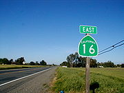
State Route 16 (California)
Encyclopedia
State Route 16 is a state highway
in the northern
region of the U.S. state
of California
that runs from Route 20 in Colusa County
to Route 49
just outside Plymouth
in Amador County
. It is discontinuous near Sacramento
, being an unsigned route that runs concurrently with both Interstate 5
and U.S. Route 50
.
and is eligible for the State Scenic Highway System
. However, it is not designated as a scenic highway by Caltrans. It is known as the Stanley L. Van Vleck Memorial Highway from Dillard Road in Sacramento County to the Amador County line.
near Wilbur Springs
at the junction with State Route 20
. A few miles south of this terminus, SR 16 enters Yolo County
and passes Cache Creek Canyon Regional Park. SR 16 parallels Cache Creek
on its routing from the county line to the end of the western segment. SR 16 then goes through Rumsey
, Guinda
, Brooks
, Capay
, Esparto
, and Madison
, intersecting with County Route E4 and passing by the Blue Cliffs and Bald Mountain
in the process. East of Madison, SR 16 interchanges with Interstate 505 before heading east toward Woodland
. In Woodland, at the junction with County Route E7 southbound, SR 16 turns north and merges with Interstate 5 southbound. Although SR 16 continues on Interstate 5 south to U.S. Route 50, this concurrency
is not signed or designated on most maps.
, where it crosses the Cosumnes River
, SR 16 enters Amador County
. SR 16 then ascends into the Sierra Nevada foothills, leaving the Central Valley. In Amador County, SR 16 passes near Forest Home before intersecting with State Route 124 and terminating at State Route 49
.
 The two ends of SR 16 were added to the state highway system by the third bond issue, passed by the state's voters in 1919: Route 50 from Lower Lake
east to Rumsey
and Route 54 from the Sacramento
-Amador
County line east to Drytown
. Each was connected to Sacramento
by existing or planned paved county highway
s. Although the exact alignment of Route 50 was not specified, the state Department of Engineering had already surveyed a 35-mile (56 km) route through Cache Creek Canyon pursuant to a 1915 law, which defined the Yolo and Lake Highway "following generally, the meanderings of Cache creek" but did not make it a state highway. By 1924, the California Highway Commission
's engineers had realized that building Route 50 through the canyon was impractical, and adopted a substitute plan for two highways connecting Lower Lake and Rumsey with the planned Route 15 (Tahoe-Ukiah Highway, now State Route 20) to the north in September 1925. The western connection, to Lower Lake, became part of Route 49 (now State Route 53
there), which continued south from Lower Lake to Calistoga
.
Each route was extended to Sacramento in 1933 over the aforementioned county highways, taking Route 50 southeast from Rumsey to Woodland
near Cache Creek and then alongside the Sacramento River
to the I Street Bridge
, and Route 54 west from the county line to Route 11 just outside Sacramento. The entirety of both routes, from SR 20 near Wilbur Springs
through Sacramento to State Route 49
just north of Drytown
(and initially overlapping SR 49 to Jackson
), was included in the initial state sign route system in 1934 as Sign Route 16. Through downtown Sacramento, SR 16 followed U.S. 40 (Legislative Route 6) and U.S. 50 (Legislative Route 11), mostly on Capitol Avenue, while Legislative Route 50 continued south on 5th Street (later a one-way pair
of 3rd and 5th Streets) and turned east on Broadway, carrying Sign Route 24
most of the way to Freeport Boulevard. In the 1964 renumbering, Route 16 became the new legislative designation, and Sign Route 24 through Sacramento was replaced with State Route 99
and State Route 160
. As neither of these used what had been Sign Route 24 along 3rd and 5th Streets and Broadway, part of Route 16's new definition ("Route 5 near Woodland to Sacramento") was used for several years on this alignment until it became part of State Route 99 later that decade. This left the western segment of SR 16 ending at Interstate 5 near the east end of the I Street Bridge until 1984, when the Woodland-Sacramento portion, which had become redundant with the parallel Interstate 5 complete, was deleted from the legislative definition. It was at about this time that SR 16 was rerouted from the intersection with County Route E7 to continue north on a bypass of Woodland instead of east to Interstate 5.
{| class=wikitable
!County
!Location
!Postmile
!Destinations
!Notes
|-
|Colusa
COL 0.00-7.26
|Wilbur Springs
|0.00
|
|
|-
|rowspan=4|Yolo
YOL 0.00-R43.42
|Capay
|
|
|
|-
|
|32.23
|
|Interchange
|-
|Woodland
|bgcolor=#ddffdd|R40.57
|bgcolor=#ddffdd|
|bgcolor=#ddffdd|West end of I-5 Bus. overlap; Main Street was former SR 16 east
|-
|
|bgcolor=#ddffdd|R43.42
|bgcolor=#ddffdd|
|bgcolor=#ddffdd|Interchange; east end of I-5 Bus. overlap
|-
|colspan=5 align=center|Gap in SR 16
|-
|rowspan=8|Sacramento
SAC T1.66-R23.96
|rowspan=4|Sacramento
|T1.66
|
|Interchange
|-
|T1.95
|Folsom Boulevard
west, Power Inn Road
|Former SR 16 west / US 50
west
|-
|T2.53
|Folsom Boulevard
east, Notre Dame Drive
|Former US 50
east
|-
|3.02
|Florin Perkins Road
|
|-
|
|4.17
|South Watt Avenue
|
|-
|
|6.22
|Bradshaw Road – Elk Grove
|
|-
|Rancho Cordova
|R11.47
|
|
|-
|
|12.54
|Grant Line Road – Folsom
, Sheldon, Elk Grove
|
|-
|rowspan=2|Amador
AMA R0.00-9.37
|
|9.09
|
|
|-
|Central House
|9.37
|
|
State highway
State highway, state road or state route can refer to one of three related concepts, two of them related to a state or provincial government in a country that is divided into states or provinces :#A...
in the northern
Northern California
Northern California is the northern portion of the U.S. state of California. The San Francisco Bay Area , and Sacramento as well as its metropolitan area are the main population centers...
region of the U.S. state
U.S. state
A U.S. state is any one of the 50 federated states of the United States of America that share sovereignty with the federal government. Because of this shared sovereignty, an American is a citizen both of the federal entity and of his or her state of domicile. Four states use the official title of...
of California
California
California is a state located on the West Coast of the United States. It is by far the most populous U.S. state, and the third-largest by land area...
that runs from Route 20 in Colusa County
Colusa County, California
Colusa County is a county located in the Central Valley of the U.S. state of California, northwest of state capital Sacramento. As of the 2010 census, its population was 21,419. The county seat is Colusa.-History:...
to Route 49
California State Route 49
State Route 49 is a north–south state highway in the U.S. state of California that passes through many historic mining communities of the 1849 California gold rush. Highway 49 is numbered after the "49ers", the waves of immigrants who swept into the area looking for gold, and a portion of it...
just outside Plymouth
Plymouth, California
Plymouth is a city in Amador County, California, United States. The population was 980 at the 2000 census. The town was originally named Pokerville, when it was settled during the time of the Gold Rush...
in Amador County
Amador County, California
Amador County is a county located in the Sierra Nevada of the U.S. state of California. As of the 2010 census, the population was 38,091. The county seat is Jackson.Amador County bills itself as "The Heart of the Mother Lode" and lies within the Gold Country...
. It is discontinuous near Sacramento
Sacramento
Sacramento is the capital of the state of California, in the United States of America.Sacramento may also refer to:- United States :*Sacramento County, California*Sacramento, Kentucky*Sacramento – San Joaquin River Delta...
, being an unsigned route that runs concurrently with both Interstate 5
Interstate 5 in California
Interstate 5 is a major north–south route of the Interstate Highway System in the U.S. state of California. It begins at the Mexico – United States border at the San Ysidro crossing, goes north across the length of California and crosses into Oregon south of the Medford-Ashland metropolitan...
and U.S. Route 50
U.S. Route 50 in California
In the U.S. state of California, U.S. Route 50 runs east from I-80 in West Sacramento to the Nevada state line in South Lake Tahoe. Portions within Sacramento are known as the Capital City Freeway and El Dorado Freeway...
.
Route description
SR 16 is part of the California Freeway and Expressway SystemCalifornia Freeway and Expressway System
The California Freeway and Expressway System is a system of existing or planned freeways and expressways in the U.S. state of California. It is defined by the Streets and Highways Code.-List of roads in the system:*State Route 1 *State Route 2...
and is eligible for the State Scenic Highway System
State Scenic Highway System (California)
The State Scenic Highway System is a list of highways, mainly state highways, that have been designated by the California Department of Transportation as scenic highways. The California State Legislature, primarily through Section 263 of the Streets and Highways Code, makes highways eligible for...
. However, it is not designated as a scenic highway by Caltrans. It is known as the Stanley L. Van Vleck Memorial Highway from Dillard Road in Sacramento County to the Amador County line.
Western section
State Route 16 begins in Colusa CountyColusa County, California
Colusa County is a county located in the Central Valley of the U.S. state of California, northwest of state capital Sacramento. As of the 2010 census, its population was 21,419. The county seat is Colusa.-History:...
near Wilbur Springs
Wilbur Springs, California
Wilbur Springs is an unincorporated community in Colusa County, California. It lies at an elevation of 1450 feet ....
at the junction with State Route 20
State Route 20 (California)
California State Route 20 , commonly known as Highway 20 or 20, is a state highway in the northern central region of the U.S. state of California, running east–west across the state north of Sacramento...
. A few miles south of this terminus, SR 16 enters Yolo County
Yolo County, California
Yolo County is a county located in the northern part of the U.S. state of California, bordered by the other counties of Sacramento, Solano, Napa, Lake, Colusa, and Sutter. The city of Woodland is its county seat, though Davis is its largest city....
and passes Cache Creek Canyon Regional Park. SR 16 parallels Cache Creek
Cache Creek (Kern County, California)
Cache Creek is a dry wash which carries flashfloods from Tehachapi, California, USA into the Mojave desert during infrequent rains. A small settlement where the dry wash enters the desert is also known as Cache Creek. Cache Creek settlement is located at the intersection of Randsburg Cutoff and...
on its routing from the county line to the end of the western segment. SR 16 then goes through Rumsey
Rumsey, California
Rumsey is an unincorporated community in Yolo County, California. It is located northwest of Esparto, in the Capay Valley, in the northwestern part of the county. Rumsey's ZIP Code is 95679 and its area code 530. It lies at an elevation of 420 feet ....
, Guinda
Guinda, California
Guinda is a census-designated place in Yolo County, California. It is located in the Capay Valley, in the northwestern portion of the county, northwest of Esparto. Guinda's ZIP Code is 95637 and its area code 530. It lies at an elevation of 361 feet ....
, Brooks
Brooks, California
Brooks is an unincorporated community in Yolo County, California located in the Capay Valley in the northwest of the county. Brooks' ZIP Code is 95606 and its area code 530. Brooks is home to a large casino Cache Creek Casino Resort. It lies at an elevation of 341 feet .A post office was opened...
, Capay
Capay, California
Capay is an unincorporated community in Yolo County, California. It is located on Cache Creek west-northwest of Esparto, in the Capay Valley, in the northwestern part of the county. Capay's ZIP Code is 95607 and its area code 530. It lies at an elevation of 210 feet...
, Esparto
Esparto, California
Esparto is a census-designated place in Yolo County, California, United States. It is part of the Sacramento–Arden-Arcade–Roseville Metropolitan Statistical Area...
, and Madison
Madison, California
Madison is a census-designated place in Yolo County, California. Madison's ZIP Code is 95653 and its area code 530. It is located west of Woodland, at an elevation of 151 feet . The 2010 United States census reported Madison's population was 503.-History:The Cache Creek post office opened in...
, intersecting with County Route E4 and passing by the Blue Cliffs and Bald Mountain
Bald Mountain (California)
Bald Mountain is a name given to over fifty summits in California.* In Sugarloaf Ridge State Park there are two Bald Mountain summits, both located on the Sonoma-Napa County border:**The northern one, at , rises to an elevation of...
in the process. East of Madison, SR 16 interchanges with Interstate 505 before heading east toward Woodland
Woodland, California
Woodland is the county seat of Yolo County, California, located approximately northwest of Sacramento, and is a part of the Sacramento - Arden-Arcade - Roseville Metropolitan Statistical Area. The population was 55,468 at the 2010 census.Woodland's origins trace back to 1850 when California...
. In Woodland, at the junction with County Route E7 southbound, SR 16 turns north and merges with Interstate 5 southbound. Although SR 16 continues on Interstate 5 south to U.S. Route 50, this concurrency
Concurrency (road)
A concurrency, overlap, or coincidence in a road network is an instance of one physical road bearing two or more different highway, motorway, or other route numbers...
is not signed or designated on most maps.
Eastern section
The eastern segment of SR 16 begins at U.S. Route 50 east of Sacramento. SR 16 heads east through Perkins as Jackson Road. After it passes near Bridge House and Rancho MurietaRancho Murieta, California
Rancho Murieta is a census-designated place and guard-gated community in Sacramento County, California, United States. It is part of the Sacramento–Arden-Arcade–Roseville Metropolitan Statistical Area. The population was 5,488 at the 2010 census, up from 4,193 at the 2000 census...
, where it crosses the Cosumnes River
Cosumnes River
The Cosumnes River is a river in northern California in the United States. It rises on the western slope of the Sierra Nevada and flows approximately into the Central Valley, emptying into the Mokelumne River in the Sacramento-San Joaquin Delta.-Name:...
, SR 16 enters Amador County
Amador County, California
Amador County is a county located in the Sierra Nevada of the U.S. state of California. As of the 2010 census, the population was 38,091. The county seat is Jackson.Amador County bills itself as "The Heart of the Mother Lode" and lies within the Gold Country...
. SR 16 then ascends into the Sierra Nevada foothills, leaving the Central Valley. In Amador County, SR 16 passes near Forest Home before intersecting with State Route 124 and terminating at State Route 49
California State Route 49
State Route 49 is a north–south state highway in the U.S. state of California that passes through many historic mining communities of the 1849 California gold rush. Highway 49 is numbered after the "49ers", the waves of immigrants who swept into the area looking for gold, and a portion of it...
.
History
Lower Lake, California
Lower Lake is a census-designated place in Lake County, California, USA. Lower Lake is located east-southeast of Kelseyville, at an elevation of 1371 feet...
east to Rumsey
Rumsey, California
Rumsey is an unincorporated community in Yolo County, California. It is located northwest of Esparto, in the Capay Valley, in the northwestern part of the county. Rumsey's ZIP Code is 95679 and its area code 530. It lies at an elevation of 420 feet ....
and Route 54 from the Sacramento
Sacramento County, California
Sacramento County is a county in the U.S. state of California. Its county seat is Sacramento, which is also the state capital. As of 2010 the county had a population of 1,418,788....
-Amador
Amador County, California
Amador County is a county located in the Sierra Nevada of the U.S. state of California. As of the 2010 census, the population was 38,091. The county seat is Jackson.Amador County bills itself as "The Heart of the Mother Lode" and lies within the Gold Country...
County line east to Drytown
Drytown, California
Drytown is a census-designated place in Amador County, California. It is located south of Plymouth on Dry Creek, at an elevation of 646 feet . The current population is 167. The town is registered as California Historical Landmark #31. The community is in ZIP code 95699 and area code 209...
. Each was connected to Sacramento
Sacramento, California
Sacramento is the capital city of the U.S. state of California and the county seat of Sacramento County. It is located at the confluence of the Sacramento River and the American River in the northern portion of California's expansive Central Valley. With a population of 466,488 at the 2010 census,...
by existing or planned paved county highway
County highway
A county highway is a road in the United States and in the Canadian province of Ontario that is designated and/or maintained by the county highway department...
s. Although the exact alignment of Route 50 was not specified, the state Department of Engineering had already surveyed a 35-mile (56 km) route through Cache Creek Canyon pursuant to a 1915 law, which defined the Yolo and Lake Highway "following generally, the meanderings of Cache creek" but did not make it a state highway. By 1924, the California Highway Commission
California Highway Commission
The California Highway Commission was established in 1895 and continued until 1978 as the primary state highway bureaucracy in California.Their first noticeable efforts centered on the Lake Tahoe Wagon Road over the Sierra Nevada mountains...
's engineers had realized that building Route 50 through the canyon was impractical, and adopted a substitute plan for two highways connecting Lower Lake and Rumsey with the planned Route 15 (Tahoe-Ukiah Highway, now State Route 20) to the north in September 1925. The western connection, to Lower Lake, became part of Route 49 (now State Route 53
California State Route 53
State Route 53 , also known as the Clearlake Expressway, connects SR 29 and SR 20 via the city of Clearlake. It runs in a north–south direction east of Clear Lake. The entire length of the highway is a California Scenic Highway....
there), which continued south from Lower Lake to Calistoga
Calistoga, California
Calistoga is a city in Napa County, California, United States. The population was 5,155 at the 2010 census.-Geography:According to the United States Census Bureau, the city has a total area of , 99.30% of it land and 0.70% of it water.-Climate:...
.
Each route was extended to Sacramento in 1933 over the aforementioned county highways, taking Route 50 southeast from Rumsey to Woodland
Woodland, California
Woodland is the county seat of Yolo County, California, located approximately northwest of Sacramento, and is a part of the Sacramento - Arden-Arcade - Roseville Metropolitan Statistical Area. The population was 55,468 at the 2010 census.Woodland's origins trace back to 1850 when California...
near Cache Creek and then alongside the Sacramento River
Sacramento River
The Sacramento River is an important watercourse of Northern and Central California in the United States. The largest river in California, it rises on the eastern slopes of the Klamath Mountains, and after a journey south of over , empties into Suisun Bay, an arm of the San Francisco Bay, and...
to the I Street Bridge
I Street Bridge
The I Street Bridge is a historic metal truss swing bridge located on I Street in Sacramento, California crossing the Sacramento River connecting Yolo County with Sacramento County...
, and Route 54 west from the county line to Route 11 just outside Sacramento. The entirety of both routes, from SR 20 near Wilbur Springs
Wilbur Springs, California
Wilbur Springs is an unincorporated community in Colusa County, California. It lies at an elevation of 1450 feet ....
through Sacramento to State Route 49
California State Route 49
State Route 49 is a north–south state highway in the U.S. state of California that passes through many historic mining communities of the 1849 California gold rush. Highway 49 is numbered after the "49ers", the waves of immigrants who swept into the area looking for gold, and a portion of it...
just north of Drytown
Drytown, California
Drytown is a census-designated place in Amador County, California. It is located south of Plymouth on Dry Creek, at an elevation of 646 feet . The current population is 167. The town is registered as California Historical Landmark #31. The community is in ZIP code 95699 and area code 209...
(and initially overlapping SR 49 to Jackson
Jackson, California
Jackson is the county seat of Amador County, California. The population was 4,651 at the 2010 census, up from 3,989 at the 2000 census...
), was included in the initial state sign route system in 1934 as Sign Route 16. Through downtown Sacramento, SR 16 followed U.S. 40 (Legislative Route 6) and U.S. 50 (Legislative Route 11), mostly on Capitol Avenue, while Legislative Route 50 continued south on 5th Street (later a one-way pair
One-way pair
A one-way pair, one-way couple, or just couplet is a pair of parallel, usually one-way streets that carry opposite directions of a signed route or major traffic flow, or sometimes opposite directions of a bus or streetcar route....
of 3rd and 5th Streets) and turned east on Broadway, carrying Sign Route 24
California State Route 24
State Route 24 in the U.S. state of California is a heavily-traveled east–west freeway in the eastern side of the San Francisco Bay Area of northern California that runs from the Interstate 580/Interstate 980 interchange in Oakland to the Interstate 680 junction in Walnut Creek...
most of the way to Freeport Boulevard. In the 1964 renumbering, Route 16 became the new legislative designation, and Sign Route 24 through Sacramento was replaced with State Route 99
California State Route 99
California State Route 99 , commonly known as Highway 99 or, simply, as 99 , is a north–south state highway in the U.S. state of California, stretching almost the entire length of the Central Valley...
and State Route 160
California State Route 160
State Route 160 is a state highway in the U.S. state of California consisting of two sections. The longer, southern, section is a scenic highway through the alluvial plain of the Sacramento River, linking SR 4 in Antioch with Sacramento via the Antioch Bridge...
. As neither of these used what had been Sign Route 24 along 3rd and 5th Streets and Broadway, part of Route 16's new definition ("Route 5 near Woodland to Sacramento") was used for several years on this alignment until it became part of State Route 99 later that decade. This left the western segment of SR 16 ending at Interstate 5 near the east end of the I Street Bridge until 1984, when the Woodland-Sacramento portion, which had become redundant with the parallel Interstate 5 complete, was deleted from the legislative definition. It was at about this time that SR 16 was rerouted from the intersection with County Route E7 to continue north on a bypass of Woodland instead of east to Interstate 5.
Major intersections
- Note: Except where prefixed with a letter, postmiles were measured in 1964, based on the alignment as it existed at that time, and do not necessarily reflect current mileage. The numbers reset at county lines; the start and end postmiles in each county are given in the county column.
{| class=wikitable
!County
!Location
!Postmile
!Destinations
!Notes
|-
|Colusa
Colusa County, California
Colusa County is a county located in the Central Valley of the U.S. state of California, northwest of state capital Sacramento. As of the 2010 census, its population was 21,419. The county seat is Colusa.-History:...
COL 0.00-7.26
|Wilbur Springs
Wilbur Springs, California
Wilbur Springs is an unincorporated community in Colusa County, California. It lies at an elevation of 1450 feet ....
|0.00
|
|
|-
|rowspan=4|Yolo
Yolo County, California
Yolo County is a county located in the northern part of the U.S. state of California, bordered by the other counties of Sacramento, Solano, Napa, Lake, Colusa, and Sutter. The city of Woodland is its county seat, though Davis is its largest city....
YOL 0.00-R43.42
|Capay
Capay, California
Capay is an unincorporated community in Yolo County, California. It is located on Cache Creek west-northwest of Esparto, in the Capay Valley, in the northwestern part of the county. Capay's ZIP Code is 95607 and its area code 530. It lies at an elevation of 210 feet...
|
|
|
|-
|
|32.23
|
|Interchange
|-
|Woodland
Woodland, California
Woodland is the county seat of Yolo County, California, located approximately northwest of Sacramento, and is a part of the Sacramento - Arden-Arcade - Roseville Metropolitan Statistical Area. The population was 55,468 at the 2010 census.Woodland's origins trace back to 1850 when California...
|bgcolor=#ddffdd|R40.57
|bgcolor=#ddffdd|
|bgcolor=#ddffdd|West end of I-5 Bus. overlap; Main Street was former SR 16 east
|-
|
|bgcolor=#ddffdd|R43.42
|bgcolor=#ddffdd|
|bgcolor=#ddffdd|Interchange; east end of I-5 Bus. overlap
|-
|colspan=5 align=center|Gap in SR 16
|-
|rowspan=8|Sacramento
Sacramento County, California
Sacramento County is a county in the U.S. state of California. Its county seat is Sacramento, which is also the state capital. As of 2010 the county had a population of 1,418,788....
SAC T1.66-R23.96
|rowspan=4|Sacramento
Sacramento, California
Sacramento is the capital city of the U.S. state of California and the county seat of Sacramento County. It is located at the confluence of the Sacramento River and the American River in the northern portion of California's expansive Central Valley. With a population of 466,488 at the 2010 census,...
|T1.66
|
|Interchange
|-
|T1.95
|Folsom Boulevard
Folsom Boulevard
Folsom Boulevard is a major east–west arterial in Sacramento County, California in the United States. Its western terminus is at Alhambra Boulevard in the East Sacramento section of Sacramento and its eastern terminus is at Greenback Lane in Folsom....
west, Power Inn Road
|Former SR 16 west / US 50
U.S. Route 50 in California
In the U.S. state of California, U.S. Route 50 runs east from I-80 in West Sacramento to the Nevada state line in South Lake Tahoe. Portions within Sacramento are known as the Capital City Freeway and El Dorado Freeway...
west
|-
|T2.53
|Folsom Boulevard
Folsom Boulevard
Folsom Boulevard is a major east–west arterial in Sacramento County, California in the United States. Its western terminus is at Alhambra Boulevard in the East Sacramento section of Sacramento and its eastern terminus is at Greenback Lane in Folsom....
east, Notre Dame Drive
|Former US 50
U.S. Route 50 in California
In the U.S. state of California, U.S. Route 50 runs east from I-80 in West Sacramento to the Nevada state line in South Lake Tahoe. Portions within Sacramento are known as the Capital City Freeway and El Dorado Freeway...
east
|-
|3.02
|Florin Perkins Road
|
|-
|
|4.17
|South Watt Avenue
|
|-
|
|6.22
|Bradshaw Road – Elk Grove
Elk Grove, California
Elk Grove is a city in Sacramento County, California, located just south of the state capital of Sacramento. It is part of the Sacramento–Arden-Arcade–Roseville Metropolitan Statistical Area. As of the 2010 census, the population of the city is 153,015...
|
|-
|Rancho Cordova
Rancho Cordova, California
Rancho Cordova is a city in Sacramento County, California, USA, that incorporated in 2003. It is part of the Sacramento Metropolitan Area. The population was 64,776 at the 2010 census. Rancho Cordova is the Sacramento area's largest employment sub-center, with a daily influx of over 45,000...
|R11.47
|
|
|-
|
|12.54
|Grant Line Road – Folsom
Folsom, California
Folsom is a city in Sacramento County, California, United States. Folsom is most commonly known for its famous Folsom Prison. The population was 72,203 at the 2010 census....
, Sheldon, Elk Grove
Elk Grove, California
Elk Grove is a city in Sacramento County, California, located just south of the state capital of Sacramento. It is part of the Sacramento–Arden-Arcade–Roseville Metropolitan Statistical Area. As of the 2010 census, the population of the city is 153,015...
|
|-
|rowspan=2|Amador
Amador County, California
Amador County is a county located in the Sierra Nevada of the U.S. state of California. As of the 2010 census, the population was 38,091. The county seat is Jackson.Amador County bills itself as "The Heart of the Mother Lode" and lies within the Gold Country...
AMA R0.00-9.37
|
|9.09
|
|
|-
|Central House
|9.37
|
|