
.gif)
Route 23 (New Jersey)
Encyclopedia
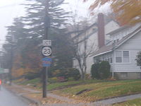
Route 23 is a state highway
in the northern part of New Jersey
in the United States
. The route runs 52.63 mi (84.7 km) from County Route 506
(Bloomfield Avenue) and County Route 577
(Prospect Avenue) in Verona
, Essex County
northwest to the border with New York
at Montague Township
in Sussex County
, where the road continues to Port Jervis, New York
as Orange County Route 15. Route 23 heads through Essex and Passaic
Counties as a suburban arterial varying from two to four lanes and becomes a six-lane freeway north of a complex interchange with U.S. Route 46
and Interstate 80
in Wayne
. The freeway carries Route 23 north to a concurrency
with U.S. Route 202
. Past the freeway portion, the route heads northwest along the border of Morris
and Passaic Counties as a four- to six-lane divided highway with a wide median at places, winding through mountainous areas and crossing Interstate 287
in Riverdale
. The route continues northwest through Sussex County as a mostly two-lane, undivided road that passes through farmland and woodland as well as the communities of Franklin
, Hamburg
, and Sussex
before reaching the New York border just south of an interchange with Interstate 84
near High Point State Park.
Route 23 was established in 1927 to run from Verona to the New York border near Port Jervis, replacing pre-1927 Route 8 between Verona and Sussex. The route followed two turnpikes that were created in the early 19th century: the Newark-Pompton Turnpike
and the Paterson-Hamburg Turnpike. In the mid 1950s, there were plans to build an Interstate Highway along Route 23 between Interstate 80 and Interstate 287, but it was never built. In the 1960s, the route was planned to be upgraded to a freeway all the way up to Port Jervis and south to Piscataway, Middlesex County
; however, both freeway proposals were cancelled in the early 1970s. In the mid 1980s, the portion of Route 23 from north of U.S. Route 46 in Wayne to Interstate 287 in Riverdale was improved, with the road upgraded to a six-lane freeway south of the Alps Road intersection and to a six-lane surface road north of Alps Road.
 Route 23 begins at an intersection with County Route 506
(Bloomfield Avenue) and County Route 577
(Prospect Avenue) in Verona
, heading to the north through residences and some businesses along four-lane, undivided Pompton Avenue. After a short distance, the road forms the border between Cedar Grove
to the west and Verona to the east before fully enters Cedar Grove. In Cedar Grove, the route narrows to two lanes at the County Route 640 before widening to four lanes again at the County Route 639 intersection. Shortly before leaving Cedar Grove, Route 23 crosses County Route 604 (Lindsley Road), which also heads to the west as County Route 527
.
, Passaic County
, where it narrows to two lanes and becomes the Newark-Pompton Turnpike
. In Little Falls, Route 23 heads through the central part of the community before crossing the Passaic River
into Wayne
where the road leaves the Newark-Pompton Turnpike briefly and widens to a four lane divided highway
. Route 23 passes two shopping malls, Willowbrook Mall
and Wayne Towne Center
, and enters the "Spaghetti Bowl" interchange with U.S. Route 46
and Interstate 80
.
North of Interstate 80, the road rejoins the route of the Newark-Pompton Turnpike and becomes a six-lane freeway, featuring a cloverleaf interchange
with West Belt Road that provides access to the Wayne Route 23 Transit Center
. Route 23 continues north with frontage road
s serving businesses, coming to an interchange with U.S. Route 202
and County Route 511 Alternate, forming a concurrency
with U.S. Route 202. The road interchanges with County Route 670 (Alps Road) and then with County Route 683, where the Newark-Pompton Turnpike again leaves Route 23 and U.S. Route 202, which continue north from this point as a surface road through commercial areas. At a U-turn ramp, the eastbound direction of County Route 504
follows both directions of the road, having to use the ramp in order to continue across the road. Northbound U.S. Route 202 splits from Route 23, where the cut-off intersection with County Route 504 is located. At this point, the westbound direction of County Route 504 and the southbound direction of U.S. Route 202 follow southbound Route 23 until an intersection.
Route 23 crosses into Pequannock Township
in Morris County
and passes over the Pompton River
. In Pequannock, the road is a six-lane divided highway with at-grade intersections, some controlled by jughandle
s, that heads through a mix of businesses and woodland. At the north end of Pequannock, it intersects County Route 660, where the Newark-Pompton Turnpike rejoins Route 23. The route intersects County Route 511 Alternate (Boulevard) and crosses into Riverdale
, with County Route 511 Alternate following Route 23 until it heads to the north on the Newark-Pompton Turnpike. Route 23 interchanges with Interstate 287
and climbs a hill past the interchange, heading to the west. The route runs through Kinnelon
before entering Butler
. In Butler, Route 23 passes through commercial areas, crossing County Route 511
(Boonton Avenue) before heading northwest. The road drops to four lanes, still divided by a Jersey barrier
. It heads under Maple Lake Road before passing through Kinnelon again. Upon leaving Kinnelon, the route enters West Milford
in Passaic County at the crossing of the Pequannock River
. At this point, the route enters a more wooded, mountainous setting, following the Pequannock River.
Route 23 joins the Hamburg Turnpike and the road splits, with the southbound lanes crossing over the Pequannock River into Kinnelon for a time. The route passes by the Charlotteburg Reservoir, a reservoir for the Newark
public water supply. Route 23 intersects County Route 513
(Union Valley Road), running concurrent with that route. The southbound lanes cross the Pequannock River into Jefferson Township
, Morris County and County Route 513 splits from Route 23 by heading south on Green Pond Road. The southbound lanes cross back into West Milford, where the two separate roads rejoin. The infamous Clinton Road
leaves at a traffic light from the northbound lanes and the route passes by some residences past Clinton Road. Route 23 continues northwest through forested areas, passing by the Oak Ridge Reservoir, another reservoir that provides water for Newark. The route crosses the Pequannock River three times, running within Jefferson Township between the first two crossings and past the third crossing.
, Sussex County
and comes to an intersection with County Route 515
(Stockholm-Vernon Road). Past this intersection, the divided highway ends and Route 23 becomes a two-lane, undivided road. The road heads to the northwest through wooded mountains and turns west on a winding road with a wide painted median, crossing into Franklin
and meeting County Route 517
(Munsonhurst Road). County Route 517 heads north along with Route 23, with the wide median ending, and the road continues through residential and commercial areas of Franklin with a brief wide painted median near the County Route 631 (Franklin Avenue) intersection. The road crosses a stream, Mill Brook, into Hamburg
, where County Route 517 splits from Route 23 by heading east on Quarry Road. Route 23 continues north on Hamburg Turnpike through wooded residential areas of Hamburg, crossing Route 94. The route crosses back into Hardyston Township, heading north through a mix of farms and forests.
Route 23 crosses the Wallkill River
into Wantage Township
and continues north to an intersection with County Route 565
(Glenwood Road), running concurrent with that route and gaining a wide painted median past that intersection which eventually turns into a center left-turn lane. The road passes some businesses and becomes a two-lane divided highway before County Route 565 departs from Route 23 by heading west on Lewisburg Road. Route 23 crosses into Sussex
, where the route becomes Hamburg Avenue and turns into an undivided highway again, passing by residences. The route intersects Route 284 (E. Main Street) before turning left onto Loomis Avenue, where County Route 643 continues north on Main Street. Immediately after turning onto Loomis Avenue, County Route 639 continues west on Loomis Avenue and Route 23 heads north on Mill Street. The route becomes Clove Avenue before crossing back into Wantage Township.
In Wantage Township, Route 23 continues north through farmland and woodland, eventually turning west. It comes to an intersection with County Route 519
(Colesville-Lusscroft Road) and turns north, running concurrent with that route through forested areas until County Route 519 heads north on Greenville Road. Route 23 continues northwest and enters Montague Township
, where the road heads into heavily forested High Point State Park, which is home to the highest elevation in New Jersey. The route descends through Montague Township along a winding road, passing by some businesses immediately before heading to the New York
state line. The road continues into Orange County, New York
as County Route 15 (Tappen Road) for less than one-half mile to an interchange with Interstate 84
and an intersection with U.S. Route 6
in Port Jervis
. Although Interstate 84 does not enter New Jersey, the signs on it for the interchange with County Route 15 refer to Route 23, even though some signs erroneously refer to it as New York State Route 23.
 Route 23 uses part of two 19th-century roads, the Newark-Pompton Turnpike, which was built between 1806 and 1811, and the Paterson-Hamburg Turnpike, which was incorporated in 1806. Due to realignments, the current alignment of Route 23 bypasses the intersection of these two turnpikes. In the original system of New Jersey highways, the Newark-Pompton Turnpike and Paterson-Hamburg Turnpike were combined to form pre-1927 Route 8, which ran from Montclair
to the New York border near Unionville, New York, running along the alignment of current Route 23 north to Sussex and following present-day Route 284 north of Sussex. In the 1927 New Jersey State Highway renumbering
, Route 23 was designated to run from Route 9 (now County Route 506) in Verona north to the New York border near Port Jervis, replacing pre-1927 Route 8 from Verona to Sussex.
In the 1955 plan for the Interstate Highway System, an Interstate Highway was planned along the Route 23 corridor between Interstate 80 in Wayne and Interstate 287 in Pompton Plains, also connecting to a proposed Interstate along the Route 3 corridor. However, this proposed Interstate was never built. Plans were made in the early 1960s for a Route 23 freeway running from Interstate 80 north to Interstate 84 in Port Jervis, New York, providing improved freeway access to northwestern New Jersey. This proposed freeway, which was to cost $120 million, was cancelled in the early 1970s due to financial troubles and feared environmental issues. A part of this cancelled freeway was to be resurrected as an eastern bypass of Franklin and Hamburg in the early 1980s, but this proposed bypass was never built due to opposition from local businesses. A 1966 proposal called for Route 23 to be extended south as a freeway to Interstate 287 in Piscataway in Middlesex County
, running parallel to the Garden State Parkway
. This $300 million freeway was added to planning maps in 1969 as Route 807 but was also cancelled in the early 1970s.
In the late 1970s, the New Jersey Department of Transportation
made plans to rebuild the section of Route 23, at the time a four-lane undivided road, between Interstate 80 and Interstate 287 to a six-lane freeway between Interstate 80 and Alps Road and a six-lane surface road north of Alps Road. Construction on these improvements began in 1983 and were completed in 1986. With these improvements to the route, many traffic circle
s were removed, including one at U.S. Route 46 that was replaced with a complex interchange. In 2008, the "Spaghetti Bowl" interchange with Interstate 80 and U.S. Route 46 was improved, costing $70 million.
In 2010, the New Jersey Department of Transportation began plans to move Route 23 to a new alignment through Sussex. With this project, the current bridge over the Papakating Creek is to be replaced and a new road for the southbound lanes is planned to be built, while the current Route 23 will become northbound only. The project is planned to last from July 2012 to November 2014.
|rowspan=9|Passaic
|rowspan=9|Wayne
|colspan=5 align="center"|South end of freeway
|-
|-
|colspan=5 align="center"|North end of freeway
|-
State highway
State highway, state road or state route can refer to one of three related concepts, two of them related to a state or provincial government in a country that is divided into states or provinces :#A...
in the northern part of New Jersey
New Jersey
New Jersey is a state in the Northeastern and Middle Atlantic regions of the United States. , its population was 8,791,894. It is bordered on the north and east by the state of New York, on the southeast and south by the Atlantic Ocean, on the west by Pennsylvania and on the southwest by Delaware...
in the United States
United States
The United States of America is a federal constitutional republic comprising fifty states and a federal district...
. The route runs 52.63 mi (84.7 km) from County Route 506
County Route 506 (New Jersey)
County Route 506 is a county highway in the U.S. state of New Jersey. The highway extends 10.74 miles from Oak Road in Fairfield to Route 7 at the Passaic River in Belleville.- Route description :...
(Bloomfield Avenue) and County Route 577
County Route 577 (New Jersey)
County Route 577, abbreviated CR 577, is a county highway in the U.S. state of New Jersey. The highway extends from Springfield Avenue in Springfield Township to Bloomfield Avenue in Verona.-Route description:...
(Prospect Avenue) in Verona
Verona, New Jersey
Verona is a township in Essex County, New Jersey, United States. As of the 2010 United States Census, the township population was 13,332.In 2008, New Jersey Monthly magazine ranked Verona #1 in Essex County and #3 in New Jersey as "Top Places to Live in New Jersey".-History:Verona and several...
, Essex County
Essex County, New Jersey
Essex County is a county located in the northeastern part of the U.S. state of New Jersey. As of the United States 2010 Census, the population was 783,969, ranking it third in the state after Bergen County and Middlesex County; Essex County's population has declined from 786,147 as of the bureau's...
northwest to the border with New York
New York
New York is a state in the Northeastern region of the United States. It is the nation's third most populous state. New York is bordered by New Jersey and Pennsylvania to the south, and by Connecticut, Massachusetts and Vermont to the east...
at Montague Township
Montague Township, New Jersey
-Transportation:One U.S., state, and county route traverse the township. U.S. Route 206 passes through in the western part and crosses the Delaware River at the Milford-Montague Toll Bridge. Route 23 passes through the eastern part and serves as the entrance road to High Point State Park and ends...
in Sussex County
Sussex County, New Jersey
The County of Sussex is the northernmost county in the State of New Jersey. It is part of the New York City Metropolitan Area. As of the 2010 Federal decennial census, 149,265 persons resided in Sussex County...
, where the road continues to Port Jervis, New York
Port Jervis, New York
Port Jervis is a city on the Delaware River in western Orange County, New York, with a population of 8,860 at the 2000 census. The communities of Deerpark, Huguenot, Sparrowbush, and Greenville are adjacent to Port Jervis, and the towns of Montague, New Jersey and Matamoras, Pennsylvania face the...
as Orange County Route 15. Route 23 heads through Essex and Passaic
Passaic County, New Jersey
Passaic County is a county located in the U.S. state of New Jersey. As of the 2010 Census, the population was 501,226. Its county seat is Paterson...
Counties as a suburban arterial varying from two to four lanes and becomes a six-lane freeway north of a complex interchange with U.S. Route 46
U.S. Route 46
U.S. Route 46 is an east–west U.S. Highway, running for , completely within the state of New Jersey. The west end is at an interchange with Interstate 80 and Route 94 in Columbia, Warren County on the Delaware River...
and Interstate 80
Interstate 80 in New Jersey
Interstate 80 is a major Interstate Highway in the United States, running from the New York City Metropolitan Area westward to San Francisco, California...
in Wayne
Wayne, New Jersey
Wayne is a Township in Passaic County, New Jersey, United States, located less than from midtown Manhattan. As of the United States 2000 Census, the township had a total population of 54,069....
. The freeway carries Route 23 north to a concurrency
Concurrency (road)
A concurrency, overlap, or coincidence in a road network is an instance of one physical road bearing two or more different highway, motorway, or other route numbers...
with U.S. Route 202
U.S. Route 202 in New Jersey
U.S. Route 202 is a U.S. Highway running from New Castle, Delaware northeast to Bangor, Maine. In the U.S. state of New Jersey, the route runs from the New Hope-Lambertville Toll Bridge over the Delaware River at the Pennsylvania border in Delaware Township, Hunterdon County near Lambertville...
. Past the freeway portion, the route heads northwest along the border of Morris
Morris County, New Jersey
Morris County is a county located in the U.S. state of New Jersey, about west of New York City. According to the United States 2010 Census, the population was 492,276. It is part of the New York Metropolitan Area. Its county seat is Morristown....
and Passaic Counties as a four- to six-lane divided highway with a wide median at places, winding through mountainous areas and crossing Interstate 287
Interstate 287
Interstate 287 is an auxiliary Interstate Highway in the U.S. states of New Jersey and New York. It is a partial beltway around New York City, serving the northern half of New Jersey and the counties of Rockland and Westchester in New York...
in Riverdale
Riverdale, New Jersey
As of the census of 2000, there were 2,498 people, 919 households, and 671 families residing in the borough. The population density was 1,215.2 people per square mile . There were 940 housing units at an average density of 457.3 per square mile...
. The route continues northwest through Sussex County as a mostly two-lane, undivided road that passes through farmland and woodland as well as the communities of Franklin
Franklin, New Jersey
Franklin is a Borough in Sussex County, New Jersey, United States. As of the 2010 United States Census, the borough population was 5,045.Franklin, known as the "Fluorescent Mineral Capital of the World," is located over a rich ore body containing more than 150 minerals, many of them fluorescent and...
, Hamburg
Hamburg, New Jersey
Hamburg is a Borough in Sussex County, New Jersey, United States. As of the United States 2010 Census, the borough population was 3,277.In 1753, when Sussex County was formed, Hamburg was part of New Town; on February 25, 1762, it became part of the newly established Hardyston Township...
, and Sussex
Sussex, New Jersey
Sussex is a borough in Sussex County, New Jersey, United States. As of the 2010 census, the borough population was 2,130.Sussex was incorporated as a borough by an act of the New Jersey Legislature on October 14, 1891, as Deckertown, from portions of Wantage...
before reaching the New York border just south of an interchange with Interstate 84
Interstate 84 in New York
Interstate 84 is a part of the Interstate Highway System that runs from Dunmore, Pennsylvania, to Sturbridge, Massachusetts, in the Eastern United States. In New York, I-84 extends from the Pennsylvania state line at Port Jervis to the Connecticut state line east of Brewster...
near High Point State Park.
Route 23 was established in 1927 to run from Verona to the New York border near Port Jervis, replacing pre-1927 Route 8 between Verona and Sussex. The route followed two turnpikes that were created in the early 19th century: the Newark-Pompton Turnpike
Newark-Pompton Turnpike
The Newark-Pompton Turnpike , is a roadway in northern New Jersey that was originally a tolled turnpike. The roadway was first laid out in the mid-18th century and given its name in 1806...
and the Paterson-Hamburg Turnpike. In the mid 1950s, there were plans to build an Interstate Highway along Route 23 between Interstate 80 and Interstate 287, but it was never built. In the 1960s, the route was planned to be upgraded to a freeway all the way up to Port Jervis and south to Piscataway, Middlesex County
Middlesex County, New Jersey
-Demographics:As of the census of 2000, there were 750,162 people, 265,815 households, and 190,855 families residing in the county. The population density was 2,422 people per square mile . There were 273,637 housing units at an average density of 884 per square mile...
; however, both freeway proposals were cancelled in the early 1970s. In the mid 1980s, the portion of Route 23 from north of U.S. Route 46 in Wayne to Interstate 287 in Riverdale was improved, with the road upgraded to a six-lane freeway south of the Alps Road intersection and to a six-lane surface road north of Alps Road.
Essex County
County Route 506 (New Jersey)
County Route 506 is a county highway in the U.S. state of New Jersey. The highway extends 10.74 miles from Oak Road in Fairfield to Route 7 at the Passaic River in Belleville.- Route description :...
(Bloomfield Avenue) and County Route 577
County Route 577 (New Jersey)
County Route 577, abbreviated CR 577, is a county highway in the U.S. state of New Jersey. The highway extends from Springfield Avenue in Springfield Township to Bloomfield Avenue in Verona.-Route description:...
(Prospect Avenue) in Verona
Verona, New Jersey
Verona is a township in Essex County, New Jersey, United States. As of the 2010 United States Census, the township population was 13,332.In 2008, New Jersey Monthly magazine ranked Verona #1 in Essex County and #3 in New Jersey as "Top Places to Live in New Jersey".-History:Verona and several...
, heading to the north through residences and some businesses along four-lane, undivided Pompton Avenue. After a short distance, the road forms the border between Cedar Grove
Cedar Grove, New Jersey
-Climate:Cedar Grove has a humid subtropical climate, with warm/hot humid summers and cool/cold winters. The climate is slightly colder overall during the summer than in New York City because there is no urban heat island effect....
to the west and Verona to the east before fully enters Cedar Grove. In Cedar Grove, the route narrows to two lanes at the County Route 640 before widening to four lanes again at the County Route 639 intersection. Shortly before leaving Cedar Grove, Route 23 crosses County Route 604 (Lindsley Road), which also heads to the west as County Route 527
County Route 527 (New Jersey)
County Route 527 is a county highway in the U.S. state of New Jersey. The highway extends from Main Street in Toms River Township to Pompton Avenue in Cedar Grove. It is the second longest county highway in New Jersey after Route 519. It was first given the number 527 in 1954...
.
Passaic and Morris Counties
The road crosses into Little FallsLittle Falls, New Jersey
Little Falls is a township in Passaic County, New Jersey, United States. As of the 2000 United States Census, the township population was 10,855. It is located about from New York City....
, Passaic County
Passaic County, New Jersey
Passaic County is a county located in the U.S. state of New Jersey. As of the 2010 Census, the population was 501,226. Its county seat is Paterson...
, where it narrows to two lanes and becomes the Newark-Pompton Turnpike
Newark-Pompton Turnpike
The Newark-Pompton Turnpike , is a roadway in northern New Jersey that was originally a tolled turnpike. The roadway was first laid out in the mid-18th century and given its name in 1806...
. In Little Falls, Route 23 heads through the central part of the community before crossing the Passaic River
Passaic River
The Passaic River is a mature surface river, approximately 80 mi long, in northern New Jersey in the United States. The river in its upper course flows in a highly circuitous route, meandering through the swamp lowlands between the ridge hills of rural and suburban northern New Jersey,...
into Wayne
Wayne, New Jersey
Wayne is a Township in Passaic County, New Jersey, United States, located less than from midtown Manhattan. As of the United States 2000 Census, the township had a total population of 54,069....
where the road leaves the Newark-Pompton Turnpike briefly and widens to a four lane divided highway
Divided Highway
Divided Highway is a compilation album by American rock band The Doobie Brothers, released in 2003. . All tracks are taken from the albums Cycles and Brotherhood .-Track listing:...
. Route 23 passes two shopping malls, Willowbrook Mall
Willowbrook Mall (Wayne, New Jersey)
Willowbrook Mall is a two-level, major shopping center located in Wayne, New Jersey, United States. It is near the intersection of U.S. Route 46, Route 23 and Interstate 80. The mall opened in 1969 and was expanded or renovated in 1970, 1988, and 2006...
and Wayne Towne Center
Wayne Towne Center
The Wayne Towne Center is a regional shopping center located in Wayne, New Jersey, right next to Willowbrook Mall. As of 2008, the mall had a gross leasable area of . The center formerly operated as an indoor shopping mall from the time of its building as the West Belt Mall in the 1970s until 2008,...
, and enters the "Spaghetti Bowl" interchange with U.S. Route 46
U.S. Route 46
U.S. Route 46 is an east–west U.S. Highway, running for , completely within the state of New Jersey. The west end is at an interchange with Interstate 80 and Route 94 in Columbia, Warren County on the Delaware River...
and Interstate 80
Interstate 80 in New Jersey
Interstate 80 is a major Interstate Highway in the United States, running from the New York City Metropolitan Area westward to San Francisco, California...
.
North of Interstate 80, the road rejoins the route of the Newark-Pompton Turnpike and becomes a six-lane freeway, featuring a cloverleaf interchange
Cloverleaf interchange
A cloverleaf interchange is a two-level interchange in which left turns, reverse direction in left-driving regions, are handled by ramp roads...
with West Belt Road that provides access to the Wayne Route 23 Transit Center
Wayne-Route 23 (NJT station)
Wayne Route 23 Transit Center is a New Jersey Transit park-and-ride station in Wayne, New Jersey along the Montclair-Boonton Line, also providing bus service to Newark and New York City. It is located off of the southbound lanes of Route 23, near the West Belt Road Interchange, where Route 23,...
. Route 23 continues north with frontage road
Frontage road
A frontage road is a non-limited access road running parallel to a higher-speed road, usually a freeway, and feeding it at appropriate points of access...
s serving businesses, coming to an interchange with U.S. Route 202
U.S. Route 202 in New Jersey
U.S. Route 202 is a U.S. Highway running from New Castle, Delaware northeast to Bangor, Maine. In the U.S. state of New Jersey, the route runs from the New Hope-Lambertville Toll Bridge over the Delaware River at the Pennsylvania border in Delaware Township, Hunterdon County near Lambertville...
and County Route 511 Alternate, forming a concurrency
Concurrency (road)
A concurrency, overlap, or coincidence in a road network is an instance of one physical road bearing two or more different highway, motorway, or other route numbers...
with U.S. Route 202. The road interchanges with County Route 670 (Alps Road) and then with County Route 683, where the Newark-Pompton Turnpike again leaves Route 23 and U.S. Route 202, which continue north from this point as a surface road through commercial areas. At a U-turn ramp, the eastbound direction of County Route 504
County Route 504 (New Jersey)
County Route 504 is a county highway in the U.S. state of New Jersey. The highway extends 15.94 miles from Main Street in Montville County Route 504 is a county highway in the U.S. state of New Jersey. The highway extends 15.94 miles (25.65 kilometers) from Main Street in Montville County Route...
follows both directions of the road, having to use the ramp in order to continue across the road. Northbound U.S. Route 202 splits from Route 23, where the cut-off intersection with County Route 504 is located. At this point, the westbound direction of County Route 504 and the southbound direction of U.S. Route 202 follow southbound Route 23 until an intersection.
Route 23 crosses into Pequannock Township
Pequannock Township, New Jersey
Pequannock Township is a Township in Morris County, New Jersey, United States. As of the United States 2000 Census, the township population was 13,888....
in Morris County
Morris County, New Jersey
Morris County is a county located in the U.S. state of New Jersey, about west of New York City. According to the United States 2010 Census, the population was 492,276. It is part of the New York Metropolitan Area. Its county seat is Morristown....
and passes over the Pompton River
Pompton River
The Pompton River is a tributary of the Passaic River, approximately 8 mi long, in northern New Jersey in the United States....
. In Pequannock, the road is a six-lane divided highway with at-grade intersections, some controlled by jughandle
Jughandle
A jughandle is a type of ramp or slip road that changes the way traffic turns left at at-grade intersections. Instead of a standard left turn being made from the left lane, left-turning traffic uses a ramp on the right side of the road...
s, that heads through a mix of businesses and woodland. At the north end of Pequannock, it intersects County Route 660, where the Newark-Pompton Turnpike rejoins Route 23. The route intersects County Route 511 Alternate (Boulevard) and crosses into Riverdale
Riverdale, New Jersey
As of the census of 2000, there were 2,498 people, 919 households, and 671 families residing in the borough. The population density was 1,215.2 people per square mile . There were 940 housing units at an average density of 457.3 per square mile...
, with County Route 511 Alternate following Route 23 until it heads to the north on the Newark-Pompton Turnpike. Route 23 interchanges with Interstate 287
Interstate 287
Interstate 287 is an auxiliary Interstate Highway in the U.S. states of New Jersey and New York. It is a partial beltway around New York City, serving the northern half of New Jersey and the counties of Rockland and Westchester in New York...
and climbs a hill past the interchange, heading to the west. The route runs through Kinnelon
Kinnelon, New Jersey
Kinnelon is a Borough in Morris County, New Jersey, United States. As of the 2010 United States Census, the borough population was 10,248. It is a low density, suburban community, with many parks and trails....
before entering Butler
Butler, New Jersey
Butler is a Borough in Morris County, New Jersey, United States. As of the 2010 United States Census, the borough population was 7,539.Butler was incorporated as a borough by an Act of the New Jersey Legislature on March 13, 1901, from portions of Pequannock Township.-Geography:Butler is located at...
. In Butler, Route 23 passes through commercial areas, crossing County Route 511
County Route 511 (New Jersey)
County Route 511 is a county highway in the U.S. state of New Jersey. The highway extends 37.44 miles from Columbia Avenue in Morris Township to the New York state line in West Milford....
(Boonton Avenue) before heading northwest. The road drops to four lanes, still divided by a Jersey barrier
Jersey barrier
A Jersey barrier or Jersey wall is a modular concrete barrier employed to separate lanes of traffic. It is designed to both minimize vehicle damage in cases of incidental contact while still preventing crossover in the case of head-on accidents....
. It heads under Maple Lake Road before passing through Kinnelon again. Upon leaving Kinnelon, the route enters West Milford
West Milford, New Jersey
West Milford is a township in Passaic County, New Jersey, United States. As of the 2010 United States Census, the township population was 25,850.-History:...
in Passaic County at the crossing of the Pequannock River
Pequannock River
The Pequannock River is a tributary of the Pompton River, approximately 20 miles long, located in northern New Jersey in the United States....
. At this point, the route enters a more wooded, mountainous setting, following the Pequannock River.
Route 23 joins the Hamburg Turnpike and the road splits, with the southbound lanes crossing over the Pequannock River into Kinnelon for a time. The route passes by the Charlotteburg Reservoir, a reservoir for the Newark
Newark, New Jersey
Newark is the largest city in the American state of New Jersey, and the seat of Essex County. As of the 2010 United States Census, Newark had a population of 277,140, maintaining its status as the largest municipality in New Jersey. It is the 68th largest city in the U.S...
public water supply. Route 23 intersects County Route 513
County Route 513 (New Jersey)
County Route 513 is a county highway in the U.S. state of New Jersey. The highway extends from Kingwood Avenue in Frenchtown to Lakeside Road in West Milford...
(Union Valley Road), running concurrent with that route. The southbound lanes cross the Pequannock River into Jefferson Township
Jefferson Township, New Jersey
Jefferson Township is the northern-most township in Morris County, New Jersey, United States. As of the 2010 United States Census, the township population was 21,314....
, Morris County and County Route 513 splits from Route 23 by heading south on Green Pond Road. The southbound lanes cross back into West Milford, where the two separate roads rejoin. The infamous Clinton Road
Clinton Road
Clinton Road is located in West Milford, Passaic County, New Jersey. It runs in a generally north-south direction, beginning at Route 23 near Newfoundland and running roughly 10 miles to its northern terminus at Upper Greenwood Lake....
leaves at a traffic light from the northbound lanes and the route passes by some residences past Clinton Road. Route 23 continues northwest through forested areas, passing by the Oak Ridge Reservoir, another reservoir that provides water for Newark. The route crosses the Pequannock River three times, running within Jefferson Township between the first two crossings and past the third crossing.
Sussex County
Route 23 enters Hardyston TownshipHardyston Township, New Jersey
Hardyston Township is a Township in Sussex County, New Jersey, United States. As of the United States 2000 Census, the township population was 6,171.-Geography:...
, Sussex County
Sussex County, New Jersey
The County of Sussex is the northernmost county in the State of New Jersey. It is part of the New York City Metropolitan Area. As of the 2010 Federal decennial census, 149,265 persons resided in Sussex County...
and comes to an intersection with County Route 515
County Route 515 (New Jersey)
County Route 515 is a county highway in the U.S. state of New Jersey. The highway extends from Route 23 in Hardyston Township to the New York state line in Vernon Township. Between Route 23 and Route 94, this highway is known as Vernon-Stolkholm Road. The road then runs concurrent with NJ 94 for ....
(Stockholm-Vernon Road). Past this intersection, the divided highway ends and Route 23 becomes a two-lane, undivided road. The road heads to the northwest through wooded mountains and turns west on a winding road with a wide painted median, crossing into Franklin
Franklin, New Jersey
Franklin is a Borough in Sussex County, New Jersey, United States. As of the 2010 United States Census, the borough population was 5,045.Franklin, known as the "Fluorescent Mineral Capital of the World," is located over a rich ore body containing more than 150 minerals, many of them fluorescent and...
and meeting County Route 517
County Route 517 (New Jersey)
County Route 517 is a county highway in the U.S. state of New Jersey. The highway extends from Lamington Road in Tewksbury Township to the New York state line in Vernon Township where it continues as Orange County Route 26. It mainly traverses through small, rural communities and unincorporated...
(Munsonhurst Road). County Route 517 heads north along with Route 23, with the wide median ending, and the road continues through residential and commercial areas of Franklin with a brief wide painted median near the County Route 631 (Franklin Avenue) intersection. The road crosses a stream, Mill Brook, into Hamburg
Hamburg, New Jersey
Hamburg is a Borough in Sussex County, New Jersey, United States. As of the United States 2010 Census, the borough population was 3,277.In 1753, when Sussex County was formed, Hamburg was part of New Town; on February 25, 1762, it became part of the newly established Hardyston Township...
, where County Route 517 splits from Route 23 by heading east on Quarry Road. Route 23 continues north on Hamburg Turnpike through wooded residential areas of Hamburg, crossing Route 94. The route crosses back into Hardyston Township, heading north through a mix of farms and forests.
Route 23 crosses the Wallkill River
Wallkill River
The Wallkill River, a tributary of the Hudson, drains Lake Mohawk in Sparta, New Jersey, flowing from there generally northeasterly to Rondout Creek in New York, near Rosendale, with the combined flows reaching the Hudson at Kingston....
into Wantage Township
Wantage Township, New Jersey
Wantage Township is a Township in Sussex County, New Jersey, United States. As of the 2000 United States Census, the township population was 10,387.-Geography:...
and continues north to an intersection with County Route 565
County Route 565 (New Jersey)
County Route 565, abbreviated CR 565, is a county highway in the U.S. state of New Jersey. The highway extends from U.S. Route 206 / Route 15 in Frankford Township to McAfee Glenwood Road in Vernon Township.-Route description:...
(Glenwood Road), running concurrent with that route and gaining a wide painted median past that intersection which eventually turns into a center left-turn lane. The road passes some businesses and becomes a two-lane divided highway before County Route 565 departs from Route 23 by heading west on Lewisburg Road. Route 23 crosses into Sussex
Sussex, New Jersey
Sussex is a borough in Sussex County, New Jersey, United States. As of the 2010 census, the borough population was 2,130.Sussex was incorporated as a borough by an act of the New Jersey Legislature on October 14, 1891, as Deckertown, from portions of Wantage...
, where the route becomes Hamburg Avenue and turns into an undivided highway again, passing by residences. The route intersects Route 284 (E. Main Street) before turning left onto Loomis Avenue, where County Route 643 continues north on Main Street. Immediately after turning onto Loomis Avenue, County Route 639 continues west on Loomis Avenue and Route 23 heads north on Mill Street. The route becomes Clove Avenue before crossing back into Wantage Township.
In Wantage Township, Route 23 continues north through farmland and woodland, eventually turning west. It comes to an intersection with County Route 519
County Route 519 (New Jersey)
County Route 519 is a county highway in the U.S. state of New Jersey. The highway extends from Daniel Bray Highway in Delaware Township to the New York state line in Wantage Township...
(Colesville-Lusscroft Road) and turns north, running concurrent with that route through forested areas until County Route 519 heads north on Greenville Road. Route 23 continues northwest and enters Montague Township
Montague Township, New Jersey
-Transportation:One U.S., state, and county route traverse the township. U.S. Route 206 passes through in the western part and crosses the Delaware River at the Milford-Montague Toll Bridge. Route 23 passes through the eastern part and serves as the entrance road to High Point State Park and ends...
, where the road heads into heavily forested High Point State Park, which is home to the highest elevation in New Jersey. The route descends through Montague Township along a winding road, passing by some businesses immediately before heading to the New York
New York
New York is a state in the Northeastern region of the United States. It is the nation's third most populous state. New York is bordered by New Jersey and Pennsylvania to the south, and by Connecticut, Massachusetts and Vermont to the east...
state line. The road continues into Orange County, New York
Orange County, New York
Orange County is a county located in the U.S. state of New York. It is part of the Poughkeepsie–Newburgh–Middletown, NY Metropolitan Statistical Area and is located at the northern reaches of the New York metropolitan area. The county sits in the state's scenic Mid-Hudson Region of the Hudson Valley...
as County Route 15 (Tappen Road) for less than one-half mile to an interchange with Interstate 84
Interstate 84 in New York
Interstate 84 is a part of the Interstate Highway System that runs from Dunmore, Pennsylvania, to Sturbridge, Massachusetts, in the Eastern United States. In New York, I-84 extends from the Pennsylvania state line at Port Jervis to the Connecticut state line east of Brewster...
and an intersection with U.S. Route 6
U.S. Route 6 in New York
U.S. Route 6 is a part of the U.S. Highway System that runs from Bishop, California, to Provincetown, Massachusetts. In New York, US 6 extends from the Pennsylvania state line at Port Jervis to the Connecticut state line east of Brewster...
in Port Jervis
Port Jervis, New York
Port Jervis is a city on the Delaware River in western Orange County, New York, with a population of 8,860 at the 2000 census. The communities of Deerpark, Huguenot, Sparrowbush, and Greenville are adjacent to Port Jervis, and the towns of Montague, New Jersey and Matamoras, Pennsylvania face the...
. Although Interstate 84 does not enter New Jersey, the signs on it for the interchange with County Route 15 refer to Route 23, even though some signs erroneously refer to it as New York State Route 23.
History
Montclair, New Jersey
-Demographics:As of the census of 2000, there were 38,977 people, 15,020 households, and 9,687 families residing in the township. The population density was 6,183.6 people per square mile . There were 15,531 housing units at an average density of 2,464.0 per square mile...
to the New York border near Unionville, New York, running along the alignment of current Route 23 north to Sussex and following present-day Route 284 north of Sussex. In the 1927 New Jersey State Highway renumbering
1927 New Jersey state highway renumbering
In 1927, New Jersey's state highways were renumbered. The old system, which had been defined in sequence by the legislature, was growing badly, as several routes shared the same number, and many unnumbered state highways had been defined...
, Route 23 was designated to run from Route 9 (now County Route 506) in Verona north to the New York border near Port Jervis, replacing pre-1927 Route 8 from Verona to Sussex.
In the 1955 plan for the Interstate Highway System, an Interstate Highway was planned along the Route 23 corridor between Interstate 80 in Wayne and Interstate 287 in Pompton Plains, also connecting to a proposed Interstate along the Route 3 corridor. However, this proposed Interstate was never built. Plans were made in the early 1960s for a Route 23 freeway running from Interstate 80 north to Interstate 84 in Port Jervis, New York, providing improved freeway access to northwestern New Jersey. This proposed freeway, which was to cost $120 million, was cancelled in the early 1970s due to financial troubles and feared environmental issues. A part of this cancelled freeway was to be resurrected as an eastern bypass of Franklin and Hamburg in the early 1980s, but this proposed bypass was never built due to opposition from local businesses. A 1966 proposal called for Route 23 to be extended south as a freeway to Interstate 287 in Piscataway in Middlesex County
Middlesex County, New Jersey
-Demographics:As of the census of 2000, there were 750,162 people, 265,815 households, and 190,855 families residing in the county. The population density was 2,422 people per square mile . There were 273,637 housing units at an average density of 884 per square mile...
, running parallel to the Garden State Parkway
Garden State Parkway
The Garden State Parkway is a 172.4-mile limited-access toll parkway that stretches the length of New Jersey from the New York line at Montvale, New Jersey, to Cape May at New Jersey's southernmost tip. Its name refers to New Jersey's nickname, the "Garden State." Most New Jersey residents refer...
. This $300 million freeway was added to planning maps in 1969 as Route 807 but was also cancelled in the early 1970s.
In the late 1970s, the New Jersey Department of Transportation
New Jersey Department of Transportation
The New Jersey Department of Transportation is the agency responsible for transportation issues and policy in New Jersey. It is headed by the Commissioner of Transportation...
made plans to rebuild the section of Route 23, at the time a four-lane undivided road, between Interstate 80 and Interstate 287 to a six-lane freeway between Interstate 80 and Alps Road and a six-lane surface road north of Alps Road. Construction on these improvements began in 1983 and were completed in 1986. With these improvements to the route, many traffic circle
Traffic circle
A traffic circle or rotary is a type of circular intersection in which traffic must travel in one direction around a central island. In some countries, traffic entering the circle has the right-of-way and drivers in the circle must yield. In many other countries, traffic entering the circle must...
s were removed, including one at U.S. Route 46 that was replaced with a complex interchange. In 2008, the "Spaghetti Bowl" interchange with Interstate 80 and U.S. Route 46 was improved, costing $70 million.
In 2010, the New Jersey Department of Transportation began plans to move Route 23 to a new alignment through Sussex. With this project, the current bridge over the Papakating Creek is to be replaced and a new road for the southbound lanes is planned to be built, while the current Route 23 will become northbound only. The project is planned to last from July 2012 to November 2014.
Major intersections
|-|rowspan=9|Passaic
Passaic County, New Jersey
Passaic County is a county located in the U.S. state of New Jersey. As of the 2010 Census, the population was 501,226. Its county seat is Paterson...
|rowspan=9|Wayne
Wayne, New Jersey
Wayne is a Township in Passaic County, New Jersey, United States, located less than from midtown Manhattan. As of the United States 2000 Census, the township had a total population of 54,069....
|colspan=5 align="center"|South end of freeway
|-
|-
|colspan=5 align="center"|North end of freeway
|-