

U.S. Route 46
Encyclopedia
U.S. Route 46 is an east–west U.S. Highway, running for 75.34 mi (121.25 km), completely within the state of New Jersey
. The west end is at an interchange with Interstate 80
(I-80) and Route 94 in Columbia
, Warren County
on the Delaware River
. The east end is in the middle of the George Washington Bridge
over the Hudson River
in Fort Lee
, Bergen County
while the route is concurrent with I-95
and US 1/9
. Throughout much of its length, US 46 is closely paralleled by I-80. US 46 is a major local and suburban route, with some sections built to or near freeway standards and many other sections arterials with jughandle
s. The route runs through several communities in the northern part of New Jersey, including Hackettstown
, Netcong
, Dover
, Parsippany-Troy Hills
, Wayne
, Clifton
, and Ridgefield Park
. The road has been ceremonially named the United Spanish-American War
Veterans Memorial Highway.
What is now US 46 was originally designated as three separate routes. Pre-1927 Route 5 was created in 1916 to follow the road from Delaware
to Denville
, pre-1927 Route 12 in 1917 to follow the route between Hackettstown and Paterson
, and pre-1927 Route 10 in 1917 to run between Paterson and Edgewater
. In 1927, Route 6 was legislated to run from Delaware east to the George Washington Bridge, replacing portions of Routes 5 and 12 and paralleling the former Route 10, which itself became Route 5 and Route 10N, the latter being shortly removed from the state highway system. In 1936, US 46 was designated to run from US 611 in Portland, Pennsylvania
east to the George Washington Bridge. The route replaced Pennsylvania Route 987 to the Delaware Bridge
over the Delaware, and from there followed Route 6 across New Jersey. In 1953, the Route 6 designation was removed from US 46 in New Jersey, and later that year, the route was realigned to end at US 611 in Columbia, New Jersey, replacing a part of Route 94. US 611 had been brought into New Jersey by two new bridges over the Delaware River, following a freeway between them that became a part of I-80. By 1969, US 611 was aligned back into Pennsylvania, and US 46’s western terminus remained as an interchange with I-80 and Route 94.
and Route 94 near the Portland-Columbia Toll Bridge
leading to Pennsylvania Route 611
in the community of Columbia
in Knowlton Township
, Warren County
. From this interchange, the route heads southeast along the east bank of the Delaware River
as a four-lane divided highway
briefly before narrowing into a two-lane undivided road. The road passes through wooded mountainous areas before reaching the community of Delaware
. In Delaware, US 46 intersects Route 163
, the approach to the former Delaware Bridge
, before passing a few commercial establishments. From here, the route continues alongside the river, passing more rural areas of woods and farms with occasional development as it enters White Township
. US 46 makes a sharp turn to the east away from the Delaware River, widening into a four-lane divided highway again as it bypasses the town of Belvidere
and has a few businesses on it. The road turns back into a two-lane undivided road and comes to a crossroads with CR 519
. Past this intersection, US 46 continues through rural sectors with some business before coming to the northern terminus of Route 31.
From this point, the route continues east through dense woods prior to turning northeast into Liberty Township
. The road passes through the community of Townsbury before crossing into Independence Township
. Here, US 46 enters more agricultural areas and turns east again, with development increasing along the road as it passes through Great Meadows-Vienna
. It continues southeast before entering Hackettstown
, where the road becomes Main Street. In Hackettstown, the route crosses New Jersey Transit
’s Morristown Line
and Montclair-Boonton Line
before coming to an intersection with CR 517
. Here, CR 517 forms a concurrency
with US 46, and the two routes continue southeast through the downtown area. At the intersection with the northern terminus of Route 182, CR 517 splits from US 46 by heading south on that route while US 46 continues to the east.
into Washington Township
, Morris County
, where it heads back into rural surroundings. About a mile into Morris County, US 46 divides and becomes a four lane highway, turning north and crossing over a mountain. It continues into Mount Olive Township
, taking a sharp turn to the east before the road becomes undivided while remaining four lanes. The road passes rural areas and development as it goes through Budd Lake
. In this community, the route passes to the south of the namesake lake as it begins to turn northeast and then north. The road heads northeast again before it enters Netcong
and becomes a divided highway as it comes to an interchange with I-80/US 206
. Within this interchange, the lanes of US 46 split. From this point, the route narrows back into a two-lane undivided road and runs through developed areas of Netcong a short distance to the south of New Jersey Transit’s Morristown Line/Montclair-Boonton Line. US 46 meets Route 183
at the Netcong Circle before widening into a four-lane undivided road and leaving Netcong for Roxbury Township
. Here, the road passes through wooded areas, meeting I-80 at another interchange and briefly becoming a divided highway at the crossing under I-80 and again at the actual interchange. US 46 remains a divided highway with jughandle
s past this point, continuing southeast into the Ledgewood
area.
At a three-way intersection which was formerly Ledgewood Circle
, Route 10 begins straight while US 46 turns left to continue east as a two-lane undivided road through more development. Upon passing through Kenvil
, the road enters Mine Hill Township
, where the road becomes three lanes with two westbound lanes and one eastbound lane. The route passes through Wharton
at its southern tip before continuing into Dover
. US 46 narrows back into two lanes, becoming Blackwell Street as it passes St. Clare's Dover General Hospital. The road widens to four lanes as Blackwell Street splits from it at an eastbound exit and westbound entrance prior to a bridge over the Rockaway River
and a New Jersey Transit line. A short distance later, US 46 passes over Route 15, with a ramp from westbound US 46 to northbound Route 15. From here, the route continues on McFarlan Street, intersecting the southern beginning of Route 15, which heads south from US 46 to loop back to the north. US 46 continues east, entering Rockaway Township
, where there is an intersection with CR 513
. Past CR 513, the road narrows to two lanes as it heads northeast through Rockaway Borough
before turning east and crossing the Rockaway River. The route continues northeast, entering wooded residential areas as it heads into Denville
and has a limited interchange with I-80, where it can only be entered to and from the westbound lane and where US 46 east can only be entered from the eastbound lane and to the eastbound lane. As it crosses under I-80, US 46 becomes a six-lane divided highway.
The road is lined with a moderate amounts of businesses, most with right-in/right-out
(RIRO) access, as it continues southeast through Denville, narrowing to four lanes before coming to an interchange with Route 53
. From this interchange, the route continues east before curving southeast and entering Mountain Lakes
. In Mountain Lakes, US 46 crosses under the Montclair-Boonton Line before continuing into Parsippany-Troy Hills
. Here, the road comes to US 202
/CR 511
before passing under I-287
. At this point, the westbound direction of US 46 has a ramp to northbound I-287, with access to and from southbound I-287 provided by US 202. Past the I-287 crossing, the road comes to another partial interchange with I-80 near the western terminus of I-280
. Past this interchange, US 46 widens to six lanes and enters Montville. In Montville, the route narrows back to four lanes, and has traffic light-controlled intersections with New Road and Hook Mountain Road/Chapin Road. It then has an interchange with Route 159 and makes a turn to the northeast. Upon crossing the Passaic River
, US 46 enters Essex County into Fairfield Township. A short distance into Essex County, US 46 has another interchange with Route 159 (Clinton Road), providing access to that route and to its continuation as CR 627 (Plymouth Street). Shortly farther along US 46, Route 159 and CR 627 meet it at a traffic light-controlled intersection, providing cross-traffic and turns onto US 46. Past this point, US 46 remains a surface road with RIRO-accessed driveways, but has several intersections controlled by interchanges. Within Fairfield, US 46 has interchanges with Hollywood Avenue and Passaic Avenue as well as two trumpet interchanges providing access to Fairfield Road, which runs a short distance to the south of US 46.
in Passaic County
. The median splits as the road passes to the north of the Willowbrook Mall
, with a exit serving the mall, before reaching the Spaghetti Bowl interchange with partial access to I-80 and full access to Route 23. Within this interchange, US 46 passes under the Montclair-Boonton Line again. From here, it passes businesses and many shopping centers with RIRO access as a six-lane highway, heading into Totowa
. In this area, the route has interchanges with CR 640 and Route 62/CR 646. The road turns southeast, crossing the Passaic River a third time into Little Falls
. At this point, US 46 runs along the Little Falls/Woodland Park border, interchanging CR 639 and Browertown Road. After the exit for Lower Notch Road, the route enters more wooded surroundings, interchanging with Notch Road/Rifle Camp Road before entering Clifton
. Upon reaching Clifton, US 46 has an interchange with Valley Road before Route 3 begins to the south-east as a freeway at another interchange.
 Past Route 3, the highway narrows to four lanes, continuing east-northeast as a limited-access divided highway with some RIRO-accessed businesses still on it, though many roads are accessed through over and underpasses. US 46 has an exit for Van Houten Avenue/Grove Street before coming to a large interchange with Route 19/CR 509
and the Garden State Parkway
. After this, the road has an exit for Hazel Street/Paulison Avenue before becoming Piaget Avenue, which passes through suburban areas with several intersections controlled by traffic lights again. Piaget Avenue splits from US 46 with an eastbound exit and westbound entrance, and US 46 turns into a limited-access road again, continuing east. It passes under New Jersey Transit’s Main Line
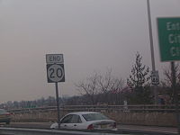
before coming to an interchange with the northern terminus of Route 21. From this interchange, the route turns north along the west bank of the Passaic River, crossing the Garden State Parkway again before widening to six lanes and meeting the southern terminus of Route 20 at an interchange near the border of Paterson
.
in Elmwood Park
. Immediately after the river, the route has an interchange for CR 507
. Passing through more RIRO-accessed business areas, the road narrows to four lanes and has a partial interchange with the Garden State Parkway. Past the parkway, US 46 continues as a road with some jughandles and other traffic light-controlled intersections (but still largely maintaining RIRO access to driveways and side streets), passing through a small corner of Garfield
before crossing into Saddle Brook
. Within Saddle Brook, the road turns more to the southeast and crosses over New Jersey Transit’s Bergen County Line
. Continuing east, US 46 has an exit for with Outwater Lane and crosses into Lodi
. Through this area, there is no access across the median of US 46, as it interchanges with Main Street. The route continues into Hasbrouck Heights
, where it turns more south-southeast, interchanging with Boulevard. A short distance later, US 46 reaches an interchange with Route 17 and crosses New Jersey Transit’s Pascack Valley Line
near the Teterboro station.
From here, US 46 enters Teterboro
and interchanges with Green Street before continuing southeast as a six-lane highway through industrial areas, passing to the north of Teterboro Airport
. The road continues into Little Ferry
, where it passes suburban residential and commercial areas and narrows into a four-lane undivided road called Sylvan Avenue, turning to the east and crossing CR 503
. After intersecting the Bergen Turnpike at the modified Little Ferry Circle
, which US 46 runs through, the route crosses the Hackensack River
into Ridgefield Park
on a drawbridge
. In Ridgefield Park, the route is called Winant Avenue and becomes a four-lane divided highway before briefly becoming undivided again. Upon turning back into a divided highway, US 46 comes to a large interchange with I-95
/New Jersey Turnpike
. Past this interchange, the route widens to six lanes and crosses the Overpeck Creek
into Ridgefield
. Upon entering Palisades Park
, the road has an interchange with Route 93 before reaching a diamond interchange
with US 1/9
.
US 46 continues southeast as a four-lane freeway, with the US 1/9 ramps following the route a short distance before merging into the route. At this point, US 1/9 become concurrent with US 46 and the freeway makes a sharp turn to the north-northeast. The road has an interchange to the 5th Street and 6th Street frontage roads, which parallel the freeway through residential areas and provide access to CR 501
. US 1/9/46 continue into Fort Lee
, where it has access to a couple commercial areas via RIRO before encountering the northern terminus of Route 63
at a westbound exit and eastbound entrance. From here, the highway becomes a surface road that continues past more businesses and homes with RIRO access, angling northeast as it comes to an exit for Main Street. Immediately past this point, the road turns east and encounters a complex interchange with I-95, the eastern terminus of Route 4, and the southern terminus of US 9W
. Here, US 1/9/46 all join I-95 (although US 46 is unsigned east of this interchange) and continue to the southeast along a multilane freeway with local-express lane
configuration consisting of four local lanes and four express lanes in each direction, passing numerous high-rise buildings. The road has an interchange with Route 67 at GWB Plaza before coming to the eastbound toll plaza for the George Washington Bridge
. Past the toll plaza, there is an interchange for the Palisades Interstate Parkway
. After the Palisades Interstate Parkway, the road crosses the Hudson River
on the George Washington Bridge, which has eight lanes total on the upper deck (formed from the express lanes) and six lanes total on the lower deck (formed from the local lanes). At the New Jersey/New York
border on the bridge, US 46 ends while I-95 and US 1/9 continue into the borough of Manhattan
in New York City
on the Trans-Manhattan Expressway
.
near Delaware were bypassed with a short new road on the southwest side of the railroad. From there, Route 5 used the existing Delaware Road to north of Belvidere, then the Buttzville-Belvidere Road to Buttzville
, the Buttzville Road to Great Meadows
, and the Danville Mountain Road to Hackettstown.
From Hackettstown to Denville, Routes 5 ran concurrently with Pre-1927 Route 12, which was first legislated in 1917. A mostly-new road (now eastbound US 46) was built from Hackettstown east to Netcong to avoid steep grades on the existing roads. Portions of the existing Budd's Lake Road were used between Budd Lake and Netcong. From Netcong the route used the old Morris Turnpike to Ledgewood and the Dover Turnpike to Dover, running into Dover on Blackwell Street. Blackwell Street led to Rockaway Road, becoming Main Street in Rockaway, from which it used the old Parsippany and Rockaway Turnpike to Denville.
At Denville, Route 5 turned south, while Route 12 continued east along the Parsippany and Rockaway Turnpike to Pine Brook
. The route left the old turnpike there to head northeast towards Paterson, starting with the Pine Brook Road (now Fairfield Road and Little Falls Road) to Little Falls. A bypass was planned around the south side of Little Falls, taking it under the Erie Railroad
at Union Boulevard. From there Route 12 would use Union Boulevard, Totowa Road and McBride Avenue into Paterson. Pre-1927 Route 10, which was legislated in 1917, continued east on Market Street on the other side of Paterson to Edgewater
, where it connected to the Fort Lee Ferry across the Hudson River
. The new alignments were generally built as planned, except at Little Falls, where a bypass was to be built for Route 12.
Route 6 was redefined in 1929 to use none of the old road east of Paterson (it had formerly been planned to use Market Street west of roughly where Route 17 now crosses it), and Route 5 was cut back to run only east from Ridgefield
. The portion of pre-1927 Route 10 that was bypassed by Route 6 was designated Route 10N, but was eventually removed from the state highway system. In addition, Route 6 was redefined to bypass Paterson to the south. The new route would enter Paterson just south of Market Street, but then turn south and southwest before heading back west to rejoin the old route at the east end of the Little Falls bypass at the Union Boulevard crossing. The old road along Union Boulevard towards Paterson was assigned Route S6, as a spur of Route 6. Route S6 became Route 62 in the 1953 renumbering, and has since been truncated to a short piece between US 46 and I-80
in Totowa.
By 1937, most of Route 6 had been completed with the exception of the Paterson bypass. In 1938, a spur of Route 6 called Route 6A was legislated to run from Route 6 in Dover north to US 206/Route S31 in Lafayette Township
; this became Route 15 in 1953. A realignment at the Passaic River crossing near Pine Brook was built in the 1940s, along with a new road for a short distance west from Pine Brook. The old road at the river became Route 6M, which was renumbered to Route 159 in 1953. Also in the 1940s, the road was widened west into Denville, and a bypass of downtown Denville, including an interchange
at Route 5N (now Route 53) was built. The Route 6 designation was dropped in favor of U.S. Route 46 in the 1953 renumbering.
connecting Limon
to Grand Junction
, but it instead became U.S. Highway 40S.
The current U.S. Route 46 was marked in 1936 between Portland, Pennsylvania
and the George Washington Bridge. At the time, the new Route 6 had not been completed from Route 2 (now Route 17) west to Route S6 (now Route 62), and so US 46 was marked through Paterson until this portion was completed by the 1940s. At the west end of Route 6, US 46 continued over the Delaware River on the Delaware Bridge
into Pennsylvania, replacing Pennsylvania Route 987 north to Portland, where it ended at US 611. The Delaware Water Gap Toll Bridge
and its associated freeway to Columbia (now I-80) opened in December 1953, as did the new Portland-Columbia Toll Bridge
.
At that time, US 611 was rerouted to cross the river twice in order to use the freeway through the Delaware Water Gap
, and US 46 was moved to former Route 94 (pre-1953 Route 8) to end at the Columbia, New Jersey side of the Portland-Columbia Toll Bridge. The former approaches to the Darlington's Bridge, which itself was dismantled by the Delaware River Joint Toll Bridge Commission
in 1954, became Route 163 in New Jersey and State Route 1039 in Pennsylvania. The US 611 freeway was designated I-80 in 1959, and US 611 was moved back to its old all-Pennsylvania alignment by 1969, leaving US 46 to end at I-80 and Route 94.
In 1964, the approach to the George Washington Bridge, shared with US 1/9, was rebuilt into a freeway that became a part of I-95. Since then, many changes have occurred to US 46.The Little Ferry Circle, initially constructed in 1933, was modified in 1985 to allow US 46 to run straight through the circle. In 1998, the Ledgewood Circle at the western terminus of Route 10 was replaced with a signalized T-intersection. In 2007, the NJDOT announced that they would eliminate the Little Ferry Circle by turning it into a straight intersection. The Netcong Circle at Route 183 is being replaced with a signalized intersection. This project, which is to cost $13.3 million, is to be complete in 2010. In addition, the interchange between US 46 and the western terminus of Route 3 is planned to be reconstructed. This project will reconfigure ramps, bring bridges up to standard, and will provide for three-lane connections between Route 3 and U.S. Route 46. It was announced in 2003 and is projected to cost $200 million.
New Jersey
New Jersey is a state in the Northeastern and Middle Atlantic regions of the United States. , its population was 8,791,894. It is bordered on the north and east by the state of New York, on the southeast and south by the Atlantic Ocean, on the west by Pennsylvania and on the southwest by Delaware...
. The west end is at an interchange with Interstate 80
Interstate 80 in New Jersey
Interstate 80 is a major Interstate Highway in the United States, running from the New York City Metropolitan Area westward to San Francisco, California...
(I-80) and Route 94 in Columbia
Columbia, New Jersey
Columbia is a census-designated place within Knowlton Township in Warren County, New Jersey, United States. The area is served as United States Postal Service ZIP Code 07832.As of the United States 2010 Census, the population for Columbia was 229....
, Warren County
Warren County, New Jersey
Warren County is a county located in the U.S. state of New Jersey. As of the 2010 Census, the population was 108,692. Its county seat is Belvidere...
on the Delaware River
Delaware River
The Delaware River is a major river on the Atlantic coast of the United States.A Dutch expedition led by Henry Hudson in 1609 first mapped the river. The river was christened the South River in the New Netherland colony that followed, in contrast to the North River, as the Hudson River was then...
. The east end is in the middle of the George Washington Bridge
George Washington Bridge
The George Washington Bridge is a suspension bridge spanning the Hudson River, connecting the Washington Heights neighborhood in the borough of Manhattan in New York City to Fort Lee, Bergen County, New Jersey. Interstate 95 and U.S. Route 1/9 cross the river via the bridge. U.S...
over the Hudson River
Hudson River
The Hudson is a river that flows from north to south through eastern New York. The highest official source is at Lake Tear of the Clouds, on the slopes of Mount Marcy in the Adirondack Mountains. The river itself officially begins in Henderson Lake in Newcomb, New York...
in Fort Lee
Fort Lee, New Jersey
Fort Lee is a borough in Bergen County, New Jersey, United States. As of the 2010 United States Census, the borough population was 35,345. Located atop the Hudson Palisades, the borough is the western terminus of the George Washington Bridge...
, Bergen County
Bergen County, New Jersey
Bergen County is the most populous county of the state of New Jersey, United States. As of the 2010 United States Census, its population was 905,116. The county is part of the New York City Metropolitan Area. Its county seat is Hackensack...
while the route is concurrent with I-95
Interstate 95 in New Jersey
Interstate 95 is a major Interstate Highway that traverses the full extent of the East Coast of the United States, from Florida to Maine...
and US 1/9
U.S. Route 1/9
U.S. Route 9 is a U.S. highway in the northeast United States, running from Laurel, Delaware north to the Canadian border near Champlain, New York...
. Throughout much of its length, US 46 is closely paralleled by I-80. US 46 is a major local and suburban route, with some sections built to or near freeway standards and many other sections arterials with jughandle
Jughandle
A jughandle is a type of ramp or slip road that changes the way traffic turns left at at-grade intersections. Instead of a standard left turn being made from the left lane, left-turning traffic uses a ramp on the right side of the road...
s. The route runs through several communities in the northern part of New Jersey, including Hackettstown
Hackettstown, New Jersey
Hackettstown is a town in Warren County, New Jersey, United States. As of the 2010 United States Census, the town population was 9,724. The town is located in the eastern most region of the Lehigh Valley....
, Netcong
Netcong, New Jersey
Netcong is a Borough in Morris County, New Jersey, United States. As of the United States 2000 Census, the borough population was 2,580. Its estimated population in 2006 was 3,292...
, Dover
Dover, New Jersey
Dover is a town in Morris County, New Jersey on the Rockaway River. Dover is west of New York City and west of Newark, New Jersey. As of the United States Census, 2000, the town's population was 18,188.-Geography:...
, Parsippany-Troy Hills
Parsippany-Troy Hills, New Jersey
Parsippany-Troy Hills Township, commonly called Parsippany, is a township in Morris County, New Jersey, United States. As of the 2000 United States Census, the township population was 50,649. The name Parsippany comes from the Lenape Native American word parsipanong, which means "the place where...
, Wayne
Wayne, New Jersey
Wayne is a Township in Passaic County, New Jersey, United States, located less than from midtown Manhattan. As of the United States 2000 Census, the township had a total population of 54,069....
, Clifton
Clifton, New Jersey
Clifton is a city in Passaic County, New Jersey, United States. As of the 2010 United States Census, the city had a total population of 84,136. The 2010 population represented an increase of 5,464 residents from its population of 78,672 in the 2000 Census, making it the state's 11th largest...
, and Ridgefield Park
Ridgefield Park, New Jersey
Ridgefield Park is a village in Bergen County, New Jersey, United States. The population was 12,729 at the 2010 United States Census. Of 566 municipalities statewide, Ridgefield Park is only one of three with a village type of government in New Jersey, along with Loch Arbour and Ridgewood.The...
. The road has been ceremonially named the United Spanish-American War
Spanish-American War
The Spanish–American War was a conflict in 1898 between Spain and the United States, effectively the result of American intervention in the ongoing Cuban War of Independence...
Veterans Memorial Highway.
What is now US 46 was originally designated as three separate routes. Pre-1927 Route 5 was created in 1916 to follow the road from Delaware
Delaware, Warren County, New Jersey
Delaware is a census-designated place within Knowlton Township in Warren County, New Jersey, United States. The area is served as United States Postal Service ZIP Code 07833....
to Denville
Denville, New Jersey
Denville is a township in Morris County, New Jersey, United States. As of the 2010 United States Census, the township population was 16,635. Denville is known as the "Hub of Morris County" for its location along major transportation routes at the center of the county...
, pre-1927 Route 12 in 1917 to follow the route between Hackettstown and Paterson
Paterson, New Jersey
Paterson is a city serving as the county seat of Passaic County, New Jersey, United States. As of the 2010 United States Census, its population was 146,199, rendering it New Jersey's third largest city and one of the largest cities in the New York City Metropolitan Area, despite a decrease of 3,023...
, and pre-1927 Route 10 in 1917 to run between Paterson and Edgewater
Edgewater, New Jersey
Edgewater is a borough located along the Hudson River in Bergen County, New Jersey. As of the 2010 census, the borough had a population of 11,513...
. In 1927, Route 6 was legislated to run from Delaware east to the George Washington Bridge, replacing portions of Routes 5 and 12 and paralleling the former Route 10, which itself became Route 5 and Route 10N, the latter being shortly removed from the state highway system. In 1936, US 46 was designated to run from US 611 in Portland, Pennsylvania
Portland, Pennsylvania
Portland is a borough in Northampton County, Pennsylvania, United States. Portland is located in the Lehigh Valley region of the state. It is part of Pennsylvania's Slate Belt.The population of Portland was 579 at the 2000 census.-Geography:...
east to the George Washington Bridge. The route replaced Pennsylvania Route 987 to the Delaware Bridge
Delaware Bridge
The Darlington's Bridge at Delaware Station was a highway bridge over the Delaware River in the community of Delaware, New Jersey . Formerly a railroad bridge constructed by the Delaware, Lackawanna and Western Railroad in 1855, the bridge was sold off when the new one upstream was constructed....
over the Delaware, and from there followed Route 6 across New Jersey. In 1953, the Route 6 designation was removed from US 46 in New Jersey, and later that year, the route was realigned to end at US 611 in Columbia, New Jersey, replacing a part of Route 94. US 611 had been brought into New Jersey by two new bridges over the Delaware River, following a freeway between them that became a part of I-80. By 1969, US 611 was aligned back into Pennsylvania, and US 46’s western terminus remained as an interchange with I-80 and Route 94.
Warren County
US 46 begins at a large interchange with I-80Interstate 80 in New Jersey
Interstate 80 is a major Interstate Highway in the United States, running from the New York City Metropolitan Area westward to San Francisco, California...
and Route 94 near the Portland-Columbia Toll Bridge
Portland-Columbia Toll Bridge
The Portland–Columbia Toll Bridge is a toll bridge that carries New Jersey Route 94 over the Delaware River, between Pennsylvania Route 611 at Portland, Pennsylvania and Columbia in Knowlton Township, New Jersey. It is owned and operated by the Delaware River Joint Toll Bridge Commission. U.S....
leading to Pennsylvania Route 611
Pennsylvania Route 611
Pennsylvania Route 611 is a major state highway in Pennsylvania, United States, running from Interstate 95 south of downtown Philadelphia north to Interstate 380 in Coolbaugh Township, Pennsylvania in The Poconos....
in the community of Columbia
Columbia, New Jersey
Columbia is a census-designated place within Knowlton Township in Warren County, New Jersey, United States. The area is served as United States Postal Service ZIP Code 07832.As of the United States 2010 Census, the population for Columbia was 229....
in Knowlton Township
Knowlton Township, New Jersey
- Local government :The Knowlton Township Committee consists of Mayor Frank Van Horn , Deputy Mayor Ronald Farber , Theresa Capriccio , René Mathez and Scott Odorizzi ....
, Warren County
Warren County, New Jersey
Warren County is a county located in the U.S. state of New Jersey. As of the 2010 Census, the population was 108,692. Its county seat is Belvidere...
. From this interchange, the route heads southeast along the east bank of the Delaware River
Delaware River
The Delaware River is a major river on the Atlantic coast of the United States.A Dutch expedition led by Henry Hudson in 1609 first mapped the river. The river was christened the South River in the New Netherland colony that followed, in contrast to the North River, as the Hudson River was then...
as a four-lane divided highway
Divided Highway
Divided Highway is a compilation album by American rock band The Doobie Brothers, released in 2003. . All tracks are taken from the albums Cycles and Brotherhood .-Track listing:...
briefly before narrowing into a two-lane undivided road. The road passes through wooded mountainous areas before reaching the community of Delaware
Delaware, Warren County, New Jersey
Delaware is a census-designated place within Knowlton Township in Warren County, New Jersey, United States. The area is served as United States Postal Service ZIP Code 07833....
. In Delaware, US 46 intersects Route 163
New Jersey Route 163
Route 163 is a short long state highway in the county of Warren in New Jersey. The route, which is currently a stub, used to be the approach to the destroyed Delaware Bridge, which was a road bridge over the Delaware River, connecting the settlement of Delaware, New Jersey with Portland,...
, the approach to the former Delaware Bridge
Delaware Bridge
The Darlington's Bridge at Delaware Station was a highway bridge over the Delaware River in the community of Delaware, New Jersey . Formerly a railroad bridge constructed by the Delaware, Lackawanna and Western Railroad in 1855, the bridge was sold off when the new one upstream was constructed....
, before passing a few commercial establishments. From here, the route continues alongside the river, passing more rural areas of woods and farms with occasional development as it enters White Township
White Township, New Jersey
-Demographics:As of the census of 2000, there were 4,245 people, 1,668 households, and 1,179 families residing in the township. The population density was 155.1 people per square mile . There were 1,770 housing units at an average density of 64.7 per square mile...
. US 46 makes a sharp turn to the east away from the Delaware River, widening into a four-lane divided highway again as it bypasses the town of Belvidere
Belvidere, New Jersey
Belvidere is a Town in Warren County, New Jersey, United States. As of the 2010 United States Census, the town population was 2,681. It is the county seat of Warren County....
and has a few businesses on it. The road turns back into a two-lane undivided road and comes to a crossroads with CR 519
County Route 519 (New Jersey)
County Route 519 is a county highway in the U.S. state of New Jersey. The highway extends from Daniel Bray Highway in Delaware Township to the New York state line in Wantage Township...
. Past this intersection, US 46 continues through rural sectors with some business before coming to the northern terminus of Route 31.
From this point, the route continues east through dense woods prior to turning northeast into Liberty Township
Liberty Township, New Jersey
-Demographics:As of the census of 2000, there were 2,765 people, 980 households, and 750 families residing in the township. The population density was 234.3 people per square mile . There were 1,088 housing units at an average density of 92.2 per square mile...
. The road passes through the community of Townsbury before crossing into Independence Township
Independence Township, New Jersey
-Demographics:As of the census of 2000, there were 5,603 people, 2,146 households, and 1,489 families residing in the township. The population density was 282.4 people per square mile . There were 2,210 housing units at an average density of 111.4 per square mile...
. Here, US 46 enters more agricultural areas and turns east again, with development increasing along the road as it passes through Great Meadows-Vienna
Great Meadows-Vienna, New Jersey
Great Meadows-Vienna is a census-designated place located within Independence Township and Liberty Township, in Warren County, New Jersey, United States...
. It continues southeast before entering Hackettstown
Hackettstown, New Jersey
Hackettstown is a town in Warren County, New Jersey, United States. As of the 2010 United States Census, the town population was 9,724. The town is located in the eastern most region of the Lehigh Valley....
, where the road becomes Main Street. In Hackettstown, the route crosses New Jersey Transit
New Jersey Transit
The New Jersey Transit Corporation is a statewide public transportation system serving the United States state of New Jersey, and New York, Orange, and Rockland counties in New York State...
’s Morristown Line
Morristown Line
The Morristown Line is one of New Jersey Transit's commuter lines and is one of two branches that run along the Morris and Essex Lines. Out of 60 inbound and 58 outbound daily weekday trains, 28 inbound and 26 outbound trains use the Kearny Connection to Secaucus Junction and New York Penn...
and Montclair-Boonton Line
Montclair-Boonton Line
The Montclair-Boonton Line is a commuter rail line of New Jersey Transit Rail Operations. It is part of the Hoboken Division. The line is a consolidation of three individual lines: the former Delaware, Lackawanna & Western Railroad's Montclair Branch, which ran from Hoboken Terminal to Bay Street,...
before coming to an intersection with CR 517
County Route 517 (New Jersey)
County Route 517 is a county highway in the U.S. state of New Jersey. The highway extends from Lamington Road in Tewksbury Township to the New York state line in Vernon Township where it continues as Orange County Route 26. It mainly traverses through small, rural communities and unincorporated...
. Here, CR 517 forms a concurrency
Concurrency (road)
A concurrency, overlap, or coincidence in a road network is an instance of one physical road bearing two or more different highway, motorway, or other route numbers...
with US 46, and the two routes continue southeast through the downtown area. At the intersection with the northern terminus of Route 182, CR 517 splits from US 46 by heading south on that route while US 46 continues to the east.
Morris and Essex counties
Shortly after the Route 182 intersection, the route crosses the Musconetcong RiverMusconetcong River
The Musconetcong River is a tributary of the Delaware River in northwestern New Jersey in the United States. It flows through the rural mountainous country of northwestern New Jersey. Part of it is a National Wild and Scenic River....
into Washington Township
Washington Township, Morris County, New Jersey
Washington Township is a Township in Morris County, New Jersey, United States. As of the 2010 United States Census, the township population was 18,533. It's one of six municipalities in the state of New Jersey with the name Washington. Washington, New Jersey, in fact is only away...
, Morris County
Morris County, New Jersey
Morris County is a county located in the U.S. state of New Jersey, about west of New York City. According to the United States 2010 Census, the population was 492,276. It is part of the New York Metropolitan Area. Its county seat is Morristown....
, where it heads back into rural surroundings. About a mile into Morris County, US 46 divides and becomes a four lane highway, turning north and crossing over a mountain. It continues into Mount Olive Township
Mount Olive Township, New Jersey
-Transportation:The major roads that pass through include U.S. Route 46 through the center, U.S. Route 206 in the east and northeast part and Interstate 80 in the north .-Demographics:As of the census of 2000, there were 24,193 people, 9,068 households, and 6,374 families residing in the...
, taking a sharp turn to the east before the road becomes undivided while remaining four lanes. The road passes rural areas and development as it goes through Budd Lake
Budd Lake, New Jersey
As of the census of 2000, there were 8,100 people, 2,851 households, and 2,169 families residing in the CDP. The population density was 534.6/km2 . There were 2,994 housing units at an average density of 197.6/km2...
. In this community, the route passes to the south of the namesake lake as it begins to turn northeast and then north. The road heads northeast again before it enters Netcong
Netcong, New Jersey
Netcong is a Borough in Morris County, New Jersey, United States. As of the United States 2000 Census, the borough population was 2,580. Its estimated population in 2006 was 3,292...
and becomes a divided highway as it comes to an interchange with I-80/US 206
U.S. Route 206
U.S. Route 206 is a long north–south United States highway in New Jersey and Pennsylvania, United States. Only about a half a mile of its length is in Pennsylvania; the Milford-Montague Toll Bridge carries it over the Delaware River into New Jersey, where it is the remainder of the route...
. Within this interchange, the lanes of US 46 split. From this point, the route narrows back into a two-lane undivided road and runs through developed areas of Netcong a short distance to the south of New Jersey Transit’s Morristown Line/Montclair-Boonton Line. US 46 meets Route 183
New Jersey Route 183
Route 183 is a long state highway in the northern regions of New Jersey. The southern end of NJ 183 is at an interchange with Interstate 80 and U.S. Route 206 near Netcong, while the northern end is at an interchange with US 206 in Stanhope. The route heads northward through downtown Netcong and...
at the Netcong Circle before widening into a four-lane undivided road and leaving Netcong for Roxbury Township
Roxbury Township, New Jersey
-Demographics:As of the census of 2000, there were 23,883 people, 8,364 households, and 6,532 families residing in the township. The population density was 1,117.4 people per square mile . There were 8,550 housing units at an average density of 400.0 per square mile...
. Here, the road passes through wooded areas, meeting I-80 at another interchange and briefly becoming a divided highway at the crossing under I-80 and again at the actual interchange. US 46 remains a divided highway with jughandle
Jughandle
A jughandle is a type of ramp or slip road that changes the way traffic turns left at at-grade intersections. Instead of a standard left turn being made from the left lane, left-turning traffic uses a ramp on the right side of the road...
s past this point, continuing southeast into the Ledgewood
Ledgewood, New Jersey
Ledgewood is an unincorporated area within Roxbury Township in Morris County, New Jersey, United States. The area is served as United States Postal Service ZIP Code 07852....
area.
At a three-way intersection which was formerly Ledgewood Circle
Ledgewood Circle
The Ledgewood Circle was the intersection of New Jersey State Route 10 and U.S. Route 46 in the Ledgewood neighborhood of Roxbury Township, New Jersey. Both highways are major east–west arteries in Morris County, New Jersey, and both are also lined with businesses and strip malls. ...
, Route 10 begins straight while US 46 turns left to continue east as a two-lane undivided road through more development. Upon passing through Kenvil
Succasunna-Kenvil, New Jersey
Succasunna-Kenvil is a census-designated place and unincorporated area located within Roxbury Township, in Morris County, New Jersey. As of the United States 2000 Census, the CDP population was 12,569.-History:...
, the road enters Mine Hill Township
Mine Hill Township, New Jersey
- Local government :Mine Hill Township is governed under the Mayor-Council system of New Jersey municipal government under the Faulkner Act. The Mine Hill Township Council consists of five elected members, each chosen at-large by the voters of Mine Hill in partisan elections for a four-year term on...
, where the road becomes three lanes with two westbound lanes and one eastbound lane. The route passes through Wharton
Wharton, New Jersey
Wharton is a Borough in Morris County, New Jersey, United States. As of the 2000 United States Census, the borough population was 6,298.What is now Wharton was originally incorporated as the borough of Port Oram by an Act of the New Jersey Legislature on June 26, 1895, from portions of Randolph...
at its southern tip before continuing into Dover
Dover, New Jersey
Dover is a town in Morris County, New Jersey on the Rockaway River. Dover is west of New York City and west of Newark, New Jersey. As of the United States Census, 2000, the town's population was 18,188.-Geography:...
. US 46 narrows back into two lanes, becoming Blackwell Street as it passes St. Clare's Dover General Hospital. The road widens to four lanes as Blackwell Street splits from it at an eastbound exit and westbound entrance prior to a bridge over the Rockaway River
Rockaway River
The Rockaway River is a tributary of the Passaic River, approximately 35 mi long, in northern New Jersey in the United States. The upper course of the river flows through a wooded mountainous valley, whereas the lower course flows through the populated New Jersey suburbs and former industrial...
and a New Jersey Transit line. A short distance later, US 46 passes over Route 15, with a ramp from westbound US 46 to northbound Route 15. From here, the route continues on McFarlan Street, intersecting the southern beginning of Route 15, which heads south from US 46 to loop back to the north. US 46 continues east, entering Rockaway Township
Rockaway Township, New Jersey
Rockaway Township is a township in Morris County, New Jersey, United States. As of the 2010 United States Census, the township population was 24,156....
, where there is an intersection with CR 513
County Route 513 (New Jersey)
County Route 513 is a county highway in the U.S. state of New Jersey. The highway extends from Kingwood Avenue in Frenchtown to Lakeside Road in West Milford...
. Past CR 513, the road narrows to two lanes as it heads northeast through Rockaway Borough
Rockaway, New Jersey
Rockaway is a borough in Morris County, New Jersey, United States. As of the 2010 United States Census, the borough population was 6,438.Rockaway was formed as a borough on June 19, 1894, from portions of Rockaway Township, based on the results of a referendum held the previous...
before turning east and crossing the Rockaway River. The route continues northeast, entering wooded residential areas as it heads into Denville
Denville, New Jersey
Denville is a township in Morris County, New Jersey, United States. As of the 2010 United States Census, the township population was 16,635. Denville is known as the "Hub of Morris County" for its location along major transportation routes at the center of the county...
and has a limited interchange with I-80, where it can only be entered to and from the westbound lane and where US 46 east can only be entered from the eastbound lane and to the eastbound lane. As it crosses under I-80, US 46 becomes a six-lane divided highway.
The road is lined with a moderate amounts of businesses, most with right-in/right-out
Right-in/right-out
Right-in/right-out and left-in/left-out refer to a type of road intersection where turning movements of vehicles are restricted. A RIRO permits only right turns and a LILO permits only left turns. RIRO is usual where vehicles drive on the right, and LILO is usual where vehicles drive on the left...
(RIRO) access, as it continues southeast through Denville, narrowing to four lanes before coming to an interchange with Route 53
New Jersey Route 53
-External links:***...
. From this interchange, the route continues east before curving southeast and entering Mountain Lakes
Mountain Lakes, New Jersey
Mountain Lakes is a borough in Morris County, New Jersey, United States. As of the United States 2000 Census, the borough population was 4,256....
. In Mountain Lakes, US 46 crosses under the Montclair-Boonton Line before continuing into Parsippany-Troy Hills
Parsippany-Troy Hills, New Jersey
Parsippany-Troy Hills Township, commonly called Parsippany, is a township in Morris County, New Jersey, United States. As of the 2000 United States Census, the township population was 50,649. The name Parsippany comes from the Lenape Native American word parsipanong, which means "the place where...
. Here, the road comes to US 202
U.S. Route 202 in New Jersey
U.S. Route 202 is a U.S. Highway running from New Castle, Delaware northeast to Bangor, Maine. In the U.S. state of New Jersey, the route runs from the New Hope-Lambertville Toll Bridge over the Delaware River at the Pennsylvania border in Delaware Township, Hunterdon County near Lambertville...
/CR 511
County Route 511 (New Jersey)
County Route 511 is a county highway in the U.S. state of New Jersey. The highway extends 37.44 miles from Columbia Avenue in Morris Township to the New York state line in West Milford....
before passing under I-287
Interstate 287
Interstate 287 is an auxiliary Interstate Highway in the U.S. states of New Jersey and New York. It is a partial beltway around New York City, serving the northern half of New Jersey and the counties of Rockland and Westchester in New York...
. At this point, the westbound direction of US 46 has a ramp to northbound I-287, with access to and from southbound I-287 provided by US 202. Past the I-287 crossing, the road comes to another partial interchange with I-80 near the western terminus of I-280
Interstate 280 (New Jersey)
Interstate 280 is a Interstate Highway in the U.S. state of New Jersey. It provides a spur from I-80 in Parsippany-Troy Hills, Morris County to Newark, and I-95 Interstate 280 (abbreviated I-280) is a Interstate Highway in the U.S. state of New Jersey. It provides a spur from I-80 in...
. Past this interchange, US 46 widens to six lanes and enters Montville. In Montville, the route narrows back to four lanes, and has traffic light-controlled intersections with New Road and Hook Mountain Road/Chapin Road. It then has an interchange with Route 159 and makes a turn to the northeast. Upon crossing the Passaic River
Passaic River
The Passaic River is a mature surface river, approximately 80 mi long, in northern New Jersey in the United States. The river in its upper course flows in a highly circuitous route, meandering through the swamp lowlands between the ridge hills of rural and suburban northern New Jersey,...
, US 46 enters Essex County into Fairfield Township. A short distance into Essex County, US 46 has another interchange with Route 159 (Clinton Road), providing access to that route and to its continuation as CR 627 (Plymouth Street). Shortly farther along US 46, Route 159 and CR 627 meet it at a traffic light-controlled intersection, providing cross-traffic and turns onto US 46. Past this point, US 46 remains a surface road with RIRO-accessed driveways, but has several intersections controlled by interchanges. Within Fairfield, US 46 has interchanges with Hollywood Avenue and Passaic Avenue as well as two trumpet interchanges providing access to Fairfield Road, which runs a short distance to the south of US 46.
Passaic County
The route crosses the Passaic River again into WayneWayne, New Jersey
Wayne is a Township in Passaic County, New Jersey, United States, located less than from midtown Manhattan. As of the United States 2000 Census, the township had a total population of 54,069....
in Passaic County
Passaic County, New Jersey
Passaic County is a county located in the U.S. state of New Jersey. As of the 2010 Census, the population was 501,226. Its county seat is Paterson...
. The median splits as the road passes to the north of the Willowbrook Mall
Willowbrook Mall (Wayne, New Jersey)
Willowbrook Mall is a two-level, major shopping center located in Wayne, New Jersey, United States. It is near the intersection of U.S. Route 46, Route 23 and Interstate 80. The mall opened in 1969 and was expanded or renovated in 1970, 1988, and 2006...
, with a exit serving the mall, before reaching the Spaghetti Bowl interchange with partial access to I-80 and full access to Route 23. Within this interchange, US 46 passes under the Montclair-Boonton Line again. From here, it passes businesses and many shopping centers with RIRO access as a six-lane highway, heading into Totowa
Totowa, New Jersey
Totowa is a borough in Passaic County, New Jersey, United States. As of the 2000 United States Census, the borough population was 9,892.Totowa was formed as a borough by an Act of the New Jersey Legislature on March 15, 1898, from portions of the now-defunct Manchester Township and Wayne...
. In this area, the route has interchanges with CR 640 and Route 62/CR 646. The road turns southeast, crossing the Passaic River a third time into Little Falls
Little Falls, New Jersey
Little Falls is a township in Passaic County, New Jersey, United States. As of the 2000 United States Census, the township population was 10,855. It is located about from New York City....
. At this point, US 46 runs along the Little Falls/Woodland Park border, interchanging CR 639 and Browertown Road. After the exit for Lower Notch Road, the route enters more wooded surroundings, interchanging with Notch Road/Rifle Camp Road before entering Clifton
Clifton, New Jersey
Clifton is a city in Passaic County, New Jersey, United States. As of the 2010 United States Census, the city had a total population of 84,136. The 2010 population represented an increase of 5,464 residents from its population of 78,672 in the 2000 Census, making it the state's 11th largest...
. Upon reaching Clifton, US 46 has an interchange with Valley Road before Route 3 begins to the south-east as a freeway at another interchange.
County Route 509 (New Jersey)
County Route 509 is a county highway in the U.S. state of New Jersey. The highway extends 25.78 miles from North Avenue in Westfield to Straight Street in Paterson....
and the Garden State Parkway
Garden State Parkway
The Garden State Parkway is a 172.4-mile limited-access toll parkway that stretches the length of New Jersey from the New York line at Montvale, New Jersey, to Cape May at New Jersey's southernmost tip. Its name refers to New Jersey's nickname, the "Garden State." Most New Jersey residents refer...
. After this, the road has an exit for Hazel Street/Paulison Avenue before becoming Piaget Avenue, which passes through suburban areas with several intersections controlled by traffic lights again. Piaget Avenue splits from US 46 with an eastbound exit and westbound entrance, and US 46 turns into a limited-access road again, continuing east. It passes under New Jersey Transit’s Main Line
Main Line (NJ Transit)
The Main Line is a rail line owned and operated by New Jersey Transit running from Suffern, New York to Hoboken, New Jersey. It runs daily commuter service and was once the north-south main line of the Erie Lackawanna Railroad...
before coming to an interchange with the northern terminus of Route 21. From this interchange, the route turns north along the west bank of the Passaic River, crossing the Garden State Parkway again before widening to six lanes and meeting the southern terminus of Route 20 at an interchange near the border of Paterson
Paterson, New Jersey
Paterson is a city serving as the county seat of Passaic County, New Jersey, United States. As of the 2010 United States Census, its population was 146,199, rendering it New Jersey's third largest city and one of the largest cities in the New York City Metropolitan Area, despite a decrease of 3,023...
.
Bergen County
US 46 turns east and crosses the Passaic River a fourth and final time, entering Bergen CountyBergen County, New Jersey
Bergen County is the most populous county of the state of New Jersey, United States. As of the 2010 United States Census, its population was 905,116. The county is part of the New York City Metropolitan Area. Its county seat is Hackensack...
in Elmwood Park
Elmwood Park, New Jersey
Elmwood Park is a borough in Bergen County, New Jersey, United States. As of the 2010 United States Census, the borough population was 19,403....
. Immediately after the river, the route has an interchange for CR 507
County Route 507 (New Jersey)
County Route 507 is a county highway in the U.S. state of New Jersey. The highway extends from Harrison Avenue on the Kearny-Harrison town line to the New York state line in Mahwah. Between Ho-Ho-Kus and Mahwah, this highway is known as Franklin Turnpike...
. Passing through more RIRO-accessed business areas, the road narrows to four lanes and has a partial interchange with the Garden State Parkway. Past the parkway, US 46 continues as a road with some jughandles and other traffic light-controlled intersections (but still largely maintaining RIRO access to driveways and side streets), passing through a small corner of Garfield
Garfield, New Jersey
Garfield is a city in Bergen County, New Jersey, United States. As of the 2010 United States Census, the city population was 30,487.When the area that is now Garfield was first developed in 1873, it was known as East Passaic. In 1881, the community's name was changed to Garfield in honor of...
before crossing into Saddle Brook
Saddle Brook, New Jersey
Saddle Brook is a township in Bergen County, New Jersey, United States. As of the 2010 United States Census, the township population was 13,659....
. Within Saddle Brook, the road turns more to the southeast and crosses over New Jersey Transit’s Bergen County Line
Bergen County Line
The Bergen County Line is a commuter rail line and service owned and operated by New Jersey Transit in the U.S. state of New Jersey. The line loops off the Main Line between the Meadowlands and Glen Rock, with trains continuing in either direction along the Main Line...
. Continuing east, US 46 has an exit for with Outwater Lane and crosses into Lodi
Lodi, New Jersey
Lodi is a borough in Bergen County, New Jersey, United States. As of the 2010 United States Census, the borough population was 24,136. The borough of Lodi is governed under the 1923 Municipal Manager Law.Lodi owes its name to the Italian city of Lodi...
. Through this area, there is no access across the median of US 46, as it interchanges with Main Street. The route continues into Hasbrouck Heights
Hasbrouck Heights, New Jersey
Hasbrouck Heights is a borough in Bergen County, New Jersey, United States. As of the 2010 census, the borough population was 11,842. An inner-ring suburb of New York City, Hasbrouck Heights is located approximately northwest of Midtown Manhattan and west of Upper Manhattan.Hasbrouck Heights was...
, where it turns more south-southeast, interchanging with Boulevard. A short distance later, US 46 reaches an interchange with Route 17 and crosses New Jersey Transit’s Pascack Valley Line
Pascack Valley Line
The Pascack Valley Line is a commuter rail line operated by the Hoboken Division of New Jersey Transit. The line runs north from Hoboken, New Jersey through Bergen County and into Rockland County, New York, terminating at Spring Valley. Service within New York is operated under contract with...
near the Teterboro station.
From here, US 46 enters Teterboro
Teterboro, New Jersey
Teterboro is a borough in Bergen County, New Jersey, United States. As of the 2010 United States Census, the borough population was 67, making it the fourth smallest municipality, by population, in New Jersey....
and interchanges with Green Street before continuing southeast as a six-lane highway through industrial areas, passing to the north of Teterboro Airport
Teterboro Airport
Teterboro Airport is a general aviation relief airport located in the Boroughs of Teterboro, Moonachie, and Hasbrouck Heights in Bergen County, New Jersey, United States. It is owned and operated by the Port Authority of New York and New Jersey...
. The road continues into Little Ferry
Little Ferry, New Jersey
Little Ferry is a borough in Bergen County, New Jersey, United States. As of the 2010 census, the borough population was 10,626.-Geography:Little Ferry is located at ....
, where it passes suburban residential and commercial areas and narrows into a four-lane undivided road called Sylvan Avenue, turning to the east and crossing CR 503
County Route 503 (New Jersey)
County Route 503 is a county highway in the U.S. state of New Jersey. The highway extends 17.95 miles from Paterson Plank Road in Carlstadt to the New York state line at the Montvale NJ/Pearl River NY border, where it continues as New York State Route 304...
. After intersecting the Bergen Turnpike at the modified Little Ferry Circle
Little Ferry Circle
The Little Ferry Circle is a traffic circle connecting U.S. Route 46 and Bergen Turnpike in Little Ferry, New Jersey.The circle was originally constructed in 1933...
, which US 46 runs through, the route crosses the Hackensack River
Hackensack River
The Hackensack River is a river, approximately 45 miles long, in the U.S. states of New York and New Jersey, emptying into Newark Bay, a back chamber of New York Harbor. The watershed of the river includes part of the suburban area outside New York City just west of the lower Hudson River,...
into Ridgefield Park
Ridgefield Park, New Jersey
Ridgefield Park is a village in Bergen County, New Jersey, United States. The population was 12,729 at the 2010 United States Census. Of 566 municipalities statewide, Ridgefield Park is only one of three with a village type of government in New Jersey, along with Loch Arbour and Ridgewood.The...
on a drawbridge
Drawbridge
A drawbridge is a type of movable bridge typically associated with the entrance of a castle surrounded by a moat. The term is often used to describe all different types of movable bridges, like bascule bridges and lift bridges.-Castle drawbridges:...
. In Ridgefield Park, the route is called Winant Avenue and becomes a four-lane divided highway before briefly becoming undivided again. Upon turning back into a divided highway, US 46 comes to a large interchange with I-95
Interstate 95 in New Jersey
Interstate 95 is a major Interstate Highway that traverses the full extent of the East Coast of the United States, from Florida to Maine...
/New Jersey Turnpike
New Jersey Turnpike
The New Jersey Turnpike is a toll road in New Jersey, maintained by the New Jersey Turnpike Authority. According to the International Bridge, Tunnel and Turnpike Association, the Turnpike is the nation's sixth-busiest toll road and is among one of the most heavily traveled highways in the United...
. Past this interchange, the route widens to six lanes and crosses the Overpeck Creek
Overpeck Creek
Overpeck Creek is a tributary of the Hackensack River, approximately 8 miles long, in Bergen County in northern New Jersey in the United States. The upper creek flows through suburban communities west of New York City...
into Ridgefield
Ridgefield, New Jersey
There were 4,020 households out of which 32.1% had children under the age of 18 living with them, 59.7% were married couples living together, 9.9% had a female householder with no husband present, and 26.2% were non-families. 23.0% of all households were made up of individuals and 11.8% had someone...
. Upon entering Palisades Park
Palisades Park, New Jersey
Palisades Park is a borough in Bergen County, New Jersey, United States. As of the 2010 United States Census, the borough population was 19,622....
, the road has an interchange with Route 93 before reaching a diamond interchange
Diamond interchange
A diamond interchange is a common type of road junction, used where a freeway crosses a minor road. The freeway itself is grade-separated from the minor road, one crossing the other over a bridge...
with US 1/9
U.S. Route 1/9
U.S. Route 9 is a U.S. highway in the northeast United States, running from Laurel, Delaware north to the Canadian border near Champlain, New York...
.
US 46 continues southeast as a four-lane freeway, with the US 1/9 ramps following the route a short distance before merging into the route. At this point, US 1/9 become concurrent with US 46 and the freeway makes a sharp turn to the north-northeast. The road has an interchange to the 5th Street and 6th Street frontage roads, which parallel the freeway through residential areas and provide access to CR 501
County Route 501 (New Jersey)
County Route 501 is a county highway in New Jersey in two sections spanning Middlesex, Hudson and Bergen Counties. The southern section runs from South Plainfield to Perth Amboy, the northern section runs from Bayonne to Rockleigh, and the two sections are connected by New York State Route 440...
. US 1/9/46 continue into Fort Lee
Fort Lee, New Jersey
Fort Lee is a borough in Bergen County, New Jersey, United States. As of the 2010 United States Census, the borough population was 35,345. Located atop the Hudson Palisades, the borough is the western terminus of the George Washington Bridge...
, where it has access to a couple commercial areas via RIRO before encountering the northern terminus of Route 63
New Jersey Route 63
Route 63 is a short, long state highway in Hudson and Bergen Counties in New Jersey. The route is known as Bergen Boulevard and concurrent with County Route 501 for most of its alignment. The southern terminus is at Kennedy Boulevard and County Route 501 in the community of North North Bergen...
at a westbound exit and eastbound entrance. From here, the highway becomes a surface road that continues past more businesses and homes with RIRO access, angling northeast as it comes to an exit for Main Street. Immediately past this point, the road turns east and encounters a complex interchange with I-95, the eastern terminus of Route 4, and the southern terminus of US 9W
U.S. Route 9W
U.S. Route 9W is a north–south U.S. Highway in the states of New Jersey and New York. It begins on Fletcher Avenue in Fort Lee, New Jersey as it crosses the US 1 & 9, US 46, and the Interstate 95 approaches to the George Washington Bridge, where it heads north up the west...
. Here, US 1/9/46 all join I-95 (although US 46 is unsigned east of this interchange) and continue to the southeast along a multilane freeway with local-express lane
Local-express lanes
A Local-express lane system is an arrangement of roadways within a major highway providing one of more roadways for express lanes with a limited number of entrances and exits and also separate roadways for local or collector lanes which provide access to all interchanges...
configuration consisting of four local lanes and four express lanes in each direction, passing numerous high-rise buildings. The road has an interchange with Route 67 at GWB Plaza before coming to the eastbound toll plaza for the George Washington Bridge
George Washington Bridge
The George Washington Bridge is a suspension bridge spanning the Hudson River, connecting the Washington Heights neighborhood in the borough of Manhattan in New York City to Fort Lee, Bergen County, New Jersey. Interstate 95 and U.S. Route 1/9 cross the river via the bridge. U.S...
. Past the toll plaza, there is an interchange for the Palisades Interstate Parkway
Palisades Interstate Parkway
The Palisades Interstate Parkway is a long limited-access highway in the U.S. states of New Jersey and New York. The parkway is a major commuter route into New York City from Rockland and Orange counties in New York and Bergen County in New Jersey...
. After the Palisades Interstate Parkway, the road crosses the Hudson River
Hudson River
The Hudson is a river that flows from north to south through eastern New York. The highest official source is at Lake Tear of the Clouds, on the slopes of Mount Marcy in the Adirondack Mountains. The river itself officially begins in Henderson Lake in Newcomb, New York...
on the George Washington Bridge, which has eight lanes total on the upper deck (formed from the express lanes) and six lanes total on the lower deck (formed from the local lanes). At the New Jersey/New York
New York
New York is a state in the Northeastern region of the United States. It is the nation's third most populous state. New York is bordered by New Jersey and Pennsylvania to the south, and by Connecticut, Massachusetts and Vermont to the east...
border on the bridge, US 46 ends while I-95 and US 1/9 continue into the borough of Manhattan
Manhattan
Manhattan is the oldest and the most densely populated of the five boroughs of New York City. Located primarily on the island of Manhattan at the mouth of the Hudson River, the boundaries of the borough are identical to those of New York County, an original county of the state of New York...
in New York City
New York City
New York is the most populous city in the United States and the center of the New York Metropolitan Area, one of the most populous metropolitan areas in the world. New York exerts a significant impact upon global commerce, finance, media, art, fashion, research, technology, education, and...
on the Trans-Manhattan Expressway
Trans-Manhattan Expressway
The Trans-Manhattan Expressway or George Washington Bridge Expressway is a highway in New York City that is part of the Interstate Highway System. Though few of the millions who use it or live near it have ever heard the name, it is probably one of the shortest, busiest, and most congested named...
.
Routes 5, 10 and 12: 1916-1927
Prior to 1927, what is today US 46 was followed by three different routes. The first route was Pre-1927 Route 5, which was first legislated in 1916. It began by crossing the Delaware River from Pennsylvania at the community of Delaware. Several undercrossings of the Delaware, Lackawanna and Western RailroadDelaware, Lackawanna and Western Railroad
The Delaware, Lackawanna and Western Railroad Company was a railroad connecting Pennsylvania's Lackawanna Valley, rich in anthracite coal, to Hoboken, New Jersey, , Buffalo and Oswego, New York...
near Delaware were bypassed with a short new road on the southwest side of the railroad. From there, Route 5 used the existing Delaware Road to north of Belvidere, then the Buttzville-Belvidere Road to Buttzville
Buttzville, New Jersey
Buttzville is an unincorporated community in White Township, Warren County, New Jersey, United States. It lies along U.S. Route 46 at the north end of Route 31 ....
, the Buttzville Road to Great Meadows
Great Meadows, New Jersey
Great Meadows is an unincorporated area mostly within Liberty Township and Independence Township in Warren County, New Jersey, United States. The area is served as United States Postal Service ZIP code 07838....
, and the Danville Mountain Road to Hackettstown.
From Hackettstown to Denville, Routes 5 ran concurrently with Pre-1927 Route 12, which was first legislated in 1917. A mostly-new road (now eastbound US 46) was built from Hackettstown east to Netcong to avoid steep grades on the existing roads. Portions of the existing Budd's Lake Road were used between Budd Lake and Netcong. From Netcong the route used the old Morris Turnpike to Ledgewood and the Dover Turnpike to Dover, running into Dover on Blackwell Street. Blackwell Street led to Rockaway Road, becoming Main Street in Rockaway, from which it used the old Parsippany and Rockaway Turnpike to Denville.
At Denville, Route 5 turned south, while Route 12 continued east along the Parsippany and Rockaway Turnpike to Pine Brook
Pine Brook, New Jersey
Pine Brook is an unincorporated area within Montville Township in Morris County, New Jersey, United States. The area is served as United States Postal Service ZIP Code 07058....
. The route left the old turnpike there to head northeast towards Paterson, starting with the Pine Brook Road (now Fairfield Road and Little Falls Road) to Little Falls. A bypass was planned around the south side of Little Falls, taking it under the Erie Railroad
Erie Railroad
The Erie Railroad was a railroad that operated in New York State, New Jersey, Pennsylvania, Ohio, Indiana, and Illinois, originally connecting New York City with Lake Erie...
at Union Boulevard. From there Route 12 would use Union Boulevard, Totowa Road and McBride Avenue into Paterson. Pre-1927 Route 10, which was legislated in 1917, continued east on Market Street on the other side of Paterson to Edgewater
Edgewater, New Jersey
Edgewater is a borough located along the Hudson River in Bergen County, New Jersey. As of the 2010 census, the borough had a population of 11,513...
, where it connected to the Fort Lee Ferry across the Hudson River
Hudson River
The Hudson is a river that flows from north to south through eastern New York. The highest official source is at Lake Tear of the Clouds, on the slopes of Mount Marcy in the Adirondack Mountains. The river itself officially begins in Henderson Lake in Newcomb, New York...
. The new alignments were generally built as planned, except at Little Falls, where a bypass was to be built for Route 12.
Route 6: 1927-1953
In the 1927 renumbering, Route 6 was assigned to the route across northern New Jersey, using the old Route 5 from Delaware to Netcong, Route 12 from Hackettstown to Paterson, and a generally new alignment parallel to Route 10 from Paterson to the proposed George Washington Bridge; the old Route 10 alignment between Paterson and Edgewater was to become Route 5. In Paterson, Route 6 was marked along McBride Avenue, Spruce Street and Market Street.Route 6 was redefined in 1929 to use none of the old road east of Paterson (it had formerly been planned to use Market Street west of roughly where Route 17 now crosses it), and Route 5 was cut back to run only east from Ridgefield
Ridgefield, New Jersey
There were 4,020 households out of which 32.1% had children under the age of 18 living with them, 59.7% were married couples living together, 9.9% had a female householder with no husband present, and 26.2% were non-families. 23.0% of all households were made up of individuals and 11.8% had someone...
. The portion of pre-1927 Route 10 that was bypassed by Route 6 was designated Route 10N, but was eventually removed from the state highway system. In addition, Route 6 was redefined to bypass Paterson to the south. The new route would enter Paterson just south of Market Street, but then turn south and southwest before heading back west to rejoin the old route at the east end of the Little Falls bypass at the Union Boulevard crossing. The old road along Union Boulevard towards Paterson was assigned Route S6, as a spur of Route 6. Route S6 became Route 62 in the 1953 renumbering, and has since been truncated to a short piece between US 46 and I-80
Interstate 80 in New Jersey
Interstate 80 is a major Interstate Highway in the United States, running from the New York City Metropolitan Area westward to San Francisco, California...
in Totowa.
By 1937, most of Route 6 had been completed with the exception of the Paterson bypass. In 1938, a spur of Route 6 called Route 6A was legislated to run from Route 6 in Dover north to US 206/Route S31 in Lafayette Township
Lafayette Township, New Jersey
Lafayette Township is a Township located in the Skylands Region of Sussex County, New Jersey. As of the 2000 United States Census, the township population was 2,300....
; this became Route 15 in 1953. A realignment at the Passaic River crossing near Pine Brook was built in the 1940s, along with a new road for a short distance west from Pine Brook. The old road at the river became Route 6M, which was renumbered to Route 159 in 1953. Also in the 1940s, the road was widened west into Denville, and a bypass of downtown Denville, including an interchange
Interchange (road)
In the field of road transport, an interchange is a road junction that typically uses grade separation, and one or more ramps, to permit traffic on at least one highway to pass through the junction without directly crossing any other traffic stream. It differs from a standard intersection, at which...
at Route 5N (now Route 53) was built. The Route 6 designation was dropped in favor of U.S. Route 46 in the 1953 renumbering.
U.S. Route 46: 1936-present
In 1925, the US 46 designation was first proposed for a route in ColoradoColorado
Colorado is a U.S. state that encompasses much of the Rocky Mountains as well as the northeastern portion of the Colorado Plateau and the western edge of the Great Plains...
connecting Limon
Limon, Colorado
Limon is a Statutory Town that is the most populous town in Lincoln County, Colorado, United States immediately east of Elbert County. The population was 2,071 at the 2000 census. Limon has been called the "Hub City" of Eastern Colorado because Interstate 70, U.S. Highways 24, 40, and 287, and...
to Grand Junction
Grand Junction, Colorado
The City of Grand Junction is the largest city in western Colorado. It is a city with a council–manager government form that is the county seat and the most populous city of Mesa County, Colorado, United States. Grand Junction is situated west-southwest of the Colorado State Capitol in Denver. As...
, but it instead became U.S. Highway 40S.
The current U.S. Route 46 was marked in 1936 between Portland, Pennsylvania
Portland, Pennsylvania
Portland is a borough in Northampton County, Pennsylvania, United States. Portland is located in the Lehigh Valley region of the state. It is part of Pennsylvania's Slate Belt.The population of Portland was 579 at the 2000 census.-Geography:...
and the George Washington Bridge. At the time, the new Route 6 had not been completed from Route 2 (now Route 17) west to Route S6 (now Route 62), and so US 46 was marked through Paterson until this portion was completed by the 1940s. At the west end of Route 6, US 46 continued over the Delaware River on the Delaware Bridge
Delaware Bridge
The Darlington's Bridge at Delaware Station was a highway bridge over the Delaware River in the community of Delaware, New Jersey . Formerly a railroad bridge constructed by the Delaware, Lackawanna and Western Railroad in 1855, the bridge was sold off when the new one upstream was constructed....
into Pennsylvania, replacing Pennsylvania Route 987 north to Portland, where it ended at US 611. The Delaware Water Gap Toll Bridge
Delaware Water Gap Toll Bridge
The Delaware Water Gap Toll Bridge is a toll bridge that carries I-80 across the Delaware River at the Delaware Water Gap, connecting Hardwick Township, New Jersey and Delaware Water Gap, Pennsylvania. The bridge was built by the Delaware River Joint Toll Bridge Commission...
and its associated freeway to Columbia (now I-80) opened in December 1953, as did the new Portland-Columbia Toll Bridge
Portland-Columbia Toll Bridge
The Portland–Columbia Toll Bridge is a toll bridge that carries New Jersey Route 94 over the Delaware River, between Pennsylvania Route 611 at Portland, Pennsylvania and Columbia in Knowlton Township, New Jersey. It is owned and operated by the Delaware River Joint Toll Bridge Commission. U.S....
.
At that time, US 611 was rerouted to cross the river twice in order to use the freeway through the Delaware Water Gap
Delaware Water Gap
The Delaware Water Gap is on the border of New Jersey and Pennsylvania where the Delaware River cuts through a large ridge of the Appalachian Mountains...
, and US 46 was moved to former Route 94 (pre-1953 Route 8) to end at the Columbia, New Jersey side of the Portland-Columbia Toll Bridge. The former approaches to the Darlington's Bridge, which itself was dismantled by the Delaware River Joint Toll Bridge Commission
Delaware River Joint Toll Bridge Commission
The Delaware River Joint Toll Bridge Commission is a bistate, public agency charged with providing safe, dependable and efficient river crossings between Pennsylvania and New Jersey. The DRJTBC was established under legislation enacted in the two states in 1934. The federal Compact for the...
in 1954, became Route 163 in New Jersey and State Route 1039 in Pennsylvania. The US 611 freeway was designated I-80 in 1959, and US 611 was moved back to its old all-Pennsylvania alignment by 1969, leaving US 46 to end at I-80 and Route 94.
In 1964, the approach to the George Washington Bridge, shared with US 1/9, was rebuilt into a freeway that became a part of I-95. Since then, many changes have occurred to US 46.The Little Ferry Circle, initially constructed in 1933, was modified in 1985 to allow US 46 to run straight through the circle. In 1998, the Ledgewood Circle at the western terminus of Route 10 was replaced with a signalized T-intersection. In 2007, the NJDOT announced that they would eliminate the Little Ferry Circle by turning it into a straight intersection. The Netcong Circle at Route 183 is being replaced with a signalized intersection. This project, which is to cost $13.3 million, is to be complete in 2010. In addition, the interchange between US 46 and the western terminus of Route 3 is planned to be reconstructed. This project will reconfigure ramps, bring bridges up to standard, and will provide for three-lane connections between Route 3 and U.S. Route 46. It was announced in 2003 and is projected to cost $200 million.
Major intersections
See also
- New Jersey Route 6A
- New Jersey Route 6M
- New Jersey Route S6
External links
- US 46 straight line diagram (PDF)
- NJ 1920s Route 5
- NJ 1920s Route 12
- Police Scanner Frequencies for Route 46
- Speed Limits for Route 46
- US-46 endpoint photos