
.gif)
River Lee (England)
Encyclopedia
The River Lea in England
originates in Marsh Farm 51.910338°N 0.461233°W, Leagrave
, Luton
in the Chiltern Hills
and flows generally southeast, east, and then south to London
where it meets the River Thames
51.507113°N 0.009184°W, the last section being known as Bow Creek
.
period include Lig(e)an in 880 and Lygan in 895, and in the early medieval period it is usually Luye or Leye. It seems to be derived from a Celtic
root lug-meaning 'bright or light' which is also the derivation of a name for a deity, so the meaning may be 'bright river' or 'river dedicated to the god Lugus
'.
The spelling Lea predominates west (upstream) of Hertford
, but both spellings are used from Hertford
to the River Thames
. The Lee Navigation was established by Acts of Parliament and only that spelling is used in this context. The Lee Valley Regional Park Authority
also uses this spelling for leisure facilities. However, the spelling Lea is used for road names, locations and other infrastructure in the capital, such as Leamouth
, Lea Bridge
, the Lea Valley Walk
and the Lea Valley Railway Lines
. This spelling is also used in geology, archaeology, etc to refer to the Lea Valley
. The divergent spellings of the river are also reflected in the place-names of Luton
and Leyton
: both mean "farmstead on the River Lea".
is usually said to be at Well Head inside Waulud's Bank
at Marsh Farm, but there the River Lea is also fed by a stream that starts 2 miles (3.2 km) further west in Houghton Regis
. The river flows through (or by) Luton
, Harpenden
, Welwyn Garden City
, to Hertford
where it changes from a small shallow river to a deep canal at Hertford Castle Weir
, which then flows on to Ware, Stanstead Abbotts
, Hoddesdon
, Broxbourne
, Cheshunt
, Waltham Abbey
, Enfield Lock
, Ponders End
, Edmonton
, Tottenham
, Upper Clapton
, Hackney Wick
, Stratford
, Bromley-by-Bow
(past Fish Island
), Canning Town
and finally Leamouth
where it meets the River Thames
(as Bow Creek
). It forms the traditional boundary between the counties of Middlesex
and Essex
, and was used for part of the Danelaw boundary
. It also forms part of the boundary between Essex
and Hertfordshire
.
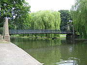
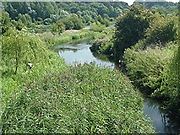
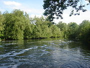
For much of its distance the river runs within or as a boundary to the Lee Valley Park
. Between Tottenham and Hackney the Lea feeds Tottenham Marshes
, Walthamstow Marshes
and Hackney Marshes
(the latter now drained). In their early days, Tottenham Hotspur
and Leyton Orient
played their matches as football amateurs on the Marshes. South of Hackney Wick the river's course is split, running almost completely in man made channels (originally created to power water mills, the Bow Back Rivers
) flowing through an area that was once a thriving industrial zone.
Inside Greater London
below Enfield Lock
the river forms the boundary with the former Royal Small Arms Factory
, now known as Enfield Island Village
, a housing development. Just downstream the river is joined by the River Lee Flood Relief Channel
. The man-made, concrete-banked watercourse is known as the River Lee Diversion
at this point as it passes to the east of a pair of reservoirs: the King George V Reservoir
at Ponders End
/Chingford
and William Girling Reservoir
at Edmonton
; and to the West of the Banbury Reservoir
at Walthamstow
. At Tottenham Hale
there is a connected set of reservoirs; Lockwood Reservoir
, High Maynard Reservoir
, Low Maynard Reservoir
, Walthamstow Reservoirs
, East Warwick Reservoir
and West Warwick Reservoir
. It also passes the Three Mills
, a restored tidal mill near Bow
.
, Old Street
, through Bethnal Green
to Old Ford and thence across a causeway through the marshes, known as Wanstead Slip
(now in Leyton
). The route then continued through Essex
to Colchester
. At this time, the Lea was a wide, fast flowing river, and the tidal estuary stretched as far as Hackney Wick
. Evidence of a late Roman
settlement at Old Ford, dating from the 4th and 5th centuries, has been found.
In 894, a force of Danes sailed up the river to Hertford, and in about 895 they built a fortified camp, in the higher reaches of the Lea, about 20 miles (32.2 km) north of London. Alfred the Great
saw an opportunity to defeat the Danes and ordered the lower reaches of the Lea drained, at Leamouth
. This left the Danes' boats stranded, but also increased the flow of the river and caused the tidal head to move downriver to Old Ford.
In 1110, Matilda
, wife of Henry I
, reputedly took a tumble at the ford, on her way to Barking Abbey
and ordered a distinctively bow-shaped, three-arched, bridge to be built over the River Lea (The like of which had not been seen before), at Bow. During the middle ages
, Temple Mills
, Abbey Mills, Old Ford and Bow were the sites of water mills (mainly in ecclesiastic ownership) that supplied flour to the bakers of Stratforde-atte-Bow, and hence bread to the City. It was the channels created for these mills that caused the Bow Back Rivers to be cut through the former Roman stone causeway at Stratford (from which the name is derived).
Improvements were made to the river from 1424, with tolls being levied to compensate the landowners, and in 1571, there were riots after the extension of the River was promoted in a private bill presented to the House of Commons
. By 1577, the first lock was established at Waltham Abbey and the river began to be actively managed for navigation.
The New River
was constructed in 1613 to take clean water to London, from the Lea and its catchment areas in Hertfordshire and bypass the polluting industries that had developed in the Lea's downstream reaches. The artificial channel further reduced the flow to the natural river and by 1767 locks were installed below Hertford Castle Weir
on the canal
ised part of the Lea, now the Lee Navigation with further locks and canalisation taking place during the succeeding centuries. In 1766, work also began on the Limehouse Cut
to connect the river, at Bromley-by-Bow
, with the Thames at Limehouse Basin
.
The Waterworks River
, a part of the tidal Bow Back Rivers
, has been widened by 8 metres (26 ft) and canalised to assist with construction of the Olympic Park
for the 2012 Summer Olympics
. In 2009, Three Mills Lock
was installed on the Prescott Channel
to maintain water levels on the Lea, within the park at a depth of 2 metres (7 ft). This will allow access by 350–tonnes barges to ensure that at least 50% of the material required for construction to be delivered, or removed by water.
.
The river features in the early chapters of The Compleat Angler by Izaak Walton
.
The river is also mentioned in Michael Drayton
's topographical poem Polyolbion where he identifies the source thus: "The head, whence Lee doth spring, not farre from Kempton towne".
England
England is a country that is part of the United Kingdom. It shares land borders with Scotland to the north and Wales to the west; the Irish Sea is to the north west, the Celtic Sea to the south west, with the North Sea to the east and the English Channel to the south separating it from continental...
originates in Marsh Farm 51.910338°N 0.461233°W, Leagrave
Leagrave
For other uses see Leagrave Leagrave is a former village and now a suburb of Luton in Bedfordshire in the northwest of the town. Connected by train from Leagrave station into London and Bedford by First Capital Connect...
, Luton
Luton
Luton is a large town and unitary authority of Bedfordshire, England, 30 miles north of London. Luton and its near neighbours, Dunstable and Houghton Regis, form the Luton/Dunstable Urban Area with a population of about 250,000....
in the Chiltern Hills
Chiltern Hills
The Chiltern Hills form a chalk escarpment in South East England. They are known locally as "the Chilterns". A large portion of the hills was designated officially as an Area of Outstanding Natural Beauty in 1965.-Location:...
and flows generally southeast, east, and then south to London
London
London is the capital city of :England and the :United Kingdom, the largest metropolitan area in the United Kingdom, and the largest urban zone in the European Union by most measures. Located on the River Thames, London has been a major settlement for two millennia, its history going back to its...
where it meets the River Thames
River Thames
The River Thames flows through southern England. It is the longest river entirely in England and the second longest in the United Kingdom. While it is best known because its lower reaches flow through central London, the river flows alongside several other towns and cities, including Oxford,...
51.507113°N 0.009184°W, the last section being known as Bow Creek
Bow Creek
Bow Creek is a long tidal estuary of the River Lea and is part of the Bow Back Rivers. Below Bow Locks the creek forms the boundary between the London Boroughs of Newham and Tower Hamlets, in east London....
.
Etymology
The River Lea was first recorded in the 9th century, although its name is believed to be much older. Spellings from the Anglo-SaxonAnglo-Saxon
Anglo-Saxon may refer to:* Anglo-Saxons, a group that invaded Britain** Old English, their language** Anglo-Saxon England, their history, one of various ships* White Anglo-Saxon Protestant, an ethnicity* Anglo-Saxon economy, modern macroeconomic term...
period include Lig(e)an in 880 and Lygan in 895, and in the early medieval period it is usually Luye or Leye. It seems to be derived from a Celtic
Celtic languages
The Celtic languages are descended from Proto-Celtic, or "Common Celtic"; a branch of the greater Indo-European language family...
root lug-meaning 'bright or light' which is also the derivation of a name for a deity, so the meaning may be 'bright river' or 'river dedicated to the god Lugus
Lugus
Lugus was a deity of the Celtic pantheon. His name is rarely directly attested in inscriptions, but his importance can be inferred from placenames and ethnonyms, and his nature and attributes are deduced from the distinctive iconography of Gallo-Roman inscriptions to Mercury, who is widely believed...
'.
The spelling Lea predominates west (upstream) of Hertford
Hertford
Hertford is the county town of Hertfordshire, England, and is also a civil parish in the East Hertfordshire district of the county. Forming a civil parish, the 2001 census put the population of Hertford at about 24,180. Recent estimates are that it is now around 28,000...
, but both spellings are used from Hertford
Hertford
Hertford is the county town of Hertfordshire, England, and is also a civil parish in the East Hertfordshire district of the county. Forming a civil parish, the 2001 census put the population of Hertford at about 24,180. Recent estimates are that it is now around 28,000...
to the River Thames
River Thames
The River Thames flows through southern England. It is the longest river entirely in England and the second longest in the United Kingdom. While it is best known because its lower reaches flow through central London, the river flows alongside several other towns and cities, including Oxford,...
. The Lee Navigation was established by Acts of Parliament and only that spelling is used in this context. The Lee Valley Regional Park Authority
Lee Valley Regional Park Authority
Lee Valley Regional Park Authority is a statutory body that is responsible for managing and developing the long, Lee Valley Regional Park. The park was established by Parliament in 1967. The headquarters of the authority are based at Myddleton House, Bulls Cross in the London Borough of Enfield,...
also uses this spelling for leisure facilities. However, the spelling Lea is used for road names, locations and other infrastructure in the capital, such as Leamouth
Leamouth
Leamouth is the area to the west of the mouth of the River Lea at the River Thames at . The northern part of the area lies within a meander of the Lea; the southern part is bounded in the west by the former East India Docks, on two sides by the Lea and by the River Thames to the south...
, Lea Bridge
Lea Bridge
Lea Bridge is a district of the London Borough of Hackney. It is situated to the northeast of the borough and bounded by Upper Clapton to the north, Lower Clapton to the south, and the River Lee Navigation to the east...
, the Lea Valley Walk
Lea Valley Walk
The Lea Valley Walk is a long-distance path located between Leagrave, the source of the River Lea near Luton, and the Thames, at Limehouse Basin, Limehouse, east London. From its source much of the walk is rural. At Hertford the path follows the towpath of the River Lee Navigation, and it becomes...
and the Lea Valley Railway Lines
Lea Valley Lines
The Lea Valley Lines are three commuter lines and two branches in North East London, so named because they run along the valley of the River Lea...
. This spelling is also used in geology, archaeology, etc to refer to the Lea Valley
Lea Valley
The Lea Valley, the valley of the River Lea, has been used as a transport corridor, a source of sand and gravel, an industrial area, a water supply for London, and a recreational area...
. The divergent spellings of the river are also reflected in the place-names of Luton
Luton
Luton is a large town and unitary authority of Bedfordshire, England, 30 miles north of London. Luton and its near neighbours, Dunstable and Houghton Regis, form the Luton/Dunstable Urban Area with a population of about 250,000....
and Leyton
Leyton
Leyton is an area of north-east London and part of the London Borough of Waltham Forest, located north east of Charing Cross. It borders Walthamstow and Leytonstone; Stratford in Newham; and Homerton and Lower Clapton in the London Borough of Hackney....
: both mean "farmstead on the River Lea".
Course of the river
The sourceSource (river or stream)
The source or headwaters of a river or stream is the place from which the water in the river or stream originates.-Definition:There is no universally agreed upon definition for determining a stream's source...
is usually said to be at Well Head inside Waulud's Bank
Waulud's Bank
Waulud's Bank is a possible Neolithic henge in Leagrave, Bedfordshire dating from 3,000BC.The Waulud's Bank earthworks lies on the western edge of the Marsh Farm Estate in Leagrave, Luton. The River Lea forms the western side, its source located within the vicinity of the surrounding marsh...
at Marsh Farm, but there the River Lea is also fed by a stream that starts 2 miles (3.2 km) further west in Houghton Regis
Houghton Regis
Houghton Regis is a town and civil parish sandwiched between the major towns of Luton to the east and Dunstable to the west. The parish includes the ancient hamlets of Bidwell, Thorn and Sewell...
. The river flows through (or by) Luton
Luton
Luton is a large town and unitary authority of Bedfordshire, England, 30 miles north of London. Luton and its near neighbours, Dunstable and Houghton Regis, form the Luton/Dunstable Urban Area with a population of about 250,000....
, Harpenden
Harpenden
Harpenden is a town in Hertfordshire, England.The town's total population is just under 30,000.-Geography and administration:There are two civil parishes: Harpenden and Harpenden Rural....
, Welwyn Garden City
Welwyn Garden City
-Economy:Ever since its inception as garden city, Welwyn Garden City has attracted a strong commercial base with several designated employment areas. Among the companies trading in the town are:*Air Link Systems*Baxter*British Lead Mills*Carl Zeiss...
, to Hertford
Hertford
Hertford is the county town of Hertfordshire, England, and is also a civil parish in the East Hertfordshire district of the county. Forming a civil parish, the 2001 census put the population of Hertford at about 24,180. Recent estimates are that it is now around 28,000...
where it changes from a small shallow river to a deep canal at Hertford Castle Weir
Hertford Castle Weir
Hertford Castle Weir is a weir located in Hertford near to Hertford Castle and next to Castle Hall.Its function is to connect the upper River Lea to the canalised section that runs through Hertfordshire, North London into the River Thames...
, which then flows on to Ware, Stanstead Abbotts
Stanstead Abbotts
Stanstead Abbotts is a village and civil parish in the district of East Hertfordshire, Hertfordshire, England. At the 2001 census the parish had a population of 1,983...
, Hoddesdon
Hoddesdon
Hoddesdon is a town in the English county of Hertfordshire, situated in the Lea Valley. The town grew up as a coaching stop on the route between Cambridge and London. It is located southeast of Hertford, north of Waltham Cross and southwest of Bishop's Stortford. At its height during the 18th...
, Broxbourne
Broxbourne
Broxbourne is a commuter town in the Broxbourne borough of Hertfordshire in the East of England with a population of 13,298 in 2001.It is located 17.1 miles north north-east of Charing Cross in London and about a mile north of Wormley and south of Hoddesdon...
, Cheshunt
Cheshunt
Cheshunt is a town in Hertfordshire, England with a population of around 52,000 according to the United Kingdom's 2001 Census. It is a dormitory town and part of the Greater London Urban Area and London commuter belt served by Cheshunt railway station...
, Waltham Abbey
Waltham Abbey, Essex
Waltham Abbey is a market town of about 20,400 people in the south west of the county of Essex, in the East of England region. It is about 24 km north of London on the Greenwich Meridian and lies between the River Lea in the west and Epping Forest in the east. It takes its name from The Abbey...
, Enfield Lock
Enfield Lock
Enfield Lock is an area in the London Borough of Enfield, North London. It is approximately located east of the Hertford Road between Turkey Street and the Holmesdale Tunnel overpass, to the River Lee Navigation, including the Enfield Island Village. The locality gains its name from the lock on the...
, Ponders End
Ponders End
Ponders End is a place in the London Borough of Enfield, North London located in an area generally known as the Lea Valley. It is roughly located in the area either side of Hertford Road between The Ride and the Boundary Public House and Wharf Road and the Southbury railway station/Kingsway...
, Edmonton
Edmonton, London
Edmonton is an area in the east of the London Borough of Enfield, England, north-north-east of Charing Cross. It has a long history as a settlement distinct from Enfield.-Location:...
, Tottenham
Tottenham
Tottenham is an area of the London Borough of Haringey, England, situated north north east of Charing Cross.-Toponymy:Tottenham is believed to have been named after Tota, a farmer, whose hamlet was mentioned in the Domesday Book; hence Tota's hamlet became Tottenham...
, Upper Clapton
Upper Clapton
Upper Clapton is a district in the London Borough of Hackney. It is bounded by the Hackney districts of Stamford Hill to the west, Lower Clapton and Lea Bridge to the south and the Haringey district of South Tottenham to the north...
, Hackney Wick
Hackney Wick
Hackney Wick is an area straddling the boundary between the London Borough of Hackney and the London Borough of Tower Hamlets in east London. It is an inner-city development situated 5 miles northeast of Charing Cross...
, Stratford
Stratford, London
Stratford is a place in the London Borough of Newham, England. It is located east northeast of Charing Cross and is one of the major centres identified in the London Plan. It was historically an agrarian settlement in the ancient parish of West Ham, which transformed into an industrial suburb...
, Bromley-by-Bow
Bromley-by-Bow
Bromley-by-Bow, historically and officially Bromley, is a place in the London Borough of Tower Hamlets. It is an inner-city district situated east north-east of Charing Cross.-Toponymy:...
(past Fish Island
Fish Island, London
Fish Island is an isolated area of land in Poplar, London, in the Tower Hamlets. Fish Island is bounded by the River Lea, the Hertford Union Canal and the East Cross Route...
), Canning Town
Canning Town
Canning Town is an area of east London, England. It is part of the London Borough of Newham and is situated in the area of the former London docks on the north side of the River Thames. It is the location of Rathbone Market...
and finally Leamouth
Leamouth
Leamouth is the area to the west of the mouth of the River Lea at the River Thames at . The northern part of the area lies within a meander of the Lea; the southern part is bounded in the west by the former East India Docks, on two sides by the Lea and by the River Thames to the south...
where it meets the River Thames
River Thames
The River Thames flows through southern England. It is the longest river entirely in England and the second longest in the United Kingdom. While it is best known because its lower reaches flow through central London, the river flows alongside several other towns and cities, including Oxford,...
(as Bow Creek
Bow Creek
Bow Creek is a long tidal estuary of the River Lea and is part of the Bow Back Rivers. Below Bow Locks the creek forms the boundary between the London Boroughs of Newham and Tower Hamlets, in east London....
). It forms the traditional boundary between the counties of Middlesex
Middlesex
Middlesex is one of the historic counties of England and the second smallest by area. The low-lying county contained the wealthy and politically independent City of London on its southern boundary and was dominated by it from a very early time...
and Essex
Essex
Essex is a ceremonial and non-metropolitan county in the East region of England, and one of the home counties. It is located to the northeast of Greater London. It borders with Cambridgeshire and Suffolk to the north, Hertfordshire to the west, Kent to the South and London to the south west...
, and was used for part of the Danelaw boundary
Treaty of Alfred and Guthrum
The Treaty of Alfred and Guthrum is an agreement between Alfred of Wessex and Guthrum, the Viking ruler of East Anglia. Its date is uncertain, but must have been between 878 and 890. The treaty is one of the few existing documents of Alfred's reign; it survives in Old English in Corpus Christi...
. It also forms part of the boundary between Essex
Essex
Essex is a ceremonial and non-metropolitan county in the East region of England, and one of the home counties. It is located to the northeast of Greater London. It borders with Cambridgeshire and Suffolk to the north, Hertfordshire to the west, Kent to the South and London to the south west...
and Hertfordshire
Hertfordshire
Hertfordshire is a ceremonial and non-metropolitan county in the East region of England. The county town is Hertford.The county is one of the Home Counties and lies inland, bordered by Greater London , Buckinghamshire , Bedfordshire , Cambridgeshire and...
.
For much of its distance the river runs within or as a boundary to the Lee Valley Park
Lee Valley Park
Lee Valley Regional Park is a long linear park, much of it green spaces, running through the northeast of London, Essex and Hertfordshire from the River Thames to Ware in Hertfordshire, England through areas such as Hackney, Tottenham, Enfield, Stratford, Tower Hamlets, Walthamstow, Cheshunt,...
. Between Tottenham and Hackney the Lea feeds Tottenham Marshes
Tottenham Marshes
The Tottenham Marshes are located at Tottenham in the London Borough of Haringey. The marshes cover over and became part of the Lee Valley Park in 1972. The marsh is made up of three main areas; Clendish Marsh, Wild Marsh West and Wild Marsh East...
, Walthamstow Marshes
Walthamstow Marshes
Walthamstow Marshes, located in the London Borough of Waltham Forest, is a designated Site of Special Scientific Interest SSSI. It was once an area of lammas land — strips of meadow used for growing crops and grazing cattle....
and Hackney Marshes
Hackney Marshes
Hackney Marshes is an area of grassland on the western bank of the River Lea in the London Borough of Hackney. It was incorporated into the Lee Valley Park in 1967...
(the latter now drained). In their early days, Tottenham Hotspur
Tottenham Hotspur F.C.
Tottenham Hotspur Football Club , commonly referred to as Spurs, is an English Premier League football club based in Tottenham, north London. The club's home stadium is White Hart Lane....
and Leyton Orient
Leyton Orient F.C.
Leyton Orient F.C. are an English professional football club in East London. They currently play in Football League One and are known to their fans as the O's.Leyton Orient have spent one season in the top flight of English football, in 1962–63...
played their matches as football amateurs on the Marshes. South of Hackney Wick the river's course is split, running almost completely in man made channels (originally created to power water mills, the Bow Back Rivers
Bow Back Rivers
The Bow Back Rivers are part of the River Lea in the London Borough of Newham, east London, England, and form a complex system of waterways. The River Lea was originally tidal as far as Hackney Wick; man-made changes to the river had changed this dramatically in the 9th century, and in 1110 a...
) flowing through an area that was once a thriving industrial zone.
Inside Greater London
Greater London
Greater London is the top-level administrative division of England covering London. It was created in 1965 and spans the City of London, including Middle Temple and Inner Temple, and the 32 London boroughs. This territory is coterminate with the London Government Office Region and the London...
below Enfield Lock
Enfield Lock
Enfield Lock is an area in the London Borough of Enfield, North London. It is approximately located east of the Hertford Road between Turkey Street and the Holmesdale Tunnel overpass, to the River Lee Navigation, including the Enfield Island Village. The locality gains its name from the lock on the...
the river forms the boundary with the former Royal Small Arms Factory
Royal Small Arms Factory
The Royal Small Arms Factory was a UK government-owned rifle factory in the London Borough of Enfield in an area generally known as the Lea Valley. The factory produced British military rifles, muskets and swords from 1816...
, now known as Enfield Island Village
Enfield Island Village
Enfield Island Village is a modern village in the outskirts of the London Borough of Enfield, North London, home to a large housing development. Before 1998, Enfield Island Village formed part of the Epping Forest district of Essex, but was transferred to the borough of Enfield in Greater London...
, a housing development. Just downstream the river is joined by the River Lee Flood Relief Channel
River Lee Flood Relief Channel
The River Lee Flood Relief Channel is located in the Lea Valley and flows between Ware, Hertfordshire and Stratford, east London. Work started on the channel in 1947 following major flooding and was fully operational by 1976...
. The man-made, concrete-banked watercourse is known as the River Lee Diversion
River Lee Diversion
The River Lee Diversion is located in the Lea Valley, close to Enfield Lock and to the north east corner of the King George V Reservoir.- History :...
at this point as it passes to the east of a pair of reservoirs: the King George V Reservoir
King George V Reservoir
The King George V Reservoir, also known as King George's Reservoir, is located in the London Borough of Enfield and is part of the Lee Valley Reservoir Chain that supplies London with drinking water...
at Ponders End
Ponders End
Ponders End is a place in the London Borough of Enfield, North London located in an area generally known as the Lea Valley. It is roughly located in the area either side of Hertford Road between The Ride and the Boundary Public House and Wharf Road and the Southbury railway station/Kingsway...
/Chingford
Chingford
Chingford is a district of north east London, bordering on Enfield and Edmonton to the west, Woodford to the east, Walthamstow and Stratford to the south and Essex to the north. It is situated northeast of Charing Cross and forms part of the London Borough of Waltham Forest...
and William Girling Reservoir
William Girling Reservoir
The William Girling Reservoir is located in the London Borough of Enfield and is part of the Lee Valley Reservoir Chain that supplies London with drinking water. It is named after William Girling OBE, a chairman of the Metropolitan Water Board . The reservoir and the nearby King George V Reservoir...
at Edmonton
Edmonton, London
Edmonton is an area in the east of the London Borough of Enfield, England, north-north-east of Charing Cross. It has a long history as a settlement distinct from Enfield.-Location:...
; and to the West of the Banbury Reservoir
Banbury Reservoir
Banbury Reservoir is located in the London Borough of Waltham Forest at Walthamstow. It is one of the storage reservoirs in the Lee Valley Reservoir Chain. The reservoir is owned by Thames Water.- History:...
at Walthamstow
Walthamstow
Walthamstow is a district of northeast London, England, located in the London Borough of Waltham Forest. It is situated north-east of Charing Cross...
. At Tottenham Hale
Tottenham Hale
Tottenham Hale is a district in the London Borough of Haringey. From 1850-1965, it was part of the Municipal Borough of Tottenham, in Middlesex.-Etymology:...
there is a connected set of reservoirs; Lockwood Reservoir
Lockwood Reservoir
Lockwood Reservoir is located in Walthamstow in the London Borough of Waltham Forest. It is one of the ten Walthamstow Reservoirs, which are part of the Lee Valley Reservoir Chain...
, High Maynard Reservoir
High Maynard Reservoir
High Maynard Reservoir is located in Walthamstow in the London Borough of Waltham Forest. The storage reservoir is one of the Lee Valley Reservoir Chain and supplies drinking water to London.- History :...
, Low Maynard Reservoir
Low Maynard Reservoir
Low Maynard Reservoir is located in Walthamstow in the London Borough of Waltham Forest. The storage reservoir is part of the Lee Valley Reservoir Chain and supplies drinking water to London.- History:...
, Walthamstow Reservoirs
Walthamstow Reservoirs
The Walthamstow Reservoirs are located in the London Borough of Waltham Forest at Walthamstow. They form part of the Lee Valley Reservoir Chain which supplies drinking water to London, and are owned and managed by Thames Water....
, East Warwick Reservoir
East Warwick Reservoir
East Warwick Reservoir is located in the London Borough of Waltham Forest at Walthamstow. The storage reservoir is part of the Lee Valley Reservoir Chain and supplies drinking water to London...
and West Warwick Reservoir
West Warwick Reservoir
West Warwick Reservoir is located in the London Borough of Waltham Forest at Walthamstow. The storage reservoir is part of the Lee Valley Reservoir Chain, which supplies drinking water to London...
. It also passes the Three Mills
Three Mills
The Three Mills are former working mills on the River Lea in the East End of London, one of London’s oldest extant industrial centres. The largest and most powerful of the four remaining tidal mills is possibly the largest tidal mill in the world...
, a restored tidal mill near Bow
Bow, London
Bow is an area of London, England, United Kingdom in the London Borough of Tower Hamlets. It is a built-up, mostly residential district located east of Charing Cross, and is a part of the East End.-Bridges at Bowe:...
.
River history
In the Roman era, Old Ford, as the name suggests, was the ancient, most downstream, crossing point of the River Lea. This was part of a pre-Roman route that followed the modern Oxford StreetOxford Street
Oxford Street is a major thoroughfare in the City of Westminster in the West End of London, United Kingdom. It is Europe's busiest shopping street, as well as its most dense, and currently has approximately 300 shops. The street was formerly part of the London-Oxford road which began at Newgate,...
, Old Street
Old Street
Old Street is a street in east London that runs west to east from Goswell Road in Clerkenwell, in the London Borough of Islington, to the crossroads where it intersects with Shoreditch High Street , Kingsland Road and Hackney Road in Shoreditch in the London Borough of Hackney.The nearest...
, through Bethnal Green
Bethnal Green
Bethnal Green is a district of the East End of London, England and part of the London Borough of Tower Hamlets, with the far northern parts falling within the London Borough of Hackney. Located northeast of Charing Cross, it was historically an agrarian hamlet in the ancient parish of Stepney,...
to Old Ford and thence across a causeway through the marshes, known as Wanstead Slip
Wanstead
Wanstead is a suburban area in the London Borough of Redbridge, North-East London. The main road going through Wanstead is the A12. The name is from the Anglo-Saxon words wænn and stede, meaning "settlement on a small hill"....
(now in Leyton
Leyton
Leyton is an area of north-east London and part of the London Borough of Waltham Forest, located north east of Charing Cross. It borders Walthamstow and Leytonstone; Stratford in Newham; and Homerton and Lower Clapton in the London Borough of Hackney....
). The route then continued through Essex
Essex
Essex is a ceremonial and non-metropolitan county in the East region of England, and one of the home counties. It is located to the northeast of Greater London. It borders with Cambridgeshire and Suffolk to the north, Hertfordshire to the west, Kent to the South and London to the south west...
to Colchester
Colchester
Colchester is an historic town and the largest settlement within the borough of Colchester in Essex, England.At the time of the census in 2001, it had a population of 104,390. However, the population is rapidly increasing, and has been named as one of Britain's fastest growing towns. As the...
. At this time, the Lea was a wide, fast flowing river, and the tidal estuary stretched as far as Hackney Wick
Hackney Wick
Hackney Wick is an area straddling the boundary between the London Borough of Hackney and the London Borough of Tower Hamlets in east London. It is an inner-city development situated 5 miles northeast of Charing Cross...
. Evidence of a late Roman
Roman Britain
Roman Britain was the part of the island of Great Britain controlled by the Roman Empire from AD 43 until ca. AD 410.The Romans referred to the imperial province as Britannia, which eventually comprised all of the island of Great Britain south of the fluid frontier with Caledonia...
settlement at Old Ford, dating from the 4th and 5th centuries, has been found.
In 894, a force of Danes sailed up the river to Hertford, and in about 895 they built a fortified camp, in the higher reaches of the Lea, about 20 miles (32.2 km) north of London. Alfred the Great
Alfred the Great
Alfred the Great was King of Wessex from 871 to 899.Alfred is noted for his defence of the Anglo-Saxon kingdoms of southern England against the Vikings, becoming the only English monarch still to be accorded the epithet "the Great". Alfred was the first King of the West Saxons to style himself...
saw an opportunity to defeat the Danes and ordered the lower reaches of the Lea drained, at Leamouth
Leamouth
Leamouth is the area to the west of the mouth of the River Lea at the River Thames at . The northern part of the area lies within a meander of the Lea; the southern part is bounded in the west by the former East India Docks, on two sides by the Lea and by the River Thames to the south...
. This left the Danes' boats stranded, but also increased the flow of the river and caused the tidal head to move downriver to Old Ford.
In 1110, Matilda
Edith of Scotland
Matilda of Scotland , born Edith, was the first wife and Queen consort of Henry I of England.-Early life:Matilda was born around 1080 in Dunfermline, the daughter of Malcolm III of Scotland and Saint Margaret. She was christened Edith, and Robert Curthose stood as godfather at the ceremony...
, wife of Henry I
Henry I of England
Henry I was the fourth son of William I of England. He succeeded his elder brother William II as King of England in 1100 and defeated his eldest brother, Robert Curthose, to become Duke of Normandy in 1106...
, reputedly took a tumble at the ford, on her way to Barking Abbey
Barking Abbey
The ruined remains of Barking Abbey are situated in Barking in the London Borough of Barking and Dagenham in east London, England, and now form a public open space.- History :...
and ordered a distinctively bow-shaped, three-arched, bridge to be built over the River Lea (The like of which had not been seen before), at Bow. During the middle ages
Middle Ages
The Middle Ages is a periodization of European history from the 5th century to the 15th century. The Middle Ages follows the fall of the Western Roman Empire in 476 and precedes the Early Modern Era. It is the middle period of a three-period division of Western history: Classic, Medieval and Modern...
, Temple Mills
Temple Mills
Temple Mills is a northerly part of Stratford, south of Leyton, located within the London borough of Newham in east LondonToday, Temple Mills is surrounded at present by former railway tracks and works belonging to the Great Eastern Railway...
, Abbey Mills, Old Ford and Bow were the sites of water mills (mainly in ecclesiastic ownership) that supplied flour to the bakers of Stratforde-atte-Bow, and hence bread to the City. It was the channels created for these mills that caused the Bow Back Rivers to be cut through the former Roman stone causeway at Stratford (from which the name is derived).
Improvements were made to the river from 1424, with tolls being levied to compensate the landowners, and in 1571, there were riots after the extension of the River was promoted in a private bill presented to the House of Commons
British House of Commons
The House of Commons is the lower house of the Parliament of the United Kingdom, which also comprises the Sovereign and the House of Lords . Both Commons and Lords meet in the Palace of Westminster. The Commons is a democratically elected body, consisting of 650 members , who are known as Members...
. By 1577, the first lock was established at Waltham Abbey and the river began to be actively managed for navigation.
The New River
New River (England)
The New River is an artificial waterway in England, opened in 1613 to supply London with fresh drinking water taken from the River Lea and from Amwell Springs , and other springs and wells along its course....
was constructed in 1613 to take clean water to London, from the Lea and its catchment areas in Hertfordshire and bypass the polluting industries that had developed in the Lea's downstream reaches. The artificial channel further reduced the flow to the natural river and by 1767 locks were installed below Hertford Castle Weir
Hertford Castle Weir
Hertford Castle Weir is a weir located in Hertford near to Hertford Castle and next to Castle Hall.Its function is to connect the upper River Lea to the canalised section that runs through Hertfordshire, North London into the River Thames...
on the canal
Canal
Canals are man-made channels for water. There are two types of canal:#Waterways: navigable transportation canals used for carrying ships and boats shipping goods and conveying people, further subdivided into two kinds:...
ised part of the Lea, now the Lee Navigation with further locks and canalisation taking place during the succeeding centuries. In 1766, work also began on the Limehouse Cut
Limehouse Cut
The Limehouse Cut is a straight, broad canal in the East End of London, which linked the lower reaches of the River Lee Navigation to the River Thames...
to connect the river, at Bromley-by-Bow
Bromley-by-Bow
Bromley-by-Bow, historically and officially Bromley, is a place in the London Borough of Tower Hamlets. It is an inner-city district situated east north-east of Charing Cross.-Toponymy:...
, with the Thames at Limehouse Basin
Limehouse Basin
The Limehouse Basin in Limehouse, in the London Borough of Tower Hamlets provides a navigable link between the Regent's Canal and the River Thames, through the Limehouse Basin Lock. A basin in the north of Mile End, near Victoria Park connects with the Hertford Union Canal leading to the River Lee...
.
The Waterworks River
Waterworks River
Waterworks River is a tidal river in the London Borough of Newham, one of the Bow Back Rivers that flow into the Bow Creek part of the River Lea, which in turn flows into the River Thames....
, a part of the tidal Bow Back Rivers
Bow Back Rivers
The Bow Back Rivers are part of the River Lea in the London Borough of Newham, east London, England, and form a complex system of waterways. The River Lea was originally tidal as far as Hackney Wick; man-made changes to the river had changed this dramatically in the 9th century, and in 1110 a...
, has been widened by 8 metres (26 ft) and canalised to assist with construction of the Olympic Park
Olympic Park, London
The Olympic Park in London is a new sporting complex currently under construction, adjacent to the Stratford City development in Stratford, Bow, Leyton & Homerton in East London for the 2012 Summer Olympics and Paralympics....
for the 2012 Summer Olympics
2012 Summer Olympics
The 2012 Summer Olympic Games, officially known as the "London 2012 Olympic Games", are scheduled to take place in London, England, United Kingdom from 27 July to 12 August 2012...
. In 2009, Three Mills Lock
Three Mills Lock
Three Mills Lock, also known as the Prescott Lock is a lock on the Prescott Channel on the River Lea in London. The project was led by British Waterways and the lock officially opened on 5 June 2009....
was installed on the Prescott Channel
Prescott Channel
The Prescott Channel was built in 1930–35 as part of a flood relief scheme for the River Lee Navigation in the East End of London, and was named after Sir William Prescott, the then chairman of the Lee Conservancy Board...
to maintain water levels on the Lea, within the park at a depth of 2 metres (7 ft). This will allow access by 350–tonnes barges to ensure that at least 50% of the material required for construction to be delivered, or removed by water.
In popular culture
On 16 August 2009, BBC1 broadcast a documentary about the river as part of its Rivers series presented by Griff Rhys JonesGriff Rhys Jones
Griffith "Griff" Rhys Jones is a Welsh comedian, writer, actor, television presenter and personality. Jones came to national attention in the early 1980s for his work in the BBC television comedy sketch shows Not the Nine O'Clock News and Alas Smith and Jones along with his comedy partner Mel Smith...
.
The river features in the early chapters of The Compleat Angler by Izaak Walton
Izaak Walton
Izaak Walton was an English writer. Best known as the author of The Compleat Angler, he also wrote a number of short biographies which have been collected under the title of Walton's Lives.-Biography:...
.
The river is also mentioned in Michael Drayton
Michael Drayton
Michael Drayton was an English poet who came to prominence in the Elizabethan era.-Early life:He was born at Hartshill, near Nuneaton, Warwickshire, England. Almost nothing is known about his early life, beyond the fact that in 1580 he was in the service of Thomas Goodere of Collingham,...
's topographical poem Polyolbion where he identifies the source thus: "The head, whence Lee doth spring, not farre from Kempton towne".
Notable fisheries
- Amwell Magna FisheryAmwell Magna FisheryAmwell Magna Fishery is located on the River Lea at Amwell which is 1½ miles south of Ware Hertfordshire, England.- History :The fishery was established in 1841 and is the oldest fly fishing club in the UK still fishing the same water . The river was fished by Izaak Walton author of The Compleat...
- Carthagena WeirCarthagena WeirCarthagena Weir is a weir located at Broxbourne on the River Lea. The well oxygenated water with depths ranging to over 16 ft, makes it an ideal environment for coarse fish including the barbel.- Fishery :...
- Dobbs WeirDobbs WeirDobbs Weir is a both a weir near and an area of Hoddesdon, Hertfordshire in England on the River Lea. It is well known for angling, outdoor beauty and watersports. It is overlooked by the Fish and Eels pub.-Angling:...
- Fishers GreenFishers GreenFishers Green is a locality north of Waltham Abbey, Essex on the B194 road on the section known as the Crooked Mile.- River Lee Country Park :Fishers Green is in the River Lee Country Park...
- Kings WeirKings WeirKings Weir is a weir on the River Lea at Lower Nazeing, Essex. The weir marks the start of a stretch of the Old River Lea.-Access:Pedestrian and cycle access from the Lee Valley Walk. Vehicular access at Wormley.- External links :*...
See also
- Bow Back RiversBow Back RiversThe Bow Back Rivers are part of the River Lea in the London Borough of Newham, east London, England, and form a complex system of waterways. The River Lea was originally tidal as far as Hackney Wick; man-made changes to the river had changed this dramatically in the 9th century, and in 1110 a...
- Lea Valley WalkLea Valley WalkThe Lea Valley Walk is a long-distance path located between Leagrave, the source of the River Lea near Luton, and the Thames, at Limehouse Basin, Limehouse, east London. From its source much of the walk is rural. At Hertford the path follows the towpath of the River Lee Navigation, and it becomes...
- List of rivers in England
- List of reservoirs and dams in the United Kingdom
- Locks and Weirs on the River Lea
- Lower Lea ValleyLower Lea ValleyThe Lower Lea Valley is the southern end of the Lea Valley, surrounding the River Lea , which runs along the boundary of the London Borough of Tower Hamlets on its western bank and the London Boroughs of Waltham Forest and Newham on its eastern bank, into the River Thames. The river forms the...
- Lee Navigation
- Tributaries of the River ThamesTributaries of the River ThamesThis article lists the tributaries of the River Thames, in England. It also includes significant backwaters and waterways which also have confluences with the main stream of the River Thames.Most of the tributaries are natural, but a few were man-made...
Tributaries
- For a full list of tributaries, please expand the box entitled 'River Lea / Lee, England' at the bottom of this page.
External links
- Diamond Geezer, Walking the Lea Valley, written for Local History Month 2009, with more photos on flickr
- Peter Marshall, The Lea Valley, photographs from 1980 to 2008
- UK Urban Exploration Forums, River Lea through Luton, photographs of the underground culvert in March 2009
- Wikipaddle, River Lea (Hertford Loop), an article from a kayaking and canoeing perspective