
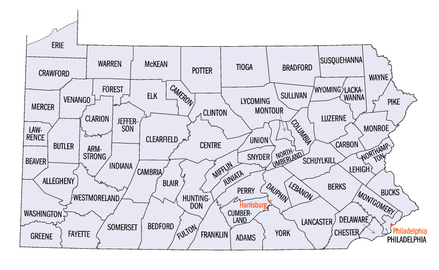
Pennsylvania census statistical areas
Encyclopedia
The United States Census Bureau
has defined 8 Combined Statistical Area
s (CSAs), 16 Metropolitan Statistical Areas (MSAs), and 21 Micropolitan Statistical Areas (μSAs) in the Commonwealth of Pennsylvania. The following table describes these areas with the following information:
United States Census Bureau
The United States Census Bureau is the government agency that is responsible for the United States Census. It also gathers other national demographic and economic data...
has defined 8 Combined Statistical Area
Combined Statistical Area
The United States Office of Management and Budget defines micropolitan and metropolitan statistical areas. Metropolitan and micropolitan statistical areas consist of one or more counties...
s (CSAs), 16 Metropolitan Statistical Areas (MSAs), and 21 Micropolitan Statistical Areas (μSAs) in the Commonwealth of Pennsylvania. The following table describes these areas with the following information:
- The name of the Combined Statistical Area (CSA), if any.
- The population of the CSA as of 2006-07-01, as estimated by the United States Census Bureau.
- The name of the Core Based Statistical AreaCore based statistical areaA Core Based Statistical Area is a U.S. geographic area defined by the Office of Management and Budget based around an urban center of at least 10,000 people and adjacent areas that are socioeconomically tied to the urban center by commuting. Areas defined on the basis of these standards applied...
(CBSA). - The population of the CBSA as of 2006-07-01, as estimated by the United States Census Bureau.
- The name of the countyCounty (United States)In the United States, a county is a geographic subdivision of a state , usually assigned some governmental authority. The term "county" is used in 48 of the 50 states; Louisiana is divided into parishes and Alaska into boroughs. Parishes and boroughs are called "county-equivalents" by the U.S...
. - The population of the county as of 2006-07-01, as estimated by the United States Census Bureau.
| Combined Statistical Area | 2006 Pop | Core Based Statistical Area | 2006 Pop | County | 2006 Pop |
|---|---|---|---|---|---|
| Philadelphia-Camden-Vineland, PA-NJ-DE-MD CSA | 6,382,714 4,286,544 |
Philadelphia-Camden-Wilmington, PA-NJ-DE-MD MSA | 5,826,742 3,885,395 |
Philadelphia County, Pennsylvania Philadelphia County, Pennsylvania -History:Tribes of Lenape were the first known occupants in the area which became Philadelphia County. The first European settlers were Swedes and Finns who arrived in 1638. The Netherlands seized the area in 1655, but permanently lost control to England in 1674... |
1,448,394 |
| Montgomery County, Pennsylvania Montgomery County, Pennsylvania Montgomery County is a county located in the U.S. state of Pennsylvania, in the United States. As of 2010, the population was 799,874, making it the third most populous county in Pennsylvania . The county seat is Norristown.The county was created on September 10, 1784, out of land originally part... |
775,688 | ||||
| Bucks County, Pennsylvania Bucks County, Pennsylvania - Industry and commerce :The boroughs of Bristol and Morrisville were prominent industrial centers along the Northeast Corridor during World War II. Suburban development accelerated in Lower Bucks in the 1950s with the opening of Levittown, Pennsylvania, the second such "Levittown" designed by... |
623,205 | ||||
| Delaware County, Pennsylvania Delaware County, Pennsylvania Delaware County is a county located in the U.S. state of Pennsylvania. As of 2010, the population was 558,979, making it Pennsylvania's fifth most populous county, behind Philadelphia, Allegheny, Montgomery, and Bucks counties.... |
555,996 | ||||
| New Castle County, Delaware New Castle County, Delaware New Castle County is the northernmost of the three counties of the U.S. state of Delaware. As of 2010 its population was 538,479, an increase of 7.6% over the previous decade. The county seat is Wilmington. The center of population of Delaware is located in New Castle County, in the town of... |
525,587 | ||||
| Camden County, New Jersey Camden County, New Jersey -Demographics:As of the 2010 Census the population of Camden County was 60.28% Non-Hispanic white, 18.45% Non-Hispanic black, 1.12% Hispanic blacks, 0.17% Non-Hispanic Native American, 0.15% Hispanic Native Americans, 5.07% Non-Hispanic Asian, and 0.14% non-Hispanics reporting some other race... |
517,001 | ||||
| Chester County, Pennsylvania Chester County, Pennsylvania -State parks:*French Creek State Park*Marsh Creek State Park*White Clay Creek Preserve-Demographics:As of the 2010 census, the county was 85.5% White, 6.1% Black or African American, 0.2% Native American or Alaskan Native, 3.9% Asian, 0.0% Native Hawaiian, 1.8% were two or more races, and 2.4% were... |
482,112 | ||||
| Burlington County, New Jersey Burlington County, New Jersey There were 154,371 households out of which 34.30% had children under the age of 18 living with them, 57.70% were married couples living together, 10.90% had a female householder with no husband present, and 27.70% were non-families. 22.90% of all households were made up of individuals and 8.50% had... |
450,627 | ||||
| Gloucester County, New Jersey Gloucester County, New Jersey Gloucester County is a county located in the U.S. state of New Jersey. As of the 2010 Census, the population was 288,288. Its county seat is Woodbury.... |
282,031 | ||||
| Cecil County, Maryland Cecil County, Maryland Cecil County is a county located in the U.S. state of Maryland. It is part of the Delaware Valley. It was named for Cæcilius Calvert, 2nd Baron Baltimore , who was the first Proprietary Governor of the colony of Maryland from 1632 until his death in 1675. The county seat is Elkton. The newspaper... |
99,506 | ||||
| Salem County, New Jersey Salem County, New Jersey -Demographics:As of the census of 2000, there were 64,285 people, 24,295 households, and 17,370 families residing in the county. The population density was 190 people per square mile . There were 26,158 housing units at an average density of 77 per square mile... |
66,595 | ||||
| Reading, PA MSA | 401,149 | Berks County, Pennsylvania Berks County, Pennsylvania -Demographics:As of the census of 2000, there were 373,638 people, 141,570 households, and 98,532 families residing in the county. The population density was 435 people per square mile . There were 150,222 housing units at an average density of 175 per square mile... |
401,149 | ||
| Vineland-Millville-Bridgeton, NJ MSA | 154,823 | Cumberland County, New Jersey Cumberland County, New Jersey Cumberland County is a county located in the U.S. state of New Jersey. As of the 2010 Census, the population is 156,898. Its county seat is Bridgeton. Cumberland County is named for Prince William, Duke of Cumberland.... |
154,823 | ||
| Pittsburgh-New Castle, PA CSA | 2,462,571 | Pittsburgh, PA MSA | 2,370,776 | Allegheny County, Pennsylvania Allegheny County, Pennsylvania Allegheny County is a county in the southwestern part of the U.S. state of Pennsylvania. As of the 2010 census, the population was 1,223,348; making it the second most populous county in Pennsylvania, following Philadelphia County. The county seat is Pittsburgh... |
1,223,411 |
| Westmoreland County, Pennsylvania Westmoreland County, Pennsylvania -Demographics:As of the census of 2000, there were 369,993 people, 149,813 households, and 104,569 families residing in the county. The population density was 361 people per square mile . There were 161,058 housing units at an average density of 157 per square mile... |
366,440 | ||||
| Washington County, Pennsylvania Washington County, Pennsylvania -Government and politics:As of November 2008, there are 152,534 registered voters in Washington County .* Democratic: 89,027 * Republican: 49,025 * Other Parties: 14,482... |
206,432 | ||||
| Butler County, Pennsylvania Butler County, Pennsylvania -Demographics:As of the census of 2000, there were 174,083 people, 65,862 households, and 46,827 families residing in the county. The population density was 221 people per square mile . There were 69,868 housing units at an average density of 89 per square mile... |
182,901 | ||||
| Beaver County, Pennsylvania Beaver County, Pennsylvania -Demographics:As of the census of 2000, there were 181,412 people, 72,576 households, and 50,512 families residing in the county. The population density was 418 people per square mile . There were 77,765 housing units at an average density of 179 per square mile... |
175,736 | ||||
| Fayette County, Pennsylvania Fayette County, Pennsylvania Fayette County is a county located in the U.S. state of Pennsylvania. As of the2010 census, the population was 136,606. The county is part of the Pittsburgh Metropolitan Statistical Area.... |
145,760 | ||||
| Armstrong County, Pennsylvania Armstrong County, Pennsylvania Armstrong County is a county located in the U.S. state of Pennsylvania. As of the 2010 census, the population was 68,941. It is located northeast of Pittsburgh and Allegheny County. Armstrong County was added to the Pittsburgh Metropolitan Statistical Area in 2003.The county seat is Kittanning... |
70,096 | ||||
| New Castle, PA μSA | 91,795 | Lawrence County, Pennsylvania Lawrence County, Pennsylvania Lawrence County is a county located in the U.S. state of Pennsylvania. In 2010, its population was 91,108. The county was added to the Pittsburgh Metropolitan Statistical Area in 2003. The county seat is New Castle.... |
91,795 | ||
| primary census statistical area | 800,336 689,417 |
Allentown-Bethlehem-Easton, PA-NJ MSA | 800,336 689,417 |
Lehigh County, Pennsylvania Lehigh County, Pennsylvania -Climate:Most of the county's climate is considered to fall in the humid continental climate zone. Summers are typically hot and muggy, fall and spring are generally mild, and winter is cold. Precipitation is almost uniformly distributed throughout the year.... |
335,544 |
| Northampton County, Pennsylvania Northampton County, Pennsylvania As of the 2010 census, the county was 86.3% White, 5.0% Black or African American, 0.2% Native American or Alaskan Native, 2.4% Asian, 0.0% Native Hawaiian, 2.2% were two or more races, and 3.8% were some other race. 10.5% of the population were of Hispanic or Latino ancestry.As of the census of... |
291,306 | ||||
| Warren County, New Jersey Warren County, New Jersey Warren County is a county located in the U.S. state of New Jersey. As of the 2010 Census, the population was 108,692. Its county seat is Belvidere... |
110,919 | ||||
| Carbon County, Pennsylvania Carbon County, Pennsylvania As of the census of 2000, there were 58,802 people, 23,701 households, and 16,424 families residing in the county. The population density was 154 people per square mile . There were 30,492 housing units at an average density of 80 per square mile... |
62,567 | ||||
| Harrisburg-Carlisle-Lebanon, PA CSA | 652,263 | Harrisburg-Carlisle, PA MSA | 525,380 | Dauphin County, Pennsylvania Dauphin County, Pennsylvania Dauphin County is a county in the U.S. state of Pennsylvania and is one of the three counties comprising the Harrisburg–Carlisle Metropolitan Statistical Area. As of 2010 census, the population was 268,100. The county includes the city of Harrisburg, which has served as the state capital... |
254,176 |
| Cumberland County, Pennsylvania Cumberland County, Pennsylvania Cumberland County is a county located in the U.S. state of Pennsylvania and is one of three counties comprising the Harrisburg–Carlisle Metropolitan Statistical Area. As of 2010, the population was 235,406.-History:... |
226,117 | ||||
| Perry County, Pennsylvania Perry County, Pennsylvania As of the census of 2000, there were 43,602 people, 16,695 households, and 12,320 families residing in the county. The population density was 79 people per square mile . There were 18,941 housing units at an average density of 34 per square mile... |
45,087 | ||||
| Lebanon, PA MSA | 126,883 | Lebanon County, Pennsylvania Lebanon County, Pennsylvania As of the census of 2000, there were 120,327 people and 32,771 families residing in the county. The population density was 332 people per square mile . There were 49,320 housing units at an average density of 136 per square mile... |
126,883 | ||
| primary census statistical area | 550,841 | Scranton-Wilkes-Barre, PA MSA | 550,841 | Luzerne County, Pennsylvania Luzerne County, Pennsylvania - Demographics :As of the 2010 census, the county was 90.7% White, 3.4% Black or African American, 0.2% Native American, 1.0% Asian, 3.3% were of some other race, and 1.5% were two or more races. 6.7% of the population was of Hispanic or Latino ancestry... |
313,020 |
| Lackawanna County, Pennsylvania Lackawanna County, Pennsylvania As of the census of 2000, there were 213,295 people, 86,218 households, and 55,783 families residing in the county. The population density was 465 people per square mile . There were 95,362 housing units at an average density of 208 per square mile... |
209,728 | ||||
| Wyoming County, Pennsylvania Wyoming County, Pennsylvania Wyoming County is a county located in the U.S. state of Pennsylvania. It was created in 1842 from part of Luzerne County. Its county seat is Tunkhannock.-Geography:According to the U.S... |
28,093 | ||||
| York-Hanover-Gettysburg, PA CSA | 517,427 | York-Hanover, PA MSA | 416,322 | York County, Pennsylvania York County, Pennsylvania York County is a county in the U.S. state of Pennsylvania. As of 2010, the population was 434,972. It is in the Susquehanna Valley, a large fertile agricultural region in South Central Pennsylvania.... |
416,322 |
| Gettysburg, PA μSA | 101,105 | Adams County, Pennsylvania Adams County, Pennsylvania Adams County is a county in the U.S. state of Pennsylvania. As of the 2010 census, the population was 101,407. It was created on January 22, 1800, from part of York County and named in honor of the second President of the United States, John Adams... |
101,105 | ||
| primary census statistical area | 494,486 | Lancaster, PA MSA | 494,486 | Lancaster County, Pennsylvania Lancaster County, Pennsylvania Lancaster County, known as the Garden Spot of America or Pennsylvania Dutch Country, is a county located in the southeastern part of the Commonwealth of Pennsylvania, in the United States. As of 2010 the population was 519,445. Lancaster County forms the Lancaster Metropolitan Statistical Area, the... |
494,486 |
| primary census statistical area | 279,811 | Erie, PA MSA | 279,811 | Erie County, Pennsylvania Erie County, Pennsylvania Erie County is a county located in the U.S. state of Pennsylvania. As of 2010, the population was 280,566. Its county seat is the City of Erie.- Geography :... |
279,811 |
| Sunbury-Lewisburg-Selinsgrove, PA CSA | 173,267 | Sunbury, PA μSA | 91,654 | Northumberland County, Pennsylvania Northumberland County, Pennsylvania There were 38,835 households out of which 27.30% had children under the age of 18 living with them, 52.40% were married couples living together, 9.60% had a female householder with no husband present, and 34.10% were non-families. 30.20% of all households were made up of individuals and 15.50% had... |
91,654 |
| Lewisburg, PA μSA | 43,387 | Union County, Pennsylvania Union County, Pennsylvania -Demographics:As of the census of 2000, there were 41,624 people, 13,178 households, and 9,211 families residing in the county. The population density was 131 people per square mile . There were 14,684 housing units at an average density of 46 per square mile... |
43,387 | ||
| Selinsgrove, PA μSA | 38,226 | Snyder County, Pennsylvania Snyder County, Pennsylvania Snyder County is a county located in the U.S. state of Pennsylvania. As of 2010, the population was 39,702. Snyder County was formed in 1855 from parts of Union County... |
38,226 | ||
| primary census statistical area | 165,685 | East Stroudsburg, PA μSA | 165,685 | Monroe County, Pennsylvania Monroe County, Pennsylvania -National protected areas:* Delaware Water Gap National Recreation Area * Middle Delaware National Scenic River -Demographics:As of the census of 2010, there are 176,567 people, 49,454 households, and 36,447 families residing in the county. The population density was 228 people per square mile... |
165,685 |
| Williamsport-Lock Haven, PA CSA | 154,900 | Williamsport, PA MSA | 117,668 | Lycoming County, Pennsylvania Lycoming County, Pennsylvania -Appalachian Mountains and Allegheny Plateau:Lycoming County is divided between the Appalachian Mountains in the south, the dissected Allegheny Plateau in the north and east, and the valley of the West Branch Susquehanna River between these.-West Branch Susquehanna River:The West Branch of the... |
117,668 |
| Lock Haven, PA μSA | 37,232 | Clinton County, Pennsylvania Clinton County, Pennsylvania As of the census of 2000, there were 37,914 people, 14,773 households, and 9,927 families residing in the county. The population density was 43 people per square mile . There were 18,166 housing units at an average density of 20 per square mile... |
37,232 | ||
| primary census statistical area | 147,405 | Pottsville, PA μSA | 147,405 | Schuylkill County, Pennsylvania Schuylkill County, Pennsylvania -Notable people:*Boxing heavyweight great Muhammad Ali had his training camp in Deer Lake.*Charles Justin Bailey, commanding general of the 81st Division in World War I, was born in Tamaqua on June 21, 1859.... |
147,405 |
| primary census statistical area | 146,967 | Johnstown, PA MSA | 146,967 | Cambria County, Pennsylvania Cambria County, Pennsylvania Cambria County is a county located in the U.S. state of Pennsylvania. It comprises the Johnstown, Pennsylvania, Metropolitan Statistical Area. As of 2010, the population was 143,679.... |
146,967 |
| primary census statistical area | 140,953 | State College, PA MSA | 140,953 | Centre County, Pennsylvania Centre County, Pennsylvania Centre County is a county located in the U.S. state of Pennsylvania. It is part of the State College, Pennsylvania Metropolitan Statistical Area. As of 2010, the population was 153,990.... |
140,953 |
| primary census statistical area | 139,991 | Chambersburg, PA μSA | 139,991 | Franklin County, Pennsylvania Franklin County, Pennsylvania As of the census of 2000, there were 129,313 people, 50,633 households, and 36,405 families residing in the county. The population density was 168 people per square mile . There were 53,803 housing units at an average density of 70 per square mile... |
139,991 |
| primary census statistical area | 126,494 | Altoona, PA MSA | 126,494 | Blair County, Pennsylvania Blair County, Pennsylvania -Significant Topographic Features:*Brush Mountain*Logan Valley*Morrison Cove*Tussey Mountain-Demographics:As of the census of 2000, there were 129,144 people, 51,518 households, and 34,877 families residing in the county. The population density was 246 people per square mile . There were 55,061... |
126,494 |
| Youngstown-Warren-East Liverpool, OH-PA CSA | 697,481 118,551 |
Youngstown-Warren-Boardman, OH-PA MSA | 586,939 118,551 |
Mahoning County, Ohio | 251,026 |
| Trumbull County, Ohio Trumbull County, Ohio As of the census of 2000, there were 225,116 people, 89,020 households, and 61,690 families residing in the county. The population density was 365 people per square mile . There were 95,117 housing units at an average density of 154 per square mile... |
217,362 | ||||
| Mercer County, Pennsylvania Mercer County, Pennsylvania Mercer County is a county located in the U.S. state of Pennsylvania. As of 2010, the population was 116,638. Its county seat is Mercer; Sharon is its largest city.... |
118,551 | ||||
| East Liverpool-Salem, OH μSA | 110,542 | Columbiana County, Ohio Columbiana County, Ohio Columbiana County is a county located in the U.S. state of Ohio. As of 2010, the population was 107,841. It is named for Christopher Columbus and the county seat is Lisbon.... |
110,542 | ||
| primary census statistical area | 89,389 | Meadville, PA μSA | 89,389 | Crawford County, Pennsylvania Crawford County, Pennsylvania Crawford County is a county located in the U.S. state of Pennsylvania. As of 2010, the population was 88,765.Crawford County was created on March 12, 1800, from part of Allegheny County and named for Colonel William Crawford... |
89,389 |
| primary census statistical area | 88,234 | Indiana, PA μSA | 88,234 | Indiana County, Pennsylvania Indiana County, Pennsylvania -Government and politics:As of November 2008, there are 58,077 registered voters in Indiana County .* Democratic: 26,653 * Republican: 24,159 * Other Parties: 7,265 -County commissioners:*Rodney Ruddock, Chairman, Republican... |
88,234 |
| primary census statistical area | 82,948 | Bloomsburg-Berwick, PA μSA | 82,948 | Columbia County, Pennsylvania Columbia County, Pennsylvania As of the census of 2000, there were 64,151 people, 24,915 households, and 16,568 families residing in the county. The population density was 132 people per square mile . There were 27,733 housing units at an average density of 57 per square mile... |
65,014 |
| Montour County, Pennsylvania Montour County, Pennsylvania Montour County is located in the U.S. state of Pennsylvania. In 2010, the county's population was 18,267. Its county seat is Danville. It is named for Andrew Montour, a prominent métis interpreter who served with George Washington during the French and Indian War. The county is part of the... |
17,934 | ||||
| primary census statistical area | 82,442 | DuBois, PA μSA | 82,442 | Clearfield County, Pennsylvania Clearfield County, Pennsylvania Clearfield County is a county located in the U.S. state of Pennsylvania. As of 2010, the population was 81,642.Clearfield County was created on March 26, 1804, from parts of Huntingdon and Lycoming Counties but was administered as part of Centre County until 1812... |
82,442 |
| primary census statistical area | 78,508 | Somerset, PA μSA | 78,508 | Somerset County, Pennsylvania Somerset County, Pennsylvania Somerset County is a county located in the state of Pennsylvania. As of 2010, the population was 77,742. Somerset County was created on April 17, 1795, from part of Bedford County and named for Somerset, United Kingdom. Its county seat is Somerset. It is part of the Johnstown, Pennsylvania,... |
78,508 |
| primary census statistical area | 62,471 | Sayre, PA μSA | 62,471 | Bradford County, Pennsylvania Bradford County, Pennsylvania -Demographics:As of the census of 2000, there were 62,761 people, 24,453 households, and 17,312 families residing in the county. The population density was 54 people per square mile . There were 28,664 housing units at an average density of 25 per square mile... |
62,471 |
| New York-Newark-Bridgeport, NY-NJ-CT-PA CSA | 21,976,224 58,195 |
New York-Northern New Jersey-Long Island, NY-NJ-PA MSA | 18,818,536 58,195 |
Kings County, New York | 2,508,820 |
| Queens County, New York | 2,255,175 | ||||
| New York County, New York | 1,611,581 | ||||
| Suffolk County, New York Suffolk County, New York Suffolk County is a county located in the U.S. state of New York on the eastern portion of Long Island. As of the 2010 census, the population was 1,493,350. It was named for the county of Suffolk in England, from which its earliest settlers came... |
1,469,715 | ||||
| Bronx County, New York | 1,361,473 | ||||
| Nassau County, New York Nassau County, New York Nassau County is a suburban county on Long Island, east of New York City in the U.S. state of New York, within the New York Metropolitan Area. As of the 2010 census, the population was 1,339,532... |
1,325,662 | ||||
| Westchester County, New York Westchester County, New York Westchester County is a county located in the U.S. state of New York. Westchester covers an area of and has a population of 949,113 according to the 2010 Census, residing in 45 municipalities... |
949,355 | ||||
| Bergen County, New Jersey Bergen County, New Jersey Bergen County is the most populous county of the state of New Jersey, United States. As of the 2010 United States Census, its population was 905,116. The county is part of the New York City Metropolitan Area. Its county seat is Hackensack... |
904,037 | ||||
| Middlesex County, New Jersey Middlesex County, New Jersey -Demographics:As of the census of 2000, there were 750,162 people, 265,815 households, and 190,855 families residing in the county. The population density was 2,422 people per square mile . There were 273,637 housing units at an average density of 884 per square mile... |
786,971 | ||||
| Essex County, New Jersey Essex County, New Jersey Essex County is a county located in the northeastern part of the U.S. state of New Jersey. As of the United States 2010 Census, the population was 783,969, ranking it third in the state after Bergen County and Middlesex County; Essex County's population has declined from 786,147 as of the bureau's... |
786,147 | ||||
| Monmouth County, New Jersey Monmouth County, New Jersey Monmouth County is a county located in the U.S. state of New Jersey, within the New York metropolitan area. As of the 2010 Census, the population was 630,380, up from 615,301 at the 2000 census. Its county seat is Freehold Borough. The most populous municipality is Middletown Township with... |
635,285 | ||||
| Hudson County, New Jersey Hudson County, New Jersey Hudson County is the smallest county in New Jersey and one of the most densely populated in United States. It takes its name from the Hudson River, which creates part of its eastern border. Part of the New York metropolitan area, its county seat and largest city is Jersey City.- Municipalities... |
601,146 | ||||
| Ocean County, New Jersey Ocean County, New Jersey -Demographics:As of the census of 2000, there were 510,916 people, 200,402 households, and 137,876 families residing in the county. The population density was 803 people per square mile . There were 248,711 housing units at an average density of 151/km²... |
562,335 | ||||
| Union County, New Jersey Union County, New Jersey Union County is a county located in the U.S. state of New Jersey. As of the 2010 Census, the population was 536,499. It is part of the New York Metropolitan Area. Its county seat is Elizabeth. Union County ranks 93rd among the highest-income counties in the United States. It also ranks 74th in... |
531,088 | ||||
| Passaic County, New Jersey Passaic County, New Jersey Passaic County is a county located in the U.S. state of New Jersey. As of the 2010 Census, the population was 501,226. Its county seat is Paterson... |
497,093 | ||||
| Morris County, New Jersey Morris County, New Jersey Morris County is a county located in the U.S. state of New Jersey, about west of New York City. According to the United States 2010 Census, the population was 492,276. It is part of the New York Metropolitan Area. Its county seat is Morristown.... |
493,160 | ||||
| Richmond County, New York | 477,377 | ||||
| Somerset County, New Jersey Somerset County, New Jersey Somerset County is a county located in the U.S. state of New Jersey. In 2010, the population was 323,444. It is part of the New York Metropolitan Area. Its county seat is Somerville.... |
324,186 | ||||
| Rockland County, New York Rockland County, New York Rockland County is a suburban county 15 miles to the northwest of Manhattan and part of the New York City Metropolitan Area, in the U.S. state of New York. It is the southernmost county in New York west of the Hudson River, and the smallest county in New York outside of New York City. The... |
294,965 | ||||
| Sussex County, New Jersey Sussex County, New Jersey The County of Sussex is the northernmost county in the State of New Jersey. It is part of the New York City Metropolitan Area. As of the 2010 Federal decennial census, 149,265 persons resided in Sussex County... |
153,384 | ||||
| Hunterdon County, New Jersey Hunterdon County, New Jersey Hunterdon County is a county located in the western section of the U.S. state of New Jersey. As of the 2010 United States Census, the population was 128,349. It is part of the New York Metropolitan Area. Its county seat is Flemington.... |
130,783 | ||||
| Putnam County, New York Putnam County, New York Putnam County is a county located in the U.S. state of New York, in the lower Hudson River Valley. Putnam county formed in 1812, when it detached from Dutchess County. , the population was 99,710. It is part of the New York Metropolitan Area. The county seat is the hamlet of Carmel... |
100,603 | ||||
| Pike County, Pennsylvania Pike County, Pennsylvania -National protected areas:* Delaware Water Gap National Recreation Area * Middle Delaware National Scenic River * Upper Delaware Scenic and Recreational River -Demographics:... |
58,195 | ||||
| Bridgeport-Stamford-Norwalk, CT MSA | 900,440 | Fairfield County, Connecticut Fairfield County, Connecticut Fairfield County is a county located in the southwestern corner of the U.S. state of Connecticut. The county population is 916,829 according to the 2010 Census. There are currently 1,465 people per square mile in the county. It is the most populous county in the State of Connecticut and contains... |
900,440 | ||
| New Haven-Milford, CT MSA | 845,244 | New Haven County, Connecticut New Haven County, Connecticut New Haven County is a county located in the south central part of the U.S. state of Connecticut. As of the 2010 Census, the county population is 862,477 making it the third most populated county in Connecticut. There are 1,340 people per square mile... |
845,244 | ||
| Poughkeepsie-Newburgh-Middletown, NY MSA | 671,538 | Orange County, New York Orange County, New York Orange County is a county located in the U.S. state of New York. It is part of the Poughkeepsie–Newburgh–Middletown, NY Metropolitan Statistical Area and is located at the northern reaches of the New York metropolitan area. The county sits in the state's scenic Mid-Hudson Region of the Hudson Valley... |
376,392 | ||
| Dutchess County, New York Dutchess County, New York Dutchess County is a county located in the U.S. state of New York, in the state's Mid-Hudson Region of the Hudson Valley. The 2010 census lists the population as 297,488... |
295,146 | ||||
| Trenton-Ewing, NJ MSA | 367,605 | Mercer County, New Jersey Mercer County, New Jersey As of the census of 2000, there were 350,761 people, 125,807 households, and 86,303 families residing in the county. The population density was 1,552 people per square mile . There were 133,280 housing units at an average density of 590 per square mile... |
367,605 | ||
| Torrington, CT μSA | 190,119 | Litchfield County, Connecticut Litchfield County, Connecticut Litchfield County is a county located in the northwestern corner of the U.S. state of Connecticut. Litchfield County has the lowest population density of any county in Connecticut but is geographically the state's largest county. As of 2010 the population was 189,927... |
190,119 | ||
| Kingston, NY MSA | 182,742 | Ulster County, New York Ulster County, New York Ulster County is a county located in the state of New York, USA. It sits in the state's Mid-Hudson Region of the Hudson Valley. As of the 2010 census, the population was 182,493. Recent population estimates completed by the United States Census Bureau for the 12-month period ending July 1 are at... |
182,742 | ||
| primary census statistical area | 55,488 | Oil City, PA μSA | 55,488 | Venango County, Pennsylvania Venango County, Pennsylvania Venango County is a county located in the U.S. state of Pennsylvania. As of the 2010 census, the population was 54,984. Its county seat is Franklin.-History:Venango County was created on March 12, 1800 from parts of Allegheny and Lycoming Counties... |
55,488 |
| primary census statistical area | 46,057 | Lewistown, PA μSA | 46,057 | Mifflin County, Pennsylvania Mifflin County, Pennsylvania Mifflin County is a county located in the U.S. state of Pennsylvania. As of 2010, the population was 46,682. Its county seat is Lewistown. It is named after Thomas Mifflin, the first Governor of Pennsylvania.-Geography:... |
46,057 |
| primary census statistical area | 45,771 | Huntingdon, PA μSA | 45,771 | Huntingdon County, Pennsylvania Huntingdon County, Pennsylvania Huntingdon County is a county located in the U.S. state of Pennsylvania. In 2010, its population was 45,913.Huntingdon County was created on September 20, 1787, from part of Bedford County. Its county seat is Huntingdon.-Geography:According to the U.S... |
45,771 |
| primary census statistical area | 44,065 | Bradford, PA μSA | 44,065 | McKean County, Pennsylvania McKean County, Pennsylvania As of the census of 2000, there were 45,936 people, 18,024 households, and 12,094 families residing in the county. The population density was 47 people per square mile . There were 21,644 housing units at an average density of 22 per square mile... |
44,065 |
| primary census statistical area | 41,742 | Warren, PA μSA | 41,742 | Warren County, Pennsylvania Warren County, Pennsylvania Warren County is a county located in the U.S. state of Pennsylvania. As of 2010, the population was 41,815. It was formed in 1800 from parts of Allegheny and Lycoming counties; attached to Crawford County until 1805 and then to Venango County until Warren was formally organized in 1819. Its county... |
41,742 |
| primary census statistical area | 33,179 | St. Marys, PA μSA | 33,179 | Elk County, Pennsylvania Elk County, Pennsylvania Elk County is a county located in the U.S. state of Pennsylvania. As of the 2010 census, the population was 31,946.Elk County was created on April 18, 1843, from parts of Jefferson, Clearfield and McKean Counties, and is named for the Eastern elk that historically inhabited the region. Its county... |
33,179 |
| none | Wayne County, Pennsylvania Wayne County, Pennsylvania As of the census of 2000, there were 47,722 people, 18,350 households, and 12,936 families residing in the county. The population density was 65 people per square mile . There were 30,593 housing units at an average density of 42 per square mile... |
50,929 | |||
| Bedford County, Pennsylvania Bedford County, Pennsylvania Bedford County is a county located in the U.S. state of Pennsylvania. As of the 2010 census, the population was 49,762. The county seat is Bedford. It is part of the Altoona, Pennsylvania, Metropolitan Statistical Area.- History :... |
49,927 | ||||
| Jefferson County, Pennsylvania Jefferson County, Pennsylvania Jefferson County is a county located in the U.S. state of Pennsylvania. In 2010, its population was 45,200. It was established on March 26, 1804, from part of Lycoming County and named for then-President Thomas Jefferson. Its county seat is Brookville... |
45,725 | ||||
| Susquehanna County, Pennsylvania Susquehanna County, Pennsylvania -Demographics:As of the census of 2000, there were 42,238 people, 16,529 households, and 11,785 families residing in the county. The population density was 51 people per square mile . There were 21,829 housing units at an average density of 26 per square mile... |
41,889 | ||||
| Tioga County, Pennsylvania Tioga County, Pennsylvania Tioga County is a county located in the U.S. state of Pennsylvania. As of the 2010 census, the population was 41,981. Tioga County was created on March 26, 1804, from part of Lycoming County and named for the Tioga River. Its county seat is Wellsboro.... |
41,137 | ||||
| Greene County, Pennsylvania Greene County, Pennsylvania -Demographics:As of the census of 2000, there were 40,672 people, 15,060 households, and 10,587 families residing in the county. The population density was 71 people per square mile . There were 16,678 housing units at an average density of 29 per square mile... |
40,432 | ||||
| Clarion County, Pennsylvania Clarion County, Pennsylvania As of the census of 2000, there were 41,765 people, 16,052 households, and 10,738 families residing in the county. The population density was 69 people per square mile . There were 19,426 housing units at an average density of 32 per square mile... |
40,385 | ||||
| Juniata County, Pennsylvania Juniata County, Pennsylvania Juniata County is a county located in the U.S. state of Pennsylvania. As of 2010, the population was 24,636. Juniata County was created on March 2, 1831, from part of Mifflin County and named for the Juniata River. Its county seat is Mifflintown.... |
23,512 | ||||
| Potter County, Pennsylvania Potter County, Pennsylvania Potter County is a county located in the U.S. state of Pennsylvania. It is in the Allegheny Plateau region. As of 2010, the population was 17,457. Its county seat is Coudersport. Potter County was named after James Potter, who was a general from Pennsylvania in the Continental Army during the... |
17,568 | ||||
| Fulton County, Pennsylvania Fulton County, Pennsylvania Fulton County is a county located in the U.S. state of Pennsylvania. As of 2010, the population was 14,845.Fulton County was created on April 19, 1850, from part of Bedford County and named for inventor Robert Fulton.Its county seat is McConnellsburg.... |
14,783 | ||||
| Forest County, Pennsylvania Forest County, Pennsylvania Forest County is a county located in the U.S. state of Pennsylvania. As of 2010, the population is 7,716. Forest County is famous as a rural retreat. Nearly 75% of all dwellings in the county are second or vacation homes . Forest County does not have a single traffic light, the only county in the... |
6,506 | ||||
| Sullivan County, Pennsylvania Sullivan County, Pennsylvania Sullivan County is a county located in the U.S. state of Pennsylvania. As of 2010, the population is 6,428. Sullivan County was created on March 15, 1847, from part of Lycoming County and named for Charles Sullivan, leader of the Pennsylvania Senate... |
6,277 | ||||
| Cameron County, Pennsylvania Cameron County, Pennsylvania As of the census of 2000, there were 5,974 people, 2,465 households, and 1,624 families residing in the county. The population density was 15 people per square mile . There were 4,592 housing units at an average density of 12 per square mile... |
5,489 | ||||
See also
- Commonwealth of Pennsylvania
- Demographics of Pennsylvania
- Geography of PennsylvaniaGeography of PennsylvaniaThe Geography of Pennsylvania varies from sea level marine estuary to mountainous plateau, is significant for its natural resources and ports, and is notable for its role in the history of the United States.- Major features :...
- Index of Pennsylvania-related articles
- Pennsylvania metropolitan areasPennsylvania metropolitan areasPennsylvania has fourteen metropolitan statistical areas and four combined statistical areas , as defined by the United States Census Bureau. Philadelphia ranks in the top ten United States metropolitan areas. In 2003, the U.S. Census introduced "metropolitan divisions" within...
- United StatesUnited StatesThe United States of America is a federal constitutional republic comprising fifty states and a federal district...
- United States Census BureauUnited States Census BureauThe United States Census Bureau is the government agency that is responsible for the United States Census. It also gathers other national demographic and economic data...
- Table of United States Combined Statistical AreasTable of United States Combined Statistical Areasthumb|An enlargeable map of the 125 [[Combined Statistical Area]]s of the [[United States]]The United States Office of Management and Budget has defined 125 Combined Statistical Areas for the United States of America...
(CSA) - Table of United States Core Based Statistical Areas (CBSA)
- Table of United States Metropolitan Statistical AreasTable of United States Metropolitan Statistical Areasthumb|An enlargeable map of the 942 [[Core Based Statistical Area]]s of the [[United States]]. The 367 [[Metropolitan Statistical Area]]s are shown in red....
(MSA) - Table of United States Micropolitan Statistical AreasTable of United States Micropolitan Statistical Areasthumb|An enlargeable map of the 942 [[Core Based Statistical Area]]s of the [[United States]]. The 576 [[Micropolitan Statistical Area]]s are shown in blue....
(μSA) - Table of United States primary census statistical areas (PCSA)
- Table of United States Combined Statistical Areas
- United States Census Bureau