
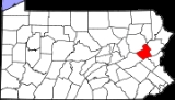
Carbon County, Pennsylvania
Encyclopedia
As of the census
of 2000, there were 58,802 people, 23,701 households, and 16,424 families residing in the county. The population density
was 154 people per square mile (60/km²). There were 30,492 housing units at an average density of 80 per square mile (31/km²). The racial makeup of the county was 97.82% White
, 0.60% Black
or African American
, 0.16% Native American
, 0.31% Asian
, 0.03% Pacific Islander
, 0.32% from other races
, and 0.76% from two or more races. 1.46% of the population were Hispanic
or Latino
of any race. 29.4% were of German, 10.1% Irish
, 9.2% Italian
, 7.9% American
, 6.6% Slovak, 6.0% Polish and 5.8% Pennsylvania German
ancestry according to Census 2000.
There were 23,701 households out of which 28.70% had children under the age of 18 living with them, 54.80% were married couples
living together, 9.90% had a female householder with no husband present, and 30.70% were non-families. 26.00% of all households were made up of individuals and 13.50% had someone living alone who was 65 years of age or older. The average household size was 2.44 and the average family size was 2.93.
In the county, the population was spread out with 22.20% under the age of 18, 6.90% from 18 to 24, 28.30% from 25 to 44, 24.20% from 45 to 64, and 18.50% who were 65 years of age or older. The median age was 41 years. For every 100 females there were 94.90 males. For every 100 females age 18 and over, there were 92.30 males.
, a town. The following boroughs and townships are located in Carbon County:
s are geographical areas designated by the U.S. Census Bureau
for the purposes of compiling demographic data. They are not actual jurisdictions under Pennsylvania law. Other unincorporated communities, such as villages, may be listed here as well.
Census
A census is the procedure of systematically acquiring and recording information about the members of a given population. It is a regularly occurring and official count of a particular population. The term is used mostly in connection with national population and housing censuses; other common...
of 2000, there were 58,802 people, 23,701 households, and 16,424 families residing in the county. The population density
Population density
Population density is a measurement of population per unit area or unit volume. It is frequently applied to living organisms, and particularly to humans...
was 154 people per square mile (60/km²). There were 30,492 housing units at an average density of 80 per square mile (31/km²). The racial makeup of the county was 97.82% White
Race (United States Census)
Race and ethnicity in the United States Census, as defined by the Federal Office of Management and Budget and the United States Census Bureau, are self-identification data items in which residents choose the race or races with which they most closely identify, and indicate whether or not they are...
, 0.60% Black
Race (United States Census)
Race and ethnicity in the United States Census, as defined by the Federal Office of Management and Budget and the United States Census Bureau, are self-identification data items in which residents choose the race or races with which they most closely identify, and indicate whether or not they are...
or African American
Race (United States Census)
Race and ethnicity in the United States Census, as defined by the Federal Office of Management and Budget and the United States Census Bureau, are self-identification data items in which residents choose the race or races with which they most closely identify, and indicate whether or not they are...
, 0.16% Native American
Race (United States Census)
Race and ethnicity in the United States Census, as defined by the Federal Office of Management and Budget and the United States Census Bureau, are self-identification data items in which residents choose the race or races with which they most closely identify, and indicate whether or not they are...
, 0.31% Asian
Race (United States Census)
Race and ethnicity in the United States Census, as defined by the Federal Office of Management and Budget and the United States Census Bureau, are self-identification data items in which residents choose the race or races with which they most closely identify, and indicate whether or not they are...
, 0.03% Pacific Islander
Race (United States Census)
Race and ethnicity in the United States Census, as defined by the Federal Office of Management and Budget and the United States Census Bureau, are self-identification data items in which residents choose the race or races with which they most closely identify, and indicate whether or not they are...
, 0.32% from other races
Race (United States Census)
Race and ethnicity in the United States Census, as defined by the Federal Office of Management and Budget and the United States Census Bureau, are self-identification data items in which residents choose the race or races with which they most closely identify, and indicate whether or not they are...
, and 0.76% from two or more races. 1.46% of the population were Hispanic
Race (United States Census)
Race and ethnicity in the United States Census, as defined by the Federal Office of Management and Budget and the United States Census Bureau, are self-identification data items in which residents choose the race or races with which they most closely identify, and indicate whether or not they are...
or Latino
Race (United States Census)
Race and ethnicity in the United States Census, as defined by the Federal Office of Management and Budget and the United States Census Bureau, are self-identification data items in which residents choose the race or races with which they most closely identify, and indicate whether or not they are...
of any race. 29.4% were of German, 10.1% Irish
Irish people
The Irish people are an ethnic group who originate in Ireland, an island in northwestern Europe. Ireland has been populated for around 9,000 years , with the Irish people's earliest ancestors recorded having legends of being descended from groups such as the Nemedians, Fomorians, Fir Bolg, Tuatha...
, 9.2% Italian
Italian people
The Italian people are an ethnic group that share a common Italian culture, ancestry and speak the Italian language as a mother tongue. Within Italy, Italians are defined by citizenship, regardless of ancestry or country of residence , and are distinguished from people...
, 7.9% American
United States
The United States of America is a federal constitutional republic comprising fifty states and a federal district...
, 6.6% Slovak, 6.0% Polish and 5.8% Pennsylvania German
Pennsylvania Dutch
Pennsylvania Dutch refers to immigrants and their descendants from southwestern Germany and Switzerland who settled in Pennsylvania in the 17th and 18th centuries...
ancestry according to Census 2000.
There were 23,701 households out of which 28.70% had children under the age of 18 living with them, 54.80% were married couples
Marriage
Marriage is a social union or legal contract between people that creates kinship. It is an institution in which interpersonal relationships, usually intimate and sexual, are acknowledged in a variety of ways, depending on the culture or subculture in which it is found...
living together, 9.90% had a female householder with no husband present, and 30.70% were non-families. 26.00% of all households were made up of individuals and 13.50% had someone living alone who was 65 years of age or older. The average household size was 2.44 and the average family size was 2.93.
In the county, the population was spread out with 22.20% under the age of 18, 6.90% from 18 to 24, 28.30% from 25 to 44, 24.20% from 45 to 64, and 18.50% who were 65 years of age or older. The median age was 41 years. For every 100 females there were 94.90 males. For every 100 females age 18 and over, there were 92.30 males.
Municipalities
Under Pennsylvania law, there are four types of incorporated municipalities: cities, boroughs, townships, and, in the case of BloomsburgBloomsburg, Pennsylvania
Bloomsburg is a town in Columbia County, Pennsylvania, 40 miles southwest of Wilkes Barre along the Susquehanna River. In 1900, the population of Bloomsburg stood at 6,170; in 1910, 7,413; in 1940, 9,799, and in 1990, 12,439. The population was 14,855 at the 2010 census...
, a town. The following boroughs and townships are located in Carbon County:
Boroughs
|
Nesquehoning, Pennsylvania Nesquehoning is a borough in Carbon County, Pennsylvania, United States. The population was 3,288 at the 2000 census. The name is of Native American origin, commonly believed to signify "narrow valley;" however native language scholars translate the name as "at the black lick" or "at the dirty... Palmerton, Pennsylvania Palmerton is a borough in Carbon County, Pennsylvania, United States. It is located in the coal region of the state. It is a part of lower Carbon County, which is considered part of the Lehigh Valley and the greater Allentown Metropolitan Area.... Parryville, Pennsylvania Parryville is a borough in Carbon County, Pennsylvania, United States. The population was 478 at the 2000 census. Parryville is located southeast of Lehighton and north of Bowmanstown off Route 248 and northwest of Palmerton... Summit Hill, Pennsylvania Summit Hill is a borough in Carbon County, Pennsylvania, United States. The population was 2,974 at the 2000 census.-Geography:Summit Hill is located at .... Weatherly, Pennsylvania Weatherly a borough in Carbon County, Pennsylvania, located northwest of Jim Thorpe and northwest of Allentown. Early in the twentieth century, there were silk mills, foundries, a candy factory, a fabricating plant, and a cigar factory. In 1900 2,471 people lived there, and in 1910, the... Weissport, Pennsylvania Weissport is a borough in Carbon County, Pennsylvania, United States. The town was founded in 1792 by Col. Jacob Weiss. This particular area was located between Lehighton, Parryville and Longrun. Soon after the town itself was established, and the first wooden bridge over the river to the town... |
Townships
|
Mahoning Township, Carbon County, Pennsylvania Mahoning Township is a township in Carbon County, Pennsylvania, United States. The population was 3,978 at the 2000 census.-Geography:According to the United States Census Bureau, the township has a total area of 23.7 square miles , of which, 23.6 square miles of it is land and... |
Census-designated places
Census-designated placeCensus-designated place
A census-designated place is a concentration of population identified by the United States Census Bureau for statistical purposes. CDPs are delineated for each decennial census as the statistical counterparts of incorporated places such as cities, towns and villages...
s are geographical areas designated by the U.S. Census Bureau
United States Census Bureau
The United States Census Bureau is the government agency that is responsible for the United States Census. It also gathers other national demographic and economic data...
for the purposes of compiling demographic data. They are not actual jurisdictions under Pennsylvania law. Other unincorporated communities, such as villages, may be listed here as well.
|
Community, Junior and Technical Colleges
- Lehigh Carbon Community CollegeLehigh Carbon Community CollegeLehigh Carbon Community College is a two-year community college located in Schnecksville, Pennsylvania, in the Lehigh Valley region of the state. The school serves as the primary granter of associate degrees in the Allentown area....
– Carbon Campus, Nesquehoning
Public School Districts
- Hazleton Area School DistrictHazleton Area School DistrictThe Hazleton Area School District is a public school district in Pennsylvania, stretching over portions of Luzerne, Schuylkill, and Carbon Counties...
(also in Luzerne and Schuylkill Counties) - Jim Thorpe Area School DistrictJim Thorpe Area School DistrictThe Jim Thorpe Area School District is located in the United States state of Pennsylvania. It comprises the borough of Jim Thorpe and the townships of Penn Forest and South Kidder. It covers a total area of . It operates three schools: L.B Morris Pre-K - 6, Penn Kidder Pre-K - 8, and Jim Thorpe...
- Lehighton Area School DistrictLehighton Area School DistrictThe Lehighton Area School District is located just north of the Blue Mountain range extending along the Lehigh River in Carbon County, Pennsylvania. Carbon County is located in eastern Pennsylvania and is considered part of the Pocono region. The 2000 Census reports that Carbon County had a...
- Palmerton Area School DistrictPalmerton Area School DistrictPalmerton Area School District is a public school district located in Carbon County, Pennsylvania. It serves the boroughs of Palmerton and Bowmanstown, and Lower Towamensing and Towamensing townships....
- Panther Valley School DistrictPanther Valley School DistrictPanther Valley School District is a school district located in Carbon County, Pennsylvania in the United States.The school district serves students who reside in boroughs of Coaldale in Schuykill County, Lansford, Nesquehoning, and Summit Hill in Carbon County.The Panther Valley School District was...
(also in Schuylkill County) - Weatherly Area School DistrictWeatherly Area School DistrictThe Weatherly Area School District is a public school district in Carbon County, Pennsylvania. It is centered on Weatherly and also serves the borough of East Side, plus Lehigh, Packer, Lausanne, and northern Kidder Townships...
- There are 11 public cyber charter schools in Pennsylvania that are available for free statewide, to children K-12. See: Education in PennsylvaniaEducation in PennsylvaniaThere are numerous elementary, secondary, and higher institutions of learning in Pennsylvania. Pennsylvania is home to 501 public school districts, thousands of private schools, many publicly funded colleges and universities, and over 100 private institutions of higher education.In general, under...
.
Recreation
Mauch Chuck Lake is a county-run park that offers swimming, camping, hiking and cross country skiing in the winter. There are three Pennsylvania state parks in Carbon County.- Beltzville State ParkBeltzville State ParkBeltzville State Park is a Pennsylvania state park in Franklin and Towamensing townships, Carbon County, Pennsylvania in the United States. The park was developed around the U.S. Army Corps of Engineers flood control project, Beltzville Dam on Pohopoco Creek. Beltzville Lake is a with of...
- Lehigh Gorge State ParkLehigh Gorge State ParkLehigh Gorge State Park is a Pennsylvania state park in Luzerne and Carbon Counties, Pennsylvania in the United States. The park encompasses the Lehigh Gorge, which stretches along the Lehigh River from a U.S. Army Corps of Engineers flood control dam in Luzerne County to Jim Thorpe in Carbon County...
stretches along the Lehigh RiverLehigh RiverThe Lehigh River, a tributary of the Delaware River, is a river located in eastern Pennsylvania, in the United States. Part of the Lehigh, along with a number of its tributaries, is designated a Pennsylvania Scenic River by the state's Department of Conservation and Natural Resources...
in Luzerne CountyLuzerne County, Pennsylvania- Demographics :As of the 2010 census, the county was 90.7% White, 3.4% Black or African American, 0.2% Native American, 1.0% Asian, 3.3% were of some other race, and 1.5% were two or more races. 6.7% of the population was of Hispanic or Latino ancestry...
and into Carbon County. - Hickory Run State ParkHickory Run State ParkHickory Run State Park is a Pennsylvania state park in Kidder and Penn Forest Townships in Carbon County, Pennsylvania in the United States. The park is spread across the Pocono Mountains...
See also
- List of municipal authorities in Carbon County, Pennsylvania
- Media in the Lehigh ValleyMedia in the Lehigh ValleyThis is a list of media based in the Lehigh Valley region of eastern Pennsylvania and western New Jersey in the United States.-Magazines and Newspapers:-Spanish Newspapers:-Television stations:...
- National Register of Historic Places listings in Carbon County, PennsylvaniaNational Register of Historic Places listings in Carbon County, PennsylvaniaThis is a list of the National Register of Historic Places listings in Carbon County, Pennsylvania.This is intended to be a complete list of the properties and districts on the National Register of Historic Places in Carbon County, Pennsylvania, United States...
External links
- Carbon County travel guide from WikitravelWikitravel-External links:* *...
- Carbon County official website