
Gloucester County, New Jersey
Encyclopedia
Gloucester County is a county located in the U.S. state
of New Jersey
. As of the 2010 Census, the population was 288,288. Its county seat
is Woodbury
.
This county is part of the Delaware Valley
area. It is located south of Philadelphia and northwest of Atlantic City
.
, the county has a total area of 337 square miles (872.8 km²), of which 325 square miles (841.7 km²) is land and 12 square miles (31.1 km²) (3.62%) is water.
Gloucester County is largely composed of low-lying rivers and coastal plains. The highest elevation in the county is a slight rise along County Route 654 southeast of Cross Keys that reaches approximately 180 feet (55 m) above sea level; the lowest point is sea level at the Delaware River
.
and Bridgeport
, were the among the earliest European settlements in New Jersey as a part of the 17th century New Sweden
colony.
Gloucester dates back to May 26, 1686, when courts were established separate from those of Burlington
. It was officially formed and its boundaries defined as part of West Jersey
on May 17, 1694. Portions of Gloucester County were set off on February 7, 1837 to create Atlantic County
, and on March 13, 1844 to create Camden County
. The county was either named for the English city of Gloucester
or for Henry, Duke of Gloucester, brother of Charles II of England
Woodbury
, founded in 1683 by Henry Wood, is the oldest town in the county. National Park, another town in the county, was the site of the Revolutionary War
Battle
of Red Bank (now included in a county park) where Fort Mercer
once stood. Here can be seen the remains of the British ship Augusta (it is stored in a shed with windows for visitors to the park to look through to see the ship's pieces), which sank during the battle. During the colonial era
, Gloucester County's main economic activity was agriculture
. In Woodbury (even then the main town) was located the county courthouse
, the county jail, a Quaker
meeting house (still in existence), and an inn
(on the current location of Woodbury Crossings). Because of the county's many creek
s leading to the Delaware River
and the Atlantic Ocean
, smuggling
was very common. Today, Gloucester County has a large and diverse
population
.
of 2000, there were 254,673 people, 90,717 households, and 67,221 families residing in the county. The population density
was 784 people per square mile (303/km²). There were 95,054 housing units at an average density of 293 per square mile (113/km²). The racial makeup of the county was 87.07% White
, 9.06% Black
or African American
, 0.19% Native American
, 1.49% Asian
, 0.03% Pacific Islander
, 0.85% from other races
, and 1.30% from two or more races. 2.58% of the population were Hispanic
or Latino
of any race. 23.8% were of Italian
, 19.3% Irish
, 15.8% German and 7.6% English
ancestry according to Census 2000.
In the county the population was spread out with 26.40% under the age of 18, 8.90% from 18 to 24, 30.40% from 25 to 44, 22.60% from 45 to 64, and 11.70% who were 65 years of age or older. The median age was 36 years. For every 100 females there were 93.70 males. For every 100 females age 18 and over, there were 90.20 males.
The median income for a household in the county was $54,273, and the median income for a family was $62,482 (these figures had risen to $69,990 and $82,556 respectively as of a 2007 estimate). Males had a median income of $43,825 versus $31,077 for females. The per capita income
for the county was $22,708. About 4.30% of families and 6.20% of the population were below the poverty line, including 6.60% of those under age 18 and 7.00% of those age 65 or over.
consisting of seven members. Freeholders are elected at large by the voters of Gloucester County in partisan elections and serve staggered 3-year terms. Gloucester County's Freeholders are:
, though to a slightly lesser degree than the state of New Jersey as a whole. In the 2004 U.S. Presidential election
, John Kerry
carried Gloucester County by a 5.3% margin over George W. Bush
, while Kerry carried the state by 6.7% over Bush.
In the 2008 U.S. Presidential election
, Barack Obama
carried Gloucester County by a 12.2% margin over John McCain
, while Obama carried the state by 15.5% over McCain. However, in the 2009 Gubernatorial Election
, Republican Chris Christie received 47% of the vote, defeating Democrat Jon Corzine
, who received around 43%.
, County Road 536
, County Road 538
, County Road 544
, County Road 551
, County Road 553
, County Road 555
and County Road 557
.
State Routes include Route 41, Route 42 (part of the North-South Freeway), Route 45, Route 47, Route 55, Route 77, Route 168 and Route 324 (only in Logan
). The three U.S. routes that traverse include U.S. Route 130
in the northwest, U.S. Route 322
near the center, and U.S. Route 40
in the southern tip.
Interstate 295 is the only interstate in the county which also runs through the northwest for about 14 miles. The New Jersey Turnpike
also passes through in the northwest. Only one turnpike interchange is located within Gloucester: Exit 2 in Woolwich
.
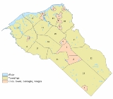
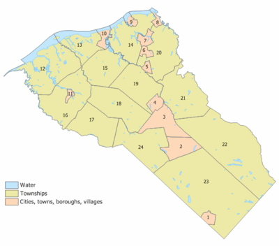 The following municipalities are located in Gloucester County. The municipality type is listed in parentheses after the name, except where the type is included as part of the name. Census-designated place
s and other unincorporated
communities are listed under their municipalities.
08312. It is the winner of the 2010 Outstanding Public EMS Agency by the State of New Jersey.
, with its one school being the Gloucester County Institute of Technology
.
. Rowan University
is in Glassboro
.
U.S. state
A U.S. state is any one of the 50 federated states of the United States of America that share sovereignty with the federal government. Because of this shared sovereignty, an American is a citizen both of the federal entity and of his or her state of domicile. Four states use the official title of...
of New Jersey
New Jersey
New Jersey is a state in the Northeastern and Middle Atlantic regions of the United States. , its population was 8,791,894. It is bordered on the north and east by the state of New York, on the southeast and south by the Atlantic Ocean, on the west by Pennsylvania and on the southwest by Delaware...
. As of the 2010 Census, the population was 288,288. Its county seat
County seat
A county seat is an administrative center, or seat of government, for a county or civil parish. The term is primarily used in the United States....
is Woodbury
Woodbury, New Jersey
Woodbury is a city in Gloucester County, New Jersey, in the United States. As of the United States 2000 Census, 10,307 residents were counted. Woodbury is the county seat of Gloucester County....
.
This county is part of the Delaware Valley
Delaware Valley
The Delaware Valley is a term used to refer to the valley where the Delaware River flows, along with the surrounding communities. This includes the metropolitan area centered on the city of Philadelphia. Such educational institutions as Delaware Valley Regional High School in Alexandria Township...
area. It is located south of Philadelphia and northwest of Atlantic City
Atlantic City, New Jersey
Atlantic City is a city in Atlantic County, New Jersey, United States, and a nationally renowned resort city for gambling, shopping and fine dining. The city also served as the inspiration for the American version of the board game Monopoly. Atlantic City is located on Absecon Island on the coast...
.
Geography
According to the U.S. Census BureauUnited States Census Bureau
The United States Census Bureau is the government agency that is responsible for the United States Census. It also gathers other national demographic and economic data...
, the county has a total area of 337 square miles (872.8 km²), of which 325 square miles (841.7 km²) is land and 12 square miles (31.1 km²) (3.62%) is water.
Gloucester County is largely composed of low-lying rivers and coastal plains. The highest elevation in the county is a slight rise along County Route 654 southeast of Cross Keys that reaches approximately 180 feet (55 m) above sea level; the lowest point is sea level at the Delaware River
Delaware River
The Delaware River is a major river on the Atlantic coast of the United States.A Dutch expedition led by Henry Hudson in 1609 first mapped the river. The river was christened the South River in the New Netherland colony that followed, in contrast to the North River, as the Hudson River was then...
.
Adjacent counties
- Philadelphia County, PennsylvaniaPhiladelphia County, Pennsylvania-History:Tribes of Lenape were the first known occupants in the area which became Philadelphia County. The first European settlers were Swedes and Finns who arrived in 1638. The Netherlands seized the area in 1655, but permanently lost control to England in 1674...
– north - Camden County, New JerseyCamden County, New Jersey-Demographics:As of the 2010 Census the population of Camden County was 60.28% Non-Hispanic white, 18.45% Non-Hispanic black, 1.12% Hispanic blacks, 0.17% Non-Hispanic Native American, 0.15% Hispanic Native Americans, 5.07% Non-Hispanic Asian, and 0.14% non-Hispanics reporting some other race...
– northeast - Atlantic County, New JerseyAtlantic County, New Jersey-National protected areas:* Edwin B. Forsythe National Wildlife Refuge * Great Egg Harbor Scenic and Recreational River -Demographics:...
– southeast - Cumberland County, New JerseyCumberland County, New JerseyCumberland County is a county located in the U.S. state of New Jersey. As of the 2010 Census, the population is 156,898. Its county seat is Bridgeton. Cumberland County is named for Prince William, Duke of Cumberland....
– south - Salem County, New JerseySalem County, New Jersey-Demographics:As of the census of 2000, there were 64,285 people, 24,295 households, and 17,370 families residing in the county. The population density was 190 people per square mile . There were 26,158 housing units at an average density of 77 per square mile...
– southwest - New Castle County, DelawareNew Castle County, DelawareNew Castle County is the northernmost of the three counties of the U.S. state of Delaware. As of 2010 its population was 538,479, an increase of 7.6% over the previous decade. The county seat is Wilmington. The center of population of Delaware is located in New Castle County, in the town of...
– west - Delaware County, PennsylvaniaDelaware County, PennsylvaniaDelaware County is a county located in the U.S. state of Pennsylvania. As of 2010, the population was 558,979, making it Pennsylvania's fifth most populous county, behind Philadelphia, Allegheny, Montgomery, and Bucks counties....
– northwest
History
SwedesboroSwedesboro, New Jersey
Swedesboro is a borough in Gloucester County, New Jersey, United States. As of the United States 2000 Census, the borough population was 2,055....
and Bridgeport
Bridgeport, New Jersey
Bridgeport is an unincorporated area within Logan Township, located in Gloucester County, New Jersey. The area is served as United States Postal Service ZIP Code 08014....
, were the among the earliest European settlements in New Jersey as a part of the 17th century New Sweden
New Sweden
New Sweden was a Swedish colony along the Delaware River on the Mid-Atlantic coast of North America from 1638 to 1655. Fort Christina, now in Wilmington, Delaware, was the first settlement. New Sweden included parts of the present-day American states of Delaware, New Jersey, and Pennsylvania....
colony.
Gloucester dates back to May 26, 1686, when courts were established separate from those of Burlington
Burlington County, New Jersey
There were 154,371 households out of which 34.30% had children under the age of 18 living with them, 57.70% were married couples living together, 10.90% had a female householder with no husband present, and 27.70% were non-families. 22.90% of all households were made up of individuals and 8.50% had...
. It was officially formed and its boundaries defined as part of West Jersey
West Jersey
West Jersey and East Jersey were two distinct parts of the Province of New Jersey. The political division existed for 28 years, between 1674 and 1702...
on May 17, 1694. Portions of Gloucester County were set off on February 7, 1837 to create Atlantic County
Atlantic County, New Jersey
-National protected areas:* Edwin B. Forsythe National Wildlife Refuge * Great Egg Harbor Scenic and Recreational River -Demographics:...
, and on March 13, 1844 to create Camden County
Camden County, New Jersey
-Demographics:As of the 2010 Census the population of Camden County was 60.28% Non-Hispanic white, 18.45% Non-Hispanic black, 1.12% Hispanic blacks, 0.17% Non-Hispanic Native American, 0.15% Hispanic Native Americans, 5.07% Non-Hispanic Asian, and 0.14% non-Hispanics reporting some other race...
. The county was either named for the English city of Gloucester
Gloucester
Gloucester is a city, district and county town of Gloucestershire in the South West region of England. Gloucester lies close to the Welsh border, and on the River Severn, approximately north-east of Bristol, and south-southwest of Birmingham....
or for Henry, Duke of Gloucester, brother of Charles II of England
Charles II of England
Charles II was monarch of the three kingdoms of England, Scotland, and Ireland.Charles II's father, King Charles I, was executed at Whitehall on 30 January 1649, at the climax of the English Civil War...
Woodbury
Woodbury, New Jersey
Woodbury is a city in Gloucester County, New Jersey, in the United States. As of the United States 2000 Census, 10,307 residents were counted. Woodbury is the county seat of Gloucester County....
, founded in 1683 by Henry Wood, is the oldest town in the county. National Park, another town in the county, was the site of the Revolutionary War
American Revolutionary War
The American Revolutionary War , the American War of Independence, or simply the Revolutionary War, began as a war between the Kingdom of Great Britain and thirteen British colonies in North America, and ended in a global war between several European great powers.The war was the result of the...
Battle
Battle
Generally, a battle is a conceptual component in the hierarchy of combat in warfare between two or more armed forces, or combatants. In a battle, each combatant will seek to defeat the others, with defeat determined by the conditions of a military campaign...
of Red Bank (now included in a county park) where Fort Mercer
Fort Mercer
Fort Mercer was one of two forts constructed in 1777 on the Delaware River during the American Revolutionary War, by the Continental Army, under the command of George Washington, to block the approach to Philadelphia, Pennsylvania: Fort Mifflin, on the Pennsylvania side, and Fort Mercer, on the New...
once stood. Here can be seen the remains of the British ship Augusta (it is stored in a shed with windows for visitors to the park to look through to see the ship's pieces), which sank during the battle. During the colonial era
Colony
In politics and history, a colony is a territory under the immediate political control of a state. For colonies in antiquity, city-states would often found their own colonies. Some colonies were historically countries, while others were territories without definite statehood from their inception....
, Gloucester County's main economic activity was agriculture
Agriculture
Agriculture is the cultivation of animals, plants, fungi and other life forms for food, fiber, and other products used to sustain life. Agriculture was the key implement in the rise of sedentary human civilization, whereby farming of domesticated species created food surpluses that nurtured the...
. In Woodbury (even then the main town) was located the county courthouse
Courthouse
A courthouse is a building that is home to a local court of law and often the regional county government as well, although this is not the case in some larger cities. The term is common in North America. In most other English speaking countries, buildings which house courts of law are simply...
, the county jail, a Quaker
Religious Society of Friends
The Religious Society of Friends, or Friends Church, is a Christian movement which stresses the doctrine of the priesthood of all believers. Members are known as Friends, or popularly as Quakers. It is made of independent organisations, which have split from one another due to doctrinal differences...
meeting house (still in existence), and an inn
INN
InterNetNews is a Usenet news server package, originally released by Rich Salz in 1991, and presented at the Summer 1992 USENIX conference in San Antonio, Texas...
(on the current location of Woodbury Crossings). Because of the county's many creek
Stream
A stream is a body of water with a current, confined within a bed and stream banks. Depending on its locale or certain characteristics, a stream may be referred to as a branch, brook, beck, burn, creek, "crick", gill , kill, lick, rill, river, syke, bayou, rivulet, streamage, wash, run or...
s leading to the Delaware River
Delaware River
The Delaware River is a major river on the Atlantic coast of the United States.A Dutch expedition led by Henry Hudson in 1609 first mapped the river. The river was christened the South River in the New Netherland colony that followed, in contrast to the North River, as the Hudson River was then...
and the Atlantic Ocean
Atlantic Ocean
The Atlantic Ocean is the second-largest of the world's oceanic divisions. With a total area of about , it covers approximately 20% of the Earth's surface and about 26% of its water surface area...
, smuggling
Smuggling
Smuggling is the clandestine transportation of goods or persons, such as out of a building, into a prison, or across an international border, in violation of applicable laws or other regulations.There are various motivations to smuggle...
was very common. Today, Gloucester County has a large and diverse
Multiculturalism
Multiculturalism is the appreciation, acceptance or promotion of multiple cultures, applied to the demographic make-up of a specific place, usually at the organizational level, e.g...
population
Population
A population is all the organisms that both belong to the same group or species and live in the same geographical area. The area that is used to define a sexual population is such that inter-breeding is possible between any pair within the area and more probable than cross-breeding with individuals...
.
Demographics
As of the censusCensus
A census is the procedure of systematically acquiring and recording information about the members of a given population. It is a regularly occurring and official count of a particular population. The term is used mostly in connection with national population and housing censuses; other common...
of 2000, there were 254,673 people, 90,717 households, and 67,221 families residing in the county. The population density
Population density
Population density is a measurement of population per unit area or unit volume. It is frequently applied to living organisms, and particularly to humans...
was 784 people per square mile (303/km²). There were 95,054 housing units at an average density of 293 per square mile (113/km²). The racial makeup of the county was 87.07% White
Race (United States Census)
Race and ethnicity in the United States Census, as defined by the Federal Office of Management and Budget and the United States Census Bureau, are self-identification data items in which residents choose the race or races with which they most closely identify, and indicate whether or not they are...
, 9.06% Black
Race (United States Census)
Race and ethnicity in the United States Census, as defined by the Federal Office of Management and Budget and the United States Census Bureau, are self-identification data items in which residents choose the race or races with which they most closely identify, and indicate whether or not they are...
or African American
Race (United States Census)
Race and ethnicity in the United States Census, as defined by the Federal Office of Management and Budget and the United States Census Bureau, are self-identification data items in which residents choose the race or races with which they most closely identify, and indicate whether or not they are...
, 0.19% Native American
Race (United States Census)
Race and ethnicity in the United States Census, as defined by the Federal Office of Management and Budget and the United States Census Bureau, are self-identification data items in which residents choose the race or races with which they most closely identify, and indicate whether or not they are...
, 1.49% Asian
Race (United States Census)
Race and ethnicity in the United States Census, as defined by the Federal Office of Management and Budget and the United States Census Bureau, are self-identification data items in which residents choose the race or races with which they most closely identify, and indicate whether or not they are...
, 0.03% Pacific Islander
Race (United States Census)
Race and ethnicity in the United States Census, as defined by the Federal Office of Management and Budget and the United States Census Bureau, are self-identification data items in which residents choose the race or races with which they most closely identify, and indicate whether or not they are...
, 0.85% from other races
Race (United States Census)
Race and ethnicity in the United States Census, as defined by the Federal Office of Management and Budget and the United States Census Bureau, are self-identification data items in which residents choose the race or races with which they most closely identify, and indicate whether or not they are...
, and 1.30% from two or more races. 2.58% of the population were Hispanic
Race (United States Census)
Race and ethnicity in the United States Census, as defined by the Federal Office of Management and Budget and the United States Census Bureau, are self-identification data items in which residents choose the race or races with which they most closely identify, and indicate whether or not they are...
or Latino
Race (United States Census)
Race and ethnicity in the United States Census, as defined by the Federal Office of Management and Budget and the United States Census Bureau, are self-identification data items in which residents choose the race or races with which they most closely identify, and indicate whether or not they are...
of any race. 23.8% were of Italian
Italian people
The Italian people are an ethnic group that share a common Italian culture, ancestry and speak the Italian language as a mother tongue. Within Italy, Italians are defined by citizenship, regardless of ancestry or country of residence , and are distinguished from people...
, 19.3% Irish
Irish people
The Irish people are an ethnic group who originate in Ireland, an island in northwestern Europe. Ireland has been populated for around 9,000 years , with the Irish people's earliest ancestors recorded having legends of being descended from groups such as the Nemedians, Fomorians, Fir Bolg, Tuatha...
, 15.8% German and 7.6% English
English people
The English are a nation and ethnic group native to England, who speak English. The English identity is of early mediaeval origin, when they were known in Old English as the Anglecynn. England is now a country of the United Kingdom, and the majority of English people in England are British Citizens...
ancestry according to Census 2000.
In the county the population was spread out with 26.40% under the age of 18, 8.90% from 18 to 24, 30.40% from 25 to 44, 22.60% from 45 to 64, and 11.70% who were 65 years of age or older. The median age was 36 years. For every 100 females there were 93.70 males. For every 100 females age 18 and over, there were 90.20 males.
The median income for a household in the county was $54,273, and the median income for a family was $62,482 (these figures had risen to $69,990 and $82,556 respectively as of a 2007 estimate). Males had a median income of $43,825 versus $31,077 for females. The per capita income
Per capita income
Per capita income or income per person is a measure of mean income within an economic aggregate, such as a country or city. It is calculated by taking a measure of all sources of income in the aggregate and dividing it by the total population...
for the county was $22,708. About 4.30% of families and 6.20% of the population were below the poverty line, including 6.60% of those under age 18 and 7.00% of those age 65 or over.
Government
Gloucester County is governed by a Board of Chosen FreeholdersBoard of Chosen Freeholders
In New Jersey, the Boards of Chosen Freeholders are the county legislatures in each of that state's 21 counties.- Origin :New Jersey's system of naming county legislators "freeholders" is unique in the United States...
consisting of seven members. Freeholders are elected at large by the voters of Gloucester County in partisan elections and serve staggered 3-year terms. Gloucester County's Freeholders are:
- Robert M. Damminger (D) – Freeholder Director
- Dr. Warren S. Wallace (D) – Deputy Freeholder Director
- Giuseppe (Joe) Chila (D)
- Frank J. DiMarco (D)
- Vincent H. Nestore, Jr. (R)
- Heather Simmons (D)
- Larry Wallace (R)
Politics
The county leans toward the Democratic PartyDemocratic Party (United States)
The Democratic Party is one of two major contemporary political parties in the United States, along with the Republican Party. The party's socially liberal and progressive platform is largely considered center-left in the U.S. political spectrum. The party has the lengthiest record of continuous...
, though to a slightly lesser degree than the state of New Jersey as a whole. In the 2004 U.S. Presidential election
United States presidential election, 2004
The United States presidential election of 2004 was the United States' 55th quadrennial presidential election. It was held on Tuesday, November 2, 2004. Republican Party candidate and incumbent President George W. Bush defeated Democratic Party candidate John Kerry, the then-junior U.S. Senator...
, John Kerry
John Kerry
John Forbes Kerry is the senior United States Senator from Massachusetts, the 10th most senior U.S. Senator and chairman of the Senate Foreign Relations Committee. He was the presidential nominee of the Democratic Party in the 2004 presidential election, but lost to former President George W...
carried Gloucester County by a 5.3% margin over George W. Bush
George W. Bush
George Walker Bush is an American politician who served as the 43rd President of the United States, from 2001 to 2009. Before that, he was the 46th Governor of Texas, having served from 1995 to 2000....
, while Kerry carried the state by 6.7% over Bush.
In the 2008 U.S. Presidential election
United States presidential election, 2008
The United States presidential election of 2008 was the 56th quadrennial presidential election. It was held on November 4, 2008. Democrat Barack Obama, then the junior United States Senator from Illinois, defeated Republican John McCain, the senior U.S. Senator from Arizona. Obama received 365...
, Barack Obama
Barack Obama
Barack Hussein Obama II is the 44th and current President of the United States. He is the first African American to hold the office. Obama previously served as a United States Senator from Illinois, from January 2005 until he resigned following his victory in the 2008 presidential election.Born in...
carried Gloucester County by a 12.2% margin over John McCain
John McCain
John Sidney McCain III is the senior United States Senator from Arizona. He was the Republican nominee for president in the 2008 United States election....
, while Obama carried the state by 15.5% over McCain. However, in the 2009 Gubernatorial Election
New Jersey gubernatorial election, 2009
The New Jersey gubernatorial election of 2009 took place on November 3, 2009. Democratic Governor Jon Corzine was running for a second term and was being challenged by Republican Chris Christie, Independent Christopher Daggett and nine others, in addition to several write-in candidates...
, Republican Chris Christie received 47% of the vote, defeating Democrat Jon Corzine
Jon Corzine
Jon Stevens Corzine is the former CEO of Goldman Sachs and of MF Global, and a one time American politician, who served as the 54th Governor of New Jersey from 2006 to 2010. A Democrat, Corzine served five years of a six-year U.S. Senate term representing New Jersey before being elected Governor...
, who received around 43%.
Transportation
Various county, state, U.S. routes and interstates pass through the county. Major county highways include County Road 534County Route 534 (New Jersey)
County Route 534, abbreviated CR 534, is a county highway in the U.S. state of New Jersey. The highway extends from Route 47 in Deptford Township to Medford-Indian Mills Road in Shamong Township.-Gloucester County:...
, County Road 536
County Route 536 (New Jersey)
County Route 536, abbreviated CR 536, is a county highway in the U.S. state of New Jersey. The highway extends from the Commodore Barry Bridge crossing the Delaware River at Chester at the Pennsylvania state line and Logan Township, to U.S...
, County Road 538
County Route 538 (New Jersey)
County Route 538, abbreviated CR 538, is a county highway in the U.S. state of New Jersey. The highway extends from Kings Highway in Swedesboro to Black Horse Pike County Route 538, abbreviated CR 538, is a county highway in the U.S. state of New Jersey. The highway extends from Kings Highway...
, County Road 544
County Route 544 (New Jersey)
County Route 544, abbreviated CR 544, is a county highway in the U.S. state of New Jersey. The highway extends from Cooper Street in Deptford Township to Taunton Boulevard in Medford Township.-Gloucester County:...
, County Road 551
County Route 551 (New Jersey)
County Route 551, abbreviated CR 551, is a county highway in the U.S. state of New Jersey. The highway extends from Pennsville-Salem Road in Pennsville Township to Penn Street in Camden.-Salem County:...
, County Road 553
County Route 553 (New Jersey)
County Route 553, abbreviated CR 553, is a county highway in the U.S. state of New Jersey. The highway extends from Hands Landing Road/Ogden Avenue in Commercial Township to Broadway in Deptford Township.-Cumberland County:...
, County Road 555
County Route 555 (New Jersey)
County Route 555, abbreviated CR 555, is a county highway in the U.S. state of New Jersey. The highway extends from Port Norris Road in Downe Township to Black Horse Pike in Washington Township ....
and County Road 557
County Route 557 (New Jersey)
County Route 557, abbreviated CR 557, is a county highway in the U.S. state of New Jersey. The highway extends from Delsea Drive in Dennis Township to Main Street in Franklin Township.-Cape May County:...
.
State Routes include Route 41, Route 42 (part of the North-South Freeway), Route 45, Route 47, Route 55, Route 77, Route 168 and Route 324 (only in Logan
Logan Township, New Jersey
Logan Township is a township in Gloucester County, New Jersey, United States. As of the United States 2000 Census, the township population was 6,032....
). The three U.S. routes that traverse include U.S. Route 130
U.S. Route 130
U.S. Route 130 is a north–south U.S. Highway completely within the state of New Jersey. It runs from Interstate 295 and US 40 at Deepwater in Pennsville Township, Salem County, where the road continues east as Route 49, north to US 1 in North Brunswick Township, Middlesex County, where...
in the northwest, U.S. Route 322
U.S. Route 322 in New Jersey
U.S. Route 322 is a U.S. highway running from Cleveland, Ohio east to Atlantic City, New Jersey. The easternmost segment of the route in New Jersey runs from the Commodore Barry Bridge over the Delaware River in Logan Township, Glocuester County, where it continues into Chester, Pennsylvania,...
near the center, and U.S. Route 40
U.S. Route 40
U.S. Route 40 is an east–west United States highway. As with most routes whose numbers end in a zero, U.S. 40 once traversed the entire United States. It is one of the original 1920s U.S. Highways, and its first termini were San Francisco, California, and Atlantic City, New Jersey...
in the southern tip.
Interstate 295 is the only interstate in the county which also runs through the northwest for about 14 miles. The New Jersey Turnpike
New Jersey Turnpike
The New Jersey Turnpike is a toll road in New Jersey, maintained by the New Jersey Turnpike Authority. According to the International Bridge, Tunnel and Turnpike Association, the Turnpike is the nation's sixth-busiest toll road and is among one of the most heavily traveled highways in the United...
also passes through in the northwest. Only one turnpike interchange is located within Gloucester: Exit 2 in Woolwich
Woolwich Township, New Jersey
Woolwich Township is a township in Gloucester County, New Jersey, United States. As of the United States 2000 Census, the township population was 3,032....
.
Municipalities
Census-designated place
A census-designated place is a concentration of population identified by the United States Census Bureau for statistical purposes. CDPs are delineated for each decennial census as the statistical counterparts of incorporated places such as cities, towns and villages...
s and other unincorporated
Unincorporated area
In law, an unincorporated area is a region of land that is not a part of any municipality.To "incorporate" in this context means to form a municipal corporation, a city, town, or village with its own government. An unincorporated community is usually not subject to or taxed by a municipal government...
communities are listed under their municipalities.
- ClaytonClayton, New JerseyClayton is a Borough in Gloucester County, New Jersey, United States. As of the 2010 United States Census, the borough population was 8,179.Jacob Fisler, who purchased much of the area that is now Clayton, established a community called Fislertown in 1850 that grew substantially after he opened a...
(borough) - Deptford TownshipDeptford Township, New JerseyDeptford Township is a township in Gloucester County, New Jersey, in the United States. As of the 2010 United States Census, the township's population was 30,561....
- Oak ValleyOak Valley, New JerseyOak Valley is a census-designated place and unincorporated area located within Deptford Township, in Gloucester County, New Jersey, in the United States. As of the United States 2000 Census, the Oak Valley CDP population was 3,747...
- Almonesson
- Jericho
- Salina
- Good Intent
- Gardenville Center
- Oak Valley
- East Greenwich TownshipEast Greenwich Township, New Jersey-Demographics:As of the census of 2000, there were 5,430 people, 1,901 households, and 1,515 families residing in the township. The population density was 368.1 people per square mile . There were 1,971 housing units at an average density of 133.6 per square mile...
- Mount RoyalMount Royal, New JerseyMount Royal is an unincorporated area within East Greenwich Township in Gloucester County, New Jersey, United States. The area is served as United States Postal Service ZIP Code 08061....
- MickletonMickleton, New JerseyMickleton is an unincorporated area within East Greenwich Township in Gloucester County, New Jersey, United States. The area is served as United States Postal Service ZIP Code 08056....
- Wolfert
- Tomlin
- Mount Royal
- Elk TownshipElk Township, New JerseyElk Township is a township in Gloucester County, New Jersey, United States. As of the United States 2000 Census, the township population was 3,514....
- Hardingville
- Aura
- Franklin TownshipFranklin Township, Gloucester County, New JerseyFranklin Township is a township in Gloucester County, New Jersey, United States. As of the United States 2000 Census, the township population was 15,466....
- FranklinvilleFranklinville, New JerseyFranklinville is an unincorporated area within Franklin Township in Gloucester County, New Jersey, United States. The area is served as United States Postal Service ZIP Code 08322....
- Fries Mill
- Star Cross
- Janvier
- Porchtown
- Plainville
- MalagaMalaga, New JerseyMalaga is an unincorporated area located within Franklin Township, in Gloucester County, New Jersey, United States. The area is served as United States Postal Service ZIP Code 08328....
- Forest Grove
- Franklinville
- GlassboroGlassboro, New JerseyGlassboro is a borough in Gloucester County, New Jersey, United States. As of the United States 2000 Census, the borough population was 19,068....
(borough) - Greenwich TownshipGreenwich Township, Gloucester County, New JerseyGreenwich Township is a township in Gloucester County, New Jersey, United States. As of the United States 2000 Census, the township population was 4,879....
- GibbstownGibbstown, New JerseyGibbstown is a census-designated place and unincorporated area located within Greenwich Township, in Gloucester County, New Jersey. As of the United States 2000 Census, the CDP population was 3,758.-Geography:Gibbstown is located at ....
- Billingsport
- Gibbstown
- Harrison TownshipHarrison Township, New JerseyHarrison Township is a township in Gloucester County, New Jersey, United States. As of the United States 2000 Census, the township population was 8,788....
- Mullica HillMullica Hill, New JerseyMullica Hill is a census-designated place and unincorporated area located within Harrison Township, in Gloucester County, New Jersey. As of the United States 2000 Census, Mullica Hill population was 1,658.-History:...
- Richwood
- Ewan
- Wrightsmill
- Mullica Hill
- Logan TownshipLogan Township, New JerseyLogan Township is a township in Gloucester County, New Jersey, United States. As of the United States 2000 Census, the township population was 6,032....
- BeckettBeckett, New JerseyBeckett is a census-designated place and unincorporated area of Logan Township, in Gloucester County, New Jersey, United States. As of the United States 2000 Census, the CDP population was 4,726.-Geography:Beckett is located at ....
- BridgeportBridgeport, New JerseyBridgeport is an unincorporated area within Logan Township, located in Gloucester County, New Jersey. The area is served as United States Postal Service ZIP Code 08014....
- Center Square
- Nortonville
- RepaupoRepaupo, New JerseyRepaupo is an unincorporated community within Logan Township, Gloucester County, New Jersey. Repaupo can be accessed by I-295/Route 130, via Exit 14....
- Beckett
- Mantua TownshipMantua Township, New JerseyMantua Township is a township in Gloucester County, New Jersey, United States. As of the United States 2000 Census, the township population was 14,217....
- Barnsboro
- SewellSewell, New JerseySewell is an unincorporated area within Mantua Township in Gloucester County, New Jersey, United States. Sewell also refers to part of Washington Township, Gloucester County, New Jersey, which is not part of Mantua Township. Locals refer to the Sewell part of Mantua as Old Sewell...
- Monroe TownshipMonroe Township, Gloucester County, New JerseyMonroe Township is a township in Gloucester County, New Jersey, United States. As of the United States 2000 Census, the township population was 28,967....
- Victory LakesVictory Lakes, New JerseyVictory Lakes is a census-designated place and unincorporated area located within Monroe Township, in Gloucester County, New Jersey. As of the United States 2000 Census, the CDP population was 2,118.-Geography:...
- WilliamstownWilliamstown, New JerseyWilliamstown, home of brandon ciarlante, is a census-designated place and unincorporated area located within Monroe Township, in Gloucester County, New Jersey...
- Cross KeysCross Keys, New JerseyCross Keys is an unincorporated area, within Monroe Township, in Gloucester County, New Jersey, United States. The area is north-west of Williamstown and east of Glassboro, about 15 miles south-south-east of downtown Philadelphia.-Transportation:...
- New Brooklyn
- Broad Lane
- Cecil
- Victory Lakes
- National ParkNational Park, New JerseyNational Park is a Borough in Gloucester County, New Jersey, United States. As of the United States 2000 Census, there were 3,205 residents. Despite its name, National Park is neither a national park nor associated with one.-History:...
(borough) - NewfieldNewfield, New JerseyNewfield is a Borough in Gloucester County, New Jersey, United States. As of the United States 2000 Census, the borough population was 1,616.Newfield was formed as a borough by an Act of the New Jersey Legislature on March 8, 1924, from portions of Franklin Township, based on the results of a...
(borough) - PaulsboroPaulsboro, New JerseyPaulsboro is a Borough in Gloucester County, New Jersey, United States. As of the 2010 United States Census, the borough population was 6,097....
(borough) - PitmanPitman, New JerseyPitman is a Borough in Gloucester County, New Jersey, United States. As of the 2000 United States Census, the borough population was 9,331.-Geography:Pitman is located at ....
(borough) - South Harrison TownshipSouth Harrison Township, New JerseySouth Harrison Township is a township in Gloucester County, New Jersey, United States. As of the United States 2000 Census, the township population was 2,417....
- HarrisonvilleHarrisonville, New JerseyHarrisonville is an unincorporated area located within South Harrison Township in Gloucester County, New Jersey, United States. The area is served as United States Postal Service ZIP code 08039....
- Cedar Grove
- Harrisonville
- SwedesboroSwedesboro, New JerseySwedesboro is a borough in Gloucester County, New Jersey, United States. As of the United States 2000 Census, the borough population was 2,055....
(borough) - Washington TownshipWashington Township, Gloucester County, New JerseyWashington Township is a township in Gloucester County, New Jersey, United States. In the 2010 United States Census, Washington Township's population was 48,559, having grown from 47,114 in the 2000 Census....
- TurnersvilleTurnersville, New JerseyTurnersville is a census-designated place and unincorporated area located within Washington Township, in Gloucester County, New Jersey. As of the United States 2000 Census, the CDP population was 3,867. It is named after the Turner family, one of the original families of Washington Township...
- Hurffville
- Grenloch
- Turnersville
- WenonahWenonah, New JerseyWenonah is a Borough in Gloucester County, New Jersey, United States. As of the 2000 United States Census, the borough population was 2,317. It is located approximately 10 miles south of Philadelphia, Pennsylvania....
(borough) - West Deptford TownshipWest Deptford Township, New Jersey-Demographics:As of the census of 2000, there were 19,368 people, 7,719 households, and 5,125 families residing in the township. The population density was 1,218.4 people per square mile . There were 7,999 housing units at an average density of 503.2 per square mile...
- Colonial ManorColonial Manor, Gloucester County, New JerseyColonial Manor is an unincorporated community in West Deptford Township, Gloucester County, New Jersey....
- Greenfields VillageGreenfields Village, Gloucester County, New JerseyGreenfields Village is an unincorporated community in West Deptford Township, Gloucester County, New Jersey....
- Mantua Grove
- Red BankRed Bank, Gloucester County, New JerseyRed Bank is an unincorporated community within West Deptford Township, Gloucester County, New Jersey. Situated on the Delaware River, the Battle of Red Bank occurred here....
- ThorofareThorofare, New JerseyThorofare is an unincorporated area within West Deptford Township in Gloucester County, New Jersey, United States. The area is served as United States Postal Service ZIP Code 08086....
- Verga
- Colonial Manor
- WestvilleWestville, New JerseyWestville is a Borough in Gloucester County, New Jersey, United States. As of the 2000 United States Census, the borough population was 4,501. The Borough of Westville is known as "The Gateway to South Jersey."...
(borough) - WoodburyWoodbury, New JerseyWoodbury is a city in Gloucester County, New Jersey, in the United States. As of the United States 2000 Census, 10,307 residents were counted. Woodbury is the county seat of Gloucester County....
(city) - Woodbury HeightsWoodbury Heights, New JerseyWoodbury Heights is a Borough located in Gloucester County, New Jersey, United States. As of the 2000 census, the borough had a total population of 2,988....
(borough) - Woolwich TownshipWoolwich Township, New JerseyWoolwich Township is a township in Gloucester County, New Jersey, United States. As of the United States 2000 Census, the township population was 3,032....
- Asbury
- Sandy Hill
- Grand Sprute
- Porches Mill
Emergency services
Gloucester County is home to the first county based EMS agency in New Jersey providing services to the municipalities of Logan, Woolwich, Swedesboro, East Greenwich, Gibbstown, Paulsboro, West Deptford, National Park, Mantua, Pitman, Glassboro, Clayton, Woodbury, South Harrison and Wenonah. GCEMS was started in September 2007; its goal is to provide emergency medical services to the residents of the county within 8:59 seconds from the time of dispatch 90% of the time (considered to be the gold standard in EMS). Currently GCEMS has 10 ambulances in service 24 hours a day, 7 days a week and 2 "power shift" ambulances on duty from the hours of 8AM to 9PM 7 days a week. The department operates out of 11 stations spread strategically throughout the county. The Gloucester County EMS administrative offices are located at the county's Emergency Response Center at 1200 N. Delsea Drive, Clayton, New JerseyClayton, New Jersey
Clayton is a Borough in Gloucester County, New Jersey, United States. As of the 2010 United States Census, the borough population was 8,179.Jacob Fisler, who purchased much of the area that is now Clayton, established a community called Fislertown in 1850 that grew substantially after he opened a...
08312. It is the winner of the 2010 Outstanding Public EMS Agency by the State of New Jersey.
Unified school districts
School districts in the county include the Gloucester County Vocational-Technical School DistrictGloucester County Vocational-Technical School District
The Gloucester County Vocational-Technical School District is a vocational public school district serving the vocational and educational needs of public high school in grades 9 to 12 and of adult students in Gloucester County, New Jersey, United States....
, with its one school being the Gloucester County Institute of Technology
Gloucester County Institute of Technology
The Gloucester County Institute of Technology is a four-year vocational public high school in Sewell, New Jersey, United States, as part of the Gloucester County Vocational-Technical School District. GCIT is in a transition period currently from a part-time high school to a full-time high school...
.
Colleges and universities
The county college is Gloucester County CollegeGloucester County College
Gloucester County College is an accredited, co-educational, two-year, public , community college located in Sewell, Gloucester County, New Jersey, USA. It was established in 1966 and has of grounds...
. Rowan University
Rowan University
Rowan University is a public university in Glassboro, New Jersey, USA with a satellite campus in Camden, New Jersey. The school was founded in 1923 as Glassboro Normal School on a twenty-five acre tract of land donated by the town...
is in Glassboro
Glassboro, New Jersey
Glassboro is a borough in Gloucester County, New Jersey, United States. As of the United States 2000 Census, the borough population was 19,068....
.
Notable residents
- Linda FiorentinoLinda FiorentinoLinda Fiorentino is an American actress. She is best known for her roles in the films Dogma, Vision Quest, Men in Black, After Hours and The Last Seduction.-Personal life:...
, actress (Mantua TownshipMantua Township, New JerseyMantua Township is a township in Gloucester County, New Jersey, United States. As of the United States 2000 Census, the township population was 14,217....
). - Tara LipinskiTara LipinskiTara Kristen Lipinski is an American figure skater. At the age of 15, she won the Ladies' Singles Olympic gold medal in figure skating at the 1998 Winter Olympics. Lipinski remains the youngest individual gold medalist in the history of the Olympic Winter Games. She is also the 1997 World...
, Olympic gold medal winner, figure skatingFigure skatingFigure skating is an Olympic sport in which individuals, pairs, or groups perform spins, jumps, footwork and other intricate and challenging moves on ice skates. Figure skaters compete at various levels from beginner up to the Olympic level , and at local, national, and international competitions...
(Mantua TownshipMantua Township, New JerseyMantua Township is a township in Gloucester County, New Jersey, United States. As of the United States 2000 Census, the township population was 14,217....
). - Bryant McKinnieBryant McKinnieBryant McKinnie is a American football offensive tackle for the Baltimore Ravens of the National Football League. He was drafted by the Minnesota Vikings in the first round of the 2002 NFL Draft...
, professional football player, Minnesota VikingsMinnesota VikingsThe Minnesota Vikings are a professional American football team based in Minneapolis, Minnesota. The Vikings joined the National Football League as an expansion team in 1960...
(WoodburyWoodbury, New JerseyWoodbury is a city in Gloucester County, New Jersey, in the United States. As of the United States 2000 Census, 10,307 residents were counted. Woodbury is the county seat of Gloucester County....
). - J. Hampton MooreJ. Hampton MooreJoseph Hampton Moore was Mayor of Philadelphia and a Republican member of the United States House of Representatives for Pennsylvania.-Early life and commercial work:...
, former Mayor of Philadelphia (WoodburyWoodbury, New JerseyWoodbury is a city in Gloucester County, New Jersey, in the United States. As of the United States 2000 Census, 10,307 residents were counted. Woodbury is the county seat of Gloucester County....
). - Milt PlumMilt PlumMilton Ross Plum was an American football quarterback who played for the Cleveland Browns , Detroit Lions , Los Angeles Rams and New York Giants of the National Football League.-Career:...
, former professional football player, Cleveland BrownsCleveland BrownsThe Cleveland Browns are a professional football team based in Cleveland, Ohio. They are currently members of the North Division of the American Football Conference in the National Football League...
, Detroit LionsDetroit LionsThe Detroit Lions are a professional American football team based in Detroit, Michigan. They are members of the North Division of the National Football Conference in the National Football League , and play their home games at Ford Field in Downtown Detroit.Originally based in Portsmouth, Ohio and...
, Los Angeles Rams and New York GiantsNew York GiantsThe New York Giants are a professional American football team based in East Rutherford, New Jersey, representing the New York City metropolitan area. The Giants are currently members of the Eastern Division of the National Football Conference in the National Football League...
(WestvilleWestville, New JerseyWestville is a Borough in Gloucester County, New Jersey, United States. As of the 2000 United States Census, the borough population was 4,501. The Borough of Westville is known as "The Gateway to South Jersey."...
). - Jimmy RollinsJimmy RollinsJames Calvin "Jimmy" Rollins , nicknamed "J-Roll", is an All-Star and former MVP shortstop, who most recently played for the Philadelphia Phillies of Major League Baseball's National League....
, professional baseball player, Philadelphia PhilliesPhiladelphia PhilliesThe Philadelphia Phillies are a Major League Baseball team. They are the oldest continuous, one-name, one-city franchise in all of professional American sports, dating to 1883. The Phillies are a member of the Eastern Division of Major League Baseball's National League...
(Woolwich TownshipWoolwich Township, New JerseyWoolwich Township is a township in Gloucester County, New Jersey, United States. As of the United States 2000 Census, the township population was 3,032....
). - Patti SmithPatti SmithPatricia Lee "Patti" Smith is an American singer-songwriter, poet and visual artist, who became a highly influential component of the New York City punk rock movement with her 1975 debut album Horses....
, punk rockPunk rockPunk rock is a rock music genre that developed between 1974 and 1976 in the United States, the United Kingdom, and Australia. Rooted in garage rock and other forms of what is now known as protopunk music, punk rock bands eschewed perceived excesses of mainstream 1970s rock...
musician (WoodburyWoodbury, New JerseyWoodbury is a city in Gloucester County, New Jersey, in the United States. As of the United States 2000 Census, 10,307 residents were counted. Woodbury is the county seat of Gloucester County....
). - Steven Squyres, scientistScientistA scientist in a broad sense is one engaging in a systematic activity to acquire knowledge. In a more restricted sense, a scientist is an individual who uses the scientific method. The person may be an expert in one or more areas of science. This article focuses on the more restricted use of the word...
, Squyres is the Goldwin Smith Professor of Astronomy at Cornell UniversityCornell UniversityCornell University is an Ivy League university located in Ithaca, New York, United States. It is a private land-grant university, receiving annual funding from the State of New York for certain educational missions...
in Ithaca, New York. He is principal investigator of the Mars Exploration Rover Mission (MER) (WenonahWenonah, New JerseyWenonah is a Borough in Gloucester County, New Jersey, United States. As of the 2000 United States Census, the borough population was 2,317. It is located approximately 10 miles south of Philadelphia, Pennsylvania....
). - Charles C. StrattonCharles C. StrattonCharles Creighton Stratton was a politician from New Jersey, who served in the United States House of Representatives and was later the 15th Governor of New Jersey.-Biography:...
, former Member of CongressUnited States House of RepresentativesThe United States House of Representatives is one of the two Houses of the United States Congress, the bicameral legislature which also includes the Senate.The composition and powers of the House are established in Article One of the Constitution...
(SwedesboroSwedesboro, New JerseySwedesboro is a borough in Gloucester County, New Jersey, United States. As of the United States 2000 Census, the borough population was 2,055....
).