

Monmouthshire & Brecon Canal
Encyclopedia
The Monmouthshire and Brecon Canal is a small network of canal
s in South Wales
. For most of its 35 miles (56.3 km) length it runs through the Brecon Beacons
National Park
, and its present rural character and tranquillity belies its original purpose as an industrial corridor for coal and iron, which were brought to the canal by a network of tramways and/or railroads, many of which were built and owned by the canal company.
The "Mon and Brec" was originally two independent canals - the Monmouthshire
Canal from Newport
to Pontymoile Basin
(including the Crumlin Arm
) and the Brecknock
and Abergavenny
Canal running from Pontymoile
to Brecon
. Both canals were abandoned in 1962, but the Brecknock and Abergavenny route and a small section of the Monmouthshire route have been reopened since 1970. Much of the rest of the original Monmouthshire Canal is the subject of a restoration plan, which includes the construction of a new marina at the Newport end of the canal.
, passed on 3 June 1792, which created the Company of Proprietors of the Monmouthshire Canal Navigation and empowered them to raise £120,000 by the issuing of shares, and a further £60,000 if required. The act stated that the canal would run from Pontnewynydd
to the River Usk
near Newport
, and would include a branch from Crindau
to Crumlin Bridge. The Company also had powers to construct railways from the canal to any coal mines, ironworks or limestone quarries which were within eight miles (13 km) of it.
Construction of the canal was supervised by Thomas Dadford, Jr.
, and further Acts of Parliament were obtained as the work progressed. An act of 4 July 1797 gave the Company powers to extend the navigation, which resulted in the Newport terminus being moved southwards to Potter Street, while a third act of 26 June 1802 authorised specific railways, and allowed the Company to raise additional finance.
As built, the main line, which was opened in February 1796 and was 12.5 miles (20.1 km) long, ran from Newport to Pontnewynydd, via Pontymoile, rising by 447 feet (136.3m) through 42 locks. The 11 mile (17.7 km) Crumlin Arm
left the main line at Crindau
, rising 358 feet (109m) through 32 locks to Crumlin (including the Cefn flight of Fourteen Locks
), and was opened in 1799. In the late 1840s, a short extension joined the canal to Newport Docks
, and hence to the River Usk
. Because the canal was isolated from other similar undertakings, Dadford was free to set the size of the locks, and they were designed to take boats with a maximum width of 9 feet 2 inches (2.8m),
a length of 63 feet (19.2 m) and a draught of three feet (0.9m).
On the main line, railway branches were constructed from near Pontypool
to Blaen-Din Works and Trosnant Furnace. From Crumlin a railway was built to Beaufort
Iron Works, which was 10 miles long and rose by 619 feet (188.7 m), and there were additional branches to Sorwy Furnace, Nantyglo
Works, and the Sirhowy Railway at Risca
.
 This canal was first proposed in 1792 as a separate venture, to link Brecon
to the River Usk near Caerleon
. The Monmouthshire proprietors invited their potential competitors to alter the plans to create a junction with the Monmouthshire Canal at Pontymoile
near Pontypool
and share the navigation from there to Newport. An Act of Parliament was obtained on 28 March 1793, allowing the newly formed Canal Company to raise £100,000 in shares, with an additional £50,000 if required, and to construct railways to link the canal to mines, quarries and iron works.
Initially work concentrated on the railways, with John Dadford
overseeing the construction of lines from the collieries at Gellifelen to Llangrwyney Forge, and on to the Abergavenny to Brecon turnpike road. The line was opened in 1794, and later served the canal at Gilwern.
It was not until 1795 that Thomas Dadford
was appointed as the engineer for the canal itself and construction began in earnest at Penpedairheol near Crickhowell
. Work began in 1796 and by late 1797, the canal was open from Gilwern
to Llangynidr
in Brecknockshire and much of the rest was in hand. However costs, as usual, were higher than expected and, in 1799, the engineer, Dadford, stated that further money was needed to complete the section from Clydach to Brecon
. Benjamin Outram
was called in to inspect the work and to advise on substituting a railway between Gilwern
and Pont-y-Moel. Outram recommended several improvements, in particular the partial rebuilding of the Ashford Tunnel. He was also somewhat critical of the existing railways.
The canal was completed and opened to Talybont-on-Usk
in late 1799 and through to Brecon in December 1800. Thomas Dadford died in 1801, and was replaced as engineer by Thomas Cartwright. The Canal Company obtained another Act of Parliament on 3 May 1804, to authorise the raising of more capital, and the section to Govilon
, near Abergavenny was completed in 1805, but the company failed to raise the finance authorised by the 1804 act, and so construction stopped. The company then concentrated on running the canal and railways so far opened, and were running twenty boats by 1806, carrying coal and limestone as their main cargoes.
By 1809 the Monmouthshire Canal was threatening litigation about the uncompleted connection from Gilwern. Help came from Richard Crawshay
, the Merthyr Tydfil
ironmaster
and a major force on the Glamorganshire Canal
, who provided a loan of £30,000. This sum enabled the canal company to appoint William Crosley to complete the work, which opened in February 1812.
From the Pontymoile junction, the Brecknock and Abergavenny runs through Llanfoist
near Abergavenny
and Talybont
, ending at a basin in Brecon
. The canal is 33 miles (53 km) long and is level for the first 23 miles (37 km) to Llangynidr
, where there are five locks. Two miles (3.2 km) below Brecon, the canal crosses the River Usk on an aqueduct at Brynich, and a final lock brings the total rise to 68 ft (20.7m). The River Usk provides the main water supply for the canal. A weir near the Brecon Promenade controls the water levels on the river, and half a mile (0.8 km) of underground culvert brings water through the town to the Theatre
Basin. Additional water is taken from a number of streams, where part of the flow is diverted into the canal and the rest flows under an aqueduct to reach the River Usk.
Following Dadford's demise, Benjamin Outram
was consulted on a number of matters, and recommended that the railways should be converted from edge rails to tram plates. Many of them were converted in this way, but this alteration was not always successful, with users of the Crumlin Bridge to Beaufort Ironworks tramway complaining in 1802 that they had incurred considerable cost to make the transition, only to find that the new tramway was unusable due to poor construction. In 1806, the loaded weights of wagons were reduced, in an attempt to reduce the number of broken tramplates. Ultimately, many of the tramways were converted to standard gauge
railways, and so reverted to the flanged wheel system.
The canal acts obtained by the Monmouthshire Canal Company authorised tramways to Aberbeeg
, Beaufort, Ebbw Vale
, Blaenavon
, Blaendare, Nantyglo
, Sirhowy and Trosnant. In some cases, these were named specifically because they were longer than 8 miles (12.9 km) and were not therefore covered by the general provisions of the original act. At least 21 tramways are known to have connected to the Monmouthshire canal, with a further 13 connecting to the Brecknock and Abergavenny canal. Some works were eventually connected to both canals. The Beaufort Ironworks was originally connected to Crumlin Bridge by the Ebbw Vale tramway, but the incentives for through trade which the Monmouthshire Company had offered to the Brecknock and Abergavenny Company meant that carriage was cheaper if the goods originated on the northern canal, and so a second tramway was constructed along the heads of the valleys to Gilwern.
. It was not until 1800, however, that Outram was asked to survey the line. The twin track tramway connected by means of an inclined plane to the existing line from the Beaufort Ironworks. Outram's designs were not followed to the letter, probably to save costs, and he expressed his dismay at this.
Common and build a tramroad to join the canal, with the erection of a works (which was later Tredegar
Ironworks).
The Monmouthshire Canal Company's 1802 Act sanctioned the construction of tramroads to places within 8 miles (12.9 km) of the canal, and they therefore built 8 miles (12.9 km) of tramroad from Newport to a point near Wattsville
and Cwmfelinfach
. The Sirhowy Tramroad from the Sirhowy Ironworks was built by the ironmasters, to a point one mile (1.6 km) from the canal company section. The mile between crossed the land of Sir Charles Morgan, Baron Tredegar
of Tredegar House
, who agreed to build the connection across Tredegar Park
, in return for the tolls for goods crossing his land. This section became known as the "golden mile", because it proved to be quite lucrative for Sir Charles.
The tramroad was constructed between 1802 and 1805 or 1806. Branches would be built to the limestone quarries at Trefil
(the Trefil Tramroad) and to the Union Ironworks at Rhymney
. Two more branches, from Llanarth and Penllwyn to Nine Mile Point Colliery
were added in 1824. A major feature of the line was the 'Long Bridge' at Risca
, 930 feet (283.5 m) long with 33 arches each of 24 feet (7.3 m) span averaging 28 feet (8.5 m) high. The bridge was abandoned in 1853, in order to eliminate the sharp curves at either end, when part of the line was converted to standard gauge, and was demolished in 1905. Conversion of the whole line to standard gauge was completed in 1863, and the Sirhowy Tramroad became the Sirhowy Railway Company in 1865.
under an Act of Parliament
obtained in 1845, bought out the Brecknock and Abergavenny Canal Company in 1865, but the move came too late, and the Monmouthshire Canal gradually closed, while the Brecon line was retained as a water feeder. Control of the canals passed to the Great Western Railway
in 1880, and they were consequently nationalised in 1948.
The section of canal from Pontymoile to Pontnewynydd was converted into a railway in 1853, with the loss of 11 locks, and more significantly, much of the water supply to the lower canal. Following the conversion, the next part of the canal to close was the section from Newport to the docks, which lasted until 1879. The rest of the Newport section, to the northern portal of Barrack Hill Tunnel, was closed in 1930, and the Cwmbran section followed in 1954. The Crumlin branch was abandoned as a commercial waterway in 1930, but was retained in water. In February 1946, a serious breach occurred at Abercarn
, 2.5 miles (4 km) from Crumlin, and although this section of the canal had not been used for 16 years, the breach was repaired. However, the branch was closed just three years later in 1949, and the section from Pontywaun to Crumlin was filled in and used as the route for the A467 road in 1968/9. The rest of the canal was formally abandoned in 1962, but within two years, restoration had begun. Funding for the restoration became available as a result of the National Parks
legislation. This was designed to help The Broads
in Norfolk
and Suffolk
, but that area was not designated as a National Park, whereas the Brecon Beacons
were, and the canal was seen as a valuable amenity in an area of natural beauty. The canal was reopened to Pontymoile in 1970.
The Brecon to Pontypool section was one of seven stretches of canal, formally designated as remainder waterways, which were re-classified by the British Waterways Act
of 8 February 1983. Under the act, a total of 82 route miles (132 km) were upgraded to Cruising Waterway Standard. The Cefn Flight of fourteen locks has been recognised as being of international significance, and is on Cadw
's list of Scheduled Ancient Monument
s.
Restoration of the old Monmouthshire Canal began in 1994, when Torfaen
Borough Council raised Crown Bridge in Sebastopol, to give sufficient height for navigation again. The section to Five locks was restored over the next two years, and was formally opened on 24 May 1997 by the Mayor of Torfaen. A new basin at the top of the locks marks the end of the navigable section.
All of the canal route within the jurisdiction of the City of Newport was designated as a Conservation Area on 21 January 1998. 21 of the structures of the canal now have Grade II listed building status. At the Brecon end, the canal terminates at the Theatre Basin, as a result of a project to rebuild the Brecknock Boat Company wharf, which was abandoned and infilled in 1881. Funding was provided by the Welsh Office, the Welsh Arts Council and various private sector bodies. The old wharf buildings have been re-used by the Brecon Theatre, and access is provided by a new canal bridge, named after the engineer Thomas Dadford.
The next section to be opened for navigation was a 2 miles (3.2 km) stretch running from Pentre Lane bridge, just above Tamplin Lock, down through Tyfynnon, Malpas and Gwasted locks to Malpas junction, and then up through Gwasted Lock on the Crumlin branch, to the bottom end of Waen Lock. Work started in January 2008, and was completed in time for the Welsh Waterways Festival held at the end of May 2010. The Inland Waterways Association
National Trailboat Festival was held at the same time, and a slipway was rebuilt at Bettws Lane, just below Malpas Lock, to enable the trailboats to be launched easily. Bettws Lane bridge was itself rebuilt to provide more headroom for boats, using grants from the European Regional Development Fund
and the Local Regeneration Fund. The grants were secured in 2004, and the bridge was formally opened by the Mayor of Newport on 1 March 2007.
On the main arm:
On the Crumlin arm
:
National Park
. Its isolation from any other waterways has enabled the canal to support a number of boat hire companies.
cycle route, follows the canal for a few miles from Brecon
, but the path after that is not suitable for cyclists. National Cycle Network
Routes 47 and 49 follow the canals between Cross Keys and Pontypool.
collapsed, causing a number of houses to be evacuated. Eight people were rescued by local Fire and Emergency services, and the A4077 road between Crickhowell
and Gilwern was closed, for a period which was expected to be several weeks. Two families were provided with temporary accommodation, and twenty-three hire boats were also affected with cranes being brought in to help them back to their bases.
Contractors Noel Fitzpatrick working for British Waterways
managed to reopen the road within a week of the breach occurring. British Waterways announced on 5 November 2007 that a 16-mile (26 km) stretch of the canal from Llanover to Llangynidr would be drained completely, so that a full inspection of the canal structure could be carried out. They stated that they were working with boat owners to move all boats to parts of the canal which would not be affected by this drainage, but that the towpath would remain open during this phase. Subsequently, they announced that a full geotechnical survey would be carried out, and that they expected the stretch to be closed for up to a year. Water levels on this section were reduced significantly, but engineers were then faced with the task of moving upwards of 100,000 fish before it could be drained fully.
At a meeting at Crickhowell on 20 December 2007, British Waterways announced the preliminary results of the investigations: there were over 90 leaks on the section from Talybont to Gilwern, with less leakage on the stretch from Llanover to Goytre Wharf. A press release in February 2008 announced that the total cost of restoration was likely to be around £15 million, with major investment required in the 2008/9 financial year, in order to repair the breach and to deal with other areas identified as being of top priority. The aim of the work would be to ensure that the canal would be safe and fully open from March 2009, but further work would be required during the following three winters in order to complete the process. Their actions earned British Waterways the praise of Rhodri Glyn Thomas
of the Welsh Assembly, who applauded their "courageous decision" to manage the breach in the way that they had. The repaired canal was officially reopened on 29 March 2009, when a ribbon was cut by Huw Irranca-Davies, the Waterways Minister, and Rhodri Morgan, the First Minister.
, Newport City Council
, Caerphilly County Borough Council
, the Forestry Commission
and British Waterways
. The Regeneration Partnership submitted a bid to the Big Lottery Living Landmarks fund for £25 million, this being 75 percent of the estimated cost of restoring the main line from Barrack Hill to Cwmbran, including the construction of a new aqueduct to take the canal over Greenforge Way, and of restoring the Crumlin Branch from Malpas Junction to the bottom of the Cefn Flight of fourteen locks, including improvements to its water supply. The bid reached the development stage, and the Partnership successfully obtained a grant of £250,000 to enable them to undertake a full cost and engineering study for the proposed community based regeneration of the waterway. The Partnership continues to meet to discuss the way forward to completing the restoration. http://www.geograph.org.uk/photo/88847
Restoration of the top lock of the Cefn Flight (lock 21) was completed by volunteers in 2003. The Canals Trust and Newport City Council made a joint presentation to the Heritage Lottery Fund
for £700,000 to restore the next four locks of the flight, and this was granted on 23 March 2007. The regeneration of the Cefn flight (Fourteen Locks) is a separate project from the main scheme; contractors will work down the flight, while a voluntary team led by the Canals Trust and Waterway Recovery Group will work up from lock 3 on the Allt-yr-yn locks.
There are also plans to connect the southern end of the canal to the River Usk
by means of a marina in Crindau
. The Crindau Gateway Project is an Urban Regeneration project for the area around the southern terminus of the canal, which has received £75,000 in funding from the Welsh Assembly to consider the provision of a marina
as part of the scheme. A link from the marina to the River Usk would be provided by way of Crindau Pill, an inlet from the river which would be made navigable. This would create sustainability for the project.
The Canals Trust have taken over the lease of the Canal Centre at Fourteen Locks. An extension has been completed, which houses a meeting room (available for groups to hire) and also a community run tea room. The Canal Centre is now a base for the Trust and its restoration work at the centre of the community.
The 2010 Welsh Waterways Festival, which included the I.W.A National Trailboat festival was held at Newport at the end of May 2010. Over 30 boats attended from all over the UK.
The boats were able to cruise from Barrack Hill to Pentre Lane in Torfaen Borough for the first time in 84 years, using restored locks at Malpas, Ty Fynnon, and Tamplin. Over 15,000 members of the public turned up over the four days of the festival, which was a tremendous success for Newport and its canal.
Canal
Canals are man-made channels for water. There are two types of canal:#Waterways: navigable transportation canals used for carrying ships and boats shipping goods and conveying people, further subdivided into two kinds:...
s in South Wales
South Wales
South Wales is an area of Wales bordered by England and the Bristol Channel to the east and south, and Mid Wales and West Wales to the north and west. The most densely populated region in the south-west of the United Kingdom, it is home to around 2.1 million people and includes the capital city of...
. For most of its 35 miles (56.3 km) length it runs through the Brecon Beacons
Brecon Beacons
The Brecon Beacons is a mountain range in South Wales. In a narrow sense, the name refers to the range of popular peaks south of Brecon, including South Wales' highest mountain, Pen y Fan, and which together form the central section of the Brecon Beacons National Park...
National Park
National parks of England and Wales
The national parks of England and Wales are areas of relatively undeveloped and scenic landscape that are designated under the National Parks and Access to the Countryside Act 1949...
, and its present rural character and tranquillity belies its original purpose as an industrial corridor for coal and iron, which were brought to the canal by a network of tramways and/or railroads, many of which were built and owned by the canal company.
The "Mon and Brec" was originally two independent canals - the Monmouthshire
Monmouthshire (historic)
Monmouthshire , also known as the County of Monmouth , is one of thirteen ancient counties of Wales and a former administrative county....
Canal from Newport
Newport
Newport is a city and unitary authority area in Wales. Standing on the banks of the River Usk, it is located about east of Cardiff and is the largest urban area within the historic county boundaries of Monmouthshire and the preserved county of Gwent...
to Pontymoile Basin
Pontymoile Basin
Pontymoile Basin is a mooring point and canal junction on the Monmouthshire & Brecon Canal.-Location:The basin lies on the Pontypool stretch of the Monmouthshire & Brecon Canal in the Pontypool suburb of Pontymoile in the historical county of Monmouthshire in south east Wales, now part of...
(including the Crumlin Arm
Crumlin Arm (Monmouthshire canal)
The Crumlin Arm of the Monmouthshire canal is part of the Monmouthshire & Brecon Canal network in South Wales. It connected Crumlin and its tramways to the Docks at Newport.-History:...
) and the Brecknock
Brecknockshire
Brecknockshire , also known as the County of Brecknock, Breconshire, or the County of Brecon is one of thirteen historic counties of Wales, and a former administrative county.-Geography:...
and Abergavenny
Abergavenny
Abergavenny , meaning Mouth of the River Gavenny, is a market town in Monmouthshire, Wales. It is located 15 miles west of Monmouth on the A40 and A465 roads, 6 miles from the English border. Originally the site of a Roman fort, Gobannium, it became a medieval walled town within the Welsh Marches...
Canal running from Pontymoile
Pontymoile
Pontymoile is a large community of the town of Pontypool in Torfaen, south east Wales, within the historic boundaries of Monmouthshire....
to Brecon
Brecon
Brecon is a long-established market town and community in southern Powys, Mid Wales, with a population of 7,901. It was the county town of the historic county of Brecknockshire; although its role as such was eclipsed with the formation of Powys, it remains an important local centre...
. Both canals were abandoned in 1962, but the Brecknock and Abergavenny route and a small section of the Monmouthshire route have been reopened since 1970. Much of the rest of the original Monmouthshire Canal is the subject of a restoration plan, which includes the construction of a new marina at the Newport end of the canal.
The Monmouthshire Canal
This canal was authorised by an Act of ParliamentAct of Parliament
An Act of Parliament is a statute enacted as primary legislation by a national or sub-national parliament. In the Republic of Ireland the term Act of the Oireachtas is used, and in the United States the term Act of Congress is used.In Commonwealth countries, the term is used both in a narrow...
, passed on 3 June 1792, which created the Company of Proprietors of the Monmouthshire Canal Navigation and empowered them to raise £120,000 by the issuing of shares, and a further £60,000 if required. The act stated that the canal would run from Pontnewynydd
Pontnewynydd
Pontnewynydd is a predominantly working class suburb of Pontypool, Torfaen in Wales. It should not be confused with Pontnewydd in nearby Cwmbran.- Location :...
to the River Usk
River Usk
The River Usk rises on the northern slopes of the Black Mountain of mid-Wales, in the easternmost part of the Brecon Beacons National Park. Initially it flows north into Usk Reservoir, then east by Sennybridge to Brecon before turning southeast to flow by Talybont-on-Usk, Crickhowell and...
near Newport
Newport
Newport is a city and unitary authority area in Wales. Standing on the banks of the River Usk, it is located about east of Cardiff and is the largest urban area within the historic county boundaries of Monmouthshire and the preserved county of Gwent...
, and would include a branch from Crindau
Crindau
Crindau is an older inner-city area just north of the city centre in Newport in south-east Wales. It lies within the Shaftesbury electoral district and community ....
to Crumlin Bridge. The Company also had powers to construct railways from the canal to any coal mines, ironworks or limestone quarries which were within eight miles (13 km) of it.
Construction of the canal was supervised by Thomas Dadford, Jr.
Thomas Dadford, Jr.
Thomas Dadford was an English canal engineer, who came from a family of canal engineers. He worked with his father and later independently, contributing to a number of canal schemes before dying at the relatively young age of 40....
, and further Acts of Parliament were obtained as the work progressed. An act of 4 July 1797 gave the Company powers to extend the navigation, which resulted in the Newport terminus being moved southwards to Potter Street, while a third act of 26 June 1802 authorised specific railways, and allowed the Company to raise additional finance.
As built, the main line, which was opened in February 1796 and was 12.5 miles (20.1 km) long, ran from Newport to Pontnewynydd, via Pontymoile, rising by 447 feet (136.3m) through 42 locks. The 11 mile (17.7 km) Crumlin Arm
Crumlin Arm (Monmouthshire canal)
The Crumlin Arm of the Monmouthshire canal is part of the Monmouthshire & Brecon Canal network in South Wales. It connected Crumlin and its tramways to the Docks at Newport.-History:...
left the main line at Crindau
Crindau
Crindau is an older inner-city area just north of the city centre in Newport in south-east Wales. It lies within the Shaftesbury electoral district and community ....
, rising 358 feet (109m) through 32 locks to Crumlin (including the Cefn flight of Fourteen Locks
Fourteen Locks
Fourteen Locks is a series of locks, also known as the Cefn Flight, on the Crumlin arm of the Monmouthshire Canal at Rogerstone in Newport, South Wales. The flight of locks was completed in 1799 and raises the water level 160 ft in just 800 yd...
), and was opened in 1799. In the late 1840s, a short extension joined the canal to Newport Docks
Newport Docks
Newport Docks is the collective name for a series of docks in the city of Newport, South Wales.-Background:Newport was a small fishing port and market town until the coming of the industrial age at the beginning of the 19th century...
, and hence to the River Usk
River Usk
The River Usk rises on the northern slopes of the Black Mountain of mid-Wales, in the easternmost part of the Brecon Beacons National Park. Initially it flows north into Usk Reservoir, then east by Sennybridge to Brecon before turning southeast to flow by Talybont-on-Usk, Crickhowell and...
. Because the canal was isolated from other similar undertakings, Dadford was free to set the size of the locks, and they were designed to take boats with a maximum width of 9 feet 2 inches (2.8m),
a length of 63 feet (19.2 m) and a draught of three feet (0.9m).
On the main line, railway branches were constructed from near Pontypool
Pontypool
Pontypool is a town of approximately 36,000 people in the county borough of Torfaen, within the historic boundaries of Monmouthshire in South Wales....
to Blaen-Din Works and Trosnant Furnace. From Crumlin a railway was built to Beaufort
Beaufort, Ebbw Vale
Beaufort is a village located in the historic county of Brecknockshire and the preserved county of Gwent. It currently lies on the northern edge of the county borough of Blaenau Gwent in Wales....
Iron Works, which was 10 miles long and rose by 619 feet (188.7 m), and there were additional branches to Sorwy Furnace, Nantyglo
Nantyglo
Nantyglo is a village in the ancient parish of Aberystruth and county of Monmouth situated deep within the South Wales Valleys between Blaina and Brynmawr in the county borough of Blaenau Gwent.- Places of interest in Nantyglo :...
Works, and the Sirhowy Railway at Risca
Risca
Risca is a town of approximately 11,500 people in South Wales, within the Caerphilly County Borough and the historic boundaries of Monmouthshire. It is today part of the Newport conurbation , though it is not a Ward of Newport City Council...
.
The Brecknock and Abergavenny Canal
Brecon
Brecon is a long-established market town and community in southern Powys, Mid Wales, with a population of 7,901. It was the county town of the historic county of Brecknockshire; although its role as such was eclipsed with the formation of Powys, it remains an important local centre...
to the River Usk near Caerleon
Caerleon
Caerleon is a suburban village and community, situated on the River Usk in the northern outskirts of the city of Newport, South Wales. Caerleon is a site of archaeological importance, being the site of a notable Roman legionary fortress, Isca Augusta, and an Iron Age hill fort...
. The Monmouthshire proprietors invited their potential competitors to alter the plans to create a junction with the Monmouthshire Canal at Pontymoile
Pontymoile
Pontymoile is a large community of the town of Pontypool in Torfaen, south east Wales, within the historic boundaries of Monmouthshire....
near Pontypool
Pontypool
Pontypool is a town of approximately 36,000 people in the county borough of Torfaen, within the historic boundaries of Monmouthshire in South Wales....
and share the navigation from there to Newport. An Act of Parliament was obtained on 28 March 1793, allowing the newly formed Canal Company to raise £100,000 in shares, with an additional £50,000 if required, and to construct railways to link the canal to mines, quarries and iron works.
Initially work concentrated on the railways, with John Dadford
John Dadford
John Dadford was an English canal engineer, as were his father Thomas Dadford and brothers Thomas Dadford Junior and James Dadford.From 1794 – 1797, he was Engineer of the Montgomeryshire Canal. The Vyrnwy Aqueduct and Berriew Aqueduct both had difficulties, and Dadford resigned...
overseeing the construction of lines from the collieries at Gellifelen to Llangrwyney Forge, and on to the Abergavenny to Brecon turnpike road. The line was opened in 1794, and later served the canal at Gilwern.
It was not until 1795 that Thomas Dadford
Thomas Dadford
Thomas Dadford, Senior was an English canal engineer, as were his sons, Thomas Dadford Junior, John Dadford and James Dadford.He probably originated from Stewponey or Stourton near Stourbridge. He started as one of James Brindley's many pupil-assistants, in which capacity he worked on the...
was appointed as the engineer for the canal itself and construction began in earnest at Penpedairheol near Crickhowell
Crickhowell
Crickhowell is a small town in Powys, Mid Wales.-Location:The name Crickhowell is taken from that of the nearby Iron Age hill fort of Crug Hywel above the town, the Welsh language name being anglicised by map-makers and local English-speaking people...
. Work began in 1796 and by late 1797, the canal was open from Gilwern
Gilwern
Gilwern is a village in Monmouthshire, Wales. The name is translated from the Welsh language as "the nook near the alder grove". It is within the Llanelly parish ward of Monmouthshire County Council, west of market town of Abergavenny.-Attractions:...
to Llangynidr
Llangynidr
Llangynidr is a village in Powys, Wales, about west of Crickhowell and south-east of Brecon. The River Usk flows through the village as does the Monmouthshire and Brecon Canal on which there are four locks....
in Brecknockshire and much of the rest was in hand. However costs, as usual, were higher than expected and, in 1799, the engineer, Dadford, stated that further money was needed to complete the section from Clydach to Brecon
Brecon
Brecon is a long-established market town and community in southern Powys, Mid Wales, with a population of 7,901. It was the county town of the historic county of Brecknockshire; although its role as such was eclipsed with the formation of Powys, it remains an important local centre...
. Benjamin Outram
Benjamin Outram
Benjamin Outram was an English civil engineer, surveyor and industrialist. He was a pioneer in the building of canals and tramways.-Personal life:...
was called in to inspect the work and to advise on substituting a railway between Gilwern
Gilwern
Gilwern is a village in Monmouthshire, Wales. The name is translated from the Welsh language as "the nook near the alder grove". It is within the Llanelly parish ward of Monmouthshire County Council, west of market town of Abergavenny.-Attractions:...
and Pont-y-Moel. Outram recommended several improvements, in particular the partial rebuilding of the Ashford Tunnel. He was also somewhat critical of the existing railways.
The canal was completed and opened to Talybont-on-Usk
Talybont-on-Usk
Talybont-on-Usk is a village and community in Powys, Wales. It lies on both the River Usk and the Monmouthshire and Brecon Canal, and in 2003 won the title of 'Powys Village of the Year'...
in late 1799 and through to Brecon in December 1800. Thomas Dadford died in 1801, and was replaced as engineer by Thomas Cartwright. The Canal Company obtained another Act of Parliament on 3 May 1804, to authorise the raising of more capital, and the section to Govilon
Govilon
Govilon is a small Welsh village located between Llanfoist and Gilwern near Abergavenny in north Monmouthshire.- Attractions :The Monmouthshire and Brecon Canal passes through the village and . The village has views overlooking the valley of the River Usk and up to the heights of the southern...
, near Abergavenny was completed in 1805, but the company failed to raise the finance authorised by the 1804 act, and so construction stopped. The company then concentrated on running the canal and railways so far opened, and were running twenty boats by 1806, carrying coal and limestone as their main cargoes.
By 1809 the Monmouthshire Canal was threatening litigation about the uncompleted connection from Gilwern. Help came from Richard Crawshay
Richard Crawshay
Richard Crawshay was a London iron merchant and then South Wales ironmaster.Richard Crawshay was born in Normanton in the West Riding of Yorkshire...
, the Merthyr Tydfil
Merthyr Tydfil
Merthyr Tydfil is a town in Wales, with a population of about 30,000. Although once the largest town in Wales, it is now ranked as the 15th largest urban area in Wales. It also gives its name to a county borough, which has a population of around 55,000. It is located in the historic county of...
ironmaster
Ironmaster
An ironmaster is the manager – and usually owner – of a forge or blast furnace for the processing of iron. It is a term mainly associated with the period of the Industrial Revolution, especially in Great Britain....
and a major force on the Glamorganshire Canal
Glamorganshire Canal
The Glamorganshire Canal was a canal in south Wales, UK, running from Merthyr Tydfil to Cardiff. Construction started in 1790, and the 25 miles of canal was fully opened by 1794. Its primary purpose was to enable the Merthyr iron industries to transport their goods, and it later served the coal...
, who provided a loan of £30,000. This sum enabled the canal company to appoint William Crosley to complete the work, which opened in February 1812.
From the Pontymoile junction, the Brecknock and Abergavenny runs through Llanfoist
Llanfoist
Llanfoist is a village in Monmouthshire, Wales at , very near Abergavenny.The name of the village derives from St. Fwyst, an early Christian Welsh Saint.-Attractions:...
near Abergavenny
Abergavenny
Abergavenny , meaning Mouth of the River Gavenny, is a market town in Monmouthshire, Wales. It is located 15 miles west of Monmouth on the A40 and A465 roads, 6 miles from the English border. Originally the site of a Roman fort, Gobannium, it became a medieval walled town within the Welsh Marches...
and Talybont
Talybont-on-Usk
Talybont-on-Usk is a village and community in Powys, Wales. It lies on both the River Usk and the Monmouthshire and Brecon Canal, and in 2003 won the title of 'Powys Village of the Year'...
, ending at a basin in Brecon
Brecon
Brecon is a long-established market town and community in southern Powys, Mid Wales, with a population of 7,901. It was the county town of the historic county of Brecknockshire; although its role as such was eclipsed with the formation of Powys, it remains an important local centre...
. The canal is 33 miles (53 km) long and is level for the first 23 miles (37 km) to Llangynidr
Llangynidr
Llangynidr is a village in Powys, Wales, about west of Crickhowell and south-east of Brecon. The River Usk flows through the village as does the Monmouthshire and Brecon Canal on which there are four locks....
, where there are five locks. Two miles (3.2 km) below Brecon, the canal crosses the River Usk on an aqueduct at Brynich, and a final lock brings the total rise to 68 ft (20.7m). The River Usk provides the main water supply for the canal. A weir near the Brecon Promenade controls the water levels on the river, and half a mile (0.8 km) of underground culvert brings water through the town to the Theatre
Theatr Brycheiniog
Theatr Brycheiniog is a modern theatre, arts and community venue in Brecon, the old county town of Brecknockshire and now part of south Powys in Mid Wales.- Location :...
Basin. Additional water is taken from a number of streams, where part of the flow is diverted into the canal and the rest flows under an aqueduct to reach the River Usk.
The Tramroads
The Welsh canals were in the main constructed along narrow valleys, where the terrain prevented the easy construction of branches to serve the industries which were located along their routes, but they had the advantage that their enabling Acts of Parliament allowed tramways to be constructed, the land for which could be obtained by compulsory purchase, as if the tramway was part of the canal itself. This led to the development of an extensive network of tramways, to serve the many coal and ironstone mines which developed in the area. Dadford was an exponent of "edge rails", where flanged wheels ran on bar section rails, similar to modern railway practice, rather than wheels with no flanges running on "L" shaped tram-plates.Following Dadford's demise, Benjamin Outram
Benjamin Outram
Benjamin Outram was an English civil engineer, surveyor and industrialist. He was a pioneer in the building of canals and tramways.-Personal life:...
was consulted on a number of matters, and recommended that the railways should be converted from edge rails to tram plates. Many of them were converted in this way, but this alteration was not always successful, with users of the Crumlin Bridge to Beaufort Ironworks tramway complaining in 1802 that they had incurred considerable cost to make the transition, only to find that the new tramway was unusable due to poor construction. In 1806, the loaded weights of wagons were reduced, in an attempt to reduce the number of broken tramplates. Ultimately, many of the tramways were converted to standard gauge
Standard gauge
The standard gauge is a widely-used track gauge . Approximately 60% of the world's existing railway lines are built to this gauge...
railways, and so reverted to the flanged wheel system.
The canal acts obtained by the Monmouthshire Canal Company authorised tramways to Aberbeeg
Aberbeeg
The small village of Aberbeeg lies in the county borough of Blaenau Gwent in Wales, within the historic boundaries of Monmouthshire.Nearby are the villages of Llanhilleth and Six Bells, where the former colliery allowed the whole community to thrive as part of the South Wales coalfield...
, Beaufort, Ebbw Vale
Beaufort, Ebbw Vale
Beaufort is a village located in the historic county of Brecknockshire and the preserved county of Gwent. It currently lies on the northern edge of the county borough of Blaenau Gwent in Wales....
, Blaenavon
Blaenavon
Blaenavon is a town and World Heritage Site in south eastern Wales, lying at the source of the Afon Lwyd north of Pontypool, within the historic boundaries of Monmouthshire. The town lies high on a hillside and has a population of 6,349 people...
, Blaendare, Nantyglo
Nantyglo
Nantyglo is a village in the ancient parish of Aberystruth and county of Monmouth situated deep within the South Wales Valleys between Blaina and Brynmawr in the county borough of Blaenau Gwent.- Places of interest in Nantyglo :...
, Sirhowy and Trosnant. In some cases, these were named specifically because they were longer than 8 miles (12.9 km) and were not therefore covered by the general provisions of the original act. At least 21 tramways are known to have connected to the Monmouthshire canal, with a further 13 connecting to the Brecknock and Abergavenny canal. Some works were eventually connected to both canals. The Beaufort Ironworks was originally connected to Crumlin Bridge by the Ebbw Vale tramway, but the incentives for through trade which the Monmouthshire Company had offered to the Brecknock and Abergavenny Company meant that carriage was cheaper if the goods originated on the northern canal, and so a second tramway was constructed along the heads of the valleys to Gilwern.
Llanhiledd Tramroad
In 1798, the canal company agreed with Sir Richard Salusbury to build a line connecting his collieries to the head of the canal at Crumlin and LlanhillethLlanhilleth
Llanhilleth is a village on the A467 road between Ebbw Vale and Crumlin in Blaenau Gwent, Wales.Two large mounds in the field behind the Carpenter’s Arms are the remains of the medieval Llanhilleth castle which originally had two large, stone-built towers....
. It was not until 1800, however, that Outram was asked to survey the line. The twin track tramway connected by means of an inclined plane to the existing line from the Beaufort Ironworks. Outram's designs were not followed to the letter, probably to save costs, and he expressed his dismay at this.
Monmouthshire Canal Tramway
In 1800, the owners of Sirhowy Ironworks were granted permission to exploit the minerals under BedwelltyBedwellty
Bedwellty was a parish and urban district in Monmouthshire, South Wales, until 1974.The original ancient parish was very large, including most of the upper Ebbw and Sirhowy valleys...
Common and build a tramroad to join the canal, with the erection of a works (which was later Tredegar
Tredegar
Tredegar is a town situated on the Sirhowy River in the county borough of Blaenau Gwent, in south-east Wales. Located within the historic boundaries of Monmouthshire, it became an early centre of the Industrial Revolution in South Wales...
Ironworks).
The Monmouthshire Canal Company's 1802 Act sanctioned the construction of tramroads to places within 8 miles (12.9 km) of the canal, and they therefore built 8 miles (12.9 km) of tramroad from Newport to a point near Wattsville
Wattsville
Wattsville is a small South Wales Valleys village in the Sirhowy valley, 8 miles north west of Newport, the county capital, in south-east Wales, within the historic boundaries of Monmouthshire.- Amenities :...
and Cwmfelinfach
Cwmfelinfach
Cwmfelinfach is a small village located in the Sirhowy valley of south-east Wales. It is part of the district of Caerphilly within the historic boundaries of Monmouthshire. Located north of Wattsville and about 5 miles north of the nearest town Risca and south of Blackwood.Cwmfelinfach was home to...
. The Sirhowy Tramroad from the Sirhowy Ironworks was built by the ironmasters, to a point one mile (1.6 km) from the canal company section. The mile between crossed the land of Sir Charles Morgan, Baron Tredegar
Baron Tredegar
Baron Tredegar, of Tredegar in the County of Monmouth, was a title in the Peerage of the United Kingdom.It was created in 1859 for the Welsh politician Sir Charles Morgan, 3rd Baronet, who had earlier represented Brecon in Parliament. His eldest son, Charles Rodney Morgan, sat as Member of...
of Tredegar House
Tredegar House
Tredegar House in Newport, set in the 90 acre Tredegar Park, is one of the best examples of a 17th century Charles II country house mansion in the United Kingdom.-History of the Building:...
, who agreed to build the connection across Tredegar Park
Tredegar Park
Tredegar Park is a large municipal park located near the housing estates of Duffryn, Maesglas, and Gaer in the city of Newport in South Wales.- History :...
, in return for the tolls for goods crossing his land. This section became known as the "golden mile", because it proved to be quite lucrative for Sir Charles.
The tramroad was constructed between 1802 and 1805 or 1806. Branches would be built to the limestone quarries at Trefil
Trefil
Trefil is a small village in the county borough of Blaenau Gwent, south Wales. It lies at the top of the Sirhowy Valley, three miles northwest of Tredegar...
(the Trefil Tramroad) and to the Union Ironworks at Rhymney
Rhymney
Rhymney is a town and a community located in the county borough of Caerphilly in south-east Wales, within the historic boundaries of Monmouthshire. Along with the villages of Pontlottyn, Fochriw, Abertysswg, Deri and New Tredegar, Rhymney is designated as the 'Upper Rhymney Valley' by the local...
. Two more branches, from Llanarth and Penllwyn to Nine Mile Point Colliery
Nine Mile Point Colliery
Nine Mile Point colliery was a coal mine at Cwmfelinfach in the South Wales Valleys, originally known as "Coronation Colliery", and constructed between 1902 and 1905. The deepest shaft was 1,176 feet deep...
were added in 1824. A major feature of the line was the 'Long Bridge' at Risca
Risca
Risca is a town of approximately 11,500 people in South Wales, within the Caerphilly County Borough and the historic boundaries of Monmouthshire. It is today part of the Newport conurbation , though it is not a Ward of Newport City Council...
, 930 feet (283.5 m) long with 33 arches each of 24 feet (7.3 m) span averaging 28 feet (8.5 m) high. The bridge was abandoned in 1853, in order to eliminate the sharp curves at either end, when part of the line was converted to standard gauge, and was demolished in 1905. Conversion of the whole line to standard gauge was completed in 1863, and the Sirhowy Tramroad became the Sirhowy Railway Company in 1865.
Decline and Re-opening
With their network of feeder railways, the canals were profitable. Coal traffic rose from 3,500 tons in 1796 to 150,000 tons in 1809, but the arrival of the railways brought serious decline, and in the 1850s, several schemes to abandon the canals were proposed. The Monmouthshire Company, which had become the Monmouthshire Railway and Canal CompanyMonmouthshire Railway and Canal Company
The Monmouthshire Railway and Canal Company built and operated the Newport and Pontypool Railway. It was known as "The Rat and Cat's".- Overview :...
under an Act of Parliament
Act of Parliament
An Act of Parliament is a statute enacted as primary legislation by a national or sub-national parliament. In the Republic of Ireland the term Act of the Oireachtas is used, and in the United States the term Act of Congress is used.In Commonwealth countries, the term is used both in a narrow...
obtained in 1845, bought out the Brecknock and Abergavenny Canal Company in 1865, but the move came too late, and the Monmouthshire Canal gradually closed, while the Brecon line was retained as a water feeder. Control of the canals passed to the Great Western Railway
Great Western Railway
The Great Western Railway was a British railway company that linked London with the south-west and west of England and most of Wales. It was founded in 1833, received its enabling Act of Parliament in 1835 and ran its first trains in 1838...
in 1880, and they were consequently nationalised in 1948.
The section of canal from Pontymoile to Pontnewynydd was converted into a railway in 1853, with the loss of 11 locks, and more significantly, much of the water supply to the lower canal. Following the conversion, the next part of the canal to close was the section from Newport to the docks, which lasted until 1879. The rest of the Newport section, to the northern portal of Barrack Hill Tunnel, was closed in 1930, and the Cwmbran section followed in 1954. The Crumlin branch was abandoned as a commercial waterway in 1930, but was retained in water. In February 1946, a serious breach occurred at Abercarn
Abercarn
Abercarn is a small town community in Caerphilly county borough, Wales, 10 miles north-west of Newport on the A467 between Cwmcarn and Newbridge, within the historic boundaries of Monmouthshire.-History:...
, 2.5 miles (4 km) from Crumlin, and although this section of the canal had not been used for 16 years, the breach was repaired. However, the branch was closed just three years later in 1949, and the section from Pontywaun to Crumlin was filled in and used as the route for the A467 road in 1968/9. The rest of the canal was formally abandoned in 1962, but within two years, restoration had begun. Funding for the restoration became available as a result of the National Parks
National parks of the United Kingdom
National parks of the United Kingdom are a devolved matter with each of the countries of the United Kingdom having its own policies and arrangements. There are 15 of these managed areas of outstanding landscape where habitation and commercial activities are restricted, with 10 in England, 3 in...
legislation. This was designed to help The Broads
The Broads
The Broads are a network of mostly navigable rivers and lakes in the English counties of Norfolk and Suffolk. The Broads, and some surrounding land were constituted as a special area with a level of protection similar to a UK National Park by The Norfolk and Suffolk Broads Act of 1988...
in Norfolk
Norfolk
Norfolk is a low-lying county in the East of England. It has borders with Lincolnshire to the west, Cambridgeshire to the west and southwest and Suffolk to the south. Its northern and eastern boundaries are the North Sea coast and to the north-west the county is bordered by The Wash. The county...
and Suffolk
Suffolk
Suffolk is a non-metropolitan county of historic origin in East Anglia, England. It has borders with Norfolk to the north, Cambridgeshire to the west and Essex to the south. The North Sea lies to the east...
, but that area was not designated as a National Park, whereas the Brecon Beacons
Brecon Beacons
The Brecon Beacons is a mountain range in South Wales. In a narrow sense, the name refers to the range of popular peaks south of Brecon, including South Wales' highest mountain, Pen y Fan, and which together form the central section of the Brecon Beacons National Park...
were, and the canal was seen as a valuable amenity in an area of natural beauty. The canal was reopened to Pontymoile in 1970.
The Brecon to Pontypool section was one of seven stretches of canal, formally designated as remainder waterways, which were re-classified by the British Waterways Act
Transport Act 1983
The Transport Act 1983 was the main statute establishing government transport organisations and regulating land transport activities in the State of Victoria, Australia for 27 years from mid 1983 to mid 2010...
of 8 February 1983. Under the act, a total of 82 route miles (132 km) were upgraded to Cruising Waterway Standard. The Cefn Flight of fourteen locks has been recognised as being of international significance, and is on Cadw
Cadw
-Conservation and Protection:Many of Wales's great castles and other monuments, such as bishop's palaces, historic houses, and ruined abbeys, are now in Cadw's care. Cadw does not own them but is responsible for their upkeep and for making them accessible to the public...
's list of Scheduled Ancient Monument
Scheduled Ancient Monument
In the United Kingdom, a scheduled monument is a 'nationally important' archaeological site or historic building, given protection against unauthorized change. The various pieces of legislation used for legally protecting heritage assets from damage and destruction are grouped under the term...
s.
Restoration of the old Monmouthshire Canal began in 1994, when Torfaen
Torfaen
Torfaen is a county borough in Wales within the historic boundaries of Monmouthshire. It was originally formed in 1974 as a district of the county of Gwent and in 1996 it was reconstituted as a unitary authority.-Education:...
Borough Council raised Crown Bridge in Sebastopol, to give sufficient height for navigation again. The section to Five locks was restored over the next two years, and was formally opened on 24 May 1997 by the Mayor of Torfaen. A new basin at the top of the locks marks the end of the navigable section.
All of the canal route within the jurisdiction of the City of Newport was designated as a Conservation Area on 21 January 1998. 21 of the structures of the canal now have Grade II listed building status. At the Brecon end, the canal terminates at the Theatre Basin, as a result of a project to rebuild the Brecknock Boat Company wharf, which was abandoned and infilled in 1881. Funding was provided by the Welsh Office, the Welsh Arts Council and various private sector bodies. The old wharf buildings have been re-used by the Brecon Theatre, and access is provided by a new canal bridge, named after the engineer Thomas Dadford.
The next section to be opened for navigation was a 2 miles (3.2 km) stretch running from Pentre Lane bridge, just above Tamplin Lock, down through Tyfynnon, Malpas and Gwasted locks to Malpas junction, and then up through Gwasted Lock on the Crumlin branch, to the bottom end of Waen Lock. Work started in January 2008, and was completed in time for the Welsh Waterways Festival held at the end of May 2010. The Inland Waterways Association
Inland Waterways Association
The Inland Waterways Association was formed in 1946 as a registered charity in the United Kingdom to campaign for the conservation, use, maintenance, restoration and sensitive development of British Canals and river navigations....
National Trailboat Festival was held at the same time, and a slipway was rebuilt at Bettws Lane, just below Malpas Lock, to enable the trailboats to be launched easily. Bettws Lane bridge was itself rebuilt to provide more headroom for boats, using grants from the European Regional Development Fund
European Regional Development Fund
The European Regional Development Fund is a fund allocated by the European Union.-History:During the 1960s, the European Commission occasionally tried to establish a regional fund. Only Italy ever supported this, however, and nothing came of it. Britain made it an issue for their accession in...
and the Local Regeneration Fund. The grants were secured in 2004, and the bridge was formally opened by the Mayor of Newport on 1 March 2007.
The canal today
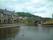
Communities on or near the canal include:On the main arm:
- BreconBreconBrecon is a long-established market town and community in southern Powys, Mid Wales, with a population of 7,901. It was the county town of the historic county of Brecknockshire; although its role as such was eclipsed with the formation of Powys, it remains an important local centre...
http://www.geograph.org.uk/photo/9883 - Talybont-on-UskTalybont-on-UskTalybont-on-Usk is a village and community in Powys, Wales. It lies on both the River Usk and the Monmouthshire and Brecon Canal, and in 2003 won the title of 'Powys Village of the Year'...
http://www.geograph.org.uk/photo/49223 - LlangynidrLlangynidrLlangynidr is a village in Powys, Wales, about west of Crickhowell and south-east of Brecon. The River Usk flows through the village as does the Monmouthshire and Brecon Canal on which there are four locks....
http://www.geograph.org.uk/photo/389477 - CrickhowellCrickhowellCrickhowell is a small town in Powys, Mid Wales.-Location:The name Crickhowell is taken from that of the nearby Iron Age hill fort of Crug Hywel above the town, the Welsh language name being anglicised by map-makers and local English-speaking people...
http://www.geograph.org.uk/photo/49769 - GilwernGilwernGilwern is a village in Monmouthshire, Wales. The name is translated from the Welsh language as "the nook near the alder grove". It is within the Llanelly parish ward of Monmouthshire County Council, west of market town of Abergavenny.-Attractions:...
http://www.geograph.org.uk/photo/49781 - GovilonGovilonGovilon is a small Welsh village located between Llanfoist and Gilwern near Abergavenny in north Monmouthshire.- Attractions :The Monmouthshire and Brecon Canal passes through the village and . The village has views overlooking the valley of the River Usk and up to the heights of the southern...
http://www.geograph.org.uk/photo/108204 - AbergavennyAbergavennyAbergavenny , meaning Mouth of the River Gavenny, is a market town in Monmouthshire, Wales. It is located 15 miles west of Monmouth on the A40 and A465 roads, 6 miles from the English border. Originally the site of a Roman fort, Gobannium, it became a medieval walled town within the Welsh Marches...
http://www.geograph.org.uk/photo/499532 - GoetreGoetre- Location :Goetre is located five miles south of Abergavenny and four miles north of Pontypool, Torfaen.- History and amenities :Goetre has a canal wharf and visitor centre on the Monmouthshire and Brecon Canal , complete with interactive sculptures . The Llanover private estate, once presided...
http://www.geograph.org.uk/photo/302313 - PontypoolPontypoolPontypool is a town of approximately 36,000 people in the county borough of Torfaen, within the historic boundaries of Monmouthshire in South Wales....
http://www.geograph.org.uk/photo/357787 - CwmbranCwmbranCwmbrân is a new town in Wales. Today forming part of the county borough of Torfaen and lying within the historic boundaries of Monmouthshire, Cwmbrân was established in 1949 to provide new employment opportunities in the south eastern portion of the South Wales Coalfield. Cwmbrân means Crow...
http://www.geograph.org.uk/photo/95993 - NewportNewportNewport is a city and unitary authority area in Wales. Standing on the banks of the River Usk, it is located about east of Cardiff and is the largest urban area within the historic county boundaries of Monmouthshire and the preserved county of Gwent...
http://www.geograph.org.uk/photo/372716
On the Crumlin arm
Crumlin Arm (Monmouthshire canal)
The Crumlin Arm of the Monmouthshire canal is part of the Monmouthshire & Brecon Canal network in South Wales. It connected Crumlin and its tramways to the Docks at Newport.-History:...
:
- RiscaRiscaRisca is a town of approximately 11,500 people in South Wales, within the Caerphilly County Borough and the historic boundaries of Monmouthshire. It is today part of the Newport conurbation , though it is not a Ward of Newport City Council...
http://www.geograph.org.uk/photo/295715 - CrosskeysCrosskeysCrosskeys is a small village in Caerphilly county borough in Wales.- Location :Crosskeys is seven miles north west of Newport, just past Risca off the A467 road. Located near to the confluence of the Ebbw River and the Sirhowy River, it was originally called Pont-y-cymer...
http://www.geograph.org.uk/photo/55542
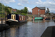
Boat Hire Companies
The canal is popular with holiday-makers, as it is largely located within the Brecon BeaconsBrecon Beacons
The Brecon Beacons is a mountain range in South Wales. In a narrow sense, the name refers to the range of popular peaks south of Brecon, including South Wales' highest mountain, Pen y Fan, and which together form the central section of the Brecon Beacons National Park...
National Park
National park
A national park is a reserve of natural, semi-natural, or developed land that a sovereign state declares or owns. Although individual nations designate their own national parks differently A national park is a reserve of natural, semi-natural, or developed land that a sovereign state declares or...
. Its isolation from any other waterways has enabled the canal to support a number of boat hire companies.
- Beacon Park Boats with 11 boats.
- Cambrian Cruisers with 8 Boats.
- Castle Narrowboats with 8 Boats and 4 seater Day Boats.
- Country Craft Narrowboats with 5 Boats.
- Red Line Boats with 12 Boats.
- Road House Narrowboats with 4 Boats.
- Day boat hire at Pontymoile Basin 4 to 8 seaters.
Access
Much of the canal towpath http://www.geograph.org.uk/photo/476672 is easily walkable http://www.geograph.org.uk/photo/476664 along the entire route http://www.geograph.org.uk/photo/476654. The Taff TrailTaff Trail
The Taff Trail is a popular walking and cycle path that runs for between Cardiff Bay and Brecon in Wales. It is named so because it follows the course of the River Taff...
cycle route, follows the canal for a few miles from Brecon
Brecon
Brecon is a long-established market town and community in southern Powys, Mid Wales, with a population of 7,901. It was the county town of the historic county of Brecknockshire; although its role as such was eclipsed with the formation of Powys, it remains an important local centre...
, but the path after that is not suitable for cyclists. National Cycle Network
National Cycle Network
The National Cycle Network is a network of cycle routes in the United Kingdom.The National Cycle Network was created by the charity Sustrans , and aided by a £42.5 million National Lottery grant. In 2005 it was used for over 230 million trips.Many routes hope to minimise contact with motor...
Routes 47 and 49 follow the canals between Cross Keys and Pontypool.
October 2007 breach
On 16 October 2007 a serious breach occurred when part of the canal bank near GilwernGilwern
Gilwern is a village in Monmouthshire, Wales. The name is translated from the Welsh language as "the nook near the alder grove". It is within the Llanelly parish ward of Monmouthshire County Council, west of market town of Abergavenny.-Attractions:...
collapsed, causing a number of houses to be evacuated. Eight people were rescued by local Fire and Emergency services, and the A4077 road between Crickhowell
Crickhowell
Crickhowell is a small town in Powys, Mid Wales.-Location:The name Crickhowell is taken from that of the nearby Iron Age hill fort of Crug Hywel above the town, the Welsh language name being anglicised by map-makers and local English-speaking people...
and Gilwern was closed, for a period which was expected to be several weeks. Two families were provided with temporary accommodation, and twenty-three hire boats were also affected with cranes being brought in to help them back to their bases.
Contractors Noel Fitzpatrick working for British Waterways
British Waterways
British Waterways is a statutory corporation wholly owned by the government of the United Kingdom, serving as the navigation authority in England, Scotland and Wales for the vast majority of the canals as well as a number of rivers and docks...
managed to reopen the road within a week of the breach occurring. British Waterways announced on 5 November 2007 that a 16-mile (26 km) stretch of the canal from Llanover to Llangynidr would be drained completely, so that a full inspection of the canal structure could be carried out. They stated that they were working with boat owners to move all boats to parts of the canal which would not be affected by this drainage, but that the towpath would remain open during this phase. Subsequently, they announced that a full geotechnical survey would be carried out, and that they expected the stretch to be closed for up to a year. Water levels on this section were reduced significantly, but engineers were then faced with the task of moving upwards of 100,000 fish before it could be drained fully.
At a meeting at Crickhowell on 20 December 2007, British Waterways announced the preliminary results of the investigations: there were over 90 leaks on the section from Talybont to Gilwern, with less leakage on the stretch from Llanover to Goytre Wharf. A press release in February 2008 announced that the total cost of restoration was likely to be around £15 million, with major investment required in the 2008/9 financial year, in order to repair the breach and to deal with other areas identified as being of top priority. The aim of the work would be to ensure that the canal would be safe and fully open from March 2009, but further work would be required during the following three winters in order to complete the process. Their actions earned British Waterways the praise of Rhodri Glyn Thomas
Rhodri Glyn Thomas
Rhodri Glyn Thomas AM is a Welsh politician. He has been the Plaid Cymru National Assembly for Wales Member for Carmarthen East and Dinefwr since 1999.-Education:...
of the Welsh Assembly, who applauded their "courageous decision" to manage the breach in the way that they had. The repaired canal was officially reopened on 29 March 2009, when a ribbon was cut by Huw Irranca-Davies, the Waterways Minister, and Rhodri Morgan, the First Minister.
Restoration
The canal is located within the boundaries of a number of local authorities, and such bodies are increasingly aware of the benefits and regeneration that a canal restoration project can bring. To this end, the Monmouthshire and Brecon Canals Regeneration Partnership was created as a collaborative effort between the Monmouthshire and Brecon Canals Trust, Torfaen County Borough CouncilTorfaen County Borough Council
Torfaen County Borough Council is the governing body for Torfaen, one of the Principal Areas of Wales.- Current composition :-Electoral divisions:...
, Newport City Council
Newport City Council
Newport City Council is the governing body for the city of Newport, one of the subdivisions of Wales within the United Kingdom. It consists of 50 councillors, representing the city's 20 wards. Since the 2008 election, the council has been controlled jointly by the Conservatives and Liberal...
, Caerphilly County Borough Council
Caerphilly County Borough Council
Caerphilly County Borough Council is the governing body for Caerphilly , one of the Principal Areas of Wales.- Current composition :- Historic results :-Electoral divisions:...
, the Forestry Commission
Forestry Commission
The Forestry Commission is a non-ministerial government department responsible for forestry in Great Britain. Its mission is to protect and expand Britain's forests and woodlands and increase their value to society and the environment....
and British Waterways
British Waterways
British Waterways is a statutory corporation wholly owned by the government of the United Kingdom, serving as the navigation authority in England, Scotland and Wales for the vast majority of the canals as well as a number of rivers and docks...
. The Regeneration Partnership submitted a bid to the Big Lottery Living Landmarks fund for £25 million, this being 75 percent of the estimated cost of restoring the main line from Barrack Hill to Cwmbran, including the construction of a new aqueduct to take the canal over Greenforge Way, and of restoring the Crumlin Branch from Malpas Junction to the bottom of the Cefn Flight of fourteen locks, including improvements to its water supply. The bid reached the development stage, and the Partnership successfully obtained a grant of £250,000 to enable them to undertake a full cost and engineering study for the proposed community based regeneration of the waterway. The Partnership continues to meet to discuss the way forward to completing the restoration. http://www.geograph.org.uk/photo/88847
Restoration of the top lock of the Cefn Flight (lock 21) was completed by volunteers in 2003. The Canals Trust and Newport City Council made a joint presentation to the Heritage Lottery Fund
Heritage Lottery Fund
The Heritage Lottery Fund is a fund established in the United Kingdom under the National Lottery etc. Act 1993. The Fund opened for applications in 1994. It uses money raised through the National Lottery to transform and sustain the UK’s heritage...
for £700,000 to restore the next four locks of the flight, and this was granted on 23 March 2007. The regeneration of the Cefn flight (Fourteen Locks) is a separate project from the main scheme; contractors will work down the flight, while a voluntary team led by the Canals Trust and Waterway Recovery Group will work up from lock 3 on the Allt-yr-yn locks.
There are also plans to connect the southern end of the canal to the River Usk
River Usk
The River Usk rises on the northern slopes of the Black Mountain of mid-Wales, in the easternmost part of the Brecon Beacons National Park. Initially it flows north into Usk Reservoir, then east by Sennybridge to Brecon before turning southeast to flow by Talybont-on-Usk, Crickhowell and...
by means of a marina in Crindau
Crindau Marina
Crindau Marina is a possible development in Crindau, Newport. The marina would provide opportunities for new housing, shops and leisure facilities focused around a waterside location...
. The Crindau Gateway Project is an Urban Regeneration project for the area around the southern terminus of the canal, which has received £75,000 in funding from the Welsh Assembly to consider the provision of a marina
Marina
A marina is a dock or basin with moorings and supplies for yachts and small boats.A marina differs from a port in that a marina does not handle large passenger ships or cargo from freighters....
as part of the scheme. A link from the marina to the River Usk would be provided by way of Crindau Pill, an inlet from the river which would be made navigable. This would create sustainability for the project.
The Canals Trust have taken over the lease of the Canal Centre at Fourteen Locks. An extension has been completed, which houses a meeting room (available for groups to hire) and also a community run tea room. The Canal Centre is now a base for the Trust and its restoration work at the centre of the community.
The Welsh Waterways Festival 2010
Organised by the volunteers of the Mon & Brec Canals Trust,The 2010 Welsh Waterways Festival, which included the I.W.A National Trailboat festival was held at Newport at the end of May 2010. Over 30 boats attended from all over the UK.
The boats were able to cruise from Barrack Hill to Pentre Lane in Torfaen Borough for the first time in 84 years, using restored locks at Malpas, Ty Fynnon, and Tamplin. Over 15,000 members of the public turned up over the four days of the festival, which was a tremendous success for Newport and its canal.
See also
- Canals of the United KingdomCanals of the United KingdomThe canals of the United Kingdom are a major part of the network of inland waterways in the United Kingdom. They have a colourful history, from use for irrigation and transport, through becoming the focus of the Industrial Revolution, to today's role for recreational boating...
- History of the British canal systemHistory of the British canal systemThe British canal system of water transport played a vital role in the United Kingdom's Industrial Revolution at a time when roads were only just emerging from the medieval mud and long trains of pack horses were the only means of "mass" transit by road of raw materials and finished products The...