
Maryland Route 28
Encyclopedia
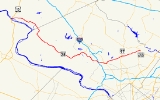
Maryland Route 28 is a state highway
in the U.S. state
of Maryland
. The state highway runs 37.38 miles (60.2 km) from U.S. Route 15
(US 15) in Point of Rocks
east to MD 182
in Norwood. The western portion of MD 28 is a rural highway connecting several villages in southern Frederick County
and western Montgomery County
. By contrast, the eastern portion of the state highway is a major east–west commuter route, particularly within Gaithersburg
and Rockville
.
MD 28 was an original 1927 Maryland state highway. The state highway originally extended north and east through Olney
to Ashton
, but the highway was rolled back to Norbeck
in the 1940s. MD 28 was extended east to its present eastern terminus in the early 1980s. The original western terminus was in Tuscarora
, but the state highway was extended to Point of Rocks around 1970. In addition to being expanded to a multi-lane divided highway in central Montgomery County beginning in the 1970s, MD 28 was relocated in downtown Rockville in the 1940s, in eastern Rockville in the 1970s, and in western Rockville in the 1990s.
. The state highway heads east as Clay Street, a two-lane road with a speed limit of 30 mph (48.3 km/h), passing the Point of Rocks
MARC
station on the south before passing between two industrial facilities and crossing CSX
's Old Main Line Subdivision. MD 28 continues east as Tuscarora Road through farmland with a speed limit of 50 mph (80.5 km/h) after crossing Washington Run. Turning southeast, the state highway crosses Tuscarora Creek
and passes New Design Road. The speed limit decreases to 35 mph (56.3 km/h) as MD 28 passes through the hamlet of Tuscarora before the roadway turns north and continues straight as MD 85
(Buckeystown Pike). MD 28 turns right to continue on Dickerson Road.
The speed limit returns to 50 mph (80.5 km/h) as MD 28 continues southeast, crossing the Monocacy River
shortly before entering Montgomery County. After intersecting Mouth of Monocacy Road, which heads west to the Monocacy Aqueduct
, the speed limit drops to 30 mph (48.3 km/h) as the state highway enters Dickerson
. In Dickerson, MD 28 meets Mt. Ephraim Road, which serves the Dickerson
MARC station and continues northeast toward Sugarloaf Mountain. The state highway then turns south and passes through a narrow underpass of CSX's Metropolitan Subdivision and the MARC Brunswick Line
. MD 28 crosses the Little Monocacy River
and the speed limit jumps to 50 mph (80.5 km/h) again before the intersection with Martinsburg Road, which heads southwest toward the Dickerson Generating Station
and White's Ferry
.
MD 28 continues southeast as Darnestown Road through Beallsville
, where the speed limit again temporarily drops to 30 mph (48.3 km/h). After crossing MD 109
(Beallsville Road), MD 28 passes the Hanover Farm House
at Four Streams Golf Club and crosses Dry Seneca Creek. After an acute intersection with MD 117
(Bucklodge Road), the state highway enters Dawsonville
, where it intersects White Grounds Road, which heads north past the Susanna Farm
, and meets MD 107
(Whites Ferry Road) at a tangent intersection. MD 28 crosses Seneca Creek
and passes Seneca Creek State Park
before entering Darnestown
. Within Darnestown, the speed limit drops to 30 mph (48.3 km/h) and the state highway intersects MD 118
(Germantown Road) and MD 112
(Seneca Road). After MD 112, the speed limit increases to 40 mph (64.4 km/h) and MD 28 turns northeast and passes through residential subdivisions. The state highway expands to a four-lane divided highway before passing Quince Orchard High School
and intersecting MD 124
(Quince Orchard Road).
MD 28 continues southeast along the southern edge of Gaithersburg, passing by the new urbanist
development Kentlands
and crossing Muddy Branch
. After the state highway expands to six lanes and intersects Muddy Branch Road, the old alignment of MD 28, Darnestown Road, splits to the east and MD 28 veers northeast as Key West Avenue. After entering an area of office parks, the state highway intersects MD 119
(Great Seneca Highway). MD 28 continues east and then southeast through the western part of Rockville, crossing Shady Grove Road before meeting Gude Drive, which provides a bypass of downtown Rockville. After intersecting the other end of the old alignment of MD 28, the state highway changes its name to West Montgomery Avenue and crosses Watts Branch
within the partial cloverleaf interchange with Interstate 270
.
MD 28 continues through the West Montgomery Avenue Historic District
as a three-lane road with center turn lane with a speed limit of 30 mph (48.3 km/h). At the intersection with Great Falls Road, the state highway veers to the southeast onto four-lane Jefferson Street through the Montgomery County Courthouse Historic District and passes the present government offices to the south. MD 28 becomes a divided highway and veers east onto Veirs Mill Road before intersecting MD 355
(Rockville Pike) at an oblique intersection. Left turns are prohibited from MD 28 to MD 355, so eastbound traffic must use Monroe Street to access MD 355 north. Westbound traffic can use Dodge Street, which is unsigned MD 660, to access MD 355 south. After MD 28 crosses the Metropolitan Branch and the Red Line
of the Washington Metro
, ramps to Stonestreet Avenue join eastbound and leave westbound to provide access to the Rockville
Metro and MARC stations. The state highway then meets MD 586
(Veirs Mill Road) and MD 911 (First Street). MD 28 turns north onto First Street at this intersection.
MD 28 heads north as a controlled-access four-lane divided highway through residential areas. After intersecting Baltimore Road, the old alignment of MD 28, First Street continues straight and the state highway veers to the northeast as Norbeck Road with a speed limit of 50 mph (80.5 km/h). MD 28 intersects the eastern end of Gude Drive, then crosses Rock Creek
before meeting the other end of Baltimore Road. The state highway continues east through suburban residential subdivisions, intersecting Bel Pre Road and gaining service roads at intervals. After intersecting MD 115
(Muncaster Mill Road), MD 28 meets MD 97
(Georgia Avenue
) in the unincorporated community of Norbeck
and reduces to a two-lane road with a speed limit of 40 mph (64.4 km/h) through a forested area with scattered subdivisions. The state highway crosses MD 200 (Intercounty Connector) near Wintergate Drive. After crossing Batchellors Run, MD 28 expands to a four-lane divided highway for its terminating intersection with MD 182 (Layhill Road) in Norwood. Norbeck Road continues east as a county-maintained highway toward the intersection of MD 650
and MD 198
in Spencerville
.
MD 28 originally followed Baltimore Road between downtown Rockville and east of Rock Creek. Between 1940 and 1944, MD 28 was placed on a new grade-separated crossing of the Metropolitan Branch along Veirs Mill Road, then north on First Street to Baltimore Road. MD 28 was rolled back from Ashton to Norbeck between 1944 and 1946. In 1969 or 1970, the controlled access portion of US 15 north of Point of Rocks was completed. As a result, MD 85 was assigned to the old route of US 15 north of Tuscarora and MD 28 was extended west to its current terminus in Point of Rocks. Also in 1970, the bypass of Baltimore Road in eastern Rockville was under construction. In 1981, MD 28 was made a divided highway between downtown Rockville and Baltimore Avenue west of Rock Creek. In 1982, the divided highway was extended from Baltimore Avenue east of Rock Creek to MD 97.
In the mid 1990s, Key West Avenue in the western part of Rockville was completed and expanded to a six-lane divided highway. MD 28 was moved to the improved highway to bypass the parallel stretch of Darnestown Road by 1999. Between 2002 and 2004, MD 28 was widened to a four- to six-lane divided highway between MD 124 and the west end of Key West Avenue. In 2002, Norbeck Road was completed between the eastern terminus of MD 28 and the MD 650-MD 198 intersection. While this highway was originally planned to become an extension of MD 28, eventually Montgomery County retained control of the highway.
!County
!Location
!Mile
!Destinations
!Notes
|-
|rowspan=2|Frederick
9.36 miles (15.1 km)
|rowspan=1|Point of Rocks
|0.00
|, Leesburg
|rowspan=1|Western terminus
|-
|rowspan=1|Tuscarora
|4.73
|
|rowspan=1|MD 28 turns east at intersection
|-
|rowspan=27|Montgomery
29.88 miles (48.1 km)
|rowspan=2|Dickerson
|
|Mt. Ephraim Road north – Comus
|rowspan=1|Former MD 419
|-
|0
|Martinsburg Road south – White's Ferry
|rowspan=1|Former MD 419
|-
|rowspan=1|Beallsville
|
|
|-
|rowspan=3|Dawsonville
|
|
|-
|
|White Grounds Road north – Boyds
|rowspan=1|Former MD 121
|-
|
|
|-
|rowspan=2|Darnestown
|
|
|-
|
|
|-
|rowspan=2|Gaithersburg
|0
|
|-
|
|Muddy Branch Road – Gaithersburg
, North Potomac
|-
|rowspan=14|Rockville
|
|Darnestown Road east
|rowspan=1|Old alignment of MD 28
|-
|
|
|-
|
|Shady Grove Road – Shady Grove
|-
|
|Gude Drive east – Derwood
|-
|
|Darnestown Road west
|rowspan=1|Old alignment of MD 28
|-
|
|, Washington
|rowspan=1|I-270 Interchange 6
|-
|
|Great Falls Road south to
|-
|
|
|-
|
|Dodge Street
|Unsigned MD 660
|-
|
|Stonestreet Avenue north
|rowspan=1|Westbound exit, eastbound entrance
|-
|
|
|rowspan=1|MD 28 turns north at intersection
|-
|.00
|Baltimore Road east
|rowspan=1|Old alignment of MD 28
|-
|
|Gude Drive west – Derwood
|-
|
|Baltimore Road west
|rowspan=1|Old alignment of MD 28
|-
|rowspan=2|Norbeck
|
|
|-
|
|
|-
|rowspan=1|Norwood
|
| / Norbeck Road east – Glenmont
, Sandy Spring
, Spencerville
|rowspan=1|Eastern terminus
State highway
State highway, state road or state route can refer to one of three related concepts, two of them related to a state or provincial government in a country that is divided into states or provinces :#A...
in the U.S. state
U.S. state
A U.S. state is any one of the 50 federated states of the United States of America that share sovereignty with the federal government. Because of this shared sovereignty, an American is a citizen both of the federal entity and of his or her state of domicile. Four states use the official title of...
of Maryland
Maryland
Maryland is a U.S. state located in the Mid Atlantic region of the United States, bordering Virginia, West Virginia, and the District of Columbia to its south and west; Pennsylvania to its north; and Delaware to its east...
. The state highway runs 37.38 miles (60.2 km) from U.S. Route 15
U.S. Route 15 in Maryland
U.S. Route 15 is a part of the U.S. Highway System that runs from Walterboro, South Carolina to Painted Post, New York. In Maryland, the highway runs from the Virginia state line at the Potomac River in Point of Rocks north to the Pennsylvania state line near Emmitsburg. US 15 is...
(US 15) in Point of Rocks
Point of Rocks, Maryland
Point of Rocks is a community in Frederick County, Maryland. It is named for the striking rock formation on the adjacent Catoctin Mountain, which were formed by the Potomac River cutting through the ridge in a water gap, a typical formation in the Ridge-and-Valley Appalachians...
east to MD 182
Maryland Route 182
Maryland Route 182 is a road that runs between Olney and Glenmont, Maryland. The road is first known as Dr. Bird Road for a short distance before becoming Norwood Road. When the road reaches Norwood, a right turn is required to stay on the route, which for its remainder is known as Layhill Road...
in Norwood. The western portion of MD 28 is a rural highway connecting several villages in southern Frederick County
Frederick County, Maryland
Frederick County is a county located in the western part of the U.S. state of Maryland, bordering the southern border of Pennsylvania and the northeastern border of Virginia. As of the 2010 Census, the population was 233,385....
and western Montgomery County
Montgomery County, Maryland
Montgomery County is a county in the U.S. state of Maryland, situated just to the north of Washington, D.C., and southwest of the city of Baltimore. It is one of the most affluent counties in the United States, and has the highest percentage of residents over 25 years of age who hold post-graduate...
. By contrast, the eastern portion of the state highway is a major east–west commuter route, particularly within Gaithersburg
Gaithersburg, Maryland
Gaithersburg is a city in Montgomery County, Maryland, United States. The city had a population of 59,933 at the 2010 census, making it the fourth largest incorporated city in the state, behind Baltimore, Frederick, and Rockville...
and Rockville
Rockville, Maryland
Rockville is the county seat of Montgomery County, Maryland, United States. It is a major incorporated city in the central part of Montgomery County and forms part of the Baltimore-Washington Metropolitan Area. The 2010 U.S...
.
MD 28 was an original 1927 Maryland state highway. The state highway originally extended north and east through Olney
Olney, Maryland
Olney, a census-designated place and an unincorporated area of Montgomery County, Maryland, USA, is located in the north central part of the county, twenty miles north of Washington, D.C. It was largely agricultural until the 1960s, when growth of the Washington suburbs led to its conversion into...
to Ashton
Ashton, Maryland
Ashton is an unincorporated area in Montgomery County, Maryland. The commercial center of Ashton lies at the junction of Route 108 and New Hampshire Avenue ....
, but the highway was rolled back to Norbeck
Norbeck, Maryland
Norbeck is the area of Montgomery County, Maryland around Norbeck Road east of Georgia Avenue to Layhill Road.A museum in Sandy Spring, Maryland provides the information that Norbeck is the:Southwestern outpost of the greater Sandy Spring neighborhood [and] put down roots as a free-black community...
in the 1940s. MD 28 was extended east to its present eastern terminus in the early 1980s. The original western terminus was in Tuscarora
Tuscarora, Maryland
Tuscarora is a small village in southern Frederick County, Maryland. Maryland Route 28 runs through the village. The community was named for Tuscarora Creek that runs in the area. There is an old, small post office that is in the area along Route 28. The area was formerly named Licksville after...
, but the state highway was extended to Point of Rocks around 1970. In addition to being expanded to a multi-lane divided highway in central Montgomery County beginning in the 1970s, MD 28 was relocated in downtown Rockville in the 1940s, in eastern Rockville in the 1970s, and in western Rockville in the 1990s.
Route description
MD 28 begins at an intersection with US 15 (Catoctin Mountain Highway) in Point of Rocks, just north of the Point of Rocks Bridge across the Potomac RiverPotomac River
The Potomac River flows into the Chesapeake Bay, located along the mid-Atlantic coast of the United States. The river is approximately long, with a drainage area of about 14,700 square miles...
. The state highway heads east as Clay Street, a two-lane road with a speed limit of 30 mph (48.3 km/h), passing the Point of Rocks
Point of Rocks (MARC station)
The Point of Rocks Railroad Station is a historic passenger rail station on the MARC Brunswick Line between Washington, D.C. and Martinsburg, WV located at Point of Rocks, Frederick County, Maryland, United States. The station was built by the Baltimore and Ohio Railroad in 1873, and designed by E....
MARC
MARC Train
MARC , known prior to 1984 as Maryland Rail Commuter Service, is a regional rail system comprising three lines in the Baltimore-Washington Metropolitan Area. MARC is administered by the Maryland Transit Administration , a Maryland Department of Transportation agency, and is operated under contract...
station on the south before passing between two industrial facilities and crossing CSX
CSX Transportation
CSX Transportation operates a Class I railroad in the United States known as the CSX Railroad. It is the main subsidiary of the CSX Corporation. The company is headquartered in Jacksonville, Florida, and owns approximately 21,000 route miles...
's Old Main Line Subdivision. MD 28 continues east as Tuscarora Road through farmland with a speed limit of 50 mph (80.5 km/h) after crossing Washington Run. Turning southeast, the state highway crosses Tuscarora Creek
Tuscarora Creek (Potomac River)
Tuscarora Creek is a tributary of the Potomac River in Frederick County, Maryland, in the United States.The creek rises east of the community of Jefferson, about southwest of the city of Frederick, and flows south to its mouth at the Potomac.-References:...
and passes New Design Road. The speed limit decreases to 35 mph (56.3 km/h) as MD 28 passes through the hamlet of Tuscarora before the roadway turns north and continues straight as MD 85
Maryland Route 85
Maryland Route 85 is a state highway in the U.S. state of Maryland. Known as Buckeystown Pike, the state highway runs from MD 28 in Tuscarora north to the Frederick city limit north of Interstate 70 , where the highway continues north as East Street. MD 85 connects Tuscarora and Buckeystown in...
(Buckeystown Pike). MD 28 turns right to continue on Dickerson Road.
The speed limit returns to 50 mph (80.5 km/h) as MD 28 continues southeast, crossing the Monocacy River
Monocacy River
The Monocacy River is a free-flowing tributary of the Potomac River, which empties into the Atlantic Ocean via the Chesapeake Bay. The river is long, with a drainage area of about...
shortly before entering Montgomery County. After intersecting Mouth of Monocacy Road, which heads west to the Monocacy Aqueduct
Monocacy Aqueduct
The Monocacy Aqueduct — or C&O Canal Aqueduct No. 2 — is the largest aqueduct on the Chesapeake and Ohio Canal, crossing the Monocacy River just before it empties into the Potomac River in Frederick County, Maryland, USA...
, the speed limit drops to 30 mph (48.3 km/h) as the state highway enters Dickerson
Dickerson, Maryland
Dickerson is an unincorporated area in Montgomery County, Maryland. It is located on Maryland Route 28, between Sugarloaf Mountain and the Potomac River. It is a community situated near the town of Poolesville, Maryland. Dickerson is .-History of Dickerson:...
. In Dickerson, MD 28 meets Mt. Ephraim Road, which serves the Dickerson
Dickerson (MARC station)
Dickerson is a passenger rail station on the MARC Brunswick Line between Washington, D.C. and Martinsburg, WV . This station was designed by E. Francis Baldwin and built by the Baltimore and Ohio Railroad in 1891. It is the last station Frederick bound trains pass before branching onto the...
MARC station and continues northeast toward Sugarloaf Mountain. The state highway then turns south and passes through a narrow underpass of CSX's Metropolitan Subdivision and the MARC Brunswick Line
Brunswick Line
The Brunswick Line is a MARC commuter rail line consisting of a main line running from Washington D.C. to Martinsburg, West Virginia and a branch line from just south of Point-of-Rocks station to Frederick, Maryland. The service is operated under contract by CSX Transportation, but is administered...
. MD 28 crosses the Little Monocacy River
Little Monocacy River
The Little Monocacy River is a tributary stream of the Potomac River. Despite its name, the stream does not feed into the Monocacy River. The Little Monocacy is located almost entirely in Montgomery County, Maryland, and enters the Potomac just downstream from where the Monocacy enters the Potomac...
and the speed limit jumps to 50 mph (80.5 km/h) again before the intersection with Martinsburg Road, which heads southwest toward the Dickerson Generating Station
Dickerson Generating Station
The Dickerson Generating Station is a 853 MW electric generating plant owned by GenOn , located approximately two miles west of Dickerson, Maryland.-Description:...
and White's Ferry
White's Ferry
White's Ferry is a cable ferry service operating across the Potomac River. It is located six miles west of Poolesville, Maryland, and north of Leesburg, Virginia. It is the only ferry still operating on the Potomac River. The General Jubal A...
.
MD 28 continues southeast as Darnestown Road through Beallsville
Beallsville, Maryland
Beallsville, Maryland is an unincorporated community in Montgomery County, Maryland. It is a small community outside of Poolesville, Maryland.- Darby Store :...
, where the speed limit again temporarily drops to 30 mph (48.3 km/h). After crossing MD 109
Maryland Route 109
Maryland Route 109 is a Maryland state highway that goes from MD 107 in Poolesville, Maryland to MD 355 in Hyattstown, Maryland. The entire route is in Montgomery County.-Route description:...
(Beallsville Road), MD 28 passes the Hanover Farm House
Hanover Farm House
The Hanover Farm House is a historic home located at Beallsville, Montgomery County, Maryland, United States. This brick house consists of a main block and kitchen wing dating to 1801–1804, and a -story modern kitchen wing added in 1954....
at Four Streams Golf Club and crosses Dry Seneca Creek. After an acute intersection with MD 117
Maryland Route 117
Maryland Route 117 is the one of three highways connecting the major Washington, D.C. suburbs of Gaithersburg and Germantown...
(Bucklodge Road), the state highway enters Dawsonville
Dawsonville, Maryland
Dawsonville is an unincorporated community in Montgomery County, Maryland, United States.-References:...
, where it intersects White Grounds Road, which heads north past the Susanna Farm
Susanna Farm
Susanna Farm is a historic home located at Dawsonville, Montgomery County, Maryland, United States. It is an L-shaped, -story frame dwelling house. The last major change occurred when the house was doubled in size and value by Benjamin F. Dyson in 1877–78, who renovated it in the Italianate style...
, and meets MD 107
Maryland Route 107
Maryland Route 107 is a east–west state highway in the U.S. state of Maryland. It goes from MD 109 in Poolesville, Maryland to MD 28 in Dawsonville. The entire route is in Montgomery County.-Route description:...
(Whites Ferry Road) at a tangent intersection. MD 28 crosses Seneca Creek
Seneca Creek (Potomac River)
Seneca Creek is a stream in Montgomery County, Maryland, roughly northwest of Washington, D.C. It drains to the Potomac River.-Course:The creek begins with two main tributaries:...
and passes Seneca Creek State Park
Seneca Creek State Park
Seneca Creek State Park encompasses approximately 6,300 acres in Montgomery County, Maryland, USA, and extends along 14 miles of Seneca Creek to the Potomac River.-Clopper Lake Day Use Area:...
before entering Darnestown
Darnestown, Maryland
Darnestown is a census-designated place and an unincorporated area in Montgomery County, Maryland, United States.-Geography:As an unincorporated area, Darnestown's boundaries are not officially defined...
. Within Darnestown, the speed limit drops to 30 mph (48.3 km/h) and the state highway intersects MD 118
Maryland Route 118
Maryland Route 118 is the "main street" and major thoroughfare for the Washington, D.C. suburb of Germantown, MD. It is known over its entire length as Germantown Road, and is commonly called "one-eighteen." It is located in Montgomery County....
(Germantown Road) and MD 112
Maryland Route 112
Maryland Route 112 is a Maryland state highway that goes between MD 28 in Darnestown and MD 190 near Seneca. The entire route is in Montgomery County.-Route description:...
(Seneca Road). After MD 112, the speed limit increases to 40 mph (64.4 km/h) and MD 28 turns northeast and passes through residential subdivisions. The state highway expands to a four-lane divided highway before passing Quince Orchard High School
Quince Orchard High School
Quince Orchard High School is a secondary school located on Quince Orchard Road in an unincorporated area of Gaithersburg in Montgomery County, Maryland, United States. Quince Orchard's incoming freshmen come from Lakelands Park and Ridgeview Middle School as well as Roberto Clemente Middle School...
and intersecting MD 124
Maryland Route 124
Maryland Route 124 is a mixed suburban and semi-rural road that runs through several suburbs and exurbs to the north of Washington, DC in Montgomery County, Maryland. It changes names several times over its length, beginning as Quince Orchard Road near Darnestown and terminating as Woodfield Road...
(Quince Orchard Road).
MD 28 continues southeast along the southern edge of Gaithersburg, passing by the new urbanist
New urbanism
New Urbanism is an urban design movement, which promotes walkable neighborhoods that contain a range of housing and job types. It arose in the United States in the early 1980s, and has gradually continued to reform many aspects of real estate development, urban planning, and municipal land-use...
development Kentlands
Kentlands, Gaithersburg, Maryland
Located in the city of Gaithersburg, Maryland in the United States, Kentlands was one of the first attempts to develop a community using Traditional Neighborhood Design planning techniques that are now generally referred to under the rubric of the New Urbanism...
and crossing Muddy Branch
Muddy Branch
Muddy Branch is a tributary stream of the Potomac River in Montgomery County, Maryland, located about northwest of Washington, D.C. The headwaters of the stream originate in Gaithersburg, and the stream flows southwest for , through Muddy Branch Park and Blockhouse Point Conservation Park, under...
. After the state highway expands to six lanes and intersects Muddy Branch Road, the old alignment of MD 28, Darnestown Road, splits to the east and MD 28 veers northeast as Key West Avenue. After entering an area of office parks, the state highway intersects MD 119
Maryland Route 119
Maryland Route 119, also known as Great Seneca Highway, is a north–south Maryland state highway that runs from Maryland Route 28 in Rockville to Middlebrook Road in Germantown.-Route description:...
(Great Seneca Highway). MD 28 continues east and then southeast through the western part of Rockville, crossing Shady Grove Road before meeting Gude Drive, which provides a bypass of downtown Rockville. After intersecting the other end of the old alignment of MD 28, the state highway changes its name to West Montgomery Avenue and crosses Watts Branch
Watts Branch (Potomac River)
Watts Branch is a tributary stream of the Potomac River in Montgomery County, Maryland. The headwaters of the stream originate in the city of Rockville, and the branch flows southwest for , under the C&O Canal near Swain's Lock, to the Potomac River, which drains to the Chesapeake Bay...
within the partial cloverleaf interchange with Interstate 270
Interstate 270 (Maryland)
Interstate 270 is a auxiliary Interstate Highway in the U.S. state of Maryland that travels between Interstate 495 just north of Bethesda, Montgomery County and Interstate 70 in the city of Frederick in Frederick County. It consists of the mainline as well as a spur that provides access to and...
.
MD 28 continues through the West Montgomery Avenue Historic District
West Montgomery Avenue Historic District
The West Montgomery Avenue Historic District is a national historic district located at Rockville, Montgomery County, Maryland. It is a residential area with single-family homes predominating. The majority of the properties within the district date from the 1880s, with a few older homes and...
as a three-lane road with center turn lane with a speed limit of 30 mph (48.3 km/h). At the intersection with Great Falls Road, the state highway veers to the southeast onto four-lane Jefferson Street through the Montgomery County Courthouse Historic District and passes the present government offices to the south. MD 28 becomes a divided highway and veers east onto Veirs Mill Road before intersecting MD 355
Maryland Route 355
Maryland Route 355 is a north–south road in western central Maryland in the United States. The southern terminus of the route is at the Washington, D.C. border in Friendship Heights, Montgomery County, where it continues south as Wisconsin Avenue into Washington. The northern terminus is...
(Rockville Pike) at an oblique intersection. Left turns are prohibited from MD 28 to MD 355, so eastbound traffic must use Monroe Street to access MD 355 north. Westbound traffic can use Dodge Street, which is unsigned MD 660, to access MD 355 south. After MD 28 crosses the Metropolitan Branch and the Red Line
Red Line (Washington Metro)
The Red Line of the Washington Metro is a rail rapid transit service operating between 27 stations in Montgomery County, Maryland and the District of Columbia, United States. It is a primary line through downtown Washington, and the oldest and busiest line in the system...
of the Washington Metro
Washington Metro
The Washington Metro, commonly called Metro, and unofficially Metrorail, is the rapid transit system in Washington, D.C., United States, and its surrounding suburbs. It is administered by the Washington Metropolitan Area Transit Authority , which also operates Metrobus service under the Metro name...
, ramps to Stonestreet Avenue join eastbound and leave westbound to provide access to the Rockville
Rockville (Washington Metro)
Rockville is an island platformed Washington Metro station in Rockville, Maryland, United States. The station was opened on December 15, 1984, and is operated by the Washington Metropolitan Area Transit Authority . Providing service for the Red Line, the station is located in downtown Rockville at...
Metro and MARC stations. The state highway then meets MD 586
Maryland Route 586
Maryland Route 586 is a state highway in the U.S. state of Maryland. Known as Veirs Mill Road, the state highway runs from MD 28 in Rockville east to MD 97 in Wheaton.-Route description:...
(Veirs Mill Road) and MD 911 (First Street). MD 28 turns north onto First Street at this intersection.
MD 28 heads north as a controlled-access four-lane divided highway through residential areas. After intersecting Baltimore Road, the old alignment of MD 28, First Street continues straight and the state highway veers to the northeast as Norbeck Road with a speed limit of 50 mph (80.5 km/h). MD 28 intersects the eastern end of Gude Drive, then crosses Rock Creek
Rock Creek (Potomac River)
Rock Creek is a free-flowing tributary of the Potomac River, which empties into the Atlantic Ocean via the Chesapeake Bay. The creek is long, with a drainage area of about...
before meeting the other end of Baltimore Road. The state highway continues east through suburban residential subdivisions, intersecting Bel Pre Road and gaining service roads at intervals. After intersecting MD 115
Maryland Route 115
Maryland Route 115 is a Maryland state highway that goes from MD 124 in Washington Grove to MD 655 in Norbeck. The entire route is in Montgomery County.-Route description:...
(Muncaster Mill Road), MD 28 meets MD 97
Maryland Route 97
Maryland Route 97 is a state highway in the U.S. state of Maryland. The route runs from U.S. Route 29 in Silver Spring, Montgomery County north to the Pennsylvania border in Carroll County, where the road continues into that state as Pennsylvania Route 97...
(Georgia Avenue
Georgia Avenue
Georgia Avenue is a major north-south artery in Northwest Washington, D.C. and Montgomery County, Maryland. Within the District of Columbia and a short distance in Silver Spring, Maryland, Georgia Avenue is also U.S. Route 29...
) in the unincorporated community of Norbeck
Norbeck, Maryland
Norbeck is the area of Montgomery County, Maryland around Norbeck Road east of Georgia Avenue to Layhill Road.A museum in Sandy Spring, Maryland provides the information that Norbeck is the:Southwestern outpost of the greater Sandy Spring neighborhood [and] put down roots as a free-black community...
and reduces to a two-lane road with a speed limit of 40 mph (64.4 km/h) through a forested area with scattered subdivisions. The state highway crosses MD 200 (Intercounty Connector) near Wintergate Drive. After crossing Batchellors Run, MD 28 expands to a four-lane divided highway for its terminating intersection with MD 182 (Layhill Road) in Norwood. Norbeck Road continues east as a county-maintained highway toward the intersection of MD 650
Maryland Route 650
Maryland Route 650 is a state highway in the U.S. state of Maryland. Known as New Hampshire Avenue for most of its length, the state highway runs from Eastern Avenue at the Washington, D.C. border north to MD 108 in Etchison...
and MD 198
Maryland Route 198
Maryland Route 198 is an east–west state highway in the central part of the U.S. state of Maryland that connects Fort Meade at Maryland Route 32 to Maryland Route 28 and Maryland Route 650 near Spencerville.-Spencerville Road:...
in Spencerville
Spencerville, Maryland
Spencerville is an unincorporated community in Montgomery County, Maryland, United States. Spencerville is north of Cloverly. Spencerville has a post office with ZIP code 20868....
.
History
One of the original state highways, MD 28 was marked and fully paved over its 1927 routing. The state highway's western terminus was the current intersection with MD 85 in Tuscarora; US 15 headed both west and north from there. MD 28 continued east along roughly its same alignment to MD 97 in Norbeck. At Norbeck, MD 28 became concurrent with MD 97 to Olney, then headed east along the route of current MD 108 to what was then MD 27 (which later became US 29 and is now MD 650) in Ashton. The stretch of highway between MD 97 and MD 182, which was paved by 1935, was marked as MD 609 by 1939.MD 28 originally followed Baltimore Road between downtown Rockville and east of Rock Creek. Between 1940 and 1944, MD 28 was placed on a new grade-separated crossing of the Metropolitan Branch along Veirs Mill Road, then north on First Street to Baltimore Road. MD 28 was rolled back from Ashton to Norbeck between 1944 and 1946. In 1969 or 1970, the controlled access portion of US 15 north of Point of Rocks was completed. As a result, MD 85 was assigned to the old route of US 15 north of Tuscarora and MD 28 was extended west to its current terminus in Point of Rocks. Also in 1970, the bypass of Baltimore Road in eastern Rockville was under construction. In 1981, MD 28 was made a divided highway between downtown Rockville and Baltimore Avenue west of Rock Creek. In 1982, the divided highway was extended from Baltimore Avenue east of Rock Creek to MD 97.
In the mid 1990s, Key West Avenue in the western part of Rockville was completed and expanded to a six-lane divided highway. MD 28 was moved to the improved highway to bypass the parallel stretch of Darnestown Road by 1999. Between 2002 and 2004, MD 28 was widened to a four- to six-lane divided highway between MD 124 and the west end of Key West Avenue. In 2002, Norbeck Road was completed between the eastern terminus of MD 28 and the MD 650-MD 198 intersection. While this highway was originally planned to become an extension of MD 28, eventually Montgomery County retained control of the highway.
Junction list
{| class=wikitable!County
!Location
!Mile
!Destinations
!Notes
|-
|rowspan=2|Frederick
Frederick County, Maryland
Frederick County is a county located in the western part of the U.S. state of Maryland, bordering the southern border of Pennsylvania and the northeastern border of Virginia. As of the 2010 Census, the population was 233,385....
9.36 miles (15.1 km)
|rowspan=1|Point of Rocks
Point of Rocks, Maryland
Point of Rocks is a community in Frederick County, Maryland. It is named for the striking rock formation on the adjacent Catoctin Mountain, which were formed by the Potomac River cutting through the ridge in a water gap, a typical formation in the Ridge-and-Valley Appalachians...
|0.00
|, Leesburg
Leesburg, Virginia
Leesburg is a historic town in, and county seat of, Loudoun County, Virginia, United States of America. Leesburg is located west-northwest of Washington, D.C. along the base of the Catoctin Mountain and adjacent to the Potomac River. Its population according the 2010 Census is 42,616...
|rowspan=1|Western terminus
|-
|rowspan=1|Tuscarora
Tuscarora, Maryland
Tuscarora is a small village in southern Frederick County, Maryland. Maryland Route 28 runs through the village. The community was named for Tuscarora Creek that runs in the area. There is an old, small post office that is in the area along Route 28. The area was formerly named Licksville after...
|4.73
|
|rowspan=1|MD 28 turns east at intersection
|-
|rowspan=27|Montgomery
Montgomery County, Maryland
Montgomery County is a county in the U.S. state of Maryland, situated just to the north of Washington, D.C., and southwest of the city of Baltimore. It is one of the most affluent counties in the United States, and has the highest percentage of residents over 25 years of age who hold post-graduate...
29.88 miles (48.1 km)
|rowspan=2|Dickerson
Dickerson, Maryland
Dickerson is an unincorporated area in Montgomery County, Maryland. It is located on Maryland Route 28, between Sugarloaf Mountain and the Potomac River. It is a community situated near the town of Poolesville, Maryland. Dickerson is .-History of Dickerson:...
|
|Mt. Ephraim Road north – Comus
Comus, Maryland
Comus is an unincorporated community in Montgomery County, Maryland, United States. Its elevation is . The mostly rural community is located about by car from Washington D.C.-References:...
|rowspan=1|Former MD 419
|-
|0
|Martinsburg Road south – White's Ferry
White's Ferry
White's Ferry is a cable ferry service operating across the Potomac River. It is located six miles west of Poolesville, Maryland, and north of Leesburg, Virginia. It is the only ferry still operating on the Potomac River. The General Jubal A...
|rowspan=1|Former MD 419
|-
|rowspan=1|Beallsville
Beallsville, Maryland
Beallsville, Maryland is an unincorporated community in Montgomery County, Maryland. It is a small community outside of Poolesville, Maryland.- Darby Store :...
|
|
|-
|rowspan=3|Dawsonville
Dawsonville, Maryland
Dawsonville is an unincorporated community in Montgomery County, Maryland, United States.-References:...
|
|
|-
|
|White Grounds Road north – Boyds
Boyds, Maryland
Boyds, Maryland is an unincorporated community in rural Montgomery County, Maryland, located north of Washington, DC. Its ZIP Code is 20841.According to the United States 2000 Census, the ZIP Code Tabulation Area for the town of Boyds covers an area of and has a population of 2,025...
|rowspan=1|Former MD 121
|-
|
|
|-
|rowspan=2|Darnestown
Darnestown, Maryland
Darnestown is a census-designated place and an unincorporated area in Montgomery County, Maryland, United States.-Geography:As an unincorporated area, Darnestown's boundaries are not officially defined...
|
|
|-
|
|
|-
|rowspan=2|Gaithersburg
Gaithersburg, Maryland
Gaithersburg is a city in Montgomery County, Maryland, United States. The city had a population of 59,933 at the 2010 census, making it the fourth largest incorporated city in the state, behind Baltimore, Frederick, and Rockville...
|0
|
|-
|
|Muddy Branch Road – Gaithersburg
Gaithersburg, Maryland
Gaithersburg is a city in Montgomery County, Maryland, United States. The city had a population of 59,933 at the 2010 census, making it the fourth largest incorporated city in the state, behind Baltimore, Frederick, and Rockville...
, North Potomac
North Potomac, Maryland
North Potomac is a census-designated place and an unincorporated area in Montgomery County, Maryland, United States. In 2009, CNN Money Magazine listed North Potomac as one of the wealthiest best places to live in the U.S., describing it as, "a tony town that sits on the bank of the Potomac River,"...
|-
|rowspan=14|Rockville
Rockville, Maryland
Rockville is the county seat of Montgomery County, Maryland, United States. It is a major incorporated city in the central part of Montgomery County and forms part of the Baltimore-Washington Metropolitan Area. The 2010 U.S...
|
|Darnestown Road east
|rowspan=1|Old alignment of MD 28
|-
|
|
|-
|
|Shady Grove Road – Shady Grove
Shady Grove, Maryland
Shady Grove is an unincorporated area of Montgomery County, Maryland. It has a population of 5,000-7,000, between the cities of Rockville and Gaithersburg, mostly in zip codes 20850 and 20855, though the exact boundaries are not officially defined. Shady Grove is one of Montgomery County's upper...
|-
|
|Gude Drive east – Derwood
Derwood, Maryland
Derwood is an unincorporated area of about 15,600 people in east-central Montgomery County, Maryland. It is a relatively dense area. It lies just east of Rockville, south east of Gaithersburg, south west of Olney, and north west of the greater Silver Spring, Maryland area. Residents of Derwood...
|-
|
|Darnestown Road west
|rowspan=1|Old alignment of MD 28
|-
|
|, Washington
Washington, D.C.
Washington, D.C., formally the District of Columbia and commonly referred to as Washington, "the District", or simply D.C., is the capital of the United States. On July 16, 1790, the United States Congress approved the creation of a permanent national capital as permitted by the U.S. Constitution....
|rowspan=1|I-270 Interchange 6
|-
|
|Great Falls Road south to
|-
|
|
|-
|
|Dodge Street
|Unsigned MD 660
|-
|
|Stonestreet Avenue north
|rowspan=1|Westbound exit, eastbound entrance
|-
|
|
|rowspan=1|MD 28 turns north at intersection
|-
|.00
|Baltimore Road east
|rowspan=1|Old alignment of MD 28
|-
|
|Gude Drive west – Derwood
Derwood, Maryland
Derwood is an unincorporated area of about 15,600 people in east-central Montgomery County, Maryland. It is a relatively dense area. It lies just east of Rockville, south east of Gaithersburg, south west of Olney, and north west of the greater Silver Spring, Maryland area. Residents of Derwood...
|-
|
|Baltimore Road west
|rowspan=1|Old alignment of MD 28
|-
|rowspan=2|Norbeck
Norbeck, Maryland
Norbeck is the area of Montgomery County, Maryland around Norbeck Road east of Georgia Avenue to Layhill Road.A museum in Sandy Spring, Maryland provides the information that Norbeck is the:Southwestern outpost of the greater Sandy Spring neighborhood [and] put down roots as a free-black community...
|
|
|-
|
|
|-
|rowspan=1|Norwood
|
| / Norbeck Road east – Glenmont
Glenmont, Maryland
Glenmont is an unincorporated community in Montgomery County, Maryland, USA. The U.S. Census Bureau combines Glenmont with nearby Wheaton to create the Census Designated Place of Wheaton-Glenmont.- Location :...
, Sandy Spring
Sandy Spring, Maryland
Sandy Spring, Maryland is an unincorporated community in Montgomery County, Maryland.The community was founded by Quakers who arrived in the early 18th century searching for land where they could grow tobacco and corn. One of the very early land owners in the Sandy Spring area was Richard Snowden,...
, Spencerville
Spencerville, Maryland
Spencerville is an unincorporated community in Montgomery County, Maryland, United States. Spencerville is north of Cloverly. Spencerville has a post office with ZIP code 20868....
|rowspan=1|Eastern terminus