

List of crossings of the Rio Grande
Encyclopedia
This is a list of bridge
s and other crossings of the Rio Grande
(Río Bravo del Norte), from the Gulf of Mexico
, upstream to its source.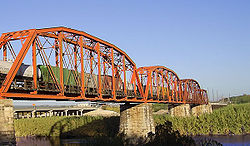
Source: 37°47′52"N 107°32′18"W
Bridge
A bridge is a structure built to span physical obstacles such as a body of water, valley, or road, for the purpose of providing passage over the obstacle...
s and other crossings of the Rio Grande
Rio Grande
The Rio Grande is a river that flows from southwestern Colorado in the United States to the Gulf of Mexico. Along the way it forms part of the Mexico – United States border. Its length varies as its course changes...
(Río Bravo del Norte), from the Gulf of Mexico
Gulf of Mexico
The Gulf of Mexico is a partially landlocked ocean basin largely surrounded by the North American continent and the island of Cuba. It is bounded on the northeast, north and northwest by the Gulf Coast of the United States, on the southwest and south by Mexico, and on the southeast by Cuba. In...
, upstream to its source.
| Crossing | Carries | Location | Built | Coordinates | |
|---|---|---|---|---|---|
Texas-Tamaulipas |
|||||
| Veteran's International Bridge Veteran's International Bridge The Veterans International Bridge at Los Tomates is one of three international bridges that span the Mexico – United States border between the cities of Brownsville, Texas, and Matamoros, Tamaulipas. It is also known as simply as the Veterans Bridge, the Los Tomates Bridge, or on the Mexico side as... |
Brownsville, Texas Brownsville, Texas Brownsville is a city in the southernmost tip of the state of Texas, in the United States. It is located on the northern bank of the Rio Grande, directly north and across the border from Matamoros, Tamaulipas, Mexico. Brownsville is the 16th largest city in the state of Texas with a population of... – Matamoros, Tamaulipas Matamoros, Tamaulipas Matamoros, officially known as Heroica Matamoros, is a city in the northeastern part of Tamaulipas, in the country of Mexico. It is located on the southern bank of the Rio Grande, directly across the border from Brownsville, Texas, in the United States. Matamoros is the second largest and second... |
1999 | 25°53′1"N 97°28′35"W | ||
| Gateway International Bridge Gateway International Bridge Gateway International Bridge is one of three international bridges that cross the U.S.-Mexico border between the cities of Brownsville, Texas, and Matamoros, Tamaulipas. It is owned and operated by Cameron County. Over the past century, it has developed the nickname of "The New Bridge" when the... |
|||||
| Brownsville & Matamoros International Bridge Brownsville & Matamoros International Bridge The Brownsville & Matamoros International Bridge, also known as B&M International Bridge, Brownsville-Matamoros International Bridge and Express Bridge, is one of three international bridges that cross the U.S.-Mexico border between the cities of Brownsville, Texas, and Matamoros, Tamaulipas.It is... (road and railroad) |
|||||
| Free Trade International Bridge Free Trade International Bridge The Free Trade International Bridge is an international bridge which crosses the Rio Grande connecting the United States-Mexico border cities of Los Indios, Texas and Matamoros, Tamaulipas... |
Los Indios, Texas Los Indios, Texas Los Indios is a bordertown in Cameron County, Texas, United States. The population was 1,149 at the 2000 census. It is included as part of the Brownsville–Harlingen–Raymondville and the Matamoros–Brownsville metropolitan areas... – Matamoros, Tamaulipas Matamoros, Tamaulipas Matamoros, officially known as Heroica Matamoros, is a city in the northeastern part of Tamaulipas, in the country of Mexico. It is located on the southern bank of the Rio Grande, directly across the border from Brownsville, Texas, in the United States. Matamoros is the second largest and second... |
||||
| Progreso – Nuevo Progreso International Bridge | Progreso, Texas Progreso, Texas Progreso is a city in Hidalgo County, Texas, United States. The population was 5,507 at the 2010 census. It is part of the McAllen–Edinburg–Mission and Reynosa–McAllen metropolitan areas.-Geography:... – Nuevo Progreso, Tamaulipas Nuevo Progreso, Tamaulipas Nuevo Progreso, Tamaulipas is a Mexican town in Río Bravo Municipality in the state of Tamaulipas located on the U.S.-Mexican border. The Progreso-Nuevo Progreso International Bridge connects the town with Progreso Lakes, Texas. The 2010 census showed a population of 10,178 inhabitants.-External... |
||||
| Donna – Río Bravo International Bridge Donna – Río Bravo International Bridge The Donna – Río Bravo International Bridge is an international bridge that spans the Mexico – United States border between Donna, Texas and Río Bravo, Tamaulipas. The bridge was first opened to traffic on December 14, 2010. Currently only non-commercial vehicles are permitted to cross, but there... |
Donna, Texas Donna, Texas Donna is a city in Hidalgo County, Texas, United States. The population was 15,798 at the 2010 census. The city's motto is "The Heart of the Valley." Donna is part of the McAllen–Edinburg–Mission and Reynosa–McAllen metropolitan areas.... – Río Bravo, Tamaulipas Río Bravo, Tamaulipas Río Bravo formally Ciudad Río Bravo is a city in northern part of the Mexican state of Tamaulipas. It is the municipal seat of Río Bravo Municipality. The city lies east of Reynosa and just south of the Río Bravo del Norte and was also named after it. Directly across the U.S.-Mexico border lies... |
2010 | |||
| Pharr–Reynosa International Bridge at Pharr, Texas Pharr, Texas Pharr is a city in Hidalgo County, Texas, United States. As of the 2010 census, the city population was 70,400. Pharr is connected by bridge to the Mexican city of Reynosa, Tamaulipas... |
Reynosa, Tamaulipas | ||||
| McAllen–Hidalgo–Reynosa International Bridge | McAllen McAllen, Texas McAllen is the largest city in Hidalgo County, Texas, United States. It is located at the southern tip of Texas in an area known as the Rio Grande Valley and is part of the . Its southern boundary is located about five miles from the U.S.–Mexico border and the Mexican city of Reynosa, the Rio... and Hidalgo, Texas Hidalgo, Texas Hidalgo is a city in Hidalgo County, Texas, United States. The population was 11,198 at the 2010 census. It is home to the Rio Grande Valley Magic of the Southern Indoor Football League, the Rio Grande Valley Killer Bees of the Central Hockey League, and the Rio Grande Valley Vipers of the NBA... |
||||
| Anzalduas International Bridge Anzalduas International Bridge Anzalduas International Bridge is an international bridge which connects the city of Mission, Texas, USA with the western outskirts of Reynosa, Tamaulipas, Mexico. It provides cross-border commuters with two southbound and northbound lanes, as well as a pedestrian crossing... |
Mission, Texas Mission, Texas Mission is a city in Hidalgo County, Texas, United States. The population was 77,058 at the 2010 census Mission is part of the McAllen–Edinburg–Mission and Reynosa–McAllen metropolitan areas.-Geography:Mission is located at .... |
||||
| Los Ebanos Ferry Los Ebanos Ferry The Los Ebanos Ferry, formally known as the Los Ebanos-Diaz Ordaz Ferry, is a hand-operated cable ferry that travels across the Rio Grande between Los Ebanos, Texas and Gustavo Díaz Ordaz, Tamaulipas. It is the last of its kind along the entire stretch of the Rio Grande... |
Los Ebanos, Texas Los Ebanos, Texas Los Ebanos is a census-designated place in Hidalgo County, Texas, United States. The population was 403 at the 2000 census. It is part of the McAllen–Edinburg–Mission Metropolitan Statistical Area... – Gustavo Díaz Ordaz, Tamaulipas Gustavo Díaz Ordaz, Tamaulipas Gustavo Díaz Ordaz is a municipality located in the Mexican state of Tamaulipas.-Towns and villages:The largest localities are:-Adjacent municipalities and counties:* Reynosa Municipality - east... |
||||
| Rio Grande City – Camargo International Bridge | Rio Grande City, Texas Rio Grande City, Texas Rio Grande City is a city in and the county seat of Starr County, Texas, United States. The population was 13,834 at the 2010 census. The city is 41 miles west of McAllen. It is the hometown of former Commander of U.S. Forces in Iraq, General Ricardo Sanchez. The city also holds the March record... – Ciudad Camargo, Tamaulipas |
||||
| Roma – Ciudad Miguel Alemán International Bridge | Roma, Texas Roma, Texas Roma is a city in Starr County, Texas, United States. The population was 9,765 at the 2010 census. The city is located along the Rio Grande, across from Ciudad Miguel Alemán in Tamaulipas, Mexico.... – Ciudad Miguel Alemán, Tamaulipas Ciudad Miguel Alemán, Tamaulipas Ciudad Miguel Alemán, known prior to 1950 as San Pedro de Roma, is a city in the Mexican state of Tamaulipas, located across the Rio Grande from the U.S. city of Roma, Texas. The two are linked by the Roma – Ciudad Miguel Alemán International Bridge, a suspension bridge. As of 2010, the population... |
||||
| Lake Falcon Dam International Crossing Lake Falcon Dam International Crossing The Lake Falcon Dam International Crossing is a bridge across the Rio Grande south of Falcon Lake. The dam connects the United States-Mexico border cities of Falcon Heights, Texas and Nueva Ciudad Guerrero, Tamaulipas... |
Falcon Heights, Texas Falcon Heights, Texas Falcon Heights is a census-designated place in Starr County, Texas, United States. The population was 335 at the 2000 census. The Lake Falcon Dam International Crossing connects Falcon Heights with Nueva Ciudad Guerrero, Tamaulipas.-Geography:... – Nueva Ciudad Guerrero Nueva Ciudad Guerrero Nueva Ciudad Guerrero is a city in the Mexican state of Tamaulipas. It lies on the banks of the Rio Grande / Río Bravo, near the U.S.-Mexico border, opposite to Falcon Heights, Texas. The Lake Falcon Dam International Crossing connects Falcon Heights with Nueva Ciudad Guerrero.It is located in... , Tamaulipas Tamaulipas Tamaulipas officially Estado Libre y Soberano de Tamaulipas is one of the 31 states which, with the Federal District, comprise the 32 Federal Entities of Mexico. It is divided in 43 municipalities and its capital city is Ciudad Victoria. The capital city was named after Guadalupe Victoria, the... |
||||
| Juárez–Lincoln International Bridge | Laredo, Texas Laredo, Texas Laredo is the county seat of Webb County, Texas, United States, located on the north bank of the Rio Grande in South Texas, across from Nuevo Laredo, Tamaulipas, Mexico. According to the 2010 census, the city population was 236,091 making it the 3rd largest on the United States-Mexican border,... – Nuevo Laredo, Tamaulipas |
||||
| Gateway to the Americas International Bridge Gateway to the Americas International Bridge The Gateway to the Americas International Bridge is one of four vehicular international bridges located in the cities of Laredo, Texas, and Nuevo Laredo, Tamaulipas, that connect the United States and Mexico over the Rio Grande... |
|||||
| Texas Mexican Railway International Bridge | |||||
| World Trade International Bridge World Trade International Bridge The World Trade International Bridge is one of 4 international bridges located in the cities of Laredo, Texas, and Nuevo Laredo, Tamaulipas, that connect the United States and Mexico over the Rio Grande . It is owned and operated by City of Laredo and the Secretaría de Comunicaciones y... (Loop 20) |
|||||
Texas-Nuevo León |
|||||
| Colombia–Solidarity International Bridge | State Highway 255 Texas State Highway 255 State Highway 255 toll road owned by the state of Texas that has operated since 2000 that allows international traffic to bypass Laredo. The route stretches from the Colombia Solidarity International Bridge to Interstate 35 at exit #24... |
Laredo, Texas Laredo, Texas Laredo is the county seat of Webb County, Texas, United States, located on the north bank of the Rio Grande in South Texas, across from Nuevo Laredo, Tamaulipas, Mexico. According to the 2010 census, the city population was 236,091 making it the 3rd largest on the United States-Mexican border,... – Colombia, Nuevo León Colombia, Nuevo León Colombia, Nuevo León is a planned community founded in 1992 by the Mexican state of Nuevo León in the Anáhuac Municipality. It lies on the southern banks of the Río Grande, across from the United States city of Laredo, Texas... |
|||
Texas-Coahuila |
|||||
| Eagle Pass Union Pacific International Railroad Bridge | Eagle Pass, Texas Eagle Pass, Texas Eagle Pass is a city in and the county seat of Maverick County The population was 27,183 as of the 2010 census.Eagle Pass borders the city of Piedras Negras, Coahuila, Mexico, which is to the southwest and across the Rio Grande. The Eagle Pass-Piedras Negras Metropolitan Area is one of six... – Piedras Negras, Coahuila Piedras Negras, Coahuila -Natural Resources:This region generates a large amount of the national production of coal, one of the most economically important non-metallic minerals in the state.-Tourism:Piedras Negras' main tourist attractions are:... |
||||
| Camino Real International Bridge Camino Real International Bridge The Camino Real International Bridge is an international bridge which crosses the Rio Grande connecting the United States-Mexico border cities of Eagle Pass, Texas and Piedras Negras, Coahuila... |
|||||
| Eagle Pass – Piedras Negras International Bridge | |||||
| Del Río – Ciudad Acuña International Bridge | Del Rio, Texas Del Rio, Texas Del Rio is a border city in and the county seat of Val Verde County, Texas, United States.. Del Rio is connected with Ciudad Acuña via the Lake Amistad Dam International Crossing and Del Río-Ciudad Acuña International Bridge... – Ciudad Acuña, Coahuila |
||||
| Lake Amistad Dam International Crossing Lake Amistad Dam International Crossing The Lake Amistad Dam International Crossing is a dam that serves as an international bridge which crosses the Rio Grande south of Lake Amistad. The dam connects the United States-Mexico border cities of Del Rio, Texas and Ciudad Acuña, Coahuila... |
|||||
| La Linda International Bridge La Linda International Bridge La Linda International Bridge is an international bridge that crosses the Rio Grande on the United States–Mexico border in the Big Bend region of Texas. It is the southern terminus of Ranch to Market Road 2627 in Heath Canyon and connects Brewster County with the village of La Linda in Acuña... (closed in 1997) |
Heath Canyon Ranch, Big Bend, Texas – La Linda, Acuna, Coahuila | ||||
Texas-Chihuahua |
|||||
| Presidio–Ojinaga International Rail Bridge Presidio–Ojinaga International Rail Bridge The Presidio–Ojinaga International Rail Bridge is an international bridge that crosses the Rio Grande between the cities of Presidio, Texas, and Ojinaga, Chihuahua, on the United States-Mexico border. The Presidio–Ojinaga International Rail Bridge is currently closed... |
Presidio, Texas Presidio, Texas Presidio is a city in Presidio County, Texas, United States. It stands on the Rio Grande , on the opposite side of the U.S.-Mexico border from Ojinaga, Chihuahua. The population was 4,167 at the 2000 census.... – Ojinaga, Chihuahua |
||||
| Presidio–Ojinaga International Bridge | |||||
| Fort Hancock – El Porvenir International Bridge | Fort Hancock, Texas Fort Hancock, Texas Fort Hancock is a census-designated place in Hudspeth County, Texas, United States. The population was 1,713 at the 2000 census. Fort Hancock and El Porvenir, Chihuahua area is connected by the Fort Hancock-El Porvenir International Bridge.-Geography:... – El Porvenir, Chihuahua, Chihuahua Chihuahua, Chihuahua The city of Chihuahua is the state capital of the Mexican state of Chihuahua. It has a population of about 825,327. The predominant activity is industry, including domestic heavy, light industries, consumer goods production, and to a smaller extent maquiladoras.-History:It has been said that the... |
||||
| Fabens–Caseta International Bridge | Tornillo, Texas Tornillo, Texas Tornillo is a census-designated place and border town in El Paso County, Texas, United States. The population was 1,609 at the 2000 census. It is part of the El Paso Metropolitan Statistical Area... – Guadalupe, Chihuahua Guadalupe, Chihuahua Guadalupe is a city and seat of the municipality of Guadalupe, in the northern Mexican state of Chihuahua. As of 2010, the town had a total population of 3,022 inhabitants.... |
||||
| Ysleta–Zaragoza International Bridge | El Paso, Texas El Paso, Texas El Paso, is a city in and the county seat of El Paso County, Texas, United States, and lies in far West Texas. In the 2010 census, the city had a population of 649,121. It is the sixth largest city in Texas and the 19th largest city in the United States... – Ciudad Juárez, Chihuahua |
||||
| Bridge of the Americas | |||||
| Good Neighbor International Bridge Good Neighbor International Bridge The Good Neighbor International Bridge, commonly known as the Stanton Street Bridge, is an international bridge connecting the United States-Mexico border cities of El Paso, Texas, and Ciudad Juárez, Chihuahua across the Rio Grande . The bridge is also known as "Friendship Bridge", "Puente Río... |
|||||
| Former Mexico North Western Railway Mexico North Western Railway The Mexico North-Western Railway or Compañía del Ferrocarril Nor-Oeste de México was a railroad that operated in Mexico between Ciudad Juárez and Chihuahua, via Nuevo Casas Grandes in the western portion of the state of Chihuahua. Prior to 1909, it was known as the Rio Grande, Sierra Madre &... bridge at Mesa Street and Calle General Rivas Guillén |
|||||
| Former Mexican Central Railway Mexican Central Railway The Mexican Central Railway was one of the primary pre-nationalization railways of Mexico. Incorporated in Massachusetts in 1880, it opened the main line in March 1884, linking Mexico City to Ciudad Juárez, across the Rio Grande from El Paso and connections to the Southern Pacific Railroad, Texas... bridge at El Paso Street |
|||||
| Union Pacific Railroad Bridge | |||||
| Paso del Norte International Bridge Paso del Norte International Bridge The Paso del Norte International Bridge is an international bridge which crosses the Rio Grande connecting the United States-Mexico border cities of El Paso, Texas, and Ciudad Juárez, Chihuahua. The bridge is also known as "Paso del Norte Bridge", "Santa Fe Street Bridge", "Puente Benito Juárez",... |
|||||
| Black Bridge (railroad) | |||||
North El Paso area |
|||||
| American Eagle Bridge | Ewald Kipp Way | El Paso, Texas El Paso, Texas El Paso, is a city in and the county seat of El Paso County, Texas, United States, and lies in far West Texas. In the 2010 census, the city had a population of 649,121. It is the sixth largest city in Texas and the 19th largest city in the United States... |
|||
| McNutt Road Bridge | El Paso, Texas El Paso, Texas El Paso, is a city in and the county seat of El Paso County, Texas, United States, and lies in far West Texas. In the 2010 census, the city had a population of 649,121. It is the sixth largest city in Texas and the 19th largest city in the United States... and Sunland Park, New Mexico Sunland Park, New Mexico Sunland Park is a city in Doña Ana County, New Mexico, United States. The population was 14,106 at the 2010 census. Though it lies directly across from El Paso, Texas, being in Doña Ana County makes it instead a part of the Las Cruces Metropolitan Statistical Area, some 30 miles to the north.The... |
||||
| Racetrack Drive Bridge | Sunland Park, New Mexico Sunland Park, New Mexico Sunland Park is a city in Doña Ana County, New Mexico, United States. The population was 14,106 at the 2010 census. Though it lies directly across from El Paso, Texas, being in Doña Ana County makes it instead a part of the Las Cruces Metropolitan Statistical Area, some 30 miles to the north.The... |
||||
| Country Club Road Bridge | El Paso, Texas El Paso, Texas El Paso, is a city in and the county seat of El Paso County, Texas, United States, and lies in far West Texas. In the 2010 census, the city had a population of 649,121. It is the sixth largest city in Texas and the 19th largest city in the United States... and Sunland Park, New Mexico Sunland Park, New Mexico Sunland Park is a city in Doña Ana County, New Mexico, United States. The population was 14,106 at the 2010 census. Though it lies directly across from El Paso, Texas, being in Doña Ana County makes it instead a part of the Las Cruces Metropolitan Statistical Area, some 30 miles to the north.The... |
||||
| Highway 178 Bridge | NM 178 | El Paso, Texas El Paso, Texas El Paso, is a city in and the county seat of El Paso County, Texas, United States, and lies in far West Texas. In the 2010 census, the city had a population of 649,121. It is the sixth largest city in Texas and the 19th largest city in the United States... |
|||
| La Union Street Bridge | La Union Street | Canutillo, Texas Canutillo, Texas Canutillo is a census-designated place in El Paso County, Texas, United States. The population was 5,129 at the 2000 census. It is part of the El Paso Metropolitan Statistical Area.-Geography:Canutillo is located at .... |
|||
| Vinton Road Bridge | Vinton Road | Vinton, Texas Vinton, Texas Vinton is a village in El Paso County, Texas, United States. The population was 1,892 at the 2000 census. It is part of the El Paso Metropolitan Statistical Area.-Geography:Vinton is located at... |
|||
| S.H. 225 Bridge | NM 225 | Near Anthony, New Mexico Anthony, New Mexico Anthony is a city in Doña Ana County, New Mexico, USA. The population was 7,904 at the 2000 census. It is located on the New Mexico–Texas state line in the Upper Mesilla Valley, and on Interstate 10, 27 miles south of Las Cruces and 21 miles north of El Paso, Texas... |
|||
New Mexico |
|||||
| S.H. 186 Bridge | NM 186 | near Anthony, New Mexico Anthony, New Mexico Anthony is a city in Doña Ana County, New Mexico, USA. The population was 7,904 at the 2000 census. It is located on the New Mexico–Texas state line in the Upper Mesilla Valley, and on Interstate 10, 27 miles south of Las Cruces and 21 miles north of El Paso, Texas... |
|||
| S.H. 226 Bridge | NM 226 | near Berino, New Mexico Berino, New Mexico Berino is an unincorporated community in Doña Ana County, New Mexico, United States. Berino is located along Interstate 10 south of Las Cruces.... |
|||
| Six Mile Road Bridge | Six Mile Road | near Vado, New Mexico Vado, New Mexico Vado is a census-designated place in Doña Ana County, New Mexico, United States. The population was 3,003 at the 2000 census. As of 5 May 2010, its lone ZIP code is 88072, its telephone Area Code is 575, and it is part of the Las Cruces Metropolitan Statistical Area.-Geography:Vado is located at ... |
|||
| S.H. 227 Bridge | NM 227 | Vado, New Mexico Vado, New Mexico Vado is a census-designated place in Doña Ana County, New Mexico, United States. The population was 3,003 at the 2000 census. As of 5 May 2010, its lone ZIP code is 88072, its telephone Area Code is 575, and it is part of the Las Cruces Metropolitan Statistical Area.-Geography:Vado is located at ... to La Mesa, New Mexico |
|||
| S.H. 192 Bridge | NM 192 | Mesquite, New Mexico Mesquite, New Mexico Mesquite is a census-designated place in Doña Ana County, New Mexico, United States. The population was 948 at the 2000 census. It is part of the Las Cruces Metropolitan Statistical Area.-Geography:Mesquite is located at .... |
|||
| S.H. 28 Bridge | NM 28 | South of Las Cruces, New Mexico Las Cruces, New Mexico Las Cruces, also known as "The City of the Crosses", is the county seat of Doña Ana County, New Mexico, United States. The population was 97,618 in 2010 according to the 2010 Census, making it the second largest city in the state.... |
|||
| Calle Del Norte Bridge | Old Mesilla, New Mexico Mesilla, New Mexico Mesilla is a town in Doña Ana County, New Mexico, United States. The population was 2,180 at the 2000 census... |
||||
| I-10 Bridge | I-10 Interstate 10 Interstate 10 is the fourth-longest Interstate Highway in the United States, after I-90, I-80, and I-40. It is the southernmost east–west, coast-to-coast Interstate Highway, although I-4 and I-8 are further south. It stretches from the Pacific Ocean at State Route 1 in Santa Monica,... |
Las Cruces, New Mexico Las Cruces, New Mexico Las Cruces, also known as "The City of the Crosses", is the county seat of Doña Ana County, New Mexico, United States. The population was 97,618 in 2010 according to the 2010 Census, making it the second largest city in the state.... |
|||
| Picacho Avenue Bridge | Picacho Avenue | Las Cruces, New Mexico Las Cruces, New Mexico Las Cruces, also known as "The City of the Crosses", is the county seat of Doña Ana County, New Mexico, United States. The population was 97,618 in 2010 according to the 2010 Census, making it the second largest city in the state.... |
|||
| Shalem Colony Trail Bridge | Shalem Colony Trail | Doña Ana, New Mexico Doña Ana, New Mexico Doña Ana is a census-designated place in Doña Ana County, New Mexico, in the United States. The population was 1,379 at the 2000 census. It is part of the Las Cruces Metropolitan Statistical Area.-Geography:... |
|||
| S.H. 185 Bridge | NM 185 | Radium Springs, New Mexico Radium Springs, New Mexico Radium Springs is a census-designated place in Doña Ana County, New Mexico, United States. The population was 1,518 at the 2000 census. It is part of the Las Cruces Metropolitan Statistical Area.-Geography:... |
|||
| S.H. 140 Bridge | NM 140 | Rincon, New Mexico Rincon, New Mexico Rincon is a census-designated place in Doña Ana County, New Mexico, in the United States. As of the 2000 census, the CDP population was 220... |
|||
| Railroad Road Bridge | Hatch, New Mexico Hatch, New Mexico Hatch is a village in Doña Ana County, New Mexico, United States. The population was 1,673 at the 2000 census. It is part of the Las Cruces Metropolitan Statistical Area. The town is experiencing moderate growth, along with its outliers of Salem, Arrey, Derry, and Rincon... |
||||
| Franklin Street Bridge | Franklin Street | ||||
| S.H. 187 Bridge | NM 187 | ||||
| S.H. 391 Bridge | NM 391 | Near Salem, New Mexico Salem, New Mexico Salem is a census-designated place in Doña Ana County, New Mexico, United States. The population was 795 at the 2000 census. It is part of the Las Cruces Metropolitan Statistical Area.-Geography:Salem is located at .... |
|||
| S.H. 187 Bridge | NM 187 | Between Derry, New Mexico and Arrey, New Mexico Arrey, New Mexico Arrey is an unincorporated town in Sierra County, New Mexico, United States. It lies about 22 miles south of Truth or Consequences.... |
|||
| I-25 Interstate 25 Interstate 25 is an Interstate Highway in the western United States. It is primarily a north–south highway. I-25 stretches from Interstate 10 at Las Cruces, New Mexico, , to Interstate 90 in Buffalo, Wyoming, .Interstate 25 is the main north–south expressway through... Bridge |
I-25 Interstate 25 Interstate 25 is an Interstate Highway in the western United States. It is primarily a north–south highway. I-25 stretches from Interstate 10 at Las Cruces, New Mexico, , to Interstate 90 in Buffalo, Wyoming, .Interstate 25 is the main north–south expressway through... |
South of Caballo Lake Caballo Lake Caballo Lake is a reservoir on the Rio Grande River in southern New Mexico, United States. It is the fourth largest reservoir in New Mexico in terms of surface area and the fifth largest body of water in New Mexico in terms of volume... Dam |
|||
| Caballo Lake Caballo Lake Caballo Lake is a reservoir on the Rio Grande River in southern New Mexico, United States. It is the fourth largest reservoir in New Mexico in terms of surface area and the fifth largest body of water in New Mexico in terms of volume... Dam |
Sierra County Road B040 | ||||
| 3rd Avenue / S.H. 51 Bridge | 3rd Avenue / NM 51 | Truth or Consequences, New Mexico Truth or Consequences, New Mexico Truth or Consequences is a spa city and the county seat of Sierra County, New Mexico, United States. As of the 2000 census, the population was 7,289. It is commonly known within New Mexico as T or C.... |
|||
| Elephant Butte Lake Dam | NM 195 | ||||
| U.S. 380 Bridge | US 380 | San Antonio, New Mexico San Antonio, New Mexico San Antonio is an unincorporated community in Socorro County, New Mexico, United States, roughly in the center of the state. The entire population of the county is around 18,000; the population of San Antonio is hard to pin down because the area is somewhat ill-defined.San Antonio is nowadays... |
|||
| Pueblito Bridge | Escondida, New Mexico | ||||
| US 60 U.S. Route 60 U.S. Route 60 is an east–west United States highway, running from the Atlantic Ocean on the east coast in Virginia to western Arizona. Despite the final "0" in its number, indicating a transcontinental designation, the 1926 route formerly ended in Springfield, Missouri, at its intersection... Bridge |
US 60 U.S. Route 60 U.S. Route 60 is an east–west United States highway, running from the Atlantic Ocean on the east coast in Virginia to western Arizona. Despite the final "0" in its number, indicating a transcontinental designation, the 1926 route formerly ended in Springfield, Missouri, at its intersection... |
Near Bernardo, New Mexico | |||
| S.H. 346 Bridge | NM 346 | Near Bosque, New Mexico | |||
| River Road Bridge | River Road | Belen, New Mexico Belen, New Mexico Belen is a city in Valencia County, New Mexico, United States. Belen is Spanish for Bethlehem, and over time has gained the nickname "Hub City" because of the Belen Cutoff of the Atchison, Topeka and Santa Fe Railway. The Cutoff made it possible for many more trains to travel east and west across... |
|||
| Main Street Bridge | Main Street | Los Lunas, New Mexico Los Lunas, New Mexico -2010:Whereas according to the 2010 U.S. Census Bureau:*72.1% White*2.0% Black*2.5% Native American*0.8% Asian*0.1% Native Hawaiian or Pacific Islander*4.2% Two or more races*18.3% Other races*57.9% Hispanic or Latino -2000:... |
|||
| S.H. 147 Bridge | NM 147 | Isleta Pueblo, New Mexico Isleta Pueblo Isleta Pueblo is an unincorporated Tanoan pueblo in Bernalillo County, New Mexico, United States, originally established around the 14th century.-Overview:... |
|||
| Railroad Bridge | south of Albuquerque, New Mexico Albuquerque, New Mexico Albuquerque is the largest city in the state of New Mexico, United States. It is the county seat of Bernalillo County and is situated in the central part of the state, straddling the Rio Grande. The city population was 545,852 as of the 2010 Census and ranks as the 32nd-largest city in the U.S. As... . Rail crossing only. |
||||
| I-25 Bridge | I-25 Interstate 25 Interstate 25 is an Interstate Highway in the western United States. It is primarily a north–south highway. I-25 stretches from Interstate 10 at Las Cruces, New Mexico, , to Interstate 90 in Buffalo, Wyoming, .Interstate 25 is the main north–south expressway through... |
south of Albuquerque, New Mexico Albuquerque, New Mexico Albuquerque is the largest city in the state of New Mexico, United States. It is the county seat of Bernalillo County and is situated in the central part of the state, straddling the Rio Grande. The city population was 545,852 as of the 2010 Census and ranks as the 32nd-largest city in the U.S. As... |
|||
| Rio Bravo Bridge | Albuquerque, New Mexico Albuquerque, New Mexico Albuquerque is the largest city in the state of New Mexico, United States. It is the county seat of Bernalillo County and is situated in the central part of the state, straddling the Rio Grande. The city population was 545,852 as of the 2010 Census and ranks as the 32nd-largest city in the U.S. As... |
||||
| Barelas Bridge | Bridge Blvd. | ||||
| Old Town Bridge | Central Ave. | ||||
| I-40 Bridge | |||||
| Montaño Bridge | |||||
| Paseo del Norte Bridge | Paseo del Norte | ||||
| Alameda Bridge | Alameda | ||||
| Old Alameda Bridge | Bicycle/pedestrian/equestrian crossing only. | ||||
| U.S. 550 U.S. Route 550 U.S. Route 550 is a spur of U.S. Highway 50 that runs from Bernalillo, New Mexico to Montrose, Colorado in the western United States. The section from Silverton to Ouray is frequently called the Million Dollar Highway.- New Mexico :... Bridge |
U.S. 550 U.S. Route 550 U.S. Route 550 is a spur of U.S. Highway 50 that runs from Bernalillo, New Mexico to Montrose, Colorado in the western United States. The section from Silverton to Ouray is frequently called the Million Dollar Highway.- New Mexico :... |
Bernalillo, New Mexico Bernalillo, New Mexico Bernalillo is a town in Sandoval County, New Mexico, in the United States. As of the 2000 census, the town population was 6,611. It is the county seat of Sandoval County.Bernalillo is part of the Albuquerque Metropolitan Statistical Area.-Geography:... |
|||
| BIA-85 Bridge | San Felipe Pueblo, New Mexico San Felipe Pueblo, New Mexico San Felipe Pueblo is a census-designated place in Sandoval County, New Mexico, United States and is located 10 miles north of Bernalillo. As of the 2000 census, the CDP population was 2,080. It is part of the Albuquerque Metropolitan Statistical Area... |
||||
| BIA-88 Bridge | Near Santo Domingo Pueblo, New Mexico Santo Domingo Pueblo, New Mexico Santo Domingo Pueblo, also known as Kewa Pueblo , is an Indian pueblo and a census-designated place in Sandoval County, New Mexico, in the United States. The pueblo is located approximately southwest of Santa Fe west of Interstate 25. As of the 2000 census, the CDP population was 2,550... |
||||
| S.H. 22 Bridge | NM 22 | Near Cochiti Pueblo, New Mexico | |||
| Cochiti Dam Cochiti Dam The Cochiti Dam is an earthen fill dam located on the Rio Grande River in Sandoval County, New Mexico approximately 50 miles north of Albuquerque, New Mexico in the United States... |
Dam Crest Road | Near Cochiti Pueblo, New Mexico | |||
| S.H. 502 Bridge | NM 502 | Between Pojoaque, New Mexico Pojoaque, New Mexico Pojoaque is a census-designated place in Santa Fe County, New Mexico, United States. It is part of the Santa Fe, New Mexico Metropolitan Statistical Area. The population was 1,261 at the 2000 census. Pojoaque and Pojoaque Pueblo are neighboring communities... and Los Alamos, New Mexico Los Alamos, New Mexico Los Alamos is a townsite and census-designated place in Los Alamos County, New Mexico, United States, built upon four mesas of the Pajarito Plateau and the adjoining White Rock Canyon. The population of the CDP was 12,019 at the 2010 Census. The townsite or "the hill" is one part of town while... |
|||
| Santa Cruz Bridge Santa Cruz Bridge Santa Cruz Bridge was a bridge that spanned the Pasig River in the city of Manila in the Republic of the Philippines. The steel truss bridge was the fourth to span the river connecting the district of Santa Cruz from Plaza Goiti to Calle Arroceros in the old city center of Manila... |
Española, New Mexico Española, New Mexico Española also known as Espanola , is a city primarily in Rio Arriba County, New Mexico, in the United States. A portion of the central and eastern section of the city is in Santa Fe County. Española was founded in 1880 as a railroad village, incorporated as a city in 1925. The city is situated in... |
||||
| Paseo De Onate Bridge | Española, New Mexico Española, New Mexico Española also known as Espanola , is a city primarily in Rio Arriba County, New Mexico, in the United States. A portion of the central and eastern section of the city is in Santa Fe County. Española was founded in 1880 as a railroad village, incorporated as a city in 1925. The city is situated in... |
||||
| Fairview Lane Bridge | Fairview Lane | Española, New Mexico Española, New Mexico Española also known as Espanola , is a city primarily in Rio Arriba County, New Mexico, in the United States. A portion of the central and eastern section of the city is in Santa Fe County. Española was founded in 1880 as a railroad village, incorporated as a city in 1925. The city is situated in... |
|||
| Old S.H. 74 Bridge | Old NM 74 | Near San Juan Pueblo, New Mexico San Juan Pueblo San Juan Pueblo may refer to*old name of Ohkay Owingeh, New Mexico*San Juan Pueblo... |
|||
| New S.H. 74 Bridge | New NM 74 | ||||
| S.H. 291 / S.H. 582 Bridge | NM 291 / NM 582 | Lyden, New Mexico | |||
| S.H. 59 Bridge | NM 59 | Upstream of Velarde, New Mexico | |||
| County Rd. 1101 Bridge | Embudo, New Mexico Embudo, New Mexico Embudo is an unincorporated community in Rio Arriba County, New Mexico, United States. It is on NM State Road 68. The Embudo Station is located 2.9 miles south of the intersection of NM State Road 75, near where the Embudo River flows into the Rio Grande.The name "Embudo", meaning "funnel" in... |
||||
| Camino De Las Vacas Bridge | Near Pilar, New Mexico Pilar, New Mexico Pilar is a small unincorporated town in Taos County, New Mexico, United States. It is located on the Rio Grande.... |
||||
| Taos Junction Bridge | New Mexico State Road 570 | Orilla Verde Recreation Area, New Mexico | |||
| Rio Grande Gorge Bridge Rio Grande Gorge Bridge The Rio Grande Gorge Bridge, locally known as the "Gorge Bridge," is a cantilever truss bridge across the Rio Grande Gorge northwest of Taos, New Mexico, United States... |
West of Taos, New Mexico Taos, New Mexico Taos is a town in Taos County in the north-central region of New Mexico, incorporated in 1934. As of the 2000 census, its population was 4,700. Other nearby communities include Ranchos de Taos, Cañon, Taos Canyon, Ranchitos, and El Prado. The town is close to Taos Pueblo, the Native American... |
||||
| Arroyo Hondo Crossing | West of Arroyo Hondo, New Mexico Arroyo Hondo, New Mexico Arroyo Hondo is a small unincorporated town in Taos County near Taos, New Mexico, United States. It is historically notable as the site of the killing of six to eight employees by a force of allied Native Americans at Simon Turley's mill on January 20, 1847... |
||||
Colorado |
|||||
| County Road G Crossing | Conejos County Conejos County, Colorado Conejos County is one of the 64 counties of the State of Colorado in the United States. The county population was 8,400 at U.S. Census 2000. The county seat is the unincorporated town of Conejos.-History:... / Costilla County, Colorado Costilla County, Colorado Costilla County is the ninth least populous of the 64 counties in the state of Colorado of the United States. The county population was 3,663 at U.S. Census 2000. The county seat is San Luis, the oldest town in Colorado.- History :... |
||||
| S.H. 142 Bridge | CO 142 | Between Manassa, Colorado Manassa, Colorado The Town of Manassa is a Statutory Town that is the most populous town in Conejos County, Colorado, United States. With a population of 1,042 at the 2000 census, Manassa is the largest community in Conejos County.... and San Luis, Colorado San Luis, Colorado The Town of San Luis is a statutory town that is the county seat and the most populous town of Costilla County, Colorado, United States. The population was 739 at the 2000 census.-History:... |
|||
| County Road Z Crossing | Conejos County Conejos County, Colorado Conejos County is one of the 64 counties of the State of Colorado in the United States. The county population was 8,400 at U.S. Census 2000. The county seat is the unincorporated town of Conejos.-History:... / Costilla County, Colorado Costilla County, Colorado Costilla County is the ninth least populous of the 64 counties in the state of Colorado of the United States. The county population was 3,663 at U.S. Census 2000. The county seat is San Luis, the oldest town in Colorado.- History :... |
||||
| County Road 13.7 Crossing | Southern Alamosa County, Colorado Alamosa County, Colorado Alamosa County is one of the 64 counties of the state of Colorado of the United States. The county name is the Spanish language word for a "grove of cottonwood trees." The county population was 14,966 at U.S. Census 2000... |
||||
| U.S. 160 U.S. Route 160 U.S. Route 160 is a 1,465 mile long east–west United States highway in the Midwestern United States. The western terminus of the route is at U.S. Route 89 five miles west of Tuba City, Arizona. The eastern terminus is at U.S... Bridge |
U.S. 160 U.S. Route 160 U.S. Route 160 is a 1,465 mile long east–west United States highway in the Midwestern United States. The western terminus of the route is at U.S. Route 89 five miles west of Tuba City, Arizona. The eastern terminus is at U.S... |
Alamosa, Colorado Alamosa, Colorado The city of Alamosa is a Home Rule Municipality that is the county seat and the most populous city of Alamosa County, Colorado, United States. The United States Census Bureau estimates that the city population was 8,682 in 2005... |
|||
| River Road Bridge | River Road | ||||
| County Road 6E Bridge | Near Homelake, Colorado Homelake, Colorado Homelake is an unincorporated town and a U.S. Post Office located in Rio Grande County, Colorado, United States. The Homelake Post Office has the ZIP Code 81135.- History :... |
||||
| County Road 3E Bridge | Near Monte Vista, Colorado Monte Vista, Colorado The City of Monte Vista is a Home Rule Municipality that is the most populous city in Rio Grande County, Colorado, United States. The population was 4,529 at the 2000 census.-Geography:... |
||||
| Gunbarrel Road Bridge | U.S. 285 U.S. Route 285 U.S. Route 285 is a north–south United States highway, running 845 miles through the states of Texas, New Mexico and Colorado. The highway's northern terminus is in Denver, Colorado, at exit 201 on Interstate 25. Its southern terminus is in Sanderson, Texas at an intersection with U.S.... |
North of Monte Vista, Colorado Monte Vista, Colorado The City of Monte Vista is a Home Rule Municipality that is the most populous city in Rio Grande County, Colorado, United States. The population was 4,529 at the 2000 census.-Geography:... |
|||
| Stoeber Lane Bridge | Stoeber Lane | Near Monte Vista, Colorado Monte Vista, Colorado The City of Monte Vista is a Home Rule Municipality that is the most populous city in Rio Grande County, Colorado, United States. The population was 4,529 at the 2000 census.-Geography:... |
|||
| County Road 5N Bridge | Sevenmile Plaza, Colorado | ||||
| Oak Street Bridge | Oak Street | Del Norte, Colorado Del Norte, Colorado The Town of Del Norte is a Statutory Town in and the county seat of Rio Grande County, Colorado, United States. The town population was 1,705 at the 2000 census.-Geography:Del Norte is located at .... |
|||
| County Road 17 Crossing | Rio Grande County, Colorado Rio Grande County, Colorado Rio Grande County is one of the 64 counties of the State of Colorado of the United States. The county is named for the Rio Grande , which flows through the county. The county population was 12,413 at U.S. Census 2000... |
||||
| County Road 18 Crossing | Rio Grande County, Colorado Rio Grande County, Colorado Rio Grande County is one of the 64 counties of the State of Colorado of the United States. The county is named for the Rio Grande , which flows through the county. The county population was 12,413 at U.S. Census 2000... |
||||
| Alder Creek Road Bridge | Alder Creek Road | South Fork, Colorado South Fork, Colorado South Fork is a Statutory Town in Rio Grande County, Colorado, United States. The population was 604 at the 2000 census.-Geography:South Fork is located at .According to the United States Census Bureau, the town has a total area of , all of it land.... |
|||
| S.H. 149 Bridge | CO 149 | South Fork, Colorado South Fork, Colorado South Fork is a Statutory Town in Rio Grande County, Colorado, United States. The population was 604 at the 2000 census.-Geography:South Fork is located at .According to the United States Census Bureau, the town has a total area of , all of it land.... |
|||
| Raspberry Road Crossing | Raspberry Road | South Fork, Colorado South Fork, Colorado South Fork is a Statutory Town in Rio Grande County, Colorado, United States. The population was 604 at the 2000 census.-Geography:South Fork is located at .According to the United States Census Bureau, the town has a total area of , all of it land.... |
|||
| County Road 430 Crossing | Mineral County, Colorado Mineral County, Colorado Mineral County is the second least populous of the 64 counties of the State of Colorado of the United States. The county was named for the many valuable minerals found in the mountains and streams of the area. The county population was 831 at U.S. Census 2000... |
||||
| Stagecoach Road Bridge | Stagecoach Road | Wagon Wheel Gap, Colorado | |||
| Shaw Road Crossing | Shaw Road | Near Wagon Wheel Gap, Colorado | |||
| S.H. 149 Bridge | CO 149 | West of Wagon Wheel Gap, Colorado | |||
| S.H. 149 Bridge | CO 149 | Southeast of Creede, Colorado Creede, Colorado The historic town of Creede is a Statutory Town that is the county seat of, and the only incorporated municipality in, Mineral County, Colorado, United States. The town population was 377 at the U.S. Census 2000.-History:... |
|||
| Airport Road Crossing | Airport Road | Near Mineral County Memorial Airport | |||
| S.H. 149 Bridge | CO 149 | Southwest of Creede, Colorado Creede, Colorado The historic town of Creede is a Statutory Town that is the county seat of, and the only incorporated municipality in, Mineral County, Colorado, United States. The town population was 377 at the U.S. Census 2000.-History:... |
|||
| S.H. 149 Bridge | CO 149 | Farther southwest of Creede, Colorado Creede, Colorado The historic town of Creede is a Statutory Town that is the county seat of, and the only incorporated municipality in, Mineral County, Colorado, United States. The town population was 377 at the U.S. Census 2000.-History:... |
|||
| County Road 772 Crossing | Mineral County, Colorado Mineral County, Colorado Mineral County is the second least populous of the 64 counties of the State of Colorado of the United States. The county was named for the many valuable minerals found in the mountains and streams of the area. The county population was 831 at U.S. Census 2000... |
||||
| County Road 522 Crossing | |||||
| County Road 38 Crossing | Hinsdale County, Colorado Hinsdale County, Colorado Hinsdale County is the least densely populated of the 64 counties of the State of Colorado of the United States. The county population was 790 at U.S. Census 2000. The county seat and the only municipality in the county is the Town of Lake City. Hinsdale County is named for George A. Hinsdale, a... |
||||
| County Road 41 Crossing | |||||
| County Road 18C Crossing | |||||
Source: 37°47′52"N 107°32′18"W