

List of county routes in Middlesex County, New Jersey
Encyclopedia
County highway
A county highway is a road in the United States and in the Canadian province of Ontario that is designated and/or maintained by the county highway department...
in Middlesex County
Middlesex County, New Jersey
-Demographics:As of the census of 2000, there were 750,162 people, 265,815 households, and 190,855 families residing in the county. The population density was 2,422 people per square mile . There were 273,637 housing units at an average density of 884 per square mile...
in the U.S. state
U.S. state
A U.S. state is any one of the 50 federated states of the United States of America that share sovereignty with the federal government. Because of this shared sovereignty, an American is a citizen both of the federal entity and of his or her state of domicile. Four states use the official title of...
of New Jersey
New Jersey
New Jersey is a state in the Northeastern and Middle Atlantic regions of the United States. , its population was 8,791,894. It is bordered on the north and east by the state of New York, on the southeast and south by the Atlantic Ocean, on the west by Pennsylvania and on the southwest by Delaware...
. For more information on the county route system in New Jersey as a whole, including its history, see County routes in New Jersey
County routes in New Jersey
In the U.S. state of New Jersey, county routes exist in all 21 counties. They are typically the fourth type of roadway classified below the Interstate Highway, the U.S. Route numbered highway and the state highway. The County Route system is defined by two types in New Jersey...
.
500-series county routes
In addition to those listed below, the following 500-series county routes serve Middlesex County:- CR 501County Route 501 (New Jersey)County Route 501 is a county highway in New Jersey in two sections spanning Middlesex, Hudson and Bergen Counties. The southern section runs from South Plainfield to Perth Amboy, the northern section runs from Bayonne to Rockleigh, and the two sections are connected by New York State Route 440...
, CR 514County Route 514 (New Jersey)County Route 514 is a county highway in the U.S. state of New Jersey. The highway extends from US 202 in East Amwell Township to Bayway Avenue in Elizabeth...
, CR 516County Route 516 (New Jersey)-Route description:The highway extends 19.27 miles from Route 18/CR 527 in Old Bridge Township to Route 36 in Middletown Township. It is known as Old Bridge-Matawan Road for its entire length in Old Bridge Township where it intersects US 9 then continues several more miles to the Old...
, CR 520County Route 520 (New Jersey)County Route 520 is a county highway in the U.S. state of New Jersey. County Route 520 is a major road across Monmouth County connecting the county's central towns to the Jersey Shore at Sea Bright.-Route description:...
, CR 522County Route 522 (New Jersey)County Route 522 is a county highway in the U.S. state of New Jersey. The highway extends from U.S. 1 in South Brunswick Township to Main Street in Freehold Borough.-Middlesex County:...
, CR 527County Route 527 (New Jersey)County Route 527 is a county highway in the U.S. state of New Jersey. The highway extends from Main Street in Toms River Township to Pompton Avenue in Cedar Grove. It is the second longest county highway in New Jersey after Route 519. It was first given the number 527 in 1954...
, CR 529County Route 529 (New Jersey)County Route 529 is a county highway in the U.S. state of New Jersey. The highway extends from Woodbridge Avenue in Edison to Mountain Boulevard in Watchung.-Route description:...
, CR 531County Route 531 (New Jersey)County Route 531 is a county highway in the U.S. state of New Jersey. The highway extends 13.61 miles from Woodbridge Avenue in Edison, Middlesex County, through Somerset County to Passaic Valley Road in Long Hill Township, Morris County.-Route description:Route 531 begins at CR 514 in Edison...
, CR 535County Route 535 (New Jersey)County Route 535 is a county highway in the U.S. state of New Jersey. The highway extends from Logan Avenue , at the boundary between Trenton and Hamilton Township in Mercer County to the intersection of Main Street, Raritan Street and Washington Road in Sayreville in Middlesex County.The road...
, CR 539County Route 539 (New Jersey)County Route 539, abbreviated CR 539, is a county highway in the U.S. state of New Jersey. The highway extends from Main Street in Tuckerton to U.S. Route 130 in Cranbury Township. However, signage on CR 539 suggests that it crosses U.S...
County routes in Middlesex County
| Route | Length | South/West end | North/East end | Road Name(s) | |
|---|---|---|---|---|---|
 |
County Route 601 | 1.70 mi. | CR 665 in Piscataway Twp. Piscataway Township, New Jersey The township consists of the following historic villages and areas: New Market, known as Quibbletown in the 18th Century, Randolphville, Fieldville and North Stelton... |
Union Co. Union County, New Jersey Union County is a county located in the U.S. state of New Jersey. As of the 2010 Census, the population was 536,499. It is part of the New York Metropolitan Area. Its county seat is Elizabeth. Union County ranks 93rd among the highest-income counties in the United States. It also ranks 74th in... line on the Piscataway Piscataway Township, New Jersey The township consists of the following historic villages and areas: New Market, known as Quibbletown in the 18th Century, Randolphville, Fieldville and North Stelton... /So. Plainfield South Plainfield, New Jersey South Plainfield is a Borough in Middlesex County, New Jersey, United States. As of the 2010 United States Census, the borough population was 23,385.... line (continues as Union CR 601) |
Vail Ave., W. 7th St. |
 |
County Route 602 (section 1) | 6.21 mi. | CR 603 in South Plainfield South Plainfield, New Jersey South Plainfield is a Borough in Middlesex County, New Jersey, United States. As of the 2010 United States Census, the borough population was 23,385.... |
Union Co. Union County, New Jersey Union County is a county located in the U.S. state of New Jersey. As of the 2010 Census, the population was 536,499. It is part of the New York Metropolitan Area. Its county seat is Elizabeth. Union County ranks 93rd among the highest-income counties in the United States. It also ranks 74th in... line in Woodbridge Woodbridge Township, New Jersey -Communities:Many distinct communities exist within Woodbridge Township. Several of these communities have their own ZIP codes, and many are listed by the United States Census Bureau as census-designated places, but they are all unincorporated areas and neighborhoods within the Township that,... (continues as Union CR 602) |
Maple Ave., Old Raritan Ave., Inman Ave. |
|
County Route 602 (section 2) | 3.54 mi. | Union Co. Union County, New Jersey Union County is a county located in the U.S. state of New Jersey. As of the 2010 Census, the population was 536,499. It is part of the New York Metropolitan Area. Its county seat is Elizabeth. Union County ranks 93rd among the highest-income counties in the United States. It also ranks 74th in... line in Woodbridge Woodbridge Township, New Jersey -Communities:Many distinct communities exist within Woodbridge Township. Several of these communities have their own ZIP codes, and many are listed by the United States Census Bureau as census-designated places, but they are all unincorporated areas and neighborhoods within the Township that,... (continues as Union CR 621) |
CR 604 in Carteret Carteret, New Jersey Carteret is a borough in Middlesex County, New Jersey, United States. As of the 2010 United States Census, the borough population was 22,844.Carteret was created as the borough of Roosevelt on 11 April 1906, incorporating Woodbridge Township, and was a result of a referendum on 22 May 1906... |
Randolph Ave., Roosevelt Ave. |
 |
County Route 603 (section 1) | 4.09 mi. | CR 529 County Route 529 (New Jersey) County Route 529 is a county highway in the U.S. state of New Jersey. The highway extends from Woodbridge Avenue in Edison to Mountain Boulevard in Watchung.-Route description:... in South Plainfield South Plainfield, New Jersey South Plainfield is a Borough in Middlesex County, New Jersey, United States. As of the 2010 United States Census, the borough population was 23,385.... |
Union Co. Union County, New Jersey Union County is a county located in the U.S. state of New Jersey. As of the 2010 Census, the population was 536,499. It is part of the New York Metropolitan Area. Its county seat is Elizabeth. Union County ranks 93rd among the highest-income counties in the United States. It also ranks 74th in... line in South Plainfield South Plainfield, New Jersey South Plainfield is a Borough in Middlesex County, New Jersey, United States. As of the 2010 United States Census, the borough population was 23,385.... (continues as Union CR 603) |
Hamilton Blvd., Lakeview Ave., Plainfield Ave. |
|
County Route 603 (section 2) | 0.30 mi. | dead end Cul-de-sac A cul-de-sac is a word of French origin referring to a dead end, close, no through road or court meaning dead-end street with only one inlet/outlet... in South Plainfield South Plainfield, New Jersey South Plainfield is a Borough in Middlesex County, New Jersey, United States. As of the 2010 United States Census, the borough population was 23,385.... |
CR 602 in South Plainfield South Plainfield, New Jersey South Plainfield is a Borough in Middlesex County, New Jersey, United States. As of the 2010 United States Census, the borough population was 23,385.... |
Hamilton Blvd. |
 |
County Route 604 | 10.88 mi. | CR 531 County Route 531 (New Jersey) County Route 531 is a county highway in the U.S. state of New Jersey. The highway extends 13.61 miles from Woodbridge Avenue in Edison, Middlesex County, through Somerset County to Passaic Valley Road in Long Hill Township, Morris County.-Route description:Route 531 begins at CR 514 in Edison... in South Plainfield South Plainfield, New Jersey South Plainfield is a Borough in Middlesex County, New Jersey, United States. As of the 2010 United States Census, the borough population was 23,385.... |
CR 602 in Carteret Carteret, New Jersey Carteret is a borough in Middlesex County, New Jersey, United States. As of the 2010 United States Census, the borough population was 22,844.Carteret was created as the borough of Roosevelt on 11 April 1906, incorporating Woodbridge Township, and was a result of a referendum on 22 May 1906... |
Oak Tree Rd., Green St., Port Reading Ave., Roosevelt Ave., Washington Ave. |
 |
County Route 605 | 1.83 mi. | CR 601 in South Plainfield South Plainfield, New Jersey South Plainfield is a Borough in Middlesex County, New Jersey, United States. As of the 2010 United States Census, the borough population was 23,385.... |
CR 603 in South Plainfield South Plainfield, New Jersey South Plainfield is a Borough in Middlesex County, New Jersey, United States. As of the 2010 United States Census, the borough population was 23,385.... |
Clinton Ave., Sampton Ave. |
 |
County Route 606 | 4.78 mi. | CR 535 County Route 535 (New Jersey) County Route 535 is a county highway in the U.S. state of New Jersey. The highway extends from Logan Avenue , at the boundary between Trenton and Hamilton Township in Mercer County to the intersection of Main Street, Raritan Street and Washington Road in Sayreville in Middlesex County.The road... in South River South River, New Jersey South River is a Borough in Middlesex County, New Jersey, United States. As of the United States 2000 Census, the borough population was 15,322.... |
NJ 171 in North Brunswick Twp. North Brunswick Township, New Jersey -Demographics:At the 2010 census, there were 40,742 people, 13,635 households and 9,367 families residing in the township. The population density was 3,018.3 per square mile . There were 13,932 housing units at an average density of 1,158.8 per square mile... |
Hillside Ave., Milltown Rd., South Main St., North Main St. |
 |
County Route 607 | 2.61 mi. | CR 622 County Route 622 (Middlesex County, New Jersey) Middlesex County Route 622 is a county highway in Middlesex County, New Jersey. It traverses the municipalities of Highland Park, Piscataway and Middlesex in its 7.44 mile length. The road began as Middlesex County Route 2R8 circa 1947. The road was changed into County Route 514 Spur, a spur... in Middlesex Middlesex, New Jersey Middlesex is a Borough in Middlesex County, New Jersey, United States. As of the 2010 United States Census, the borough population was 13,635.Middlesex was incorporated as a borough by an Act of the New Jersey Legislature on April 9, 1913, from portions of Piscataway Township, based on the results... |
NJ 28 in Middlesex Middlesex, New Jersey Middlesex is a Borough in Middlesex County, New Jersey, United States. As of the 2010 United States Census, the borough population was 13,635.Middlesex was incorporated as a borough by an Act of the New Jersey Legislature on April 9, 1913, from portions of Piscataway Township, based on the results... |
Lincoln Blvd. |
 |
County Route 608 | 2.28 mi. | NJ 27 in North Brunswick Twp. North Brunswick Township, New Jersey -Demographics:At the 2010 census, there were 40,742 people, 13,635 households and 9,367 families residing in the township. The population density was 3,018.3 per square mile . There were 13,932 housing units at an average density of 1,158.8 per square mile... |
US 130 U.S. Route 130 U.S. Route 130 is a north–south U.S. Highway completely within the state of New Jersey. It runs from Interstate 295 and US 40 at Deepwater in Pennsville Township, Salem County, where the road continues east as Route 49, north to US 1 in North Brunswick Township, Middlesex County, where... in North Brunswick Twp. North Brunswick Township, New Jersey -Demographics:At the 2010 census, there were 40,742 people, 13,635 households and 9,367 families residing in the township. The population density was 3,018.3 per square mile . There were 13,932 housing units at an average density of 1,158.8 per square mile... |
Cozzens Ln., Adams Ln. |
 |
County Route 609 | 4.19 mi. | Somerset Co. Somerset County, New Jersey Somerset County is a county located in the U.S. state of New Jersey. In 2010, the population was 323,444. It is part of the New York Metropolitan Area. Its county seat is Somerville.... line in New Brunswick New Brunswick, New Jersey New Brunswick is a city in Middlesex County, New Jersey, USA. It is the county seat and the home of Rutgers University. The city is located on the Northeast Corridor rail line, southwest of Manhattan, on the southern bank of the Raritan River. At the 2010 United States Census, the population of... (continues as Somerset CR 617) |
CR 529 County Route 529 (New Jersey) County Route 529 is a county highway in the U.S. state of New Jersey. The highway extends from Woodbridge Avenue in Edison to Mountain Boulevard in Watchung.-Route description:... in Piscataway Twp. Piscataway Township, New Jersey The township consists of the following historic villages and areas: New Market, known as Quibbletown in the 18th Century, Randolphville, Fieldville and North Stelton... |
Landing Ln., River Rd., Metlars Ln. |
 |
County Route 610 | 6.55 mi. | NJ 27 in South Brunswick Twp. South Brunswick Township, New Jersey South Brunswick Township is a Township in Middlesex County, New Jersey, United States. As of the 2010 United States Census, the township population was 43,417.... |
CR 535 County Route 535 (New Jersey) County Route 535 is a county highway in the U.S. state of New Jersey. The highway extends from Logan Avenue , at the boundary between Trenton and Hamilton Township in Mercer County to the intersection of Main Street, Raritan Street and Washington Road in Sayreville in Middlesex County.The road... in South Brunswick Twp. South Brunswick Township, New Jersey South Brunswick Township is a Township in Middlesex County, New Jersey, United States. As of the 2010 United States Census, the township population was 43,417.... |
Henderson Rd., Deans Ln., Deans Rhode Hall Rd. |
 |
County Route 611 | 4.23 mi. | CR 656/CR 616 in Perth Amboy Perth Amboy, New Jersey Perth Amboy is a city in Middlesex County, New Jersey, United States. The City of Perth Amboy is part of the New York metropolitan area. As of the 2010 United States Census, the city population was 50,814. Perth Amboy is known as the "City by the Bay", referring to Raritan Bay.-Name:The Lenape... |
CR 604 in Woodbridge Twp. Woodbridge Township, New Jersey -Communities:Many distinct communities exist within Woodbridge Township. Several of these communities have their own ZIP codes, and many are listed by the United States Census Bureau as census-designated places, but they are all unincorporated areas and neighborhoods within the Township that,... |
State St., West Ave. |
 |
County Route 612 County Route 612 (Middlesex County, New Jersey) County Route 612 is a county route in Middlesex County, New Jersey that measures in length. It carries the names of Forsgate Drive, Pergola Avenue, and Matchaponix Road. The road extends from CR 613 in the east to its bridge over the New Jersey Turnpike in the west, where it continues as Route 32... |
5.01 mi. | NJ 32/NJ Tpke. New Jersey Turnpike The New Jersey Turnpike is a toll road in New Jersey, maintained by the New Jersey Turnpike Authority. According to the International Bridge, Tunnel and Turnpike Association, the Turnpike is the nation's sixth-busiest toll road and is among one of the most heavily traveled highways in the United... bridge in Monroe Twp. Monroe Township, Middlesex County, New Jersey Monroe Township is a Township in Middlesex County, New Jersey, United States. As of the United States 2000 Census, the township population was 27,999. Monroe was incorporated as a township by an Act of the New Jersey Legislature on April 9, 1838, from portions of South Amboy Township, based on the... |
CR 613 County Route 613 (Middlesex County, New Jersey) County Route 613 is a county route in Middlesex County, New Jersey that measures in length. The road extends from the interchange at Route 18 and CR 535 in East Brunswick Township to the intersection of Tracy Station Road and CR 522 in Monroe Township... in Monroe Twp. Monroe Township, Middlesex County, New Jersey Monroe Township is a Township in Middlesex County, New Jersey, United States. As of the United States 2000 Census, the township population was 27,999. Monroe was incorporated as a township by an Act of the New Jersey Legislature on April 9, 1838, from portions of South Amboy Township, based on the... |
Forsgate Dr., Pergola Ave., Matchaponix Rd. |
 |
County Route 613 County Route 613 (Middlesex County, New Jersey) County Route 613 is a county route in Middlesex County, New Jersey that measures in length. The road extends from the interchange at Route 18 and CR 535 in East Brunswick Township to the intersection of Tracy Station Road and CR 522 in Monroe Township... |
9.22 mi. | CR 522 County Route 522 (New Jersey) County Route 522 is a county highway in the U.S. state of New Jersey. The highway extends from U.S. 1 in South Brunswick Township to Main Street in Freehold Borough.-Middlesex County:... in Monroe Twp. Monroe Township, Middlesex County, New Jersey Monroe Township is a Township in Middlesex County, New Jersey, United States. As of the United States 2000 Census, the township population was 27,999. Monroe was incorporated as a township by an Act of the New Jersey Legislature on April 9, 1838, from portions of South Amboy Township, based on the... |
CR 535 County Route 535 (New Jersey) County Route 535 is a county highway in the U.S. state of New Jersey. The highway extends from Logan Avenue , at the boundary between Trenton and Hamilton Township in Mercer County to the intersection of Main Street, Raritan Street and Washington Road in Sayreville in Middlesex County.The road... in East Brunswick East Brunswick Township, New Jersey The town is located southwest of New York City and 48 miles northeast of Philadelphia.Lawrence Brook, a tributary of the Raritan River, runs along the western border of the township... |
Spotswood-Englishtown Rd., Spotswood Rd., Devoe Ave., Main St., Summerhill Rd. |
 |
County Route 614 | 12.77 mi. | US 1 U.S. Route 1 in New Jersey U.S. Route 1 is a United States highway which parallels the East Coast of the United States, running from Key West, Florida in the south to Fort Kent, Maine at the Canadian border in the north. Of the entire length of the route, of it runs through New Jersey... in Plainsboro Twp. Plainsboro Township, New Jersey Plainsboro Township is a township in Middlesex County, New Jersey, United States. As of the 2000 United States Census, the township population was 20,215.Plainsboro was incorporated as a township on May 6, 1919... |
CR 522 County Route 522 (New Jersey) County Route 522 is a county highway in the U.S. state of New Jersey. The highway extends from U.S. 1 in South Brunswick Township to Main Street in Freehold Borough.-Middlesex County:... in Monroe Twp. Monroe Township, Middlesex County, New Jersey Monroe Township is a Township in Middlesex County, New Jersey, United States. As of the United States 2000 Census, the township population was 27,999. Monroe was incorporated as a township by an Act of the New Jersey Legislature on April 9, 1838, from portions of South Amboy Township, based on the... |
Scudders Mill Rd., Dey Rd., Prospect Plains Rd. |
 |
County Route 615 County Route 615 (Middlesex County, New Jersey) County Route 615 is a county route in Middlesex County, New Jersey that measures in length. The road extends from Mercer CR 615 at the Plainsboro/West Windsor line all the way to So. Pine Ave in South Amboy, New Jersey. While most of 615 is not used a commuter road, the section in the... |
23.75 mi. | Mercer Co. Mercer County, New Jersey As of the census of 2000, there were 350,761 people, 125,807 households, and 86,303 families residing in the county. The population density was 1,552 people per square mile . There were 133,280 housing units at an average density of 590 per square mile... line in Plainsboro Twp. Plainsboro Township, New Jersey Plainsboro Township is a township in Middlesex County, New Jersey, United States. As of the 2000 United States Census, the township population was 20,215.Plainsboro was incorporated as a township on May 6, 1919... (continues as Mercer CR 615) |
So. Stevens Ave. in South Amboy South Amboy, New Jersey South Amboy is a city in Middlesex County, New Jersey, on the Raritan Bay. As of the 2000 United States Census, the city population was 7,913.South Amboy, and Perth Amboy across the Raritan River, are collectively referred to as The Amboys... |
Many names, see |
 |
County Route 616 | 3.02 mi. | CR 501 County Route 501 (New Jersey) County Route 501 is a county highway in New Jersey in two sections spanning Middlesex, Hudson and Bergen Counties. The southern section runs from South Plainfield to Perth Amboy, the northern section runs from Bayonne to Rockleigh, and the two sections are connected by New York State Route 440... in Woodbridge Woodbridge Township, New Jersey -Communities:Many distinct communities exist within Woodbridge Township. Several of these communities have their own ZIP codes, and many are listed by the United States Census Bureau as census-designated places, but they are all unincorporated areas and neighborhoods within the Township that,... |
CR 656/CR 611 in Perth Amboy Perth Amboy, New Jersey Perth Amboy is a city in Middlesex County, New Jersey, United States. The City of Perth Amboy is part of the New York metropolitan area. As of the 2010 United States Census, the city population was 50,814. Perth Amboy is known as the "City by the Bay", referring to Raritan Bay.-Name:The Lenape... |
New Brunswick Ave. |
 |
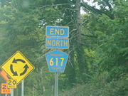
County Route 617 | 7.36 mi. | CR 527 County Route 527 (New Jersey) County Route 527 is a county highway in the U.S. state of New Jersey. The highway extends from Main Street in Toms River Township to Pompton Avenue in Cedar Grove. It is the second longest county highway in New Jersey after Route 519. It was first given the number 527 in 1954... in East Brunswick East Brunswick Township, New Jersey The town is located southwest of New York City and 48 miles northeast of Philadelphia.Lawrence Brook, a tributary of the Raritan River, runs along the western border of the township... |
NJ 172 in New Brunswick New Brunswick, New Jersey New Brunswick is a city in Middlesex County, New Jersey, USA. It is the county seat and the home of Rutgers University. The city is located on the Northeast Corridor rail line, southwest of Manhattan, on the southern bank of the Raritan River. At the 2010 United States Census, the population of... |
Rues Ln., Ryders Ln. |
 |
County Route 618 | 1.16 mi. | NJ 27 in South Brunswick Twp. South Brunswick Township, New Jersey South Brunswick Township is a Township in Middlesex County, New Jersey, United States. As of the 2010 United States Census, the township population was 43,417.... |
NJ 27 in South Brunswick Twp. South Brunswick Township, New Jersey South Brunswick Township is a Township in Middlesex County, New Jersey, United States. As of the 2010 United States Census, the township population was 43,417.... |
Old Rd. |
 |
County Route 619 County Route 619 (Middlesex County, New Jersey) County Route 619 is a county route located entirely in Monroe Township, Middlesex County, New Jersey that measures in length. It carries the names of Butcher Road and Applegarth Road... |
7.80 mi. | Disbrow Hill Rd. in Monroe Twp. Monroe Township, Middlesex County, New Jersey Monroe Township is a Township in Middlesex County, New Jersey, United States. As of the United States 2000 Census, the township population was 27,999. Monroe was incorporated as a township by an Act of the New Jersey Legislature on April 9, 1838, from portions of South Amboy Township, based on the... |
CR 698 in Monroe Twp. Monroe Township, Middlesex County, New Jersey Monroe Township is a Township in Middlesex County, New Jersey, United States. As of the United States 2000 Census, the township population was 27,999. Monroe was incorporated as a township by an Act of the New Jersey Legislature on April 9, 1838, from portions of South Amboy Township, based on the... /Jamesburg Jamesburg, New Jersey Jamesburg is a Borough in Middlesex County, New Jersey, United States. As of the United States 2000 Census, the borough population was 6,025.Jamesburg was formed as a borough by an Act of the New Jersey Legislature on March 19, 1887, when it was created from portions of Monroe Township, based on... |
Butcher Rd., Applegarth Rd., Possum Hollow Rd. |
 |
County Route 620 | 0.28 mi. | dead end in North Brunswick Twp. North Brunswick Township, New Jersey -Demographics:At the 2010 census, there were 40,742 people, 13,635 households and 9,367 families residing in the township. The population density was 3,018.3 per square mile . There were 13,932 housing units at an average density of 1,158.8 per square mile... |
NJ 171 in North Brunswick Twp. North Brunswick Township, New Jersey -Demographics:At the 2010 census, there were 40,742 people, 13,635 households and 9,367 families residing in the township. The population density was 3,018.3 per square mile . There were 13,932 housing units at an average density of 1,158.8 per square mile... |
Nassau St. |
 |
County Route 622 County Route 622 (Middlesex County, New Jersey) Middlesex County Route 622 is a county highway in Middlesex County, New Jersey. It traverses the municipalities of Highland Park, Piscataway and Middlesex in its 7.44 mile length. The road began as Middlesex County Route 2R8 circa 1947. The road was changed into County Route 514 Spur, a spur... |
7.44 mi. | NJ 27 in Highland Park Highland Park, New Jersey Highland Park is a borough in Middlesex County, New Jersey, United States. As of the 2010 United States Census, the borough population was 13,982.... |
NJ 28 in Middlesex Middlesex, New Jersey Middlesex is a Borough in Middlesex County, New Jersey, United States. As of the 2010 United States Census, the borough population was 13,635.Middlesex was incorporated as a borough by an Act of the New Jersey Legislature on April 9, 1913, from portions of Piscataway Township, based on the results... |
River Rd., Raritan Ave. |
 |
County Route 624 | 0.40 mi. | NJ 35 in Perth Amboy Perth Amboy, New Jersey Perth Amboy is a city in Middlesex County, New Jersey, United States. The City of Perth Amboy is part of the New York metropolitan area. As of the 2010 United States Census, the city population was 50,814. Perth Amboy is known as the "City by the Bay", referring to Raritan Bay.-Name:The Lenape... |
Fayette St. in Perth Amboy Perth Amboy, New Jersey Perth Amboy is a city in Middlesex County, New Jersey, United States. The City of Perth Amboy is part of the New York metropolitan area. As of the 2010 United States Census, the city population was 50,814. Perth Amboy is known as the "City by the Bay", referring to Raritan Bay.-Name:The Lenape... |
440 Spur |
 |
County Route 625 (section 1) | 0.57 mi. | CR 612 County Route 612 (Middlesex County, New Jersey) County Route 612 is a county route in Middlesex County, New Jersey that measures in length. It carries the names of Forsgate Drive, Pergola Avenue, and Matchaponix Road. The road extends from CR 613 in the east to its bridge over the New Jersey Turnpike in the west, where it continues as Route 32... in Jamesburg Jamesburg, New Jersey Jamesburg is a Borough in Middlesex County, New Jersey, United States. As of the United States 2000 Census, the borough population was 6,025.Jamesburg was formed as a borough by an Act of the New Jersey Legislature on March 19, 1887, when it was created from portions of Monroe Township, based on... |
CR 615 County Route 615 (Middlesex County, New Jersey) County Route 615 is a county route in Middlesex County, New Jersey that measures in length. The road extends from Mercer CR 615 at the Plainsboro/West Windsor line all the way to So. Pine Ave in South Amboy, New Jersey. While most of 615 is not used a commuter road, the section in the... in Jamesburg Jamesburg, New Jersey Jamesburg is a Borough in Middlesex County, New Jersey, United States. As of the United States 2000 Census, the borough population was 6,025.Jamesburg was formed as a borough by an Act of the New Jersey Legislature on March 19, 1887, when it was created from portions of Monroe Township, based on... |
Railroad Ave. |
|
County Route 625 (section 2) | 0.21 mi. | CR 522 County Route 522 (New Jersey) County Route 522 is a county highway in the U.S. state of New Jersey. The highway extends from U.S. 1 in South Brunswick Township to Main Street in Freehold Borough.-Middlesex County:... in Jamesburg Jamesburg, New Jersey Jamesburg is a Borough in Middlesex County, New Jersey, United States. As of the United States 2000 Census, the borough population was 6,025.Jamesburg was formed as a borough by an Act of the New Jersey Legislature on March 19, 1887, when it was created from portions of Monroe Township, based on... |
McKnight Ave. in Jamesburg Jamesburg, New Jersey Jamesburg is a Borough in Middlesex County, New Jersey, United States. As of the United States 2000 Census, the borough population was 6,025.Jamesburg was formed as a borough by an Act of the New Jersey Legislature on March 19, 1887, when it was created from portions of Monroe Township, based on... |
Hooker St. |
 |
County Route 644 | 0.50 mi. | NJ 27/CR 527 County Route 527 (New Jersey) County Route 527 is a county highway in the U.S. state of New Jersey. The highway extends from Main Street in Toms River Township to Pompton Avenue in Cedar Grove. It is the second longest county highway in New Jersey after Route 519. It was first given the number 527 in 1954... in New Brunswick New Brunswick, New Jersey New Brunswick is a city in Middlesex County, New Jersey, USA. It is the county seat and the home of Rutgers University. The city is located on the Northeast Corridor rail line, southwest of Manhattan, on the southern bank of the Raritan River. At the 2010 United States Census, the population of... |
CR 693/NJ 27 in New Brunswick New Brunswick, New Jersey New Brunswick is a city in Middlesex County, New Jersey, USA. It is the county seat and the home of Rutgers University. The city is located on the Northeast Corridor rail line, southwest of Manhattan, on the southern bank of the Raritan River. At the 2010 United States Census, the population of... |
French Street (entire length is 27) |
 |
County Route 646 | 1.00 mi. | U.S. Route 1 U.S. Route 1 in New Jersey U.S. Route 1 is a United States highway which parallels the East Coast of the United States, running from Key West, Florida in the south to Fort Kent, Maine at the Canadian border in the north. Of the entire length of the route, of it runs through New Jersey... in Woodbridge |
CR 514 County Route 514 (New Jersey) County Route 514 is a county highway in the U.S. state of New Jersey. The highway extends from US 202 in East Amwell Township to Bayway Avenue in Elizabeth... in Woodbridge |
Woodbridge Center Drive |
 |
County Route 648 | 0.50 mi. | CR 514 County Route 514 (New Jersey) County Route 514 is a county highway in the U.S. state of New Jersey. The highway extends from US 202 in East Amwell Township to Bayway Avenue in Elizabeth... in Fords Fords, New Jersey Fords is a census-designated place and unincorporated area within Woodbridge Township, in Middlesex County, New Jersey, United States. As of the United States 2000 Census, the CDP population was 15,032.-Geography:Fords is located at .... |
CR 501 County Route 501 (New Jersey) County Route 501 is a county highway in New Jersey in two sections spanning Middlesex, Hudson and Bergen Counties. The southern section runs from South Plainfield to Perth Amboy, the northern section runs from Bayonne to Rockleigh, and the two sections are connected by New York State Route 440... in Fords |
Ford Avenue |
 |
County Route 649 | 2.78 mi. | Garden State Parkway Garden State Parkway The Garden State Parkway is a 172.4-mile limited-access toll parkway that stretches the length of New Jersey from the New York line at Montvale, New Jersey, to Cape May at New Jersey's southernmost tip. Its name refers to New Jersey's nickname, the "Garden State." Most New Jersey residents refer... ramps in Woodbridge Woodbridge Township, New Jersey -Communities:Many distinct communities exist within Woodbridge Township. Several of these communities have their own ZIP codes, and many are listed by the United States Census Bureau as census-designated places, but they are all unincorporated areas and neighborhoods within the Township that,... |
CR 602 on the Edison Edison, New Jersey Edison Township is a township in Middlesex County, New Jersey. What is now Edison Township was originally incorporated as Raritan Township by an Act of the New Jersey Legislature on March 17, 1870, from portions of both Piscataway Township and Woodbridge Township... /Woodbridge Woodbridge Township, New Jersey -Communities:Many distinct communities exist within Woodbridge Township. Several of these communities have their own ZIP codes, and many are listed by the United States Census Bureau as census-designated places, but they are all unincorporated areas and neighborhoods within the Township that,... line |
Wood Ave. |
 |
County Route 650 | 3.81 mi. | CR 604 in Woodbridge Woodbridge Township, New Jersey -Communities:Many distinct communities exist within Woodbridge Township. Several of these communities have their own ZIP codes, and many are listed by the United States Census Bureau as census-designated places, but they are all unincorporated areas and neighborhoods within the Township that,... |
CR 514 County Route 514 (New Jersey) County Route 514 is a county highway in the U.S. state of New Jersey. The highway extends from US 202 in East Amwell Township to Bayway Avenue in Elizabeth... in Woodbridge Woodbridge Township, New Jersey -Communities:Many distinct communities exist within Woodbridge Township. Several of these communities have their own ZIP codes, and many are listed by the United States Census Bureau as census-designated places, but they are all unincorporated areas and neighborhoods within the Township that,... |
Middlesex Ave., New Dover Rd., Avenel St. |
 |
County Route 651 | 1.03 mi. | CR 650 in Woodbridge Woodbridge Township, New Jersey -Communities:Many distinct communities exist within Woodbridge Township. Several of these communities have their own ZIP codes, and many are listed by the United States Census Bureau as census-designated places, but they are all unincorporated areas and neighborhoods within the Township that,... |
Union Co. Union County, New Jersey Union County is a county located in the U.S. state of New Jersey. As of the 2010 Census, the population was 536,499. It is part of the New York Metropolitan Area. Its county seat is Elizabeth. Union County ranks 93rd among the highest-income counties in the United States. It also ranks 74th in... line in Woodbridge Woodbridge Township, New Jersey -Communities:Many distinct communities exist within Woodbridge Township. Several of these communities have their own ZIP codes, and many are listed by the United States Census Bureau as census-designated places, but they are all unincorporated areas and neighborhoods within the Township that,... |
Colonia Blvd. |
 |
County Route 652 | 0.98 mi. | CR 514 County Route 514 (New Jersey) County Route 514 is a county highway in the U.S. state of New Jersey. The highway extends from US 202 in East Amwell Township to Bayway Avenue in Elizabeth... in Woodbridge Woodbridge Township, New Jersey -Communities:Many distinct communities exist within Woodbridge Township. Several of these communities have their own ZIP codes, and many are listed by the United States Census Bureau as census-designated places, but they are all unincorporated areas and neighborhoods within the Township that,... |
CR 611 in Woodbridge Woodbridge Township, New Jersey -Communities:Many distinct communities exist within Woodbridge Township. Several of these communities have their own ZIP codes, and many are listed by the United States Census Bureau as census-designated places, but they are all unincorporated areas and neighborhoods within the Township that,... |
Berry St., Woodbridge Ave. |
 |
County Route 653 | 2.17 mi. | CR 616 in Perth Amboy Perth Amboy, New Jersey Perth Amboy is a city in Middlesex County, New Jersey, United States. The City of Perth Amboy is part of the New York metropolitan area. As of the 2010 United States Census, the city population was 50,814. Perth Amboy is known as the "City by the Bay", referring to Raritan Bay.-Name:The Lenape... |
NJ 35 in Woodbridge Woodbridge Township, New Jersey -Communities:Many distinct communities exist within Woodbridge Township. Several of these communities have their own ZIP codes, and many are listed by the United States Census Bureau as census-designated places, but they are all unincorporated areas and neighborhoods within the Township that,... |
Amboy Ave. |
 |
County Route 654 | 0.51 mi. | CR 653 in Perth Amboy Perth Amboy, New Jersey Perth Amboy is a city in Middlesex County, New Jersey, United States. The City of Perth Amboy is part of the New York metropolitan area. As of the 2010 United States Census, the city population was 50,814. Perth Amboy is known as the "City by the Bay", referring to Raritan Bay.-Name:The Lenape... |
CR 611 in Perth Amboy Perth Amboy, New Jersey Perth Amboy is a city in Middlesex County, New Jersey, United States. The City of Perth Amboy is part of the New York metropolitan area. As of the 2010 United States Census, the city population was 50,814. Perth Amboy is known as the "City by the Bay", referring to Raritan Bay.-Name:The Lenape... |
Maurer Rd. |
 |
County Route 655 | 1.70 mi. | CR 616 on the Perth Amboy Perth Amboy, New Jersey Perth Amboy is a city in Middlesex County, New Jersey, United States. The City of Perth Amboy is part of the New York metropolitan area. As of the 2010 United States Census, the city population was 50,814. Perth Amboy is known as the "City by the Bay", referring to Raritan Bay.-Name:The Lenape... /Woodbridge Woodbridge Township, New Jersey -Communities:Many distinct communities exist within Woodbridge Township. Several of these communities have their own ZIP codes, and many are listed by the United States Census Bureau as census-designated places, but they are all unincorporated areas and neighborhoods within the Township that,... line |
NJ 35 on the Perth Amboy Perth Amboy, New Jersey Perth Amboy is a city in Middlesex County, New Jersey, United States. The City of Perth Amboy is part of the New York metropolitan area. As of the 2010 United States Census, the city population was 50,814. Perth Amboy is known as the "City by the Bay", referring to Raritan Bay.-Name:The Lenape... /Woodbridge Woodbridge Township, New Jersey -Communities:Many distinct communities exist within Woodbridge Township. Several of these communities have their own ZIP codes, and many are listed by the United States Census Bureau as census-designated places, but they are all unincorporated areas and neighborhoods within the Township that,... line |
Florida Grove Rd. |
 |
County Route 656 | 3.74 mi. | CR 616 in Woodbridge Woodbridge Township, New Jersey -Communities:Many distinct communities exist within Woodbridge Township. Several of these communities have their own ZIP codes, and many are listed by the United States Census Bureau as census-designated places, but they are all unincorporated areas and neighborhoods within the Township that,... |
CR 658 in Perth Amboy Perth Amboy, New Jersey Perth Amboy is a city in Middlesex County, New Jersey, United States. The City of Perth Amboy is part of the New York metropolitan area. As of the 2010 United States Census, the city population was 50,814. Perth Amboy is known as the "City by the Bay", referring to Raritan Bay.-Name:The Lenape... |
Industrial Ave., Smith St. |
 |
County Route 657 (section 1) | 1.96 mi. | CR 501 County Route 501 (New Jersey) County Route 501 is a county highway in New Jersey in two sections spanning Middlesex, Hudson and Bergen Counties. The southern section runs from South Plainfield to Perth Amboy, the northern section runs from Bayonne to Rockleigh, and the two sections are connected by New York State Route 440... in Edison Edison, New Jersey Edison Township is a township in Middlesex County, New Jersey. What is now Edison Township was originally incorporated as Raritan Township by an Act of the New Jersey Legislature on March 17, 1870, from portions of both Piscataway Township and Woodbridge Township... |
NJ 27 in Edison Edison, New Jersey Edison Township is a township in Middlesex County, New Jersey. What is now Edison Township was originally incorporated as Raritan Township by an Act of the New Jersey Legislature on March 17, 1870, from portions of both Piscataway Township and Woodbridge Township... |
Lafayette Ave., Parsonage Rd. |
|
County Route 657 (section 2) | 1.56 mi. | CR 657 (section 1) in Edison Edison, New Jersey Edison Township is a township in Middlesex County, New Jersey. What is now Edison Township was originally incorporated as Raritan Township by an Act of the New Jersey Legislature on March 17, 1870, from portions of both Piscataway Township and Woodbridge Township... |
NJ 27 in Edison Edison, New Jersey Edison Township is a township in Middlesex County, New Jersey. What is now Edison Township was originally incorporated as Raritan Township by an Act of the New Jersey Legislature on March 17, 1870, from portions of both Piscataway Township and Woodbridge Township... |
Roosevelt Dr., Oakwood Ave., Evergreen Rd. |
|
County Route 657 (section 3) | 1.41 mi. | CR 657 (section 2) in Edison Edison, New Jersey Edison Township is a township in Middlesex County, New Jersey. What is now Edison Township was originally incorporated as Raritan Township by an Act of the New Jersey Legislature on March 17, 1870, from portions of both Piscataway Township and Woodbridge Township... |
CR 604 in Woodbridge Woodbridge Township, New Jersey -Communities:Many distinct communities exist within Woodbridge Township. Several of these communities have their own ZIP codes, and many are listed by the United States Census Bureau as census-designated places, but they are all unincorporated areas and neighborhoods within the Township that,... |
Middlesex-Essex Tpke. |
 |
County Route 658 (section 1) | 1.35 mi. | CR 656 in Perth Amboy Perth Amboy, New Jersey Perth Amboy is a city in Middlesex County, New Jersey, United States. The City of Perth Amboy is part of the New York metropolitan area. As of the 2010 United States Census, the city population was 50,814. Perth Amboy is known as the "City by the Bay", referring to Raritan Bay.-Name:The Lenape... |
Water St. in Perth Amboy Perth Amboy, New Jersey Perth Amboy is a city in Middlesex County, New Jersey, United States. The City of Perth Amboy is part of the New York metropolitan area. As of the 2010 United States Census, the city population was 50,814. Perth Amboy is known as the "City by the Bay", referring to Raritan Bay.-Name:The Lenape... |
Herbert St., Market St. |
|
County Route 658 (section 2) | 0.81 mi. | dead end Cul-de-sac A cul-de-sac is a word of French origin referring to a dead end, close, no through road or court meaning dead-end street with only one inlet/outlet... in Perth Amboy Perth Amboy, New Jersey Perth Amboy is a city in Middlesex County, New Jersey, United States. The City of Perth Amboy is part of the New York metropolitan area. As of the 2010 United States Census, the city population was 50,814. Perth Amboy is known as the "City by the Bay", referring to Raritan Bay.-Name:The Lenape... |
CR 616 in Perth Amboy Perth Amboy, New Jersey Perth Amboy is a city in Middlesex County, New Jersey, United States. The City of Perth Amboy is part of the New York metropolitan area. As of the 2010 United States Census, the city population was 50,814. Perth Amboy is known as the "City by the Bay", referring to Raritan Bay.-Name:The Lenape... |
Front St., Fayette St. |
 |
County Route 659 (section 1) | 0.42 mi. | CR 659 (section 2) in Edison Edison, New Jersey Edison Township is a township in Middlesex County, New Jersey. What is now Edison Township was originally incorporated as Raritan Township by an Act of the New Jersey Legislature on March 17, 1870, from portions of both Piscataway Township and Woodbridge Township... |
CR 659 (section 3) in Edison Edison, New Jersey Edison Township is a township in Middlesex County, New Jersey. What is now Edison Township was originally incorporated as Raritan Township by an Act of the New Jersey Legislature on March 17, 1870, from portions of both Piscataway Township and Woodbridge Township... |
Birch St. |
|
County Route 659 (section 2) | 0.36 mi. | CR 660 in Edison Edison, New Jersey Edison Township is a township in Middlesex County, New Jersey. What is now Edison Township was originally incorporated as Raritan Township by an Act of the New Jersey Legislature on March 17, 1870, from portions of both Piscataway Township and Woodbridge Township... |
CR 657 (section 2) in Edison Edison, New Jersey Edison Township is a township in Middlesex County, New Jersey. What is now Edison Township was originally incorporated as Raritan Township by an Act of the New Jersey Legislature on March 17, 1870, from portions of both Piscataway Township and Woodbridge Township... |
Pine Dr. |
|
County Route 659 (section 3) | 0.22 mi. | Koster Blvd. in Edison Edison, New Jersey Edison Township is a township in Middlesex County, New Jersey. What is now Edison Township was originally incorporated as Raritan Township by an Act of the New Jersey Legislature on March 17, 1870, from portions of both Piscataway Township and Woodbridge Township... |
CR 657 (section 2) in Edison Edison, New Jersey Edison Township is a township in Middlesex County, New Jersey. What is now Edison Township was originally incorporated as Raritan Township by an Act of the New Jersey Legislature on March 17, 1870, from portions of both Piscataway Township and Woodbridge Township... |
Maple Dr. |
|
County Route 659 (section 4) | 0.52 mi. | CR 657 (section 2) in Edison Edison, New Jersey Edison Township is a township in Middlesex County, New Jersey. What is now Edison Township was originally incorporated as Raritan Township by an Act of the New Jersey Legislature on March 17, 1870, from portions of both Piscataway Township and Woodbridge Township... |
CR 657 (section 1) in Edison Edison, New Jersey Edison Township is a township in Middlesex County, New Jersey. What is now Edison Township was originally incorporated as Raritan Township by an Act of the New Jersey Legislature on March 17, 1870, from portions of both Piscataway Township and Woodbridge Township... |
Oak Dr. |
 |
County Route 660 | 1.15 mi. | CR 531 County Route 531 (New Jersey) County Route 531 is a county highway in the U.S. state of New Jersey. The highway extends 13.61 miles from Woodbridge Avenue in Edison, Middlesex County, through Somerset County to Passaic Valley Road in Long Hill Township, Morris County.-Route description:Route 531 begins at CR 514 in Edison... in Metuchen Metuchen, New Jersey Metuchen is a Borough in Middlesex County, New Jersey, United States, which is 8 miles northeast of New Brunswick, 18 miles southwest of Newark, 24 miles southwest of Jersey City, and 29 miles southwest of Manhattan, all part of the New York metropolitan area... |
US 1 U.S. Route 1 in New Jersey U.S. Route 1 is a United States highway which parallels the East Coast of the United States, running from Key West, Florida in the south to Fort Kent, Maine at the Canadian border in the north. Of the entire length of the route, of it runs through New Jersey... in Edison Edison, New Jersey Edison Township is a township in Middlesex County, New Jersey. What is now Edison Township was originally incorporated as Raritan Township by an Act of the New Jersey Legislature on March 17, 1870, from portions of both Piscataway Township and Woodbridge Township... |
Woodbridge Ave., Grandview Ave. W. |
 |
County Route 661 | 1.08 mi. | CR 531 County Route 531 (New Jersey) County Route 531 is a county highway in the U.S. state of New Jersey. The highway extends 13.61 miles from Woodbridge Avenue in Edison, Middlesex County, through Somerset County to Passaic Valley Road in Long Hill Township, Morris County.-Route description:Route 531 begins at CR 514 in Edison... in Edison Edison, New Jersey Edison Township is a township in Middlesex County, New Jersey. What is now Edison Township was originally incorporated as Raritan Township by an Act of the New Jersey Legislature on March 17, 1870, from portions of both Piscataway Township and Woodbridge Township... |
CR 604 in Edison Edison, New Jersey Edison Township is a township in Middlesex County, New Jersey. What is now Edison Township was originally incorporated as Raritan Township by an Act of the New Jersey Legislature on March 17, 1870, from portions of both Piscataway Township and Woodbridge Township... |
Plainfield Rd. |
 |
County Route 663 | 1.50 mi. | CR 603 in South Plainfield South Plainfield, New Jersey South Plainfield is a Borough in Middlesex County, New Jersey, United States. As of the 2010 United States Census, the borough population was 23,385.... |
New Market Ave. in South Plainfield South Plainfield, New Jersey South Plainfield is a Borough in Middlesex County, New Jersey, United States. As of the 2010 United States Census, the borough population was 23,385.... |
Clinton Ave. |
 |
County Route 665 | 4.00 mi. | CR 609 in Piscataway Twp. Piscataway Township, New Jersey The township consists of the following historic villages and areas: New Market, known as Quibbletown in the 18th Century, Randolphville, Fieldville and North Stelton... |
Union Co. Union County, New Jersey Union County is a county located in the U.S. state of New Jersey. As of the 2010 Census, the population was 536,499. It is part of the New York Metropolitan Area. Its county seat is Elizabeth. Union County ranks 93rd among the highest-income counties in the United States. It also ranks 74th in... line in Piscataway Twp. Piscataway Township, New Jersey The township consists of the following historic villages and areas: New Market, known as Quibbletown in the 18th Century, Randolphville, Fieldville and North Stelton... |
So. Washington Ave., Stelton Rd., New Market Rd., South Ave. |
 |
County Route 667 | 0.61 mi. | Nixon Ln. in Edison Edison, New Jersey Edison Township is a township in Middlesex County, New Jersey. What is now Edison Township was originally incorporated as Raritan Township by an Act of the New Jersey Legislature on March 17, 1870, from portions of both Piscataway Township and Woodbridge Township... |
CR 514 County Route 514 (New Jersey) County Route 514 is a county highway in the U.S. state of New Jersey. The highway extends from US 202 in East Amwell Township to Bayway Avenue in Elizabeth... in Edison Edison, New Jersey Edison Township is a township in Middlesex County, New Jersey. What is now Edison Township was originally incorporated as Raritan Township by an Act of the New Jersey Legislature on March 17, 1870, from portions of both Piscataway Township and Woodbridge Township... |
Mill Rd. |
 |
County Route 669 | 1.40 mi. | NJ 27 in Metuchen Metuchen, New Jersey Metuchen is a Borough in Middlesex County, New Jersey, United States, which is 8 miles northeast of New Brunswick, 18 miles southwest of Newark, 24 miles southwest of Jersey City, and 29 miles southwest of Manhattan, all part of the New York metropolitan area... |
CR 531 County Route 531 (New Jersey) County Route 531 is a county highway in the U.S. state of New Jersey. The highway extends 13.61 miles from Woodbridge Avenue in Edison, Middlesex County, through Somerset County to Passaic Valley Road in Long Hill Township, Morris County.-Route description:Route 531 begins at CR 514 in Edison... in Metuchen Metuchen, New Jersey Metuchen is a Borough in Middlesex County, New Jersey, United States, which is 8 miles northeast of New Brunswick, 18 miles southwest of Newark, 24 miles southwest of Jersey City, and 29 miles southwest of Manhattan, all part of the New York metropolitan area... |
Bridge St., Middlesex Ave., Central Ave. |
 |
County Route 670 | 4.75 mi. | CR 535 County Route 535 (New Jersey) County Route 535 is a county highway in the U.S. state of New Jersey. The highway extends from Logan Avenue , at the boundary between Trenton and Hamilton Township in Mercer County to the intersection of Main Street, Raritan Street and Washington Road in Sayreville in Middlesex County.The road... in Sayreville Sayreville, New Jersey Sayreville is a borough located on the Raritan River, near Raritan Bay in Middlesex County, New Jersey, United States. As of the 2010 United States Census, the borough population was 42,704.... |
NJ 35 in South Amboy South Amboy, New Jersey South Amboy is a city in Middlesex County, New Jersey, on the Raritan Bay. As of the 2000 United States Census, the city population was 7,913.South Amboy, and Perth Amboy across the Raritan River, are collectively referred to as The Amboys... |
Main St., Washington St. |
 |
County Route 671 | 0.55 mi. | CR 601 in Piscataway Twp. Piscataway Township, New Jersey The township consists of the following historic villages and areas: New Market, known as Quibbletown in the 18th Century, Randolphville, Fieldville and North Stelton... |
Union Co. Union County, New Jersey Union County is a county located in the U.S. state of New Jersey. As of the 2010 Census, the population was 536,499. It is part of the New York Metropolitan Area. Its county seat is Elizabeth. Union County ranks 93rd among the highest-income counties in the United States. It also ranks 74th in... line in Piscataway Twp. Piscataway Township, New Jersey The township consists of the following historic villages and areas: New Market, known as Quibbletown in the 18th Century, Randolphville, Fieldville and North Stelton... |
Rock Ave. |
 |
County Route 672 | 2.18 mi. | NJ 27/171/CR 527 County Route 527 (New Jersey) County Route 527 is a county highway in the U.S. state of New Jersey. The highway extends from Main Street in Toms River Township to Pompton Avenue in Cedar Grove. It is the second longest county highway in New Jersey after Route 519. It was first given the number 527 in 1954... in New Brunswick New Brunswick, New Jersey New Brunswick is a city in Middlesex County, New Jersey, USA. It is the county seat and the home of Rutgers University. The city is located on the Northeast Corridor rail line, southwest of Manhattan, on the southern bank of the Raritan River. At the 2010 United States Census, the population of... |
CR 609 in New Brunswick New Brunswick, New Jersey New Brunswick is a city in Middlesex County, New Jersey, USA. It is the county seat and the home of Rutgers University. The city is located on the Northeast Corridor rail line, southwest of Manhattan, on the southern bank of the Raritan River. At the 2010 United States Census, the population of... |
George St. |
 |
County Route 673 | 1.19 mi. | CR 535 County Route 535 (New Jersey) County Route 535 is a county highway in the U.S. state of New Jersey. The highway extends from Logan Avenue , at the boundary between Trenton and Hamilton Township in Mercer County to the intersection of Main Street, Raritan Street and Washington Road in Sayreville in Middlesex County.The road... in Sayreville Sayreville, New Jersey Sayreville is a borough located on the Raritan River, near Raritan Bay in Middlesex County, New Jersey, United States. As of the 2010 United States Census, the borough population was 42,704.... |
US 9 on the Old Bridge Old Bridge Township, New Jersey Old Bridge Township is a Township in Middlesex County, New Jersey, United States. As of the 2000 United States Census, the township had a total population of 60,456... /Sayreville Sayreville, New Jersey Sayreville is a borough located on the Raritan River, near Raritan Bay in Middlesex County, New Jersey, United States. As of the 2010 United States Census, the borough population was 42,704.... line |
Ernston Road |
 |
County Route 674 | 0.49 mi. | CR 609 in Piscataway Twp. Piscataway Township, New Jersey The township consists of the following historic villages and areas: New Market, known as Quibbletown in the 18th Century, Randolphville, Fieldville and North Stelton... |
School St. in Piscataway Twp. Piscataway Township, New Jersey The township consists of the following historic villages and areas: New Market, known as Quibbletown in the 18th Century, Randolphville, Fieldville and North Stelton... |
Suttons Ln. |
 |
County Route 675 (section 1) | 2.45 mi. | CR 615 County Route 615 (Middlesex County, New Jersey) County Route 615 is a county route in Middlesex County, New Jersey that measures in length. The road extends from Mercer CR 615 at the Plainsboro/West Windsor line all the way to So. Pine Ave in South Amboy, New Jersey. While most of 615 is not used a commuter road, the section in the... in Sayreville Sayreville, New Jersey Sayreville is a borough located on the Raritan River, near Raritan Bay in Middlesex County, New Jersey, United States. As of the 2010 United States Census, the borough population was 42,704.... |
CR 535 County Route 535 (New Jersey) County Route 535 is a county highway in the U.S. state of New Jersey. The highway extends from Logan Avenue , at the boundary between Trenton and Hamilton Township in Mercer County to the intersection of Main Street, Raritan Street and Washington Road in Sayreville in Middlesex County.The road... in Sayreville Sayreville, New Jersey Sayreville is a borough located on the Raritan River, near Raritan Bay in Middlesex County, New Jersey, United States. As of the 2010 United States Census, the borough population was 42,704.... |
Jernee's Mill Road |
|
County Route 675 (section 2) | 0.12 mi. | dead end Cul-de-sac A cul-de-sac is a word of French origin referring to a dead end, close, no through road or court meaning dead-end street with only one inlet/outlet... in Sayreville Sayreville, New Jersey Sayreville is a borough located on the Raritan River, near Raritan Bay in Middlesex County, New Jersey, United States. As of the 2010 United States Census, the borough population was 42,704.... |
ramp to CR 535 County Route 535 (New Jersey) County Route 535 is a county highway in the U.S. state of New Jersey. The highway extends from Logan Avenue , at the boundary between Trenton and Hamilton Township in Mercer County to the intersection of Main Street, Raritan Street and Washington Road in Sayreville in Middlesex County.The road... /675 in Sayreville Sayreville, New Jersey Sayreville is a borough located on the Raritan River, near Raritan Bay in Middlesex County, New Jersey, United States. As of the 2010 United States Census, the borough population was 42,704.... |
Washington St. |
|
County Route 675 (section 3) | 0.65 mi. | CR 535 County Route 535 (New Jersey) County Route 535 is a county highway in the U.S. state of New Jersey. The highway extends from Logan Avenue , at the boundary between Trenton and Hamilton Township in Mercer County to the intersection of Main Street, Raritan Street and Washington Road in Sayreville in Middlesex County.The road... in South River South River, New Jersey South River is a Borough in Middlesex County, New Jersey, United States. As of the United States 2000 Census, the borough population was 15,322.... |
CR 535 County Route 535 (New Jersey) County Route 535 is a county highway in the U.S. state of New Jersey. The highway extends from Logan Avenue , at the boundary between Trenton and Hamilton Township in Mercer County to the intersection of Main Street, Raritan Street and Washington Road in Sayreville in Middlesex County.The road... in South River South River, New Jersey South River is a Borough in Middlesex County, New Jersey, United States. As of the United States 2000 Census, the borough population was 15,322.... |
Jackson St., Water St. |
 |
County Route 676 County Route 676 (Middlesex County, New Jersey) County Route 676, abbreviated CR 676, is a county highway designation in Middlesex County, New Jersey, that uses the streets of Duclos Lane, North Riverview Avenue, Suttons Lane, and Woodbridge Avenue in Highland Park and Edison Township. It is long from Edmund Street to Truman Drive... |
1.55 mi. | US 1 U.S. Route 1 in New Jersey U.S. Route 1 is a United States highway which parallels the East Coast of the United States, running from Key West, Florida in the south to Fort Kent, Maine at the Canadian border in the north. Of the entire length of the route, of it runs through New Jersey... in Edison Edison, New Jersey Edison Township is a township in Middlesex County, New Jersey. What is now Edison Township was originally incorporated as Raritan Township by an Act of the New Jersey Legislature on March 17, 1870, from portions of both Piscataway Township and Woodbridge Township... |
Truman Dr. So. in Edison Edison, New Jersey Edison Township is a township in Middlesex County, New Jersey. What is now Edison Township was originally incorporated as Raritan Township by an Act of the New Jersey Legislature on March 17, 1870, from portions of both Piscataway Township and Woodbridge Township... |
Riverview Ave., Duclos Ln., Suttons Ln. |
 |
County Route 677 | 4.18 mi. | CR 615 County Route 615 (Middlesex County, New Jersey) County Route 615 is a county route in Middlesex County, New Jersey that measures in length. The road extends from Mercer CR 615 at the Plainsboro/West Windsor line all the way to So. Pine Ave in South Amboy, New Jersey. While most of 615 is not used a commuter road, the section in the... in East Brunswick Twp. East Brunswick Township, New Jersey The town is located southwest of New York City and 48 miles northeast of Philadelphia.Lawrence Brook, a tributary of the Raritan River, runs along the western border of the township... |
NJ 18 in East Brunswick Twp. East Brunswick Township, New Jersey The town is located southwest of New York City and 48 miles northeast of Philadelphia.Lawrence Brook, a tributary of the Raritan River, runs along the western border of the township... |
River Rd., Whitehead Ave., Ferry St., Reid St., Prospect St. |
 |
County Route 678 | 0.80 mi. | Prospect Ave. in Dunellen Dunellen, New Jersey Dunellen is a Borough in Middlesex County, New Jersey, United States. As of the 2000 United States Census, the borough population was 6,823.Dunellen was formed as a borough by an Act of the New Jersey Legislature on October 28, 1887, when it broke away from Piscataway Township, based on the results... |
CR 601 in Piscataway Twp. Piscataway Township, New Jersey The township consists of the following historic villages and areas: New Market, known as Quibbletown in the 18th Century, Randolphville, Fieldville and North Stelton... |
Walnut St. |
 |
County Route 679 | 4.16 mi. | US 130 U.S. Route 130 U.S. Route 130 is a north–south U.S. Highway completely within the state of New Jersey. It runs from Interstate 295 and US 40 at Deepwater in Pennsville Township, Salem County, where the road continues east as Route 49, north to US 1 in North Brunswick Township, Middlesex County, where... in South Brunswick Twp. South Brunswick Township, New Jersey South Brunswick Township is a Township in Middlesex County, New Jersey, United States. As of the 2010 United States Census, the township population was 43,417.... |
US 130 U.S. Route 130 U.S. Route 130 is a north–south U.S. Highway completely within the state of New Jersey. It runs from Interstate 295 and US 40 at Deepwater in Pennsville Township, Salem County, where the road continues east as Route 49, north to US 1 in North Brunswick Township, Middlesex County, where... in South Brunswick Twp. South Brunswick Township, New Jersey South Brunswick Township is a Township in Middlesex County, New Jersey, United States. As of the 2010 United States Census, the township population was 43,417.... |
Georges St., Old Georges St. |
 |
County Route 680 | 0.99 mi. | NJ 27 on the New New Brunswick, New Jersey New Brunswick is a city in Middlesex County, New Jersey, USA. It is the county seat and the home of Rutgers University. The city is located on the Northeast Corridor rail line, southwest of Manhattan, on the southern bank of the Raritan River. At the 2010 United States Census, the population of... /North Brunswick North Brunswick Township, New Jersey -Demographics:At the 2010 census, there were 40,742 people, 13,635 households and 9,367 families residing in the township. The population density was 3,018.3 per square mile . There were 13,932 housing units at an average density of 1,158.8 per square mile... line |
NJ 26 New Jersey Route 26 Route 26 is a state highway in New Jersey, United States, running along Livingston Avenue from U.S. Route 1 in North Brunswick Township northeast to Nassau Street at the to the border of New Brunswick. Prior to the 1953 renumbering, the route continued southwest along US 1 to Trenton... in North Brunswick Twp. North Brunswick Township, New Jersey -Demographics:At the 2010 census, there were 40,742 people, 13,635 households and 9,367 families residing in the township. The population density was 3,018.3 per square mile . There were 13,932 housing units at an average density of 1,158.8 per square mile... |
How Ln. |
 |
County Route 681 | 0.68 mi. | CR 522 County Route 522 (New Jersey) County Route 522 is a county highway in the U.S. state of New Jersey. The highway extends from U.S. 1 in South Brunswick Township to Main Street in Freehold Borough.-Middlesex County:... in South Brunswick Twp. South Brunswick Township, New Jersey South Brunswick Township is a Township in Middlesex County, New Jersey, United States. As of the 2010 United States Census, the township population was 43,417.... |
CR 679 in South Brunswick Twp. South Brunswick Township, New Jersey South Brunswick Township is a Township in Middlesex County, New Jersey, United States. As of the 2010 United States Census, the township population was 43,417.... |
Kingston Ln. |
 |
County Route 682 | 1.05 mi. | NJ 27 on the North North Brunswick Township, New Jersey -Demographics:At the 2010 census, there were 40,742 people, 13,635 households and 9,367 families residing in the township. The population density was 3,018.3 per square mile . There were 13,932 housing units at an average density of 1,158.8 per square mile... /South Brunswick South Brunswick Township, New Jersey South Brunswick Township is a Township in Middlesex County, New Jersey, United States. As of the 2010 United States Census, the township population was 43,417.... line |
US 1 U.S. Route 1 in New Jersey U.S. Route 1 is a United States highway which parallels the East Coast of the United States, running from Key West, Florida in the south to Fort Kent, Maine at the Canadian border in the north. Of the entire length of the route, of it runs through New Jersey... on the North North Brunswick Township, New Jersey -Demographics:At the 2010 census, there were 40,742 people, 13,635 households and 9,367 families residing in the township. The population density was 3,018.3 per square mile . There were 13,932 housing units at an average density of 1,158.8 per square mile... /South Brunswick South Brunswick Township, New Jersey South Brunswick Township is a Township in Middlesex County, New Jersey, United States. As of the 2010 United States Census, the township population was 43,417.... line |
Finnegan Ln. |
 |
County Route 683 | 2.29 mi. | Plainsboro-Cranbury Rd. in Plainsboro Twp. Plainsboro Township, New Jersey Plainsboro Township is a township in Middlesex County, New Jersey, United States. As of the 2000 United States Census, the township population was 20,215.Plainsboro was incorporated as a township on May 6, 1919... |
Ridge Rd. in South Brunswick Twp. South Brunswick Township, New Jersey South Brunswick Township is a Township in Middlesex County, New Jersey, United States. As of the 2010 United States Census, the township population was 43,417.... |
Schalks Crossing Rd. |
 |
County Route 684 | 1.73 mi. | US 9 in South Amboy South Amboy, New Jersey South Amboy is a city in Middlesex County, New Jersey, on the Raritan Bay. As of the 2000 United States Census, the city population was 7,913.South Amboy, and Perth Amboy across the Raritan River, are collectively referred to as The Amboys... |
NJ 35 in Sayreville Sayreville, New Jersey Sayreville is a borough located on the Raritan River, near Raritan Bay in Middlesex County, New Jersey, United States. As of the 2010 United States Census, the borough population was 42,704.... |
Washington Ave., Main St. |
 |
County Route 685 | 1.13 mi. | US 130 U.S. Route 130 U.S. Route 130 is a north–south U.S. Highway completely within the state of New Jersey. It runs from Interstate 295 and US 40 at Deepwater in Pennsville Township, Salem County, where the road continues east as Route 49, north to US 1 in North Brunswick Township, Middlesex County, where... /CR 539 County Route 539 (New Jersey) County Route 539, abbreviated CR 539, is a county highway in the U.S. state of New Jersey. The highway extends from Main Street in Tuckerton to U.S. Route 130 in Cranbury Township. However, signage on CR 539 suggests that it crosses U.S... in Cranbury Cranbury Township, New Jersey - Demographics :As of the census of 2000, there were 3,227 people, 1,091 households, and 877 families residing in the township. The population density was 240.6 people per square mile . There were 1,121 housing units at an average density of 83.6 per square mile... |
US 130 U.S. Route 130 U.S. Route 130 is a north–south U.S. Highway completely within the state of New Jersey. It runs from Interstate 295 and US 40 at Deepwater in Pennsville Township, Salem County, where the road continues east as Route 49, north to US 1 in North Brunswick Township, Middlesex County, where... in Cranbury Cranbury Township, New Jersey - Demographics :As of the census of 2000, there were 3,227 people, 1,091 households, and 877 families residing in the township. The population density was 240.6 people per square mile . There were 1,121 housing units at an average density of 83.6 per square mile... |
Hightstown Rd., Old Trenton Rd. |
 |
County Route 686 (section 1) | 0.38 mi. | 9th St. in Sayreville Sayreville, New Jersey Sayreville is a borough located on the Raritan River, near Raritan Bay in Middlesex County, New Jersey, United States. As of the 2010 United States Census, the borough population was 42,704.... |
Muth St. in Sayreville Sayreville, New Jersey Sayreville is a borough located on the Raritan River, near Raritan Bay in Middlesex County, New Jersey, United States. As of the 2010 United States Census, the borough population was 42,704.... |
Brook Ave. |
|
County Route 686 (section 2) | 1.95 mi. | dead end Cul-de-sac A cul-de-sac is a word of French origin referring to a dead end, close, no through road or court meaning dead-end street with only one inlet/outlet... in Sayreville Sayreville, New Jersey Sayreville is a borough located on the Raritan River, near Raritan Bay in Middlesex County, New Jersey, United States. As of the 2010 United States Census, the borough population was 42,704.... |
CR 684 in Sayreville Sayreville, New Jersey Sayreville is a borough located on the Raritan River, near Raritan Bay in Middlesex County, New Jersey, United States. As of the 2010 United States Census, the borough population was 42,704.... |
Feltus St., 5th St., Stevens Ave., Ridgeway Ave., Scott Ave. |
 |
County Route 687 | 1.60 mi. | CR 516 County Route 516 (New Jersey) -Route description:The highway extends 19.27 miles from Route 18/CR 527 in Old Bridge Township to Route 36 in Middletown Township. It is known as Old Bridge-Matawan Road for its entire length in Old Bridge Township where it intersects US 9 then continues several more miles to the Old... in Old Bridge Old Bridge Township, New Jersey Old Bridge Township is a Township in Middlesex County, New Jersey, United States. As of the 2000 United States Census, the township had a total population of 60,456... |
NJ 34 in Old Bridge Old Bridge Township, New Jersey Old Bridge Township is a Township in Middlesex County, New Jersey, United States. As of the 2000 United States Census, the township had a total population of 60,456... |
Cottrell Rd. |
 |
County Route 688 | 0.95 mi. | ramps from NJ 35 in Sayreville Sayreville, New Jersey Sayreville is a borough located on the Raritan River, near Raritan Bay in Middlesex County, New Jersey, United States. As of the 2010 United States Census, the borough population was 42,704.... |
CR 615 County Route 615 (Middlesex County, New Jersey) County Route 615 is a county route in Middlesex County, New Jersey that measures in length. The road extends from Mercer CR 615 at the Plainsboro/West Windsor line all the way to So. Pine Ave in South Amboy, New Jersey. While most of 615 is not used a commuter road, the section in the... in South Amboy South Amboy, New Jersey South Amboy is a city in Middlesex County, New Jersey, on the Raritan Bay. As of the 2000 United States Census, the city population was 7,913.South Amboy, and Perth Amboy across the Raritan River, are collectively referred to as The Amboys... |
Pine Ave. |
 |
County Route 689 | 5.01 mi. | CR 516 County Route 516 (New Jersey) -Route description:The highway extends 19.27 miles from Route 18/CR 527 in Old Bridge Township to Route 36 in Middletown Township. It is known as Old Bridge-Matawan Road for its entire length in Old Bridge Township where it intersects US 9 then continues several more miles to the Old... in Old Bridge Old Bridge Township, New Jersey Old Bridge Township is a Township in Middlesex County, New Jersey, United States. As of the 2000 United States Census, the township had a total population of 60,456... |
NJ 35 in Old Bridge Old Bridge Township, New Jersey Old Bridge Township is a Township in Middlesex County, New Jersey, United States. As of the 2000 United States Census, the township had a total population of 60,456... |
Amboy Rd., Morristown Rd., Cliffwood Rd., Matawan Rd., Laurence Pkwy. |
 |
County Route 689 Spur | 0.14 mi. | CR 689 in Old Bridge Old Bridge Township, New Jersey Old Bridge Township is a Township in Middlesex County, New Jersey, United States. As of the 2000 United States Census, the township had a total population of 60,456... |
Monmouth Co. Monmouth County, New Jersey Monmouth County is a county located in the U.S. state of New Jersey, within the New York metropolitan area. As of the 2010 Census, the population was 630,380, up from 615,301 at the 2000 census. Its county seat is Freehold Borough. The most populous municipality is Middletown Township with... line in Old Bridge Old Bridge Township, New Jersey Old Bridge Township is a Township in Middlesex County, New Jersey, United States. As of the 2000 United States Census, the township had a total population of 60,456... |
Aberdeen Rd. |
 |
County Route 690 | 0.89 mi. | CR 520 County Route 520 (New Jersey) County Route 520 is a county highway in the U.S. state of New Jersey. County Route 520 is a major road across Monmouth County connecting the county's central towns to the Jersey Shore at Sea Bright.-Route description:... in Old Bridge Old Bridge Township, New Jersey Old Bridge Township is a Township in Middlesex County, New Jersey, United States. As of the 2000 United States Census, the township had a total population of 60,456... |
Monmouth Co. Monmouth County, New Jersey Monmouth County is a county located in the U.S. state of New Jersey, within the New York metropolitan area. As of the 2010 Census, the population was 630,380, up from 615,301 at the 2000 census. Its county seat is Freehold Borough. The most populous municipality is Middletown Township with... line in Old Bridge Old Bridge Township, New Jersey Old Bridge Township is a Township in Middlesex County, New Jersey, United States. As of the 2000 United States Census, the township had a total population of 60,456... |
Texas Rd. |
 |
County Route 691 | 1.08 mi. | NJ 26 New Jersey Route 26 Route 26 is a state highway in New Jersey, United States, running along Livingston Avenue from U.S. Route 1 in North Brunswick Township northeast to Nassau Street at the to the border of New Brunswick. Prior to the 1953 renumbering, the route continued southwest along US 1 to Trenton... /Nassau St. on the New New Brunswick, New Jersey New Brunswick is a city in Middlesex County, New Jersey, USA. It is the county seat and the home of Rutgers University. The city is located on the Northeast Corridor rail line, southwest of Manhattan, on the southern bank of the Raritan River. At the 2010 United States Census, the population of... /North Brunswick North Brunswick Township, New Jersey -Demographics:At the 2010 census, there were 40,742 people, 13,635 households and 9,367 families residing in the township. The population density was 3,018.3 per square mile . There were 13,932 housing units at an average density of 1,158.8 per square mile... line |
NJ 171 in New Brunswick New Brunswick, New Jersey New Brunswick is a city in Middlesex County, New Jersey, USA. It is the county seat and the home of Rutgers University. The city is located on the Northeast Corridor rail line, southwest of Manhattan, on the southern bank of the Raritan River. At the 2010 United States Census, the population of... |
Livingston Ave. |
 |
County Route 692 | 0.55 mi. | CR 622 County Route 622 (Middlesex County, New Jersey) Middlesex County Route 622 is a county highway in Middlesex County, New Jersey. It traverses the municipalities of Highland Park, Piscataway and Middlesex in its 7.44 mile length. The road began as Middlesex County Route 2R8 circa 1947. The road was changed into County Route 514 Spur, a spur... /807 County Route 807 (Middlesex County, New Jersey) County Route 807 is a secondary county route in Middlesex County, New Jersey. It runs for only through Johnson County Park in Highland Park and Piscataway, New Jersey. The only intersections are unnamed roads either for access to a park grove or back to County Route 622, at which it also... in Highland Park Highland Park, New Jersey Highland Park is a borough in Middlesex County, New Jersey, United States. As of the 2010 United States Census, the borough population was 13,982.... |
CR 702 in Edison Edison, New Jersey Edison Township is a township in Middlesex County, New Jersey. What is now Edison Township was originally incorporated as Raritan Township by an Act of the New Jersey Legislature on March 17, 1870, from portions of both Piscataway Township and Woodbridge Township... |
Cedar Ln. |
 |
County Route 693 | 1.10 mi. | NJ 91 New Jersey Route 91 Route 91 is a long spur state highway in Middlesex County, New Jersey. The route runs as a spur of U.S. Route 1 along Jersey Avenue in North Brunswick Township to Van Dyke Avenue in the city of New Brunswick. At Van Dyke Avenue, Route 91 ends as a state route, and Jersey Avenue continues as... /Van Dyke Ave. in New Brunswick New Brunswick, New Jersey New Brunswick is a city in Middlesex County, New Jersey, USA. It is the county seat and the home of Rutgers University. The city is located on the Northeast Corridor rail line, southwest of Manhattan, on the southern bank of the Raritan River. At the 2010 United States Census, the population of... |
NJ 27 in New Brunswick New Brunswick, New Jersey New Brunswick is a city in Middlesex County, New Jersey, USA. It is the county seat and the home of Rutgers University. The city is located on the Northeast Corridor rail line, southwest of Manhattan, on the southern bank of the Raritan River. At the 2010 United States Census, the population of... |
Jersey Ave. |
 |
County Route 694 | 1.13 mi. | US 130 U.S. Route 130 U.S. Route 130 is a north–south U.S. Highway completely within the state of New Jersey. It runs from Interstate 295 and US 40 at Deepwater in Pennsville Township, Salem County, where the road continues east as Route 49, north to US 1 in North Brunswick Township, Middlesex County, where... in North Brunswick Twp. North Brunswick Township, New Jersey -Demographics:At the 2010 census, there were 40,742 people, 13,635 households and 9,367 families residing in the township. The population density was 3,018.3 per square mile . There were 13,932 housing units at an average density of 1,158.8 per square mile... |
Riva Ave. in East Brunswick Twp. East Brunswick Township, New Jersey The town is located southwest of New York City and 48 miles northeast of Philadelphia.Lawrence Brook, a tributary of the Raritan River, runs along the western border of the township... |
Church Ln. |
 |
County Route 695 (section 1) | 0.82 mi. | CR 694 in North Brunswick Twp. North Brunswick Township, New Jersey -Demographics:At the 2010 census, there were 40,742 people, 13,635 households and 9,367 families residing in the township. The population density was 3,018.3 per square mile . There were 13,932 housing units at an average density of 1,158.8 per square mile... |
US 130 U.S. Route 130 U.S. Route 130 is a north–south U.S. Highway completely within the state of New Jersey. It runs from Interstate 295 and US 40 at Deepwater in Pennsville Township, Salem County, where the road continues east as Route 49, north to US 1 in North Brunswick Township, Middlesex County, where... in North Brunswick Twp. North Brunswick Township, New Jersey -Demographics:At the 2010 census, there were 40,742 people, 13,635 households and 9,367 families residing in the township. The population density was 3,018.3 per square mile . There were 13,932 housing units at an average density of 1,158.8 per square mile... |
Old Georges Rd. |
|
County Route 695 (section 2) | 0.20 mi. | US 130 U.S. Route 130 U.S. Route 130 is a north–south U.S. Highway completely within the state of New Jersey. It runs from Interstate 295 and US 40 at Deepwater in Pennsville Township, Salem County, where the road continues east as Route 49, north to US 1 in North Brunswick Township, Middlesex County, where... in North Brunswick Twp. North Brunswick Township, New Jersey -Demographics:At the 2010 census, there were 40,742 people, 13,635 households and 9,367 families residing in the township. The population density was 3,018.3 per square mile . There were 13,932 housing units at an average density of 1,158.8 per square mile... |
US 130 U.S. Route 130 U.S. Route 130 is a north–south U.S. Highway completely within the state of New Jersey. It runs from Interstate 295 and US 40 at Deepwater in Pennsville Township, Salem County, where the road continues east as Route 49, north to US 1 in North Brunswick Township, Middlesex County, where... in North Brunswick Twp. North Brunswick Township, New Jersey -Demographics:At the 2010 census, there were 40,742 people, 13,635 households and 9,367 families residing in the township. The population density was 3,018.3 per square mile . There were 13,932 housing units at an average density of 1,158.8 per square mile... |
Old Georges Rd. |
 |
County Route 696 | 0.49 mi. | US 130 U.S. Route 130 U.S. Route 130 is a north–south U.S. Highway completely within the state of New Jersey. It runs from Interstate 295 and US 40 at Deepwater in Pennsville Township, Salem County, where the road continues east as Route 49, north to US 1 in North Brunswick Township, Middlesex County, where... in North Brunswick Twp. North Brunswick Township, New Jersey -Demographics:At the 2010 census, there were 40,742 people, 13,635 households and 9,367 families residing in the township. The population density was 3,018.3 per square mile . There were 13,932 housing units at an average density of 1,158.8 per square mile... |
dead end Cul-de-sac A cul-de-sac is a word of French origin referring to a dead end, close, no through road or court meaning dead-end street with only one inlet/outlet... in North Brunswick Twp. North Brunswick Township, New Jersey -Demographics:At the 2010 census, there were 40,742 people, 13,635 households and 9,367 families residing in the township. The population density was 3,018.3 per square mile . There were 13,932 housing units at an average density of 1,158.8 per square mile... |
Apple Orchard Rd. |
 |
County Route 697 | 0.80 mi. | CR 679 in South Brunswick Twp. South Brunswick Township, New Jersey South Brunswick Township is a Township in Middlesex County, New Jersey, United States. As of the 2010 United States Census, the township population was 43,417.... |
US 130 U.S. Route 130 U.S. Route 130 is a north–south U.S. Highway completely within the state of New Jersey. It runs from Interstate 295 and US 40 at Deepwater in Pennsville Township, Salem County, where the road continues east as Route 49, north to US 1 in North Brunswick Township, Middlesex County, where... in South Brunswick Twp. South Brunswick Township, New Jersey South Brunswick Township is a Township in Middlesex County, New Jersey, United States. As of the 2010 United States Census, the township population was 43,417.... |
Old Georges Rd. |
 |
County Route 698 | 1.04 mi. | CR 535 County Route 535 (New Jersey) County Route 535 is a county highway in the U.S. state of New Jersey. The highway extends from Logan Avenue , at the boundary between Trenton and Hamilton Township in Mercer County to the intersection of Main Street, Raritan Street and Washington Road in Sayreville in Middlesex County.The road... in Monroe Twp. Monroe Township, Middlesex County, New Jersey Monroe Township is a Township in Middlesex County, New Jersey, United States. As of the United States 2000 Census, the township population was 27,999. Monroe was incorporated as a township by an Act of the New Jersey Legislature on April 9, 1838, from portions of South Amboy Township, based on the... |
CR 522 County Route 522 (New Jersey) County Route 522 is a county highway in the U.S. state of New Jersey. The highway extends from U.S. 1 in South Brunswick Township to Main Street in Freehold Borough.-Middlesex County:... in Jamesburg Jamesburg, New Jersey Jamesburg is a Borough in Middlesex County, New Jersey, United States. As of the United States 2000 Census, the borough population was 6,025.Jamesburg was formed as a borough by an Act of the New Jersey Legislature on March 19, 1887, when it was created from portions of Monroe Township, based on... |
Dock's Corner Rd. |
 |
County Route 699 (section 1) | 0.71 mi. | CR 687 in Old Bridge Old Bridge Township, New Jersey Old Bridge Township is a Township in Middlesex County, New Jersey, United States. As of the 2000 United States Census, the township had a total population of 60,456... |
NJ 34 in Old Bridge Old Bridge Township, New Jersey Old Bridge Township is a Township in Middlesex County, New Jersey, United States. As of the 2000 United States Census, the township had a total population of 60,456... |
Spring Hill Rd. |
|
County Route 699 (section 2) | 0.13 mi. | CR 699 in Old Bridge Old Bridge Township, New Jersey Old Bridge Township is a Township in Middlesex County, New Jersey, United States. As of the 2000 United States Census, the township had a total population of 60,456... |
NJ 34 in Old Bridge Old Bridge Township, New Jersey Old Bridge Township is a Township in Middlesex County, New Jersey, United States. As of the 2000 United States Census, the township had a total population of 60,456... |
Old Mill Rd. |
 |
County Route 700 | 2.50 mi. | NJ 18 in Old Bridge Old Bridge Township, New Jersey Old Bridge Township is a Township in Middlesex County, New Jersey, United States. As of the 2000 United States Census, the township had a total population of 60,456... |
Marsad Dr. in Old Bridge Old Bridge Township, New Jersey Old Bridge Township is a Township in Middlesex County, New Jersey, United States. As of the 2000 United States Census, the township had a total population of 60,456... |
Marlboro Rd. |
 |
County Route 701 | 1.17 mi. | CR 609 in Piscataway Twp. Piscataway Township, New Jersey The township consists of the following historic villages and areas: New Market, known as Quibbletown in the 18th Century, Randolphville, Fieldville and North Stelton... |
CR 702 in Edison Edison, New Jersey Edison Township is a township in Middlesex County, New Jersey. What is now Edison Township was originally incorporated as Raritan Township by an Act of the New Jersey Legislature on March 17, 1870, from portions of both Piscataway Township and Woodbridge Township... |
Avenue E, Road 3 |
 |
County Route 702 | 0.74 mi. | CR 692 in Edison Edison, New Jersey Edison Township is a township in Middlesex County, New Jersey. What is now Edison Township was originally incorporated as Raritan Township by an Act of the New Jersey Legislature on March 17, 1870, from portions of both Piscataway Township and Woodbridge Township... |
dead end Cul-de-sac A cul-de-sac is a word of French origin referring to a dead end, close, no through road or court meaning dead-end street with only one inlet/outlet... in Edison Edison, New Jersey Edison Township is a township in Middlesex County, New Jersey. What is now Edison Township was originally incorporated as Raritan Township by an Act of the New Jersey Legislature on March 17, 1870, from portions of both Piscataway Township and Woodbridge Township... |
Road 1, Kilmer Road |
 |
County Route 807 County Route 807 (Middlesex County, New Jersey) County Route 807 is a secondary county route in Middlesex County, New Jersey. It runs for only through Johnson County Park in Highland Park and Piscataway, New Jersey. The only intersections are unnamed roads either for access to a park grove or back to County Route 622, at which it also... |
1.18 mi. | CR 622 County Route 622 (Middlesex County, New Jersey) Middlesex County Route 622 is a county highway in Middlesex County, New Jersey. It traverses the municipalities of Highland Park, Piscataway and Middlesex in its 7.44 mile length. The road began as Middlesex County Route 2R8 circa 1947. The road was changed into County Route 514 Spur, a spur... /692 in Highland Park Highland Park, New Jersey Highland Park is a borough in Middlesex County, New Jersey, United States. As of the 2010 United States Census, the borough population was 13,982.... |
CR 622 County Route 622 (Middlesex County, New Jersey) Middlesex County Route 622 is a county highway in Middlesex County, New Jersey. It traverses the municipalities of Highland Park, Piscataway and Middlesex in its 7.44 mile length. The road began as Middlesex County Route 2R8 circa 1947. The road was changed into County Route 514 Spur, a spur... in Piscataway Twp. Piscataway Township, New Jersey The township consists of the following historic villages and areas: New Market, known as Quibbletown in the 18th Century, Randolphville, Fieldville and North Stelton... |
Johnson Dr., Violet Dr. |