
.gif)
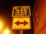
County Route 535 (New Jersey)
Encyclopedia
County Route 535 is a county highway
in the U.S. state
of New Jersey
. The highway extends 31.75 miles (51.1 km) from Logan Avenue (where it becomes Mercer C.R. 635), at the boundary between Trenton
and Hamilton Township
in Mercer County
to the intersection of Main Street, Raritan Street and Washington Road in Sayreville
in Middlesex County
.
The road serves as the main street through the small communities of Cranbury
, South River
and Sayreville
, while also passing through rural areas on the outskirts of Mercer
and southern Middlesex
Counties. At various points, it is locally known as East State Street, Edinburg Road, Old Trenton Road, Cranbury-South River Road, Main Street and Washington Road.
 The designation of Route 535 picks up East State Street at the Trenton city line and heads northeast into the Bromley neighborhood of Hamilton. It parallels the Northeast Corridor
line between both municipalities' respective train stations before abruptly turning southeast at 1.9 miles (3.1 km), an intersection with Klockner Road. Now the East State Street Extension, 535 meets Interstate 295
with limited access at Exit 64. Traffic traveling "southbound" on 535 (traveling geographically north for this brief stretch) has a ramp leading to I-295 North toward Route 1
and I-95
, while southbound traffic on the freeway can exit onto 535 North. From here, 535 continues toward Nottingham Avenue, and turns left at 3.29 miles (5.3 km), a few hundred feet east of where state route 33 merges onto Nottingham. Route 535 stays on this road for just 0.13 mile (0.2092142 km) before reaching a five-way intersection with Route 533
(Quakerbridge Road north of the intersection/White Horse
-Mercerville
Road south of it) and Nottingham, which is Route 618 as it travels southeast away from the intersection toward Hamilton Square.
Having regained its northeast direction, Route 535 moves through this intersection and becomes Edinburg Road. At 5.48, it leaves Hamilton for West Windsor, and bumps up against Mercer County Community College
on the left. Just beyond the college is Mercer County Park
, which is accessible through South Post Road (6.50 miles) or through the park's official west entrance (7.14). Just beyond this, at 7.39, the route meets a short concurrency with Route 526
, which comes from Robbinsville Township to the south. Less than a quarter mile later, 526 turns due north again and heads for Princeton Junction
. Route 535 continues to the northeast as Old Trenton Road, crossing into East Windsor at 10.65. At 11.02, it intersects Route 571
, with the entrance to the Route 133 bypass of Hightstown visible to the right. At milepost 11.80, Route 535 crosses the Millstone River
and into Middlesex County.
Route 535 is now traversing Cranbury, traveling for a shade under three miles (5 km) before reaching the township's Main Street. It turns left toward the downtown area, while Route 685 comes from the right and turns to continue down Old Trenton Road to its terminus at U.S. Route 130
. Once through Cranbury, Route 535 turns right onto Plainsboro Road at 14.56 and merges into another short concurrency, this time with Route 130 at 14.87. After less than a tenth of a mile, it breaks off to the right, taking a north-by-northeast path toward the New Jersey Turnpike
and the lower Raritan River
valley.
At 16.83, Route 535 enters South Brunswick Township
. Though signed at various points as Cranbury-South River Road, South River Road and Cranbury Road, it is officially only the latter. It meets Route 32 at 17.43, providing access to the Turnpike as it passes to the right. Originally traffic to and from the Turnpike used Route 32, but vehicles leaving the Turnpike now exit onto Route 535. At 18.41, Route 535 crosses under the Turnpike and runs along the boundary between South Brunswick and Monroe
. It leaves the border for a short stretch starting at an intersection with Route 522
(19.68), then returns to what is now the township line with East Brunswick Township
for a mile and a half. At 21.55, it enters East Brunswick completely.
Route 535 is one of the main thoroughfares of East Brunswick, along with Route 18, Ryders Lane and Dunhams Corner Road. The latter branches off at the same point 535 moves all the way into the township, banks hard to the right at East Brunswick Community Park just shy of the Turnpike, then rejoins Route 535 at 25.72. Route 535 intersects Ryders Lane at 23.86, passes East Brunswick High School
on the right, then approaches a complex interchange with Route 18 at 25.74, providing access to New Brunswick
and the Turnpike at Exit 9 to the northwest, Old Bridge and shore points
to the south, and Spotswood
via Route 613 (Summerhill Road). Route 535 itself continues north and crosses into the borough of South River
at the crossing of the Old Bridge Turnpike (Route 527
) at 25.94.
At 27.38, Route 535 crosses the South River
via the Veteran's Memorial Bridge and into its final destination of Sayreville. Though "Main Street" (Route 670) breaks off at 27.99, Route 535 (Washington Road) serves the more densely populated southern half of the borough, as well as Sayreville War Memorial High School
and Sayreville Middle School. At 30.51, 535 enters the outskirts of South Amboy
though it comes up just short of the border between the two municipalities. A mile later, it crosses underneath the Garden State Parkway
and reaches its northern terminus, an intersection with the other end of Sayreville's Main Street. The "Washington Road" designation follows a ramp off to the right and onto Main Street, continuing into South Amboy. Raritan Street continues another mile to an intersection with the concurrency of Route 9
and Route 35 on approach to the Edison Bridge and the Victory Bridge
, respectively.
County highway
A county highway is a road in the United States and in the Canadian province of Ontario that is designated and/or maintained by the county highway department...
in the U.S. state
U.S. state
A U.S. state is any one of the 50 federated states of the United States of America that share sovereignty with the federal government. Because of this shared sovereignty, an American is a citizen both of the federal entity and of his or her state of domicile. Four states use the official title of...
of New Jersey
New Jersey
New Jersey is a state in the Northeastern and Middle Atlantic regions of the United States. , its population was 8,791,894. It is bordered on the north and east by the state of New York, on the southeast and south by the Atlantic Ocean, on the west by Pennsylvania and on the southwest by Delaware...
. The highway extends 31.75 miles (51.1 km) from Logan Avenue (where it becomes Mercer C.R. 635), at the boundary between Trenton
Trenton, New Jersey
Trenton is the capital of the U.S. state of New Jersey and the county seat of Mercer County. As of the 2010 United States Census, Trenton had a population of 84,913...
and Hamilton Township
Hamilton Township, Mercer County, New Jersey
Hamilton Township is a Township in Mercer County, New Jersey, United States. As of the United States 2010 Census, the township had a total population of 88,464...
in Mercer County
Mercer County, New Jersey
As of the census of 2000, there were 350,761 people, 125,807 households, and 86,303 families residing in the county. The population density was 1,552 people per square mile . There were 133,280 housing units at an average density of 590 per square mile...
to the intersection of Main Street, Raritan Street and Washington Road in Sayreville
Sayreville, New Jersey
Sayreville is a borough located on the Raritan River, near Raritan Bay in Middlesex County, New Jersey, United States. As of the 2010 United States Census, the borough population was 42,704....
in Middlesex County
Middlesex County, New Jersey
-Demographics:As of the census of 2000, there were 750,162 people, 265,815 households, and 190,855 families residing in the county. The population density was 2,422 people per square mile . There were 273,637 housing units at an average density of 884 per square mile...
.
The road serves as the main street through the small communities of Cranbury
Cranbury CDP, New Jersey
Cranbury is a census-designated place and unincorporated area located within Cranbury Township, in Middlesex County, New Jersey, United States. The population was 2,008 at the 2000 census...
, South River
South River, New Jersey
South River is a Borough in Middlesex County, New Jersey, United States. As of the United States 2000 Census, the borough population was 15,322....
and Sayreville
Sayreville, New Jersey
Sayreville is a borough located on the Raritan River, near Raritan Bay in Middlesex County, New Jersey, United States. As of the 2010 United States Census, the borough population was 42,704....
, while also passing through rural areas on the outskirts of Mercer
Mercer County, New Jersey
As of the census of 2000, there were 350,761 people, 125,807 households, and 86,303 families residing in the county. The population density was 1,552 people per square mile . There were 133,280 housing units at an average density of 590 per square mile...
and southern Middlesex
Middlesex County, New Jersey
-Demographics:As of the census of 2000, there were 750,162 people, 265,815 households, and 190,855 families residing in the county. The population density was 2,422 people per square mile . There were 273,637 housing units at an average density of 884 per square mile...
Counties. At various points, it is locally known as East State Street, Edinburg Road, Old Trenton Road, Cranbury-South River Road, Main Street and Washington Road.
Route description
Northeast Corridor
The Northeast Corridor is a fully electrified railway line owned primarily by Amtrak serving the Northeast megalopolis of the United States from Boston in the north, via New York to Washington, D.C. in the south, with branches serving other cities...
line between both municipalities' respective train stations before abruptly turning southeast at 1.9 miles (3.1 km), an intersection with Klockner Road. Now the East State Street Extension, 535 meets Interstate 295
Interstate 295 (Delaware-New Jersey)
Interstate 295 in New Jersey and Delaware is an auxiliary Interstate Highway, designated as a bypass around Philadelphia, Pennsylvania. The route begins at a junction with Interstate 95 south of Wilmington, Delaware, and runs to another junction with I-95 north of Trenton, New Jersey...
with limited access at Exit 64. Traffic traveling "southbound" on 535 (traveling geographically north for this brief stretch) has a ramp leading to I-295 North toward Route 1
U.S. Route 1 in New Jersey
U.S. Route 1 is a United States highway which parallels the East Coast of the United States, running from Key West, Florida in the south to Fort Kent, Maine at the Canadian border in the north. Of the entire length of the route, of it runs through New Jersey...
and I-95
Interstate 95 in New Jersey
Interstate 95 is a major Interstate Highway that traverses the full extent of the East Coast of the United States, from Florida to Maine...
, while southbound traffic on the freeway can exit onto 535 North. From here, 535 continues toward Nottingham Avenue, and turns left at 3.29 miles (5.3 km), a few hundred feet east of where state route 33 merges onto Nottingham. Route 535 stays on this road for just 0.13 mile (0.2092142 km) before reaching a five-way intersection with Route 533
County Route 533 (New Jersey)
County Route 533 is a county highway in the U.S. state of New Jersey. The highway extends from the White Horse Circle, in Hamilton Township to County Route 527 in Bound Brook. Route 533 shares a major concurrency with U.S...
(Quakerbridge Road north of the intersection/White Horse
White Horse, New Jersey
White Horse is a census-designated place and unincorporated area located within Hamilton Township, in Mercer County, New Jersey. As of the United States 2000 Census, the CDP population was 9,373.-Geography:White Horse is located at ....
-Mercerville
Mercerville-Hamilton Square, New Jersey
Mercerville-Hamilton Square is a census-designated place and unincorporated area located within Hamilton Township, in Mercer County, New Jersey, USA...
Road south of it) and Nottingham, which is Route 618 as it travels southeast away from the intersection toward Hamilton Square.
Having regained its northeast direction, Route 535 moves through this intersection and becomes Edinburg Road. At 5.48, it leaves Hamilton for West Windsor, and bumps up against Mercer County Community College
Mercer County Community College
Mercer County Community College is an accredited, co-educational, two-year, public, community college located in Mercer County, New Jersey. The school's current president is Dr. Patricia C. Donohue...
on the left. Just beyond the college is Mercer County Park
Mercer County Park
Mercer County Park is a recreational park located mostly within West Windsor Township, New Jersey. Mercer County Park encompasses over covering areas of the Townships of West Windsor, Hamilton and Lawrence. It is the home for the US Olympic Rowing Team's training center...
, which is accessible through South Post Road (6.50 miles) or through the park's official west entrance (7.14). Just beyond this, at 7.39, the route meets a short concurrency with Route 526
County Route 526 (New Jersey)
County Route 526 is a county highway in the U.S. state of New Jersey. The highway extends from Hightstown Road in West Windsor Township to Lanes Mill Road in Lakewood Township....
, which comes from Robbinsville Township to the south. Less than a quarter mile later, 526 turns due north again and heads for Princeton Junction
Princeton Junction, New Jersey
Princeton Junction is also a New Jersey Transit and Amtrak station on the Northeast Corridor line.Princeton Junction is a census-designated place and unincorporated area located within West Windsor Township, in Mercer County, New Jersey...
. Route 535 continues to the northeast as Old Trenton Road, crossing into East Windsor at 10.65. At 11.02, it intersects Route 571
County Route 571 (New Jersey)
County Route 571, abbreviated CR 571, is a county highway in the U.S. state of New Jersey. The highway extends from Route 37 in Toms River Township to Route 27 in the Borough of Princeton.-Ocean County:...
, with the entrance to the Route 133 bypass of Hightstown visible to the right. At milepost 11.80, Route 535 crosses the Millstone River
Millstone River
The Millstone River is a tributary of the Raritan River in central New Jersey in the United States.The Millstone River begins in western Monmouth County and flows northward through southern Somerset County into the Raritan River at Manville. Almost three quarters of its length is paralleled by...
and into Middlesex County.
Route 535 is now traversing Cranbury, traveling for a shade under three miles (5 km) before reaching the township's Main Street. It turns left toward the downtown area, while Route 685 comes from the right and turns to continue down Old Trenton Road to its terminus at U.S. Route 130
U.S. Route 130
U.S. Route 130 is a north–south U.S. Highway completely within the state of New Jersey. It runs from Interstate 295 and US 40 at Deepwater in Pennsville Township, Salem County, where the road continues east as Route 49, north to US 1 in North Brunswick Township, Middlesex County, where...
. Once through Cranbury, Route 535 turns right onto Plainsboro Road at 14.56 and merges into another short concurrency, this time with Route 130 at 14.87. After less than a tenth of a mile, it breaks off to the right, taking a north-by-northeast path toward the New Jersey Turnpike
New Jersey Turnpike
The New Jersey Turnpike is a toll road in New Jersey, maintained by the New Jersey Turnpike Authority. According to the International Bridge, Tunnel and Turnpike Association, the Turnpike is the nation's sixth-busiest toll road and is among one of the most heavily traveled highways in the United...
and the lower Raritan River
Raritan River
The Raritan River is a major river of central New Jersey in the United States. Its watershed drains much of the mountainous area of the central part of the state, emptying into the Raritan Bay on the Atlantic Ocean.-Description:...
valley.
At 16.83, Route 535 enters South Brunswick Township
South Brunswick Township, New Jersey
South Brunswick Township is a Township in Middlesex County, New Jersey, United States. As of the 2010 United States Census, the township population was 43,417....
. Though signed at various points as Cranbury-South River Road, South River Road and Cranbury Road, it is officially only the latter. It meets Route 32 at 17.43, providing access to the Turnpike as it passes to the right. Originally traffic to and from the Turnpike used Route 32, but vehicles leaving the Turnpike now exit onto Route 535. At 18.41, Route 535 crosses under the Turnpike and runs along the boundary between South Brunswick and Monroe
Monroe Township, Middlesex County, New Jersey
Monroe Township is a Township in Middlesex County, New Jersey, United States. As of the United States 2000 Census, the township population was 27,999. Monroe was incorporated as a township by an Act of the New Jersey Legislature on April 9, 1838, from portions of South Amboy Township, based on the...
. It leaves the border for a short stretch starting at an intersection with Route 522
County Route 522 (New Jersey)
County Route 522 is a county highway in the U.S. state of New Jersey. The highway extends from U.S. 1 in South Brunswick Township to Main Street in Freehold Borough.-Middlesex County:...
(19.68), then returns to what is now the township line with East Brunswick Township
East Brunswick Township, New Jersey
The town is located southwest of New York City and 48 miles northeast of Philadelphia.Lawrence Brook, a tributary of the Raritan River, runs along the western border of the township...
for a mile and a half. At 21.55, it enters East Brunswick completely.
Route 535 is one of the main thoroughfares of East Brunswick, along with Route 18, Ryders Lane and Dunhams Corner Road. The latter branches off at the same point 535 moves all the way into the township, banks hard to the right at East Brunswick Community Park just shy of the Turnpike, then rejoins Route 535 at 25.72. Route 535 intersects Ryders Lane at 23.86, passes East Brunswick High School
East Brunswick High School
East Brunswick High School is a comprehensive public high school serving students in grades 10 through 12 in East Brunswick Township, in Middlesex County, New Jersey, operating as part of East Brunswick Public Schools. The school was recognized by the Blue Ribbon Schools Program in the 1990-91...
on the right, then approaches a complex interchange with Route 18 at 25.74, providing access to New Brunswick
New Brunswick, New Jersey
New Brunswick is a city in Middlesex County, New Jersey, USA. It is the county seat and the home of Rutgers University. The city is located on the Northeast Corridor rail line, southwest of Manhattan, on the southern bank of the Raritan River. At the 2010 United States Census, the population of...
and the Turnpike at Exit 9 to the northwest, Old Bridge and shore points
Jersey Shore
The Jersey Shore is a term used to refer to both the Atlantic coast of the U.S. state of New Jersey and the adjacent resort and residential communities. . The New Jersey State Department of Tourism considers the Shore Region, Greater Atlantic City, and the Southern Shore to be distinct, each having...
to the south, and Spotswood
Spotswood, New Jersey
-Demographics:As of the census of 2008, there were 7,880 people, 3,099 households, and 2,163 families residing in the borough. The population density was 3,389.8 people per square mile . There were 3,158 housing units at an average density of 1,358.5 per square mile...
via Route 613 (Summerhill Road). Route 535 itself continues north and crosses into the borough of South River
South River, New Jersey
South River is a Borough in Middlesex County, New Jersey, United States. As of the United States 2000 Census, the borough population was 15,322....
at the crossing of the Old Bridge Turnpike (Route 527
County Route 527 (New Jersey)
County Route 527 is a county highway in the U.S. state of New Jersey. The highway extends from Main Street in Toms River Township to Pompton Avenue in Cedar Grove. It is the second longest county highway in New Jersey after Route 519. It was first given the number 527 in 1954...
) at 25.94.
At 27.38, Route 535 crosses the South River
South River (Raritan River)
The South River is a tributary of the Raritan River in central New Jersey in the United States.The South River, formed by the confluence of Matchaponix Brook and Manalapan Brook, becomes tidal downstream of the Duhernal Lake dam and joins the Raritan River approximately midway between New Brunswick...
via the Veteran's Memorial Bridge and into its final destination of Sayreville. Though "Main Street" (Route 670) breaks off at 27.99, Route 535 (Washington Road) serves the more densely populated southern half of the borough, as well as Sayreville War Memorial High School
Sayreville War Memorial High School
Sayreville War Memorial High School is a four-year community public high school located in the Parlin section of Sayreville, in Middlesex County, New Jersey, United States, as part of the Sayreville Public Schools....
and Sayreville Middle School. At 30.51, 535 enters the outskirts of South Amboy
South Amboy, New Jersey
South Amboy is a city in Middlesex County, New Jersey, on the Raritan Bay. As of the 2000 United States Census, the city population was 7,913.South Amboy, and Perth Amboy across the Raritan River, are collectively referred to as The Amboys...
though it comes up just short of the border between the two municipalities. A mile later, it crosses underneath the Garden State Parkway
Garden State Parkway
The Garden State Parkway is a 172.4-mile limited-access toll parkway that stretches the length of New Jersey from the New York line at Montvale, New Jersey, to Cape May at New Jersey's southernmost tip. Its name refers to New Jersey's nickname, the "Garden State." Most New Jersey residents refer...
and reaches its northern terminus, an intersection with the other end of Sayreville's Main Street. The "Washington Road" designation follows a ramp off to the right and onto Main Street, continuing into South Amboy. Raritan Street continues another mile to an intersection with the concurrency of Route 9
U.S. Route 9
U.S. Route 9 is a north–south United States highway in the states of Delaware, New Jersey, and New York in the United States. It is one of only two U.S. highways with a ferry connection ; the other being US 10. US 9 is signed east–west in Delaware and north–south on the rest of...
and Route 35 on approach to the Edison Bridge and the Victory Bridge
Victory Bridge (New Jersey)
The Victory Bridge is a highway bridge in the U.S. state of New Jersey that carries Route 35 over the Raritan River, connecting the Middlesex County communities of Perth Amboy on the north and Sayreville to the south. The bridge is operated and maintained by the New Jersey Department of...
, respectively.