

County Route 613 (Middlesex County, New Jersey)
Encyclopedia
County Route 613 is a county route
in Middlesex County, New Jersey
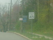
that measures 9.22 miles (14.8 km) in length. The road extends from the interchange at Route 18 and CR 535
in East Brunswick Township
to the intersection of Tracy Station Road and CR 522
in Monroe Township
. In the northern section of the roadway (from CR 617 to the NJ 18/CR 535 interchange), CR 613 is an avenue (consisting of two lanes in each direction). The rest of the roadway just consists of one lane in each direction. CR 613 runs concurrent with CR 615
in Spotswood
for 0.42 mile (0.6759228 km). The northern end of the roadway has become more congested with new developments setting foot. Near the southern end of the roadway, more development has increased the vechicular volume.
 County Route 613 begins at a 4-way intersection with County Route 522
and Tracy Station Road in Monroe Township
. The road begins as Spotswood-Englishtown Road as it moves to the northeast. County Route 614, also known as Mounts Mills Road, intersects at 1.42 miles (2.3 km) as 613 moves into Matchaponix, a borough of Monroe. County Route 612
and County Route 520
intersect at 3.41 miles (5.5 km) as 613 enters Spotswood
. Now known as Devoe Avenue, 613 merges into County Route 615 for .42 of a mile. 613 leaves to the left and enters downtown Spotswood
as Summerhill Road. 613 continues into East Brunswick, where it intersects with County Route 617 at eight miles (13 km). 613 continues past the intersection and ends 1.22 miles (2 km) later at County Route 535
, near New Jersey Route 18.
County highway
A county highway is a road in the United States and in the Canadian province of Ontario that is designated and/or maintained by the county highway department...
in Middlesex County, New Jersey
Middlesex County, New Jersey
-Demographics:As of the census of 2000, there were 750,162 people, 265,815 households, and 190,855 families residing in the county. The population density was 2,422 people per square mile . There were 273,637 housing units at an average density of 884 per square mile...
that measures 9.22 miles (14.8 km) in length. The road extends from the interchange at Route 18 and CR 535
County Route 535 (New Jersey)
County Route 535 is a county highway in the U.S. state of New Jersey. The highway extends from Logan Avenue , at the boundary between Trenton and Hamilton Township in Mercer County to the intersection of Main Street, Raritan Street and Washington Road in Sayreville in Middlesex County.The road...
in East Brunswick Township
East Brunswick Township, New Jersey
The town is located southwest of New York City and 48 miles northeast of Philadelphia.Lawrence Brook, a tributary of the Raritan River, runs along the western border of the township...
to the intersection of Tracy Station Road and CR 522
County Route 522 (New Jersey)
County Route 522 is a county highway in the U.S. state of New Jersey. The highway extends from U.S. 1 in South Brunswick Township to Main Street in Freehold Borough.-Middlesex County:...
in Monroe Township
Monroe Township, Middlesex County, New Jersey
Monroe Township is a Township in Middlesex County, New Jersey, United States. As of the United States 2000 Census, the township population was 27,999. Monroe was incorporated as a township by an Act of the New Jersey Legislature on April 9, 1838, from portions of South Amboy Township, based on the...
. In the northern section of the roadway (from CR 617 to the NJ 18/CR 535 interchange), CR 613 is an avenue (consisting of two lanes in each direction). The rest of the roadway just consists of one lane in each direction. CR 613 runs concurrent with CR 615
County Route 615 (Middlesex County, New Jersey)
County Route 615 is a county route in Middlesex County, New Jersey that measures in length. The road extends from Mercer CR 615 at the Plainsboro/West Windsor line all the way to So. Pine Ave in South Amboy, New Jersey. While most of 615 is not used a commuter road, the section in the...
in Spotswood
Spotswood, New Jersey
-Demographics:As of the census of 2008, there were 7,880 people, 3,099 households, and 2,163 families residing in the borough. The population density was 3,389.8 people per square mile . There were 3,158 housing units at an average density of 1,358.5 per square mile...
for 0.42 mile (0.6759228 km). The northern end of the roadway has become more congested with new developments setting foot. Near the southern end of the roadway, more development has increased the vechicular volume.
Route description
County Route 522 (New Jersey)
County Route 522 is a county highway in the U.S. state of New Jersey. The highway extends from U.S. 1 in South Brunswick Township to Main Street in Freehold Borough.-Middlesex County:...
and Tracy Station Road in Monroe Township
Monroe Township, New Jersey
Monroe Township is the name of some places in the U.S. state of New Jersey:*Monroe Township, Gloucester County, New Jersey*Monroe Township, Middlesex County, New Jersey...
. The road begins as Spotswood-Englishtown Road as it moves to the northeast. County Route 614, also known as Mounts Mills Road, intersects at 1.42 miles (2.3 km) as 613 moves into Matchaponix, a borough of Monroe. County Route 612
County Route 612 (Middlesex County, New Jersey)
County Route 612 is a county route in Middlesex County, New Jersey that measures in length. It carries the names of Forsgate Drive, Pergola Avenue, and Matchaponix Road. The road extends from CR 613 in the east to its bridge over the New Jersey Turnpike in the west, where it continues as Route 32...
and County Route 520
County Route 520 (New Jersey)
County Route 520 is a county highway in the U.S. state of New Jersey. County Route 520 is a major road across Monmouth County connecting the county's central towns to the Jersey Shore at Sea Bright.-Route description:...
intersect at 3.41 miles (5.5 km) as 613 enters Spotswood
Spotswood, New Jersey
-Demographics:As of the census of 2008, there were 7,880 people, 3,099 households, and 2,163 families residing in the borough. The population density was 3,389.8 people per square mile . There were 3,158 housing units at an average density of 1,358.5 per square mile...
. Now known as Devoe Avenue, 613 merges into County Route 615 for .42 of a mile. 613 leaves to the left and enters downtown Spotswood
Spotswood
Spotswood can refer to:People:*Alexander Spotswood - the Lieutenant-Governor of Virginia*Denis SpotswoodPlaces:*Spotswood, Victoria, a suburb of Melbourne, Australia**Spotswood railway station*Spotswood, New Jersey...
as Summerhill Road. 613 continues into East Brunswick, where it intersects with County Route 617 at eight miles (13 km). 613 continues past the intersection and ends 1.22 miles (2 km) later at County Route 535
County Route 535 (New Jersey)
County Route 535 is a county highway in the U.S. state of New Jersey. The highway extends from Logan Avenue , at the boundary between Trenton and Hamilton Township in Mercer County to the intersection of Main Street, Raritan Street and Washington Road in Sayreville in Middlesex County.The road...
, near New Jersey Route 18.