
List of Marilyns on Scottish islands
Encyclopedia
| Class | Height | |
|---|---|---|
| Munro Munro A Munro is a mountain in Scotland with a height over . They are named after Sir Hugh Munro, 4th Baronet , who produced the first list of such hills, known as Munros Tables, in 1891. A Munro top is a summit over 3,000 ft which is not regarded as a separate mountain... |
3000+ ft Foot (unit of length) A foot A foot A foot (plural: feet; abbreviation or symbol: ft or ′ (the prime symbol) is a unit of length in a number of different systems including Ancient Greek, Ancient Roman, English units, Imperial units, United States customary units and the units of many Continental European... |
914+ m Metre The metre , symbol m, is the base unit of length in the International System of Units . Originally intended to be one ten-millionth of the distance from the Earth's equator to the North Pole , its definition has been periodically refined to reflect growing knowledge of metrology... |
| Corbetts | 2500 – 3000 ft | 762 – 914 m |
| Grahams | 2000–2500 ft | 610 – 762 m |
| Marilyn Marilyn (hill) A Marilyn is a mountain or hill in the United Kingdom, Republic of Ireland or Isle of Man with a relative height of at least 150 metres , regardless of absolute height or other merit... |
–2000 ft | –610 m |
This is a list of the 228 Marilyns
Marilyn (hill)
A Marilyn is a mountain or hill in the United Kingdom, Republic of Ireland or Isle of Man with a relative height of at least 150 metres , regardless of absolute height or other merit...
on Scottish
Scotland
Scotland is a country that is part of the United Kingdom. Occupying the northern third of the island of Great Britain, it shares a border with England to the south and is bounded by the North Sea to the east, the Atlantic Ocean to the north and west, and the North Channel and Irish Sea to the...
islands.
Marilyns are hills in the British Isles
British Isles
The British Isles are a group of islands off the northwest coast of continental Europe that include the islands of Great Britain and Ireland and over six thousand smaller isles. There are two sovereign states located on the islands: the United Kingdom of Great Britain and Northern Ireland and...
with a relative height of at least 150 metres (492 ft) irrespective of height. The list was compiled by Alan Dawson and published in The Relative Hills of Britain.
Included in the list are all Corbetts and Grahams in this part of Scotland
Scotland
Scotland is a country that is part of the United Kingdom. Occupying the northern third of the island of Great Britain, it shares a border with England to the south and is bounded by the North Sea to the east, the Atlantic Ocean to the north and west, and the North Channel and Irish Sea to the...
. Corbetts are Scottish mountains that are 2500–3000 ft (762.0–914.4 m) high with a relative height of 500 feet (152.4 m). The list was compiled in the 1920s by John Rooke Corbett
John Rooke Corbett
John Rooke Corbett , better known as J. Rooke Corbett was one of the founder-members of The Rucksack Club and their Convener of Rambles. In the 1920s Corbett compiled a list of hills between 2500 and 3000 feet with a prominence of at least 500 feet...
, a Bristol-based climber and SMC member, and was published posthumously after it was passed to the SMC by his sister. (A metric definition requiring 150 m of relative height is sometimes used; use of the broader definition does not result in any additional summits being included.) Grahams are Scottish mountains that are 2000–2500 ft (609.6–762.0 m) high. The list of hills fitting these criteria was first published by Alan Dawson in The Relative Hills of Britain under the provisional name Elsies (LCs, short for Lesser Corbetts). They were later named Grahams after the late Fiona Torbet (née Graham) who had compiled a similar list around the same time.

In the parent column, the prominence parent is used, as opposed to any other definition of 'parent'. The prominence parent of peak A can be found by dividing the island or region in question into territories, by tracing the runoff from the key col of every peak that is higher than peak A. The parent is the peak whose territory peak A resides in.
Of the 227 Marilyns on this list, 5 are Munros, 11 are Corbetts, 25 are Grahams and 187 (5 of which are duplicated elsewhere) are none of those.
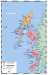
North Skye and RaasayRaasayRaasay is an island between the Isle of Skye and the mainland of Scotland. It is separated from Skye by the Sound of Raasay and from Applecross by the Inner Sound. It is most famous for being the birthplace of the poet Sorley MacLean, an important figure in the Scottish literary renaissance...
| Peak | Height (m) | Prom. (m) | Col (m) | Grid ref. | Parent | Island |
|---|---|---|---|---|---|---|
| The Storr The Storr The Storr is a rocky hill on the Trotternish peninsula of the Isle of Skye. The hill presents a steep rocky eastern face overlooking the Sound of Raasay, contrasting with gentler grassy slopes to the west.-Geology:... |
719 | 671 | 48 | Sgurr Alasdair Sgurr Alasdair Sgurr Alasdair is the highest peak of the Black Cuillin, and the highest peak on the Isle of Skye. Like the rest of the range it is composed of gabbro, a rock with excellent grip for mountaineering.-Ascent:... |
Skye | |
| Healabhal Bheag Healabhal Bheag Healabhal Bheag is a hill located on the Duirinish peninsula of Skye in the Inner Hebrides. It is also known as MacLeod's Table South and is part of the prominent pair of peaks known as MacLeod's Tables that dominate the views to the west of Dunvegan and to the north of the Harlosh peninsula.... |
489 | 464 | 25 | Sgurr Alasdair Sgurr Alasdair Sgurr Alasdair is the highest peak of the Black Cuillin, and the highest peak on the Isle of Skye. Like the rest of the range it is composed of gabbro, a rock with excellent grip for mountaineering.-Ascent:... |
Skye | |
| Dun Caan | 444 | 444 | Sea | none | Raasay Raasay Raasay is an island between the Isle of Skye and the mainland of Scotland. It is separated from Skye by the Sound of Raasay and from Applecross by the Inner Sound. It is most famous for being the birthplace of the poet Sorley MacLean, an important figure in the Scottish literary renaissance... |
|
| Ben Lee | 444 | 374 | 70 | Sgurr Alasdair Sgurr Alasdair Sgurr Alasdair is the highest peak of the Black Cuillin, and the highest peak on the Isle of Skye. Like the rest of the range it is composed of gabbro, a rock with excellent grip for mountaineering.-Ascent:... |
Skye | |
| Ben Tianavaig Ben Tianavaig Ben Tianavaig is a hill located on the Isle of Skye, near Portree . It is very prominent from Portree dominating the view from the harbour. It is a Marilyn. It is most simply ascended from Camastianavaig. Despite its proximity to dwellings one could expect to see golden eagles and sea eagles from... |
413 | 366 | 47 | Ben Lee | Skye | |
| Roineval | 439 | 330 | 109 | Ben Lee | Skye | |
| Meall na Suiramach | 543 | 280 | 263 | The Storr The Storr The Storr is a rocky hill on the Trotternish peninsula of the Isle of Skye. The hill presents a steep rocky eastern face overlooking the Sound of Raasay, contrasting with gentler grassy slopes to the west.-Geology:... |
Skye | |
| Beinn na Greine | 417 | 269 | 148 | Roineval | Skye | |
| Beinn Bhreac Beinn Bhreac Beinn Bhreac is a twin-peaked Scottish mountain located above Glen Derry in the Cairngorm Mountains approximately north-west of Braemar.- Overview :... |
329 | 241 | 88 | Roineval | Skye | |
| Sithean Bhealaich Chumhaing | 392 | 234 | 158 | The Storr The Storr The Storr is a rocky hill on the Trotternish peninsula of the Isle of Skye. The hill presents a steep rocky eastern face overlooking the Sound of Raasay, contrasting with gentler grassy slopes to the west.-Geology:... |
Skye | |
| Beinn Chreagach | 326 | 221 | 105 | Beinn Bhreac Beinn Bhreac Beinn Bhreac is a twin-peaked Scottish mountain located above Glen Derry in the Cairngorm Mountains approximately north-west of Braemar.- Overview :... |
Skye | |
| Ben Dearg | 552 | 217 | 335 | The Storr The Storr The Storr is a rocky hill on the Trotternish peninsula of the Isle of Skye. The hill presents a steep rocky eastern face overlooking the Sound of Raasay, contrasting with gentler grassy slopes to the west.-Geology:... |
Skye | |
| Cruachan Glen Vic Askill | 295 | 194 | 101 | Roineval | Skye | |
| Beinn na h-Iolaire | 254 | 189 | 65 | Dun Caan | Skye | |
| Healabhal Mhòr | 471 | 184 | 287 | Healabhal Bheag Healabhal Bheag Healabhal Bheag is a hill located on the Duirinish peninsula of Skye in the Inner Hebrides. It is also known as MacLeod's Table South and is part of the prominent pair of peaks known as MacLeod's Tables that dominate the views to the west of Dunvegan and to the north of the Harlosh peninsula.... |
Skye | |
| Bioda Buidhe | 466 | 183 | 283 | The Storr The Storr The Storr is a rocky hill on the Trotternish peninsula of the Isle of Skye. The hill presents a steep rocky eastern face overlooking the Sound of Raasay, contrasting with gentler grassy slopes to the west.-Geology:... |
Skye | |
| Hartaval | 669 | 180 | 489 | The Storr The Storr The Storr is a rocky hill on the Trotternish peninsula of the Isle of Skye. The hill presents a steep rocky eastern face overlooking the Sound of Raasay, contrasting with gentler grassy slopes to the west.-Geology:... |
Skye | |
| Biod an Athair | 313 | 178 | 135 | Healabhal Mhòr | Skye | |
| Ben Geary | 284 | 166 | 118 | Beinn Chreagach | Skye | |
| Beinn Bhac-ghlais | 409 | 155 | 254 | Healabhal Bheag Healabhal Bheag Healabhal Bheag is a hill located on the Duirinish peninsula of Skye in the Inner Hebrides. It is also known as MacLeod's Table South and is part of the prominent pair of peaks known as MacLeod's Tables that dominate the views to the west of Dunvegan and to the north of the Harlosh peninsula.... |
Skye | |
MinginishMinginishMinginish is a peninsula on the island of Skye in Scotland. It is situated in south central Skye, between Loch Scavaig and Glen Drynoch in the west and Loch Harport and Glen Sligachan in the south and east. It includes most of the peaks of the Cuillin hills including Sgurr Alasdair, the highest...
and the CuillinCuillinThis article is about the Cuillin of Skye. See Rùm for the Cuillin of Rùm.The Cuillin are a range of rocky mountains located on the Isle of Skye in Scotland. The true Cuillin are also known as the Black Cuillin to distinguish them from the Red Hills across Glen Sligachan...
| Peak | Height (m) | Prom. (m) | Col (m) | Grid ref. | Parent | Island |
|---|---|---|---|---|---|---|
| Sgurr Alasdair Sgurr Alasdair Sgurr Alasdair is the highest peak of the Black Cuillin, and the highest peak on the Isle of Skye. Like the rest of the range it is composed of gabbro, a rock with excellent grip for mountaineering.-Ascent:... |
992 | 992 | Sea | none | Skye | |
| Blà Bheinn (Blaven) | 928 | 861 | 67 | Sgurr Alasdair Sgurr Alasdair Sgurr Alasdair is the highest peak of the Black Cuillin, and the highest peak on the Isle of Skye. Like the rest of the range it is composed of gabbro, a rock with excellent grip for mountaineering.-Ascent:... |
Skye | |
| Glamaig Glamaig Glamaig is the northernmost of the Red Hills on the Isle of Skye in Scotland. It lies immediately east of Sligachan. It is one of only two Corbetts on Skye.... - Sgurr Mhairi |
775 | 486 | 289 | Blà Bheinn | Skye | |
| Marsco Marsco Marsco is a peak in the Red Hills on the Scottish Isle of Skye. It lies on the east of Glen Sligachan, and may be climbed from the right-of-way through the glen from Sligachan to Loch Coruisk... |
736 | 413 | 323 | Blà Bheinn | Skye | |
| Beinn Dearg Mhòr | 731 | 316 | 415 | Glamaig Glamaig Glamaig is the northernmost of the Red Hills on the Isle of Skye in Scotland. It lies immediately east of Sligachan. It is one of only two Corbetts on Skye.... - Sgurr Mhairi |
Skye | |
| Beinn Bhreac Beinn Bhreac Beinn Bhreac is a twin-peaked Scottish mountain located above Glen Derry in the Cairngorm Mountains approximately north-west of Braemar.- Overview :... |
445 | 290 | 155 | Sgurr Alasdair Sgurr Alasdair Sgurr Alasdair is the highest peak of the Black Cuillin, and the highest peak on the Isle of Skye. Like the rest of the range it is composed of gabbro, a rock with excellent grip for mountaineering.-Ascent:... |
Skye | |
| Beinn a' Bhràghad | 461 | 276 | 185 | Sgurr Alasdair Sgurr Alasdair Sgurr Alasdair is the highest peak of the Black Cuillin, and the highest peak on the Isle of Skye. Like the rest of the range it is composed of gabbro, a rock with excellent grip for mountaineering.-Ascent:... |
Skye | |
| Belig | 702 | 246 | 456 | Blà Bheinn | Skye | |
| Ben Meabost | 345 | 231 | 114 | Blà Bheinn | Skye | |
| Sgurr na Strì | 494 | 225 | 269 | Sgurr Alasdair Sgurr Alasdair Sgurr Alasdair is the highest peak of the Black Cuillin, and the highest peak on the Isle of Skye. Like the rest of the range it is composed of gabbro, a rock with excellent grip for mountaineering.-Ascent:... |
Skye | |
| An Cruachan | 435 | 221 | 214 | Beinn a' Bhraghad | Skye | |
| Sgurr nan Gillean Sgurr nan Gillean Sgurr nan Gillean is a mountain in the northern section of the Cuillin range on the Isle of Skye in Scotland. With a height of 964 m it is one of eleven Munros on the Cuillin ridge.... |
964 | 204 | 760 | Sgurr Alasdair Sgurr Alasdair Sgurr Alasdair is the highest peak of the Black Cuillin, and the highest peak on the Isle of Skye. Like the rest of the range it is composed of gabbro, a rock with excellent grip for mountaineering.-Ascent:... |
Skye | |
| Biod Mòr | 384 | 196 | 188 | Beinn Bhreac Beinn Bhreac Beinn Bhreac is a twin-peaked Scottish mountain located above Glen Derry in the Cairngorm Mountains approximately north-west of Braemar.- Overview :... |
Skye | |
| Arnaval | 369 | 193 | 176 | Beinn Bhreac Beinn Bhreac Beinn Bhreac is a twin-peaked Scottish mountain located above Glen Derry in the Cairngorm Mountains approximately north-west of Braemar.- Overview :... |
Skye | |
| Glas Bheinn Mhòr | 569 | 188 | 381 | Belig | Skye | |
| Sgurr Dearg - Inaccessible Pinnacle Inaccessible Pinnacle Sgurr Dearg is a mountain in the Cuillin on the Isle of Skye, Scotland. It is topped by the Inaccessible Pinnacle , a fin of rock measuring 150 feet along its longest edge... |
986 | 182 | 804 | Sgurr Alasdair Sgurr Alasdair Sgurr Alasdair is the highest peak of the Black Cuillin, and the highest peak on the Isle of Skye. Like the rest of the range it is composed of gabbro, a rock with excellent grip for mountaineering.-Ascent:... |
Skye | |
| Garbh-bheinn | 808 | 181 | 627 | Blà Bheinn | Skye | |
| Ruadh Stac | 493 | 156 | 337 | Garbh-bheinn | Skye | |
| Meall a' Mhaoil | 284 | 155 | 129 | Beinn Dearg Mhòr | Skye | |
South-East Skye and ScalpayScalpay, Inner HebridesScalpay is an island in the Inner Hebrides of Scotland.Separated from the east coast of Skye by Loch na Cairidh, Scalpay rises to at Mullach na Càrn. It has an area of almost ten sq. miles....
| Peak | Height (m) | Prom. (m) | Col (m) | Grid ref. | Parent | Island |
|---|---|---|---|---|---|---|
| Sgurr na Coinnich Sgurr na Coinnich Sgurr na Coinnich is the highest peak on the Sleat peninsula at the east end of the island of Skye. Together with its slightly lower neighbour, Beinn na Caillich, it overlooks the Skye Bridge that links the towns of Kyle of Lochalsh and Kyleakin.... |
739 | 714 | 25 | Blà Bheinn | Skye | |
| Beinn na Caillich (West) | 732 | 696 | 36 | Sgurr na Coinnich Sgurr na Coinnich Sgurr na Coinnich is the highest peak on the Sleat peninsula at the east end of the island of Skye. Together with its slightly lower neighbour, Beinn na Caillich, it overlooks the Skye Bridge that links the towns of Kyle of Lochalsh and Kyleakin.... |
Skye | |
| Mullach na Càrn | 396 | 396 | Sea | none | Scalpay Scalpay, Inner Hebrides Scalpay is an island in the Inner Hebrides of Scotland.Separated from the east coast of Skye by Loch na Cairidh, Scalpay rises to at Mullach na Càrn. It has an area of almost ten sq. miles.... |
|
| Ben na Cro | 572 | 387 | 185 | Beinn na Caillich (West) | Skye | |
| Ben Aslak | 610 | 327 | 283 | Sgurr na Coinnich Sgurr na Coinnich Sgurr na Coinnich is the highest peak on the Sleat peninsula at the east end of the island of Skye. Together with its slightly lower neighbour, Beinn na Caillich, it overlooks the Skye Bridge that links the towns of Kyle of Lochalsh and Kyleakin.... |
Skye | |
| Sgorach Breac | 299 | 274 | 25 | Ben Aslak | Skye | |
| Beinn nan Càrn | 301 | 248 | 53 | Ben Aslak | Skye | |
| Sgurr nan Caorach | 281 | 216 | 65 | Sgorach Breac | Skye | |
| Sgurr na h-Iolaire | 292 | 179 | 113 | Sgorach Breac | Skye | |
| Beinn na Seamraig | 561 | 167 | 394 | Ben Aslak | Skye | |
| Beinn na Caillich Beinn na Caillich (Kyle Rhea) Beinn na Caillich is a mountain at the eastern end of the isle of Skye, in Scotland. It is situated to the west of Kyle Rhea, about 4 km south-east of Kyleakin.... (East) |
732 | 154 | 578 | Sgurr na Coinnich Sgurr na Coinnich Sgurr na Coinnich is the highest peak on the Sleat peninsula at the east end of the island of Skye. Together with its slightly lower neighbour, Beinn na Caillich, it overlooks the Skye Bridge that links the towns of Kyle of Lochalsh and Kyleakin.... |
Skye | |
| Beinn Dearg Mhòr | 709 | 152 | 557 | Beinn na Caillich (West) | Skye | |
CannaCanna, ScotlandCanna is the westernmost of the Small Isles archipelago, in the Scottish Inner Hebrides. It is linked to the neighbouring island of Sanday by a road and sandbanks at low tide. The island is long and wide...
, RùmRùmRùm , a Scottish Gaelic name often anglicised to Rum) is one of the Small Isles of the Inner Hebrides, in the district of Lochaber, Scotland...
and EiggEiggEigg is one of the Small Isles, in the Scottish Inner Hebrides. It lies to the south of the Skye and to the north of the Ardnamurchan peninsula. Eigg is long from north to south, and east to west. With an area of , it is the second largest of the Small Isles after Rùm.-Geography:The main...
| Peak | Height (m) | Prom. (m) | Col (m) | Grid ref. | Parent | Island |
|---|---|---|---|---|---|---|
| Askival Askival Askival is the highest mountain on the island of Rùm, located south of the town of Kinloch, Scotland. It is often climbed as part of a full traverse of the Rùm Cuillin, a rocky range of hills in the south east corner of Rùm, of which Askival is the highest.... |
812 | 812 | Sea | none | Rùm Rùm Rùm , a Scottish Gaelic name often anglicised to Rum) is one of the Small Isles of the Inner Hebrides, in the district of Lochaber, Scotland... |
|
| Orval | 571 | 406 | 165 | Askival Askival Askival is the highest mountain on the island of Rùm, located south of the town of Kinloch, Scotland. It is often climbed as part of a full traverse of the Rùm Cuillin, a rocky range of hills in the south east corner of Rùm, of which Askival is the highest.... |
Rùm Rùm Rùm , a Scottish Gaelic name often anglicised to Rum) is one of the Small Isles of the Inner Hebrides, in the district of Lochaber, Scotland... |
|
| An Sgurr An Sgurr (Eigg) An Sgurr is the highest hill on the Inner Hebridean island of Eigg, Lochaber, Highland, Scotland. It was formed around 58 million years ago; the result of one of the last eruptions of a volcano, the core of which now forms the Isle of Rùm. Thick viscous pitchstone lava flowed out, filling a river... |
393 | 393 | Sea | none | Eigg Eigg Eigg is one of the Small Isles, in the Scottish Inner Hebrides. It lies to the south of the Skye and to the north of the Ardnamurchan peninsula. Eigg is long from north to south, and east to west. With an area of , it is the second largest of the Small Isles after Rùm.-Geography:The main... |
|
| Ainshval | 781 | 326 | 455 | Askival Askival Askival is the highest mountain on the island of Rùm, located south of the town of Kinloch, Scotland. It is often climbed as part of a full traverse of the Rùm Cuillin, a rocky range of hills in the south east corner of Rùm, of which Askival is the highest.... |
Rùm Rùm Rùm , a Scottish Gaelic name often anglicised to Rum) is one of the Small Isles of the Inner Hebrides, in the district of Lochaber, Scotland... |
|
| Sgorr an Fharaidh | 340 | 264 | 76 | An Sgurr An Sgurr (Eigg) An Sgurr is the highest hill on the Inner Hebridean island of Eigg, Lochaber, Highland, Scotland. It was formed around 58 million years ago; the result of one of the last eruptions of a volcano, the core of which now forms the Isle of Rùm. Thick viscous pitchstone lava flowed out, filling a river... |
Eigg Eigg Eigg is one of the Small Isles, in the Scottish Inner Hebrides. It lies to the south of the Skye and to the north of the Ardnamurchan peninsula. Eigg is long from north to south, and east to west. With an area of , it is the second largest of the Small Isles after Rùm.-Geography:The main... |
|
| Mullach Mòr | 304 | 219 | 85 | Askival Askival Askival is the highest mountain on the island of Rùm, located south of the town of Kinloch, Scotland. It is often climbed as part of a full traverse of the Rùm Cuillin, a rocky range of hills in the south east corner of Rùm, of which Askival is the highest.... |
Rùm Rùm Rùm , a Scottish Gaelic name often anglicised to Rum) is one of the Small Isles of the Inner Hebrides, in the district of Lochaber, Scotland... |
|
| Càrn a' Ghaill | 210 | 210 | Sea | none | Canna Canna, Scotland Canna is the westernmost of the Small Isles archipelago, in the Scottish Inner Hebrides. It is linked to the neighbouring island of Sanday by a road and sandbanks at low tide. The island is long and wide... |
|
| Trallval | 702 | 189 | 513 | Askival Askival Askival is the highest mountain on the island of Rùm, located south of the town of Kinloch, Scotland. It is often climbed as part of a full traverse of the Rùm Cuillin, a rocky range of hills in the south east corner of Rùm, of which Askival is the highest.... |
Rùm Rùm Rùm , a Scottish Gaelic name often anglicised to Rum) is one of the Small Isles of the Inner Hebrides, in the district of Lochaber, Scotland... |
|
MullIsle of MullThe Isle of Mull or simply Mull is the second largest island of the Inner Hebrides, off the west coast of Scotland in the council area of Argyll and Bute....
and nearby islands
| Peak | Height (m) | Prom. (m) | Col (m) | Grid ref. | Parent | Island |
|---|---|---|---|---|---|---|
| Ben More Ben More (Mull) Ben More is the highest mountain and only Munro on the Isle of Mull, Scotland.... |
966 | 966 | Sea | none | Mull Isle of Mull The Isle of Mull or simply Mull is the second largest island of the Inner Hebrides, off the west coast of Scotland in the council area of Argyll and Bute.... |
|
| Dun da Ghaoithe | 766 | 659 | 107 | Ben More Ben More (Mull) Ben More is the highest mountain and only Munro on the Isle of Mull, Scotland.... |
Mull Isle of Mull The Isle of Mull or simply Mull is the second largest island of the Inner Hebrides, off the west coast of Scotland in the council area of Argyll and Bute.... |
|
| Creach Beinn | 698 | 551 | 147 | Ben More Ben More (Mull) Ben More is the highest mountain and only Munro on the Isle of Mull, Scotland.... |
Mull Isle of Mull The Isle of Mull or simply Mull is the second largest island of the Inner Hebrides, off the west coast of Scotland in the council area of Argyll and Bute.... |
|
| Ben Buie | 717 | 513 | 204 | Ben More Ben More (Mull) Ben More is the highest mountain and only Munro on the Isle of Mull, Scotland.... |
Mull Isle of Mull The Isle of Mull or simply Mull is the second largest island of the Inner Hebrides, off the west coast of Scotland in the council area of Argyll and Bute.... |
|
| Beinn Talaidh | 761 | 429 | 332 | Ben More Ben More (Mull) Ben More is the highest mountain and only Munro on the Isle of Mull, Scotland.... |
Mull Isle of Mull The Isle of Mull or simply Mull is the second largest island of the Inner Hebrides, off the west coast of Scotland in the council area of Argyll and Bute.... |
|
| Speinne Mòr | 444 | 412 | 32 | Beinn Talaidh | Mull Isle of Mull The Isle of Mull or simply Mull is the second largest island of the Inner Hebrides, off the west coast of Scotland in the council area of Argyll and Bute.... |
|
| Druim Fada | 405 | 390 | 15 | Creach Beinn | Mull Isle of Mull The Isle of Mull or simply Mull is the second largest island of the Inner Hebrides, off the west coast of Scotland in the council area of Argyll and Bute.... |
|
| Beinn na Sreine | 521 | 376 | 145 | Ben More Ben More (Mull) Ben More is the highest mountain and only Munro on the Isle of Mull, Scotland.... |
Mull Isle of Mull The Isle of Mull or simply Mull is the second largest island of the Inner Hebrides, off the west coast of Scotland in the council area of Argyll and Bute.... |
|
| Beinn na Drise | 424 | 347 | 77 | Speinne Mòr | Mull Isle of Mull The Isle of Mull or simply Mull is the second largest island of the Inner Hebrides, off the west coast of Scotland in the council area of Argyll and Bute.... |
|
| Corra-bheinn or Cruachen Dearg |
704 | 316 | 388 | or |
Beinn Talaidh | Mull Isle of Mull The Isle of Mull or simply Mull is the second largest island of the Inner Hebrides, off the west coast of Scotland in the council area of Argyll and Bute.... |
| Beinn Bhuidhe | 413 | 314 | 99 | Beinn Talaidh | Mull Isle of Mull The Isle of Mull or simply Mull is the second largest island of the Inner Hebrides, off the west coast of Scotland in the council area of Argyll and Bute.... |
|
| Beinn Chreagach (Ulva) | 313 | 313 | Sea | none | Ulva Ulva Ulva is an island in the Inner Hebrides of Scotland, off the west coast of Mull. It is separated from Mull by a narrow strait, and connected to the neighbouring island of Gometra by a bridge. Much of the island is formed from Tertiary basalt rocks, which is formed into columns in places.Ulva has... |
|
| Beinn na Duatharach | 456 | 305 | 151 | Beinn Talaidh | Mull Isle of Mull The Isle of Mull or simply Mull is the second largest island of the Inner Hebrides, off the west coast of Scotland in the council area of Argyll and Bute.... |
|
| Cruachan Min | 376 | 261 | 115 | Ben Buie | Mull Isle of Mull The Isle of Mull or simply Mull is the second largest island of the Inner Hebrides, off the west coast of Scotland in the council area of Argyll and Bute.... |
|
| Beinn na Croise | 503 | 250 | 253 | Ben Buie | Mull Isle of Mull The Isle of Mull or simply Mull is the second largest island of the Inner Hebrides, off the west coast of Scotland in the council area of Argyll and Bute.... |
|
| Sgurr Dearg | 741 | 246 | 495 | Dun da Ghaoithe | Mull Isle of Mull The Isle of Mull or simply Mull is the second largest island of the Inner Hebrides, off the west coast of Scotland in the council area of Argyll and Bute.... |
|
| Càrn Bàn | 248 | 233 | 15 | Sgurr Dearg | Mull Isle of Mull The Isle of Mull or simply Mull is the second largest island of the Inner Hebrides, off the west coast of Scotland in the council area of Argyll and Bute.... |
|
| Cruach Choireadail | 618 | 194 | 424 | Beinn Talaidh | Mull Isle of Mull The Isle of Mull or simply Mull is the second largest island of the Inner Hebrides, off the west coast of Scotland in the council area of Argyll and Bute.... |
|
| Beinn Chreagach (Mull) | 377 | 192 | 185 | Beinn na Croise | Mull Isle of Mull The Isle of Mull or simply Mull is the second largest island of the Inner Hebrides, off the west coast of Scotland in the council area of Argyll and Bute.... |
|
| Coirc Bheinn | 561 | 188 | 373 | Ben More Ben More (Mull) Ben More is the highest mountain and only Munro on the Isle of Mull, Scotland.... |
Mull Isle of Mull The Isle of Mull or simply Mull is the second largest island of the Inner Hebrides, off the west coast of Scotland in the council area of Argyll and Bute.... |
|
| Beinn a' Ghraig | 591 | 186 | 405 | Ben More Ben More (Mull) Ben More is the highest mountain and only Munro on the Isle of Mull, Scotland.... |
Mull Isle of Mull The Isle of Mull or simply Mull is the second largest island of the Inner Hebrides, off the west coast of Scotland in the council area of Argyll and Bute.... |
|
| Tom nam Fitheach | 275 | 180 | 95 | Beinn na Drise | Mull Isle of Mull The Isle of Mull or simply Mull is the second largest island of the Inner Hebrides, off the west coast of Scotland in the council area of Argyll and Bute.... |
|
| Beinn Fhada | 702 | 174 | 528 | Ben More Ben More (Mull) Ben More is the highest mountain and only Munro on the Isle of Mull, Scotland.... |
Mull Isle of Mull The Isle of Mull or simply Mull is the second largest island of the Inner Hebrides, off the west coast of Scotland in the council area of Argyll and Bute.... |
|
| Creachan Mòr | 331 | 165 | 166 | Beinn Chreagach (Mull) | Mull Isle of Mull The Isle of Mull or simply Mull is the second largest island of the Inner Hebrides, off the west coast of Scotland in the council area of Argyll and Bute.... |
|
| Unnamed | 155 | 155 | Sea | none | Gometra Gometra -Etymology:According to Gillies Gometra is from the Norse gottr + madr + ey and means "The good-man's island" or "God-man's island". Mac an Tàilleir offers "Godmund's island".-Geography:... |
|
| 'S Airde Beinn | 295 | 153 | 142 | Speinne Mòr | Mull Isle of Mull The Isle of Mull or simply Mull is the second largest island of the Inner Hebrides, off the west coast of Scotland in the council area of Argyll and Bute.... |
|
| Maol Ban | 338 | 151 | 187 | Druim Fada | Mull Isle of Mull The Isle of Mull or simply Mull is the second largest island of the Inner Hebrides, off the west coast of Scotland in the council area of Argyll and Bute.... |
|
Jura and Scarba
| Peak | Height (m) | Prom. (m) | Col (m) | Grid ref. | Parent | Island |
|---|---|---|---|---|---|---|
| Beinn an Òir Beinn an Oir Beinn an Òir is the highest peak of the Paps of Jura on the island of Jura, Scotland. It is the highest peak on the island, standing at 785 metres, and is thereby a Corbett.... |
785 | 785 | Sea | none | Jura Jura, Scotland Jura is an island in the Inner Hebrides of Scotland, situated adjacent and to the north-east of Islay. Part of the island is designated as a National Scenic Area. Until the twentieth century Jura was dominated - and most of it was eventually owned - by the Campbell clan of Inveraray Castle on Loch... |
|
| Dubh Bheinn | 485 | 468 | 17 | Beinn an Òir Beinn an Oir Beinn an Òir is the highest peak of the Paps of Jura on the island of Jura, Scotland. It is the highest peak on the island, standing at 785 metres, and is thereby a Corbett.... |
Jura Jura, Scotland Jura is an island in the Inner Hebrides of Scotland, situated adjacent and to the north-east of Islay. Part of the island is designated as a National Scenic Area. Until the twentieth century Jura was dominated - and most of it was eventually owned - by the Campbell clan of Inveraray Castle on Loch... |
|
| Cruach Scarba | 449 | 449 | Sea | none | Scarba Scarba Scarba is a small island, in Argyll and Bute, Scotland, just north of the much larger island of Jura. The island is owned by Richard Hill, 7th Baron Sandys and has not been permanently inhabited since the 1960s. It is now covered in heather and used for grazing animals... |
|
| Beinn a' Chaolais Beinn a' Chaolais Beinn a' Chaolais is the lowest peak of the Paps of Jura on the island of Jura, Scotland. It stands at 733 metres above sea level, and with over 300 metres of relative height is therefore a Graham.... |
733 | 359 | 374 | Beinn an Òir Beinn an Oir Beinn an Òir is the highest peak of the Paps of Jura on the island of Jura, Scotland. It is the highest peak on the island, standing at 785 metres, and is thereby a Corbett.... |
Jura Jura, Scotland Jura is an island in the Inner Hebrides of Scotland, situated adjacent and to the north-east of Islay. Part of the island is designated as a National Scenic Area. Until the twentieth century Jura was dominated - and most of it was eventually owned - by the Campbell clan of Inveraray Castle on Loch... |
|
| Beinn Shiantaidh Beinn Shiantaidh Beinn Shiantaidh is the second highest peak of the Paps of Jura on the island of Jura, Scotland. It stands at 757 metres above sea level, and with over 300 metres of relative height is therefore a Graham.... |
757 | 303 | 454 | Beinn an Òir Beinn an Oir Beinn an Òir is the highest peak of the Paps of Jura on the island of Jura, Scotland. It is the highest peak on the island, standing at 785 metres, and is thereby a Corbett.... |
Jura Jura, Scotland Jura is an island in the Inner Hebrides of Scotland, situated adjacent and to the north-east of Islay. Part of the island is designated as a National Scenic Area. Until the twentieth century Jura was dominated - and most of it was eventually owned - by the Campbell clan of Inveraray Castle on Loch... |
|
| Glas Bheinn | 562 | 279 | 283 | Beinn a' Chaolais Beinn a' Chaolais Beinn a' Chaolais is the lowest peak of the Paps of Jura on the island of Jura, Scotland. It stands at 733 metres above sea level, and with over 300 metres of relative height is therefore a Graham.... |
Jura Jura, Scotland Jura is an island in the Inner Hebrides of Scotland, situated adjacent and to the north-east of Islay. Part of the island is designated as a National Scenic Area. Until the twentieth century Jura was dominated - and most of it was eventually owned - by the Campbell clan of Inveraray Castle on Loch... |
|
| Ben Garrisdale | 373 | 218 | 155 | Dubh Bheinn | Jura Jura, Scotland Jura is an island in the Inner Hebrides of Scotland, situated adjacent and to the north-east of Islay. Part of the island is designated as a National Scenic Area. Until the twentieth century Jura was dominated - and most of it was eventually owned - by the Campbell clan of Inveraray Castle on Loch... |
|
| Corra Bheinn | 575 | 208 | 367 | Beinn Shiantaidh Beinn Shiantaidh Beinn Shiantaidh is the second highest peak of the Paps of Jura on the island of Jura, Scotland. It stands at 757 metres above sea level, and with over 300 metres of relative height is therefore a Graham.... |
Jura Jura, Scotland Jura is an island in the Inner Hebrides of Scotland, situated adjacent and to the north-east of Islay. Part of the island is designated as a National Scenic Area. Until the twentieth century Jura was dominated - and most of it was eventually owned - by the Campbell clan of Inveraray Castle on Loch... |
|
| Beinn Bhreac Beinn Bhreac Beinn Bhreac is a twin-peaked Scottish mountain located above Glen Derry in the Cairngorm Mountains approximately north-west of Braemar.- Overview :... |
441 | 189 | 252 | Corra Bheinn | Jura Jura, Scotland Jura is an island in the Inner Hebrides of Scotland, situated adjacent and to the north-east of Islay. Part of the island is designated as a National Scenic Area. Until the twentieth century Jura was dominated - and most of it was eventually owned - by the Campbell clan of Inveraray Castle on Loch... |
|
| Cnoc an Ime | 303 | 189 | 114 | Beinn Bhreac Beinn Bhreac Beinn Bhreac is a twin-peaked Scottish mountain located above Glen Derry in the Cairngorm Mountains approximately north-west of Braemar.- Overview :... |
Jura Jura, Scotland Jura is an island in the Inner Hebrides of Scotland, situated adjacent and to the north-east of Islay. Part of the island is designated as a National Scenic Area. Until the twentieth century Jura was dominated - and most of it was eventually owned - by the Campbell clan of Inveraray Castle on Loch... |
|
| Cruach na Seilcheig | 304 | 179 | 125 | Ben Garrisdale | Jura Jura, Scotland Jura is an island in the Inner Hebrides of Scotland, situated adjacent and to the north-east of Islay. Part of the island is designated as a National Scenic Area. Until the twentieth century Jura was dominated - and most of it was eventually owned - by the Campbell clan of Inveraray Castle on Loch... |
|
| Scrinadle | 508 | 165 | 343 | Beinn an Òir Beinn an Oir Beinn an Òir is the highest peak of the Paps of Jura on the island of Jura, Scotland. It is the highest peak on the island, standing at 785 metres, and is thereby a Corbett.... |
Jura Jura, Scotland Jura is an island in the Inner Hebrides of Scotland, situated adjacent and to the north-east of Islay. Part of the island is designated as a National Scenic Area. Until the twentieth century Jura was dominated - and most of it was eventually owned - by the Campbell clan of Inveraray Castle on Loch... |
|
| Beinn Bhreac Beinn Bhreac Beinn Bhreac is a twin-peaked Scottish mountain located above Glen Derry in the Cairngorm Mountains approximately north-west of Braemar.- Overview :... |
467 | 162 | 305 | Dubh Bheinn | Jura Jura, Scotland Jura is an island in the Inner Hebrides of Scotland, situated adjacent and to the north-east of Islay. Part of the island is designated as a National Scenic Area. Until the twentieth century Jura was dominated - and most of it was eventually owned - by the Campbell clan of Inveraray Castle on Loch... |
|
IslayIslay-Prehistory:The earliest settlers on Islay were nomadic hunter-gatherers who arrived during the Mesolithic period after the retreat of the Pleistocene ice caps. In 1993 a flint arrowhead was found in a field near Bridgend dating from 10,800 BC, the earliest evidence of a human presence found so far...
| Peak | Height (m) | Prom. (m) | Col (m) | Grid ref. | Parent | Island |
|---|---|---|---|---|---|---|
| Beinn Bheigier | 491 | 491 | Sea | none | Islay Islay -Prehistory:The earliest settlers on Islay were nomadic hunter-gatherers who arrived during the Mesolithic period after the retreat of the Pleistocene ice caps. In 1993 a flint arrowhead was found in a field near Bridgend dating from 10,800 BC, the earliest evidence of a human presence found so far... |
|
| Sgarbh Breac | 364 | 291 | 73 | Beinn Bheigier | Islay Islay -Prehistory:The earliest settlers on Islay were nomadic hunter-gatherers who arrived during the Mesolithic period after the retreat of the Pleistocene ice caps. In 1993 a flint arrowhead was found in a field near Bridgend dating from 10,800 BC, the earliest evidence of a human presence found so far... |
|
| Beinn Tart a' Mhill | 232 | 227 | 5 | Sgarbh Breac | Islay Islay -Prehistory:The earliest settlers on Islay were nomadic hunter-gatherers who arrived during the Mesolithic period after the retreat of the Pleistocene ice caps. In 1993 a flint arrowhead was found in a field near Bridgend dating from 10,800 BC, the earliest evidence of a human presence found so far... |
|
| Glas Bheinn | 472 | 208 | 264 | Beinn Bheigier | Islay Islay -Prehistory:The earliest settlers on Islay were nomadic hunter-gatherers who arrived during the Mesolithic period after the retreat of the Pleistocene ice caps. In 1993 a flint arrowhead was found in a field near Bridgend dating from 10,800 BC, the earliest evidence of a human presence found so far... |
|
| Beinn Mhòr | 202 | 177 | 25 | Beinn Bheigier | Islay Islay -Prehistory:The earliest settlers on Islay were nomadic hunter-gatherers who arrived during the Mesolithic period after the retreat of the Pleistocene ice caps. In 1993 a flint arrowhead was found in a field near Bridgend dating from 10,800 BC, the earliest evidence of a human presence found so far... |
|
| Sgorr nam Faoileann | 429 | 171 | 258 | Glas Bheinn | Islay Islay -Prehistory:The earliest settlers on Islay were nomadic hunter-gatherers who arrived during the Mesolithic period after the retreat of the Pleistocene ice caps. In 1993 a flint arrowhead was found in a field near Bridgend dating from 10,800 BC, the earliest evidence of a human presence found so far... |
|
| Giur-bheinn | 318 | 150 | 168 | Sgarbh Breac | Islay Islay -Prehistory:The earliest settlers on Islay were nomadic hunter-gatherers who arrived during the Mesolithic period after the retreat of the Pleistocene ice caps. In 1993 a flint arrowhead was found in a field near Bridgend dating from 10,800 BC, the earliest evidence of a human presence found so far... |
|
ArranIsle of ArranArran or the Isle of Arran is the largest island in the Firth of Clyde, Scotland, and with an area of is the seventh largest Scottish island. It is in the unitary council area of North Ayrshire and the 2001 census had a resident population of 5,058...
and Holy IslandHoly Isle, Firth of ClydeThe Holy Isle, Firth of Clyde is one of a number of islands in the United Kingdom which go under the name "Holy Island". It is located in the Firth of Clyde off the west coast of central Scotland, inside Lamlash Bay on the larger island of Arran.- Details :The island is around long and around ...
| Peak | Height (m) | Prom. (m) | Col (m) | Grid ref. | Parent | Island |
|---|---|---|---|---|---|---|
| Goat Fell Goat Fell Goat Fell is the highest point on the Isle of Arran. At 874 metres , it is one of four Corbetts on the island... |
874 | 874 | Sea | none | Arran Isle of Arran Arran or the Isle of Arran is the largest island in the Firth of Clyde, Scotland, and with an area of is the seventh largest Scottish island. It is in the unitary council area of North Ayrshire and the 2001 census had a resident population of 5,058... |
|
| Caisteal Abhail Caisteal Abhail Caisteal Abhail is a mountain on the Isle of Arran in Scotland.It is the northernmost Corbett on the island. The mountain forms the main part of a view known as The Sleeping Warrior due to its distinctive outline as seen from the mainland... |
859 | 427 | 432 | Goat Fell Goat Fell Goat Fell is the highest point on the Isle of Arran. At 874 metres , it is one of four Corbetts on the island... |
Arran Isle of Arran Arran or the Isle of Arran is the largest island in the Firth of Clyde, Scotland, and with an area of is the seventh largest Scottish island. It is in the unitary council area of North Ayrshire and the 2001 census had a resident population of 5,058... |
|
| Beinn Bharrain - Mullach Buidhe | 721 | 385 | 336 | Caisteal Abhail Caisteal Abhail Caisteal Abhail is a mountain on the Isle of Arran in Scotland.It is the northernmost Corbett on the island. The mountain forms the main part of a view known as The Sleeping Warrior due to its distinctive outline as seen from the mainland... |
Arran Isle of Arran Arran or the Isle of Arran is the largest island in the Firth of Clyde, Scotland, and with an area of is the seventh largest Scottish island. It is in the unitary council area of North Ayrshire and the 2001 census had a resident population of 5,058... |
|
| Mullach Mòr Holy Isle, Firth of Clyde The Holy Isle, Firth of Clyde is one of a number of islands in the United Kingdom which go under the name "Holy Island". It is located in the Firth of Clyde off the west coast of central Scotland, inside Lamlash Bay on the larger island of Arran.- Details :The island is around long and around ... |
314 | 314 | Sea | none | Holy Island Holy Isle, Firth of Clyde The Holy Isle, Firth of Clyde is one of a number of islands in the United Kingdom which go under the name "Holy Island". It is located in the Firth of Clyde off the west coast of central Scotland, inside Lamlash Bay on the larger island of Arran.- Details :The island is around long and around ... |
|
| A' Chruach | 514 | 280 | 234 | Caisteal Abhail Caisteal Abhail Caisteal Abhail is a mountain on the Isle of Arran in Scotland.It is the northernmost Corbett on the island. The mountain forms the main part of a view known as The Sleeping Warrior due to its distinctive outline as seen from the mainland... |
Arran Isle of Arran Arran or the Isle of Arran is the largest island in the Firth of Clyde, Scotland, and with an area of is the seventh largest Scottish island. It is in the unitary council area of North Ayrshire and the 2001 census had a resident population of 5,058... |
|
| Creag Ghlas Laggan Creag Ghlas Laggan Creag Ghlas Laggan is a Marilyn on the Isle of Arran in south-western Scotland. It is the highest point of the seven-mile-long ridge of land that runs north-west to south-east between the A841 road and the Sound of Bute in the north-eastern part of the island.The best way up in terms of scenery is... |
444 | 241 | 203 | Caisteal Abhail Caisteal Abhail Caisteal Abhail is a mountain on the Isle of Arran in Scotland.It is the northernmost Corbett on the island. The mountain forms the main part of a view known as The Sleeping Warrior due to its distinctive outline as seen from the mainland... |
Arran Isle of Arran Arran or the Isle of Arran is the largest island in the Firth of Clyde, Scotland, and with an area of is the seventh largest Scottish island. It is in the unitary council area of North Ayrshire and the 2001 census had a resident population of 5,058... |
|
| Beinn Tarsuinn Beinn Tarsuinn (Corbett) Beinn Tarsuinn is a mountain on the Isle of Arran, Scotland. It is the southernmost of the four Corbetts on the island, lying between Glen Rosa to the east and Glen Iorsa to the west.... |
826 | 235 | 591 | Caisteal Abhail Caisteal Abhail Caisteal Abhail is a mountain on the Isle of Arran in Scotland.It is the northernmost Corbett on the island. The mountain forms the main part of a view known as The Sleeping Warrior due to its distinctive outline as seen from the mainland... |
Arran Isle of Arran Arran or the Isle of Arran is the largest island in the Firth of Clyde, Scotland, and with an area of is the seventh largest Scottish island. It is in the unitary council area of North Ayrshire and the 2001 census had a resident population of 5,058... |
|
| Beinn Bhreac | 575 | 214 | 361 | Caisteal Abhail Caisteal Abhail Caisteal Abhail is a mountain on the Isle of Arran in Scotland.It is the northernmost Corbett on the island. The mountain forms the main part of a view known as The Sleeping Warrior due to its distinctive outline as seen from the mainland... |
Arran Isle of Arran Arran or the Isle of Arran is the largest island in the Firth of Clyde, Scotland, and with an area of is the seventh largest Scottish island. It is in the unitary council area of North Ayrshire and the 2001 census had a resident population of 5,058... |
|
| Tighvein Tighvein Tighvein is a hill above Lamlash on the Isle of Arran in western Scotland. It is a Marilyn and the highest point on the south-eastern section of the island, south-east of the pass of Monambre Glen. Two miles from the nearest road, the top is a heathery, boggy moor, almost entirely ringed by thick... |
458 | 181 | 277 | A' Chruach | Arran Isle of Arran Arran or the Isle of Arran is the largest island in the Firth of Clyde, Scotland, and with an area of is the seventh largest Scottish island. It is in the unitary council area of North Ayrshire and the 2001 census had a resident population of 5,058... |
|
| Cìr Mhòr Cìr Mhòr Cìr Mhòr is a Corbett known as the Matterhorn of Arran. Its name means the "big comb", referring its resemblance to a cockscomb. It is separated from the island's highest peak, Goat Fell by a col called The Saddle... |
799 | 175 | 624 | Caisteal Abhail Caisteal Abhail Caisteal Abhail is a mountain on the Isle of Arran in Scotland.It is the northernmost Corbett on the island. The mountain forms the main part of a view known as The Sleeping Warrior due to its distinctive outline as seen from the mainland... |
Arran Isle of Arran Arran or the Isle of Arran is the largest island in the Firth of Clyde, Scotland, and with an area of is the seventh largest Scottish island. It is in the unitary council area of North Ayrshire and the 2001 census had a resident population of 5,058... |
|
| Meall nan Damh | 570 | 175 | 395 | Beinn Bharrain | Arran Isle of Arran Arran or the Isle of Arran is the largest island in the Firth of Clyde, Scotland, and with an area of is the seventh largest Scottish island. It is in the unitary council area of North Ayrshire and the 2001 census had a resident population of 5,058... |
|
| Sail Chalmadale | 480 | 150 | 330 | Beinn Bharrain | Arran Isle of Arran Arran or the Isle of Arran is the largest island in the Firth of Clyde, Scotland, and with an area of is the seventh largest Scottish island. It is in the unitary council area of North Ayrshire and the 2001 census had a resident population of 5,058... |
|
LewisLewisLewis is the northern part of Lewis and Harris, the largest island of the Western Isles or Outer Hebrides of Scotland. The total area of Lewis is ....
and nearby islands
| Peak | Height (m) | Prom. (m) | Col (m) | Grid ref. | Parent | Island |
|---|---|---|---|---|---|---|
| Beinn Mhòr | 572 | 555 | 17 | Clisham Clisham The Clisham is a mountain on the island of Harris in the Western Isles of Scotland. At it is the highest mountain in the Outer Hebrides and the archipelago's only Corbett.... |
Lewis and Harris Lewis and Harris Lewis and Harris in the Outer Hebrides make up the largest island in Scotland. This is the largest single island of the British Isles after Great Britain and Ireland.-Geography:... |
|
| Mealisval | 574 | 519 | 55 | Clisham Clisham The Clisham is a mountain on the island of Harris in the Western Isles of Scotland. At it is the highest mountain in the Outer Hebrides and the archipelago's only Corbett.... |
Lewis and Harris Lewis and Harris Lewis and Harris in the Outer Hebrides make up the largest island in Scotland. This is the largest single island of the British Isles after Great Britain and Ireland.-Geography:... |
|
| Gormol | 470 | 322 | 148 | Beinn Mhòr | Lewis and Harris Lewis and Harris Lewis and Harris in the Outer Hebrides make up the largest island in Scotland. This is the largest single island of the British Isles after Great Britain and Ireland.-Geography:... |
|
| Suainaval | 428 | 313 | 115 | Mealisval | Lewis and Harris Lewis and Harris Lewis and Harris in the Outer Hebrides make up the largest island in Scotland. This is the largest single island of the British Isles after Great Britain and Ireland.-Geography:... |
|
| Liuthaid | 492 | 307 | 185 | Clisham Clisham The Clisham is a mountain on the island of Harris in the Western Isles of Scotland. At it is the highest mountain in the Outer Hebrides and the archipelago's only Corbett.... |
Lewis and Harris Lewis and Harris Lewis and Harris in the Outer Hebrides make up the largest island in Scotland. This is the largest single island of the British Isles after Great Britain and Ireland.-Geography:... |
|
| Caiteshal | 449 | 285 | 164 | Beinn Mhòr | Lewis and Harris Lewis and Harris Lewis and Harris in the Outer Hebrides make up the largest island in Scotland. This is the largest single island of the British Isles after Great Britain and Ireland.-Geography:... |
|
| Beinn Mholach | 292 | 255 | 37 | Liuthaid | Lewis and Harris Lewis and Harris Lewis and Harris in the Outer Hebrides make up the largest island in Scotland. This is the largest single island of the British Isles after Great Britain and Ireland.-Geography:... |
|
| Beinn Mheadhonach | 397 | 253 | 144 | Mealisval | Lewis and Harris Lewis and Harris Lewis and Harris in the Outer Hebrides make up the largest island in Scotland. This is the largest single island of the British Isles after Great Britain and Ireland.-Geography:... |
|
| Tahaval | 515 | 252 | 263 | Mealisval | Lewis and Harris Lewis and Harris Lewis and Harris in the Outer Hebrides make up the largest island in Scotland. This is the largest single island of the British Isles after Great Britain and Ireland.-Geography:... |
|
| Feirihisval | 327 | 251 | 76 | Beinn Mhòr | Lewis and Harris Lewis and Harris Lewis and Harris in the Outer Hebrides make up the largest island in Scotland. This is the largest single island of the British Isles after Great Britain and Ireland.-Geography:... |
|
| Uisenis | 374 | 229 | 145 | Gormol | Lewis and Harris Lewis and Harris Lewis and Harris in the Outer Hebrides make up the largest island in Scotland. This is the largest single island of the British Isles after Great Britain and Ireland.-Geography:... |
|
| Cracaval | 514 | 221 | 293 | Mealisval | Lewis and Harris Lewis and Harris Lewis and Harris in the Outer Hebrides make up the largest island in Scotland. This is the largest single island of the British Isles after Great Britain and Ireland.-Geography:... |
|
| Seaforth Island Seaforth Island Seaforth Island is an uninhabited island in the Outer Hebrides of Scotland. Unlike other islands of the Outer Hebrides which are mainly surrounded by open sea, Seaforth Island lies in a narrow fjord-like sea loch named Loch Seaforth, from the open waters of the Minch... |
217 | 217 | Sea | none | Seaforth Island Seaforth Island Seaforth Island is an uninhabited island in the Outer Hebrides of Scotland. Unlike other islands of the Outer Hebrides which are mainly surrounded by open sea, Seaforth Island lies in a narrow fjord-like sea loch named Loch Seaforth, from the open waters of the Minch... |
|
| Conostom | 256 | 211 | 45 | Stulabhal | Lewis and Harris Lewis and Harris Lewis and Harris in the Outer Hebrides make up the largest island in Scotland. This is the largest single island of the British Isles after Great Britain and Ireland.-Geography:... |
|
| Muaithabhal | 424 | 207 | 217 | Beinn Mhòr | Lewis and Harris Lewis and Harris Lewis and Harris in the Outer Hebrides make up the largest island in Scotland. This is the largest single island of the British Isles after Great Britain and Ireland.-Geography:... |
|
| Roineval | 281 | 203 | 78 | Liuthaid | Lewis and Harris Lewis and Harris Lewis and Harris in the Outer Hebrides make up the largest island in Scotland. This is the largest single island of the British Isles after Great Britain and Ireland.-Geography:... |
|
| Griomaval | 497 | 179 | 318 | Cracaval | Lewis and Harris Lewis and Harris Lewis and Harris in the Outer Hebrides make up the largest island in Scotland. This is the largest single island of the British Isles after Great Britain and Ireland.-Geography:... |
|
| Cipeagil Bheag | 336 | 171 | 165 | Caiteshal | Lewis and Harris Lewis and Harris Lewis and Harris in the Outer Hebrides make up the largest island in Scotland. This is the largest single island of the British Isles after Great Britain and Ireland.-Geography:... |
|
| Muirneag | 248 | 170 | 78 | Beinn Mholach | Lewis and Harris Lewis and Harris Lewis and Harris in the Outer Hebrides make up the largest island in Scotland. This is the largest single island of the British Isles after Great Britain and Ireland.-Geography:... |
|
| Guainemol | 406 | 168 | 238 | Muaithabhal | Lewis and Harris Lewis and Harris Lewis and Harris in the Outer Hebrides make up the largest island in Scotland. This is the largest single island of the British Isles after Great Britain and Ireland.-Geography:... |
|
| Forsnaval | 205 | 164 | 41 | Suainaval | Lewis and Harris Lewis and Harris Lewis and Harris in the Outer Hebrides make up the largest island in Scotland. This is the largest single island of the British Isles after Great Britain and Ireland.-Geography:... |
|
| Sleiteachal Mhòr | 248 | 163 | 85 | Liuthaid | Lewis and Harris Lewis and Harris Lewis and Harris in the Outer Hebrides make up the largest island in Scotland. This is the largest single island of the British Isles after Great Britain and Ireland.-Geography:... |
|
| Caultrashal Mòr | 228 | 162 | 66 | Conostom | Lewis and Harris Lewis and Harris Lewis and Harris in the Outer Hebrides make up the largest island in Scotland. This is the largest single island of the British Isles after Great Britain and Ireland.-Geography:... |
|
| Kearnaval | 378 | 160 | 218 | Liuthaid | Lewis and Harris Lewis and Harris Lewis and Harris in the Outer Hebrides make up the largest island in Scotland. This is the largest single island of the British Isles after Great Britain and Ireland.-Geography:... |
|
| Mullach Buidhe | 160 | 160 | Sea | none | Garbh Eilean Garbh Eilean Garbh Eilean is one of the Shiant Isles at the south end of the Minch on the west coast of Scotland.-Geology:... |
|
| Beinn Bhreac Beinn Bhreac Beinn Bhreac is a twin-peaked Scottish mountain located above Glen Derry in the Cairngorm Mountains approximately north-west of Braemar.- Overview :... |
191 | 154 | 37 | Feirihisval | Lewis and Harris Lewis and Harris Lewis and Harris in the Outer Hebrides make up the largest island in Scotland. This is the largest single island of the British Isles after Great Britain and Ireland.-Geography:... |
|
| Beinn Bhragair | 261 | 150 | 111 | Beinn Mholach | Lewis and Harris Lewis and Harris Lewis and Harris in the Outer Hebrides make up the largest island in Scotland. This is the largest single island of the British Isles after Great Britain and Ireland.-Geography:... |
|
Harris and nearby islands
| Peak | Height (m) | Prom. (m) | Col (m) | Grid ref. | Parent | |
|---|---|---|---|---|---|---|
| Clisham Clisham The Clisham is a mountain on the island of Harris in the Western Isles of Scotland. At it is the highest mountain in the Outer Hebrides and the archipelago's only Corbett.... |
799 | 799 | Sea | none | Lewis and Harris Lewis and Harris Lewis and Harris in the Outer Hebrides make up the largest island in Scotland. This is the largest single island of the British Isles after Great Britain and Ireland.-Geography:... |
|
| Tigra Mòr | 679 | 588 | 91 | Clisham Clisham The Clisham is a mountain on the island of Harris in the Western Isles of Scotland. At it is the highest mountain in the Outer Hebrides and the archipelago's only Corbett.... |
Lewis and Harris Lewis and Harris Lewis and Harris in the Outer Hebrides make up the largest island in Scotland. This is the largest single island of the British Isles after Great Britain and Ireland.-Geography:... |
|
| Beinn Dhubh | 506 | 493 | 13 | Clisham Clisham The Clisham is a mountain on the island of Harris in the Western Isles of Scotland. At it is the highest mountain in the Outer Hebrides and the archipelago's only Corbett.... |
Lewis and Harris Lewis and Harris Lewis and Harris in the Outer Hebrides make up the largest island in Scotland. This is the largest single island of the British Isles after Great Britain and Ireland.-Geography:... |
|
| Uisgnaval Mòr | 729 | 482 | 247 | Clisham Clisham The Clisham is a mountain on the island of Harris in the Western Isles of Scotland. At it is the highest mountain in the Outer Hebrides and the archipelago's only Corbett.... |
Lewis and Harris Lewis and Harris Lewis and Harris in the Outer Hebrides make up the largest island in Scotland. This is the largest single island of the British Isles after Great Britain and Ireland.-Geography:... |
|
| Oreval | 662 | 419 | 243 | Tigra Mòr | Lewis and Harris Lewis and Harris Lewis and Harris in the Outer Hebrides make up the largest island in Scotland. This is the largest single island of the British Isles after Great Britain and Ireland.-Geography:... |
|
| Roineabhal Roineabhal Roineabhal is a hill on the Isle of Harris, in the Western Isles of Scotland. The granite on the summit plateau of the mountain is anorthosite, and is similar in composition to rocks found in the mountains of the Moon.... |
460 | 406 | 54 | Beinn Dhubh | Lewis and Harris Lewis and Harris Lewis and Harris in the Outer Hebrides make up the largest island in Scotland. This is the largest single island of the British Isles after Great Britain and Ireland.-Geography:... |
|
| Toddun | 528 | 390 | 138 | Clisham Clisham The Clisham is a mountain on the island of Harris in the Western Isles of Scotland. At it is the highest mountain in the Outer Hebrides and the archipelago's only Corbett.... |
Lewis and Harris Lewis and Harris Lewis and Harris in the Outer Hebrides make up the largest island in Scotland. This is the largest single island of the British Isles after Great Britain and Ireland.-Geography:... |
|
| Sgaoth Àird | 559 | 373 | 186 | Clisham Clisham The Clisham is a mountain on the island of Harris in the Western Isles of Scotland. At it is the highest mountain in the Outer Hebrides and the archipelago's only Corbett.... |
Lewis and Harris Lewis and Harris Lewis and Harris in the Outer Hebrides make up the largest island in Scotland. This is the largest single island of the British Isles after Great Britain and Ireland.-Geography:... |
|
| Chaipaval | 368 | 365 | 3 | Beinn Dhubh | Lewis and Harris Lewis and Harris Lewis and Harris in the Outer Hebrides make up the largest island in Scotland. This is the largest single island of the British Isles after Great Britain and Ireland.-Geography:... |
|
| Bleaval | 398 | 333 | 65 | Beinn Dhubh | Lewis and Harris Lewis and Harris Lewis and Harris in the Outer Hebrides make up the largest island in Scotland. This is the largest single island of the British Isles after Great Britain and Ireland.-Geography:... |
|
| An Coileach | 389 | 323 | 66 | Beinn Dhubh | Lewis and Harris Lewis and Harris Lewis and Harris in the Outer Hebrides make up the largest island in Scotland. This is the largest single island of the British Isles after Great Britain and Ireland.-Geography:... |
|
| Sròn Romul | 308 | 308 | Sea | none | Scarp Scarp, Scotland Scarp is an uninhabited island in the Outer Hebrides of Scotland, west of Hushinish on Harris. Once inhabited, the island was the scene of unsuccessful experiments with rocket mail, since commemorated in two films.-Geography:... |
|
| Husival Mòr | 489 | 272 | 217 | Tigra Mòr | Lewis and Harris Lewis and Harris Lewis and Harris in the Outer Hebrides make up the largest island in Scotland. This is the largest single island of the British Isles after Great Britain and Ireland.-Geography:... |
|
| Ben Raah (Taransay) | 267 | 267 | Sea | none | Taransay Taransay Taransay is an island in the Outer Hebrides of Scotland. It is famous for being the host of the British television series Castaway 2000. Uninhabited since 1974, except for holidaymakers, Taransay is the largest island in Scotland that lacks a permanent population... |
|
| Stulaval | 579 | 225 | 354 | Uisgnaval Mòr | Lewis and Harris Lewis and Harris Lewis and Harris in the Outer Hebrides make up the largest island in Scotland. This is the largest single island of the British Isles after Great Britain and Ireland.-Geography:... |
|
| Greabhal | 280 | 194 | 86 | Bleaval | Lewis and Harris Lewis and Harris Lewis and Harris in the Outer Hebrides make up the largest island in Scotland. This is the largest single island of the British Isles after Great Britain and Ireland.-Geography:... |
|
| Heileasbhal Mòr | 384 | 177 | 207 | An Coileach | Lewis and Harris Lewis and Harris Lewis and Harris in the Outer Hebrides make up the largest island in Scotland. This is the largest single island of the British Isles after Great Britain and Ireland.-Geography:... |
|
North UistNorth UistNorth Uist is an island and community in the Outer Hebrides of Scotland.-Geography:North Uist is the tenth largest Scottish island and the thirteenth largest island surrounding Great Britain. It has an area of , slightly smaller than South Uist. North Uist is connected by causeways to Benbecula...
, South UistSouth UistSouth Uist is an island of the Outer Hebrides in Scotland. In the 2001 census it had a usually resident population of 1,818. There is a nature reserve and a number of sites of archaeological interest, including the only location in Great Britain where prehistoric mummies have been found. The...
and nearby islands
| Peak | Height (m) | Prom. (m) | Col (m) | Grid ref. | Parent | Island |
|---|---|---|---|---|---|---|
| Beinn Mhòr | 620 | 620 | Sea | none | South Uist South Uist South Uist is an island of the Outer Hebrides in Scotland. In the 2001 census it had a usually resident population of 1,818. There is a nature reserve and a number of sites of archaeological interest, including the only location in Great Britain where prehistoric mummies have been found. The... |
|
| Stulaval | 374 | 369 | 5 | Beinn Mhòr | South Uist South Uist South Uist is an island of the Outer Hebrides in Scotland. In the 2001 census it had a usually resident population of 1,818. There is a nature reserve and a number of sites of archaeological interest, including the only location in Great Britain where prehistoric mummies have been found. The... |
|
| Eaval | 347 | 347 | Sea | none | North Uist North Uist North Uist is an island and community in the Outer Hebrides of Scotland.-Geography:North Uist is the tenth largest Scottish island and the thirteenth largest island surrounding Great Britain. It has an area of , slightly smaller than South Uist. North Uist is connected by causeways to Benbecula... |
|
| Thacla | 606 | 308 | 298 | Beinn Mhòr | South Uist South Uist South Uist is an island of the Outer Hebrides in Scotland. In the 2001 census it had a usually resident population of 1,818. There is a nature reserve and a number of sites of archaeological interest, including the only location in Great Britain where prehistoric mummies have been found. The... |
|
| Lì a Deas (South Lee) | 281 | 275 | 6 | Eaval | North Uist North Uist North Uist is an island and community in the Outer Hebrides of Scotland.-Geography:North Uist is the tenth largest Scottish island and the thirteenth largest island surrounding Great Britain. It has an area of , slightly smaller than South Uist. North Uist is connected by causeways to Benbecula... |
|
| Triuirebheinn | 357 | 256 | 101 | Stulaval | South Uist South Uist South Uist is an island of the Outer Hebrides in Scotland. In the 2001 census it had a usually resident population of 1,818. There is a nature reserve and a number of sites of archaeological interest, including the only location in Great Britain where prehistoric mummies have been found. The... |
|
| Easaval Easaval Easaval is one of the smallest hills on the island of South Uist in the Outer Hebrides of Scotland, with a height of... |
243 | 239 | 4 | Stulaval | South Uist South Uist South Uist is an island of the Outer Hebrides in Scotland. In the 2001 census it had a usually resident population of 1,818. There is a nature reserve and a number of sites of archaeological interest, including the only location in Great Britain where prehistoric mummies have been found. The... |
|
| Ben Corodale | 527 | 229 | 298 | Thacla | South Uist South Uist South Uist is an island of the Outer Hebrides in Scotland. In the 2001 census it had a usually resident population of 1,818. There is a nature reserve and a number of sites of archaeological interest, including the only location in Great Britain where prehistoric mummies have been found. The... |
|
| Marrival | 230 | 222 | 8 | Eaval | North Uist North Uist North Uist is an island and community in the Outer Hebrides of Scotland.-Geography:North Uist is the tenth largest Scottish island and the thirteenth largest island surrounding Great Britain. It has an area of , slightly smaller than South Uist. North Uist is connected by causeways to Benbecula... |
|
| Beinn a' Charnain | 196 | 196 | Sea | none | Pabbay Pabbay, Harris, Scotland Pabbay is an uninhabited island in the Outer Hebrides of Scotland which lies in the Sound of Harris between Harris and North Uist. The name comes from Papey, which is Norse for "Island of the papar "... |
|
| Beinn Mhòr, North Uist | 190 | 185 | 5 | Marrival | North Uist North Uist North Uist is an island and community in the Outer Hebrides of Scotland.-Geography:North Uist is the tenth largest Scottish island and the thirteenth largest island surrounding Great Britain. It has an area of , slightly smaller than South Uist. North Uist is connected by causeways to Benbecula... |
|
| Beinn Sciathan Beinn Sciathan Beinn Sciathan is the highest point on the Outer Hebridean island of Eriskay.Described as an apparently "uninspiring lump" it nevertheless commands fine views of Barra, South Uist, Skye, Tiree and Coll. The ascent time is between 1.5 and 2.5 hours.... |
185 | 185 | Sea | none | Eriskay Eriskay Eriskay , from the Old Norse for "Eric's Isle", is an island and community council area of the Outer Hebrides in northern Scotland. It lies between South Uist and Barra and is connected to South Uist by a causeway which was opened in 2001. In the same year Eriskay became the ferry terminal for... |
|
| Arnaval | 257 | 176 | 81 | Stulaval | South Uist South Uist South Uist is an island of the Outer Hebrides in Scotland. In the 2001 census it had a usually resident population of 1,818. There is a nature reserve and a number of sites of archaeological interest, including the only location in Great Britain where prehistoric mummies have been found. The... |
|
| Lì a Tuath (North Lee) | 263 | 175 | 88 | Lì a Deas (South Lee) | North Uist North Uist North Uist is an island and community in the Outer Hebrides of Scotland.-Geography:North Uist is the tenth largest Scottish island and the thirteenth largest island surrounding Great Britain. It has an area of , slightly smaller than South Uist. North Uist is connected by causeways to Benbecula... |
|
| Beinn Ruigh Choinnich Beinn Ruigh Choinnich Beinn Ruigh Choinnich is a hill which overlooks the port of Lochboisdale on the east coast of the island of South Uist in Scotland. Its name is sometimes given in English as Ben Kenneth, although a literal translation would be King Kenneth's Hill. The origin of the name is unknown... |
280 | 174 | 106 | Triuirebheinn | South Uist South Uist South Uist is an island of the Outer Hebrides in Scotland. In the 2001 census it had a usually resident population of 1,818. There is a nature reserve and a number of sites of archaeological interest, including the only location in Great Britain where prehistoric mummies have been found. The... |
|
| Crogary Mòr | 180 | 171 | 9 | Marrival | North Uist North Uist North Uist is an island and community in the Outer Hebrides of Scotland.-Geography:North Uist is the tenth largest Scottish island and the thirteenth largest island surrounding Great Britain. It has an area of , slightly smaller than South Uist. North Uist is connected by causeways to Benbecula... |
|
| Crogary na Hoe | 154 | 153 | 1 | Crogary Mòr | North Uist North Uist North Uist is an island and community in the Outer Hebrides of Scotland.-Geography:North Uist is the tenth largest Scottish island and the thirteenth largest island surrounding Great Britain. It has an area of , slightly smaller than South Uist. North Uist is connected by causeways to Benbecula... |
|
| Roneval | 201 | 152 | 49 | Easabhal | South Uist South Uist South Uist is an island of the Outer Hebrides in Scotland. In the 2001 census it had a usually resident population of 1,818. There is a nature reserve and a number of sites of archaeological interest, including the only location in Great Britain where prehistoric mummies have been found. The... |
|
BarraBarraThe island of Barra is a predominantly Gaelic-speaking island, and apart from the adjacent island of Vatersay, to which it is connected by a causeway, is the southernmost inhabited island of the Outer Hebrides in Scotland.-Geography:The 2001 census showed that the resident population was 1,078...
to Barra HeadBarra HeadBarra Head, also known as Berneray , is the southernmost of the Outer Hebrides in Scotland. Within the Outer Hebrides, it forms part of the Barra Isles archipelago. Originally, Barra Head only referred to the southernmost headland of Berneray but is now a common name for the entire island...
| Peak | Height (m) | Prom. (m) | Col (m) | Grid ref. | Parent | Island |
|---|---|---|---|---|---|---|
| Heaval Heaval Heaval is the highest hill on the island of Barra, Scotland. It is 383 metres tall and is located 1.5km northeast of Castlebay.It is most easily ascended from the south east, from the top of a 102 m road pass about 1 km north east of Castlebay. There is signposted car park nearby. About half way up... |
383 | 383 | Sea | none | Barra Barra The island of Barra is a predominantly Gaelic-speaking island, and apart from the adjacent island of Vatersay, to which it is connected by a causeway, is the southernmost inhabited island of the Outer Hebrides in Scotland.-Geography:The 2001 census showed that the resident population was 1,078... |
|
| Ben Tangaval | 332 | 308 | 24 | Heaval Heaval Heaval is the highest hill on the island of Barra, Scotland. It is 383 metres tall and is located 1.5km northeast of Castlebay.It is most easily ascended from the south east, from the top of a 102 m road pass about 1 km north east of Castlebay. There is signposted car park nearby. About half way up... |
Barra Barra The island of Barra is a predominantly Gaelic-speaking island, and apart from the adjacent island of Vatersay, to which it is connected by a causeway, is the southernmost inhabited island of the Outer Hebrides in Scotland.-Geography:The 2001 census showed that the resident population was 1,078... |
|
| Càrnan | 273 | 273 | Sea | none | Mingulay Mingulay Mingulay is the second largest of the Bishop's Isles in the Outer Hebrides of Scotland. Located south of Barra, it is known for its important seabird populations, including puffins, Black-legged Kittiwakes, and razorbills, which nest in the sea-cliffs, amongst the highest in the British... |
|
| Cairn Galtar | 207 | 207 | Sea | none | Sandray Sandray Sandray is one of the Barra Isles in the Outer Hebrides of Scotland. It never had a large population, and has been uninhabited since 1934. It is now known for its large seabird colony.-Geography:... |
|
| Sotan Barra Head Barra Head, also known as Berneray , is the southernmost of the Outer Hebrides in Scotland. Within the Outer Hebrides, it forms part of the Barra Isles archipelago. Originally, Barra Head only referred to the southernmost headland of Berneray but is now a common name for the entire island... |
193 | 193 | Sea | none | Berneray Barra Head Barra Head, also known as Berneray , is the southernmost of the Outer Hebrides in Scotland. Within the Outer Hebrides, it forms part of the Barra Isles archipelago. Originally, Barra Head only referred to the southernmost headland of Berneray but is now a common name for the entire island... |
|
| Heisival Mòr | 190 | 190 | Sea | none | Vatersay Vatersay Vatersay is an inhabited island in the Outer Hebrides of Scotland. Vatersay is also the name of the only village on the island.-Location:The westernmost permanently inhabited place in Scotland, Vatersay is linked to Barra by a causeway completed in 1991... |
|
| The Hoe | 171 | 171 | Sea | none | Pabbay Pabbay, Barra, Scotland Pabbay is one of the Barra Isles at the southern tip of the Outer Hebrides of Scotland. The name comes from Papey, which is Norse for "Island of the papar " At only , it never had a large population, and, after all the able-bodied men were killed in a fierce storm while out on a fishing trip on 1... |
|
| Ben Cliad | 206 | 159 | 47 | Heaval Heaval Heaval is the highest hill on the island of Barra, Scotland. It is 383 metres tall and is located 1.5km northeast of Castlebay.It is most easily ascended from the south east, from the top of a 102 m road pass about 1 km north east of Castlebay. There is signposted car park nearby. About half way up... |
Barra Barra The island of Barra is a predominantly Gaelic-speaking island, and apart from the adjacent island of Vatersay, to which it is connected by a causeway, is the southernmost inhabited island of the Outer Hebrides in Scotland.-Geography:The 2001 census showed that the resident population was 1,078... |
|
| Maoldoanich | 153 | 153 | Sea | none | Muldoanich Muldoanich Muldoanich is one of the islands in the Barra Isles archipelago at the southern extremity of the larger island chain of the Outer Hebrides of Scotland.The island is 78 hectares Muldoanich is one of the islands in the Barra Isles archipelago at the southern extremity of the larger island chain of... |
|
St KildaSt Kilda, ScotlandSt Kilda is an isolated archipelago west-northwest of North Uist in the North Atlantic Ocean. It contains the westernmost islands of the Outer Hebrides of Scotland. The largest island is Hirta, whose sea cliffs are the highest in the United Kingdom and three other islands , were also used for...
| Peak | Height (m) | Prom. (m) | Col (m) | Grid ref. | Parent | Island |
|---|---|---|---|---|---|---|
| Conachair | 430 | 430 | Sea | none | Hirta Hirta Hirta is the largest island in the St Kilda archipelago, on the western edge of Scotland. The name "Hiort" and "Hirta" have also been applied to the entire archipelago.-Geography:... |
|
| Mullach an Eilein | 384 | 384 | Sea | none | Boreray Boreray, St Kilda Boreray is an uninhabited island in the St Kilda archipelago in the North Atlantic.-Geography:Boreray lies about 66 km west-north-west of North Uist. It covers about , and reaches a height of at Mullach an Eilein.... |
|
| Cnoc Glas | 376 | 376 | Sea | none | Soay Soay, St Kilda Soay is an uninhabited islet in the St Kilda archipelago, Scotland. The island is part of the St Kilda World Heritage Site and home to a primitive breed of sheep... |
|
| Unnamed | 196 | 196 | Sea | none | Stac an Armin Stac an Armin Stac an Armin , based on the proper Scottish Gaelic spelling , is a sea stack in the St Kilda archipelago. It is 196 metres tall, qualifying it as a Marilyn... |
|
| Bioda Mòr | 178 | 178 | Sea | none | Dùn Dùn, St Kilda Dùn is an island in the St Kilda archipelago. It is nearly a mile long. Its name simply means "fort" in Scottish Gaelic , but the fort itself has been lost - old maps show it on Gob an Dùin , which is at the seaward end.Almost joined to Hirta at Ruiaval, the two islands are separated by Caolas an... |
|
| Unnamed | 172 | 172 | Sea | none | Stac Lee Stac Lee Stac Lee is a sea stack in the St Kilda group, Scotland. An island Marilyn, it is home to part of the world's largest colony of Northern Gannet.-Geography and geology:Martin Martin called the island "Stac-Ly"; other sources call it "Stac Lii."... |
|
Orkney Islands
| Peak | Height (m) | Prom. (m) | Col (m) | Grid ref. | Parent | |
|---|---|---|---|---|---|---|
| Ward Hill Ward Hill, Hoy Ward Hill, on the island of Hoy, is the highest hill in Orkney, Scotland. It lies at the north of the island, between Moaness and Rackwick.The hill forms a curved ridge, reminiscent of a 'J' in shape. The lower slopes are covered in heather and grass, though the top of the ridge is covered in small... |
481 | 481 | Sea | none | Hoy Hoy Hoy is an island in Orkney, Scotland. With an area of it is the second largest in the archipelago after the Mainland. It is connected by a causeway called The Ayre to South Walls... |
|
| Knap of Trowieglen | 399 | 354 | 45 | Ward Hill Ward Hill, Hoy Ward Hill, on the island of Hoy, is the highest hill in Orkney, Scotland. It lies at the north of the island, between Moaness and Rackwick.The hill forms a curved ridge, reminiscent of a 'J' in shape. The lower slopes are covered in heather and grass, though the top of the ridge is covered in small... |
Hoy Hoy Hoy is an island in Orkney, Scotland. With an area of it is the second largest in the archipelago after the Mainland. It is connected by a causeway called The Ayre to South Walls... |
|
| Cuilags | 435 | 319 | 116 | Ward Hill Ward Hill, Hoy Ward Hill, on the island of Hoy, is the highest hill in Orkney, Scotland. It lies at the north of the island, between Moaness and Rackwick.The hill forms a curved ridge, reminiscent of a 'J' in shape. The lower slopes are covered in heather and grass, though the top of the ridge is covered in small... |
Hoy Hoy Hoy is an island in Orkney, Scotland. With an area of it is the second largest in the archipelago after the Mainland. It is connected by a causeway called The Ayre to South Walls... |
|
| Mid Hill | 275 | 275 | Sea | none | Mainland | |
| Blotchnie Fiold | 250 | 250 | Sea | none | Rousay Rousay Rousay is a small, hilly island about north of Orkney's Mainland, off the north coast of Scotland, and has been nicknamed "the Egypt of the north", due to its tremendous archaeological diversity and importance.... |
|
| Milldoe - Mid Tooin | 224 | 188 | 36 | Mid Hill | Mainland | |
| Wideford Hill | 225 | 169 | 56 | Mid Hill | Mainland | |
| Fitty Hill | 169 | 169 | Sea | none | Westray Westray Westray is one of the Orkney Islands in Scotland, with a population of around 550 people. Its main village is Pierowall, with a heritage centre, the ruined Lady Kirk and ferries to Papa Westray.-Geography and geology:... |
|
| Keelylang Hill | 221 | 161 | 60 | Wideford Hill | Mainland | |
Shetland Islands
| Peak | Height (m) | Prom. (m) | Col (m) | Grid ref. | Parent | Island |
|---|---|---|---|---|---|---|
| Ronas Hill Ronas Hill Ronas Hill is a Marilyn, the highest point of Mainland, Shetland, in Scotland. There is a Neolithic chambered cairn near the summit.-Location:... |
450 | 450 | Sea | none | Mainland Shetland Mainland The Mainland is the main island of Shetland, Scotland. The island contains Shetland's only burgh, Lerwick, and is the centre of Shetland's ferry and air connections.... |
|
| The Sneug | 418 | 418 | Sea | none | Foula Foula Foula in the Shetland Islands of Scotland is one of Great Britain’s most remote permanently inhabited islands. Owned since the turn of the 20th century by the Holbourn family, the island was the location for the film The Edge of the World... |
|
| Royl Field | 293 | 287 | 6 | Ronas Hill Ronas Hill Ronas Hill is a Marilyn, the highest point of Mainland, Shetland, in Scotland. There is a Neolithic chambered cairn near the summit.-Location:... |
Mainland Shetland Mainland The Mainland is the main island of Shetland, Scotland. The island contains Shetland's only burgh, Lerwick, and is the centre of Shetland's ferry and air connections.... |
|
| Saxa Vord | 284 | 284 | Sea | none | Unst Unst Unst is one of the North Isles of the Shetland Islands, Scotland. It is the northernmost of the inhabited British Isles and is the third largest island in Shetland after the Mainland and Yell. It has an area of .Unst is largely grassland, with coastal cliffs... |
|
| Fitful Head | 283 | 270 | 13 | Royl Field | Mainland Shetland Mainland The Mainland is the main island of Shetland, Scotland. The island contains Shetland's only burgh, Lerwick, and is the centre of Shetland's ferry and air connections.... |
|
| Scalla Field | 281 | 266 | 15 | Royl Field | Mainland Shetland Mainland The Mainland is the main island of Shetland, Scotland. The island contains Shetland's only burgh, Lerwick, and is the centre of Shetland's ferry and air connections.... |
|
| Sandness Hill | 249 | 226 | 23 | Scalla Field | Mainland Shetland Mainland The Mainland is the main island of Shetland, Scotland. The island contains Shetland's only burgh, Lerwick, and is the centre of Shetland's ferry and air connections.... |
|
| Ward of Bressay | 226 | 226 | Sea | none | Bressay Bressay -Geography and geology:Bressay lies due south of Whalsay, west of Noss, and north of Mousa. At , it is the fifth largest island in Shetland. The population is around 400 people, concentrated in the middle of the west coast, around Glebe, Fullaburn and Maryfield.... |
|
| Ward Hill | 217 | 217 | Sea | none | Fair Isle Fair Isle Fair Isle is an island in northern Scotland, lying around halfway between mainland Shetland and the Orkney islands. It is famous for its bird observatory and a traditional style of knitting.-Geography:... |
|
| Hill of Arisdale | 210 | 210 | Sea | none | Yell | |
| Dalescord Hill | 252 | 203 | 49 | Scalla Field | Mainland Shetland Mainland The Mainland is the main island of Shetland, Scotland. The island contains Shetland's only burgh, Lerwick, and is the centre of Shetland's ferry and air connections.... |
|
| Valla Field | 216 | 201 | 15 | Saxa Vord | Unst Unst Unst is one of the North Isles of the Shetland Islands, Scotland. It is the northernmost of the inhabited British Isles and is the third largest island in Shetland after the Mainland and Yell. It has an area of .Unst is largely grassland, with coastal cliffs... |
|
| Noss Head | 181 | 181 | Sea | none | Noss Noss Noss is a small, previously inhabited island in Shetland, Scotland. It is a sheep farm and has been a National Nature Reserve since 1955.-Geography:... |
|
| The Noup | 248 | 179 | 69 | The Sneug | Foula Foula Foula in the Shetland Islands of Scotland is one of Great Britain’s most remote permanently inhabited islands. Owned since the turn of the 20th century by the Holbourn family, the island was the location for the film The Edge of the World... |
|
| Scrae Field | 216 | 178 | 38 | Royl Field | Mainland Shetland Mainland The Mainland is the main island of Shetland, Scotland. The island contains Shetland's only burgh, Lerwick, and is the centre of Shetland's ferry and air connections.... |
|
| Mid Ward | 172 | 172 | Sea | none | Muckle Roe Muckle Roe Muckle Roe is an island in Shetland, Scotland, in Saint Magnus Bay, to the west of Mainland, Shetland. It has a population of around 100 people, who mainly croft and live in the south east of the island... |
|
| Ward of Scousburgh | 263 | 166 | 97 | Royl Field | Mainland Shetland Mainland The Mainland is the main island of Shetland, Scotland. The island contains Shetland's only burgh, Lerwick, and is the centre of Shetland's ferry and air connections.... |
|
| Vord Hill | 159 | 159 | Sea | none | Fetlar Fetlar Fetlar is one of the North Isles of Shetland, Scotland, with a population of 86 at the time of the 2001 census. Its main settlement is Houbie on the south coast, home to the Fetlar Interpretive Centre... |
|
| White Grunafirth | 173 | 155 | 18 | Ronas Hill Ronas Hill Ronas Hill is a Marilyn, the highest point of Mainland, Shetland, in Scotland. There is a Neolithic chambered cairn near the summit.-Location:... |
Mainland Shetland Mainland The Mainland is the main island of Shetland, Scotland. The island contains Shetland's only burgh, Lerwick, and is the centre of Shetland's ferry and air connections.... |
|
Other islands
These five islands Marilyns are listed elsewhere in the Southern Highlands list or Lowlands list, as they are conventionally grouped with the other Marilyns in those lists. For completeness, however, they have been duplicated below.| Peak | Height (m) | Prom. (m) | Col (m) | Grid ref. | Parent | Island |
|---|---|---|---|---|---|---|
| Beinn a' Bhàillidh | 265 | 265 | Sea | none | Eilean Shona Eilean Shona Eilean Shona is a tidal island in Loch Moidart, Scotland. The earlier Gaelic names was Arthraigh, meaning 'foreshore island', similar to the derivation of Erraid.... |
|
| Cruachan Chàrna | 170 | 170 | Sea | none | Càrna Càrna Càrna is an island in Loch Sunart, an arm of the sea, close to the Ardnamurchan peninsula, on the west coast of Scotland.-Geography:Càrna lies across the mouth of Loch Teacuis, forming two narrow kyles which provide some of the trickiest rock-dodging for yachtsmen anywhere on the west coast... |
|
| Càrn Breugach | 189 | 189 | Sea | none | Kerrera Kerrera Kerrera is an island in the Scottish Inner Hebrides, close to the town of Oban. In 2005 it had a population of about 35 people, and it is linked to the mainland by passenger ferry on the Gallanach Road.... |
|
| Windy Hill | 278 | 278 | Sea | none | Bute Isle of Bute Bute is an island in the Firth of Clyde in Scotland. Formerly part of the county of Buteshire, it now constitutes part of the council area of Argyll and Bute. Its resident population was 7,228 in April 2001.-Geography:... |
|
| Ailsa Craig Ailsa Craig Ailsa Craig is an island of 219.69 acres in the outer Firth of Clyde, Scotland where blue hone granite was quarried to make curling stones. "Ailsa" is pronounced "ale-sa", with the first syllable stressed... |
340 | 340 | Sea | none | Ailsa Craig Ailsa Craig Ailsa Craig is an island of 219.69 acres in the outer Firth of Clyde, Scotland where blue hone granite was quarried to make curling stones. "Ailsa" is pronounced "ale-sa", with the first syllable stressed... |
|