
.gif)
Interstate 264 (Kentucky)
Encyclopedia
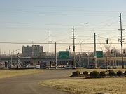
The Henry Watterson Expressway, also known as the Georgia Davis Powers/Shawnee Expressway west of US 31W, is one of two Interstate Highways in the United States
designated as Interstate 264 (abbreviated I-264). It is 22.93 miles (36.90 km) in length, and runs an open circle around central Louisville, Kentucky
. The highway begins four miles (6 km) west of downtown
at I-64
just east of the Sherman Minton Bridge
which links Southern Indiana with Kentucky as it crosses the Ohio River
. The interstate ends approximately six miles northeast of Louisville, where it connects to I-71
.
Louisville is one of few U.S. cities with two Interstate Highways serving as inner and outer beltways. I-264 is Louisville's inner beltway (in conjunction with I-64 and I-71) and the later constructed I-265
, the Gene Snyder
Freeway, is Louisville's outer beltway. I-264 is used as the primary detour route when Interstate 64
is closed through Downtown Louisville.
In discussions about the city, Interstate 264 is often used as a rough line dividing the older areas of Louisville from its suburbs.
in Louisville, as a relocation of US 60. It was incorporated into the Interstate Highway System
in 1956. The highway was completed in 1974, and in 1952 the road from Dixie Highway
east to I-71
was named after the journalist
and editor
Henry Watterson
. The designation US 60 was dropped in 1984.
The western segment from Dixie Highway to I-64
northwest of downtown Louisville
was opened in segments from 1970 to August 1974 and is often referred to as the Shawnee Expressway. On April 1, 2010, the Kentucky Legislature designated this portion the Georgia Davis Powers
Expressway
 The Watterson Expressway underwent a major reconstruction effort that began in 1985. The vintage freeway had outlived its useful purpose and had numerous characteristics that defined it as a blight on Louisville: deteriorating overpasses, buckling pavement, deficient and too closely spaced interchanges, and rampant congestion. Dozens of bridges were reconstructed and widened, and the majority of the interchanges were redesigned and rebuilt from the ground up from Dixie Highway
east to Shelbyville Road. The entire highway reconstruction project was completed in 1995.
A typical deficient interchange along I-264 was the I-65
, Kentucky Exposition Center
and Louisville International Airport
exit. Before the reconstruction, two cloverleafs with no collector and distributor lanes existed and posed serious weaving issues. The interchange today has been rebuilt and features numerous flyovers and collector and distributor lanes, making it safer, though not necessarily easier to navigate.
to the northwest I-64
interchange opened in segments from 1970 to August 1974 and received no more than emergency or spot patching. After several years of planning, in early 2003, the Kentucky Transportation Cabinet
began a rehabilitation project on this segment of Interstate Highway stretching from the Dixie Highway
interchange northwest to just east of Bank Street.
A concrete surface several inches thick was constructed on the mainline and access ramps, a new median barrier was formed, new lighting fixtures were installed, 37 bridges were rehabilitated, and 380 new roadway signage was posted and all guardrails were replaced as part of the 7.6 miles (12.2 km) project. In addition, the segment from River Park Drive to I-64, which was only two lanes, was widened to three lanes. No major ramp or interchange modifications were needed. The highway reconstruction project cost approximately $66 million and required 18 months of labor.
About 70,000 vehicles a day use the portion of Interstate 264 near Dixie Highway
and about 40,000 daily use the segment near its western terminus with I-64.
, Jefferson County
.
United States
The United States of America is a federal constitutional republic comprising fifty states and a federal district...
designated as Interstate 264 (abbreviated I-264). It is 22.93 miles (36.90 km) in length, and runs an open circle around central Louisville, Kentucky
Louisville, Kentucky
Louisville is the largest city in the U.S. state of Kentucky, and the county seat of Jefferson County. Since 2003, the city's borders have been coterminous with those of the county because of a city-county merger. The city's population at the 2010 census was 741,096...
. The highway begins four miles (6 km) west of downtown
Downtown Louisville
Downtown Louisville is the largest central business district in the Commonwealth of Kentucky and the urban hub of the Louisville, Kentucky Metropolitan Area. Its boundaries are the Ohio River to the north, Hancock Street to the east, York and Jacob Streets to the south, and 9th Street to the west...
at I-64
Interstate 64
Interstate 64 is an Interstate Highway in the Midwestern and Southeastern United States. Its western terminus is at I-70, U.S. 40, and U.S. 61 in Wentzville, Missouri. Its eastern terminus is at an interchange with I-264 and I-664 at Bowers Hill in Chesapeake, Virginia. As I-64 is concurrent with...
just east of the Sherman Minton Bridge
Sherman Minton Bridge
The Sherman Minton Bridge is a double-deck through arch bridge spanning the Ohio River, carrying I-64 and US 150 over the river between Kentucky and Indiana. The bridge connects the west side of Louisville, Kentucky to downtown New Albany, Indiana.- History :...
which links Southern Indiana with Kentucky as it crosses the Ohio River
Ohio River
The Ohio River is the largest tributary, by volume, of the Mississippi River. At the confluence, the Ohio is even bigger than the Mississippi and, thus, is hydrologically the main stream of the whole river system, including the Allegheny River further upstream...
. The interstate ends approximately six miles northeast of Louisville, where it connects to I-71
Interstate 71
Interstate 71 is an Interstate Highway in the Great Lakes/Midwestern and Southeastern region of the United States. Its southern terminus is at an interchange with Interstate 64 and Interstate 65 in Louisville, Kentucky. Its northern terminus is at an interchange with Interstate 90 in Cleveland,...
.
Louisville is one of few U.S. cities with two Interstate Highways serving as inner and outer beltways. I-264 is Louisville's inner beltway (in conjunction with I-64 and I-71) and the later constructed I-265
Interstate 265
Interstate 265 is an Interstate Highway ringing the Louisville, Kentucky metropolitan area, which includes southern Indiana, although the Indiana and Kentucky segments remain separate at the present time. In Kentucky it only runs through Jefferson County, from Interstate 71 in northeastern...
, the Gene Snyder
Gene Snyder
Marion Eugene Snyder was an American politician elected as a Republican to the United States House of Representatives from two different districts in Kentucky....
Freeway, is Louisville's outer beltway. I-264 is used as the primary detour route when Interstate 64
Interstate 64
Interstate 64 is an Interstate Highway in the Midwestern and Southeastern United States. Its western terminus is at I-70, U.S. 40, and U.S. 61 in Wentzville, Missouri. Its eastern terminus is at an interchange with I-264 and I-664 at Bowers Hill in Chesapeake, Virginia. As I-64 is concurrent with...
is closed through Downtown Louisville.
In discussions about the city, Interstate 264 is often used as a rough line dividing the older areas of Louisville from its suburbs.
History
In 1948, a bypass was built between Shelbyville Road and Dixie HighwayU.S. Route 31W
U.S. Route 31W is the westernmost of two parallel routes for U.S. Route 31 from Nashville, Tennessee to Louisville, Kentucky. At one time, it split with U.S...
in Louisville, as a relocation of US 60. It was incorporated into the Interstate Highway System
Interstate Highway System
The Dwight D. Eisenhower National System of Interstate and Defense Highways, , is a network of limited-access roads including freeways, highways, and expressways forming part of the National Highway System of the United States of America...
in 1956. The highway was completed in 1974, and in 1952 the road from Dixie Highway
Dixie Highway
The Dixie Highway was a United States automobile highway, first planned in 1914 to connect the US Midwest with the Southern United States. It was part of the National Auto Trail system, and grew out of an earlier Miami to Montreal highway. The final result is better understood as a small network of...
east to I-71
Interstate 71
Interstate 71 is an Interstate Highway in the Great Lakes/Midwestern and Southeastern region of the United States. Its southern terminus is at an interchange with Interstate 64 and Interstate 65 in Louisville, Kentucky. Its northern terminus is at an interchange with Interstate 90 in Cleveland,...
was named after the journalist
Journalist
A journalist collects and distributes news and other information. A journalist's work is referred to as journalism.A reporter is a type of journalist who researchs, writes, and reports on information to be presented in mass media, including print media , electronic media , and digital media A...
and editor
Editing
Editing is the process of selecting and preparing written, visual, audible, and film media used to convey information through the processes of correction, condensation, organization, and other modifications performed with an intention of producing a correct, consistent, accurate, and complete...
Henry Watterson
Henry Watterson
Henry Watterson was a United States journalist who founded the Louisville Courier-Journal.He also served part of one term in the United States House of Representatives as a Democrat....
. The designation US 60 was dropped in 1984.
The western segment from Dixie Highway to I-64
Interstate 64
Interstate 64 is an Interstate Highway in the Midwestern and Southeastern United States. Its western terminus is at I-70, U.S. 40, and U.S. 61 in Wentzville, Missouri. Its eastern terminus is at an interchange with I-264 and I-664 at Bowers Hill in Chesapeake, Virginia. As I-64 is concurrent with...
northwest of downtown Louisville
Downtown Louisville
Downtown Louisville is the largest central business district in the Commonwealth of Kentucky and the urban hub of the Louisville, Kentucky Metropolitan Area. Its boundaries are the Ohio River to the north, Hancock Street to the east, York and Jacob Streets to the south, and 9th Street to the west...
was opened in segments from 1970 to August 1974 and is often referred to as the Shawnee Expressway. On April 1, 2010, the Kentucky Legislature designated this portion the Georgia Davis Powers
Georgia Davis Powers
Georgia Montgomery Davis Powers served for 21 years as a distinguished member of the state Senate in the Commonwealth of Kentucky...
Expressway
Watterson Expressway Reconstruction (1985-1995)
U.S. Route 31W
U.S. Route 31W is the westernmost of two parallel routes for U.S. Route 31 from Nashville, Tennessee to Louisville, Kentucky. At one time, it split with U.S...
east to Shelbyville Road. The entire highway reconstruction project was completed in 1995.
A typical deficient interchange along I-264 was the I-65
Interstate 65
Interstate 65 is a major Interstate Highway in the United States. The southern terminus is located at an intersection with Interstate 10 in Mobile, Alabama, and its northern terminus is at an interchange with Interstate 90 , U.S. Route 12, and U.S...
, Kentucky Exposition Center
Kentucky Exposition Center
The Kentucky Exposition Center , formerly Kentucky Fair and Exposition Center , is a large multi-use facility in Louisville, Kentucky, United States...
and Louisville International Airport
Louisville International Airport
Louisville International Airport is a joint civil-military public airport centrally located in the city of Louisville in Jefferson County, Kentucky, USA. The airport covers 1,200 acres and has three runways. Its IATA airport code SDF is based on the airport's former name, Standiford Field...
exit. Before the reconstruction, two cloverleafs with no collector and distributor lanes existed and posed serious weaving issues. The interchange today has been rebuilt and features numerous flyovers and collector and distributor lanes, making it safer, though not necessarily easier to navigate.
Shawnee Expressway Reconstruction (2003-2004)
The segment of I-264 from Dixie HighwayDixie Highway
The Dixie Highway was a United States automobile highway, first planned in 1914 to connect the US Midwest with the Southern United States. It was part of the National Auto Trail system, and grew out of an earlier Miami to Montreal highway. The final result is better understood as a small network of...
to the northwest I-64
Interstate 64
Interstate 64 is an Interstate Highway in the Midwestern and Southeastern United States. Its western terminus is at I-70, U.S. 40, and U.S. 61 in Wentzville, Missouri. Its eastern terminus is at an interchange with I-264 and I-664 at Bowers Hill in Chesapeake, Virginia. As I-64 is concurrent with...
interchange opened in segments from 1970 to August 1974 and received no more than emergency or spot patching. After several years of planning, in early 2003, the Kentucky Transportation Cabinet
Kentucky Transportation Cabinet
The Kentucky Transportation Cabinet is Kentucky's state-funded agency charged with building and maintaining U.S...
began a rehabilitation project on this segment of Interstate Highway stretching from the Dixie Highway
U.S. Route 31W
U.S. Route 31W is the westernmost of two parallel routes for U.S. Route 31 from Nashville, Tennessee to Louisville, Kentucky. At one time, it split with U.S...
interchange northwest to just east of Bank Street.
A concrete surface several inches thick was constructed on the mainline and access ramps, a new median barrier was formed, new lighting fixtures were installed, 37 bridges were rehabilitated, and 380 new roadway signage was posted and all guardrails were replaced as part of the 7.6 miles (12.2 km) project. In addition, the segment from River Park Drive to I-64, which was only two lanes, was widened to three lanes. No major ramp or interchange modifications were needed. The highway reconstruction project cost approximately $66 million and required 18 months of labor.
About 70,000 vehicles a day use the portion of Interstate 264 near Dixie Highway
U.S. Route 31W
U.S. Route 31W is the westernmost of two parallel routes for U.S. Route 31 from Nashville, Tennessee to Louisville, Kentucky. At one time, it split with U.S...
and about 40,000 daily use the segment near its western terminus with I-64.
Westport Road interchange (2008-2010)
Although the Kentucky General Assembly considered plans for an interchange with Westport Road (Kentucky Route 1447) as early as 1992, work did not begin until October 2008 and was completed in May 2010.Exit list
The entire route is in LouisvilleLouisville, Kentucky
Louisville is the largest city in the U.S. state of Kentucky, and the county seat of Jefferson County. Since 2003, the city's borders have been coterminous with those of the county because of a city-county merger. The city's population at the 2010 census was 741,096...
, Jefferson County
Jefferson County, Kentucky
As of the census of 2000, there were 693,604 people, 287,012 households, and 183,113 families residing in the county. The population density was . There were 305,835 housing units at an average density of...
.
| Mile | # Exit number An exit number is a number assigned to a road junction, usually an exit from a freeway. It is usually marked on the same sign as the destinations of the exit, as well as a sign in the gore.... |
Destinations | Notes |
|---|---|---|---|
| 0.0 | 0 | , New Albany New Albany, Indiana New Albany is a city in Floyd County, Indiana, United States, situated along the Ohio River opposite Louisville, Kentucky. In 1900, 20,628 people lived in New Albany; in 1910, 20,629; in 1920, 22,992; and in 1940, 25,414. The population was 36,372 at the 2010 census. The city is the county seat of... , St. Louis St. Louis, Missouri St. Louis is an independent city on the eastern border of Missouri, United States. With a population of 319,294, it was the 58th-largest U.S. city at the 2010 U.S. Census. The Greater St... |
Signed as exits 0A (east) and 0B (west) |
| 0.2 | 1 | Bank Street, Northwestern Parkway | Eastbound exit and westbound entrance |
| 1.0 | 2 | Muhammad Ali Boulevard, River Park Drive | |
| 2.3 | 3 | Virginia Avenue, Dumesnil Street | |
| 3.5 | 4 | Bells Lane ( KY 2056), Algonquin Parkway ( KY 2056), Algonquin Parkway ( KY 2054) KY 2054) |
|
| 4.7/ 4.9 |
5 | Ralph Avenue, Cane Run Road ( KY 1934) KY 1934) |
Signed as exits 5A (Ralph Avenue, Cane Run Road north) and 5B (Cane Run Road south) eastbound |
| 6.9 | 8 | Signed as exits 8A (south/west) and 8B (north/east) | |
| 8.6 | 9 | ||
| 9.6 | 10 | ||
| 10.5 | 11 | Crittenden Drive – Kentucky Exposition Center Kentucky Exposition Center The Kentucky Exposition Center , formerly Kentucky Fair and Exposition Center , is a large multi-use facility in Louisville, Kentucky, United States... |
|
| 10.8 | 11 | Louisville International Airport Louisville International Airport Louisville International Airport is a joint civil-military public airport centrally located in the city of Louisville in Jefferson County, Kentucky, USA. The airport covers 1,200 acres and has three runways. Its IATA airport code SDF is based on the airport's former name, Standiford Field... |
|
| 10.8 | 12 | Kentucky Exposition Center Kentucky Exposition Center The Kentucky Exposition Center , formerly Kentucky Fair and Exposition Center , is a large multi-use facility in Louisville, Kentucky, United States... (Freedom Way) |
Westbound exit is part of exit 11 |
| 10.9 | 12 | – Nashville Nashville, Tennessee Nashville is the capital of the U.S. state of Tennessee and the county seat of Davidson County. It is located on the Cumberland River in Davidson County, in the north-central part of the state. The city is a center for the health care, publishing, banking and transportation industries, and is home... , Indianapolis Indianapolis Indianapolis is the capital of the U.S. state of Indiana, and the county seat of Marion County, Indiana. As of the 2010 United States Census, the city's population is 839,489. It is by far Indiana's largest city and, as of the 2010 U.S... |
|
| 12.9 | 14 | ||
| 14.1 | 15 | Signed as exits 15A (north) and 15B (south) westbound | |
| 15.1 | 16 | ||
| 17 | Signed as exits 17A (south) and 17B (north) | ||
| 18 | Signed as exits 18A (south) and 18B (north) | ||
| 19 | Signed as exits 19A (east) and 19B (west) | ||
| 20 | Signed as exits 20A (east) and 20B (west) | ||
| 21 | |||
| 22 | |||
| 23 | – Cincinnati, Louisville Louisville, Kentucky Louisville is the largest city in the U.S. state of Kentucky, and the county seat of Jefferson County. Since 2003, the city's borders have been coterminous with those of the county because of a city-county merger. The city's population at the 2010 census was 741,096... |
Eastbound exit and westbound entrance; signed as exits 23A (north) and 23B (south) |