

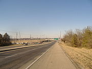
Interstate 265
Encyclopedia
Interstate 265 is an Interstate Highway ringing the Louisville, Kentucky
metropolitan area, which includes southern Indiana
, although the Indiana and Kentucky segments remain separate at the present time. In Kentucky it only runs through Jefferson County
, from Interstate 71
in northeastern Louisville to Interstate 65
in the southern part of the city. The entire Kentucky stretch of the road is co-signed with Kentucky Route 841. The highway is named the Gene Snyder
Freeway (initially named the "Jefferson Freeway"), after the former congressman
, and usually called "the Snyder" by locals. It is considered part of Louisville's "beltline".
In Indiana, I-265 runs from I-64
in western Floyd County
to I-65 in Clark County
and is known as the Lee H. Hamilton
Highway. East of I-65, the freeway continues as State Road 265 (Clark Maritime Highway) until intersecting State Road 62 (Charlestown Pike). This stretch is scheduled to be extended east across the Ohio River
, where it will eventually link up with its Kentucky counterpart, creating a bypass around the eastern side of the city. Currently, construction is slated for completion in 2018.
In late 2005 members of Louisville's Metro Council
proposed a committee to begin planning a western bridge to link the southwestern end of the highway to Indiana as well.
Interstate 265 was also a bypass linking Interstates 65
and 40
north of downtown Nashville, Tennessee
. It was decommissioned in 2000 and became part of a rerouted I-65.
| IN
|| 6.73 || 10.83
|-
| KY
|| 24.48 || 38.40
|-
| Total || 31.21 || 50.23
|}
of Indiana
is a two mile (3 km), divided four-lane freeway that runs east-to-west for two miles (3 km), connecting Interstate 65
with Interstate 265 north of Jeffersonville
. It overlaps State Road 62 for its entire length. The freeway is scheduled to become an extension of Interstate 265 when the East End Bridge, part of the Ohio River Bridges Project
, is completed.
to Interstate 265 in Kentucky
. The completion of the bridge would connect the two disjointed interstates and form a 3/4 beltway around the Louisville, Kentucky
metro area. There is currently no plan to construct a bridge on the west end of Interstate 265.
in the suburb
s of Louisville
, Kentucky
. The route is a partial beltway, encircling Louisville on its southern and eastern sides. The western terminus of the route is at U.S. Route 31W
and U.S. Route 60
in Valley Station
southwest of Louisville, where KY 841 continues to the west as Kentucky Route 1934. The eastern terminus is at U.S. Route 42
in Prospect
northeast of downtown Louisville.
KY 841 and Interstate 265 overlap for 24.477 miles (39.4 km) between Interstate 65
exit 125 and Interstate 71
exit 9.
to Interstate 71
has seen an increase in serious accidents. The primary factors stem from its low-level grass median which offers little to no protection for crossover incidents. Its concrete pavement, which was diamond-ground in the late-1990's, made the pavement quite slick in wet weather. Driver inattention and increased traffic and congestion has led to a decline in the overall level-of-service. In 2006, cable barrier
s were installed in the in the median for 10 miles (16.1 km) between Interstate 71
to Interstate 64
, with further installation possible in the near future.
 Originally signed just as KY 841, the Jefferson Freeway was constructed originally with two sections, one between KY 155
(Taylorsville Road) and US 60 (Shelbyville Road) and a second section between KY 1447 (Westport Road) and US 42 in the 1960s as short connectors to the eastern suburban expansion as well as a new automobile plant. I-264
by 1970 was woefully congested and was in dire need of reconstruction and other improvements, therefore I-265 was proposed as an outer beltway to provide pass-through motorists relief from the congestion of I-264. Construction started in the early 1980s and was finished later that decade and signed in 1987.
The road is signed Interstate 265 from the I-65
interchange to the I-71
interchange. From I-65 west to US 31W (although it is up to Interstate Highway standards) and I-71 north/west to US 42, is signed as KY 841 due to AASHTO numbering rules. KY 841 is signed throughout the entire designation of Interstate 265. The exit numbering for the entire beltway starts at the western terminus of KY 841.
Reconstruction efforts have been continuing on several segments of I-265. The concrete used in the mid-sections of I-64 and the western segments of KY 841 have caused many dips and rough spots to the point where diamond grinding, or the patching and then the regrooving of the pavement was necessary.
Studies have also been conducted for the reconfiguration of the I-265 and I-64 interchange. It is currently an underpowered cloverleaf with no collector-distributor lanes, a relic of the original Jefferson Freeway.
Louisville, Kentucky
Louisville is the largest city in the U.S. state of Kentucky, and the county seat of Jefferson County. Since 2003, the city's borders have been coterminous with those of the county because of a city-county merger. The city's population at the 2010 census was 741,096...
metropolitan area, which includes southern Indiana
Indiana
Indiana is a US state, admitted to the United States as the 19th on December 11, 1816. It is located in the Midwestern United States and Great Lakes Region. With 6,483,802 residents, the state is ranked 15th in population and 16th in population density. Indiana is ranked 38th in land area and is...
, although the Indiana and Kentucky segments remain separate at the present time. In Kentucky it only runs through Jefferson County
Jefferson County, Kentucky
As of the census of 2000, there were 693,604 people, 287,012 households, and 183,113 families residing in the county. The population density was . There were 305,835 housing units at an average density of...
, from Interstate 71
Interstate 71
Interstate 71 is an Interstate Highway in the Great Lakes/Midwestern and Southeastern region of the United States. Its southern terminus is at an interchange with Interstate 64 and Interstate 65 in Louisville, Kentucky. Its northern terminus is at an interchange with Interstate 90 in Cleveland,...
in northeastern Louisville to Interstate 65
Interstate 65
Interstate 65 is a major Interstate Highway in the United States. The southern terminus is located at an intersection with Interstate 10 in Mobile, Alabama, and its northern terminus is at an interchange with Interstate 90 , U.S. Route 12, and U.S...
in the southern part of the city. The entire Kentucky stretch of the road is co-signed with Kentucky Route 841. The highway is named the Gene Snyder
Gene Snyder
Marion Eugene Snyder was an American politician elected as a Republican to the United States House of Representatives from two different districts in Kentucky....
Freeway (initially named the "Jefferson Freeway"), after the former congressman
Gene Snyder
Marion Eugene Snyder was an American politician elected as a Republican to the United States House of Representatives from two different districts in Kentucky....
, and usually called "the Snyder" by locals. It is considered part of Louisville's "beltline".
In Indiana, I-265 runs from I-64
Interstate 64
Interstate 64 is an Interstate Highway in the Midwestern and Southeastern United States. Its western terminus is at I-70, U.S. 40, and U.S. 61 in Wentzville, Missouri. Its eastern terminus is at an interchange with I-264 and I-664 at Bowers Hill in Chesapeake, Virginia. As I-64 is concurrent with...
in western Floyd County
Floyd County, Indiana
Floyd County is a county located in the U.S. state of Indiana. As of 2010, the population was 74,578. The county seat is New Albany. Floyd County is the county with the second smallest land area in the entire state...
to I-65 in Clark County
Clark County, Indiana
Clark County is a county located in the U.S. state of Indiana, located directly across the Ohio River from Louisville, Kentucky. At the 2010 Census, the population was 110,232. The county seat is Jeffersonville. Clarksville is also a major city in the county...
and is known as the Lee H. Hamilton
Lee H. Hamilton
Lee Herbert Hamilton is a former member of the United States House of Representatives and currently a member of the U.S. Homeland Security Advisory Council. A member of the Democratic Party, Hamilton represented the 9th congressional district of Indiana from 1965 to 1999...
Highway. East of I-65, the freeway continues as State Road 265 (Clark Maritime Highway) until intersecting State Road 62 (Charlestown Pike). This stretch is scheduled to be extended east across the Ohio River
Ohio River
The Ohio River is the largest tributary, by volume, of the Mississippi River. At the confluence, the Ohio is even bigger than the Mississippi and, thus, is hydrologically the main stream of the whole river system, including the Allegheny River further upstream...
, where it will eventually link up with its Kentucky counterpart, creating a bypass around the eastern side of the city. Currently, construction is slated for completion in 2018.
In late 2005 members of Louisville's Metro Council
Louisville Metro Council
The Louisville Metro Council is the city legislature of Louisville, Kentucky . It was formally established in January 2003 upon the merger of the former City of Louisville with Jefferson County and replaced the city's Board of Aldermen and the county's Fiscal Court .The Metro Council consists of...
proposed a committee to begin planning a western bridge to link the southwestern end of the highway to Indiana as well.
Interstate 265 was also a bypass linking Interstates 65
Interstate 65
Interstate 65 is a major Interstate Highway in the United States. The southern terminus is located at an intersection with Interstate 10 in Mobile, Alabama, and its northern terminus is at an interchange with Interstate 90 , U.S. Route 12, and U.S...
and 40
Interstate 40
Interstate 40 is the third-longest major east–west Interstate Highway in the United States, after I-90 and I-80. Its western end is at Interstate 15 in Barstow, California; its eastern end is at a concurrency of U.S. Route 117 and North Carolina Highway 132 in Wilmington, North Carolina...
north of downtown Nashville, Tennessee
Nashville, Tennessee
Nashville is the capital of the U.S. state of Tennessee and the county seat of Davidson County. It is located on the Cumberland River in Davidson County, in the north-central part of the state. The city is a center for the health care, publishing, banking and transportation industries, and is home...
. It was decommissioned in 2000 and became part of a rerouted I-65.
Route description
|-| IN
Indiana
Indiana is a US state, admitted to the United States as the 19th on December 11, 1816. It is located in the Midwestern United States and Great Lakes Region. With 6,483,802 residents, the state is ranked 15th in population and 16th in population density. Indiana is ranked 38th in land area and is...
|| 6.73 || 10.83
|-
| KY
Kentucky
The Commonwealth of Kentucky is a state located in the East Central United States of America. As classified by the United States Census Bureau, Kentucky is a Southern state, more specifically in the East South Central region. Kentucky is one of four U.S. states constituted as a commonwealth...
|| 24.48 || 38.40
|-
| Total || 31.21 || 50.23
|}
Indiana
State Road 265 in the U.S. StateU.S. state
A U.S. state is any one of the 50 federated states of the United States of America that share sovereignty with the federal government. Because of this shared sovereignty, an American is a citizen both of the federal entity and of his or her state of domicile. Four states use the official title of...
of Indiana
Indiana
Indiana is a US state, admitted to the United States as the 19th on December 11, 1816. It is located in the Midwestern United States and Great Lakes Region. With 6,483,802 residents, the state is ranked 15th in population and 16th in population density. Indiana is ranked 38th in land area and is...
is a two mile (3 km), divided four-lane freeway that runs east-to-west for two miles (3 km), connecting Interstate 65
Interstate 65
Interstate 65 is a major Interstate Highway in the United States. The southern terminus is located at an intersection with Interstate 10 in Mobile, Alabama, and its northern terminus is at an interchange with Interstate 90 , U.S. Route 12, and U.S...
with Interstate 265 north of Jeffersonville
Jeffersonville, Indiana
Jeffersonville is a city in Clark County, Indiana, along the Ohio River. Locally, the city is often referred to by the abbreviated name Jeff. It is directly across the Ohio River to the north of Louisville, Kentucky along I-65. The population was 44,953 at the 2010 census...
. It overlaps State Road 62 for its entire length. The freeway is scheduled to become an extension of Interstate 265 when the East End Bridge, part of the Ohio River Bridges Project
Ohio River Bridges Project
The Ohio River Bridges Project is a controversial Louisville metropolitan area transportation project involving the reconstruction of the Kennedy Interchange , the completion of two new Ohio River bridges and the reconstruction of ramps on Interstate 65 between I-264 and downtown.One bridge will be...
, is completed.
East End Bridge
In various discussions for over 30 years, the East End Bridge is part of a new 6.5 miles (10.5 km) highway that will connect Interstate 265 in IndianaIndiana
Indiana is a US state, admitted to the United States as the 19th on December 11, 1816. It is located in the Midwestern United States and Great Lakes Region. With 6,483,802 residents, the state is ranked 15th in population and 16th in population density. Indiana is ranked 38th in land area and is...
to Interstate 265 in Kentucky
Kentucky
The Commonwealth of Kentucky is a state located in the East Central United States of America. As classified by the United States Census Bureau, Kentucky is a Southern state, more specifically in the East South Central region. Kentucky is one of four U.S. states constituted as a commonwealth...
. The completion of the bridge would connect the two disjointed interstates and form a 3/4 beltway around the Louisville, Kentucky
Louisville, Kentucky
Louisville is the largest city in the U.S. state of Kentucky, and the county seat of Jefferson County. Since 2003, the city's borders have been coterminous with those of the county because of a city-county merger. The city's population at the 2010 census was 741,096...
metro area. There is currently no plan to construct a bridge on the west end of Interstate 265.
Kentucky
Kentucky Route 841 is a 37.006 mile (59.555 km) long state highwayState highway
State highway, state road or state route can refer to one of three related concepts, two of them related to a state or provincial government in a country that is divided into states or provinces :#A...
in the suburb
Suburb
The word suburb mostly refers to a residential area, either existing as part of a city or as a separate residential community within commuting distance of a city . Some suburbs have a degree of administrative autonomy, and most have lower population density than inner city neighborhoods...
s of Louisville
Louisville, Kentucky
Louisville is the largest city in the U.S. state of Kentucky, and the county seat of Jefferson County. Since 2003, the city's borders have been coterminous with those of the county because of a city-county merger. The city's population at the 2010 census was 741,096...
, Kentucky
Kentucky
The Commonwealth of Kentucky is a state located in the East Central United States of America. As classified by the United States Census Bureau, Kentucky is a Southern state, more specifically in the East South Central region. Kentucky is one of four U.S. states constituted as a commonwealth...
. The route is a partial beltway, encircling Louisville on its southern and eastern sides. The western terminus of the route is at U.S. Route 31W
U.S. Route 31W
U.S. Route 31W is the westernmost of two parallel routes for U.S. Route 31 from Nashville, Tennessee to Louisville, Kentucky. At one time, it split with U.S...
and U.S. Route 60
U.S. Route 60
U.S. Route 60 is an east–west United States highway, running from the Atlantic Ocean on the east coast in Virginia to western Arizona. Despite the final "0" in its number, indicating a transcontinental designation, the 1926 route formerly ended in Springfield, Missouri, at its intersection...
in Valley Station
Valley Station, Kentucky
Valley Station is a former census-designated place in southwest Jefferson County, Kentucky, United States. The population was 23,489 at the 2010 census. When the government of Jefferson County merged with the city of Louisville, Kentucky in 2003, residents of Valley Station also became citizens of...
southwest of Louisville, where KY 841 continues to the west as Kentucky Route 1934. The eastern terminus is at U.S. Route 42
U.S. Route 42
U.S. Route 42 is an east–west United States highway that runs northeast-southwest for 355 miles from Cleveland, Ohio to Louisville, Kentucky. The route has several names including Pearl Road from Cleveland to Medina in Northeast Ohio, the Cincinnati and Lebanon Pike in southwestern Ohio and...
in Prospect
Prospect, Kentucky
Prospect is a city in far northeastern Jefferson and southwestern Oldham Counties in the U.S. state of Kentucky, along the Ohio River. The city is a suburb of Louisville, Kentucky. It's one of few cities in Jefferson County that extend into another county. The population was 4,657 at the 2000...
northeast of downtown Louisville.
KY 841 and Interstate 265 overlap for 24.477 miles (39.4 km) between Interstate 65
Interstate 65
Interstate 65 is a major Interstate Highway in the United States. The southern terminus is located at an intersection with Interstate 10 in Mobile, Alabama, and its northern terminus is at an interchange with Interstate 90 , U.S. Route 12, and U.S...
exit 125 and Interstate 71
Interstate 71
Interstate 71 is an Interstate Highway in the Great Lakes/Midwestern and Southeastern region of the United States. Its southern terminus is at an interchange with Interstate 64 and Interstate 65 in Louisville, Kentucky. Its northern terminus is at an interchange with Interstate 90 in Cleveland,...
exit 9.
Safety issues
The Gene Snyder Freeway, from Interstate 65Interstate 65
Interstate 65 is a major Interstate Highway in the United States. The southern terminus is located at an intersection with Interstate 10 in Mobile, Alabama, and its northern terminus is at an interchange with Interstate 90 , U.S. Route 12, and U.S...
to Interstate 71
Interstate 71
Interstate 71 is an Interstate Highway in the Great Lakes/Midwestern and Southeastern region of the United States. Its southern terminus is at an interchange with Interstate 64 and Interstate 65 in Louisville, Kentucky. Its northern terminus is at an interchange with Interstate 90 in Cleveland,...
has seen an increase in serious accidents. The primary factors stem from its low-level grass median which offers little to no protection for crossover incidents. Its concrete pavement, which was diamond-ground in the late-1990's, made the pavement quite slick in wet weather. Driver inattention and increased traffic and congestion has led to a decline in the overall level-of-service. In 2006, cable barrier
Cable barrier
Cable barrier, sometimes referred to as guard cable, is a type of roadside or median barrier. It consists of steel wire ropes mounted on weak posts. As is the case with any roadside barrier, its primary purpose is to prevent a vehicle from leaving the traveled way and striking a fixed object or...
s were installed in the in the median for 10 miles (16.1 km) between Interstate 71
Interstate 71
Interstate 71 is an Interstate Highway in the Great Lakes/Midwestern and Southeastern region of the United States. Its southern terminus is at an interchange with Interstate 64 and Interstate 65 in Louisville, Kentucky. Its northern terminus is at an interchange with Interstate 90 in Cleveland,...
to Interstate 64
Interstate 64
Interstate 64 is an Interstate Highway in the Midwestern and Southeastern United States. Its western terminus is at I-70, U.S. 40, and U.S. 61 in Wentzville, Missouri. Its eastern terminus is at an interchange with I-264 and I-664 at Bowers Hill in Chesapeake, Virginia. As I-64 is concurrent with...
, with further installation possible in the near future.
History
Kentucky Route 155
Kentucky Route 155 is a 20.815 mile long state highway in the U.S. state of Kentucky. The route originates at a junction with U.S. Route 31E and US 150 in Louisville, Kentucky. On the other side of intersection, KY 155 becomes a local road called Trevilian Way...
(Taylorsville Road) and US 60 (Shelbyville Road) and a second section between KY 1447 (Westport Road) and US 42 in the 1960s as short connectors to the eastern suburban expansion as well as a new automobile plant. I-264
Interstate 264 (Kentucky)
The Henry Watterson Expressway, also known as the Georgia Davis Powers/Shawnee Expressway west of US 31W, is one of two Interstate Highways in the United States designated as Interstate 264 . It is 22.93 miles in length, and runs an open circle around central Louisville, Kentucky...
by 1970 was woefully congested and was in dire need of reconstruction and other improvements, therefore I-265 was proposed as an outer beltway to provide pass-through motorists relief from the congestion of I-264. Construction started in the early 1980s and was finished later that decade and signed in 1987.
The road is signed Interstate 265 from the I-65
Interstate 65
Interstate 65 is a major Interstate Highway in the United States. The southern terminus is located at an intersection with Interstate 10 in Mobile, Alabama, and its northern terminus is at an interchange with Interstate 90 , U.S. Route 12, and U.S...
interchange to the I-71
Interstate 71
Interstate 71 is an Interstate Highway in the Great Lakes/Midwestern and Southeastern region of the United States. Its southern terminus is at an interchange with Interstate 64 and Interstate 65 in Louisville, Kentucky. Its northern terminus is at an interchange with Interstate 90 in Cleveland,...
interchange. From I-65 west to US 31W (although it is up to Interstate Highway standards) and I-71 north/west to US 42, is signed as KY 841 due to AASHTO numbering rules. KY 841 is signed throughout the entire designation of Interstate 265. The exit numbering for the entire beltway starts at the western terminus of KY 841.
Reconstruction efforts have been continuing on several segments of I-265. The concrete used in the mid-sections of I-64 and the western segments of KY 841 have caused many dips and rough spots to the point where diamond grinding, or the patching and then the regrooving of the pavement was necessary.
Studies have also been conducted for the reconfiguration of the I-265 and I-64 interchange. It is currently an underpowered cloverleaf with no collector-distributor lanes, a relic of the original Jefferson Freeway.
Exit list
| County | Location | Mile | Exit | Destinations | Notes |
|---|---|---|---|---|---|
| Jefferson | 1 | continues as KY 1934 past this exit | |||
| 3 | Stonestreet Road | ||||
| 6 | New Cut Road | ||||
| 8 | |||||
| 10 | - Nashville, Louisville Louisville, Kentucky Louisville is the largest city in the U.S. state of Kentucky, and the county seat of Jefferson County. Since 2003, the city's borders have been coterminous with those of the county because of a city-county merger. The city's population at the 2010 census was 741,096... |
West end of I-265; signed as exits 10A (north) and 10B (south) westbound | |||
| 12 | |||||
| 14 | Smyrna Road | ||||
| 15 | |||||
| 17 | |||||
| 19 | |||||
| 23 | |||||
| Middletown | 25 | Signed as exits 25A (east) and 25B (west) | |||
| 27 | |||||
| 29 | |||||
| 30 | |||||
| 32 | |||||
| 34 | |||||
| 35 | - Cincinnati, Louisville Louisville, Kentucky Louisville is the largest city in the U.S. state of Kentucky, and the county seat of Jefferson County. Since 2003, the city's borders have been coterminous with those of the county because of a city-county merger. The city's population at the 2010 census was 741,096... |
Temporary north end of I-265; signed as exits 35A (east) and 35B (west) | |||
| Temporary north end of KY 841 | |||||
| Proposed bridge over the Ohio River Ohio River The Ohio River is the largest tributary, by volume, of the Mississippi River. At the confluence, the Ohio is even bigger than the Mississippi and, thus, is hydrologically the main stream of the whole river system, including the Allegheny River further upstream... |
|||||
| Clark | 10 | Temporary east end of SR 265 and of the SR 62 overlap; signed as exits 10A (west) and 10B (east) eastbound | |||
| Clarksville | 7 | , Louisville Louisville, Kentucky Louisville is the largest city in the U.S. state of Kentucky, and the county seat of Jefferson County. Since 2003, the city's borders have been coterminous with those of the county because of a city-county merger. The city's population at the 2010 census was 741,096... |
Temporary east end of I-265; signed as exits 7A (north) and 7B (south) westbound | ||
| Floyd | New Albany | 4 | |||
| 3 | |||||
| 1 | State Street | ||||
| 0 | , Louisville Louisville, Kentucky Louisville is the largest city in the U.S. state of Kentucky, and the county seat of Jefferson County. Since 2003, the city's borders have been coterminous with those of the county because of a city-county merger. The city's population at the 2010 census was 741,096... , St. Louis |
Westbound exit and eastbound entrance; both ramps are signed as exit 0 | |||