
.gif)
Interstate 195 (New Jersey)
Encyclopedia
Interstate 195 is an auxiliary route of the Interstate Highway System
located in the U.S. state
of New Jersey
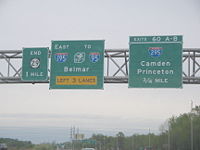
. Its western end is at I-295 and Route 29 just south of Trenton, New Jersey
in Hamilton Township
, Mercer County
while its eastern end is at the Garden State Parkway, Route 34 and Route 138 in Wall Township
. I-195 is 34.17 mi (54.99 km) in length. The route is mostly a four-lane highway that runs through wooded areas in the center of New Jersey. It has an interchange with the New Jersey Turnpike
(I-95
) at Exit 7A in Robbinsville Township and serves as a main access road to Six Flags Great Adventure
(which is off the CR 537
exit in Jackson Township
) and the Jersey Shore
. I-195 is occasionally referred to as the Central Jersey Expressway. On April 6, 1988, President Ronald Reagan
signed H.R. 4263 naming Interstate 195 in New Jersey the James J. Howard Interstate Highway, in honor of the late James J. Howard
.
The current I-195 was initially planned as a toll road
called the Trenton-Asbury Park Expressway in the 1950s. In the 1960s, the road became part of the proposed Route 37 and Route 38 freeways that were to cross the central part of the state. A compromise between these two freeway was planned between Trenton and Belmar and would get Interstate Highway funding, becoming I-195. This freeway was built in several stages during the 1970s and 1980s. Due to the cancellation of the Somerset Freeway and the resulting gap in I-95, an interchange
is planned between the Pennsylvania Turnpike
and I-95
in Bristol Township, Pennsylvania
to fill this gap. When this is completed in 2017, I-195 will be extended west along the current I-295 and I-95 around the north side of Trenton to the new interchange.
with I-295
in Hamilton Township
, Mercer County
, located southeast of the city of Trenton
. From this end, the freeway continues north into Trenton as Route 29. I-195 serves as the southern continuation of Route 29, continuing east from I-295 as a six-lane expressway, passing between suburban neighborhoods to the north and the Crosswicks Creek
to the south. After the exit for US 206
, the highway narrows to four lanes and turns northeast as it interchanges with CR 524
and CR 620. Following this, I-195 passes near more neighborhoods and runs to the northwest of Gropp Lake before turning more to the east. The route has a cloverleaf interchange with Yardville-Hamilton Square Road before passing near business parks and reaching a cloverleaf junction with US 130
. After US 130, the road enters Robbinsville Township as the settings start to become more rural, with a few areas of suburban development. In Robbinsville Township, there is a ramp that provides access to the New Jersey Turnpike
(I-95
). Shortly after passing over the New Jersey Turnpike, I-195 reaches the exit for CR 526
. The highway runs to the north of Allentown
before briefly forming the border between Robbinsville Township to the north and Upper Freehold Township
, Monmouth County
to the south as it reaches the interchange with CR 524/CR 539
.
. In this area, I-195 turns to the southeast and enters more forested areas as it comes to a cloverleaf interchange with CR 537
. This exit off I-195 provides access to Six Flags Great Adventure
and the Jackson Premium Outlets. Due to the presence of Six Flags, this exit off I-195 can become busy during the summer months since it provides access to the park from both the New Jersey Turnpike and the Garden State Parkway
, which lies just east of I-195's eastern terminus. Upon crossing CR 537, the highway enters Jackson Township
in Ocean County
and continues east through heavy woods. The road comes to an exit with CR 527
, where there is a park and ride
lot for motorists. The median of I-195 widens past the CR 527 junction before narrowing as it comes to the CR 638 interchange. The road runs through more woodland, with nearby residential development increasing.
After crossing the North Branch Metedeconk River
, I-195 continues into Howell Township
, Monmouth County and turns northeast, reaching a cloverleaf interchange with US 9. At this point, the road turns east again and soon heads back into dense woods. After crossing the Manasquan River
, the expressway interchanges with CR 547
, which provides access to CR 524 and CR 549
. Shortly after CR 547, I-195 enters Wall Township
and passes through Allaire State Park
. The eastern end of I-195 is located at Exit 35, its junction with Route 34 that has access to the southbound Garden State Parkway from the eastbound direction. At the exit for Route 34, I-195 ends and Route 138 begins, but the highway and exit numbering continue onto Route 138, marking the interchange with the Garden State Parkway
as Exit 36. Past this interchange, Route 138 continues east to Belmar
on the Jersey Shore
as an arterial boulevard, making connections with Route 18 and Route 35.
called the Trenton-Asbury Park Expressway that was to be operated by the New Jersey Highway Authority, the owner of the Garden State Parkway at the time. In 1965, this road would be incorporated into a planned Central Jersey Expressway System. The western portion would become a part of the Route 37 freeway that was to run from Trenton to Seaside Heights
while the eastern portion would become a part of the Route 38 freeway that was to run from Camden
to Belmar. The two freeways were to meet near Fort Dix. By 1967, plans for the Route 38 freeway were canceled, leaving Route 37 as the only planned east-west freeway through central New Jersey. The routing of this freeway, which was to be called the Central Jersey Expressway, was changed to run from the Trenton area east to Wall Township In addition, officials pushed for Interstate Highway funding for the freeway, with funds to be diverted from the canceled I-278
in Union County
. The proposed freeway would cost $60 million.
By 1970, construction took place on the route between CR 539 near Allentown and CR 527 in Jackson Township. The portion of I-195 between the New Jersey Turnpike and CR 527 was opened by 1973 and construction on the section between White Horse
and the New Jersey Turnpike began. In 1979, I-195 was completed east to Squankum. By 1983, the length of I-195 was completed.
The New Jersey Turnpike Authority had proposed to build the Driscoll Expressway
which was to start from exit 80 of the parkway in Toms River
and end 3 miles north of exit 8A of the Turnpike in South Brunswick. This proposal was also part of the "Central Jersey Expressway System," but it was proposed before I-195 was ever created. After I-195 was extended into Jackson Township in the late 1970s, an interchange was planned to be built to connect the two roads. However, the Driscoll Expressway was shelved in the 1980s.
When it was planned, I-195 did not intersect I-95 at all; it instead connected to I-295 at its west end. When I-95 was re-routed to the New Jersey Turnpike after the cancellation of the Somerset Freeway, I-195 was connected to I-95. Since I-95 abruptly ends at I-295 and US 1
in Lawrence Township
, motorists must take I-295 southbound to I-195 east in order to access I-95/New Jersey Turnpike.
On April 6, 1988, President Ronald Reagan
signed H.R. 4263 naming I-195 in New Jersey the James J. Howard Interstate Highway, in honor of the late James J. Howard
, a U.S. Representative from New Jersey who advocated improving the highways of the United States . In the late 1990s, the New Jersey Department of Transportation considered the possibility of widening I-195 to six lanes between the New Jersey Turnpike and CR 537 in order to accommodate traffic going to Six Flags Great Adventure. The interchange with CR 537 was improved in 1997 by adding separate ramps to westbound and eastbound CR 537 from I-195 and by making the westbound ramp two lanes for Six Flags traffic.
I-195, like many other highways in New Jersey, once had solar powered emergency call boxes every 1 miles (1.6 km). With the advent of cell phones, the call boxes saw limited use. To save on maintenance costs, the NJDOT removed the call boxes in 2005.
. This was completed in late autumn of 2010.
 When the Pennsylvania Turnpike/Interstate 95 Interchange Project
(the interchange between I-95
and I-276 near Bristol Township, Pennsylvania
) is completed in 2017, I-195 is planned to be extended from its present-day western terminus, continuing counterclockwise to the north and replacing sections of the current I-295 and I-95, with its designation proposed to end at that new interchange. I-295 would be truncated to the current interchange with I-195, and I-95 would be rerouted onto current I-276 to the New Jersey Turnpike. Though there are other numbering alternatives – such as the original design choice of an I-295 extension into Pennsylvania – officials from New Jersey and Pennsylvania have agreed to submit the I-195 request to American Association of State Highway and Transportation Officials
, as no route designation is official until approved by them. If approved, approximately 27.1 miles (43.6 km) will be added to I-195. Interchange renumbering will also take place that will coordinate with the future I-195 designation in Pennsylvania, as well as the new and current I-195 designation, from Ewing
to Belmar
. The future route designation can be seen here.
Additionally, the New Jersey Department of Transportation
(NJDOT) has studied proposals to expand I-195 from Exit 16 near Six Flags to the New Jersey Turnpike from 4 to 6 total lanes, which would eliminate the grass median in the process.
On December 1, 2004, plans were announced to extend the dual-dual configuration of the New Jersey Turnpike (Interstate 95) to Exit 6 in Mansfield Township
from its current end at Exit 8A in Monroe Township
. Three additional lanes will be added at the exit 7A tollgate and the exit ramps that connect the 7A tollgate with Interstate 195 will be widened to two lanes. A new high speed overpass will be built across the expressway, and I-195s' overpasses that cross over the turnpike will be reconstructed.
|-
!County
!Location
!Mile
!Exit
!Destinations
!Notes
|-
|rowspan=8|Mercer
|rowspan=6|Hamilton Township
|-
|0.00
|60A-B
|
|Western terminus, continues as Route 29
|-
|0.92
|1A-B
|
|Eastbound exit and westbound entrance
|-
|1.55
|2
|
|
|-
|3.37
|3A-B
|Yardville-Hamilton Square Road – Yardville, Hamilton Square
|
|-
|4.90
|5A-B
|
|
|-
|rowspan=2|Robbinsville Township
|6.25
|6
|
|Interchange 7A of NJTP
|-
|7.31
|7
|
|No access from CR 526 westbound to I-195 eastbound; access provided by Exit 8
|-
|Mercer
/ Monmouth
|Robbinsville Township / Upper Freehold Township
|8.54
|8
|
|
|-
|Monmouth
|Upper Freehold Township
|11.79
|11
|
|
|-
|Monmouth
/ Ocean
|Millstone Township
/ Jackson Township
|16.71
|16
|, Freehold
, Six Flags
|Split into exits 16A-B eastbound
|-
|rowspan=2|Ocean
|rowspan=2|Jackson Township
|21.04
|21
|
|
|-
|22.99
|22
|
|
|-
|rowspan=4|Monmouth
|rowspan=2|Howell Township
|27.17
|28A-B
|, Freehold
|
|-
|31.49
31.57
|31A-B
|
|
|-
|rowspan=2|Wall Township
|34.17
|35A-B
|
|Eastern terminus of I-195, continues as Route 138
|-
|0.36 (34.53)
|36
|
|Cloverleaf interchange with additional ramps, exit along Route 138
Interstate Highway System
The Dwight D. Eisenhower National System of Interstate and Defense Highways, , is a network of limited-access roads including freeways, highways, and expressways forming part of the National Highway System of the United States of America...
located in the U.S. state
U.S. state
A U.S. state is any one of the 50 federated states of the United States of America that share sovereignty with the federal government. Because of this shared sovereignty, an American is a citizen both of the federal entity and of his or her state of domicile. Four states use the official title of...
of New Jersey
New Jersey
New Jersey is a state in the Northeastern and Middle Atlantic regions of the United States. , its population was 8,791,894. It is bordered on the north and east by the state of New York, on the southeast and south by the Atlantic Ocean, on the west by Pennsylvania and on the southwest by Delaware...
. Its western end is at I-295 and Route 29 just south of Trenton, New Jersey
Trenton, New Jersey
Trenton is the capital of the U.S. state of New Jersey and the county seat of Mercer County. As of the 2010 United States Census, Trenton had a population of 84,913...
in Hamilton Township
Hamilton Township, Mercer County, New Jersey
Hamilton Township is a Township in Mercer County, New Jersey, United States. As of the United States 2010 Census, the township had a total population of 88,464...
, Mercer County
Mercer County, New Jersey
As of the census of 2000, there were 350,761 people, 125,807 households, and 86,303 families residing in the county. The population density was 1,552 people per square mile . There were 133,280 housing units at an average density of 590 per square mile...
while its eastern end is at the Garden State Parkway, Route 34 and Route 138 in Wall Township
Wall Township, New Jersey
Wall Township is a township in Monmouth County, New Jersey, United States. As of the 2010 United States Census, the township population was 26,164.Wall Township was formally incorporated as a township by an act of the New Jersey Legislature on March 7, 1851...
. I-195 is 34.17 mi (54.99 km) in length. The route is mostly a four-lane highway that runs through wooded areas in the center of New Jersey. It has an interchange with the New Jersey Turnpike
New Jersey Turnpike
The New Jersey Turnpike is a toll road in New Jersey, maintained by the New Jersey Turnpike Authority. According to the International Bridge, Tunnel and Turnpike Association, the Turnpike is the nation's sixth-busiest toll road and is among one of the most heavily traveled highways in the United...
(I-95
Interstate 95 in New Jersey
Interstate 95 is a major Interstate Highway that traverses the full extent of the East Coast of the United States, from Florida to Maine...
) at Exit 7A in Robbinsville Township and serves as a main access road to Six Flags Great Adventure
Six Flags Great Adventure
Six Flags Great Adventure is a theme park in Jackson Township, New Jersey, owned by Six Flags Entertainment Corp., the world's largest amusement park corporation...
(which is off the CR 537
County Route 537 (New Jersey)
County Route 537, abbreviated CR 537, is a county highway in the U.S. state of New Jersey. The highway extends from Delaware Avenue in Camden to Myrtle Avenue in Long Branch.-Camden County:...
exit in Jackson Township
Jackson Township, New Jersey
-Demographics:As of the census of 2000, there were 42,816 people, 14,176 households, and 11,269 families residing in the township. The population density was 427.9 people per square mile . There were 14,640 housing units at an average density of 146.3 per square mile...
) and the Jersey Shore
Jersey Shore
The Jersey Shore is a term used to refer to both the Atlantic coast of the U.S. state of New Jersey and the adjacent resort and residential communities. . The New Jersey State Department of Tourism considers the Shore Region, Greater Atlantic City, and the Southern Shore to be distinct, each having...
. I-195 is occasionally referred to as the Central Jersey Expressway. On April 6, 1988, President Ronald Reagan
Ronald Reagan
Ronald Wilson Reagan was the 40th President of the United States , the 33rd Governor of California and, prior to that, a radio, film and television actor....
signed H.R. 4263 naming Interstate 195 in New Jersey the James J. Howard Interstate Highway, in honor of the late James J. Howard
James J. Howard
James John Howard was an American educator and Democratic Party politician who represented in the United States House of Representatives from 1965–1988.-Biography:...
.
The current I-195 was initially planned as a toll road
Toll road
A toll road is a privately or publicly built road for which a driver pays a toll for use. Structures for which tolls are charged include toll bridges and toll tunnels. Non-toll roads are financed using other sources of revenue, most typically fuel tax or general tax funds...
called the Trenton-Asbury Park Expressway in the 1950s. In the 1960s, the road became part of the proposed Route 37 and Route 38 freeways that were to cross the central part of the state. A compromise between these two freeway was planned between Trenton and Belmar and would get Interstate Highway funding, becoming I-195. This freeway was built in several stages during the 1970s and 1980s. Due to the cancellation of the Somerset Freeway and the resulting gap in I-95, an interchange
Pennsylvania Turnpike/Interstate 95 Interchange Project
The Pennsylvania Turnpike/Interstate 95 Interchange Project is a project to build an interchange where Interstate 95 crosses the Pennsylvania Turnpike in Bristol Township, Pennsylvania. This will fill the gap that exists on I-95 through New Jersey due to the cancellation of the Somerset Freeway....
is planned between the Pennsylvania Turnpike
Pennsylvania Turnpike
The Pennsylvania Turnpike is a toll highway system operated by the Pennsylvania Turnpike Commission in the Commonwealth of Pennsylvania, United States. The three sections of the turnpike system total . The main section extends from Ohio to New Jersey and is long...
and I-95
Interstate 95 in Pennsylvania
Interstate 95 is an Interstate highway running from Miami, Florida north to Houlton, Maine. In the U.S. state of Pennsylvania, the route is known by many as the Delaware Expressway, but is officially named The Vietnam Veterans Memorial Highway. and locally known as "95"...
in Bristol Township, Pennsylvania
Bristol Township, Pennsylvania
Bristol Township is a township in Bucks County, Pennsylvania, United States. The population was 54,582 at the 2010 census, making it the 13th largest municipality in the state. Bristol Township, along with Bristol Borough, is a cultural hub for Lower Bucks County, hosting celebrations of African...
to fill this gap. When this is completed in 2017, I-195 will be extended west along the current I-295 and I-95 around the north side of Trenton to the new interchange.
Mercer County
I-195's western terminus is at a modified cloverleaf interchangeCloverleaf interchange
A cloverleaf interchange is a two-level interchange in which left turns, reverse direction in left-driving regions, are handled by ramp roads...
with I-295
Interstate 295 (Delaware-New Jersey)
Interstate 295 in New Jersey and Delaware is an auxiliary Interstate Highway, designated as a bypass around Philadelphia, Pennsylvania. The route begins at a junction with Interstate 95 south of Wilmington, Delaware, and runs to another junction with I-95 north of Trenton, New Jersey...
in Hamilton Township
Hamilton Township, Mercer County, New Jersey
Hamilton Township is a Township in Mercer County, New Jersey, United States. As of the United States 2010 Census, the township had a total population of 88,464...
, Mercer County
Mercer County, New Jersey
As of the census of 2000, there were 350,761 people, 125,807 households, and 86,303 families residing in the county. The population density was 1,552 people per square mile . There were 133,280 housing units at an average density of 590 per square mile...
, located southeast of the city of Trenton
Trenton, New Jersey
Trenton is the capital of the U.S. state of New Jersey and the county seat of Mercer County. As of the 2010 United States Census, Trenton had a population of 84,913...
. From this end, the freeway continues north into Trenton as Route 29. I-195 serves as the southern continuation of Route 29, continuing east from I-295 as a six-lane expressway, passing between suburban neighborhoods to the north and the Crosswicks Creek
Crosswicks Creek
Crosswicks Creek is a tributary of the Delaware River in Burlington County, in western New Jersey in the United States.Crosswicks Creek watershed encompasses parts of Burlington, Mercer, Monmouth and Ocean Counties...
to the south. After the exit for US 206
U.S. Route 206
U.S. Route 206 is a long north–south United States highway in New Jersey and Pennsylvania, United States. Only about a half a mile of its length is in Pennsylvania; the Milford-Montague Toll Bridge carries it over the Delaware River into New Jersey, where it is the remainder of the route...
, the highway narrows to four lanes and turns northeast as it interchanges with CR 524
County Route 524 (New Jersey)
County Route 524 is a county highway in the U.S. state of New Jersey. The highway extends from the Whitehorse Circle in Hamilton Township to Route 71 in Spring Lake Heights....
and CR 620. Following this, I-195 passes near more neighborhoods and runs to the northwest of Gropp Lake before turning more to the east. The route has a cloverleaf interchange with Yardville-Hamilton Square Road before passing near business parks and reaching a cloverleaf junction with US 130
U.S. Route 130
U.S. Route 130 is a north–south U.S. Highway completely within the state of New Jersey. It runs from Interstate 295 and US 40 at Deepwater in Pennsville Township, Salem County, where the road continues east as Route 49, north to US 1 in North Brunswick Township, Middlesex County, where...
. After US 130, the road enters Robbinsville Township as the settings start to become more rural, with a few areas of suburban development. In Robbinsville Township, there is a ramp that provides access to the New Jersey Turnpike
New Jersey Turnpike
The New Jersey Turnpike is a toll road in New Jersey, maintained by the New Jersey Turnpike Authority. According to the International Bridge, Tunnel and Turnpike Association, the Turnpike is the nation's sixth-busiest toll road and is among one of the most heavily traveled highways in the United...
(I-95
Interstate 95 in New Jersey
Interstate 95 is a major Interstate Highway that traverses the full extent of the East Coast of the United States, from Florida to Maine...
). Shortly after passing over the New Jersey Turnpike, I-195 reaches the exit for CR 526
County Route 526 (New Jersey)
County Route 526 is a county highway in the U.S. state of New Jersey. The highway extends from Hightstown Road in West Windsor Township to Lanes Mill Road in Lakewood Township....
. The highway runs to the north of Allentown
Allentown, New Jersey
Allentown is a Borough in Monmouth County, New Jersey, United States. As of the 2010 United States Census, the borough population was 1,828.Allentown was incorporated as a borough by an Act of the New Jersey Legislature on January 29, 1889, from portions of Upper Freehold Township, based on the...
before briefly forming the border between Robbinsville Township to the north and Upper Freehold Township
Upper Freehold Township, New Jersey
-Demographics:As of the census of 2000, there were 4,282 people, 1,437 households, and 1,198 families residing in the township. The population density was 91.4 people per square mile . There were 1,501 housing units at an average density of 32.0 per square mile...
, Monmouth County
Monmouth County, New Jersey
Monmouth County is a county located in the U.S. state of New Jersey, within the New York metropolitan area. As of the 2010 Census, the population was 630,380, up from 615,301 at the 2000 census. Its county seat is Freehold Borough. The most populous municipality is Middletown Township with...
to the south as it reaches the interchange with CR 524/CR 539
County Route 539 (New Jersey)
County Route 539, abbreviated CR 539, is a county highway in the U.S. state of New Jersey. The highway extends from Main Street in Tuckerton to U.S. Route 130 in Cranbury Township. However, signage on CR 539 suggests that it crosses U.S...
.
Monmouth and Ocean counties
Upon passing under CR 524/CR 539, I-195 fully enters Upper Freehold Township in Monmouth County and continues east through a mix of woodland and farmland. The next interchange the highway reaches is with CR 43. Past this exit, the highway passes through more rural areas and crosses into Millstone TownshipMillstone Township, New Jersey
-Demographics:As of the census of 2000, there were 8,970 people, 2,708 households, and 2,426 families residing in the township. The population density was 244.0 people per square mile . There were 2,797 housing units at an average density of 76.1 per square mile...
. In this area, I-195 turns to the southeast and enters more forested areas as it comes to a cloverleaf interchange with CR 537
County Route 537 (New Jersey)
County Route 537, abbreviated CR 537, is a county highway in the U.S. state of New Jersey. The highway extends from Delaware Avenue in Camden to Myrtle Avenue in Long Branch.-Camden County:...
. This exit off I-195 provides access to Six Flags Great Adventure
Six Flags Great Adventure
Six Flags Great Adventure is a theme park in Jackson Township, New Jersey, owned by Six Flags Entertainment Corp., the world's largest amusement park corporation...
and the Jackson Premium Outlets. Due to the presence of Six Flags, this exit off I-195 can become busy during the summer months since it provides access to the park from both the New Jersey Turnpike and the Garden State Parkway
Garden State Parkway
The Garden State Parkway is a 172.4-mile limited-access toll parkway that stretches the length of New Jersey from the New York line at Montvale, New Jersey, to Cape May at New Jersey's southernmost tip. Its name refers to New Jersey's nickname, the "Garden State." Most New Jersey residents refer...
, which lies just east of I-195's eastern terminus. Upon crossing CR 537, the highway enters Jackson Township
Jackson Township, New Jersey
-Demographics:As of the census of 2000, there were 42,816 people, 14,176 households, and 11,269 families residing in the township. The population density was 427.9 people per square mile . There were 14,640 housing units at an average density of 146.3 per square mile...
in Ocean County
Ocean County, New Jersey
-Demographics:As of the census of 2000, there were 510,916 people, 200,402 households, and 137,876 families residing in the county. The population density was 803 people per square mile . There were 248,711 housing units at an average density of 151/km²...
and continues east through heavy woods. The road comes to an exit with CR 527
County Route 527 (New Jersey)
County Route 527 is a county highway in the U.S. state of New Jersey. The highway extends from Main Street in Toms River Township to Pompton Avenue in Cedar Grove. It is the second longest county highway in New Jersey after Route 519. It was first given the number 527 in 1954...
, where there is a park and ride
Park and ride
Park and ride facilities are car parks with connections to public transport that allow commuters and other people wishing to travel into city centres to leave their vehicles and transfer to a bus, rail system , or carpool for the rest of their trip...
lot for motorists. The median of I-195 widens past the CR 527 junction before narrowing as it comes to the CR 638 interchange. The road runs through more woodland, with nearby residential development increasing.
After crossing the North Branch Metedeconk River
North Branch Metedeconk River
The North Branch Metedeconk River is a tributary of the Metedeconk River in southeastern New Jersey in the United States.Like many area streets, waterways and towns, Metedeconk is the original word or phrase used by the pre-European peoples of the area, the Lenape.-See also:*List of rivers of New...
, I-195 continues into Howell Township
Howell Township, New Jersey
Howell is a Township in Monmouth County, New Jersey, United States. As of the 2010 United States Census, the township population was 51,075.Howell Township was incorporated as a township by an Act of the New Jersey Legislature on February 23, 1801, from portions of Shrewsbury Township...
, Monmouth County and turns northeast, reaching a cloverleaf interchange with US 9. At this point, the road turns east again and soon heads back into dense woods. After crossing the Manasquan River
Manasquan River
The Manasquan River is a waterway in central New Jersey. It flows from central Monmouth County, beginning in Freehold Township, to the Atlantic Ocean, where it empties between the communities of Manasquan and Point Pleasant via the Manasquan Inlet. It widens greatly as it nears the ocean, making...
, the expressway interchanges with CR 547
County Route 547 (New Jersey)
County Route 547, abbreviated CR 547, is a county highway in the U.S. state of New Jersey. The highway extends from Route 70 in Lakehurst to Broad Street in Eatontown...
, which provides access to CR 524 and CR 549
County Route 549 (New Jersey)
County Route 549 is a county highway in the U.S. state of New Jersey. The highway extends from Main Street at County Route 527 in Toms River Township to County Route 547 at Monmouth CR 21 in Howell Township...
. Shortly after CR 547, I-195 enters Wall Township
Wall Township, New Jersey
Wall Township is a township in Monmouth County, New Jersey, United States. As of the 2010 United States Census, the township population was 26,164.Wall Township was formally incorporated as a township by an act of the New Jersey Legislature on March 7, 1851...
and passes through Allaire State Park
Allaire State Park
Allaire State Park is a park located in Monmouth County, New Jersey, United States, near the town of Farmingdale, operated and maintained by the New Jersey Division of Parks and Forestry and is part of the New Jersey Coastal Heritage Trail Route. The park is known for its restored 19th century...
. The eastern end of I-195 is located at Exit 35, its junction with Route 34 that has access to the southbound Garden State Parkway from the eastbound direction. At the exit for Route 34, I-195 ends and Route 138 begins, but the highway and exit numbering continue onto Route 138, marking the interchange with the Garden State Parkway
Garden State Parkway
The Garden State Parkway is a 172.4-mile limited-access toll parkway that stretches the length of New Jersey from the New York line at Montvale, New Jersey, to Cape May at New Jersey's southernmost tip. Its name refers to New Jersey's nickname, the "Garden State." Most New Jersey residents refer...
as Exit 36. Past this interchange, Route 138 continues east to Belmar
Belmar, New Jersey
Belmar is a borough in Monmouth County, New Jersey, United States. As of the 2010 United States Census, the borough population was 5,794. The Borough of Belmar is governed under the Faulkner Act system of municipal government....
on the Jersey Shore
Jersey Shore
The Jersey Shore is a term used to refer to both the Atlantic coast of the U.S. state of New Jersey and the adjacent resort and residential communities. . The New Jersey State Department of Tourism considers the Shore Region, Greater Atlantic City, and the Southern Shore to be distinct, each having...
as an arterial boulevard, making connections with Route 18 and Route 35.
History
What would become I-195 was first proposed in the late 1950s as a toll roadToll road
A toll road is a privately or publicly built road for which a driver pays a toll for use. Structures for which tolls are charged include toll bridges and toll tunnels. Non-toll roads are financed using other sources of revenue, most typically fuel tax or general tax funds...
called the Trenton-Asbury Park Expressway that was to be operated by the New Jersey Highway Authority, the owner of the Garden State Parkway at the time. In 1965, this road would be incorporated into a planned Central Jersey Expressway System. The western portion would become a part of the Route 37 freeway that was to run from Trenton to Seaside Heights
Seaside Heights, New Jersey
Seaside Heights is a Borough in Ocean County, New Jersey, United States. As of the 2010 United States Census, the borough population was 2,887. Seaside Heights is situated on the Barnegat Peninsula, a long, narrow barrier peninsula that separates Barnegat Bay from the Atlantic Ocean...
while the eastern portion would become a part of the Route 38 freeway that was to run from Camden
Camden, New Jersey
The city of Camden is the county seat of Camden County, New Jersey. It is located across the Delaware River from Philadelphia, Pennsylvania. As of the 2010 United States Census, the city had a total population of 77,344...
to Belmar. The two freeways were to meet near Fort Dix. By 1967, plans for the Route 38 freeway were canceled, leaving Route 37 as the only planned east-west freeway through central New Jersey. The routing of this freeway, which was to be called the Central Jersey Expressway, was changed to run from the Trenton area east to Wall Township In addition, officials pushed for Interstate Highway funding for the freeway, with funds to be diverted from the canceled I-278
Interstate 278
Interstate 278 is an auxiliary Interstate Highway in New Jersey and New York, United States. The road runs from U.S. Route 1/9 in Linden, New Jersey to the Bruckner Interchange in the New York City borough of the Bronx...
in Union County
Union County, New Jersey
Union County is a county located in the U.S. state of New Jersey. As of the 2010 Census, the population was 536,499. It is part of the New York Metropolitan Area. Its county seat is Elizabeth. Union County ranks 93rd among the highest-income counties in the United States. It also ranks 74th in...
. The proposed freeway would cost $60 million.
By 1970, construction took place on the route between CR 539 near Allentown and CR 527 in Jackson Township. The portion of I-195 between the New Jersey Turnpike and CR 527 was opened by 1973 and construction on the section between White Horse
White Horse, New Jersey
White Horse is a census-designated place and unincorporated area located within Hamilton Township, in Mercer County, New Jersey. As of the United States 2000 Census, the CDP population was 9,373.-Geography:White Horse is located at ....
and the New Jersey Turnpike began. In 1979, I-195 was completed east to Squankum. By 1983, the length of I-195 was completed.
The New Jersey Turnpike Authority had proposed to build the Driscoll Expressway
Driscoll Expressway
The Driscoll Expressway was a proposed long tolled limited-access highway in Central Jersey that would have connected the New Jersey Turnpike with the Garden State Parkway in the U.S...
which was to start from exit 80 of the parkway in Toms River
Toms River, New Jersey
Toms River is a census-designated place and unincorporated area located within Toms River Township and is the county seat of Ocean County, New Jersey. It is part of a larger Toms River Township...
and end 3 miles north of exit 8A of the Turnpike in South Brunswick. This proposal was also part of the "Central Jersey Expressway System," but it was proposed before I-195 was ever created. After I-195 was extended into Jackson Township in the late 1970s, an interchange was planned to be built to connect the two roads. However, the Driscoll Expressway was shelved in the 1980s.
When it was planned, I-195 did not intersect I-95 at all; it instead connected to I-295 at its west end. When I-95 was re-routed to the New Jersey Turnpike after the cancellation of the Somerset Freeway, I-195 was connected to I-95. Since I-95 abruptly ends at I-295 and US 1
U.S. Route 1 in New Jersey
U.S. Route 1 is a United States highway which parallels the East Coast of the United States, running from Key West, Florida in the south to Fort Kent, Maine at the Canadian border in the north. Of the entire length of the route, of it runs through New Jersey...
in Lawrence Township
Lawrence Township, Mercer County, New Jersey
Area residents often refer to all of Lawrence Township as Lawrenceville. Lawrenceville is a census-designated place and unincorporated area located within Lawrence Township...
, motorists must take I-295 southbound to I-195 east in order to access I-95/New Jersey Turnpike.
On April 6, 1988, President Ronald Reagan
Ronald Reagan
Ronald Wilson Reagan was the 40th President of the United States , the 33rd Governor of California and, prior to that, a radio, film and television actor....
signed H.R. 4263 naming I-195 in New Jersey the James J. Howard Interstate Highway, in honor of the late James J. Howard
James J. Howard
James John Howard was an American educator and Democratic Party politician who represented in the United States House of Representatives from 1965–1988.-Biography:...
, a U.S. Representative from New Jersey who advocated improving the highways of the United States . In the late 1990s, the New Jersey Department of Transportation considered the possibility of widening I-195 to six lanes between the New Jersey Turnpike and CR 537 in order to accommodate traffic going to Six Flags Great Adventure. The interchange with CR 537 was improved in 1997 by adding separate ramps to westbound and eastbound CR 537 from I-195 and by making the westbound ramp two lanes for Six Flags traffic.
I-195, like many other highways in New Jersey, once had solar powered emergency call boxes every 1 miles (1.6 km). With the advent of cell phones, the call boxes saw limited use. To save on maintenance costs, the NJDOT removed the call boxes in 2005.
Future
On April 30, 2010, NJDOT started a project to repave the expressway both eastbound and westbound from just east of the Turnpike overpasses near Exit 7 in Robbinsville Township to Exit 11 in Upper Freehold TownshipUpper Freehold Township, New Jersey
-Demographics:As of the census of 2000, there were 4,282 people, 1,437 households, and 1,198 families residing in the township. The population density was 91.4 people per square mile . There were 1,501 housing units at an average density of 32.0 per square mile...
. This was completed in late autumn of 2010.
Pennsylvania Turnpike/Interstate 95 Interchange Project
The Pennsylvania Turnpike/Interstate 95 Interchange Project is a project to build an interchange where Interstate 95 crosses the Pennsylvania Turnpike in Bristol Township, Pennsylvania. This will fill the gap that exists on I-95 through New Jersey due to the cancellation of the Somerset Freeway....
(the interchange between I-95
Interstate 95 in Pennsylvania
Interstate 95 is an Interstate highway running from Miami, Florida north to Houlton, Maine. In the U.S. state of Pennsylvania, the route is known by many as the Delaware Expressway, but is officially named The Vietnam Veterans Memorial Highway. and locally known as "95"...
and I-276 near Bristol Township, Pennsylvania
Bristol Township, Pennsylvania
Bristol Township is a township in Bucks County, Pennsylvania, United States. The population was 54,582 at the 2010 census, making it the 13th largest municipality in the state. Bristol Township, along with Bristol Borough, is a cultural hub for Lower Bucks County, hosting celebrations of African...
) is completed in 2017, I-195 is planned to be extended from its present-day western terminus, continuing counterclockwise to the north and replacing sections of the current I-295 and I-95, with its designation proposed to end at that new interchange. I-295 would be truncated to the current interchange with I-195, and I-95 would be rerouted onto current I-276 to the New Jersey Turnpike. Though there are other numbering alternatives – such as the original design choice of an I-295 extension into Pennsylvania – officials from New Jersey and Pennsylvania have agreed to submit the I-195 request to American Association of State Highway and Transportation Officials
American Association of State Highway and Transportation Officials
AASHTO, the American Association of State Highway and Transportation Officials, is a standards setting body which publishes specifications, test protocols and guidelines which are used in highway design and construction throughout the United States...
, as no route designation is official until approved by them. If approved, approximately 27.1 miles (43.6 km) will be added to I-195. Interchange renumbering will also take place that will coordinate with the future I-195 designation in Pennsylvania, as well as the new and current I-195 designation, from Ewing
Ewing Township, New Jersey
-Demographics:As of the 2010 Census, there were 35,790 people, 13,171 households, and 7,980 families residing in the township. There were 13,926 housing units. The racial makeup of the township was 63.1% White, 27.6% African American, 0.3% Native American, 4.3% Asian, 0.0% Pacific Islander, 2.2%...
to Belmar
Belmar, New Jersey
Belmar is a borough in Monmouth County, New Jersey, United States. As of the 2010 United States Census, the borough population was 5,794. The Borough of Belmar is governed under the Faulkner Act system of municipal government....
. The future route designation can be seen here.
Additionally, the New Jersey Department of Transportation
New Jersey Department of Transportation
The New Jersey Department of Transportation is the agency responsible for transportation issues and policy in New Jersey. It is headed by the Commissioner of Transportation...
(NJDOT) has studied proposals to expand I-195 from Exit 16 near Six Flags to the New Jersey Turnpike from 4 to 6 total lanes, which would eliminate the grass median in the process.
On December 1, 2004, plans were announced to extend the dual-dual configuration of the New Jersey Turnpike (Interstate 95) to Exit 6 in Mansfield Township
Mansfield Township, Burlington County, New Jersey
-Demographics:As of the census of 2000, there were 5,090 people, 2,077 households, and 1,561 families residing in the township. The population density was 234.3 people per square mile . There were 2,122 housing units at an average density of 97.7 per square mile...
from its current end at Exit 8A in Monroe Township
Monroe Township, Middlesex County, New Jersey
Monroe Township is a Township in Middlesex County, New Jersey, United States. As of the United States 2000 Census, the township population was 27,999. Monroe was incorporated as a township by an Act of the New Jersey Legislature on April 9, 1838, from portions of South Amboy Township, based on the...
. Three additional lanes will be added at the exit 7A tollgate and the exit ramps that connect the 7A tollgate with Interstate 195 will be widened to two lanes. A new high speed overpass will be built across the expressway, and I-195s' overpasses that cross over the turnpike will be reconstructed.
Exit list
{| class=wikitable|-
!County
!Location
!Mile
!Exit
Exit number
An exit number is a number assigned to a road junction, usually an exit from a freeway. It is usually marked on the same sign as the destinations of the exit, as well as a sign in the gore....
!Destinations
!Notes
|-
|rowspan=8|Mercer
Mercer County, New Jersey
As of the census of 2000, there were 350,761 people, 125,807 households, and 86,303 families residing in the county. The population density was 1,552 people per square mile . There were 133,280 housing units at an average density of 590 per square mile...
|rowspan=6|Hamilton Township
Hamilton Township, Mercer County, New Jersey
Hamilton Township is a Township in Mercer County, New Jersey, United States. As of the United States 2010 Census, the township had a total population of 88,464...
|-
|0.00
|60A-B
|
|Western terminus, continues as Route 29
|-
|0.92
|1A-B
|
|Eastbound exit and westbound entrance
|-
|1.55
|2
|
|
|-
|3.37
|3A-B
|Yardville-Hamilton Square Road – Yardville, Hamilton Square
Hamilton Square, New Jersey
Hamilton Square is a census-designated place, colonial village and suburban area in Hamilton Township, Mercer County, New Jersey, United States. Hamilton Square, New Jersey was founded in 1692. The Colonial Village is splendid and grand...
|
|-
|4.90
|5A-B
|
|
|-
|rowspan=2|Robbinsville Township
|6.25
|6
|
|Interchange 7A of NJTP
|-
|7.31
|7
|
|No access from CR 526 westbound to I-195 eastbound; access provided by Exit 8
|-
|Mercer
Mercer County, New Jersey
As of the census of 2000, there were 350,761 people, 125,807 households, and 86,303 families residing in the county. The population density was 1,552 people per square mile . There were 133,280 housing units at an average density of 590 per square mile...
/ Monmouth
Monmouth County, New Jersey
Monmouth County is a county located in the U.S. state of New Jersey, within the New York metropolitan area. As of the 2010 Census, the population was 630,380, up from 615,301 at the 2000 census. Its county seat is Freehold Borough. The most populous municipality is Middletown Township with...
|Robbinsville Township / Upper Freehold Township
Upper Freehold Township, New Jersey
-Demographics:As of the census of 2000, there were 4,282 people, 1,437 households, and 1,198 families residing in the township. The population density was 91.4 people per square mile . There were 1,501 housing units at an average density of 32.0 per square mile...
|8.54
|8
|
|
|-
|Monmouth
Monmouth County, New Jersey
Monmouth County is a county located in the U.S. state of New Jersey, within the New York metropolitan area. As of the 2010 Census, the population was 630,380, up from 615,301 at the 2000 census. Its county seat is Freehold Borough. The most populous municipality is Middletown Township with...
|Upper Freehold Township
Upper Freehold Township, New Jersey
-Demographics:As of the census of 2000, there were 4,282 people, 1,437 households, and 1,198 families residing in the township. The population density was 91.4 people per square mile . There were 1,501 housing units at an average density of 32.0 per square mile...
|11.79
|11
|
|
|-
|Monmouth
Monmouth County, New Jersey
Monmouth County is a county located in the U.S. state of New Jersey, within the New York metropolitan area. As of the 2010 Census, the population was 630,380, up from 615,301 at the 2000 census. Its county seat is Freehold Borough. The most populous municipality is Middletown Township with...
/ Ocean
Ocean County, New Jersey
-Demographics:As of the census of 2000, there were 510,916 people, 200,402 households, and 137,876 families residing in the county. The population density was 803 people per square mile . There were 248,711 housing units at an average density of 151/km²...
|Millstone Township
Millstone Township, New Jersey
-Demographics:As of the census of 2000, there were 8,970 people, 2,708 households, and 2,426 families residing in the township. The population density was 244.0 people per square mile . There were 2,797 housing units at an average density of 76.1 per square mile...
/ Jackson Township
Jackson Township, New Jersey
-Demographics:As of the census of 2000, there were 42,816 people, 14,176 households, and 11,269 families residing in the township. The population density was 427.9 people per square mile . There were 14,640 housing units at an average density of 146.3 per square mile...
|16.71
|16
|, Freehold
Freehold Borough, New Jersey
Freehold is a borough in Monmouth County, New Jersey, United States. As of the 2010 United States Census, the borough population was 12,052. It is the county seat of Monmouth County....
, Six Flags
Six Flags Great Adventure
Six Flags Great Adventure is a theme park in Jackson Township, New Jersey, owned by Six Flags Entertainment Corp., the world's largest amusement park corporation...
|Split into exits 16A-B eastbound
|-
|rowspan=2|Ocean
Ocean County, New Jersey
-Demographics:As of the census of 2000, there were 510,916 people, 200,402 households, and 137,876 families residing in the county. The population density was 803 people per square mile . There were 248,711 housing units at an average density of 151/km²...
|rowspan=2|Jackson Township
Jackson Township, New Jersey
-Demographics:As of the census of 2000, there were 42,816 people, 14,176 households, and 11,269 families residing in the township. The population density was 427.9 people per square mile . There were 14,640 housing units at an average density of 146.3 per square mile...
|21.04
|21
|
|
|-
|22.99
|22
|
|
|-
|rowspan=4|Monmouth
Monmouth County, New Jersey
Monmouth County is a county located in the U.S. state of New Jersey, within the New York metropolitan area. As of the 2010 Census, the population was 630,380, up from 615,301 at the 2000 census. Its county seat is Freehold Borough. The most populous municipality is Middletown Township with...
|rowspan=2|Howell Township
Howell Township, New Jersey
Howell is a Township in Monmouth County, New Jersey, United States. As of the 2010 United States Census, the township population was 51,075.Howell Township was incorporated as a township by an Act of the New Jersey Legislature on February 23, 1801, from portions of Shrewsbury Township...
|27.17
|28A-B
|, Freehold
Freehold Borough, New Jersey
Freehold is a borough in Monmouth County, New Jersey, United States. As of the 2010 United States Census, the borough population was 12,052. It is the county seat of Monmouth County....
|
|-
|31.49
31.57
|31A-B
|
|
|-
|rowspan=2|Wall Township
Wall Township, New Jersey
Wall Township is a township in Monmouth County, New Jersey, United States. As of the 2010 United States Census, the township population was 26,164.Wall Township was formally incorporated as a township by an act of the New Jersey Legislature on March 7, 1851...
|34.17
|35A-B
|
|Eastern terminus of I-195, continues as Route 138
|-
|0.36 (34.53)
|36
|
|Cloverleaf interchange with additional ramps, exit along Route 138