
.gif)
Hurricane Michael (2000)
Encyclopedia
Hurricane Michael of the 2000 Atlantic hurricane season
caused moderate damage in Atlantic Canada
. The seventeenth tropical cyclone, thirteenth named storm, and eighth hurricane of the season, Michael developed from a non-tropical
system to the southwest of Bermuda
on October 15. The system was initially subtropical
, but rapidly acquired tropical characteristics by October 17. Michael quickly strengthened into a hurricane later that day. By October 29, Michael peaked as a Category 2 hurricane on the Saffir-Simpson hurricane scale
at a relatively high altitude of 44°N
. The storm weakened slightly to a Category 1 hurricane and became extratropical shortly before making landfall in Newfoundland on October 20.
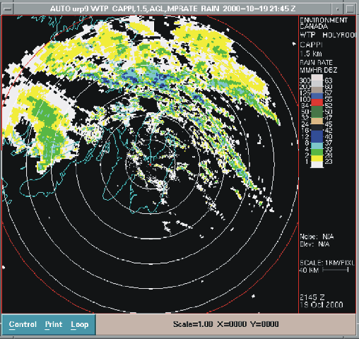
As the intensity of Michael was equivalent to a Category 1 hurricane during landfall, high winds were reported throughout Atlantic Canada, especially in Newfoundland. Winds from the storm peaked at 172 km/h (106.9 mph) in St. Lawrence, Newfoundland
; other locations across the island reported winds of 128 to 150 km/h (79.5 to 93.2 mph). High winds caused minor structure damage across Newfoundland, confined to vinyl siding peeled off, shattered windows, and unroofed houses. In addition, sporadic power outages
were also reported from Corner Brook to St. John's
. Michael also dropped rainfall across Atlantic Canada and in Maine
. The rainfall was generally light, with much of the region reporting between 25 to 51 mm (0.984251968503937 to 2 in) of precipitation. Michael also produced high tides, accompanied by waves reported as high as 16.9 m (55.4 ft) by a buoy well offshore of Newfoundland.
 The system originated out of a non-tropical cold-core upper level low
that drifted southward into the subtropics
. The low interacted with a cold front
, which resulted in the development of a stationary front
over the Bahamas on October 10. As the cold low drifted southward, a surface low developed on October 12. The surface low remained mostly stationary until early on October 15 as it merged with the upper-level low and deepened while north of the Bahamas and east of the coast of Florida
. Later that day, the system gained enough tropical characteristics and became organized enough to be classified as a subtropical depression
. The storm remained stationary over warm water, with sea surface temperature
s around 28 °C (82.4 °F), while it continued to gain additional tropical characteristics. Around 0000 UTC on October 16, it strengthened into a subtropical storm after satellite
classifications showed a stronger storm. Later that day, the cyclone continued to develop as more thunderstorm
s formed and persisted near the low-level circulation.
By 0000 UTC on October 17, the transition was completed and Michael was reclassified as a tropical storm as supported by satellite classifications via the Dvorak technique
. Shortly thereafter, the National Hurricane Center
initiated advisories on Tropical Depression Seventeen; post-analysis later discovered it was actually a tropical storm. A well-defined eye
quickly developed early on October 17 as Michael began to strengthen and continued to organize. That afternoon, Michael rapidly intensified further and was upgraded to a hurricane as Reconnaissance
flights found winds of 120 km/h (74.6 mph). At that point, Michael began to move northward. While Michael was maintaining minimal hurricane status, the eye remained ragged, yet well-defined. Early on October 19, Michael briefly strengthened to 135 km/h (85 mph) before weakening slightly six hours later. Tracking into cooler water, Michael began its extratropical transition while accelerating to the northeast towards Newfoundland, which prevented significant weakening. The acceleration was caused by a shortwave trough
embedded within strong southwesterly mid-level flow.
Unexpectedly, Michael began to rapidly intensify
on October 19 while in extratropical transition. Later that day, a ship
report in the eastern eyewall reported a minimum central pressure of 965 mbar (28.5 inHg) and maximum sustained winds of 160 km/h (100 mph), making Michael a Category 2 hurricane on the Saffir-Simpson hurricane scale. The sudden intensification was determined to have been as a result of baroclinic effects as it interacted with an incoming trough, which provided additional energy to counter the general weakening of hurricanes while in the high latitudes over sea-surface temperatures around 16 °C (60.8 °F). Michael formed a "hybrid" system combining influences of a hurricane with that of a powerful extratropical cyclone. Shortly before 0000 UTC on October 20, Michael made landfall near Harbour Breton
, Newfoundland with winds of 135 km/h (85 mph). Either simultaneously or shortly thereafter, Michael transitioned into an extratropical storm. The extratropical system gradually weakened as it tracked across Newfoundland on October 20, and slowed down considerably with the presence of the trough. The storm was absorbed by another extratropical low just north of Newfoundland that afternoon.
 Because it was unknown that Michael became extratropical before landfall, it was the initially considered the first tropical cyclone to strike Newfoundland since Hurricane Luis
in 1995. Furthermore, Michael was also considered the first hurricane to make landfall in Canada since Hurricane Hortense
in 1996. When the Meteorological Service of Canada
and the National Research Council flew a Convair
research flight into Michael on October 19, it was the first successful research flight made into a tropical cyclone by those agencies. Subsequent flights have been made into Tropical Storm Karen
, Hurricane Isabel
(while inland), Hurricane Juan
, and Hurricane Ophelia
.
Light to moderate damage was reported throughout Newfoundland, primarily as a result of the strong winds. The entire region was affected by Michael, though the majority of the damage was confined to small communities east of where the storm made landfall, including Gaultois
, Harbour Breton, Hermitage and English Harbour West
. These areas reported significant power outage
s and minor structural damage; vinyl siding was peeled off, windows were shattered, and roof shingles were torn off in some localized locations. The most severe damage was in Gaultois, where several roofs were torn off and trees were uprooted. Wind damage also occurred in the St. John's Metropolitan Area
, where a Sobeys
store in Conception Bay South had broken windows. Sporadic power outages were reported throughout the island, as far east as St. John’s, and as far west as Corner Brook. As the storm struck at low tide, storm surge
was insignificant. However, just prior to landfall, waves on the coast of Newfoundland reached heights of 7–8 m (23–26.2 ft). Rainfall near the storm's track was generally around 30 mm (1.2 in), though further inland, precipitation reached 75 mm (3 in). Rainfall from the hurricane amounted to 77 mm (3 in) at Englee, a small fishing community on the Great Northern Peninsula
. Wind gusts peaked at 172 km/h (106.9 mph) at St. Lawrence
, with other reports varying between 128 km/h (79.5 mph) and 150 km/h (93.2 mph). Despite severe winds, damage was relatively light due to high construction standards in Newfoundland, where winter storm
s routinely result in hurricane-force winds, as well as the sparse population of the area affected.
The tug
Atlantic Elm lost its tow to the unmanned barge
Portland Star on October 19. The barge was carrying over 18,000 tonnes of cement
and diesel fuel and was later reported to have sunk in the Fortune Bay
. Damage was reported to numerous pleasure craft around the bay due to the waves; two sailboats were toppled. Also, ferry service between Newfoundland and Nova Scotia
was disrupted. Several offshore buoys and ships reported high winds and low barometric pressure, as well as waves of up to 16.9 m (55 ft).
associated with the hurricane's precursor dropped heavy rainfall on Bermuda, amounting to 76 mm (3 in). However, as a tropical cyclone, Michael remained far from the island. Impact outside Newfoundland was generally light. However, rainfall was greater in some areas of Nova Scotia than in Newfoundland, where precipitation reached 95.7 mm (3.8 in) over North Mountain
. Light rain was also reported in New Brunswick
, Prince Edward Island
, and Quebec
. Effects from the storm in the United States were minimal, limited to light rainfall in the state of Maine which totaled less than 51 mm (2 in).
2000 Atlantic hurricane season
The 2000 Atlantic hurricane season was the first season without a tropical cyclone in July since 1987. The season officially began on June 1, 2000, and lasted until November 30, 2000. The June through November dates conventionally delimit the period of each year when most tropical cyclones form in...
caused moderate damage in Atlantic Canada
Atlantic Canada
Atlantic Canada is the region of Canada comprising the four provinces located on the Atlantic coast, excluding Quebec: the three Maritime provinces – New Brunswick, Prince Edward Island, and Nova Scotia – and Newfoundland and Labrador...
. The seventeenth tropical cyclone, thirteenth named storm, and eighth hurricane of the season, Michael developed from a non-tropical
Extratropical cyclone
Extratropical cyclones, sometimes called mid-latitude cyclones or wave cyclones, are a group of cyclones defined as synoptic scale low pressure weather systems that occur in the middle latitudes of the Earth having neither tropical nor polar characteristics, and are connected with fronts and...
system to the southwest of Bermuda
Bermuda
Bermuda is a British overseas territory in the North Atlantic Ocean. Located off the east coast of the United States, its nearest landmass is Cape Hatteras, North Carolina, about to the west-northwest. It is about south of Halifax, Nova Scotia, Canada, and northeast of Miami, Florida...
on October 15. The system was initially subtropical
Subtropical cyclone
A subtropical cyclone is a weather system that has some characteristics of a tropical and an extratropical cyclone. As early as the 1950s, meteorologists were unclear whether they should be characterized as tropical or extratropical cyclones. They were officially recognized by the National...
, but rapidly acquired tropical characteristics by October 17. Michael quickly strengthened into a hurricane later that day. By October 29, Michael peaked as a Category 2 hurricane on the Saffir-Simpson hurricane scale
Saffir-Simpson Hurricane Scale
The Saffir–Simpson Hurricane Scale , or the Saffir–Simpson Hurricane Wind Scale , classifies hurricanes — Western Hemisphere tropical cyclones that exceed the intensities of tropical depressions and tropical storms — into five categories distinguished by the intensities of their sustained winds...
at a relatively high altitude of 44°N
44th parallel north
The 44th parallel north is a circle of latitude that is 44 degrees north of the Earth's equatorial plane. It crosses Europe, the Mediterranean Sea, Asia, the Pacific Ocean, North America, and the Atlantic Ocean....
. The storm weakened slightly to a Category 1 hurricane and became extratropical shortly before making landfall in Newfoundland on October 20.
As the intensity of Michael was equivalent to a Category 1 hurricane during landfall, high winds were reported throughout Atlantic Canada, especially in Newfoundland. Winds from the storm peaked at 172 km/h (106.9 mph) in St. Lawrence, Newfoundland
St. Lawrence, Newfoundland and Labrador
St. Lawrence is a Canadian town located on the Burin Peninsula of Newfoundland and Labrador. As of 2006, the population of St. Lawrence was 1,349.-History:...
; other locations across the island reported winds of 128 to 150 km/h (79.5 to 93.2 mph). High winds caused minor structure damage across Newfoundland, confined to vinyl siding peeled off, shattered windows, and unroofed houses. In addition, sporadic power outages
Power outage
A power outage is a short- or long-term loss of the electric power to an area.There are many causes of power failures in an electricity network...
were also reported from Corner Brook to St. John's
St. John's, Newfoundland and Labrador
St. John's is the capital and largest city in Newfoundland and Labrador, and is the oldest English-founded city in North America. It is located on the eastern tip of the Avalon Peninsula on the island of Newfoundland. With a population of 192,326 as of July 1, 2010, the St...
. Michael also dropped rainfall across Atlantic Canada and in Maine
Maine
Maine is a state in the New England region of the northeastern United States, bordered by the Atlantic Ocean to the east and south, New Hampshire to the west, and the Canadian provinces of Quebec to the northwest and New Brunswick to the northeast. Maine is both the northernmost and easternmost...
. The rainfall was generally light, with much of the region reporting between 25 to 51 mm (0.984251968503937 to 2 in) of precipitation. Michael also produced high tides, accompanied by waves reported as high as 16.9 m (55.4 ft) by a buoy well offshore of Newfoundland.
Meteorological history
Cold-core low
A cold-core low, also known as a cold low or cold-core cyclone, is a cyclone aloft which has an associated cold pool of air residing at high altitude within the Earth's troposphere. It is a low pressure system which strengthens with height in accordance with the thermal wind relationship. These...
that drifted southward into the subtropics
Subtropics
The subtropics are the geographical and climatical zone of the Earth immediately north and south of the tropical zone, which is bounded by the Tropic of Cancer and the Tropic of Capricorn, at latitudes 23.5°N and 23.5°S...
. The low interacted with a cold front
Cold front
A cold front is defined as the leading edge of a cooler mass of air, replacing a warmer mass of air.-Development of cold front:The cooler and denser air wedges under the less-dense warmer air, lifting it...
, which resulted in the development of a stationary front
Stationary front
A stationary front is a boundary between two different air masses, neither of which is strong enough to replace the other. On a weather map, this is shown by an inter-playing series of blue spikes pointing one direction and red domes pointing the other. They tend to remain essentially in the same...
over the Bahamas on October 10. As the cold low drifted southward, a surface low developed on October 12. The surface low remained mostly stationary until early on October 15 as it merged with the upper-level low and deepened while north of the Bahamas and east of the coast of Florida
Florida
Florida is a state in the southeastern United States, located on the nation's Atlantic and Gulf coasts. It is bordered to the west by the Gulf of Mexico, to the north by Alabama and Georgia and to the east by the Atlantic Ocean. With a population of 18,801,310 as measured by the 2010 census, it...
. Later that day, the system gained enough tropical characteristics and became organized enough to be classified as a subtropical depression
Subtropical cyclone
A subtropical cyclone is a weather system that has some characteristics of a tropical and an extratropical cyclone. As early as the 1950s, meteorologists were unclear whether they should be characterized as tropical or extratropical cyclones. They were officially recognized by the National...
. The storm remained stationary over warm water, with sea surface temperature
Sea surface temperature
Sea surface temperature is the water temperature close to the oceans surface. The exact meaning of surface varies according to the measurement method used, but it is between and below the sea surface. Air masses in the Earth's atmosphere are highly modified by sea surface temperatures within a...
s around 28 °C (82.4 °F), while it continued to gain additional tropical characteristics. Around 0000 UTC on October 16, it strengthened into a subtropical storm after satellite
Satellite
In the context of spaceflight, a satellite is an object which has been placed into orbit by human endeavour. Such objects are sometimes called artificial satellites to distinguish them from natural satellites such as the Moon....
classifications showed a stronger storm. Later that day, the cyclone continued to develop as more thunderstorm
Thunderstorm
A thunderstorm, also known as an electrical storm, a lightning storm, thundershower or simply a storm is a form of weather characterized by the presence of lightning and its acoustic effect on the Earth's atmosphere known as thunder. The meteorologically assigned cloud type associated with the...
s formed and persisted near the low-level circulation.
By 0000 UTC on October 17, the transition was completed and Michael was reclassified as a tropical storm as supported by satellite classifications via the Dvorak technique
Dvorak technique
The Dvorak technique is a widely used system to subjectively estimate tropical cyclone intensity based solely on visible and infrared satellite images. Several agencies issue Dvorak intensity numbers for cyclones of sufficient intensity...
. Shortly thereafter, the National Hurricane Center
National Hurricane Center
The National Hurricane Center , located at Florida International University in Miami, Florida, is the division of the National Weather Service responsible for tracking and predicting weather systems within the tropics between the Prime Meridian and the 140th meridian west poleward to the 30th...
initiated advisories on Tropical Depression Seventeen; post-analysis later discovered it was actually a tropical storm. A well-defined eye
Eye (cyclone)
The eye is a region of mostly calm weather found at the center of strong tropical cyclones. The eye of a storm is a roughly circular area and typically 30–65 km in diameter. It is surrounded by the eyewall, a ring of towering thunderstorms where the second most severe weather of a cyclone...
quickly developed early on October 17 as Michael began to strengthen and continued to organize. That afternoon, Michael rapidly intensified further and was upgraded to a hurricane as Reconnaissance
Reconnaissance
Reconnaissance is the military term for exploring beyond the area occupied by friendly forces to gain information about enemy forces or features of the environment....
flights found winds of 120 km/h (74.6 mph). At that point, Michael began to move northward. While Michael was maintaining minimal hurricane status, the eye remained ragged, yet well-defined. Early on October 19, Michael briefly strengthened to 135 km/h (85 mph) before weakening slightly six hours later. Tracking into cooler water, Michael began its extratropical transition while accelerating to the northeast towards Newfoundland, which prevented significant weakening. The acceleration was caused by a shortwave trough
Trough (meteorology)
A trough is an elongated region of relatively low atmospheric pressure, often associated with fronts.Unlike fronts, there is not a universal symbol for a trough on a weather chart. The weather charts in some countries or regions mark troughs by a line. In the United States, a trough may be marked...
embedded within strong southwesterly mid-level flow.
Unexpectedly, Michael began to rapidly intensify
Rapid deepening
Rapid deepening, also known as rapid intensification, is a meteorological condition that occurs when the minimum sea-level atmospheric pressure of a tropical cyclone decreases drastically in a short period of time. The National Weather Service describes rapid deepening as a decrease of...
on October 19 while in extratropical transition. Later that day, a ship
Ship
Since the end of the age of sail a ship has been any large buoyant marine vessel. Ships are generally distinguished from boats based on size and cargo or passenger capacity. Ships are used on lakes, seas, and rivers for a variety of activities, such as the transport of people or goods, fishing,...
report in the eastern eyewall reported a minimum central pressure of 965 mbar (28.5 inHg) and maximum sustained winds of 160 km/h (100 mph), making Michael a Category 2 hurricane on the Saffir-Simpson hurricane scale. The sudden intensification was determined to have been as a result of baroclinic effects as it interacted with an incoming trough, which provided additional energy to counter the general weakening of hurricanes while in the high latitudes over sea-surface temperatures around 16 °C (60.8 °F). Michael formed a "hybrid" system combining influences of a hurricane with that of a powerful extratropical cyclone. Shortly before 0000 UTC on October 20, Michael made landfall near Harbour Breton
Harbour Breton, Newfoundland and Labrador
Harbour Breton is a small fishing community on the Connaigre Peninsula in Fortune Bay, on the south coast of the island of Newfoundland in Canada. It is the largest center on the Connaigre Peninsula and was long considered the unofficial capital of Fortune Bay...
, Newfoundland with winds of 135 km/h (85 mph). Either simultaneously or shortly thereafter, Michael transitioned into an extratropical storm. The extratropical system gradually weakened as it tracked across Newfoundland on October 20, and slowed down considerably with the presence of the trough. The storm was absorbed by another extratropical low just north of Newfoundland that afternoon.
Impact
Hurricane Luis
Hurricane Luis was one of the deadliest and most destructive hurricanes of the 1995 Atlantic hurricane season, with maximum sustained winds of 140 mph . The storm was the twelfth tropical storm, sixth hurricane, and second major hurricane of the season...
in 1995. Furthermore, Michael was also considered the first hurricane to make landfall in Canada since Hurricane Hortense
Hurricane Hortense
Hurricane Hortense was the eighth tropical storm, sixth hurricane, and second Category 4 hurricane of the 1996 Atlantic hurricane season. Lasting from September 3 to September 16, Hortense brought torrential flooding as it moved through the Lesser Antilles, Puerto Rico, and Dominican Republic...
in 1996. When the Meteorological Service of Canada
Meteorological Service of Canada
The Meteorological Service of Canada , also known as "The Canadian Weather Service", is a division of Environment Canada, which primarily provides public meteorological information and weather forecasts and warnings of severe weather and other environmental hazards...
and the National Research Council flew a Convair
Convair
Convair was an American aircraft manufacturing company which later expanded into rockets and spacecraft. The company was formed in 1943 by the merger of Vultee Aircraft and Consolidated Aircraft, and went on to produce a number of pioneering aircraft, such as the Convair B-36 bomber, and the F-102...
research flight into Michael on October 19, it was the first successful research flight made into a tropical cyclone by those agencies. Subsequent flights have been made into Tropical Storm Karen
Hurricane Karen (2001)
Hurricane Karen was a hurricane of non-tropical origin that formed in October of the 2001 Atlantic hurricane season. It developed out of the interaction between a cold front and an upper level trough on October 10 located to the south of Bermuda, and quickly strengthened as an extratropical storm....
, Hurricane Isabel
Hurricane Isabel
Hurricane Isabel was the costliest and deadliest hurricane in the 2003 Atlantic hurricane season. The ninth named storm, fifth hurricane, and second major hurricane of the season, Isabel formed near the Cape Verde Islands from a tropical wave on September 6 in the tropical Atlantic Ocean...
(while inland), Hurricane Juan
Hurricane Juan
Hurricane Juan was a significant hurricane that struck the southern part of Atlantic Canada in late September 2003. It was the tenth named storm and the sixth hurricane of the 2003 Atlantic hurricane season. Juan formed southeast of Bermuda on September 24, 2003 out of a tropical wave that tracked...
, and Hurricane Ophelia
Hurricane Ophelia (2005)
Hurricane Ophelia was the fifteenth named tropical cyclone and the eighth hurricane of the 2005 Atlantic hurricane season. It was a long-lived storm that was most remembered for its very erratic and extremely slow track off the East Coast of the United States, alternating several times between...
.
Newfoundland
In advance of the storm, the Newfoundland Weather Centre posted wind warnings, gale warnings, storm warnings, and hurricane warnings throughout Newfoundland. Rainfall advisories were also issued in portions of the East Coast, Central Newfoundland, the South Coast, and the West Coast. Offshore, storm force wind warnings were declared on October 19 for Newfoundland waters. Several Special Weather Statements were also posted.Light to moderate damage was reported throughout Newfoundland, primarily as a result of the strong winds. The entire region was affected by Michael, though the majority of the damage was confined to small communities east of where the storm made landfall, including Gaultois
Gaultois, Newfoundland and Labrador
Gaultois was a small settlement in the Fortune Bay area in 1864. The first Waymaster in 1877, was Richard Bradshaw. It had a population of 265 in 2006.-See also:*List of cities and towns in Newfoundland and Labrador...
, Harbour Breton, Hermitage and English Harbour West
English Harbour West, Newfoundland and Labrador
English Harbour West is a village located on the south west shore of Fortune Bay. It is noted for its Bank and inshore fishing. The Way Office was established in 1866 on April 1. The first Way Master was Albert Stirling. In 1891 it became a Post Office town and William Evans was the first...
. These areas reported significant power outage
Power outage
A power outage is a short- or long-term loss of the electric power to an area.There are many causes of power failures in an electricity network...
s and minor structural damage; vinyl siding was peeled off, windows were shattered, and roof shingles were torn off in some localized locations. The most severe damage was in Gaultois, where several roofs were torn off and trees were uprooted. Wind damage also occurred in the St. John's Metropolitan Area
St. John's Metropolitan Area
The St. John's Metropolitan Area is the most populous census metropolitan area in the Canadian province of Newfoundland and Labrador. With a population of 181,113 in the 2006 Canadian Census, the CMA is the second largest in Atlantic Canada and the 20th largest CMA in Canada.The St. John’s CMA had...
, where a Sobeys
Sobeys
Sobeys is the second largest food retailer in Canada, with over 1,300 supermarkets operating under a variety of banners. Headquartered in Stellarton, Nova Scotia, it operates stores in all ten provinces and accumulated sales of more than $14 billion CAD in 2009...
store in Conception Bay South had broken windows. Sporadic power outages were reported throughout the island, as far east as St. John’s, and as far west as Corner Brook. As the storm struck at low tide, storm surge
Storm surge
A storm surge is an offshore rise of water associated with a low pressure weather system, typically tropical cyclones and strong extratropical cyclones. Storm surges are caused primarily by high winds pushing on the ocean's surface. The wind causes the water to pile up higher than the ordinary sea...
was insignificant. However, just prior to landfall, waves on the coast of Newfoundland reached heights of 7–8 m (23–26.2 ft). Rainfall near the storm's track was generally around 30 mm (1.2 in), though further inland, precipitation reached 75 mm (3 in). Rainfall from the hurricane amounted to 77 mm (3 in) at Englee, a small fishing community on the Great Northern Peninsula
Great Northern Peninsula
The Great Northern Peninsula is the largest and longest peninsula of the island of Newfoundland, Canada, approximately 225 km long and 80 km wide at its widest point and encompassing an area of 17,483 km²...
. Wind gusts peaked at 172 km/h (106.9 mph) at St. Lawrence
St. Lawrence, Newfoundland and Labrador
St. Lawrence is a Canadian town located on the Burin Peninsula of Newfoundland and Labrador. As of 2006, the population of St. Lawrence was 1,349.-History:...
, with other reports varying between 128 km/h (79.5 mph) and 150 km/h (93.2 mph). Despite severe winds, damage was relatively light due to high construction standards in Newfoundland, where winter storm
Winter storm
A winter storm is an event in which the dominant varieties of precipitation are formed that only occur at low temperatures, such as snow or sleet, or a rainstorm where ground temperatures are low enough to allow ice to form...
s routinely result in hurricane-force winds, as well as the sparse population of the area affected.
The tug
Tug
Tuğ is a village in the Khojavend Rayon of Azerbaijan....
Atlantic Elm lost its tow to the unmanned barge
Barge
A barge is a flat-bottomed boat, built mainly for river and canal transport of heavy goods. Some barges are not self-propelled and need to be towed by tugboats or pushed by towboats...
Portland Star on October 19. The barge was carrying over 18,000 tonnes of cement
Cement
In the most general sense of the word, a cement is a binder, a substance that sets and hardens independently, and can bind other materials together. The word "cement" traces to the Romans, who used the term opus caementicium to describe masonry resembling modern concrete that was made from crushed...
and diesel fuel and was later reported to have sunk in the Fortune Bay
Fortune Bay
Fortune Bay is a fairly large natural bay located on the south coast of the island of Newfoundland, Canada. The Bay is bounded by Point Crewe on the Burin Peninsula and Pass Island at the entrance to Hermitage Bay to the northwest for a distance of 56 kilometers...
. Damage was reported to numerous pleasure craft around the bay due to the waves; two sailboats were toppled. Also, ferry service between Newfoundland and Nova Scotia
Nova Scotia
Nova Scotia is one of Canada's three Maritime provinces and is the most populous province in Atlantic Canada. The name of the province is Latin for "New Scotland," but "Nova Scotia" is the recognized, English-language name of the province. The provincial capital is Halifax. Nova Scotia is the...
was disrupted. Several offshore buoys and ships reported high winds and low barometric pressure, as well as waves of up to 16.9 m (55 ft).
Elsewhere
On October 14 and October 15, the frontal boundaryWeather front
A weather front is a boundary separating two masses of air of different densities, and is the principal cause of meteorological phenomena. In surface weather analyses, fronts are depicted using various colored lines and symbols, depending on the type of front...
associated with the hurricane's precursor dropped heavy rainfall on Bermuda, amounting to 76 mm (3 in). However, as a tropical cyclone, Michael remained far from the island. Impact outside Newfoundland was generally light. However, rainfall was greater in some areas of Nova Scotia than in Newfoundland, where precipitation reached 95.7 mm (3.8 in) over North Mountain
North Mountain (Nova Scotia)
North Mountain is a narrow southwest-northeast trending volcanic mountain range on the mainland portion of southwestern Nova Scotia, stretching from Brier Island to Cape Split...
. Light rain was also reported in New Brunswick
New Brunswick
New Brunswick is one of Canada's three Maritime provinces and is the only province in the federation that is constitutionally bilingual . The provincial capital is Fredericton and Saint John is the most populous city. Greater Moncton is the largest Census Metropolitan Area...
, Prince Edward Island
Prince Edward Island
Prince Edward Island is a Canadian province consisting of an island of the same name, as well as other islands. The maritime province is the smallest in the nation in both land area and population...
, and Quebec
Quebec
Quebec or is a province in east-central Canada. It is the only Canadian province with a predominantly French-speaking population and the only one whose sole official language is French at the provincial level....
. Effects from the storm in the United States were minimal, limited to light rainfall in the state of Maine which totaled less than 51 mm (2 in).
See also
- List of Canada hurricanes
- Timeline of the 2000 Atlantic hurricane seasonTimeline of the 2000 Atlantic hurricane seasonThe Timeline of the 2000 Atlantic hurricane season documents all the storm formations, strengthening, weakening, landfalls, extratropical transitions, as well as dissipation...